 
|
|||||||||||
This is a small selection of our inventory of antique Nebraska maps and prints. Additional inventory is available. Contact us with your request. 1-800-879-6277
|
|||||||||||
|---|---|---|---|---|---|---|---|---|---|---|---|
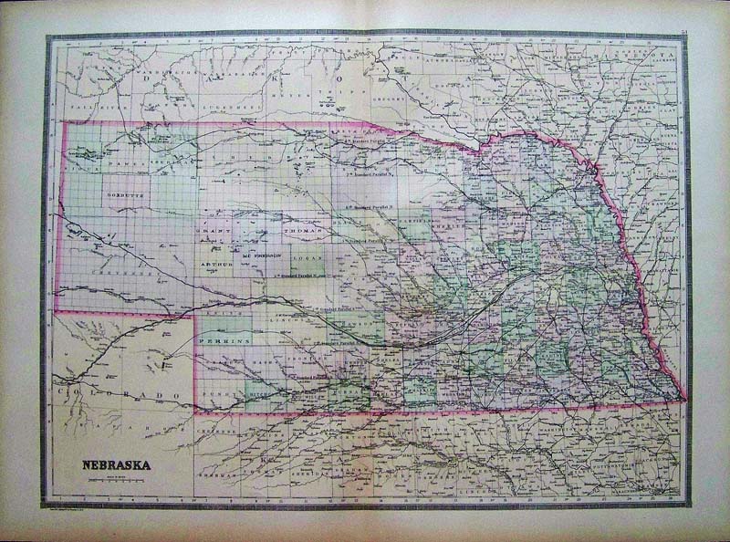
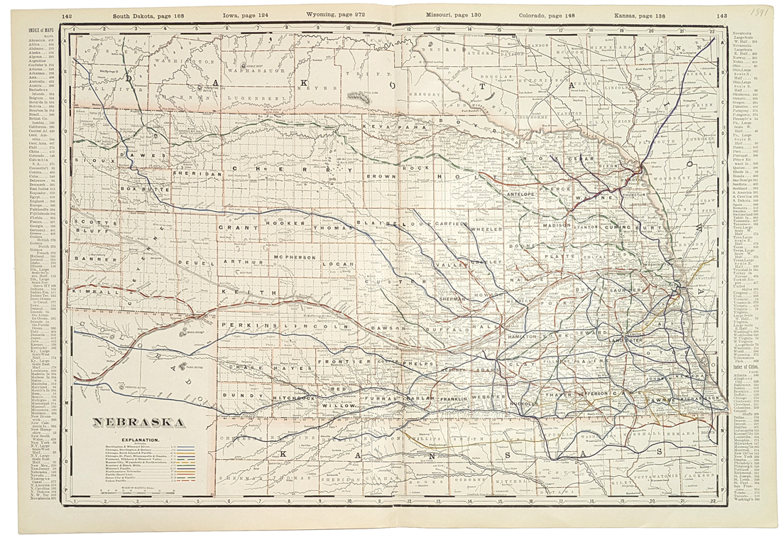 001ne: 1891 Railroad Map of Nebraska. Excellent railroad map names the numerous companies and each route. 18 x 26 in. $90 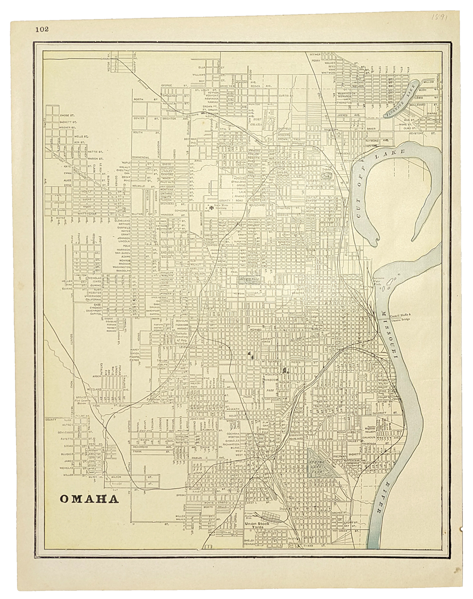 005ne: 1900 Omaha Map by Cram. Litho color - names all streets. 12 x 14 in. $25 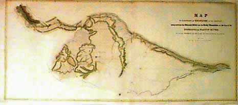 018ne: 1852 Platte River Exploration Map. Rare collectable Nebraska map by J.C. Fremont. Published by the U.S. Government, this great antique map illustrates the exploration of the country between the Missouri River and the Rocky Mountains, on the line of the Platte River. Hand colored. 34-1/2x15-1/2 in. $300 Check for availability  023ne: 1885 Color Map of Nebraska. 21 x 14-1/2 in. $90 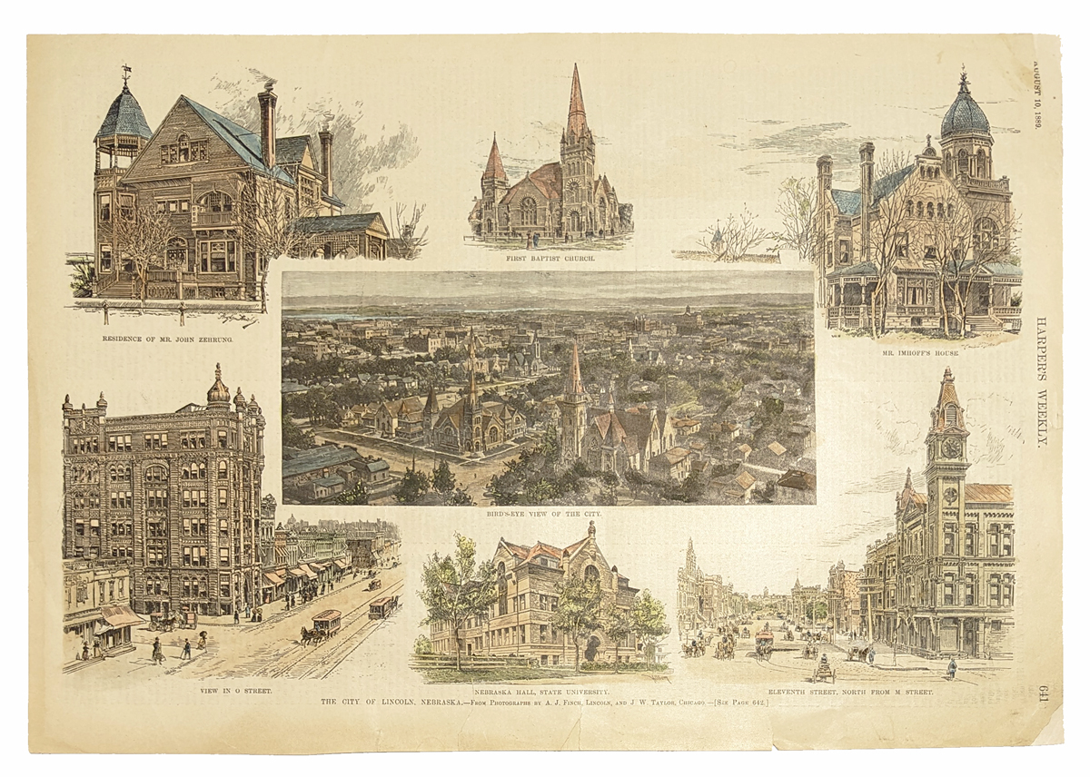 025ne: 1889: The City of Lincoln, Nebraska. shows: residence of Mr. John Zehrung, First Baptist Church, Mr. Imioff's House, birds eye view of the city, view in O Street, Nebraska Hall, State University, Eleventh Street, North from M Street. This unique engraving is from the August, 1899 edition of Harper's Weekly. size: 11x16 in. $60 
218ks: Map Showing the progress of the Public Surveys in Kansas and Nebraska Surveyor General 1862 - A large lithograph hand colored map of early surveys of Kansas and Nebraska. Only the eastern portions have been subdivided into counties and townships, with the west substantially wide open. Includes the location of Land Grant Railroads, and the 20 and 25 miles limits of same, along with land offices and the surveyor general's office. Extensive Indian detail shown, along with some early railroad lands. Condition: Very good, wide top margins, light folds, slight tear on left margin. size 33 x 20 image. $250 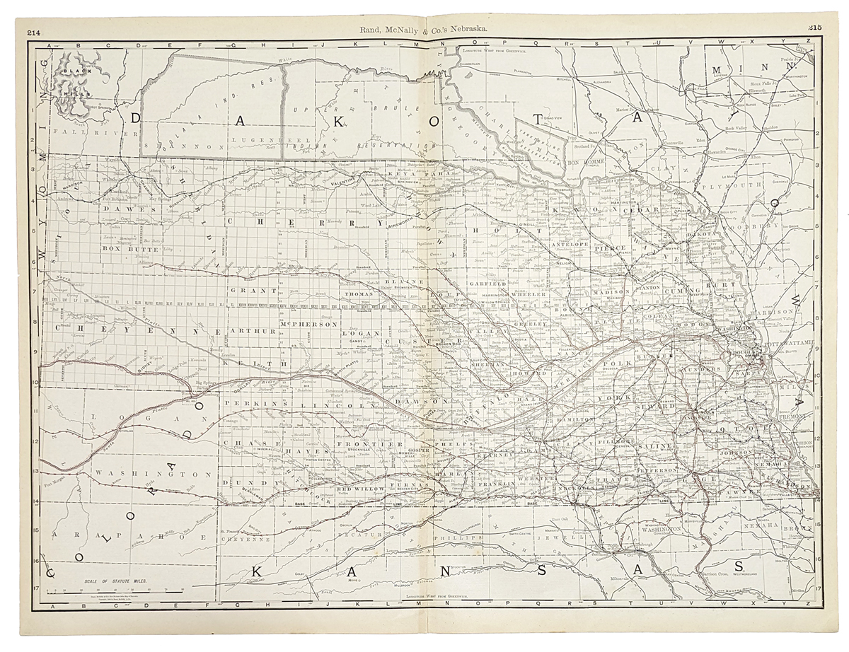 028ne: 1888 Rand, McNally & Co.'s Nebraska which also shows all railroad stops. 27 x 20-1/2 in. $120 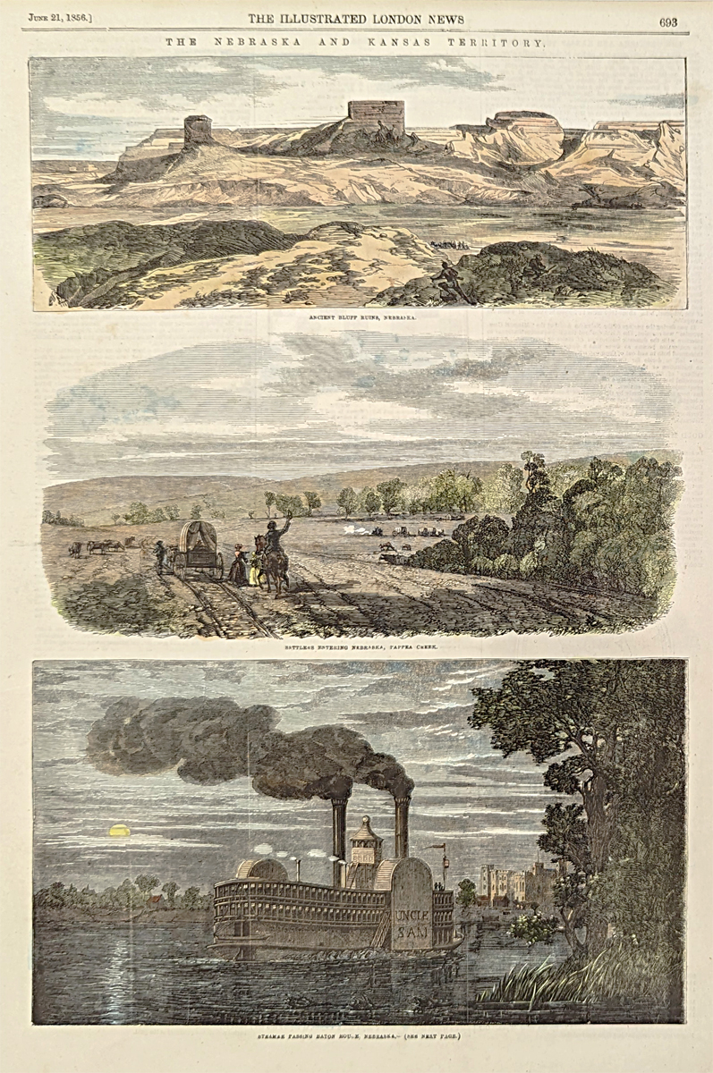 102ne: 1856 Scenes in Nebraska. Three engraved images of Nebraska scenery from the Illustrated London News of June 21, 1856. Hand colored, wood engraving. 11x16 in. $60 b/w: $40  105ne: 1863 Prairie Fire Scene in Nebraska. Woodcut engraving from the Illustrated London News of July 21, 1863, showing a prairie fire next to the tracks of the Union Pacific Railroad. Hand colored, wood engraving. 11x16 in. $60 b/w: $40  109ne: 1871 Sledding Scene: "Coasting" at Omaha. Hand colored woodcut engraving from the Feb. 11, 1871 issue of Every Saturday. 11x16 in. $40 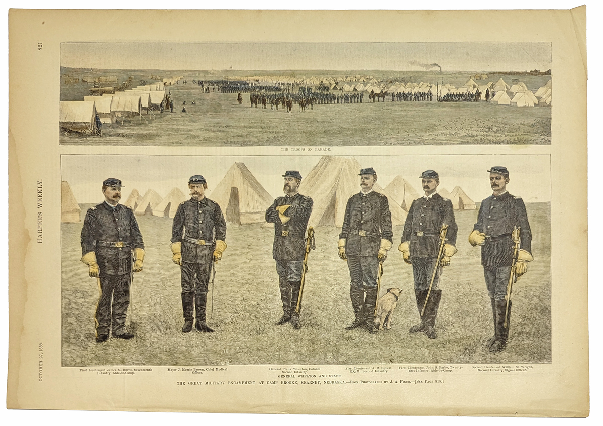 110ne: 1888 Kearney Nebraska Military Scenes. Hand colored engravings from Harper's Weekly, titled "The Great Military Encampment at Camp Brooke, Kearney Nebraska." Contains a group portrait of General Wheaton and his staff, and a view of the troops on parade. 11x16 in. $60
|
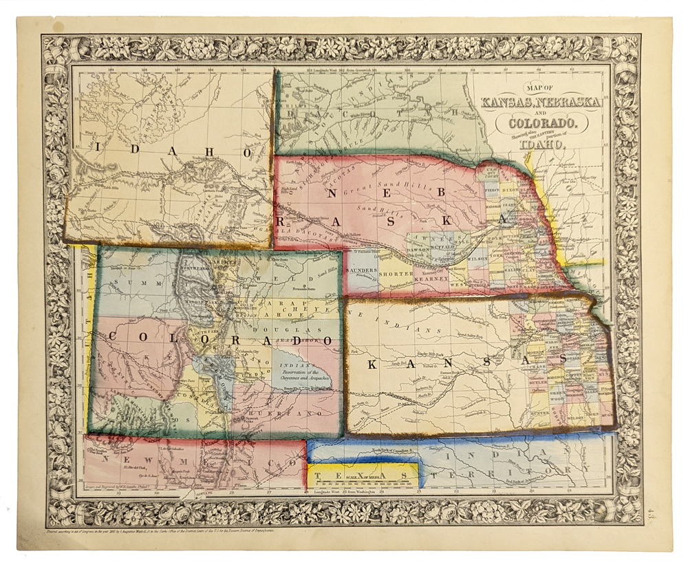
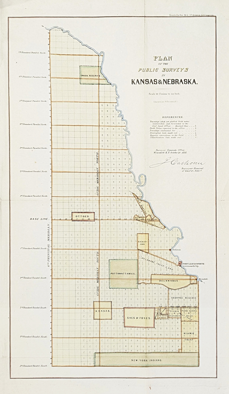
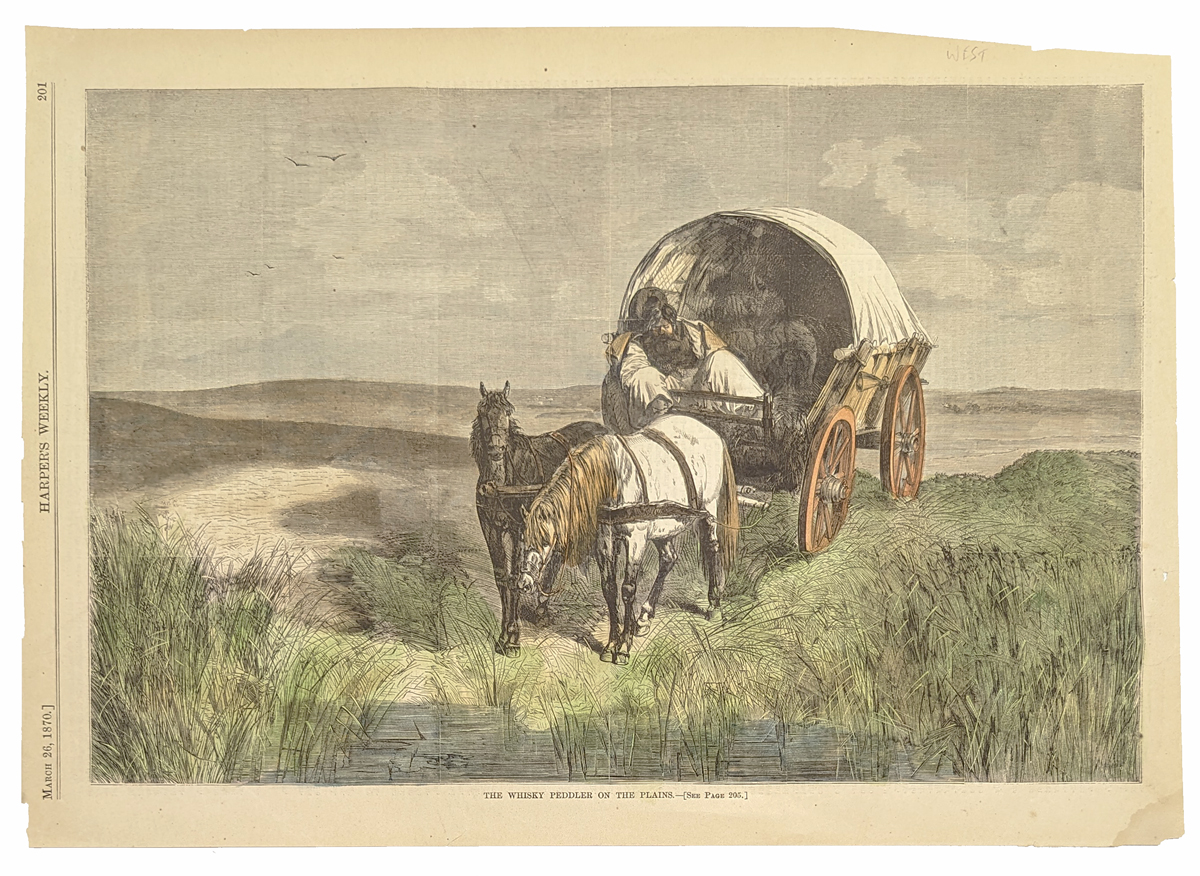 111ne: 1870 View of a Prairie Whiskey Peddler. Hand colored woodcut engraving from Harper's Weekly, titled "The Whiskey Peddler on the Plains." Shows a man, obviously drunk, sleeping in his horse-drawn wagon in the middle of the prairie. 11x16 in. $60 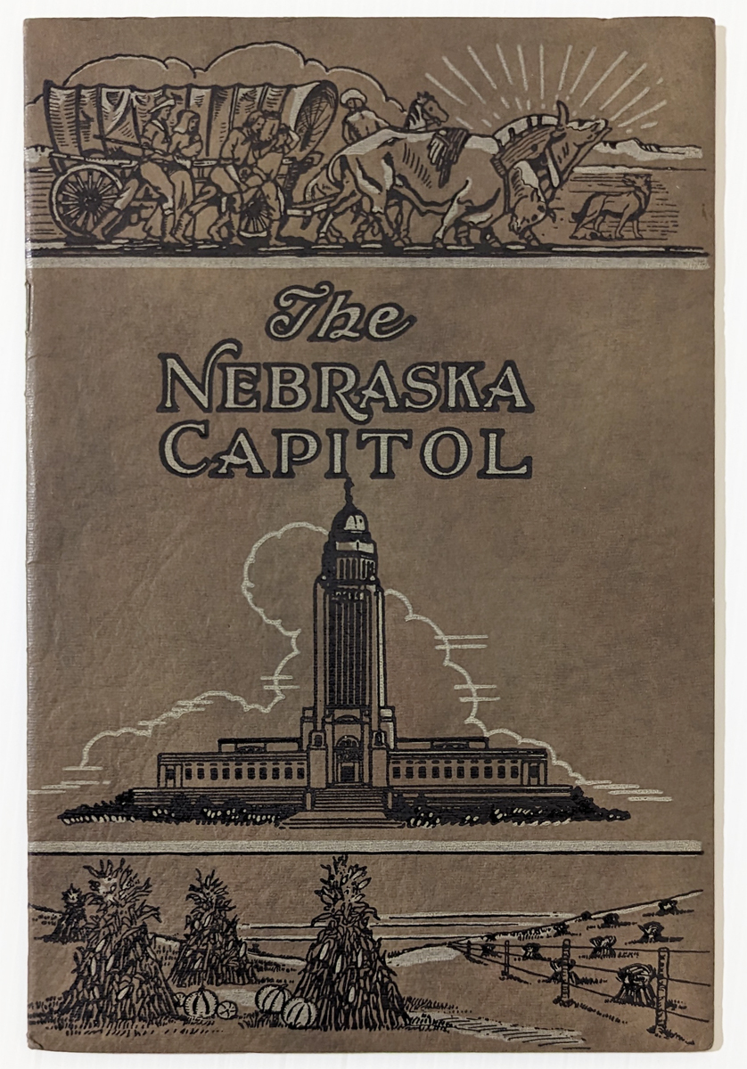 202ne: The Nebraska Capitol published in 1926. 32 page booklet profusely illustrated with photos and drawings. 6x9 in. $30 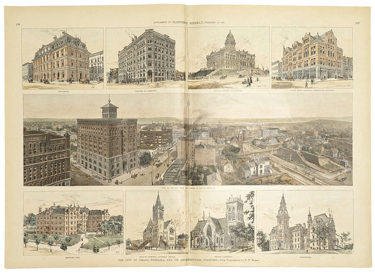 203ne: 1889 Scenes in Omaha Nebraska. Hand-colored engraving from Harper's Weekly of Feb. 16, 1889. Title is "The City of Omaha, Nebraska, and its Architectural Features." Panoramic view of the city in the center is surrounded by smaller images of prominent buildings. 16x22 in. $180  204ne: 1876 hand colored Mitchell's County & Township map of Kansas and Nebraska. Each county is in a different color. Railroad lines, rivers and meridian lines are shown as well. Note that a large part of Nebraska is still undeveloped since this map was made only ten years after statehood. 23 x 16 in. $120 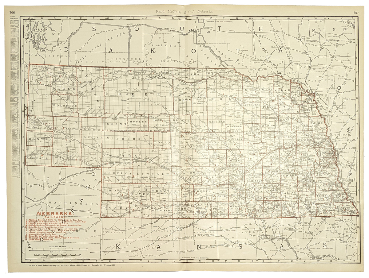 205ne: 1901 Rand, McNally & Company Railroad map of Nebraska. Each of the counties are outlined in red with the county name and county seat marked. Many cities and townships are shown as well as rivers. Twelve different railroads are shown along with their routes throughout the state. There is a key at the bottom left corner of the map identifying the different railroads. 20x28 in. $80  207ne: 1858 Hand colored Nebraska Department of the Interior Pacific Wagon Roads map titled, "Map of the Wagon-Road from Platte River Via Omaha Reserve and Dakota City To Running Water River." Geo. L. Sites, Supt. 29 x 25 in. $500 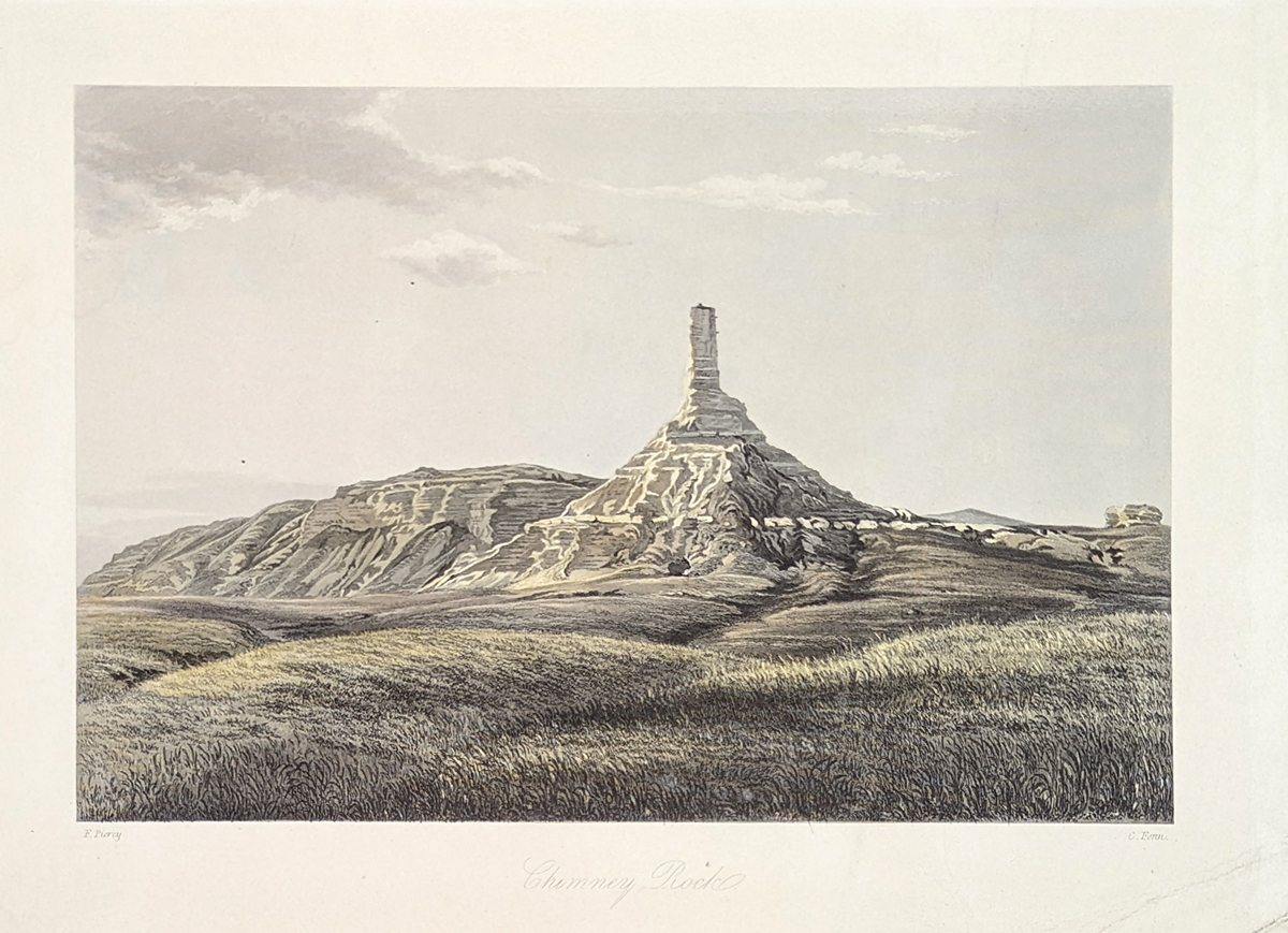 209ne: 1855 "Chimney Rock" -- Rare lightly-tinted lithograph by F. Piercy, Liverpool which was drawn on the way to Utah via the Mormon Trail. 12-1/2 x 9-1/2 in. $295 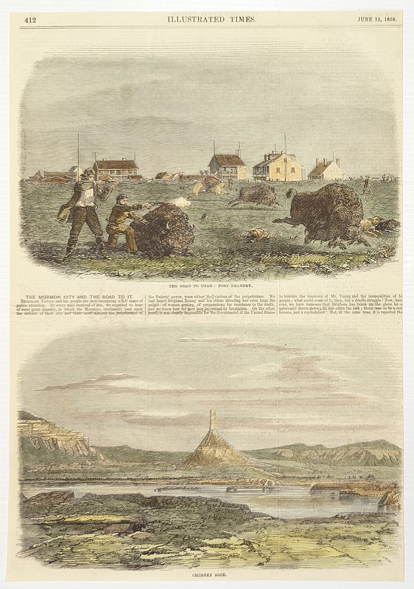 211Nebraska: 1858 Very rare hand colored wood engravings showing image from the Mormon trek to Utah: Fort Kearney in upper image, and Chimney Rock in lower image. Featured in the Illustrated Times. 13-1/2 x 9-1/2 in. $150  212Nebraska: Nebraska Map published by Gray’s Atlas of the United States. Shows Counties, Townships, Roads, Railroad Lines, and Towns. One of the earliest maps of Nebraska to appear in a commercial atlas. 1875. Hand colored, Lithograph. 13 x 15 in. $120 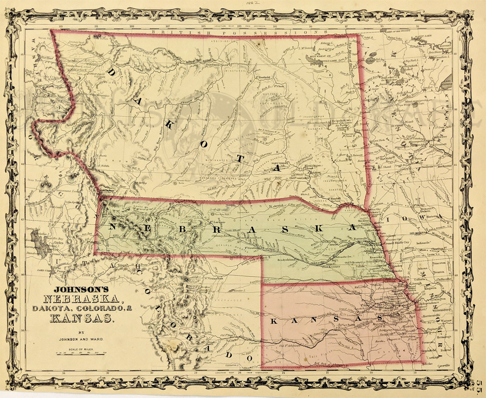 213Nebraska: 1862 Johnson's Nebraska, Dakota, Colorado, & Kansas. Showing an early configuration of the region, Nebraska extends as far as Salt Lake City. Northern half of the region is shown as part as the Dakota Territory, one year before the Idaho Territory was broken off. Other details include rivers, towns, forts, Indian tribes and trails. Hand colored, lithograph. 12 1/2 x 15 3/8 in. $300 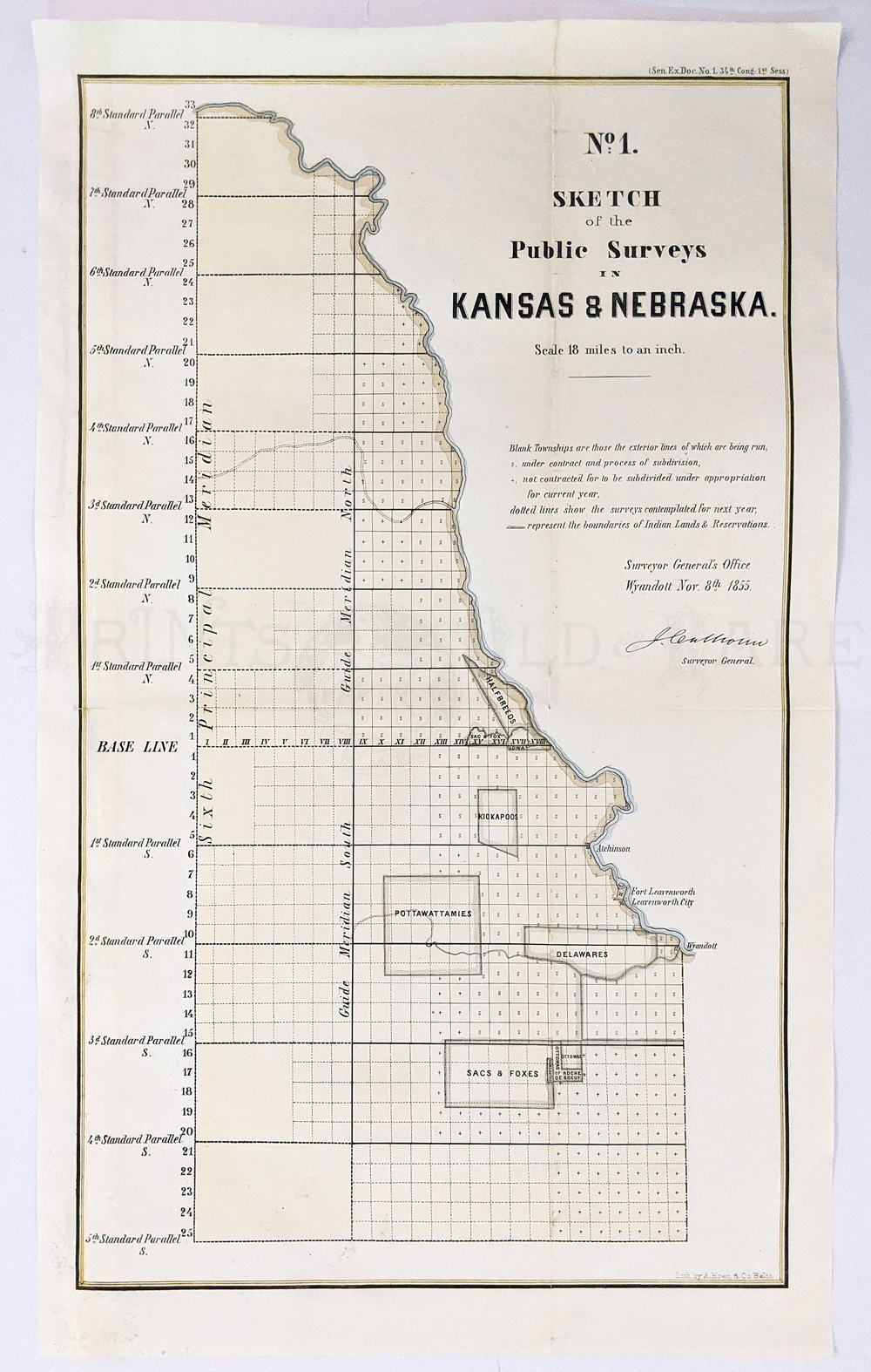 225ks: Kansas and Nebraska 1855. Very early survey of the Southern parts of these territories “Sketch of the Public Surveys” by Surveyor General’s Office. Map shows Indian tribes, Sacs & Foxes, Ottawa’s, Delawares, Pottawattamie, Kickapoos, & area of Half-breeds. Atchison and Ft. Leavenworth are also shown. Hand colored, lithograph. 13 3/8 x 22 7/8 in. $325
|
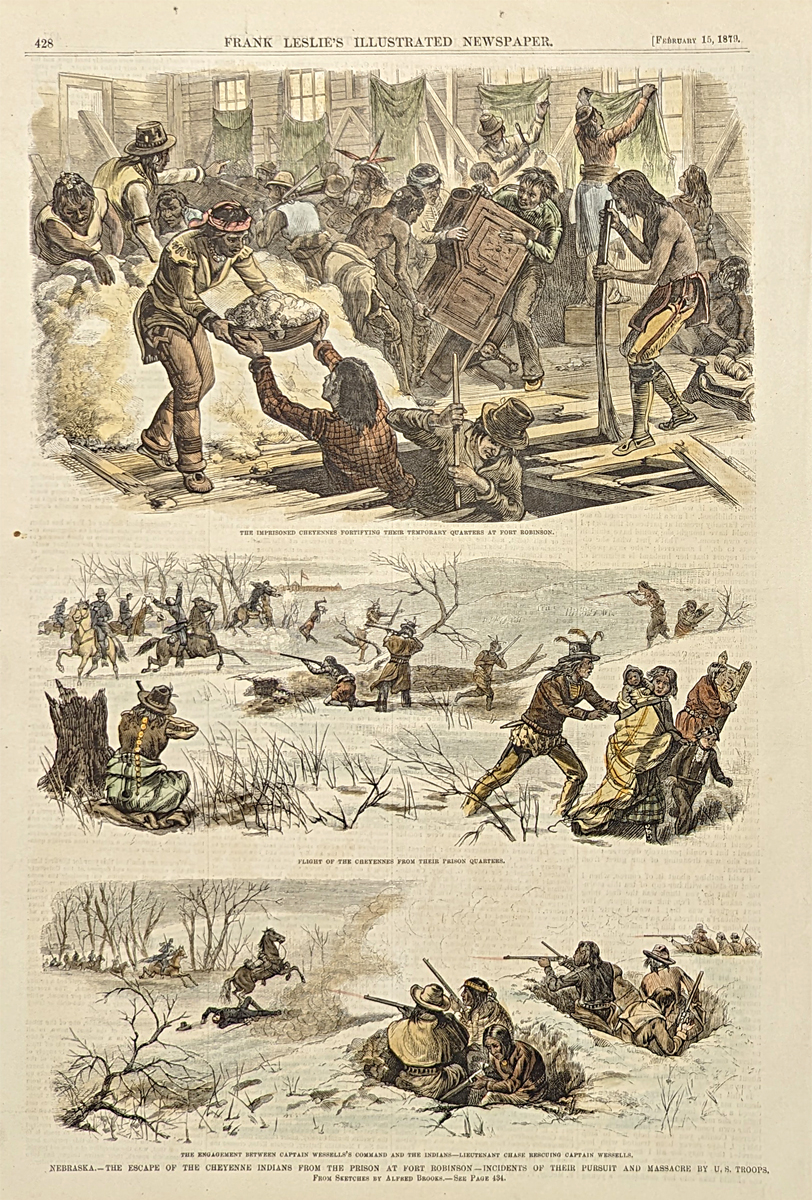 215Nebraska: The escape of the Cheyenne Indians from the prison at Fort Robinson - Incidents of their pursuit and massacre by U.S. Troops. 1879 Frank Leslies'. Hand colored, wood engraving. 11 1/4 x 16 in. $60 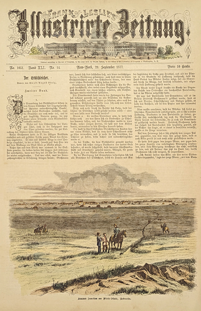 216Nebraska: Kearney Junction, Nebraska. 1877 Frank Leslie's German Edition. Hand colored, wood engraving. 11 1/4 x 16 in. $60 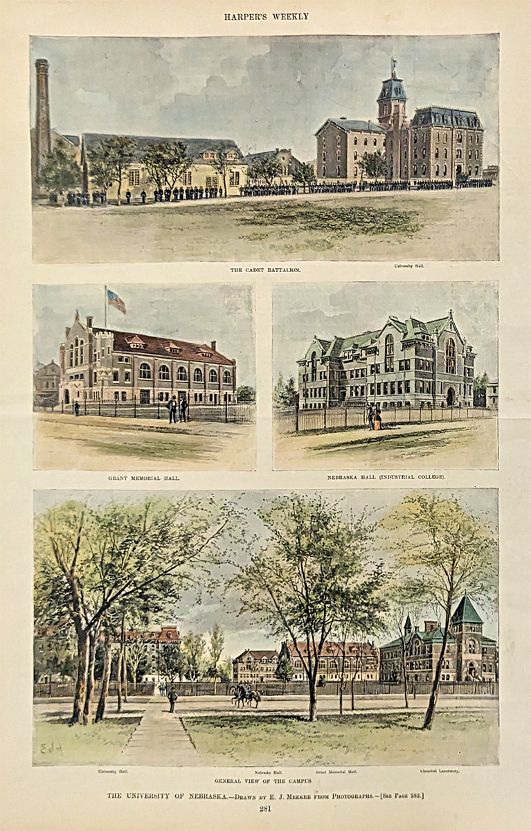 217Nebraska: The University of Nebraska. 5 views of area's around the campus. University Hall, Memorial Hall, Cadet Battalion, Nebraska Hall and General view of the campus. 10 3/4 x 15 3/4 in. $80 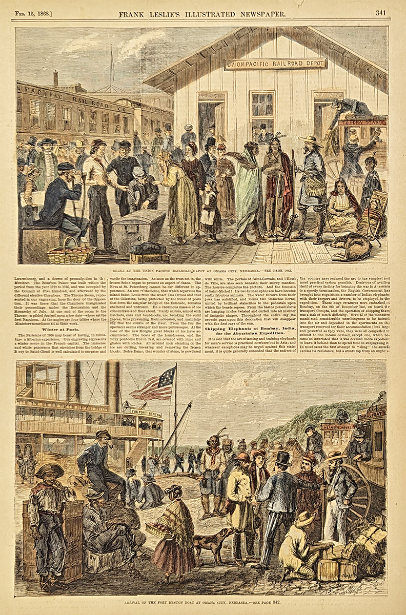 218Nebraska: Scene at the Union Pacific Railroad Depot at Omaha City, Nebraska - Arrival of the Fort Benton at Omaha City, Nebraska. 1868 Frank Leslies'. Hand colored, wood engraving. 10 1/2 x 15 1/4 in. $50 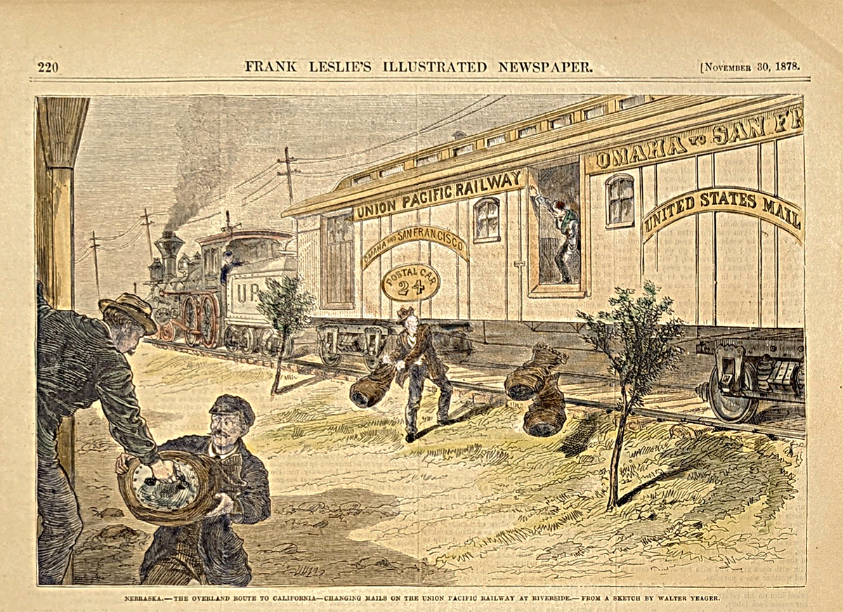 219Nebraska: The Overland Route to California - Chaning mails on the Union Pacific Railway at Riverside, Nebraska. 1878 Frank Leslies'. Hand colored, wood engraving. 7 3/8 x 10 3/8 in. $60 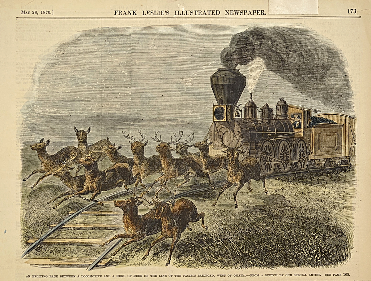 220Nebraska: An exciting race between a locomotive and a herd of deer on the line of the Pacific Railroad, West of Omaha. 1870 Frank Leslies'. Hand colored, wood engraving. *Small mend top right border. 7 3/8 x 10 1/8 in. $60 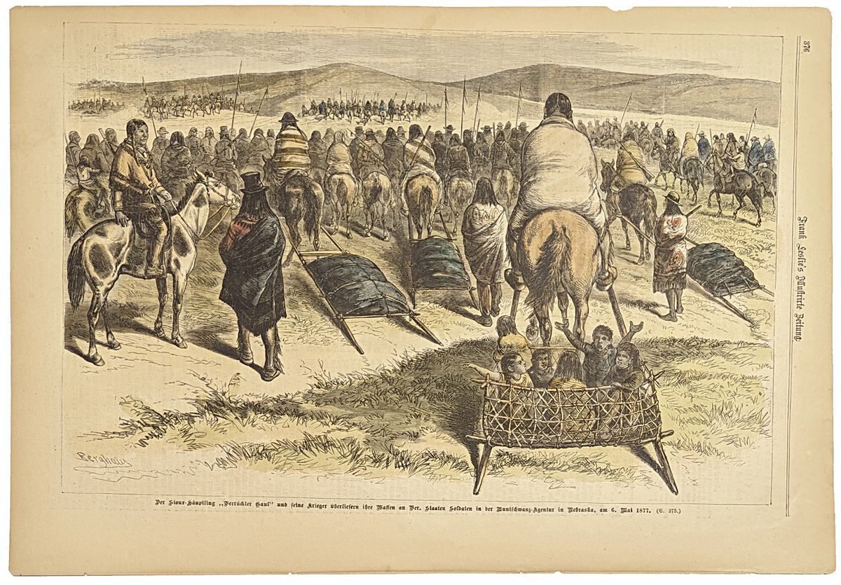 221Nebraska: Sioux Chief Gaul, following State soldiers in Nebraska. 1877 Frank Leslies'. Hand colored, wood engraving. 10 3/4 x 16 in. $60 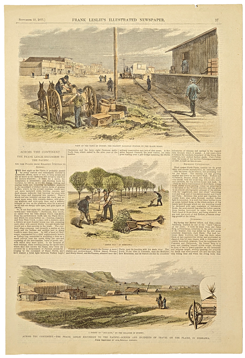 222Nebraska: Across the Continet - The Frank Leslie excursion to the Pacific - Scenes and Incidents of travel on the plains, in Nebraska. 1877 Frank Leslies'. Hand colored, wood engraving. 10 5/8 x 15 7/8 in. $60 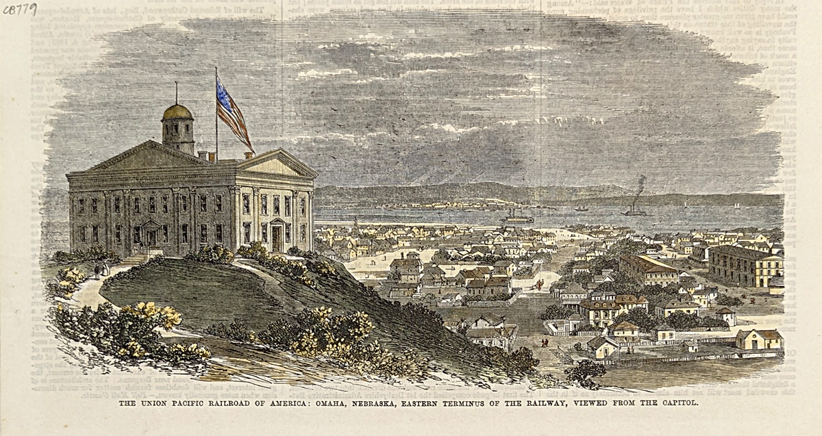 223Nebraska: The Union Pacific Railroad of America; Omaha, Nebraska, Eastern Terminus of the Railway, viewed from the Capitol. 1869 Frank Leslies'. Hand colored, wood engraving. 6 x 10 3/8 in. $40
|
|||||||||
| Order Form | |||||||||||
| Back to Homepage | |||||||||||