|
|||||||||||
This is a small selection of our inventory of antique Nevada maps and prints. Additional inventory is available. Contact us with your request. 1-800-879-6277
|
|||||||||||
|---|---|---|---|---|---|---|---|---|---|---|---|
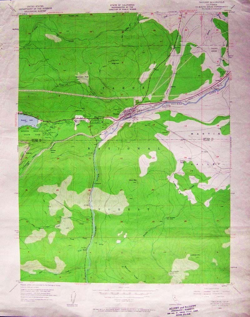 002Nevada: 1955 Truckee, Nevada color lithographed Geological Survey showing the town of Truckee, the east end of Donner Lake, Martis Valley and other interesting landmarks. Furnished by the United States Department of the Interior. 27 x 22 in. $50 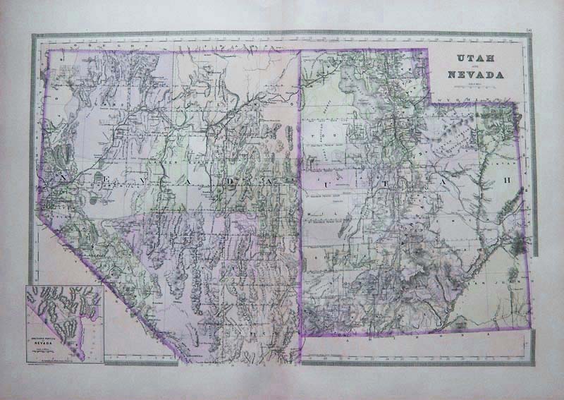
013Utah: 1886 Utah and Nevada Map. Large scale, by Bradley. Original color, attractive margins. 26x19-1/2 in. $100 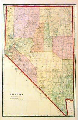 006nv: 1906 Cram Map of Nevada. Good printed color and details on this large state map. 14-1/2x22 in. $40 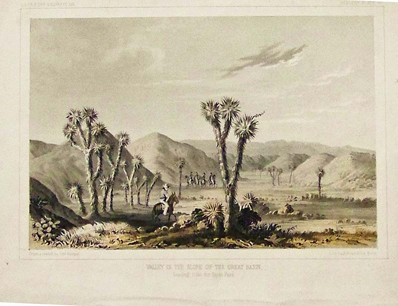
013nv: 1855 Nevada Railroad. Color litho view of the "Valley in the Slope of the Great Basin." By U.S. Government. 11x9 in. $50  015nv: 1855 Nevada Railroad Lithograph. Color view "Lost Mountains in the Great Basin." With paper mat. 11x8 in. $50 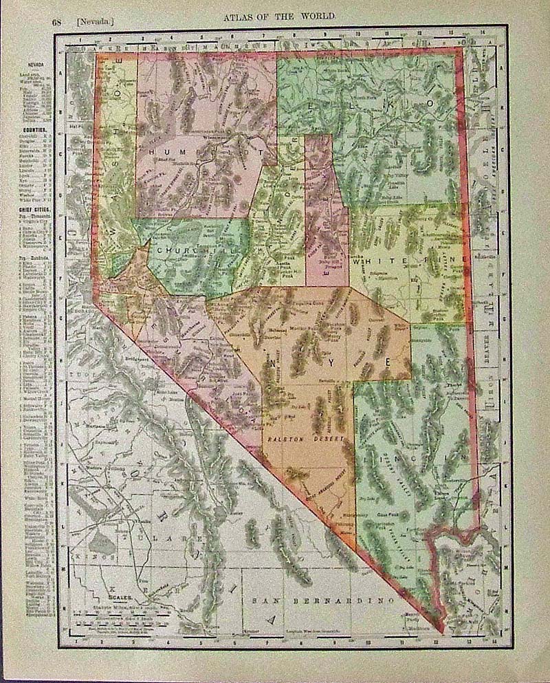 021Nevada: Color Atlas of the World mapof Nevada showing the Counties and Chief Cities in a Key on left side. 14 x 11 in. $40 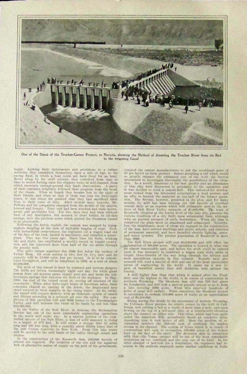
022Nevada: Harper's Weekly half-tone image with text showing one of the Dams of the Truckee-Carson Project, in Nevada, showing the Method of diverting the Truckee River from its Bed to the Irrigating Canal. 13 x 9 in. $40 
023Nevada: 1911 Geo. F. Cram colored map of Nevada. 22 x 14-1/2 in. $80 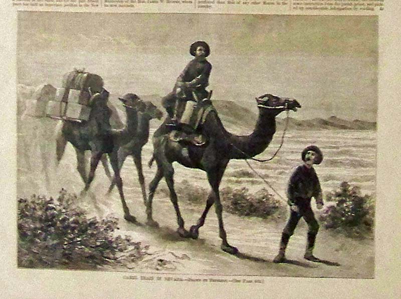
024Nevada: 1877 Harper's Weekly half-page wood engraving showing a Camel Train in Nevada. Drawn by Frenzeny. 11 x 8 in. $40 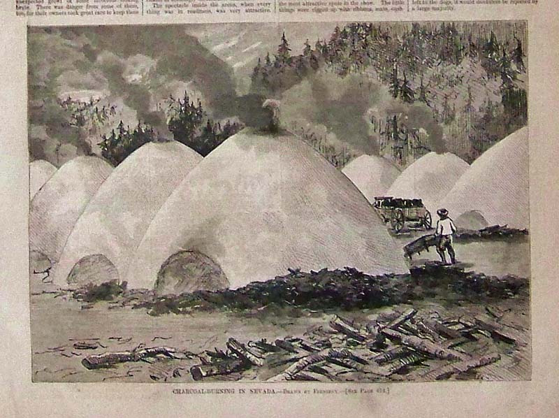
025Nevada: 1877 Harper's Weekly half-page hand colored wood engraving titled, "Charcoal-Burning in Nevada." Drawn by Frenzeny. 11 x 8 in. $40 Black & White: $30 
026Nevada: 1869 Harper's Weekly half-page hand colored wood engraving showing The Central Pacific Railroad -- Passenger Train passing Palisades, Ten-Mile Canon, Nevada. Small stain covering part of caption but doesn't affect image. 10 x 7 in. $40 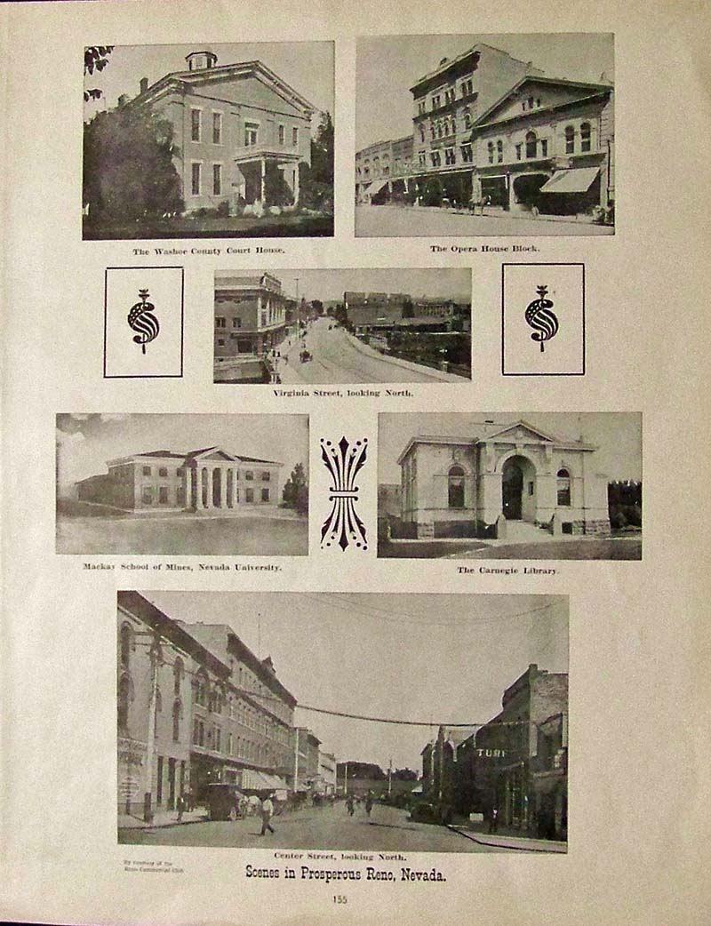
027Nevada: Six antique half-tone images of Scenes in Prosperous Reno, Nevada, by Courtesy of the Reno Commercial Club. 14-1/2 x 11-1/2 in. $30 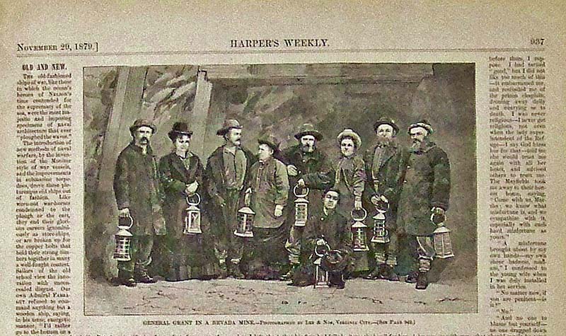
028Nevada: 1879 Harper's Weekly half-page wood engraving showing General Grant in a Nevada Mine. 10-1/2 x 6-1/2 in. $30 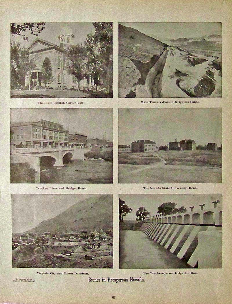
029Nevada: 1911 Antique half-tone Scenes in Prosperous Nevada, by courtesy of the Southern Pacific Railroad. The State Capitol in Carson City, the Truckee River and Bridge in Reno, and Nevada State University are just a few of the scenes shown. 14 x 11 in. $30 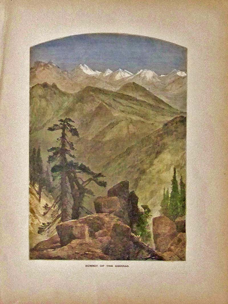
030Nevada: 1874 Hand colored wood engraving from Picturesque America showing the Summit of the Sierras. 12-1/2 x 9-1/2 in. $50 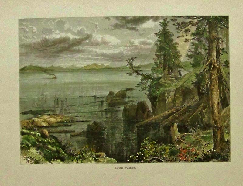
031Nevada: 1873 Thomas Moran hand colored wood engraving showing Lake Tahoe. Image was featured in Picturesque America. 12-1/2 x 9-1/2 in. $50 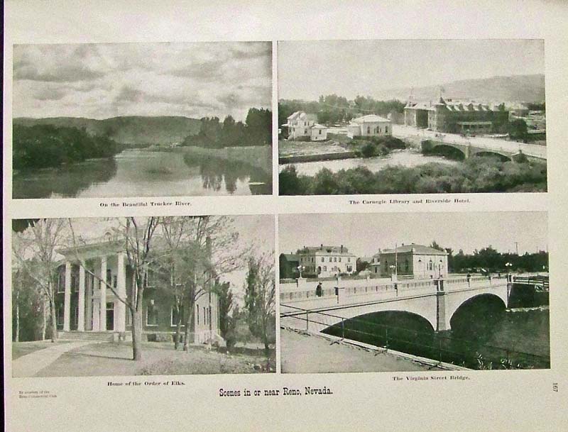
032Nevada: 1915 Half-tone Scenes in or near Reno, Nevada, by courtesy of the Reno Commercial Club. 15 x 12 in. $30 
033Nevada: 1855 Hand colored lithograph showing the Great Basin from the Summit of Tejon Pass. Part of the USPRR Exp. & Surveys - Cal. -- Geology, Plate V. 11 x 9 in. $50 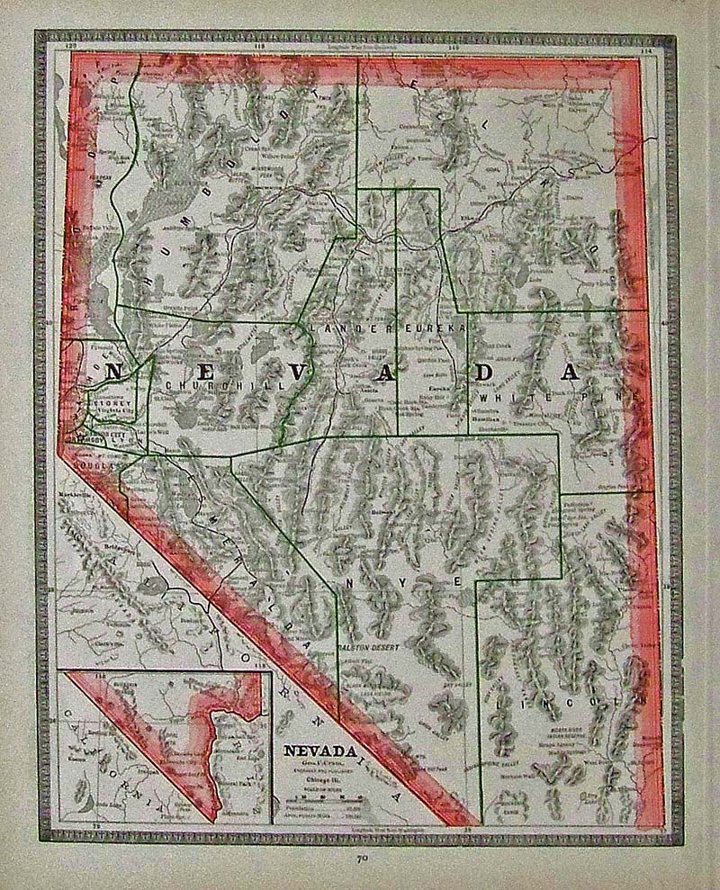
034Nevada: 1885 Color-outlined map of Nevada by Geo. F. Cram with inset bottom left corner of tip of Nevada. 13-1/2 x 11-1/2 in. $40 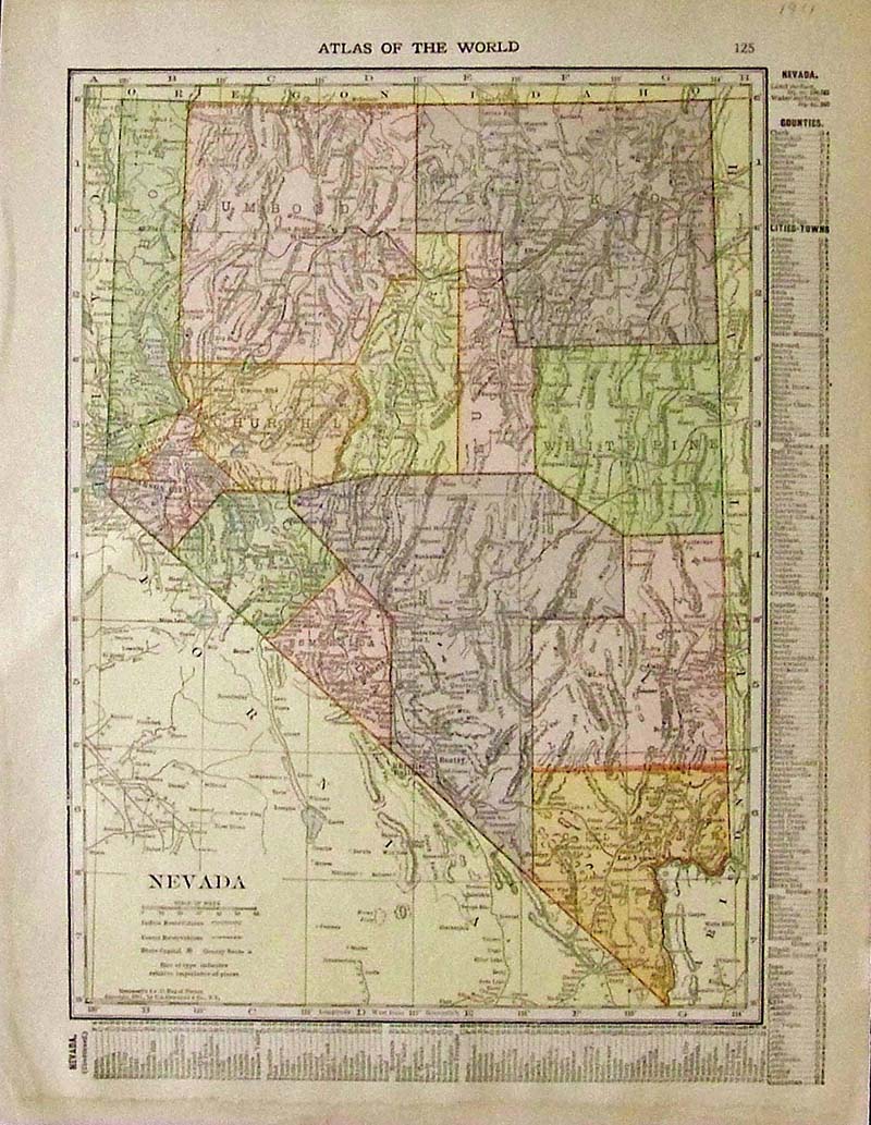
035Nevada: 1911 Color Atlas of the World Nevada map with Key to Counties and Cities/Towns on far right. 13 x 10 in. $30 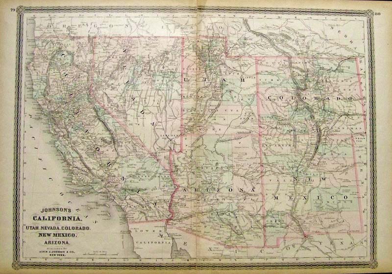
259ca: 1864 Hand colored engraved Johnson's California, also Utah, Nevada, Colorado, New Mexico, and Arizona. Published by Alvin J. Johnson & Co., New York. 26 x 18 in. $350 |
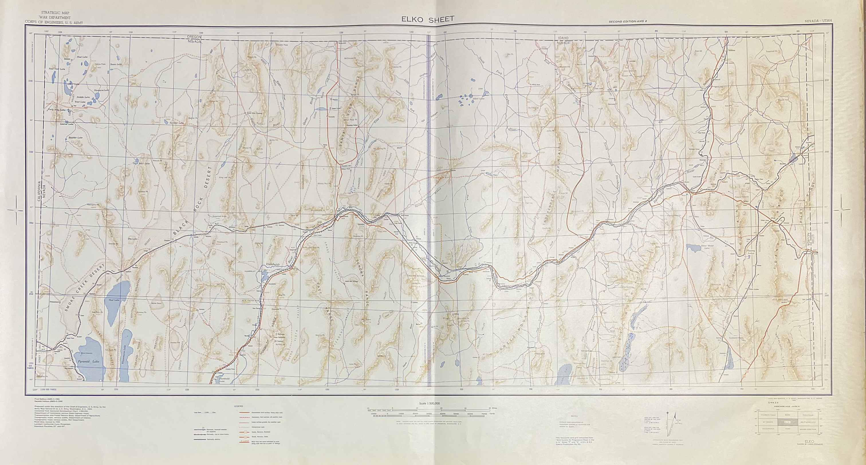
 203nv: 1952 Nevada Highway Road Map. Issued by Dept of Highway – Folded – Pre-freeways and big population. Fine condition. 4 x 9 in. $30 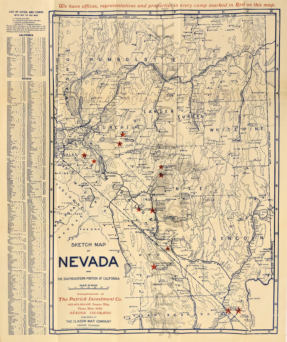 204nv: Nevada Road Map 1906. Clason Map Co. for the Patrick Investment Company of Denver. Shows their offices plus roads, towns, geographical features and railroad lines. Printed in color. 15 x 18 in. $225 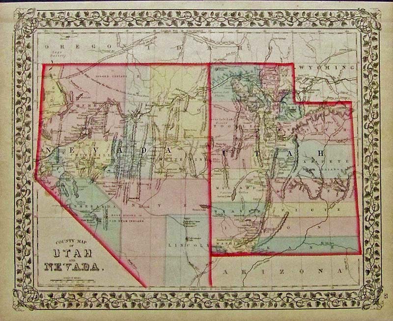 036Nevada: 1877 Hand colored engraved County Map of Utah and Nevada with ornate leaf border. Entered according to Act of Congress by S. Augustus Mitchell in the Office of the Librarian of Congress at Washington. 15 x 12-1/2 in. $80 Check for availability 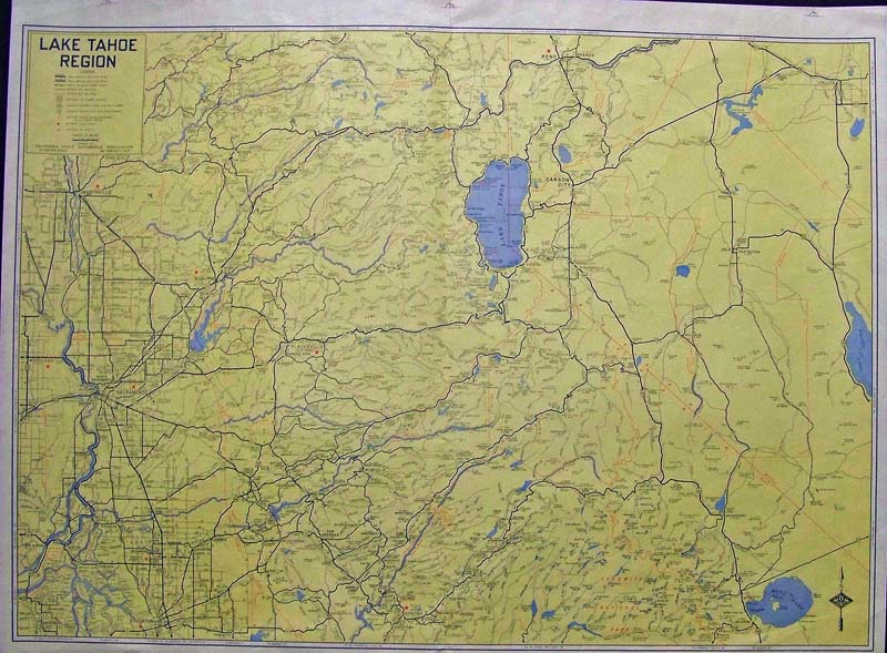
038Nevada: C.1975 Color map of the Lake Tahoe Region published by the California State Automobile Association. 28 x 21 in. $50 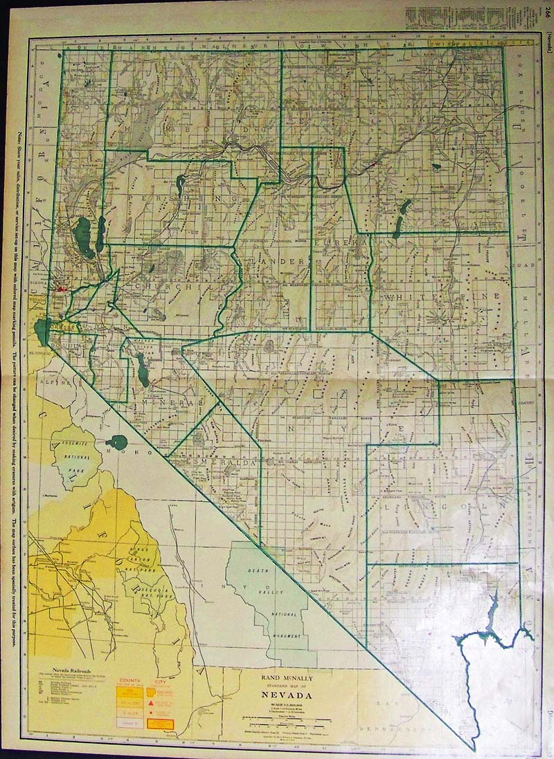
039Nevada: 1951 Color Rand McNally Standard Map of Nevada. Map displays the railroads, County and City Population, Counties, Cities and Streets as well. 27-1/2 x 20-1/2 in. $80 
041Nevada: 1898 Rare Rand, McNally & Co.'s map of Nevada which shows all the railroad lines and stops. 20-1/2 x 13 in. $160 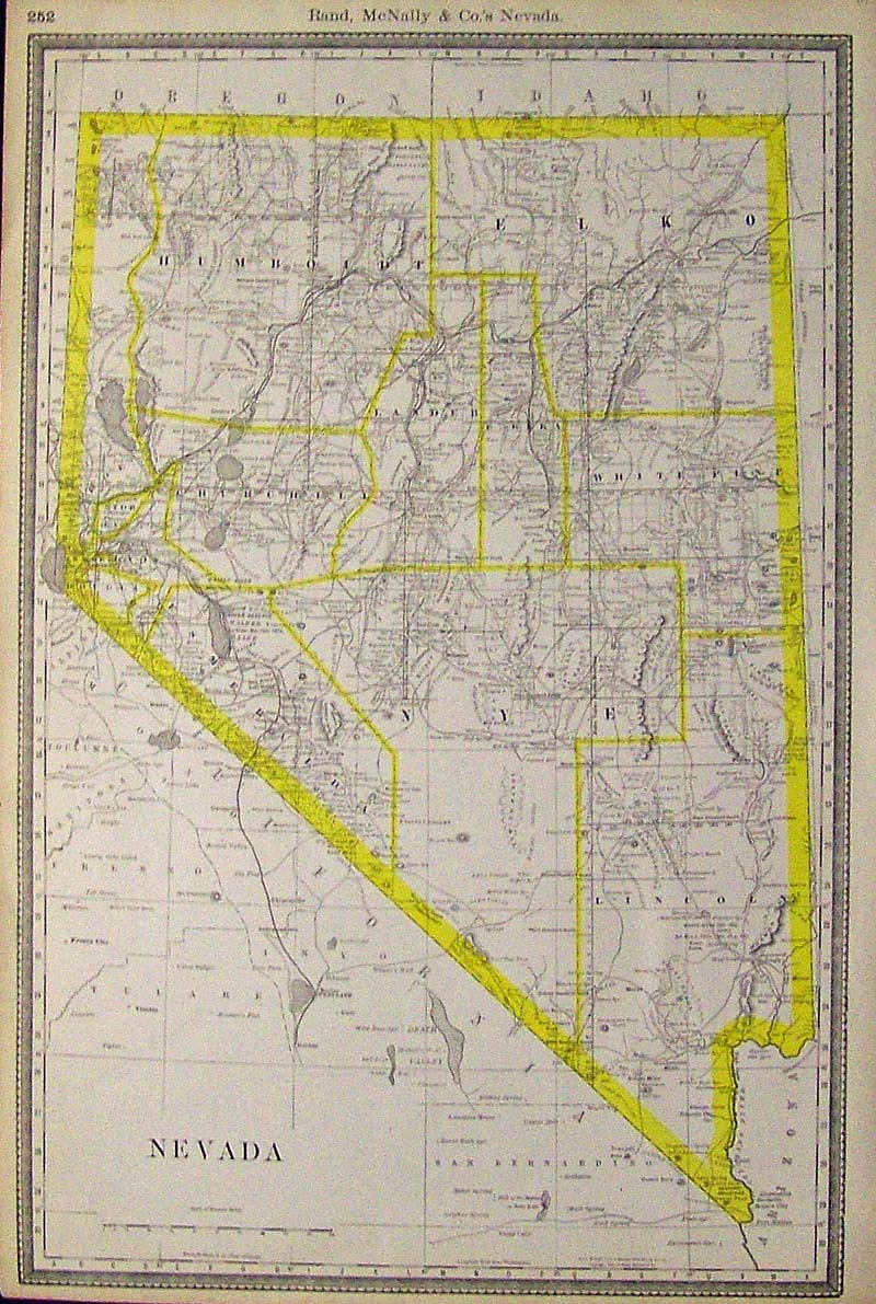
042Nevada: 1889 Rare Rand McNally & Co.'s map of Nevada which shows all the railroad lines and stops and is outlined in bright yellow. 20-1/2 x 14 in. $180 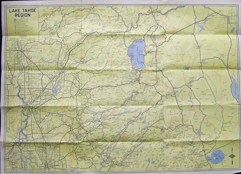
043Nevada: Early AAA map showing the Lake Tahoe Region. Counties included in map are Alpine, Almador, Calaveras, El Dorado, Nevada, Placer, Sacramento, and major portions of the counties of Mono, San Joaquin, Sierra, Sutter, Tuolumne, Yuba, and part of Nevada. Opposite side of map shows distances to and from various locations. 28 x 20-1/2 in. $40 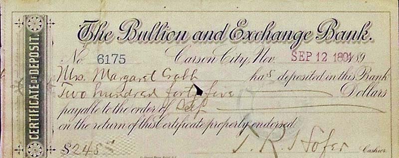
044Nevada: 1891 Certificate of Deposit from The Bullion and Exchange Bank for $245 to Mrs. Margaret Crabb. 9 x 3-1/2 in. $20 
045Nevada: 1895 Check from The Bullion and Exchange Bank written out to California State Bank for $200 to the Anglo-Californian Bank, Limited in San Francisco, Cal. 8-1/2 x 3-1/2 in. $20 
046Nevada: Antique Carson, Nevada's Saving's Bank check written out for $245. 8 x 3 in. $20 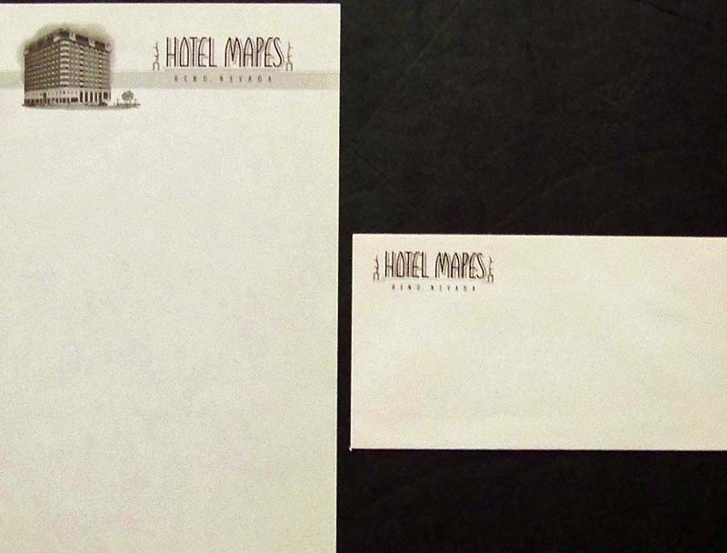
047Nevada: Stationery and envelope from Hotel Mapes from Reno, Nevada. $20 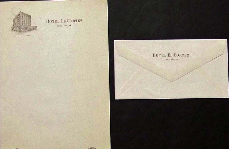
048Nevada: Stationery and envelope from Hotel El Cortez in Reno, Nevada, Home of the Trocadero. $20 
049Nevada: 1876 Check receipt received from S.T. Curtis, Superintendent for $124 from Savage Mine. 8-1/2 x 3-1/2 in. $20 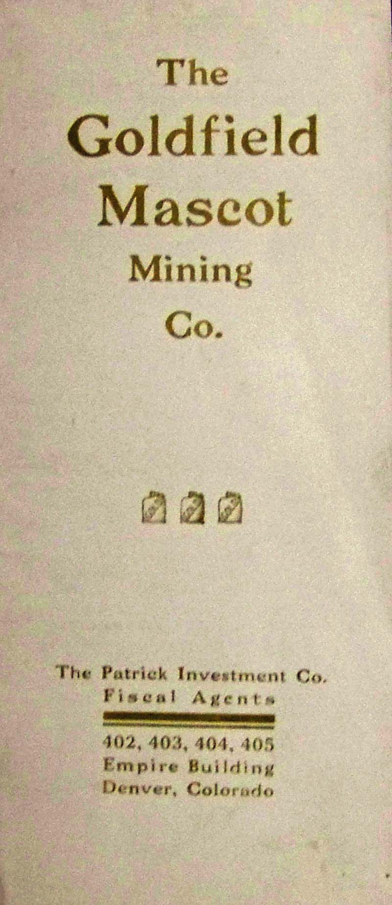
050Nevada: The Goldfield Mascot Mining Co. brochure by The Patrick Investment Co. Fiscal Agents which shows Capital Stock Shares and Treasury Shares. $30 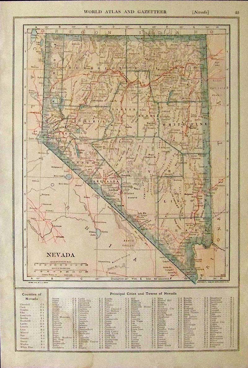
051Nevada: 1914 World Atlas and Gazetteer color map of Nevada with a key on bottom toPrincipal Cities and Towns of Nevada. 15 x 10 in. $30 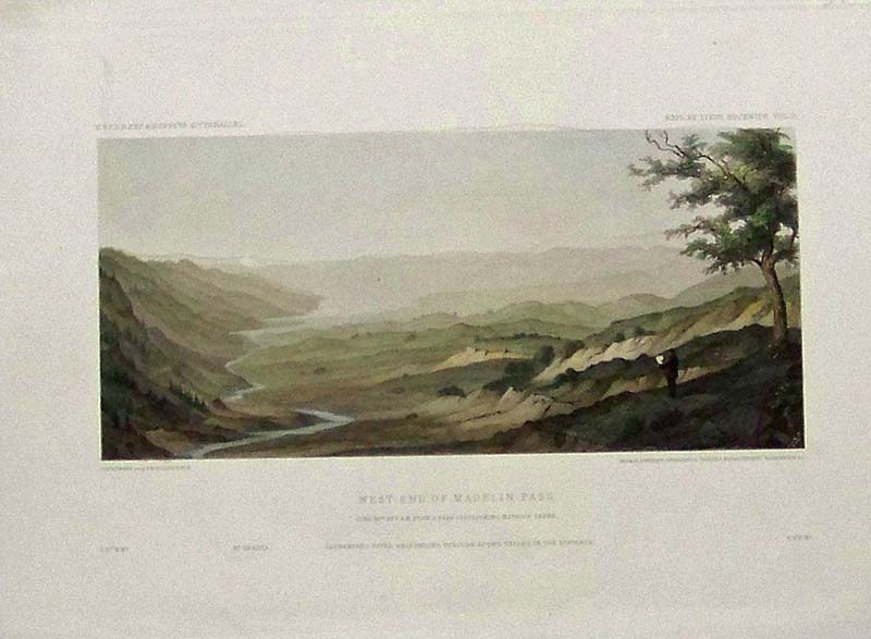
053Nevada: 1859 Hand colored steel engraving showing the West End of Madelin Pass, from a peak overlooking Madelin Creek. From the U.S.P.R.R. Exp. & Surveys, 41st. Parallel. 11-1/2 x 8-1/2 in. $60 
054Nevada: 1894 Marriage announcement with newspaper clipping of the wedding of M.C. Osburne, Superintendent of the Gas Company and Miss M.T. Fox of Gold Hill. They were married at the Arlington Hotel in Carson, Nevada. $20 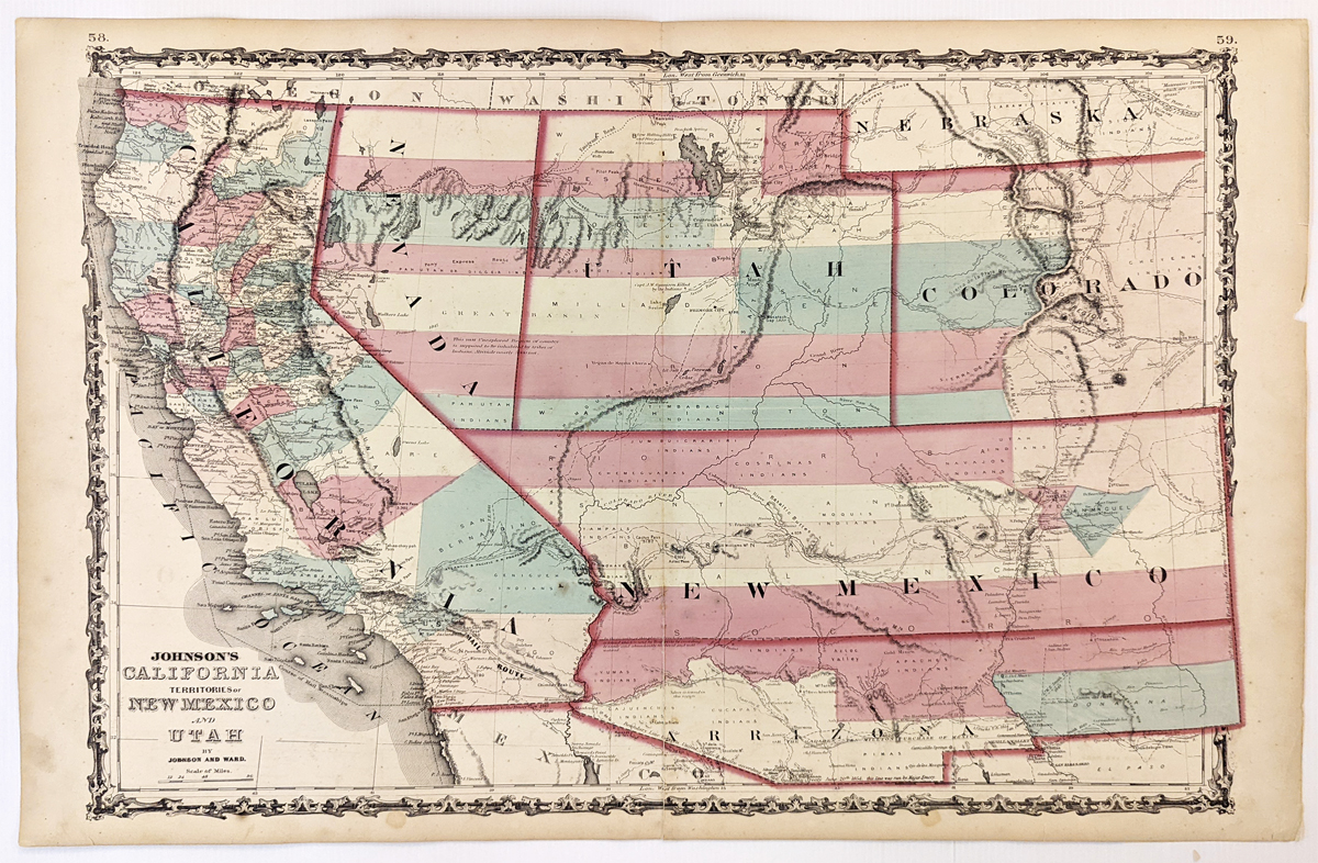
279California: Johnson’s California, Territories of New Mexico, Arizona, Colorado, Nevada and Utah 1863 - A large engraved and original hand colored map of California & the Southwest, the map has a very decorative border, pastel colored counties and shows a number of interesting territorial anomalies. Nevada has its lower corner truncated, leaving Las Vegas in Arizona. Utah extends approximately 1 degree too far to the west, prior to the last set of reductions undertaken by the US Government. Several counties still extend into both Arizona and New Mexico. In each of the states and territories, the county configurations are still largely incomplete. This is one of the most detailed accurate commercial maps of the era that includes the US Pony express route, explorer routes, the major routes of commerce, towns, forts, Indian Tribes, mountains, rivers, roads, mining districts, proposed railroad routes, important dates in the evolution of the US-Mexico Boundary, etc. Johnson's map of the West is one of the most interesting and collectable maps of the period. The maps were updated annually or more often, showing profound territorial boundary changes and county formations from year to year and even within a single year. Condition: Very good, fold in middle with some staining along the fold, water marks on margins and some light foxing inside image. size 23.5 15.5 image. $600  001Nevada: 1882 Hand colored lithograph showing the Comstock Mine Maps. Number II. United States Geological Survey. Litho by Julius Bien & Company. Largely stained. 32-1/2 x 20 in. As is: $60 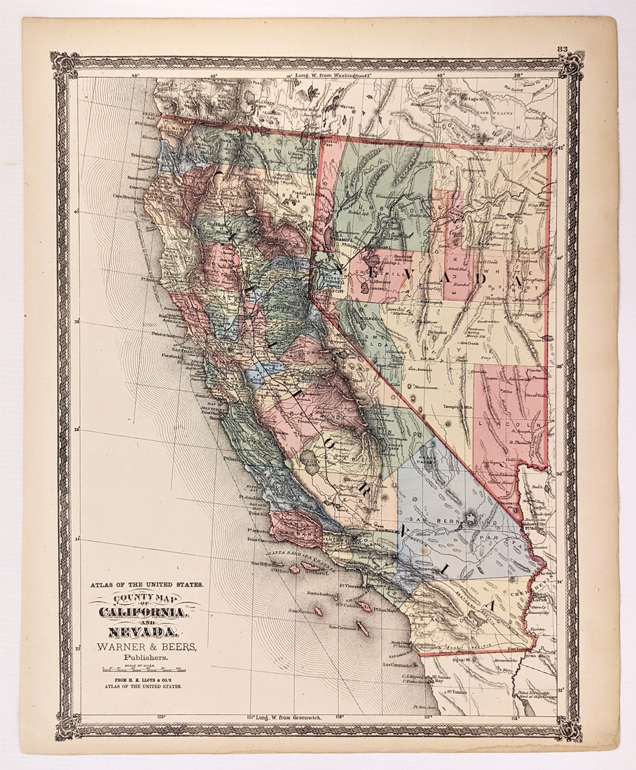 322California: 1873 County Map of California and Nevada. Warner & Beers. Shows towns, railroads, roads, rivers, mountains, dry lakes, Indian Tribes, etc. Showing only 6 Southern California Counties. Excellent condition. 15 3/8 x 18 1/8 in. $200 |
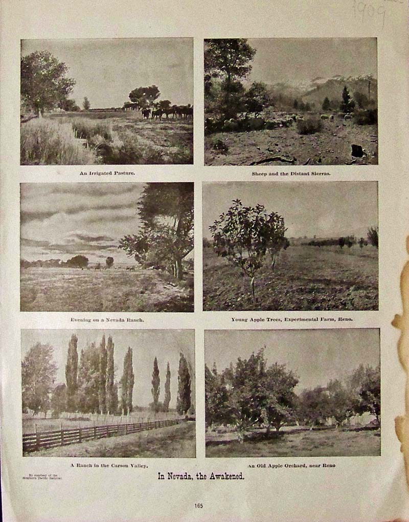 055Nevada: 1909 Half-tone images showing an irrigated pasture, sheep and the distant Sierras, an evening on a Nevada ranch, young apple trees in an experimental farm in Reno, a ranch in Carson Valley, and an old apple orchard near Reno. Images are captioned, "In Nevada, the Awakened." Published by Southern Pacific Railroad. 14-1/2 x 11 in. $30 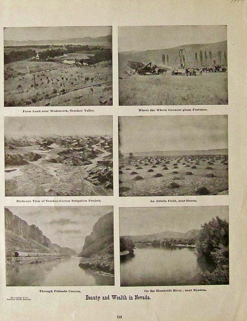
056Nevada: 1904 Half-tone images showing all the beauty and wealth in Nevada. Published by courtesy of the Southern Pacific Railroad. 14-1/2 x 11 in. $30 
057Nevada: 1868 Wood engraved images from Frank Leslie's Illustrated Newspaper showing a fight with a Nevada Desperado in top right of page. Text about image is on left middle of page. 16 x 11 in. $30 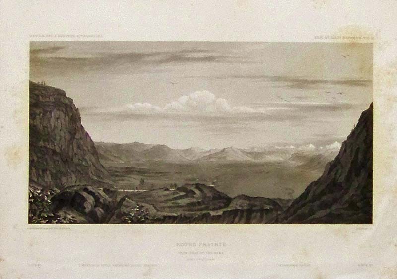
058Nevada: Steel engraving titled, "Round Prairie," From Head of the Same. Featured in the U.S.P.R.R. Exp. & Surveys, 41st Parallel. Light stains on outside border. 11 x 8 in. $30 
059Nevada: 1924 Half-tone advertisement for Dodge Brothers B Type Sedan costing only $1475 F.O.B. Reno by Osen Motor Sales Company, Inc. in Reno and Nevada. Featured in the Nevada Newsletter. 13-1/2 x 10 in. $35 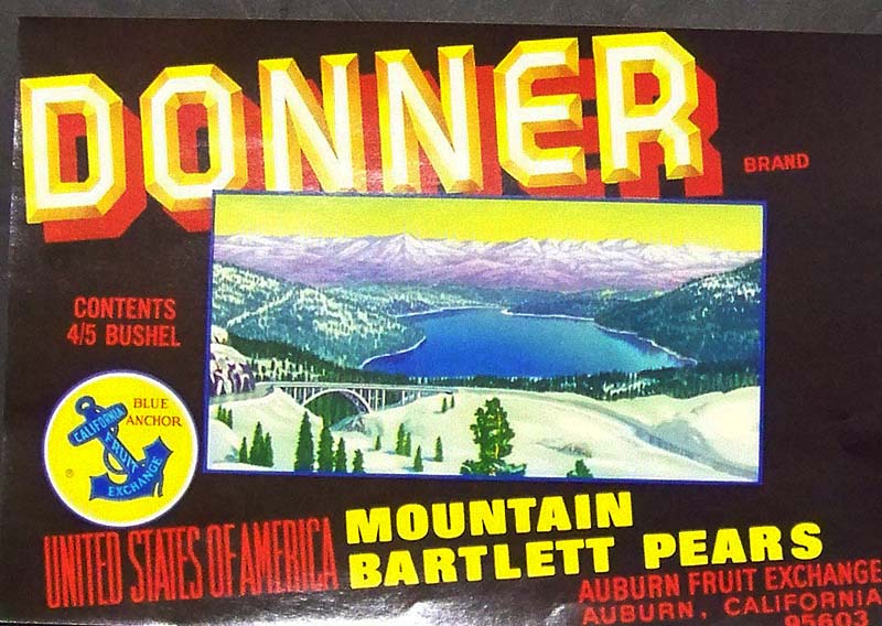
060Nevada: Color lithographed Donner Brand fruit label for United States of America Mountain Bartlett Pears grown in Auburn, CA for the Auburn Fruit Exchange. 11 x 7-1/2 in. $40 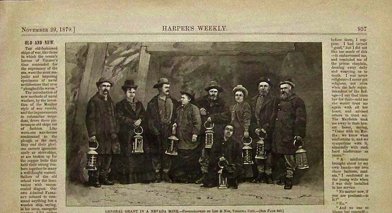
061Nevada: 1879 Harper's Weekly wood engraving on a quarter page showing General Grant in a Nevada Mine. 10-1/2 x 6 in. $30 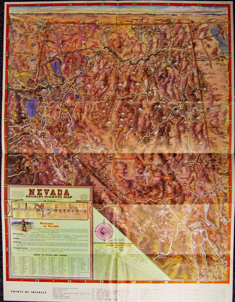
062Nevada: 1961 Color Nevada Tourist Map published by Shieldway Publishing; Gerald A. Eddy. Map shows topography, the atomic testing site, Highways 40, 50, and others, and includes an index of cities and towns in Nevada, along with recreation, climate, industry, points of interest, mileage chart, and transportation routes. 24 x 18 in. $150  100nv: 1888 Map of Nevada. Nice map of Nevada from Rand McNally's 1888 Atlas of the World. Each county is colored separately. Railroad lines through the state are shown, as well as cities, towns and geographical features. 11x14 in. $30 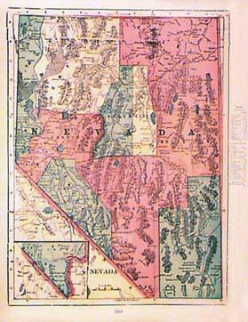 102nv: 1885 Map of Nevada. Colorful map, published circa 1885 in a world atlas. Shows cities, towns, railroad routes and geographical features throughout the state. A key in the right margin gives the locations of counties, cities and towns. 11x16 in. $30  103nv: 1906 Nevada Map by Rand McNally. Detailed map of the state, with each county colored separately. Shows cities, towns, railroad lines and geographical features. A key in the left margin gives the population by ethnic group, and the locations of counties, cities and towns. 11x14 in. $30  104nv: 1887 Bradley Map of Nevada, Utah. Engraved map of the two states, showing cities, towns, Indian reservations, railroad lines and geographical features. Each county is separately colored. 15x24 in. $90 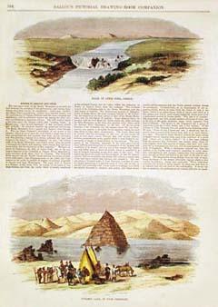 108nv: 1855 West: Pyramid Lake NV, Lewis Fork. Two hand colored engravings from Ballou's Pictorial Drawing Room Companion. Top image shows the falls of Lewis Fork, in the Oregon Territory. Bottom image is a view of Pyramid Lake in Utah Territory (now Nevada). Text between the images describes both scenes. 11x16 in. $50 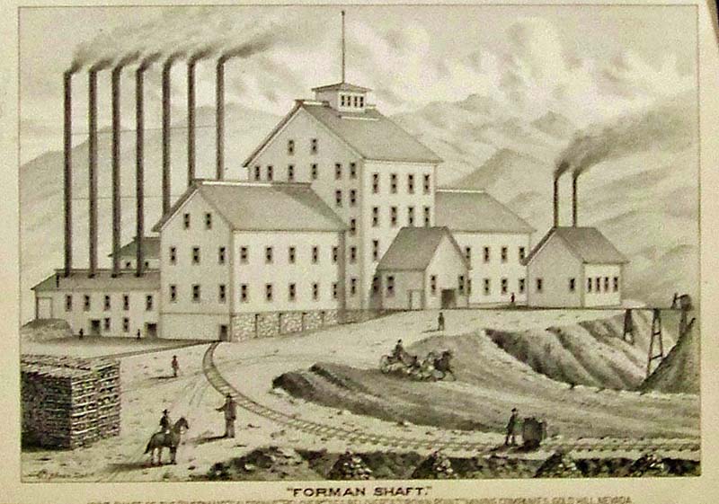
110nv: C.1880 Lithograph titled, "Forman Shaft." Image shows the Joint Shaft of the "overman," "Caledonia," "Belcher," "Seg. Belcher," & "Crown Point" Mining Companies, Gold Hill, Nevada. 11 x 8 in. $100 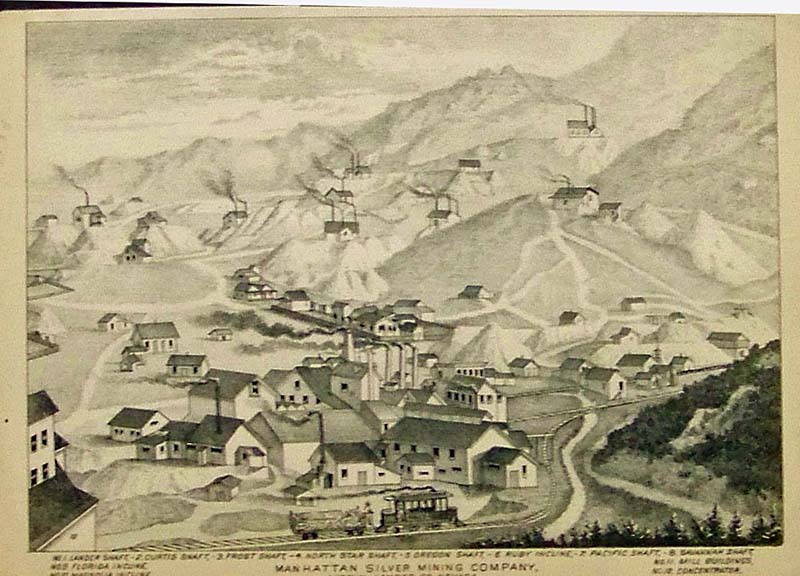
111nv: C.1880 Lithograph showing the Manhattan Silver Mining Company, Austin, Lander Co., Nevada. All the shafts and Mill Buildings are shown in rear and foreground. 11 x 8 in. $100  201nv: 1897 Railroad and County map of Nevada done by A. A. Grant of New York. County borders, meridians, cities, towns and even post offices are all shown on this map. There is great topographical detail as well names of mountians, valleys and deserts. The state border is highlighted in a pale red. A simple reference grid is contained in the border. 23x17 in. $80 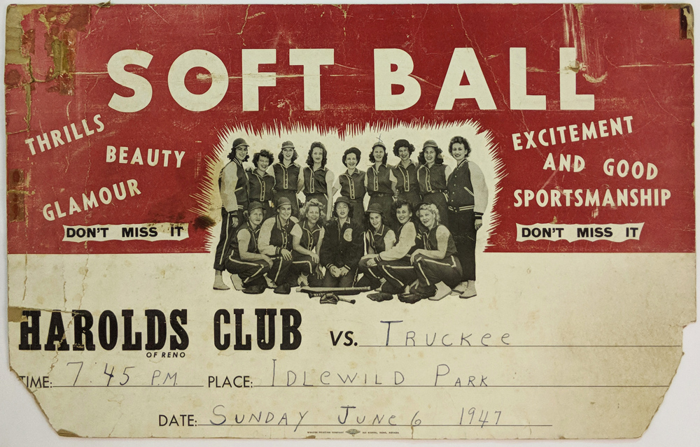 297bas: Woman's Baseball Team - Harold's Club vs Truckee. Original photo poster advertising. Photo taken on 6/6/1947. Damage to corners. 22 1/2 x 14 in. $75 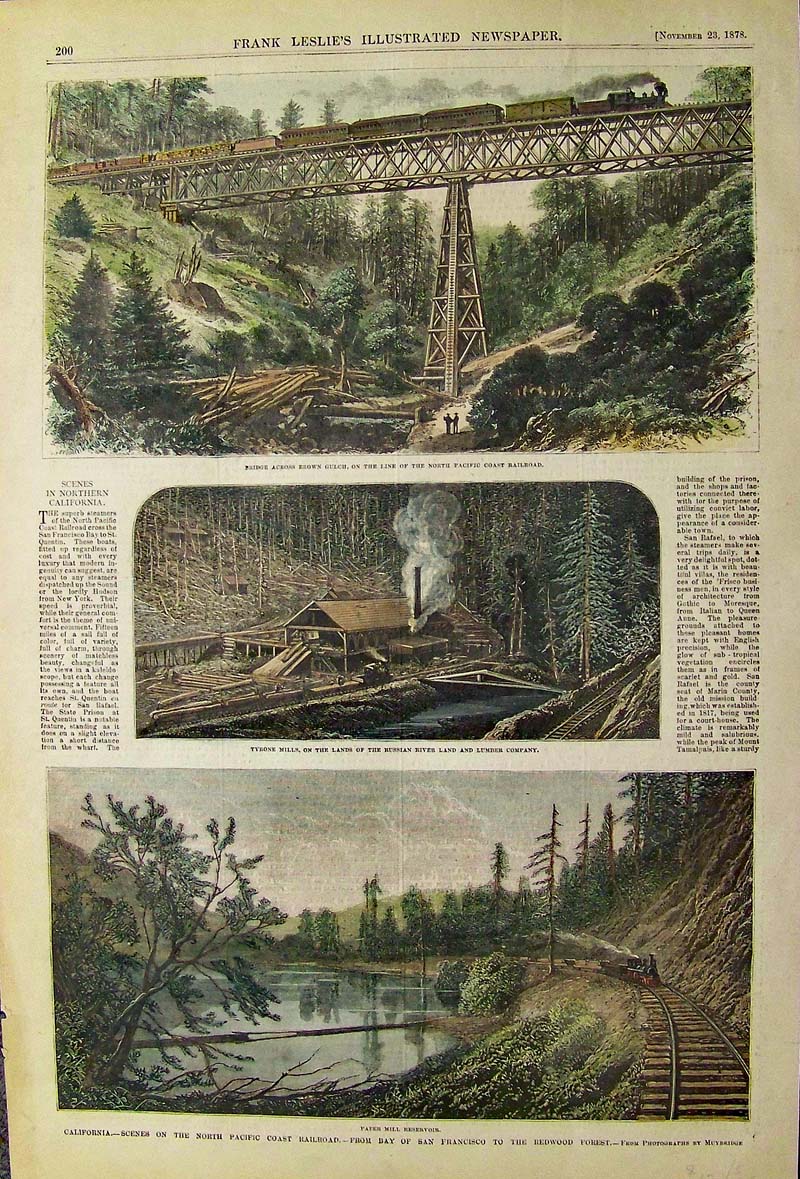 030California: 1878 Hand colored wood engraving showing Scenes on the North Pacific Coast Railroad, from Bay of San Francisco to the Redwood Forest in California. Top image shows the bridge across Brown Gulch on the line of the North Pacific Coast Railroad. 16 x 10-1/2 in. $60
|
|||||||||
| Order Form | |||||||||||
| Back to Homepage | |||||||||||