|
|||||||||||
This is a small selection of our inventory of antique New Orleans, LA maps and prints. Additional inventory is available. Contact us with your request. 1-800-879-6277
|
|||||||||||
|---|---|---|---|---|---|---|---|---|---|---|---|
 002no: Battle for New Orleans - Images show gun boats battle on the Mississippi and at New Orleans during the Civil War. 1862 Hand colored wood engraving featured in Frank Leslie's Illustrated Newspaper. 16 x 11 in. $80 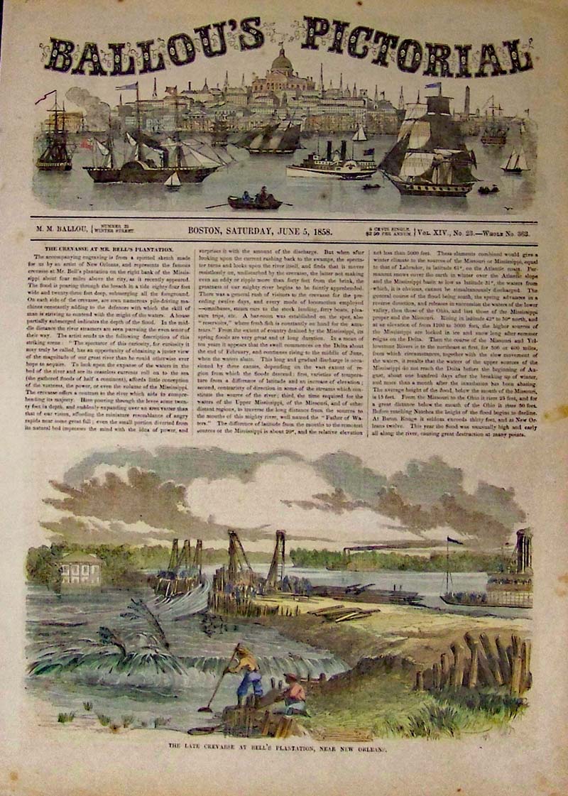
003no: Bell's Plantation in New Orleans - Image shows levee's being broken on the Bell Plantation. 1858 Hand colored wood engraving featured in Ballou's Pictorial. 16 x 11 in. $60 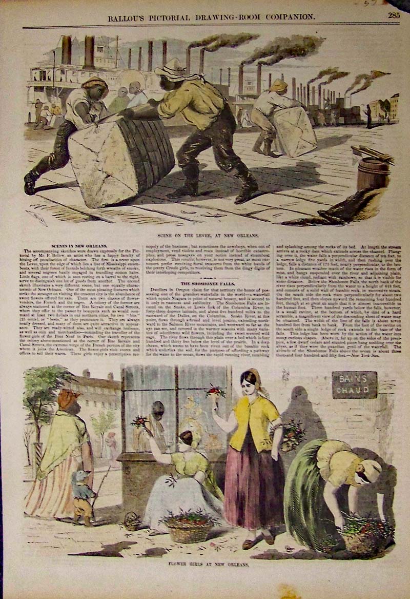
008no: Scenes in New Orleans - Life in New Orleans from work on the levee's to flower girls on the corner. 1855 Hand colored wood engravings featured in Ballou's Pictorial Drawing Room Companion. 15 x 11 in. $80 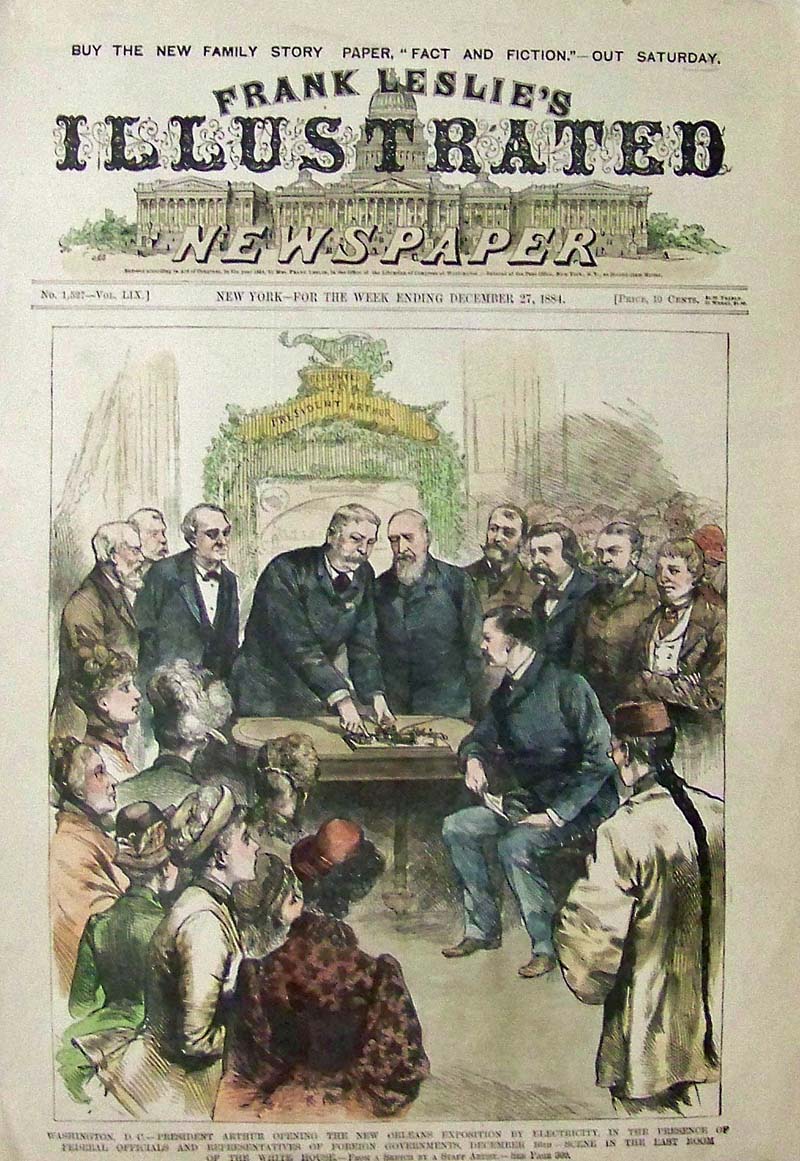 267NewOrleans: 1884 Hand colored wood engraving featured in Frank leslie's Illustrated Newspaper titled, "Washington, D.C. -- President Arthur Opening the New Orleans Exposition by Electricity, in the Presence of Federal Officials and Representatives of Foreign Governments, December 16th, -- Scene in the East Room of the White House." 16 x 10-1/2 in. $80
|
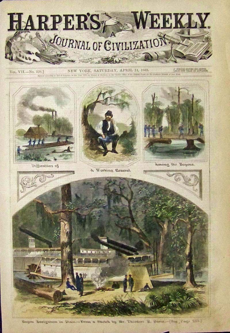
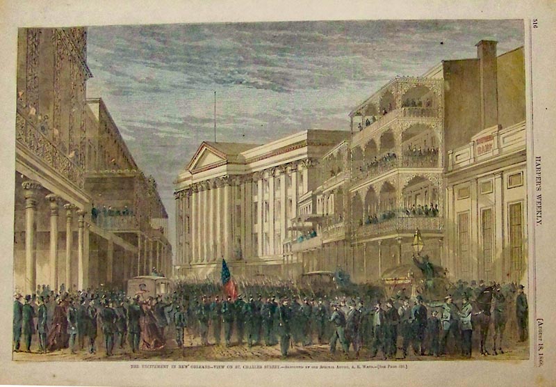 011no: 1866 New Orleans on St. Charles Street - Harper's Weekly hand colored wood engraving showing the Excitement in New Orleans. 16 x 11 in. $90 SOLD  101no: 1884 Hand colored wood engraving showing a Bird's-Eye View of New Orleans. Title of image is, "New Orleans -- The Crescent City-- Lake Pontchartrain in the Distance." Drawn by Charles Graham. Originally folded but in very good condition. 32 x 23 in. $600 SOLD  250no: 1855 Rare steel engraving by Frederick Piercy showing the route from Liverpool to the Great Salt Lake on a voyage of the steamboats which shows the New Orleans skyline. Engraving is matted. Engraving measures: 12 x 9-1/2 in. $300 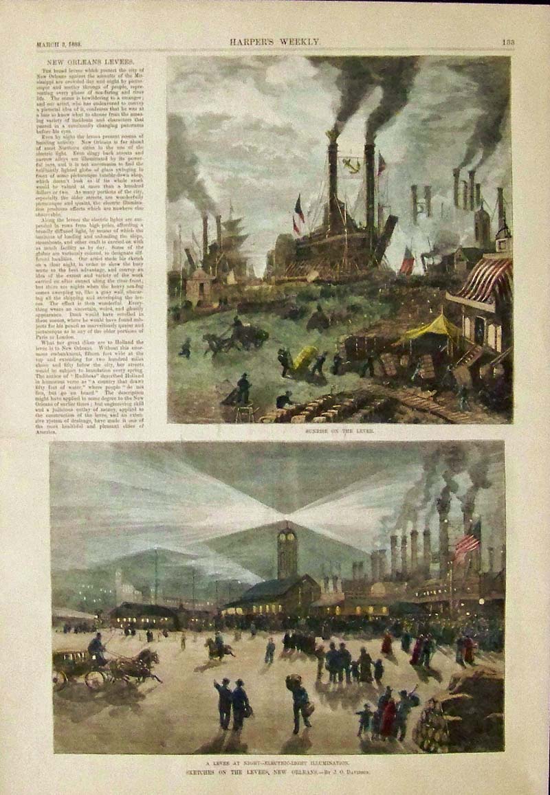 263no: 1883 Harper's Weekly hand colored wood engraving titled, "Sketches on the Levees, New Orleans." By J.O. Davidson. Small article on left side of top image on New Orleans Levees. 16 x 11 in. $50 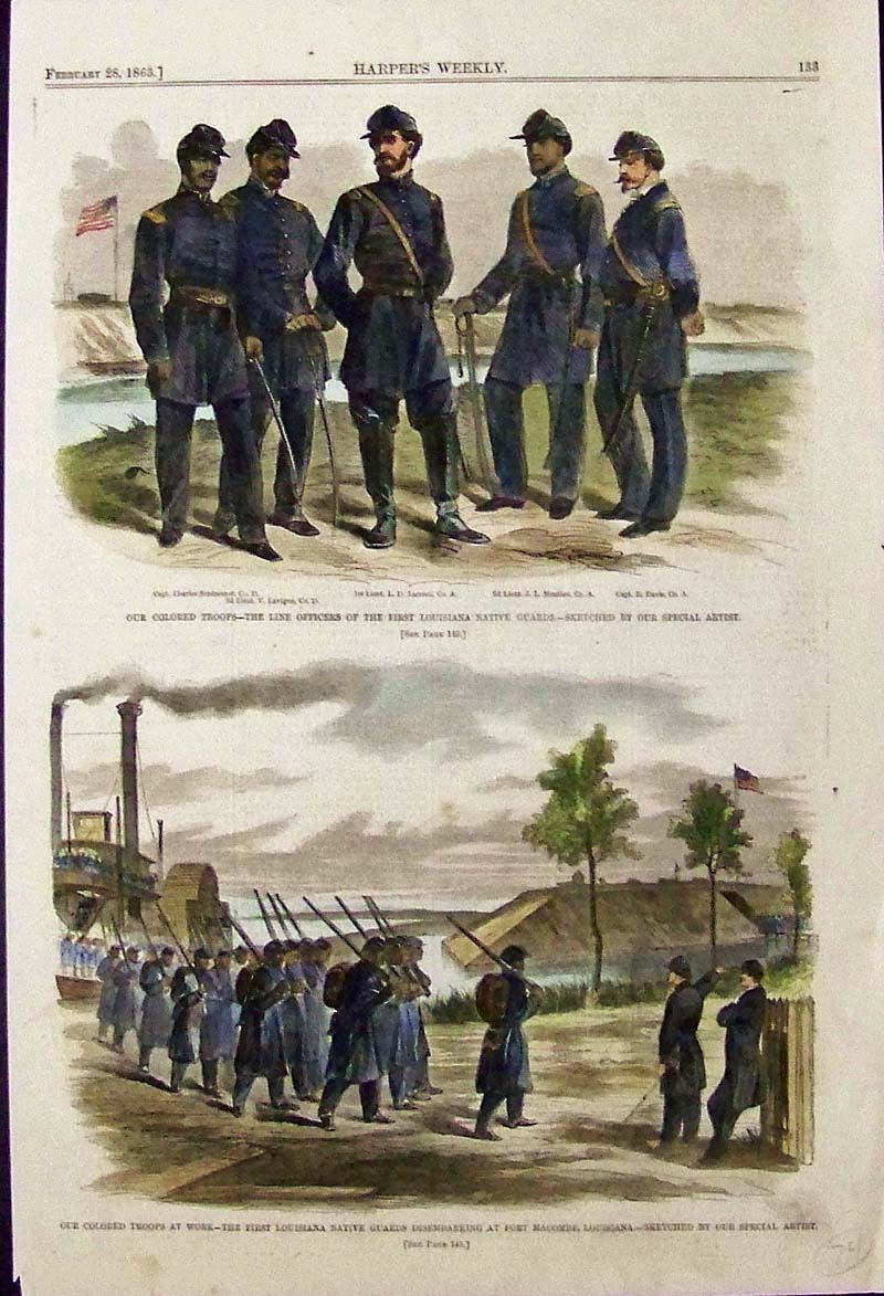
264NewOrleans: 1863 Harper's Weekly hand colored wood engravings showing the Line Officers of the First Louisiana Native Guards Disembarking at Fort Macombe, Louisiana. 16 x 10-1/2 in. $50
|
 257no: Grondvlakte van Nieuw Orleans de Hoofdstad van Louisiana. 1769 Copper engraved Plan of New Orleans which shows ancient views of New Orleans and the Mississippi River Delta. The city layout is displayed in the larger of the maps and the smaller maps detail the mouth of the Mississippi and the east passage detailing Fort La Balise. Engraved map is by Isaak Tirion. 19 x 15 in. $1,800 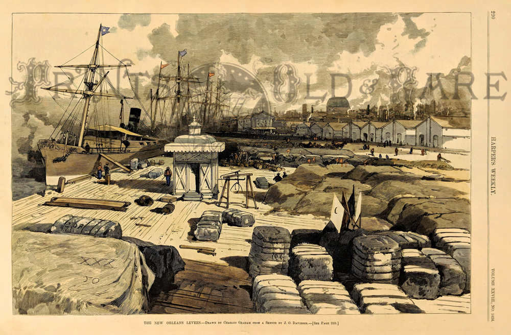 275NewOrleans: "The New Orleans Levees." 1883 Harper's Weekly. Hand colored, wood engraving. 16 x 11 in. $100
|
|||||||||
| Order Form | |||||||||||
| Back to Homepage | |||||||||||