 
|
|||||||||||
This is a small selection of our inventory of antique North America maps and prints. Additional inventory is available. Contact us with your request. 1-800-879-6277
|
|||||||||||
|---|---|---|---|---|---|---|---|---|---|---|---|
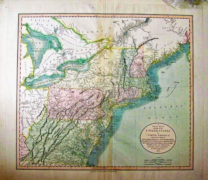 000nam: A New Map of Part of North America, Carey 1808 - A very handsome hand colored and highly detailed engraved map of the Northern portion of the United States, from John Cary's New Universal Atlas. The map includes the District of Maine and Ohio, which is still called The Western Territory. The map contains many interesting features: at the mouth of the Cayanhoga River on Lake Erie, there is a note about a seventy foot rock which makes navigation dangerous. Another note indicates that the easiest passage from Lake Erie to the Mississippi & Ohio Rivers is via the Sandusky & Sioto Rivers. A proposed fort is noted south of Detroit. The western boundary of the six Indian Nations in Western NY is noted. There are similar notes throughout the map, including annotations on each of the Great Lakes. The map is highly detailed and includes towns, roads, rivers, Indian details, springs, and a host of other information. Condition: Good, the map is mounted on fine thick paper, browning stain on vertical middle fold. size 20.5 x 18 image $500 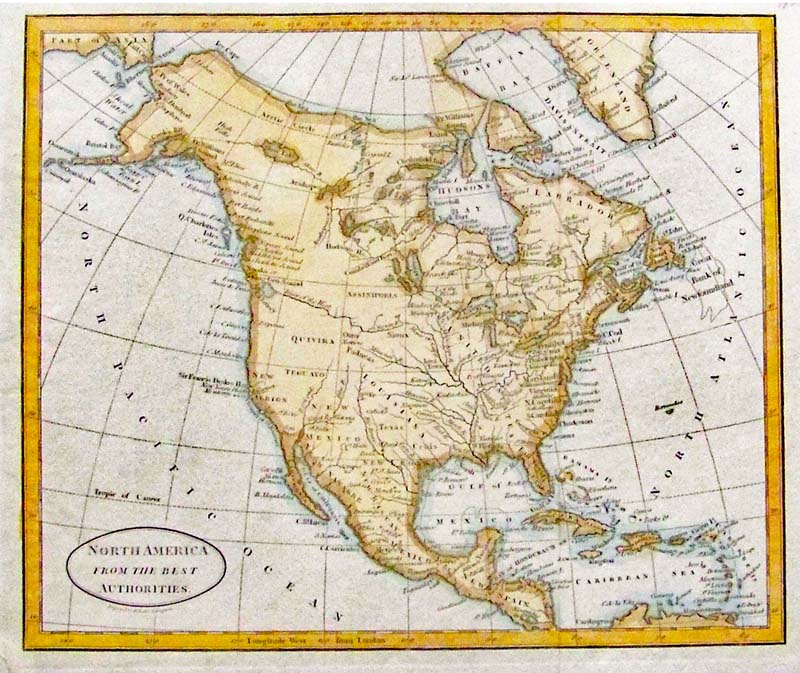 001nam: North America from the Best Authorities, Baker 1800 - An unusual engraved and hand colored map of the North American continent engraved by B. Baker Islington, with the eastern coast well populated and the western regions largely unmapped, however, the Louisiana Territory is shown. The well charted Pacific coast shows the map to be post the “Third Voyage of Captain James Cook,” but the continental interior does not yet reflect the discoveries of the Lewis and Clark expedition 1804-1806. An apocryphal "River of the West" with headwaters in the "Oregon River" flows from the center of the continent, although there is no central mountain chain marked. A fascinating map from the early years of the United States. Condition: Good, small margins, left bottom corner torn. size 7 3/4 x 9 ¼ image $150 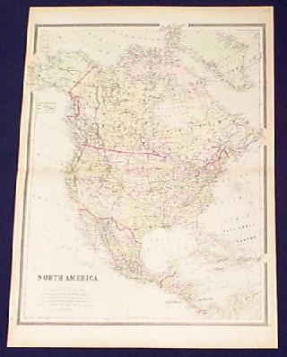
002nam: 1889 Gray's Map of North America. Beautiful hand colored map. One of the most handsome and detailed. Large 26x19 in. $100 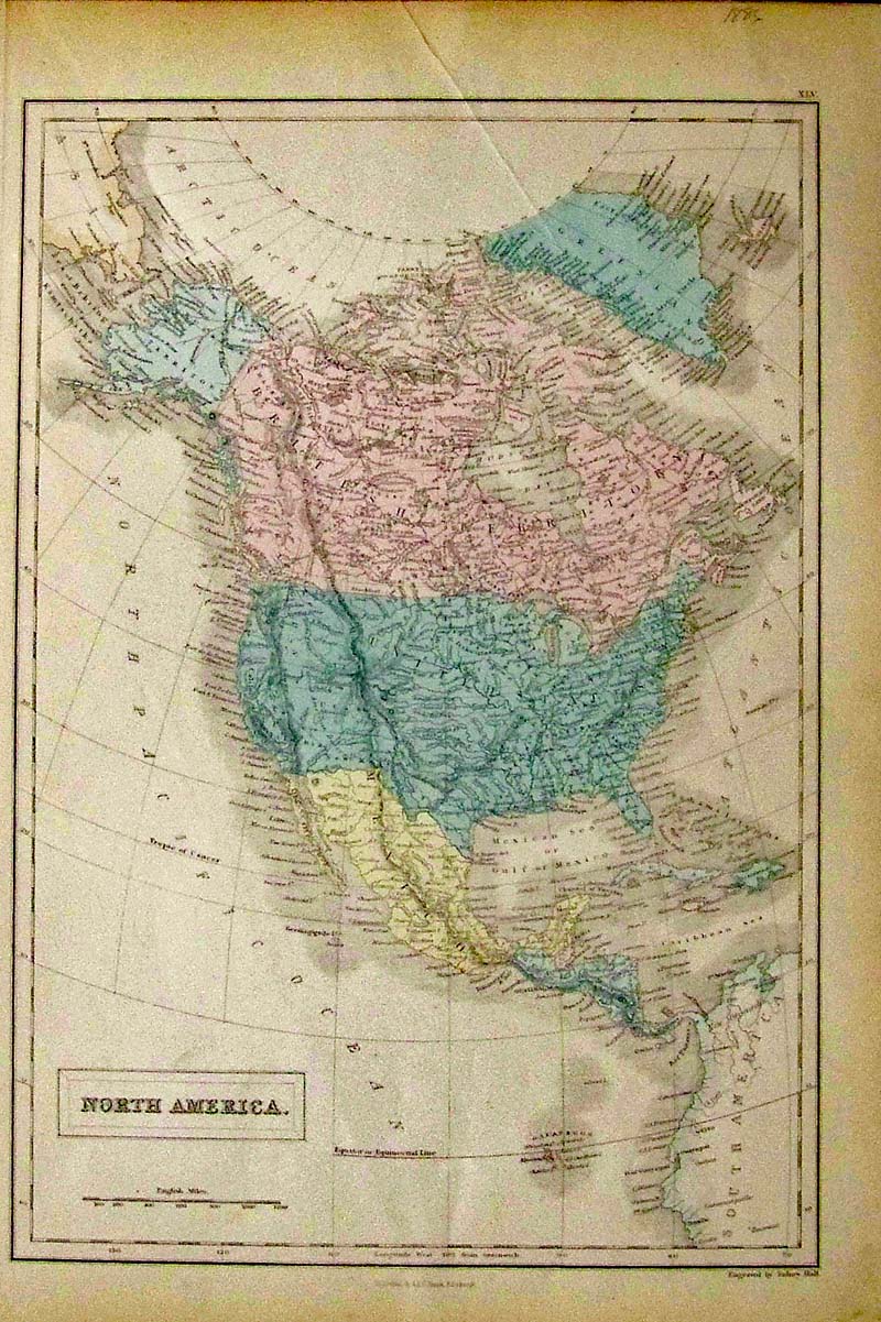 003nam: North America, Sidney Hall 1886 - An attractive engraved and original pastel colored map by Sidney Hall, published in Black's General Atlas, Canada is British Territory, Oregon extends into British Columbia, no Arizona, Washington State, or Idaho, Dakota’s and Minnesota one etc. Condition: Very good, wide margins, browning on edges small tooth six piece missing from bottom left margin. size 11.25 x 15.75 image $80 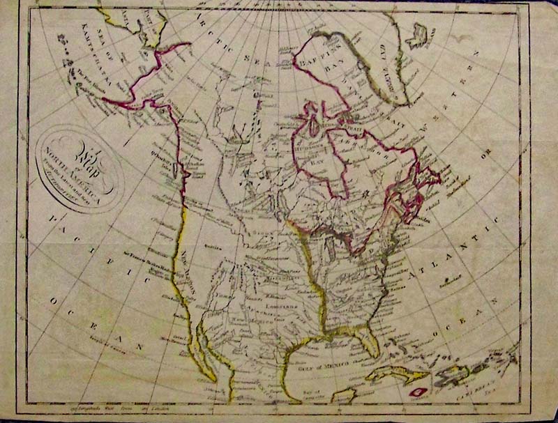
004nam: A Map of North America from the Latest and Best Authorities, Morse 1796 - A rare engraved small black and white map of North America, by Jedidiah Morse, from "The American Universal Geography", 1796. Includes New Albion and Sir Francis Drake's Harbor in California. New Albion, also known as Nova Albion, was the name of all North America north of Mexico, from "sea to sea," claimed by Sir Francis Drake for England in 1579. The extent of New Albion and the location of Drake's port have long been debated by historians, with most believing that he came ashore in the Bay Area on the coast of northern California. Also includes the River of the West, an imaginary river that connects the east and west coasts (promoted by Thomas Jefferson). Quivira also appears on this map. Quivira was one of the Seven Cities of Gold that drove many people to search North America for these cities. Condition: Good, small margins top and bottom, brown aging color throughout, some original hand coloring (sloppy). size 10.5 x 8.5 image $200 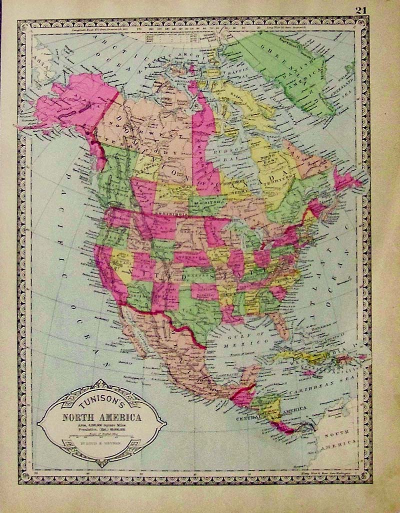
005nam: North America, Tunison, 1885 A handsome and unusual map from Tunison’s Peerless Universal Atlas created with wax engraving (cerography), more maps and atlases were able to be produced in cities beyond the major centers of New York, Philadelphia and Chicago. Henry C. Tunison issued a series of fine atlases beginning in 1885 and lasting into the beginning of the twentieth century. This map has brilliant color and decorative margins and is hand colored, show nearly all the states except Oklahoma and the Dakotas are one. Condition: Very good, slight tear outside image on right margin, small left margin and normal browning on margin edges, small dog ear missing from bottom right margin. size 10.25 x 13.25 image $90 
006nam: 1892 Large North America Map. Very detailed, printed in litho color. 25x17-1/2 in. $60 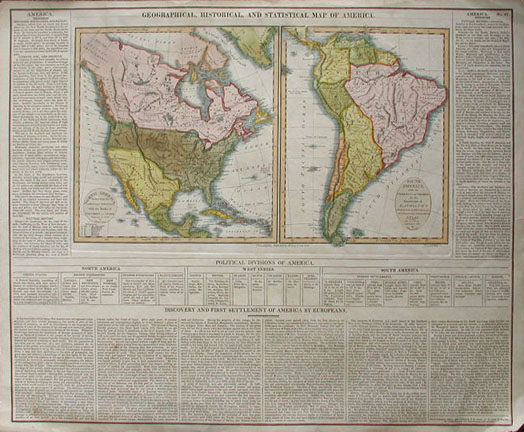 007nam: EARLY CAREY & LEA MAP OF AMERICA. Stunning old hand colored engraving, "Geographical, Historical, and Statistical Map of America" by Carey & Lea, produced in 1822. Much informational text is included on the Political Divisions of America and the Discovery and First Settlement of America by Europeans. Also includes a historical sketch. A genuine antique. Excellent Condition. 22 x 17.5 in. $400 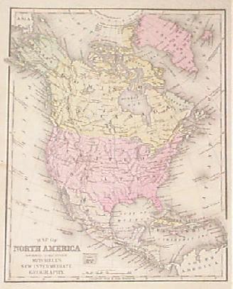
011nam: 1887 Mitchell Map of North America. From school atlas, orginal hand color. 9x12 in. $50 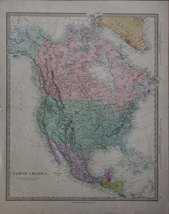 014nam: Very nice colored map of North America from 1874. Shows portions of Greenland, Canada, United States, Mexico, and portions of Central America. 14x17.5 in. $100 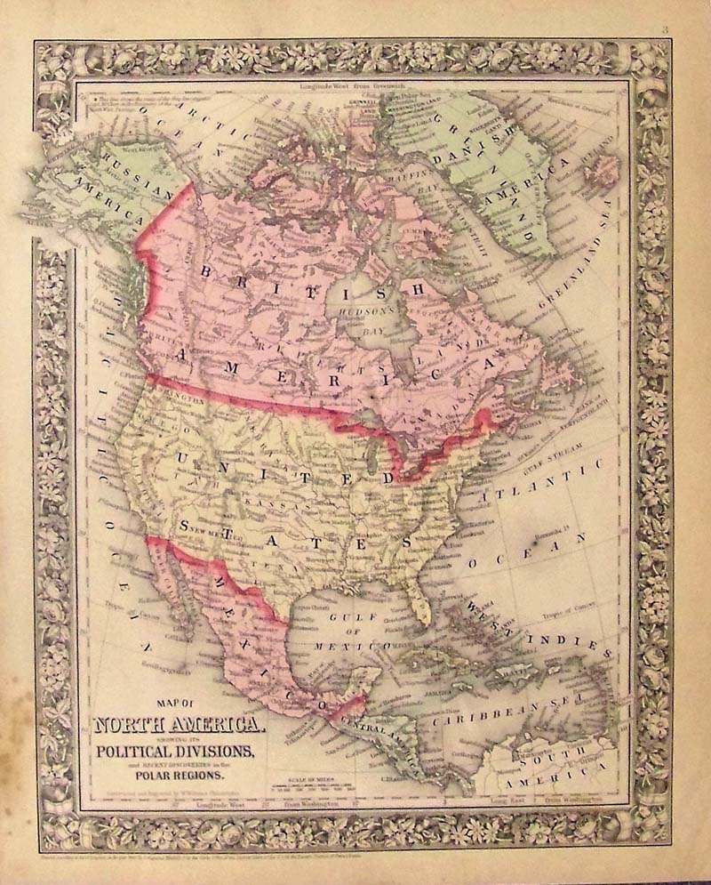
016nam: 1860 Map of North America Showing its Political Division and Recent Discoveries in Polar Regions Mitchell. This handsome map of North America was made by S. Augustus Mitchell, in 1860, for his New General Atlas. This engraved map features bright original hand coloring that differentiates regions and country sections, a decorative floral border, and fine detailing including states, cities, rivers, lakes, and other geographical features. Alaska is Russian America, Arizona, Utah, Oklahoma and the Dakotas don’t exist yet and the Yucatan is depicted as a different country than Mexico. Condition: Good with normal age coloring on good margins, lower right heavy water marks and some foxing but all outside the image. size, 10 x 13.5 image. $180  019nam: 1878 Map of North America. Hand colored antique engraved map by Gray. Very nice. 14-1/2x16-1/2 in. $120 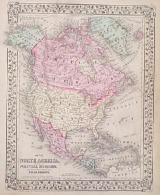
021nam: 1867 Map of North America. Beautifully hand colored engraved Mitchell map, with characteristic decorative border. 12-1/4x15-1/4 in. $120 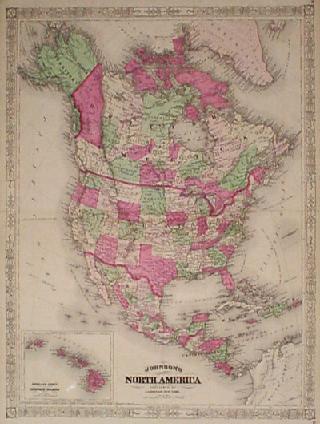
022nam: 1867 Johnson North America Map. Hand colored antique map, 1867, with inset of Sandwich Islands (Hawaii). Attractive border. 18x26 in. $140 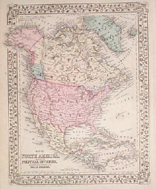
023nam: 1880 Mitchell Map of North America. Beautiful hand colored antique map, showing political divisions and recent (as of 1880) discoveries in the north polar region. 12x15 in. $120 
025nam: 1892 North America Map. Large antique color litho map by Rand McNally. Very attractive and frameable. 21x27 in. $80 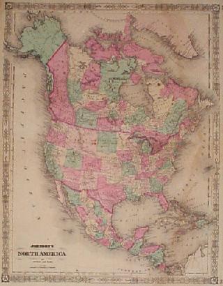
026nam: 1864 Johnson North America Map. Authentic U.S. Civil War era map of North America. Very attractive hand colored antique, large scale. 18x26-1/2 in. $140 
028nam: 1879 Zoo-Geographical North America Map. Printed in color by zones: Arctic, Boreal, Eastern, Antillean, Central, Western, Central American, Isothermals. Very interesting antique map. 11-1/2x18 in. $70  029nam: 1853 North and South America Map. Countries outlined in color. Names major cities and rivers. Very attractive old antique map. 14x17 in. $130  030nam: 1885 Hand colored lithographed map of North America by Gray which also shows the West India Islands, Central America, Greensland Danish America Alaska, and many orher provinces and islands. 24-1/2 x 19 in. $100 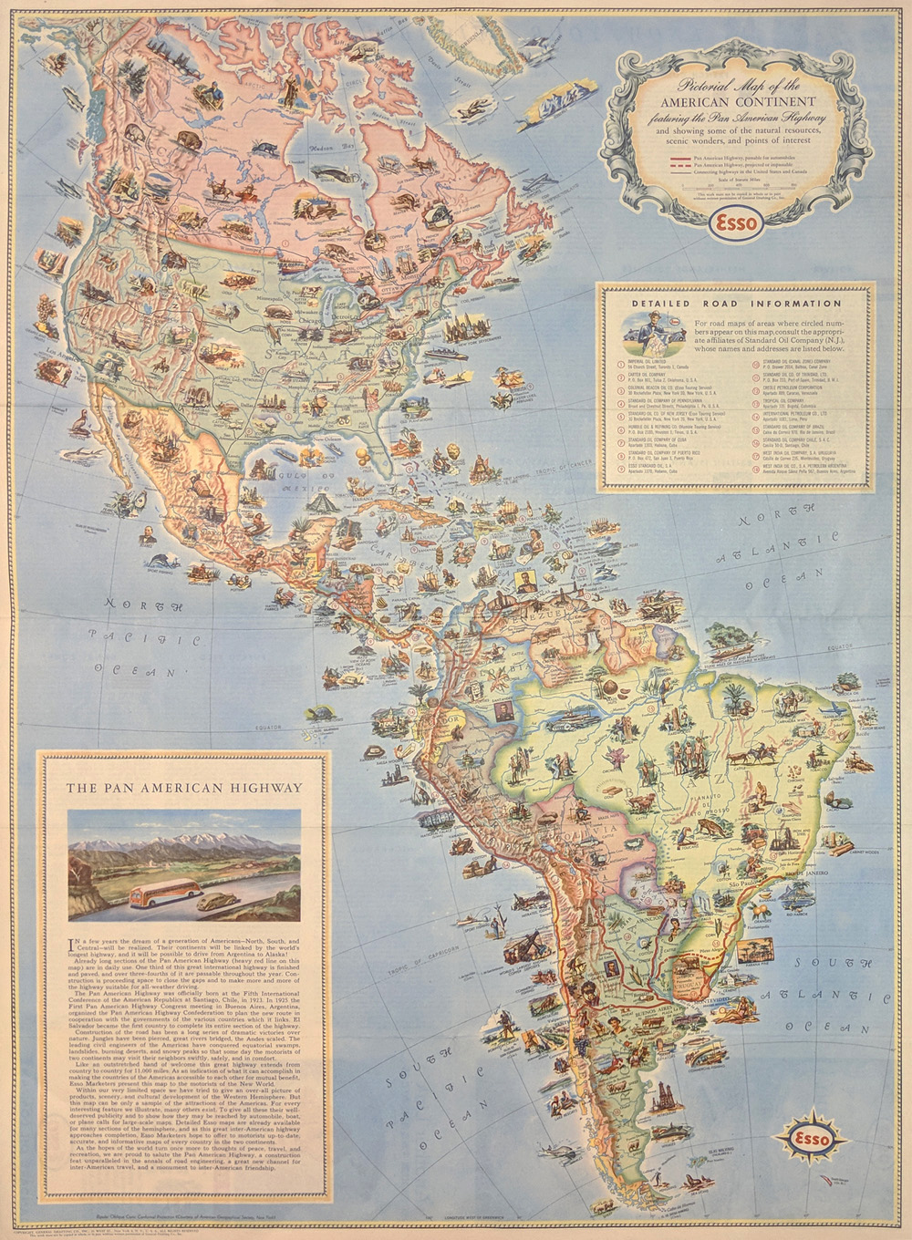 001pictorialmap: Pan American Highway Pictorial Map - Esso Corporation by American Geographical Society c1930. Pictorial Map of the American Continent showing scenic wonders and points of interest. Printed in color. 24 1/2 x 18 in. $195 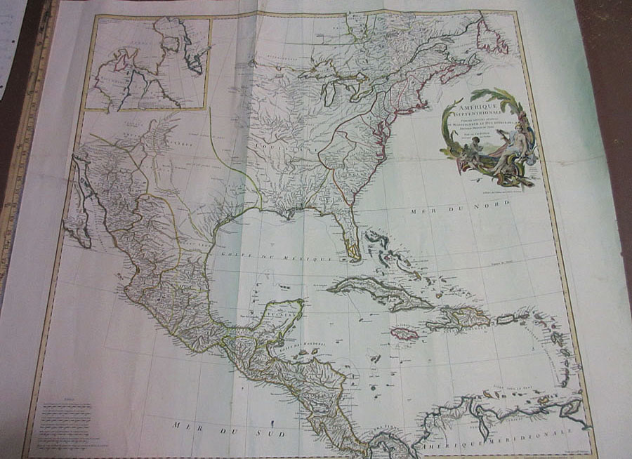 139rare: 1746 Hand colored copper engraved Map showing Amerique Septentrionale (French Map of North America) by Jean Baptiste Bourguignon d'Anville. Paris. Four professionally joined sheets. 41 x 36 in. $1500 |
 032nam: c.1840 Map of North and South America. In outline color. Shows major cities and rivers. By F.P. Becker & Co. Genuine antique map. 8x10⁻¹/2 in. $100 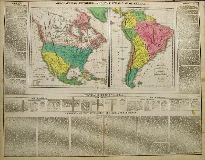 100nam: 1820 Geographical, Statistical and Historical Map of America Carey - Nicely illustrated with original pastel colors, two separate maps of North and South America printed on one sheet. Original hand color differentiates nations and claims. As noted on the map, this is second Philadelphia edition from 1817 London edition. The North American map shows the routes of Columbus and Cortes. Early Canadian border with United States. Several Indian tribal regions including "Long Hair Indians". Alaska as "Russian Settlements". South America with Pizarro's track. The map is framed on three sides with extensive text in English full of interesting statistics and history. Published in Philadelphia. Published by M. Carey and Son 1820, Philadelphia printed from the 1817 edition. Condition: Very good, some foxing and water stains on lower right text and margin, small margin at top. size 21 x 16.5, map images 15 x 8.5. $500  222nam: North America, Colton 1855 - A steel engraved and original colored map of North America, from Colton's General Atlas. A wonderful “time capsule map” showing Canada as British Possessions, Oklahoma as Indian Territory, one Dakota, Alaska Territory and a good section of the Artic including Greenland. Published by J.H. Colton and Company at No. 172 William St. New York in 1857. This is from the first edition of Colton's General Atlas, the first being a two volume issue in 1855. This historic map of North America shows many details of towns, roads and waterways in a period just before the US Civil War. Condition: Very good, wide margins, light browning on the edges. size 12 x 15 image $200 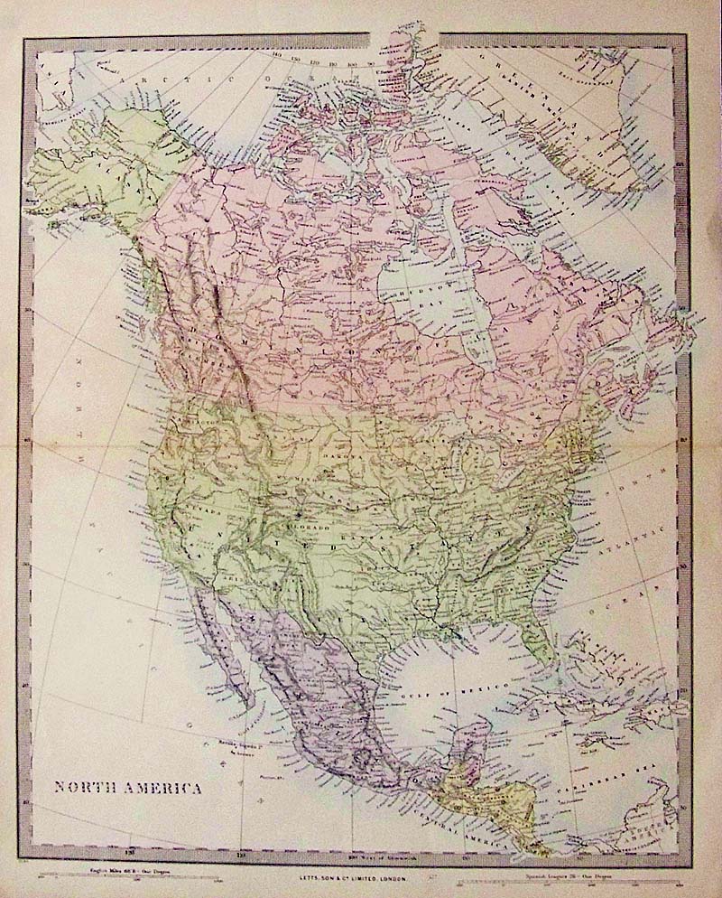
223nam: North America, Letts and Sons, 1883 - A nice and decorative lithographed map with original color published in London by Letts and Son & Co. Limited. Dominion of Canada stretches across the country, the Dakotas are one, Oklahoma doesn’t exist yet and the map has nice pastel coloring as with most Letts maps. Thomas Letts took over the family owned publishing company in 1835 and was joined by his son Charles in 1870 when the Limited company was set up. Condition: Very good printed on fine paper, fold in middle, has slight marginal soiling. size 14 x 17.25 image $120 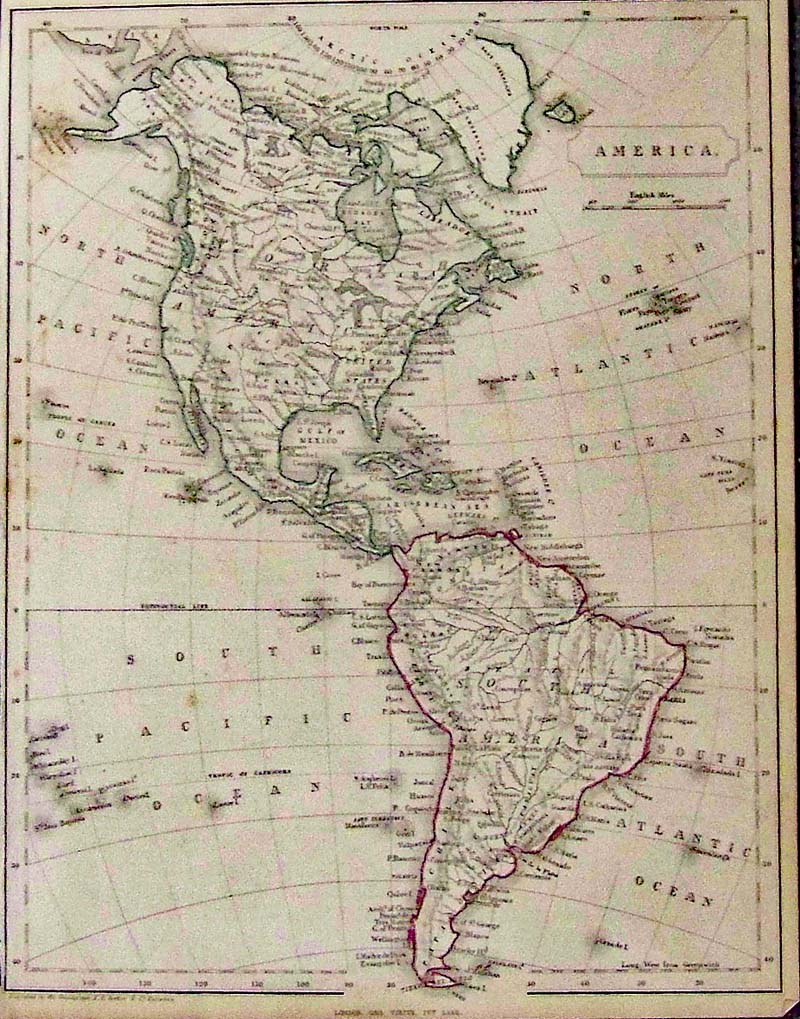
224nam: North and South America, Becker and Patentees 1850 - An unusual small, omnigraph engraved map of North and South America, by Francis Paul Becker and Company, Patentees circa 1850 for a small atlas. Contemporary outline color, of each continent, with details of Indians and some countries, no California. Condition: Good, this map was published with narrow borders particularly on the left side, some light foxing on image and browning on margin edges. size 8.5 x 9.5 image $90 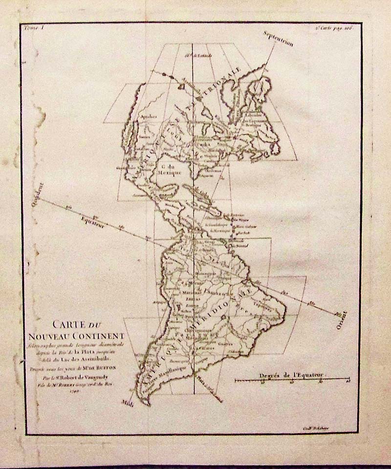
225nam: Carte Du Nouveau Continent, de Vaugondy, 1749 - A copper engraved black and white map with the North-South and East-West axis at oblique angles to the continents. In North America, the Pacific Northwest coastline is not depicted and a series of rivers and lakes make up a Northwest Passage. At upper right, inside the neat line is "2. e Carte page 206." This map is given a full-page illustration in Pedley's book on page 94 and is discussed in her chapter "Maps that Illustrate and Teach." Condition: Good, water stains on left margin into image, two folds. size 7 x 8.5 image $120 
033nam: 1868 Rare Stieler's Hand Atlas of North America outlined in color with inset of the Plateau of Mexico bottom left corner. 16 x 13-1/2 in. $250 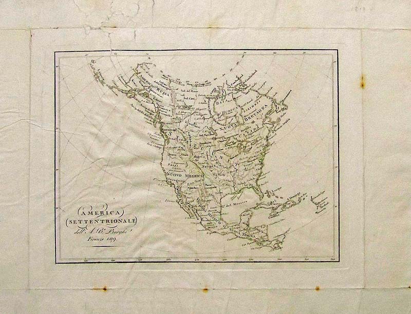
035nam: 1819 French mapof North America which shows the Indian Tribes and is titled, "America Settentrionale." 18 x 14 in. $180 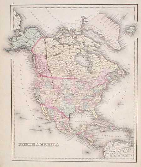
101nam: 1875 Map of North America by Gray. Interesting map, with original hand coloring, from O.W. Gray's world atlas of 1875. Each state in the United States and Mexico is separately colored. Canadian provinces and Central American nations are colored as well. Cities, towns and geographical features are shown throughout the continent. Very attractive map which would look great in a frame! 14x17 in. $140 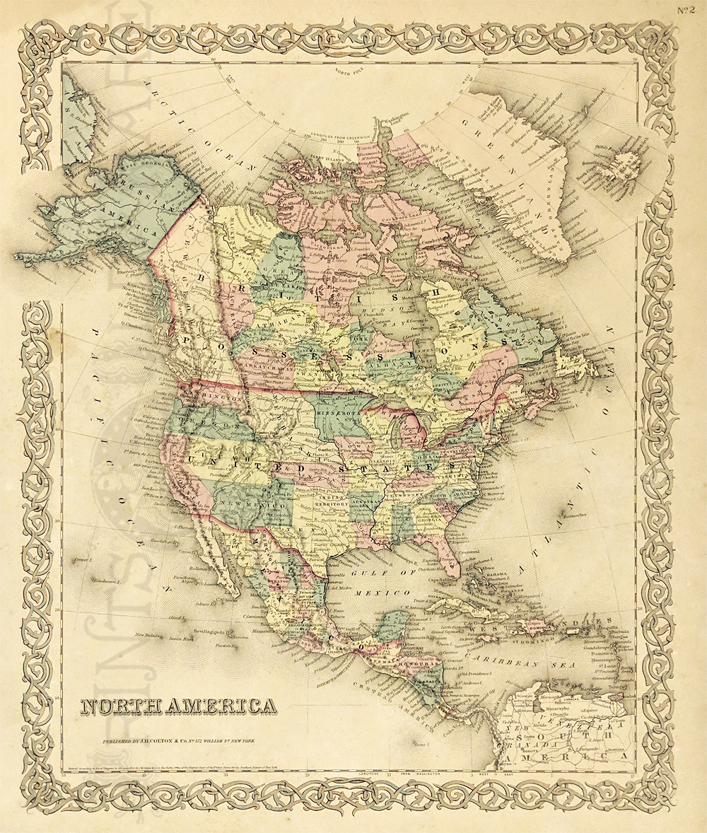
200nam: 1855 North America Map by Colton. Beautiful, engraved map with original hand coloring, from the 1855 edition of J.H. Colton's world atlas. Alaska is labeled as "Russian America," and Canada is called "British Possessions." Most of the western United States is divided into large territories. Very good condition. 17-1/2 x 14-1/2 in. $250 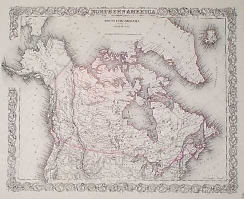
201nam: 1855 Canada, Northern US Map by Colton. Beautiful, engraved map with original hand coloring, from the 1855 edition of J.H. Colton's world atlas. Title of the map is "British, Russian and Danish Possessions in North America." The main focus is on Canada, which is labeled as "British Posessions." Alaska is called "Russian America." Most of the Northwestern United States is divided into large territories. Excellent condition. 16x18 in. $180 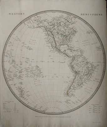 202nam: Very nice early map of the Western Hemisphere. Published in 1844 by the Superintendence of the Society for the Diffusion of Useful Knowledge. 13.5x16 in. $160 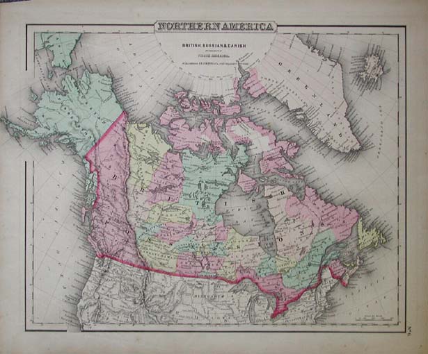 205nam: Hand colored engraving from J.H. Colton published in 1855. Map titled, Northern America British, Russian & Danish possessions in North America. 16.5x13.5 in. $180 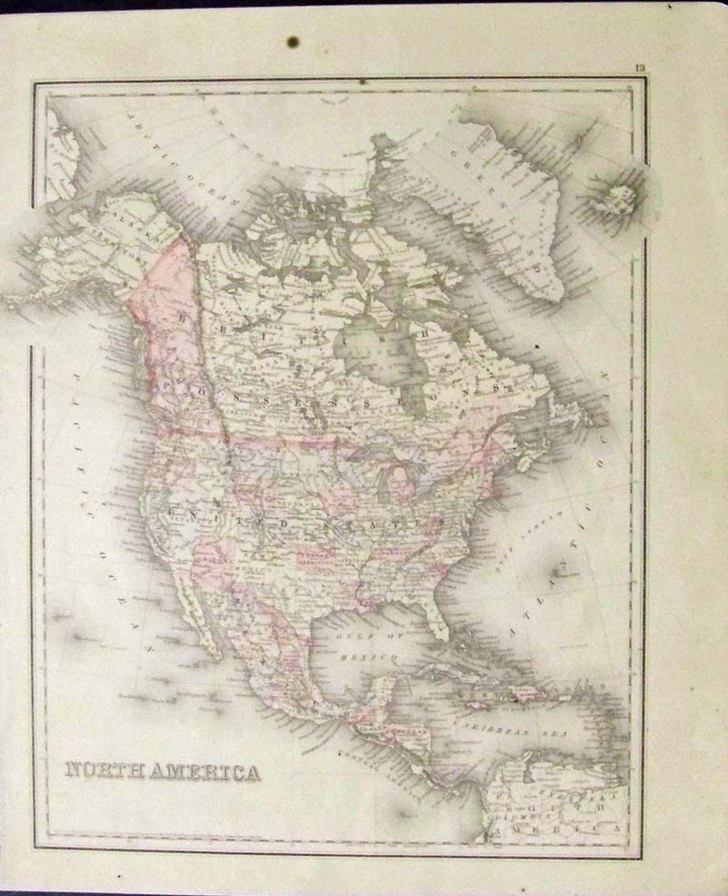 206nam: 1865 Hand colored engraved map of North America, Entered According to Act of Congress by J.H. Colton & Co., in the Clerk's Office in the District Court in the United States for the Southern District of New York. Top right of map shows part of Greenland and top left shows Alaska Territory. Backside of map shows the Population of the United States, From 1790 to 1880. 17 x 14 in. $120  207nam: Rare 1896 Map of North America from Bacon's Geographical Establishment, London. Hand-coloured lithograph map. Caribbean Islands are very detailed and the United States are shown almost as they look today, although Dakota still has not split to North & South at this point in time. Perfect condition. 14x19 in. $80  209nam: 1892 Engraved North America map by Cram Publishing Company. Map was printed in color and shows all the states, cities, islands and countries surrounding North America. 25 x 17-1/2 in. $60 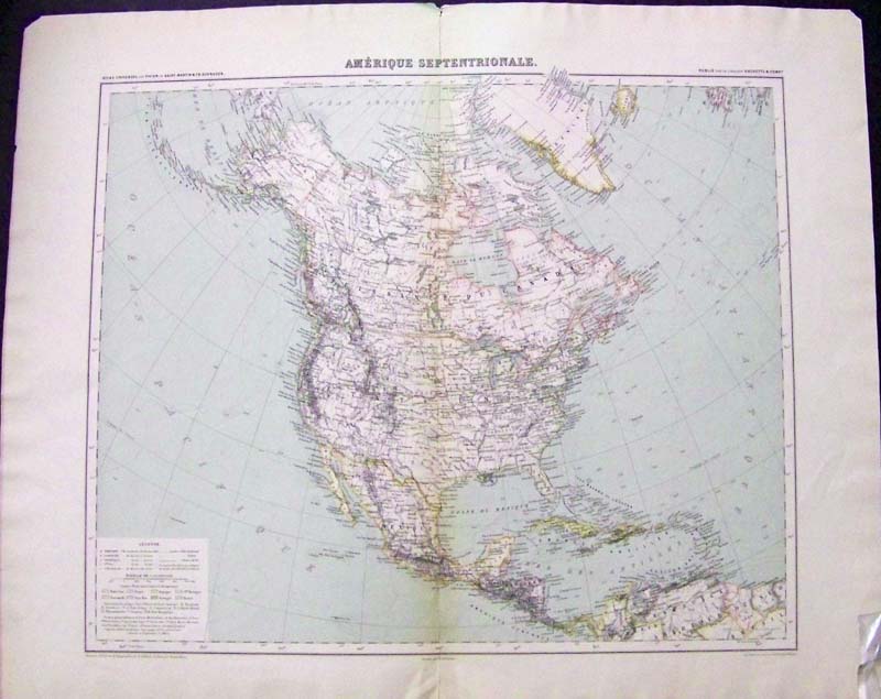 210nam: 1900 Amerique Septentroinale Atlas Universel par Vivien de Saint-Martin & Fr. Schrader. Map is outlined in color and shows European possession by color. Legende is on bottom left of map Publie par la Librairie Hachette & Comp. 26 x 21-1/2 in. $120 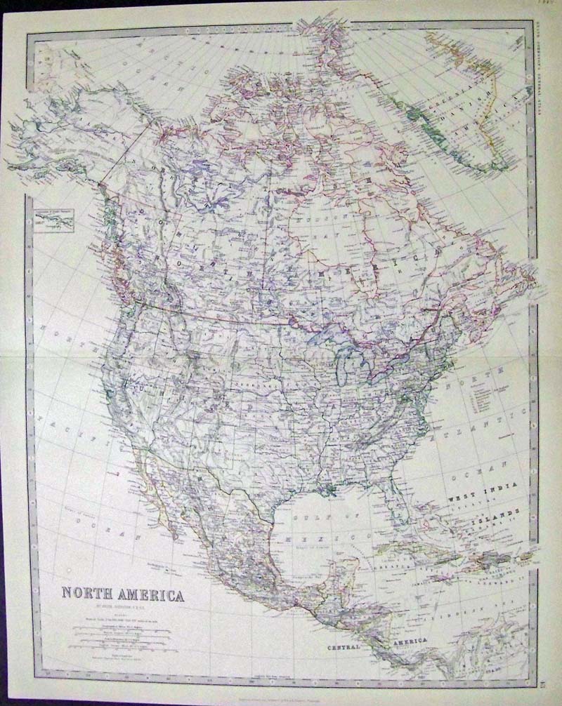 211nam: 1884 Engraved map of North America by Keith Johnston, F.R.S.E. outlined in color. Engraved, Printed & Published by W. & A.K. Johnston, Edinburgh. 24 x 19-1/2 in. $110  212nam: 1882 Hand colored engraved map of North America by J. Bartholomew, F.R.G.S., and published by A & C. Black, Edinburgh. 23 x 17-1/2 in. $90 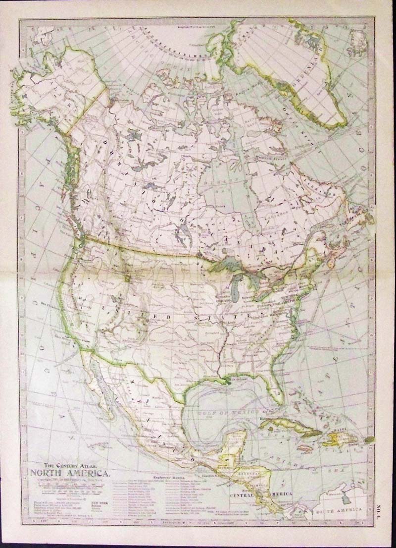
213nam: 1897 "The Century Atlas, North America, copyright by The Century Co., New York. Map was printed in color and shows adjacent explorer's routes throughout North America. 16 x 11-1/2 in. $40 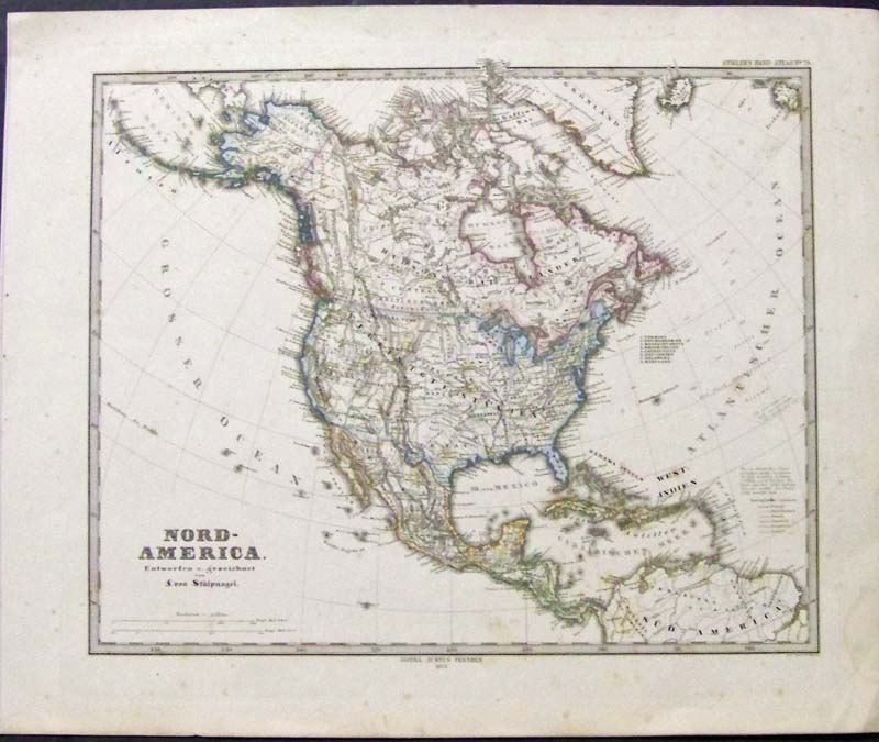 214nam: 1873 Hand colored engraved Stieler's German Hand Atlas No. 79 titled, "Nord-America, Entworfen u. gezeichnet von f. von Stulpnagel." 18 x 15 in. $80 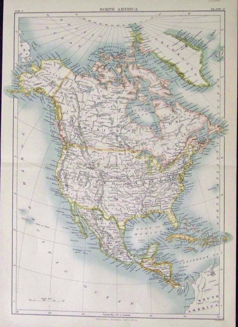
215nam: C.1880 map showing North America which was featured in the Encyclopaedia Britannica, Ninth Edition. Outlined in color, Plate X. 15 x 11 in. $30 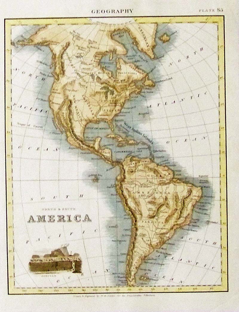 216nam: 1820 Color engraved map showing North and South America from Geography, Plate 85. Note the ancient territory. 10-1/2 x 8 in. $160 
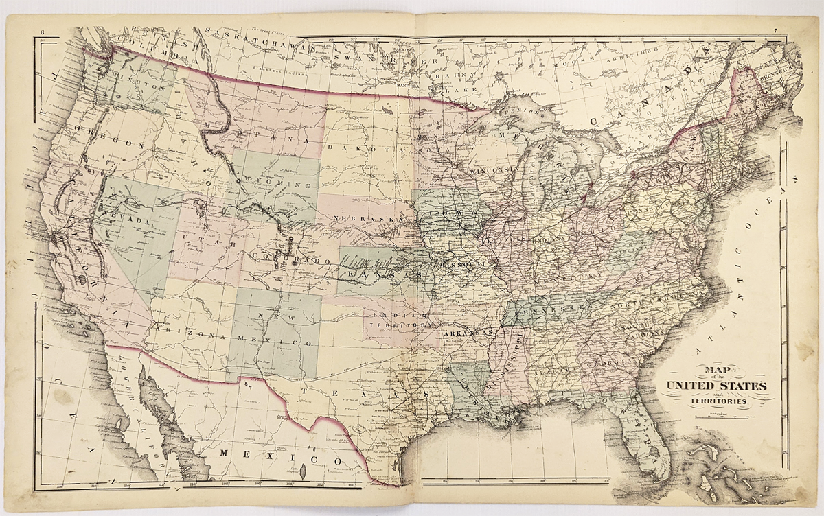
217nam: 1868 Rare original hand color map showing The Western States showing Missouri, Illinois, Iowa, Kentucky, part of Michigan, Indiana, Ohio, Lake Michigan and Lake Erie. Entered According to Act of Congress by E.J. Huntington in the Clerk's Office of the District Court of the Southern District of New York. 19 x 12 in. $150 |
 Also see our United States page 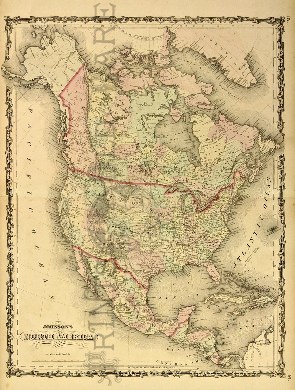 232nam: 1861 Johnson's Map of North America. Showing a number of important routes, the Pony Express and U.S. Mail Route. Also shows numerous American Indian tribes. Hand colored, lithograph. 18 x 27 in. $200 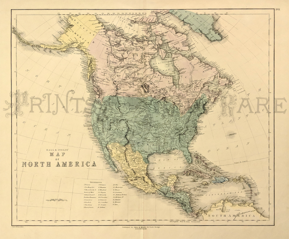 233nam: Gall & Inglis' Map of North America. c.1880's. Texas, Upper California and Oregon Territory are shown in the West, along with a massive Missouri Territory. Canadian Transmississippi West is also shown along with the missions in California. In Oregon, the British Claims extend to the Columbia River, encroaching on the American claims to Puget Sound. Alaska is Russian Territory. Hand colored, lithograph. 21 x 25 1/2 in. $200 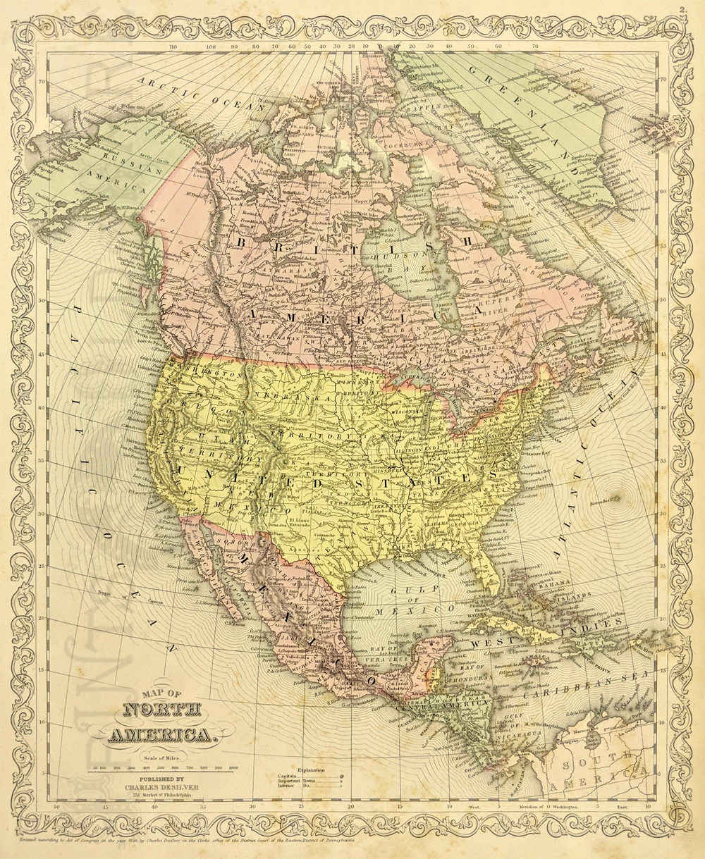 234nam: 1856 Charles Desilver's Map of North America. Detailed map showing North America, Central America, the West Indies, Mexico, the United States, Canada, and Russian Alaska. Nebraska Territory encompasses most of the Northern part of the United States. Major cities, river systems, and other features are depicted in significant detail, along with International borders. Published in the final edition of "Mitchell's New Universal Atlas," S. Augustus Mitchell had sold the atlas publishing rights to Thomas Cowperthwait who then sold them to Charles DeSilver in the mid 1850s. 13 3/4 x 17 3/8 in. $175 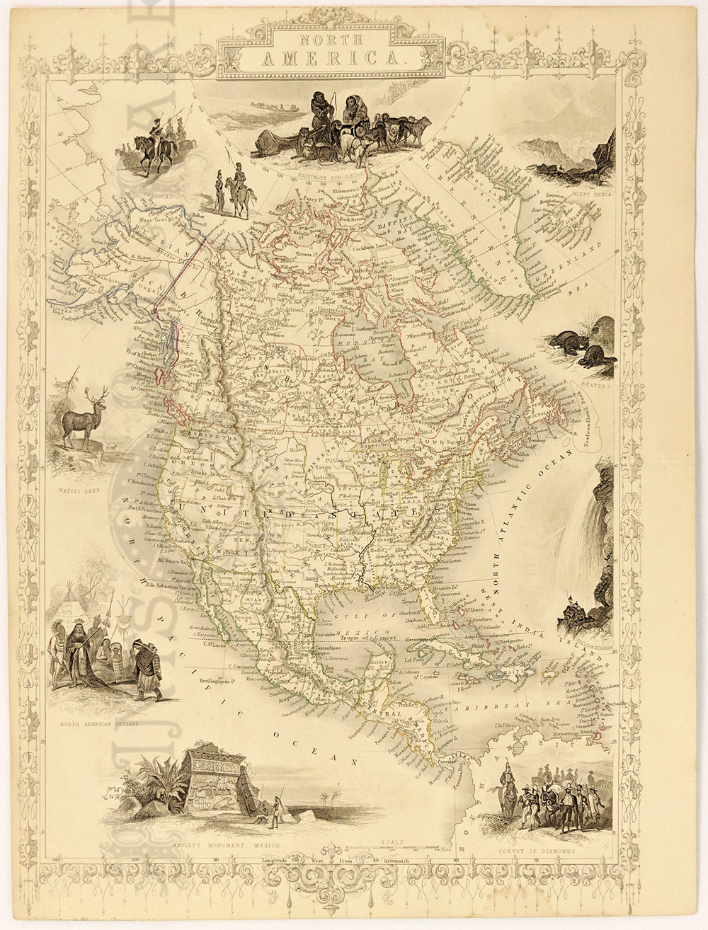 235nam: 1851 North America Map by Tallis. Decorative border featuring 10 vignettes of local scenes. Details of the map include rivers, topography, coastline, towns and political divisions. *Map does not show the American acquisition of the state of upper California from Mexico as a result of the Mexican-American War. 10 1/4 x 13 1/2 in. $200 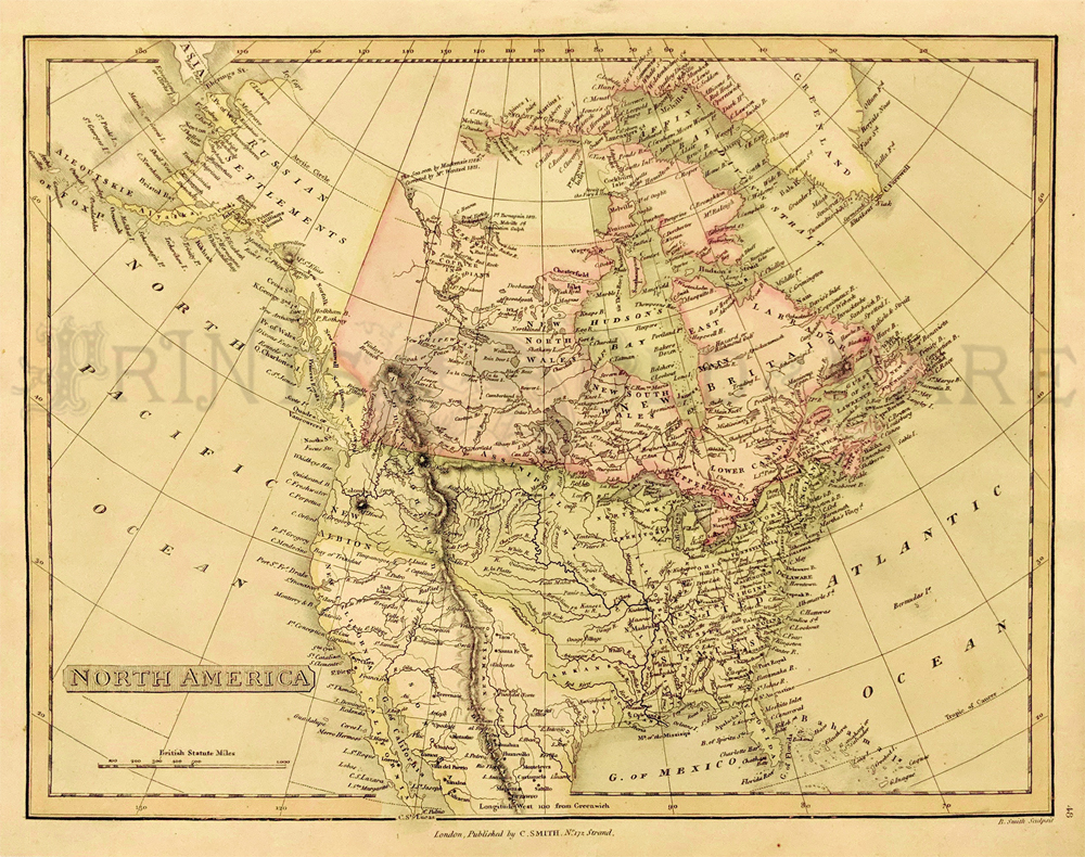 236nam: c.1808-45 Map of North America published by C. Smith from the New General Atlas. Hand colored, copperplate engraving showing the regions of North America, with Russian Territory, British Territory, United States Territory, and Mexican State. (Russian Territory is still shown at top left, and New California is still shown as part of Mexico.) 11 5/8 x 15 1/2 in. $200 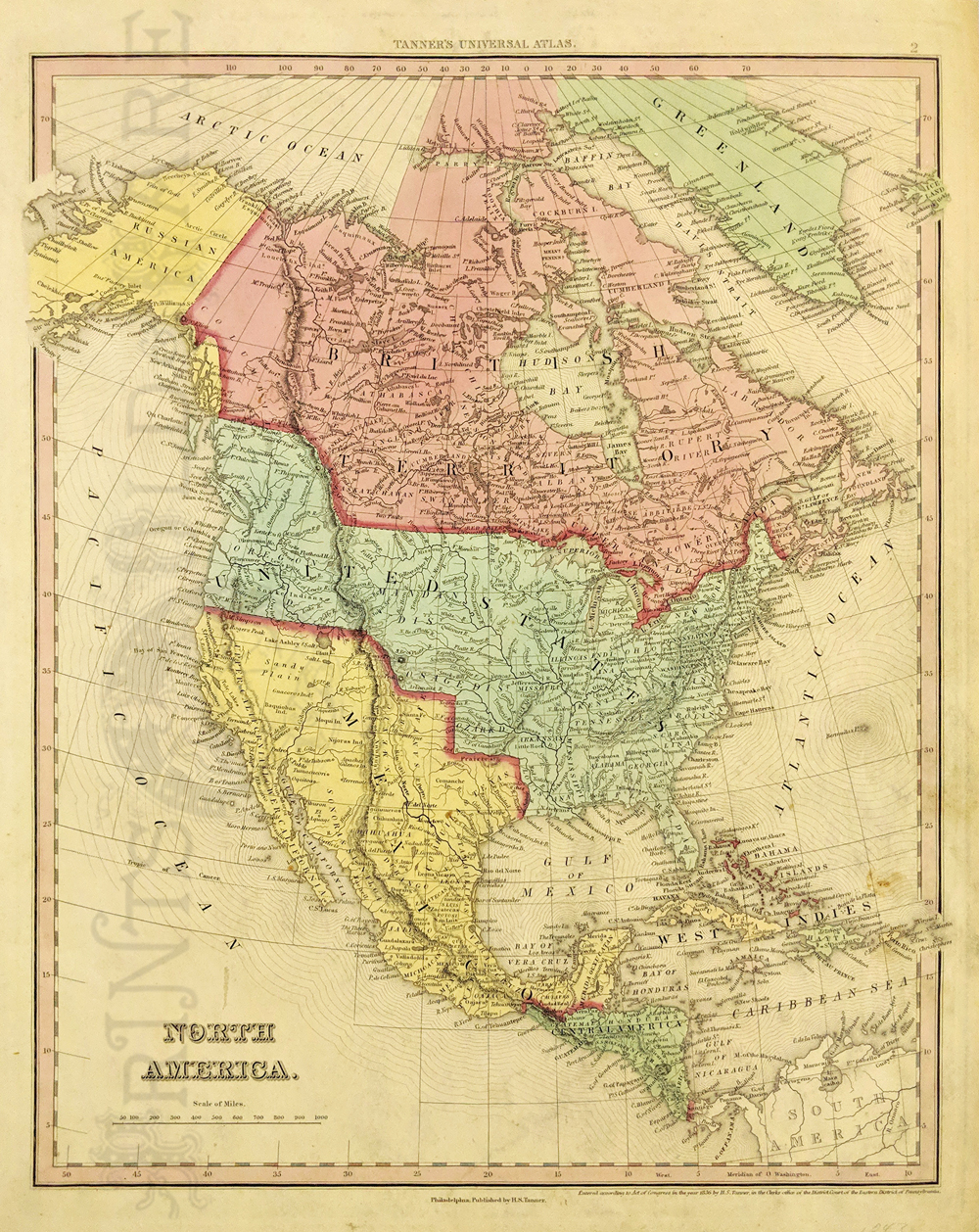 237nam: 1843 Tanner Map of North America. Showing rivers, mountains, towns, cities and topographical features. Political borders are in transition as the north is "Russian America" and Texas is shown as an independent republic. Hand colored copper engraving. *Light soiling right side. 11 5/8 x 15 1/2 in. $600 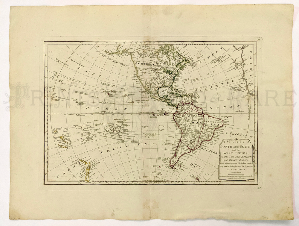 239nam: America North & South with the West Indies 1794 by Samuel Dunn – published by Laurie & Whittle. Uses info and details from Captain Cook. 18 x 23 in. $395 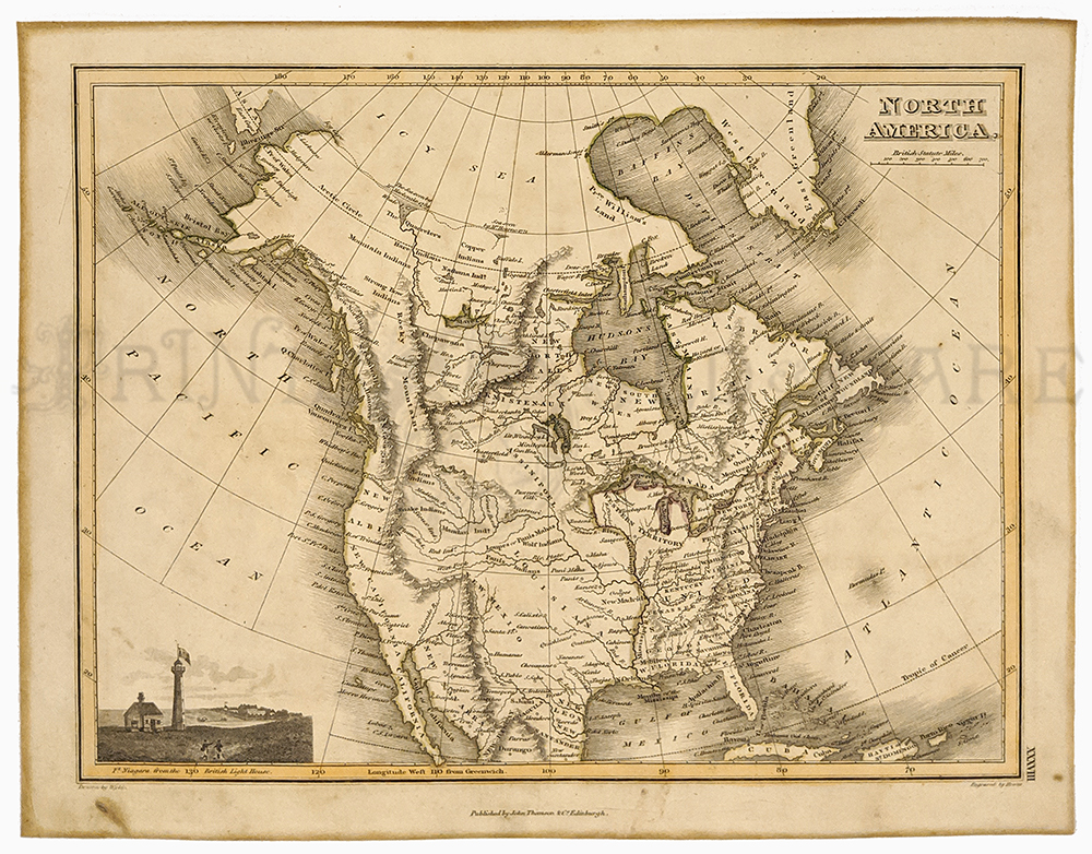 240nam: North American Map 1819 by John Thomson & Edinburgh. Important engraved map. Louisiana Purchase, also US still part of Mexico. Incredibly detailed. Inset: Ft. Niagara. 10 x 12 ¾ in. $275 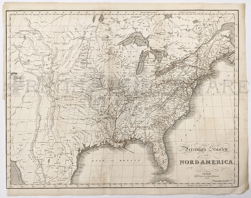 241nam: North America Map 1828 by John Melish. German version of 1822 Map. Engraving of US West to include all of Texas, Rocky Mountains, Columbia, and Columbia River. 16 1/8 x 20 ½ in. $1150 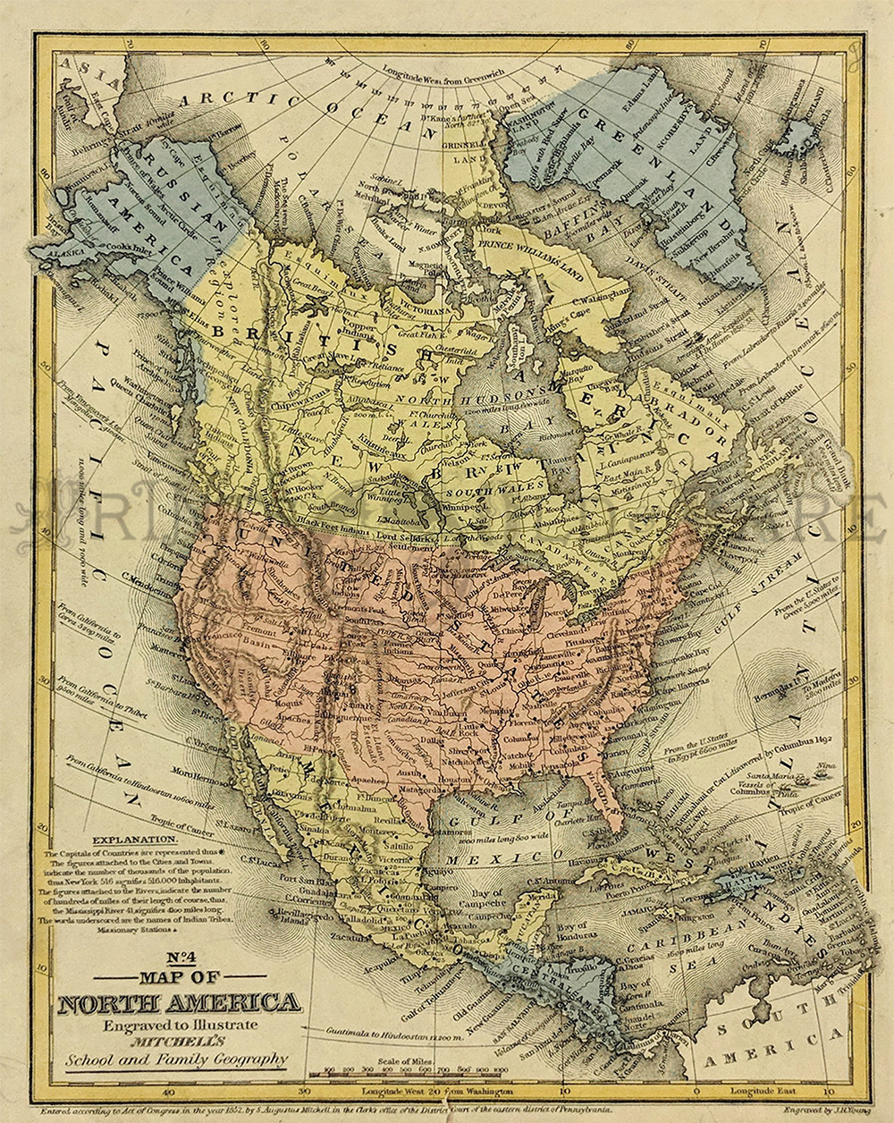 242nam: 1852 North America Map published by Mitchell from his School and Family Geography edition. 11 x 9 in. $90 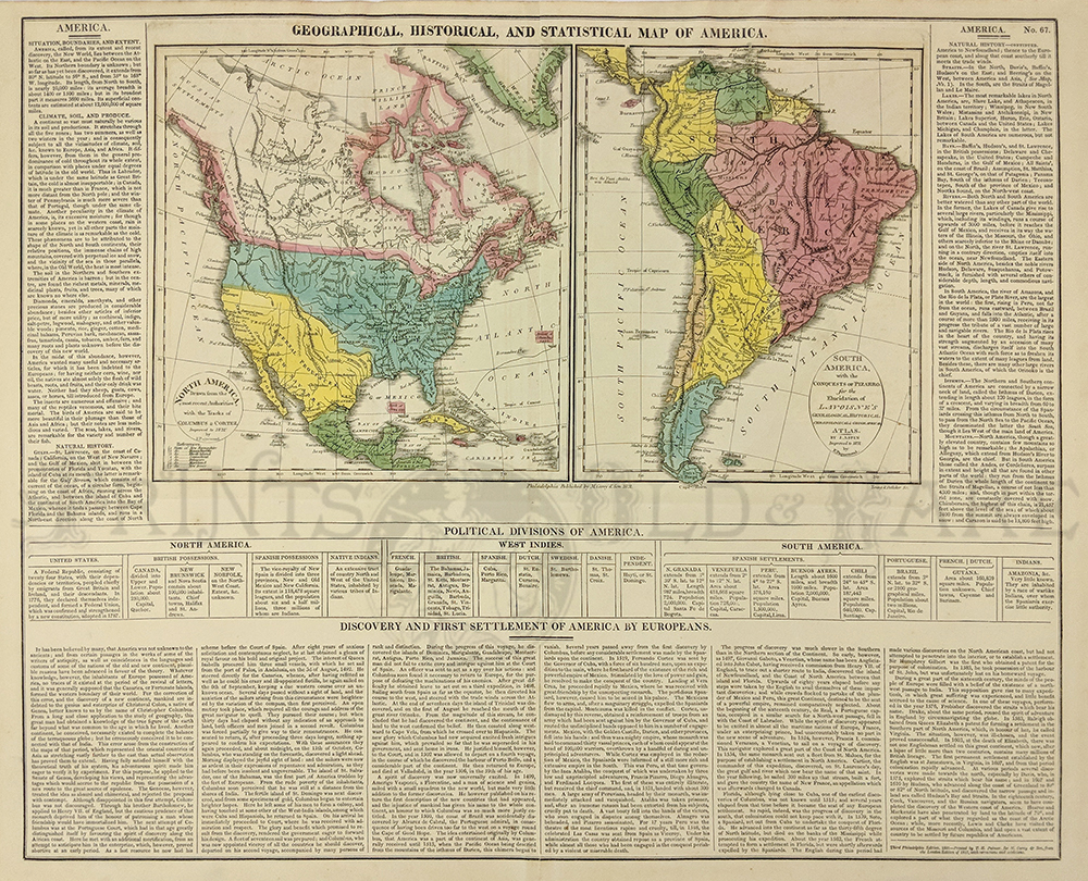 243nam: 1821 Geographical, Historical, and Statistical Map of America. from the third Philadelphia Edition - Printed by T. H. Palmer for M. Carey & Son. Note that the west is named as Internal Provinces - New Navarre. Text gives detailed information of natural history, climate, population and poitical divisions. Routes of Columbus, Cortez and Pizarro are marked on the maps. 17.5 x 22in. $200 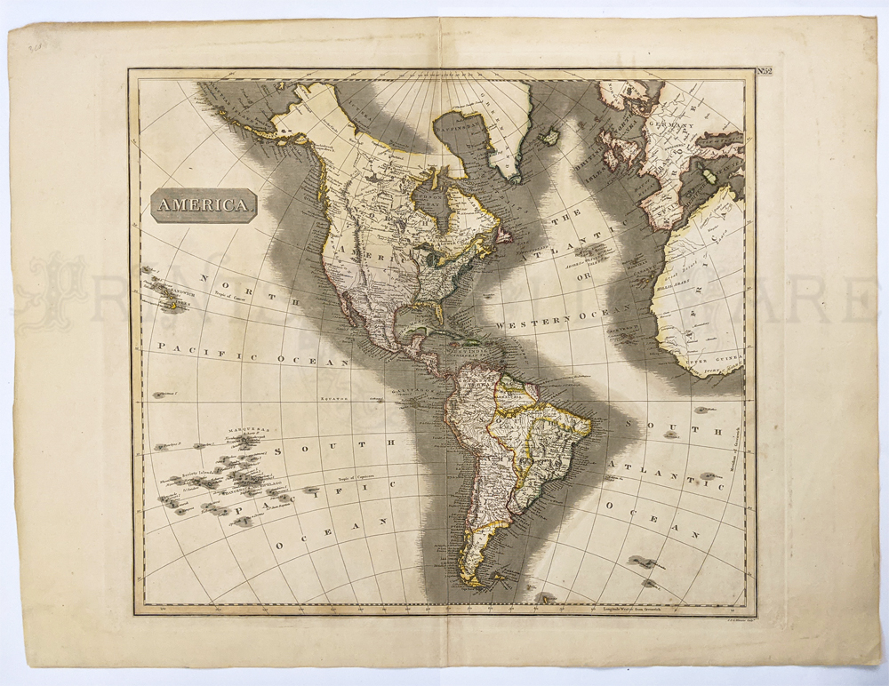 244nam: America 1799. Cary Atlas. Menzies large handsome Western Hemisphere map by J&G Menzies. Map shows Sandwich Islands and Louisiana Territory. Mexico up thru California. And US as existed right after the Revolution. 21 3/8 x 27 7/8 in. $450 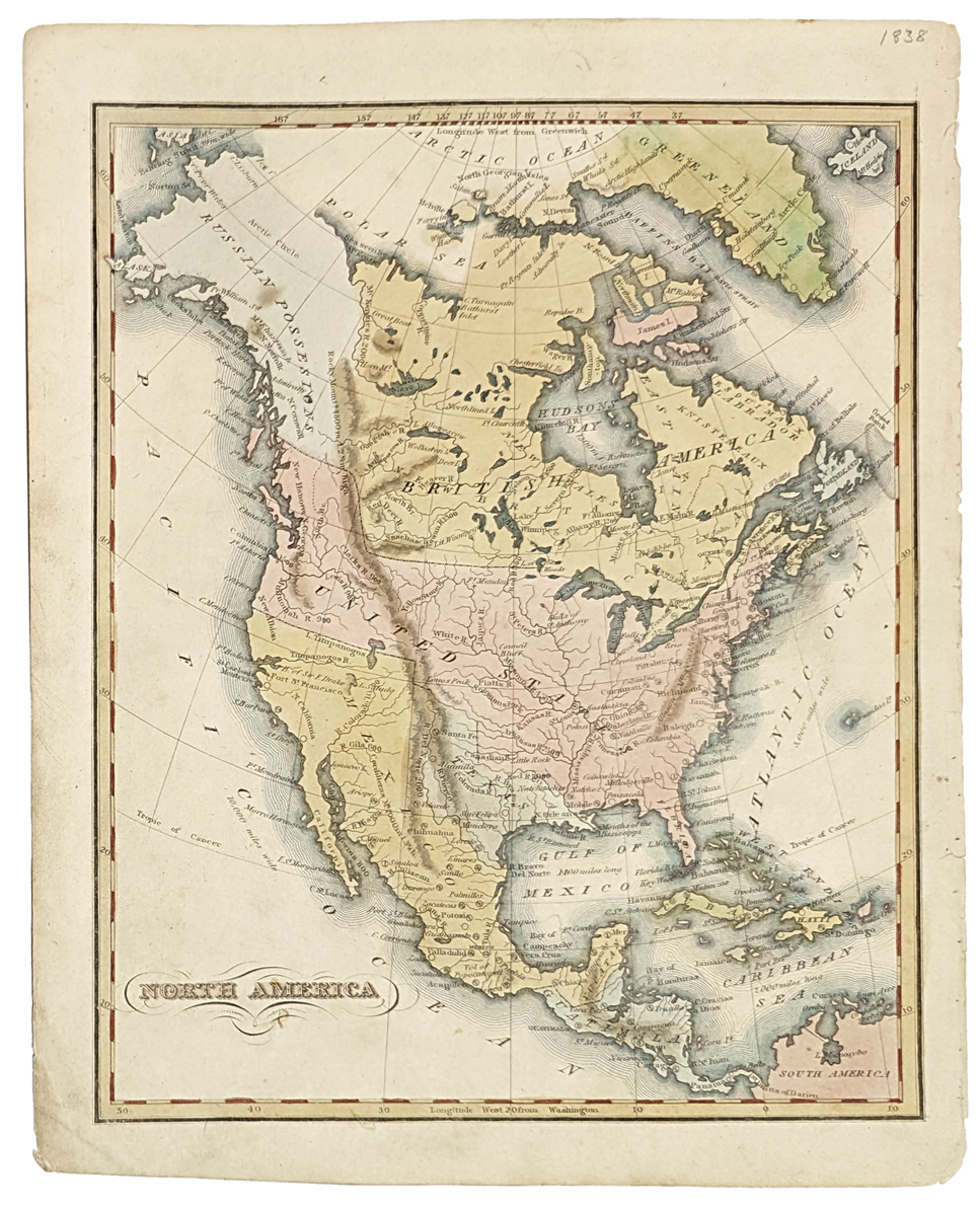 245nam: 1838 Map of North America, Republic of Texas. Drawn by Sherman and Smith, published as an illustration to Olney's School Geography. Showing Mexico covering most of the US Southwest, US extends into what is now British Columbia. Texas extends over modern day Louisiana. Indian tribes are shown in Texas, as well as rivers and a few cities. **Small tears right margin. 9 5/8 x 12 1/8 in. $300 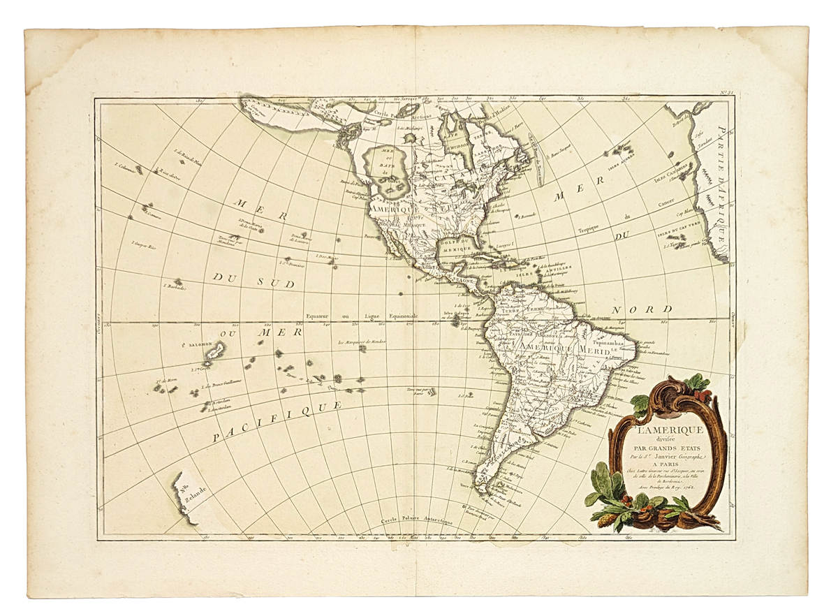 246nam: 1762 L'Amérique divisée par grands etats by Janvier. features a huge, imaginary Sea of the West and hints of a possible Northwest Passage. Alaska is shown in an early configuration with a rough shape incorporating the Aleutians and notations concerning the coastline discoveries in 1741 by the Russians. In North America, the British colonies are shown east of the mountains, French Louisiana takes in most of the interior and Spain controls Florida, New Mexico and Mexico. There are several islands shown in the Pacific and just the western coastline of New Zealand. A handsome map with a decorative rococo-style title cartouche. 15 1/2 x 21 5/8 in. $625 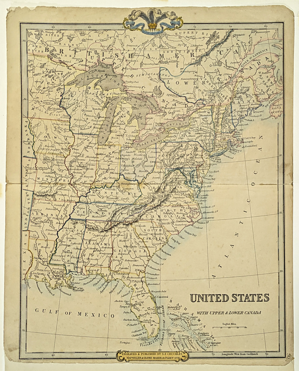 247nam: 1854 United States with Upper & Lower Canada. Published by G.F. Cruchley. Shown are cities, rivers, islands, bays, lakes, gulfs, mountains, etc. Upper Peninsula is part of Wisconsin. A number of Indian Tribes are shown. No West Viriginia shown. 14 x 18 1/2 in. $250 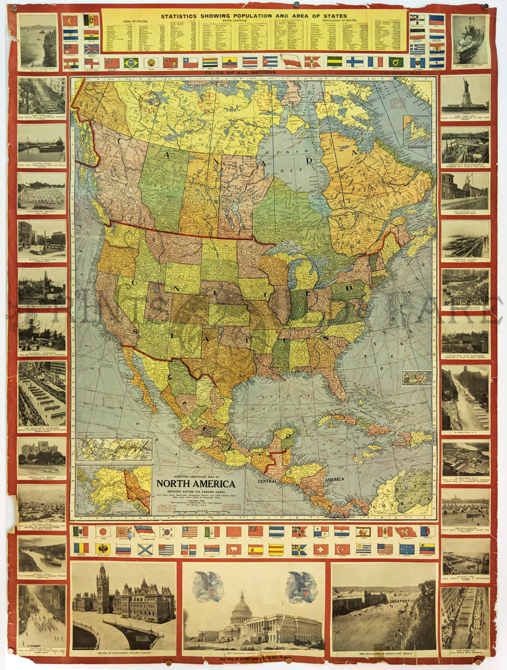 229nam: 1920 Large North America Map. Colorful patriotic WWI era map bordered with timely photos. Shows flags of all nations and state statistics of area and population. 25 1/2 x 24 1/2 in. $75  013frame: EXQUISITE PAIR - North America and British Dominions in North America by Fisher, 1823. US includes Louisiana Purchase but the rest of the west is still part of Mexico. Gorgeous gold leaf frames with beading and handmade French mats. Museum quality. Frame: 18 3/8 x 20 in. $650 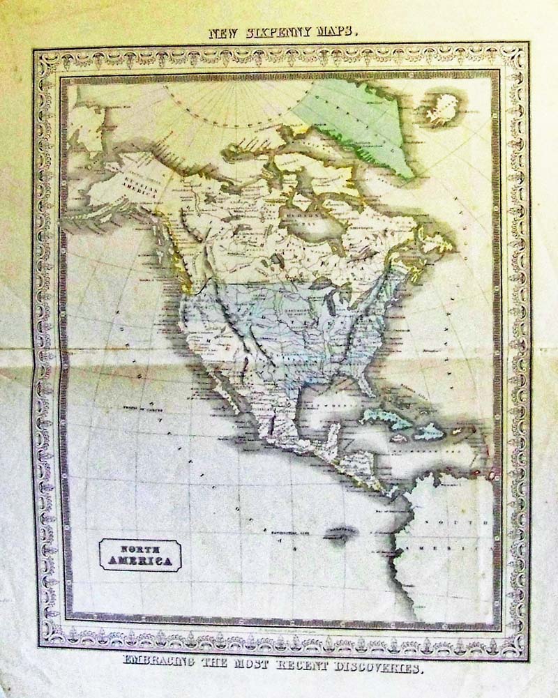 227nam: C.1850 North America New Six Penny Map by D. Macdonald, Glasgow. This is an original color engraved map. Note: Interesting feature: This map details after Texas became independent and before the California Revolution. Territory shown is the Oregon Border and Russian America, Texas in the U.S. and California and Southwest still in Mexico. 18-1/2 x 15 in. $325 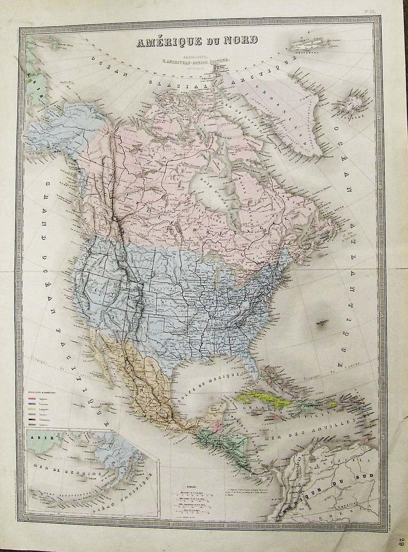
219nam: Amerique Du Nord 1870 Gujon - A large and very attractive engraved and printed in color map, published by Chez E. Andrivea-Goujon, Paris, 1870 in the Universal Atlas. Many interesting details. The inset is of the Aleutian Islands. Map is very detailed and beautifully colored. Condition: The horizontal center crease is the result of the map's binding within an atlas. Slight tearing on bottom right margin, smudge on top left where Russia meets Alaska and wide margins. Size, 17.5 x 24 in. image. $550 
220nam: North America, Colton 1855 - Classic and attractive engraved map of North America with original hand coloring and the typical "Coltonesque" decorative spiral motif border showing the tip of South America to the Artic Circle. Published by G.W. and C.B. Colton, New York, also showing Greenland with states and regions colored in pink, yellow, green and showing Oklahoma and Dakota not existing yet; Alaska is a territory and there is no sign of Alberta or Saskatchewan. Condition: Very good, slight tear outside margin lower left, and tear outside margin lower right. Both very small, normal age coloring on large margins. size, 13 x 16 image $220 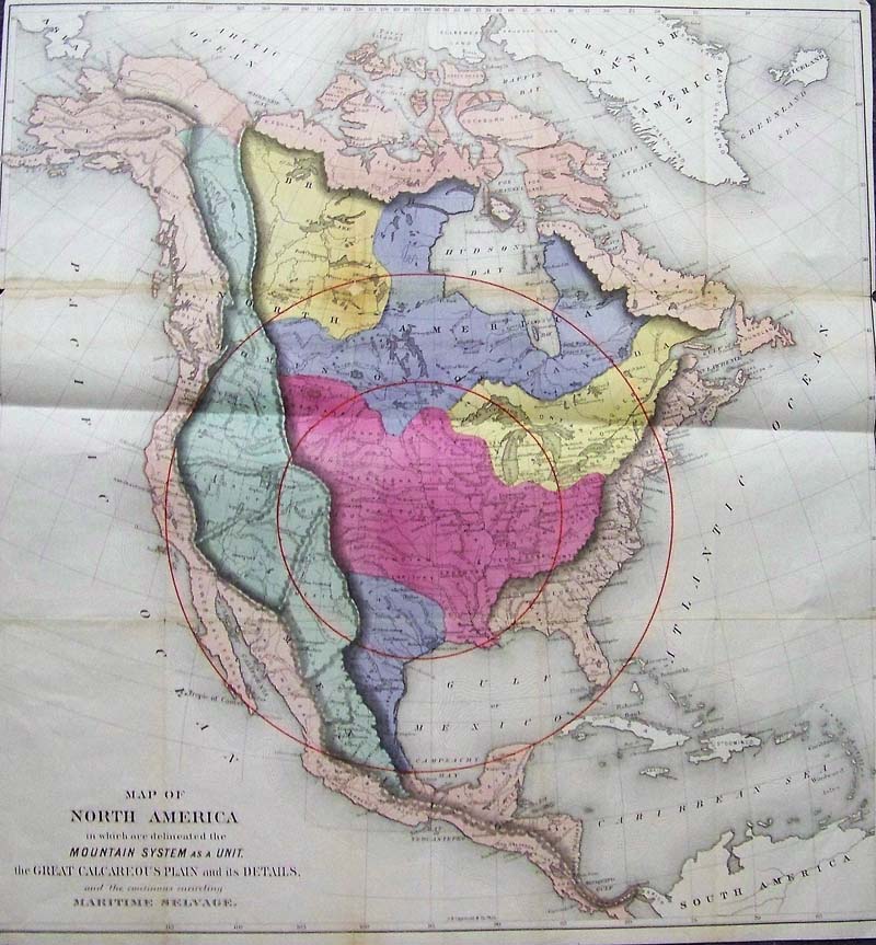
221nam: Map of North America Mountain System as a Unit, the Great Calcareous Plain and Details and the Maritime Selvage, Gilpin 1873 - A very rare attractive, engraved and large geological map of North America from the late 19th century, beautiful original color, the map shows all of North America, Mexico, Central America, and the Arctic Ocean. Most of the United States are shown except for Oklahoma and Dakota are one state. Mountain ranges are nicely shaded, along with geographical regions, and two large red circles are shown centered on the middle of the U. S. Special Note: William Gilpin (1813-1894) was a 19th century US explorer, politician, land speculator, and futurist writer about the American West. He accompanied John Fremont on his second expedition through the West, and was instrumental in the formation of the government of Oregon Territory. As a politician he was an inveterate believer in Manifest Destiny and was a visionary booster of new settlement in the West, helping lay the groundwork in his writings for a modern theory of the succession of civilizations. Gilpin was a strong believer that the American West would not only be settled but also eventually hold an enormous population. He was a particularly strong advocate of the now-debunked climatological theory of “Rain follows the plow.” Which held that settlement in the arid lands of the West would actually increase rainfall in the region, making it as fertile and green as the Eastern US. Condition: Good, small margin and two folds, discoloring on top left fold extends into image across Canada, with small tear out. size 23.5 x 24 image $800 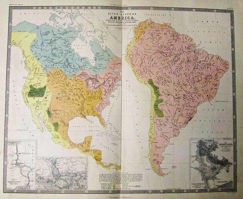
226nam: The River Systems of America, Johnston 1855 - A large double folio and rare original steel engraving with original hand color map of the river basins of North and South America, with Niagara, Mississippi and Orinoco insets. What is most unusual about this map is that is shows the Great Basin, this is rare. The length of each river is cited, and the maps feature a beautiful pastel coloring. The River Systems of America, Extended from the Designs of Professor Berghaus, with the addition of detailed maps of some of the principal hydrographical phenomena of the New World by A.K. Johnston F.R.G.S. Corrected to 1855. William Blackwood & Sons: Edinburgh & London. [1856]. Condition: Very good, fold in middle, some browning on edges, small tear on bottom fold. size 23 x 18.5 image $280 |
|||||||||
| Order Form | |||||||||||
| Back to Homepage | |||||||||||