|
|||||||||||
This is a small selection of our inventory of antique Oklahoma maps and prints. Additional inventory is available. Contact us with your request. 1-800-879-6277
|
|||||||||||
|---|---|---|---|---|---|---|---|---|---|---|---|
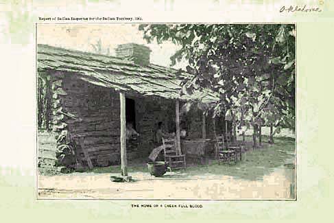 011ok: 1902 Oklahoma photo. Indian Territory report from Indian Inspector. "The Home of a Creek Full Blood." 8-1/2x5-1/2 in. $20 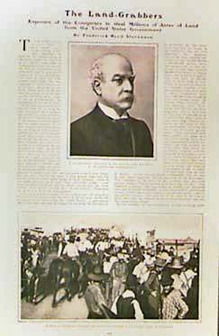 013ok: 1905 "Oklahoma Land Grabbers." Exposure of conspiracy to steal millions of acres of land from U.S. Government. Six page article from Harper's. 9x13 in. $30 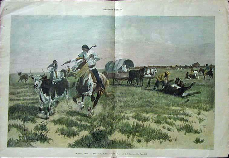 014ok: 1890 A Beef Issue in the Indain Territory. This double page hand colored engraving is from the January, 1890 edition of Harper's Weekly. It shows Indians slaughtering cattle on the plains. size: 22x16 in. $120 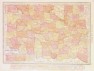 019ok: 1915 Oklahoma Map. Printed in litho color by Rand McNally. Lists principal cities, population, etc. 11x14 in. $30 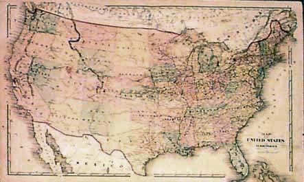
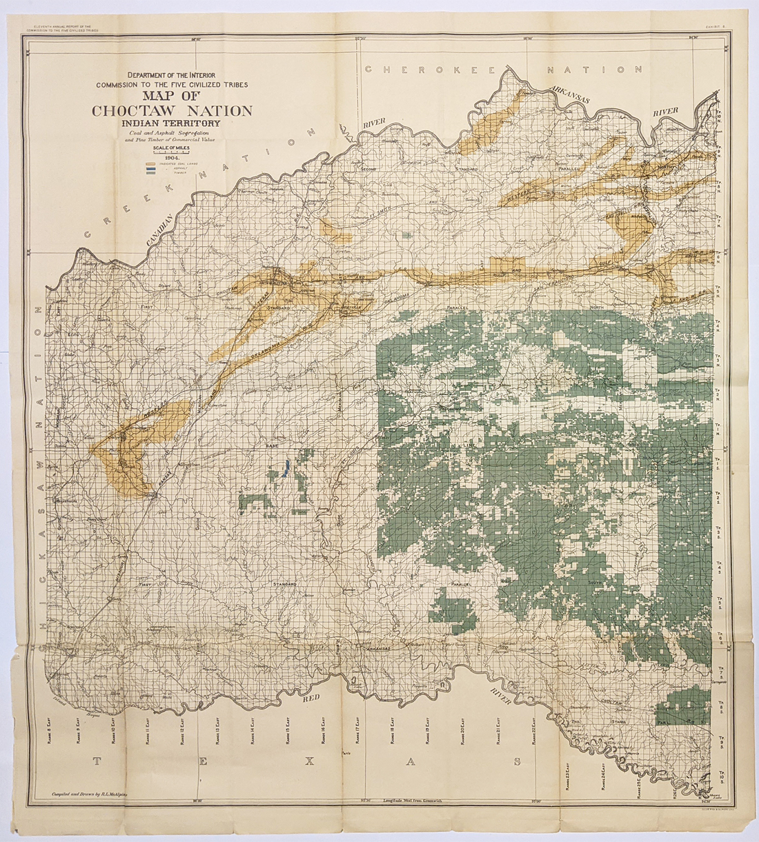
025ok: 1876 Gray's Map of the United States. Attractive hand-tinted antique map titled, "Indian Territory." Dakota not yet divided. 26 x 17 in. $100 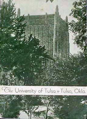 100ok: May 1933 University of Tulsa Bulletin. Twenty-one page bulletin, with lots of photos of the campus and students at Tulsa. This is basically a promotional item, with the goal of convincing prospective students to attend. 8x11 in. $40 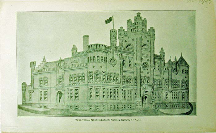 105ok: Unusual Half tone print showing the Oklahoma Territorial Normal School at Alva. Published in 1895. 9 x 8 in. $20 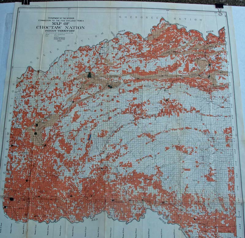 000indn: Map of Chocktaw Nation Indian Territory - The Department of the Interior Commission to the Five Civilized tribes. Red indicates the land alloted to July 1, 1904. The brown shows the Coal Segregation, and the blue symbolizes the Asphalt. 39 x 34 in. $300 |
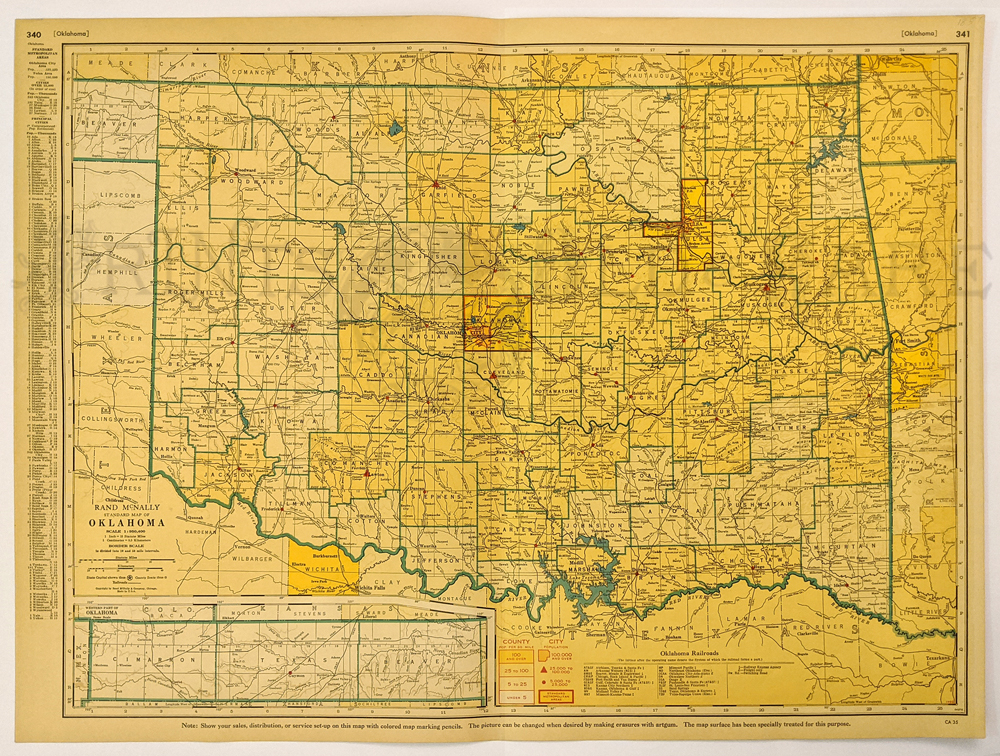
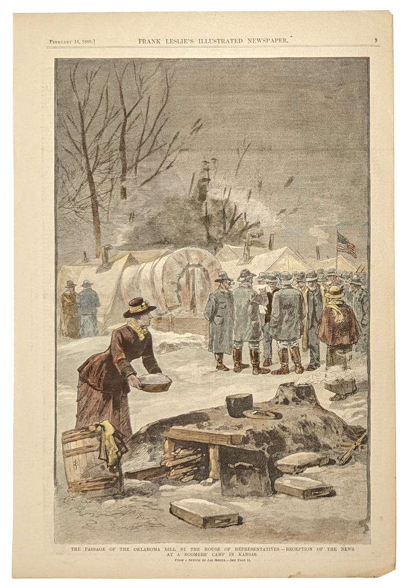
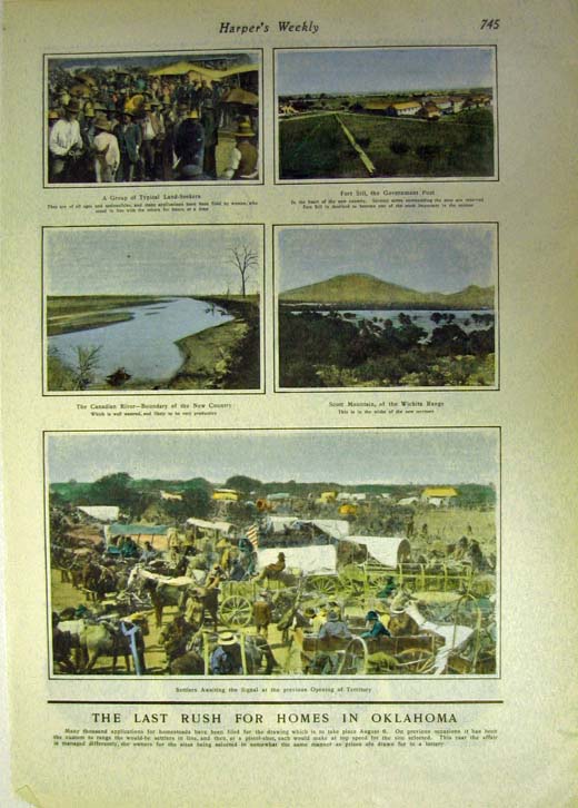 107ok: 1900 Oklahoma Land Rush an important historical print. Several hand colored scenes on one page. 11 x 16 in. $60 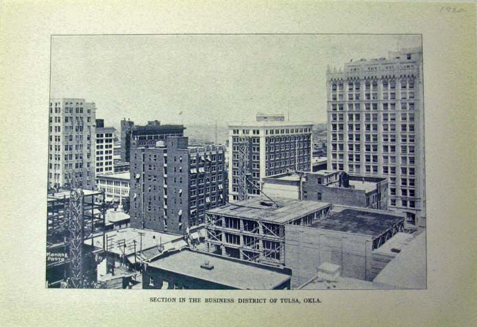 109ok: 1920 Oklahoma view of the business section in Tulsa. 10 x 7 in. $20 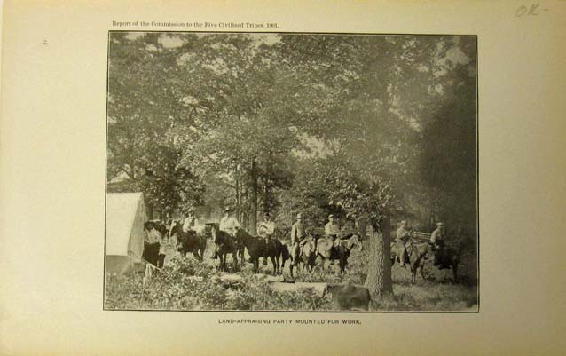 110ok: 1901 Oklahoma Land Appraising party view from U.S. 9 X 8 in. $20 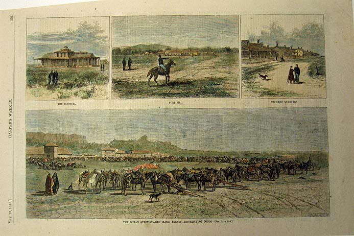 111ok: 1876 Red Cloud Agency Fort Sill. Four colored views of the Indian Question published in Harper's Weekly. 11 x 16 in. $60 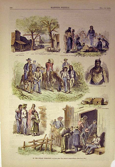 112ok: 1875 Indian Territory views several hand colored views on one page. 11 x 16 in. $50 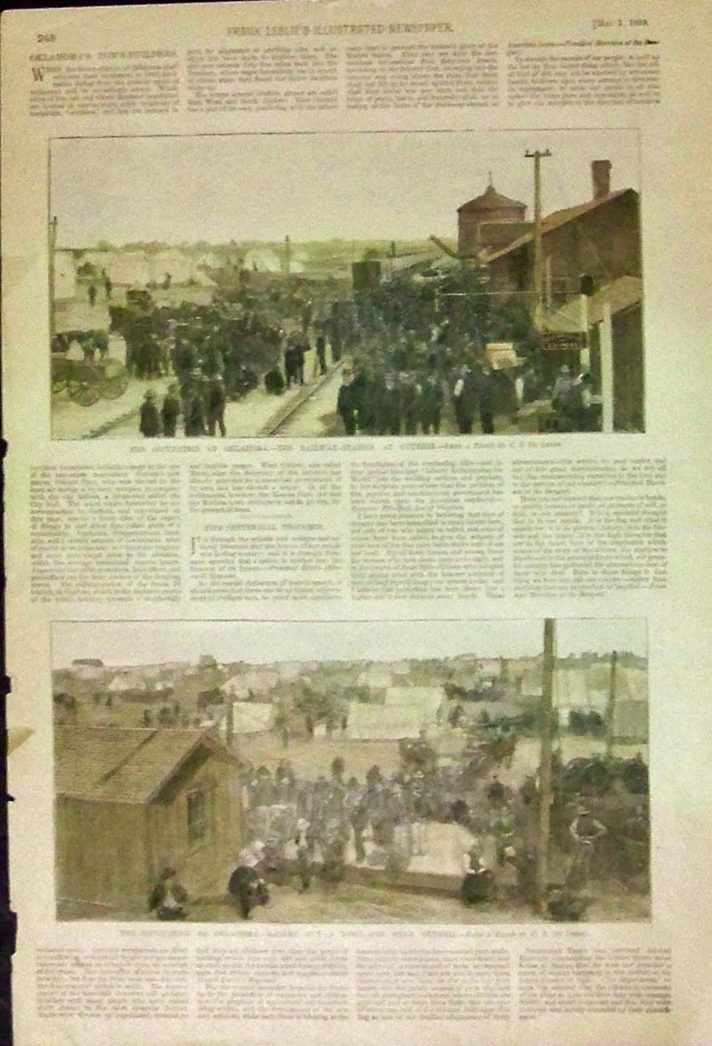 113ok: 1889 Hand colored wood engraving featured in Frank leslie's Illustrated Newspaper showing "The Occupation of Oklahoma -- The Railway-Station at Guthrie" in top image and bottom image shows, "The Occupation of Oklahoma -- Laying Out A Town-Site Near Guthrie." 15-1/2 x 11 in. $80 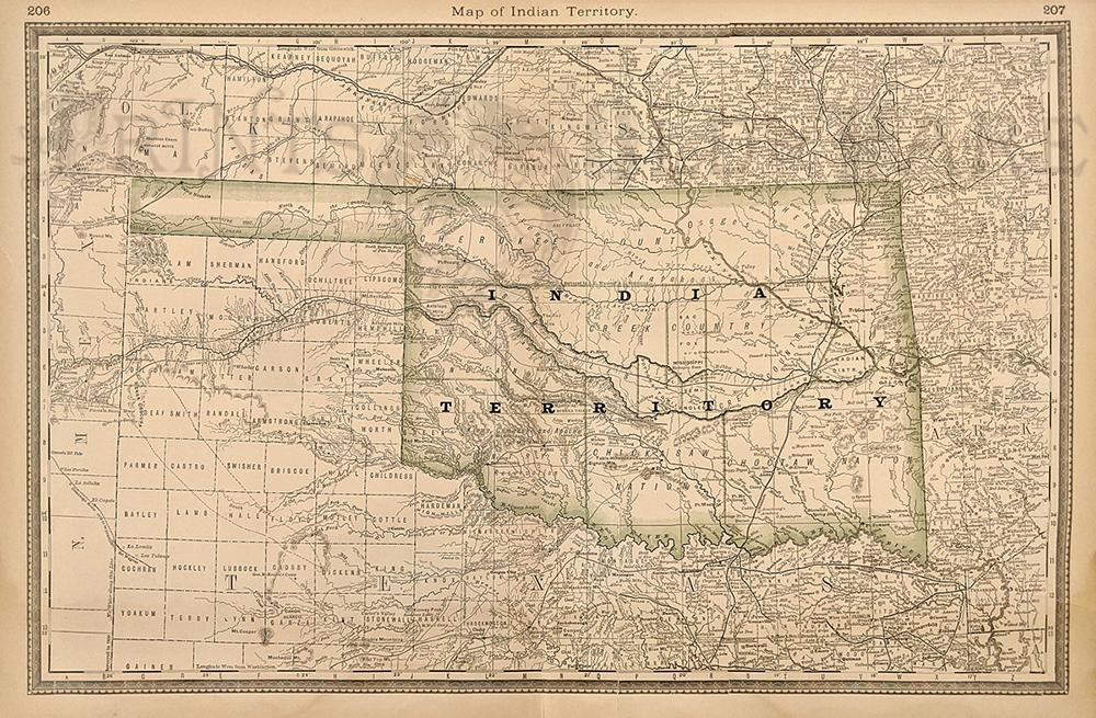 120ok: 1885 Map of Indian Territory. Showing towns, rivers, railroads, mountains, lakes, various Nations, etc. Published by Rand McNally. Hand colored, lithograph. 14 3/8 x 20 7/8 in. $180 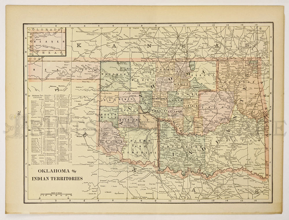 121ok: Indian Territory – Oklahoma c.1940. Shows counties, towns, cities, nations: Cherokee, Cree, Seminole, Chickasaw and Choctaw, Osage, Pawnee. 11 x 14 3/8 in. $150 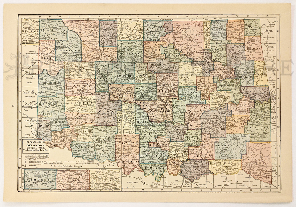 122ok: Oklahoma Map 1911. No more Indian Territory. Shows counties, towns, railroads, rivers. 10 ½ x 14 5/8 in. $40 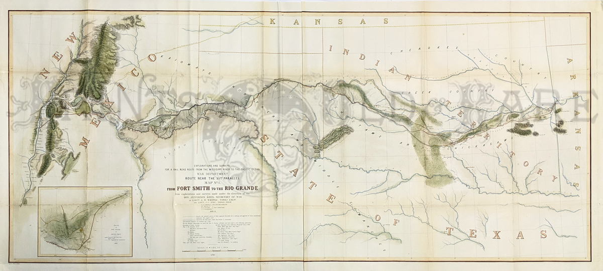 227rr: From Ft. Smith to the Rio Grande. Explorations and Surveys for a Rail Road route from the Mississippi River to the Pacific Ocean. Made under the direction of Hon. Jefferson Davis. 1854. Topographical Map. Showing parts of New Mexico, Texas, Oklahoma, and Arkansas. Indian Nations are also shown (Cherokee, Creek, Choctaws, Chickasaws.) Inset showing a Sketch of Rio Pecos at Anton Chico. 24 x 52 in. $800 |
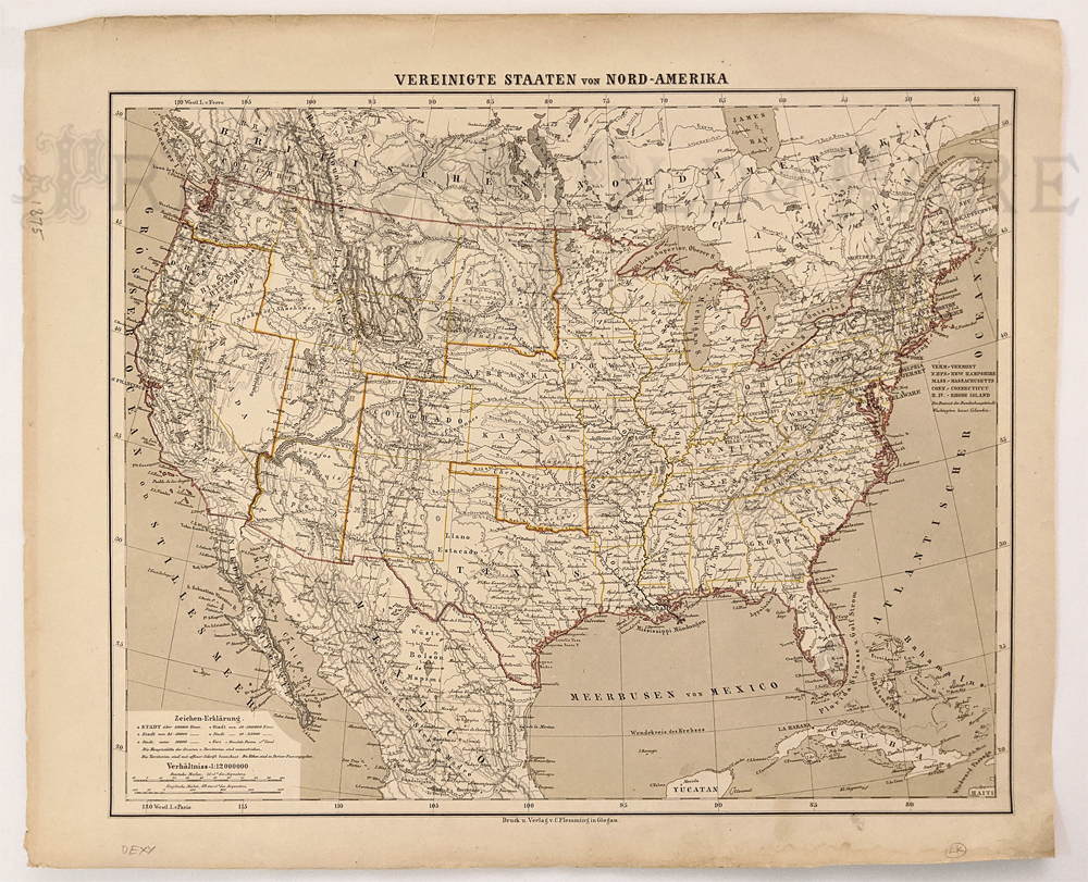
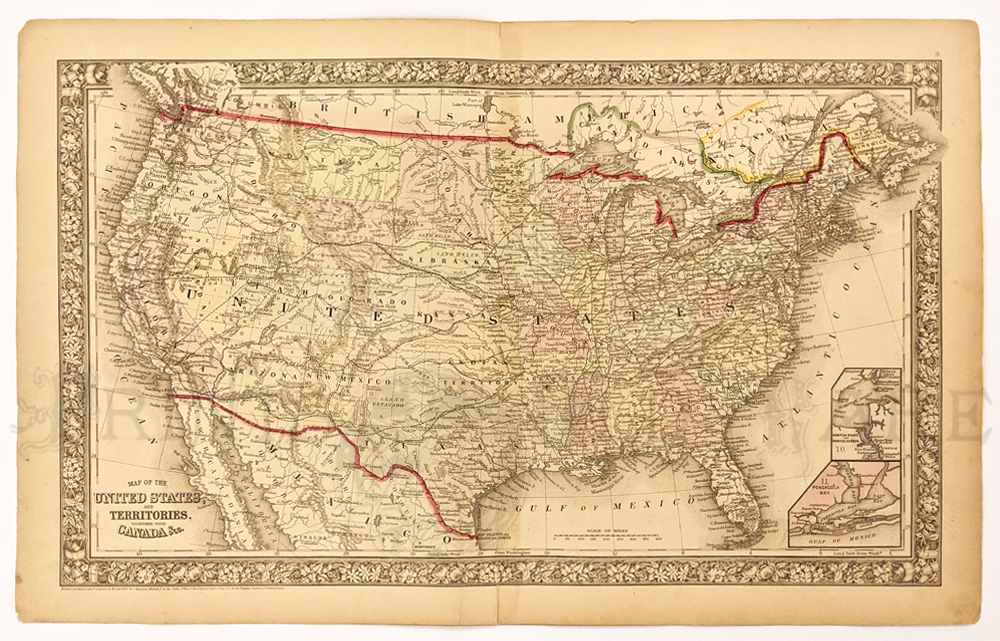 124ok: Indian Territory 1880. Mitchell map of the United States. Hand colored engraving predates Wyoming and the Dakotas. Inset of Pensacola Bay and Norfolk area. 15 ¼ x 23 1/8 in. $150
|
|||||||||
| Order Form | |||||||||||
| Back to Homepage | |||||||||||