|
|||||||||||
This is a small selection of our inventory of antique Oregon maps and prints. Additional inventory is available. Contact us with your request. 1-800-879-6277
|
|||||||||||
|---|---|---|---|---|---|---|---|---|---|---|---|
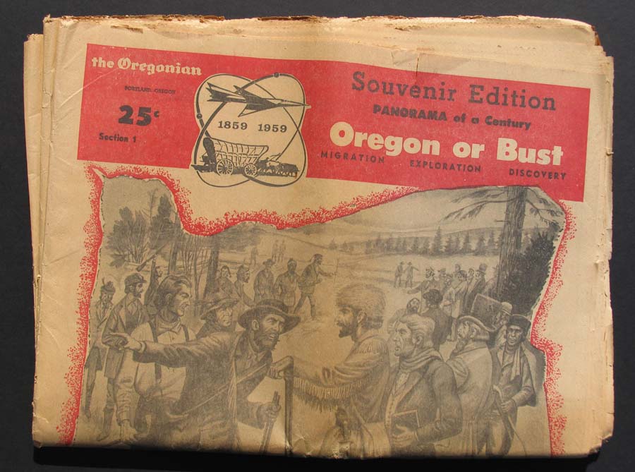 000Oregon: Oregonian - Souvenir Edition of the Centennial of the State of Oregon Panorama of a Century, 1859-1959 - "Oregon or Bust." Four sections on the migration, exploration and discovery to autos and spaceships. In very good condition. 12-1/2 x 14-1/2 in. $50 Check for availability 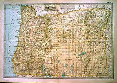 001or: 1897 Oregon Map, Century. Attractive lithographed map, very detailed. 16x11-1/2 in. $30 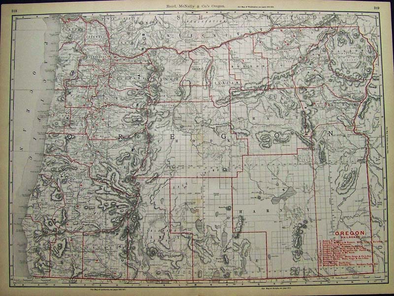
003Oregon: 1898 Rand, McNally & Co. Oregon Railroads Map with the counties outlined in red and a key to the different railroads on bottom right of map. 27-1/2 x 20-1/2 in. $140 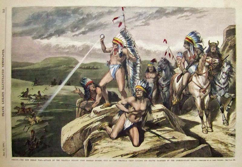
004Oregon: 1878 Hand colored wood engraving titled, "Oregon -- The New Indian War -- Attack by the Umatilla Indians upon hostile Snakes, July 2D -- The Umatilla Chief calling his Braves together by the Looking-Glass Signal." Featured in Frank Leslie's Illustrated Newspaper. 16 x 11 in. $100  005or: 1921 Oregon Mileage Map. Hand colored rail mileage between towns "regardless of topography." Rand McNally. 18-1/2x15 in. $60 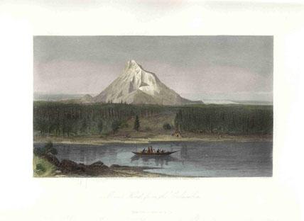 006or: 1873 Mount Hood Oregon. Mt. Hood from the Columbia River. Hand colored steel engraving. One of the very finest early views of Mt. Hood. 12x9 in. $50 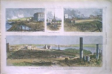 008or: 1873 Portland Oregon. Four views of the great fire at Portland. Hand colored engraving from Harper's. 16x11 in. $50 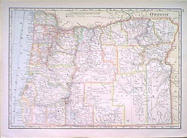 014or: 1915 Oregon Map by Cram. Outline litho color. Very detailed. 12x15 in. $30 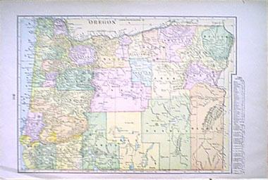
017or: 1902 Oregon Map. Litho printed in color. Lists counties and cities. 16x11-1/2 in. $30 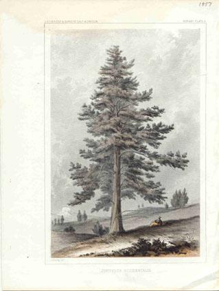 020or: 1855 Oregon view. Railroad Survey lithographic color print. "Juniperus Occidentalis." Printed by US Government. 8-1/2x11 in. $60 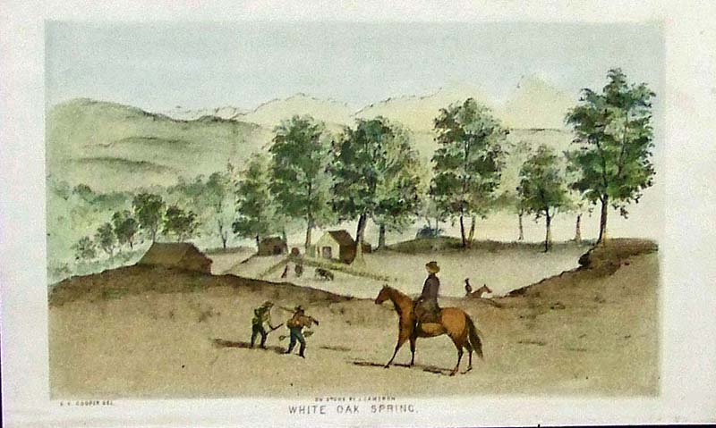 021Oregon: 1843 Rare color lithograph titled, "White Oak Spring." 9 x 5-1/2 in. $60 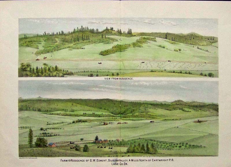
022Oregon: 1885 Color lithograph showing the Farm Residence of G.W. Ozment, Siuslaw Valley, 4 Miles North of Cartright P.O. Lane Co. OR. 15-1/2 x 11 in. $70 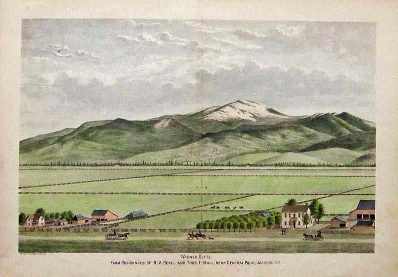
023Oregon: 1885 Color lithograph showing Wagner Butte in the background and foreground shows the Farm Residence of R.V. Beall and Thos. F. Beall, Near Central Point, Jackson Co. 15-1/2 x 11 in. $70 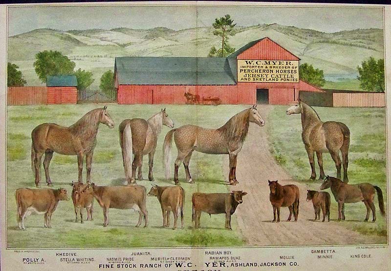
024Oregon: 1885 Color lithograph showing W.C. Myer's Percheron Horses, Jersey Cattle and Shetland Ponies in Ashland, Oregon. 15-1/2 x 11 in. $70 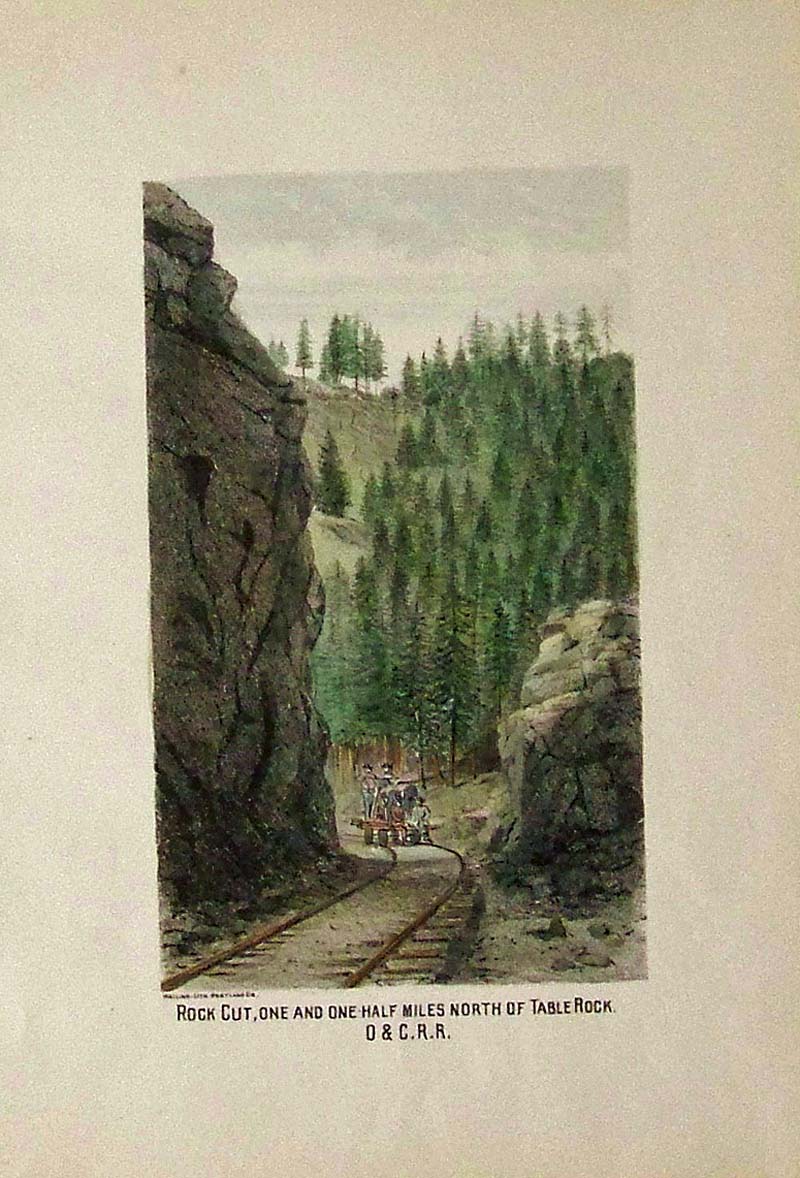
025Oregon: 1885 Color lithograph showing a Rock-Cut, One and One-Half Miles North of Table Rock, O & C.R.R. 11 x 8 in. $50 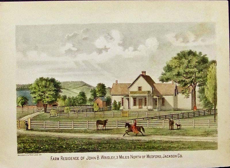
028Oregon: C.1885 Color lithograph showing the Farm Residence of John B. Wrisley, 3 Miles North of Medford, Jackson Co. 11 x 8 in. $50 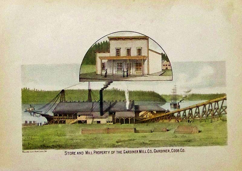
029Oregon: 1885 Color lithograph showing the Store and Mill Property of the Gardiner Mill Co., Gardiner, Coos, Co. in Oregon. 11 x 8 in. $50 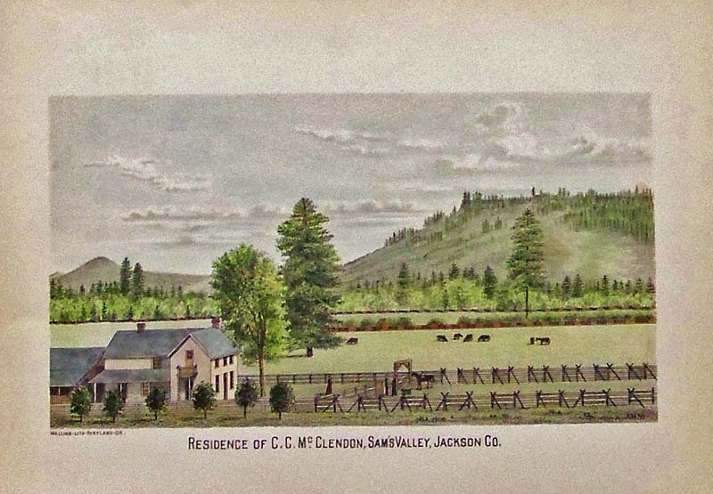
030Oregon: 1885 Color lithograph showing the Residence of C.C. McClendon, Sam's Valley, Jackson Co. 11 x 8 in. $50 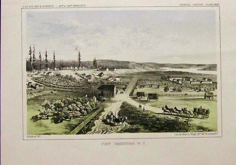
031Oregon: 1855 Hand colored lithograph by Sarony, Major & Knapp showing Fort Vancouver, W.T. From the U.S.P.R.R. Exp. & Surveys General Report, Plate XLIV. 11 x 8 in. $60 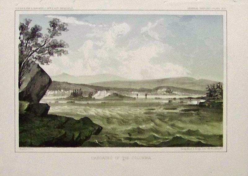
032Oregon: 1855 Sarony, Major & Knapp hand colored lithograph showing the Cascades of the Columbia, from the U.S.P.R.R. Exp. & Surveys General Report, Plate XLV. 11-1/2 x 8-1/2 in. $60 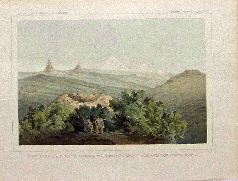
033Oregon: C.1850 Hand coloredl ithograph showing the Cascade Range with Mount Jefferson in the background, Mount Hood and Mount Adams from the Pass West of Camp 40. From the U.S.P.R.R. Exp. & Surveys -- Cal. and Oregon, General Report, Plate V. 11-1/2 x 8-1/2 in. $60 Check for availability 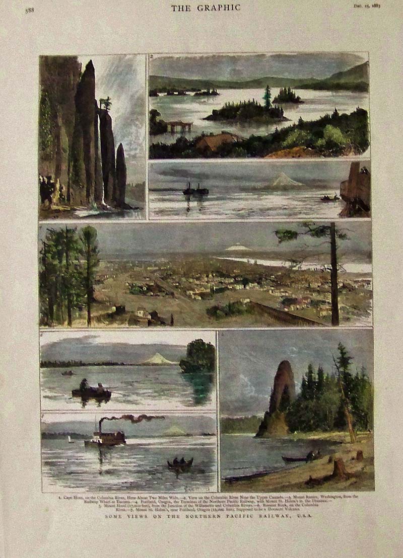
034Oregon: 1883 The Graphic hand colored wood engravings showing some Views on the Northern Pacific Railway, U.S.A. 16 x 11 in. $60 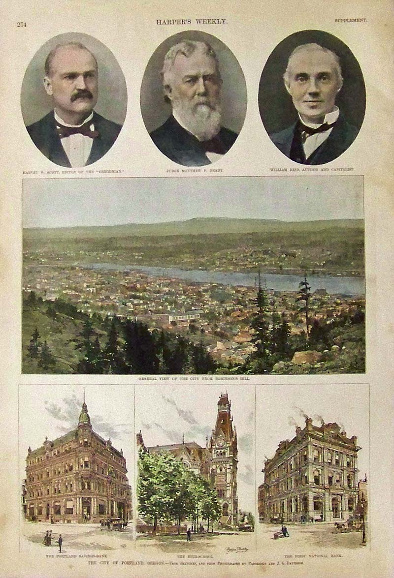
035Oregon: Harper's Weekly hand colored wood engravings ahowing The City of Portland, Oregon. 15-1/2 x 10-1/2 in. $60 
036Oregon: 1872 The Graphic hand colored wood engravings titled, "The San Juan Boundary Question." 15-1/2 x 11 in. $60 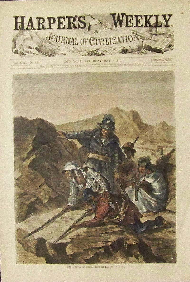
037Oregon: 1873 Hand colored wood engraving titled, "The Modocs in their Stronghold." Featured in Harper's Weekly, A Journal of Civilization. 16 x 11 in. $60 |
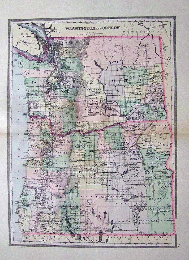 102Wasington: 1891 Bradley's Atlas of the World's hand colored map of Washington and Oregon. 26 x 19 in. $100 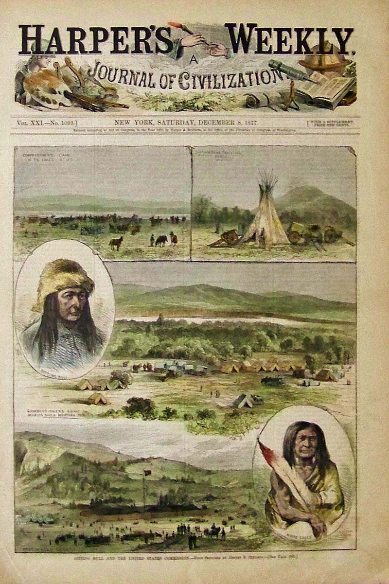
039Oregon: 1877 Hand colored wood engraving showing Sitting Bull and the United States Commission. From Sketches by Jerome B. Stillson and featured in Harper's Weekly, A Journal of Civilization. 16 x 11 in. $60 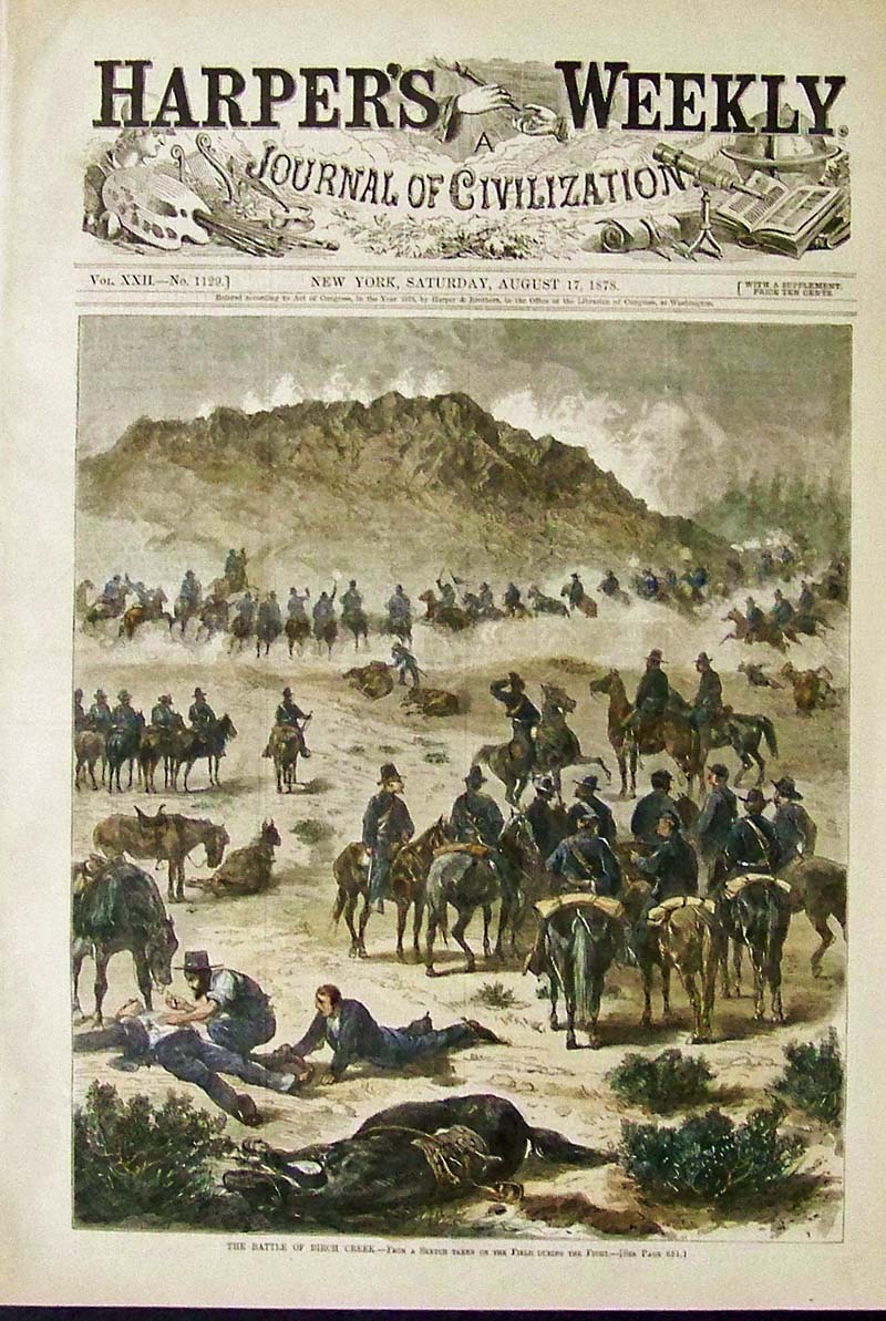
040Oregon: 1878 Hand colored wood engravings showing a scene from The Battle of Birch Creek. Featured in Harper's Weekly, A Journal of Civilization. 16 x 11 in. $60 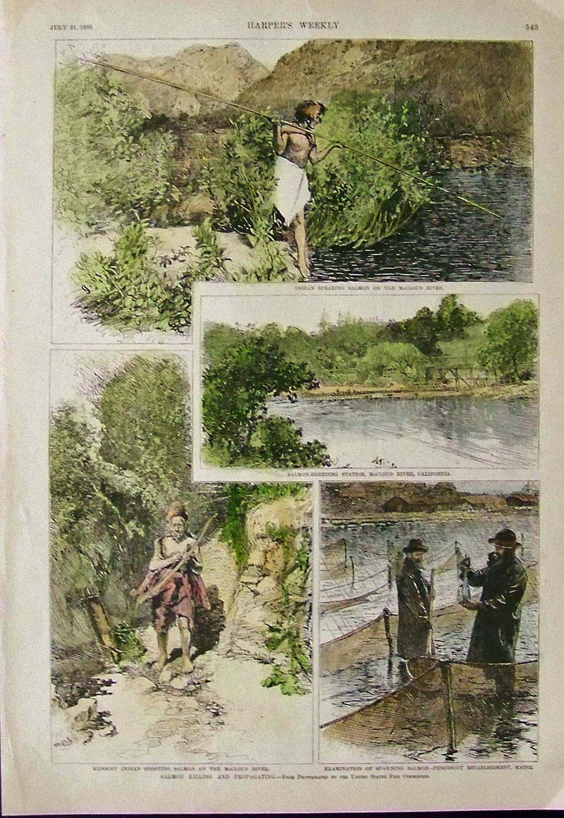
041Oregon: 1888 Harper's Weekly hand colored wood engravings showing scenes of Salmon Killing and Propagating. 16 x 11 in. $60 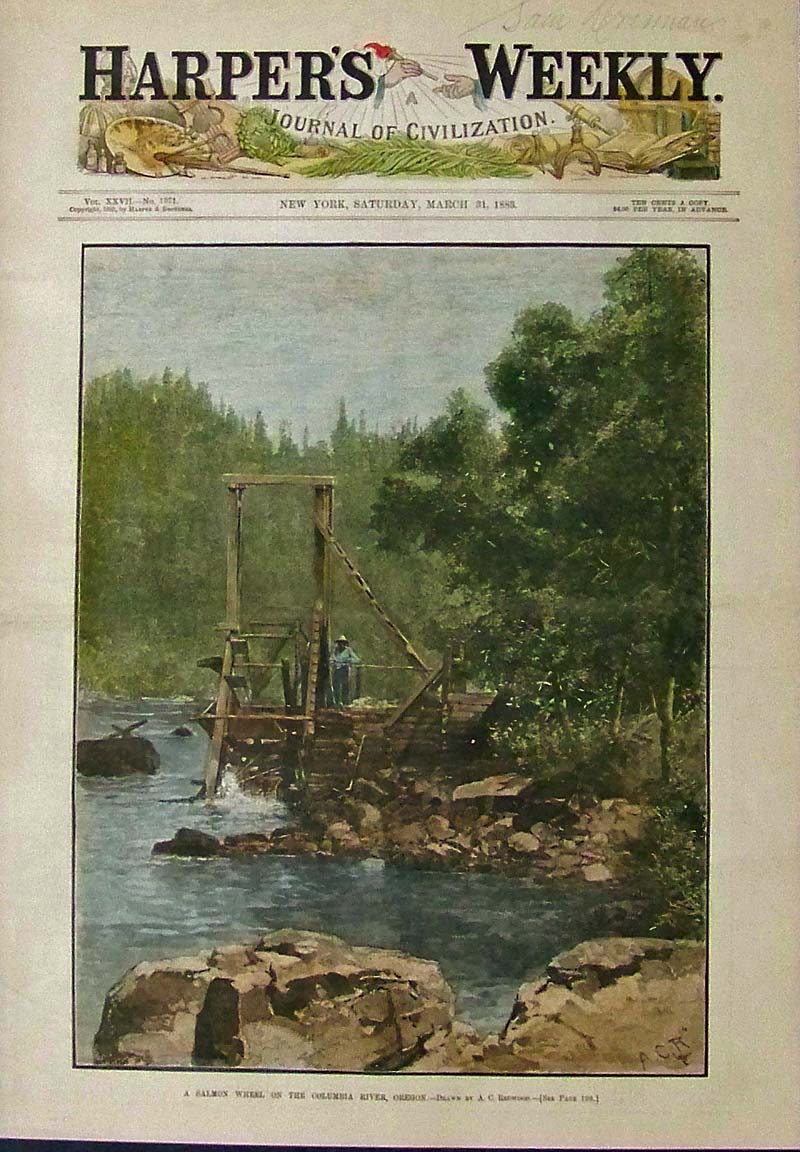
042Oregon: 1883 Hand colored wood engraving showing A Salmon Wheel on the Columbia River, Oregon. Featured in Harper's Weekly, A Journal of Civilization. 16 x 11 in. $80 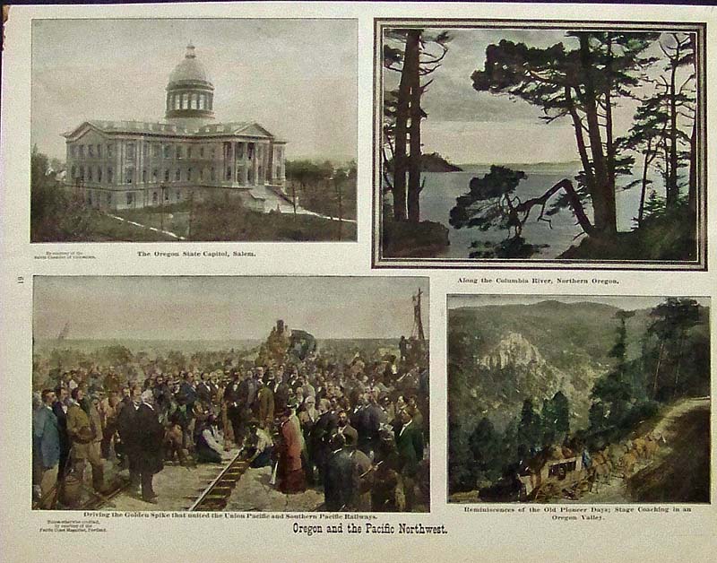
043Oregon: 1904 Color half-tone images showing scenes from Oregon and the Pacific Northwest. 14-1/2 x 11 in. $50 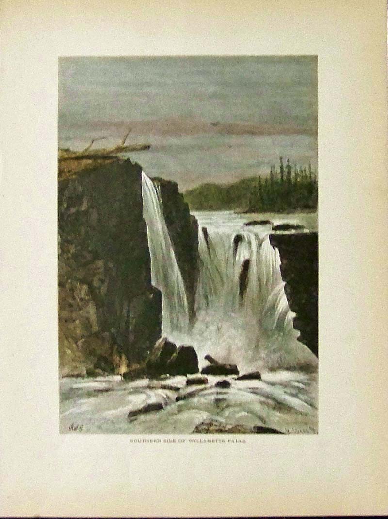
045Oregon: 1873 Hand colored wood engraving showing the Southern Side of Willamette Falls in Oregon. 12 x 9 in. $40 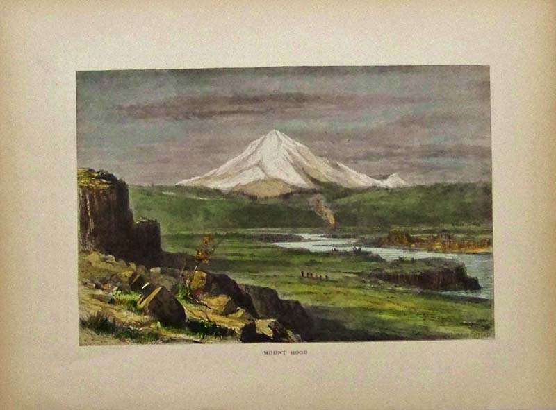
046Oregon: 1873 Hand colored wood engraving showing Mount Hood. 12-1/2 x 9-1/2 in. $40 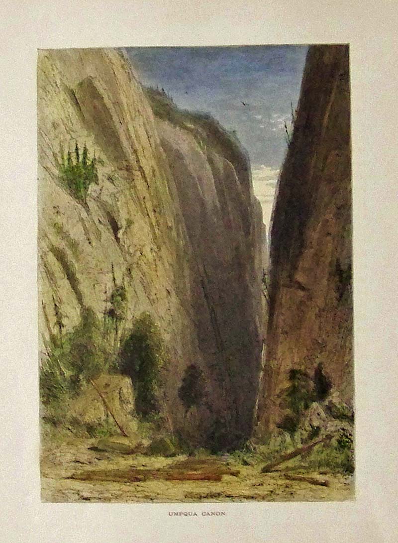
047Oregon: 1873 Hand colored wood engraving showing Umpqua Canon. 12 x 9 in. $40 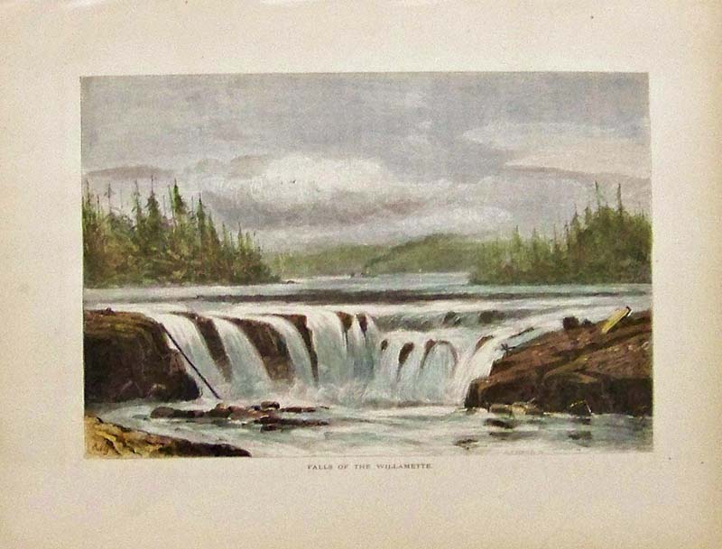
048Oregon: 1873 Hand colored wood engraving showing the Falls of the Willamette. Featured in Picturesque America. 12-1/2 x 9-1/2 in. $40 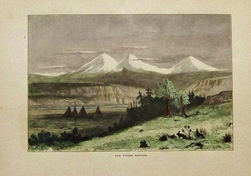
049Oregon: C.1873 Hand colored wood engraving showing The Three Sisters mountain range in Oregon. Featured in Picturesque America. 12-1/2 x 9-1/2 in. $40 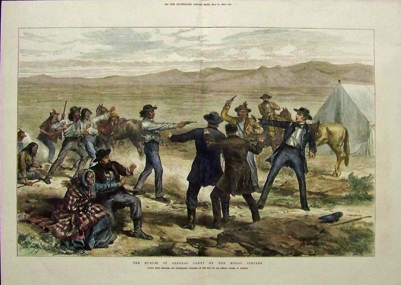
050Oregon: 1873 Hand colored wood engraving featured in The Illustrated London News titled, "The Murder of General Canby by the Modoc Indians." 21-1/2 x 16 in. $100 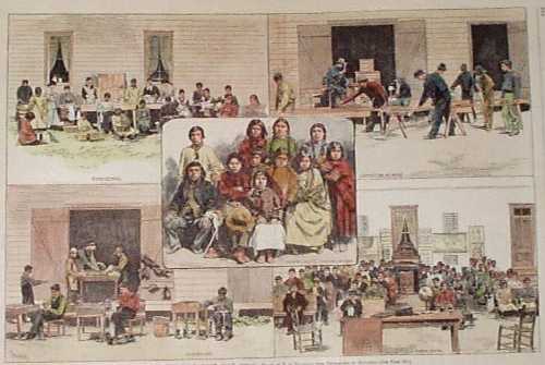 101or: 1882 School for Indian Children, Forest Grove. Hand colored, wood-engraved print from Harper's Weekly. The print is titled "Indian Training School--Forest Grove, Oregon." It contains scenes of Indian children being taught housekeeping, carpentry, shoemaking, etc. 11x16 in. $50  102or: 1900 Eastern Oregon Winter Stagecoach Scene. Hand colored halftone scene from a 1900 news weekly. Title is "A Winter Stage Route in the Mining Regions of Eastern Oregon. Mining Experts, Promoters, Engineers, Owners, etc. on their Way into the Sumpter and John Day Country." 11x16 in. $60 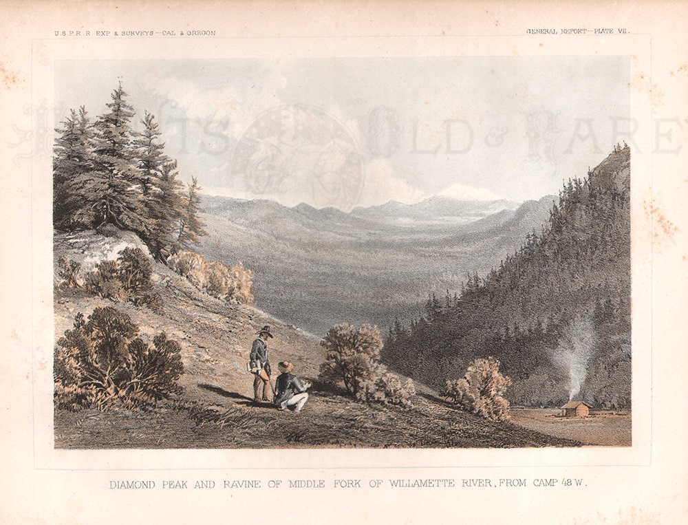 105or: 1857 View of Diamond Peak, by the Willamette River. Hand colored lithograph from the 1857 report of a US government railroad survey. Title is "Diamond Peak and Ravine of Middle Fork of Willamette River from Camp 48 W. 8x10 in. $50 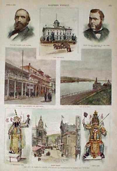
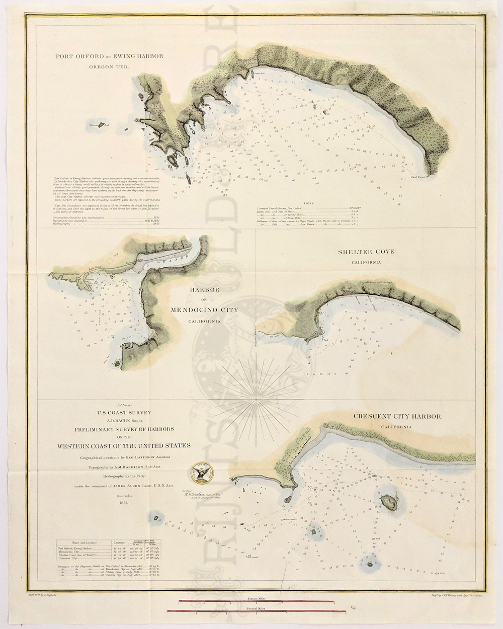
108or: 1889 Scenes in the City of Portland. Hand colored, engraved print from Harper's Weekly, showing views of streets and landmarks in the city. Portraits of two prominent Portland bankers are also shown. 11x16 in. $60 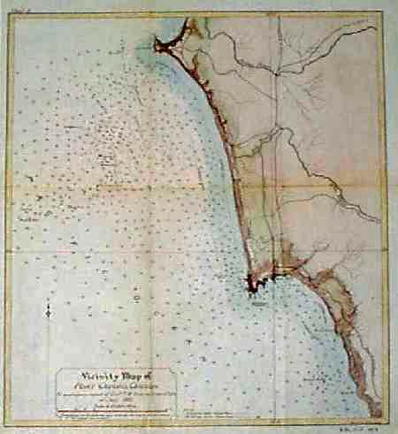 109or: 1895 Map of the Coast Around Port Orford. Hand colored, lithographed chart titled "Vicinity Map of Port Orford, Oregon." Published by the US Army Corps of Engineers. The town of Port Orford is shown, as well as roads and railroad tracks up and down the coast. Water depths in the ocean along the coast are also shown. 14x16 in. $80 Check for availability 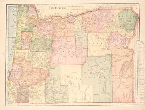 110or: 1902 Map of Oregon. Colorful map of Oregon from a 1902 world atlas. Each county is colored separately. Cities, towns, railroad lines and geographical features are all shown. 11x15 in. $30 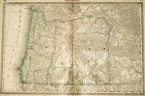
112or: 1880 Map of Oregon. Interesting map, with detailed geographical features. The state and counties are outlined in green. Map shows the locations of railroad lines, major roads, cities and towns. Entire image is surrounded by a decorative border. There are some small stains and a chip in the margin, but the image is clean and clear. 14x21 in. $40 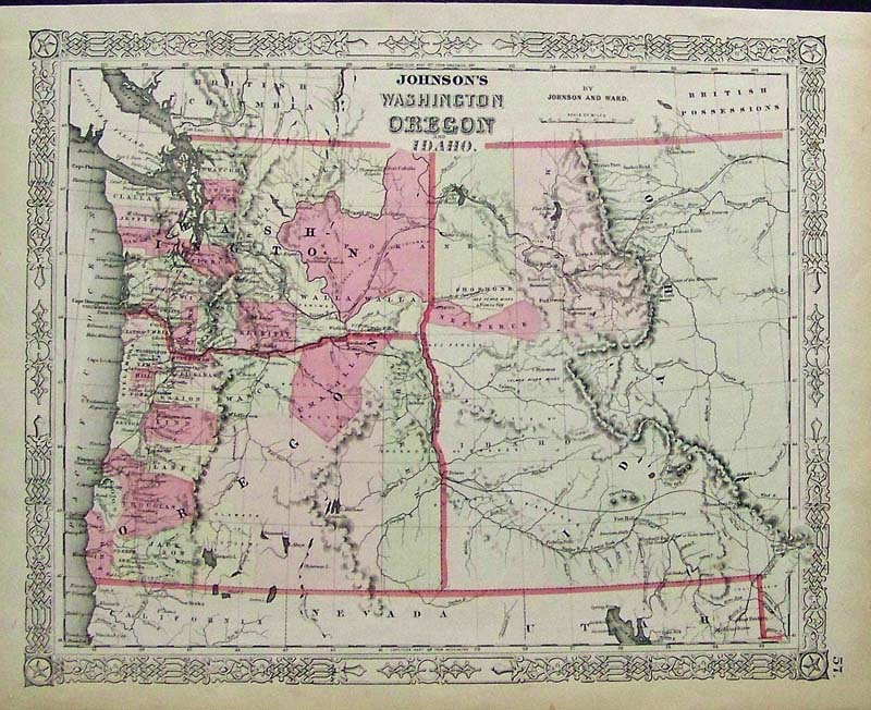
202ow: C.1860 Johnson's Washington, Oregon and Idaho hand colored engraved map. 18 x 14 in. $180 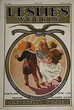
207id: Lewis & Clark Centennial Exposition -Portland, Oregon - Leslie's Weekly cover in 1905, is commemorating the Exploration from St. Louis to the Pacific by Lewis and Clark.This very nice color lithograph celebrates the 100th anniversary of their expedition. 11x16 in. $40 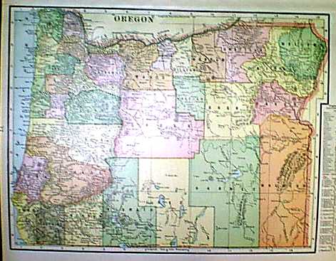 1151or: 1901 Map of Oregon. Map of Oregon (1901). Color: Printed in Color. Type: Lithograph.Size: 12x14 in. $30 |
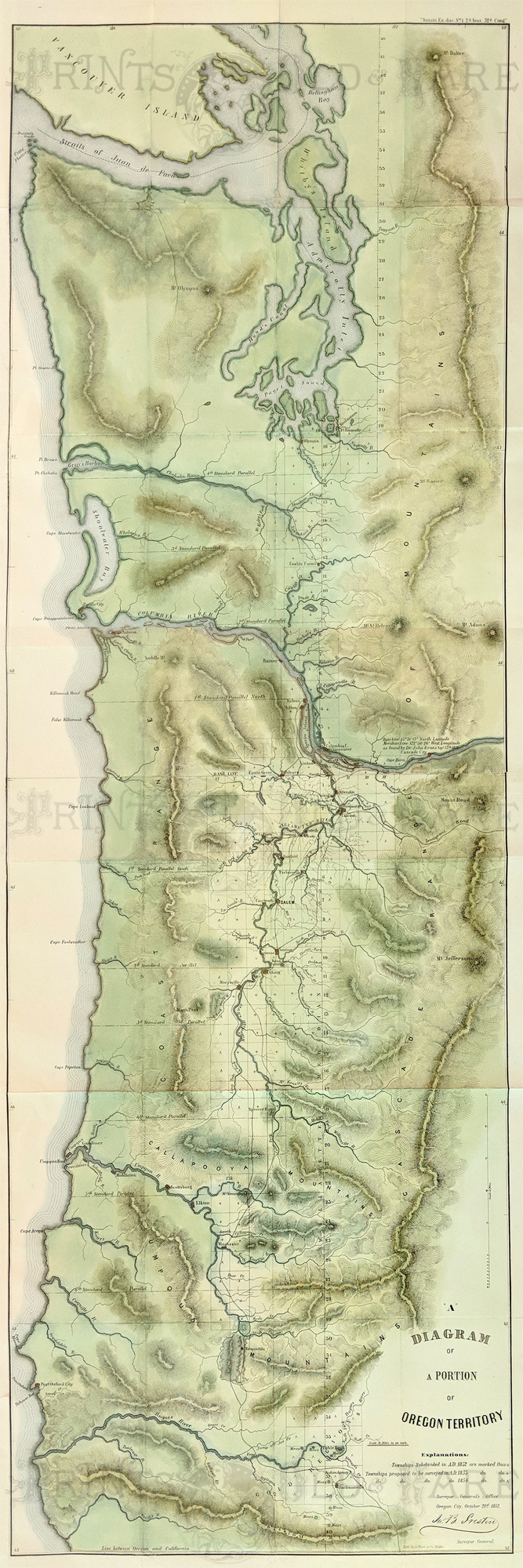 138Oregon: Oregon Territory 1852. A nicely hand colored Oregon Land Survey Map published by the General Land Office in 1852 and surveyed by John B. Preston. Showing Oregon State and moving North to Washington, Puget Sound then stopping at Vancouver Island. A finely detailed map with mountains, rivers, townships and marks notable cities such as Salem, Oregon City, Astoria and Olympia. A scarce map. 52 3/4 x 17 3/4 in. $3,200 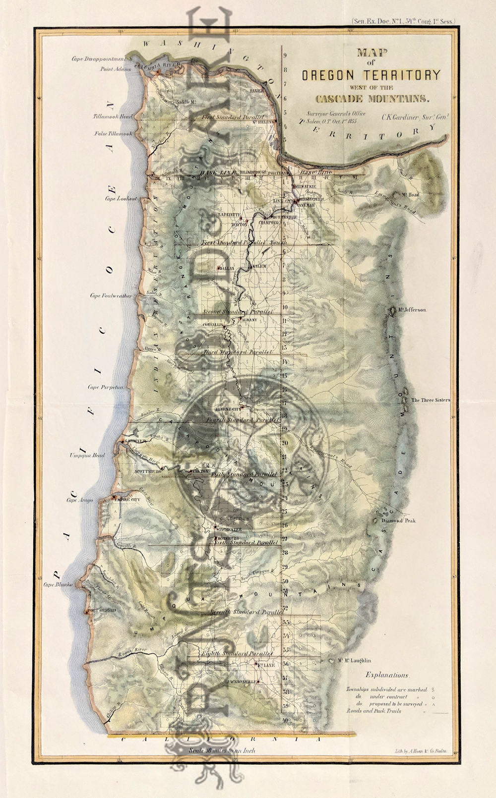 139Oregon: Beautiful Surveyor General's Office map of Oregon Territory West of the Cascade Mountains. 1855. This hand colored lithograph shows the topography, townships, roads and pack trails, as well as parallels. Portland, Eugene City, Salem, Winchester are some of the many cities shown. Willamette River Valley also highlighted. 13 x 20 3/4 in. $500 Check for availability 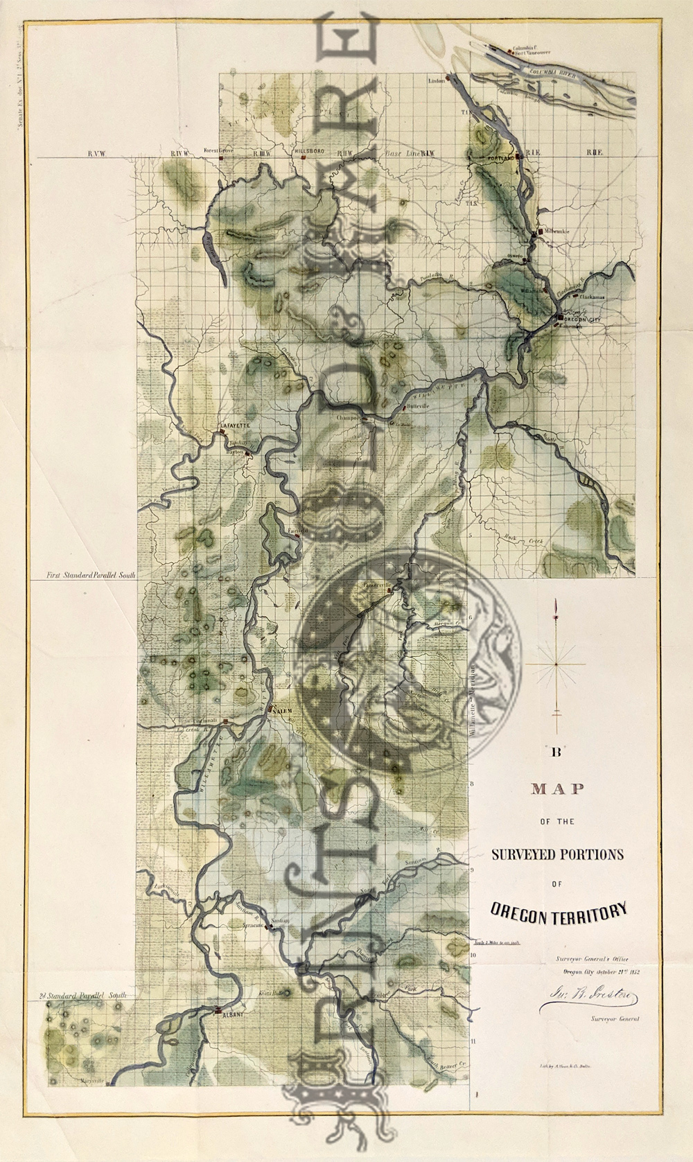 140Oregon: "Map of the Surveyed Portions of Oregon Territory." Published in 1852 by the United States Government. The map follows the Willamette River from its intersection with the Columbia in the north, past Salem and as far south as Marysville. Cities, towns and roads are shown throughout the area. Geographical features (rivers, streams, mountains, etc.) are shown as well. Hand colored, lithograph. 16 x 26 in. $850 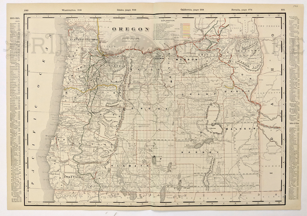 141Oregon: Detailed 1928 Railroad Map of Oregon. Color coded lines on the map show the names and locations of railroads throughout the state. State and county borders are outlined in yellow. Cities, towns, Indian reservations and geographical features are all shown. This map would look great in a frame! 18 x 27 in. $100 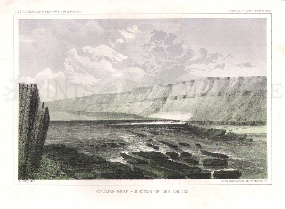 143Oregon: Columbia River -- Junction of Des Chutes. 1855 USPRR Survey. Plate LXVII. 8 1/2 x 11 in. $40 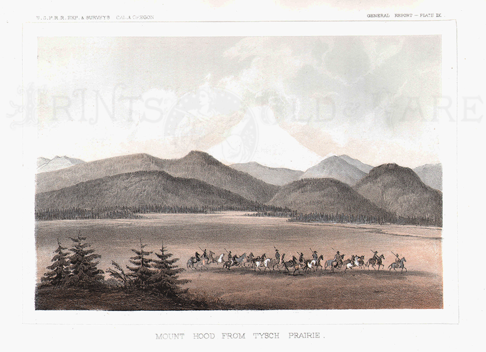 144Oregon: Mount Hood from Tysch Prairie. 1855 USPRR Survey. Plate IX. 8 1/2 x 11 1/4 in. $60 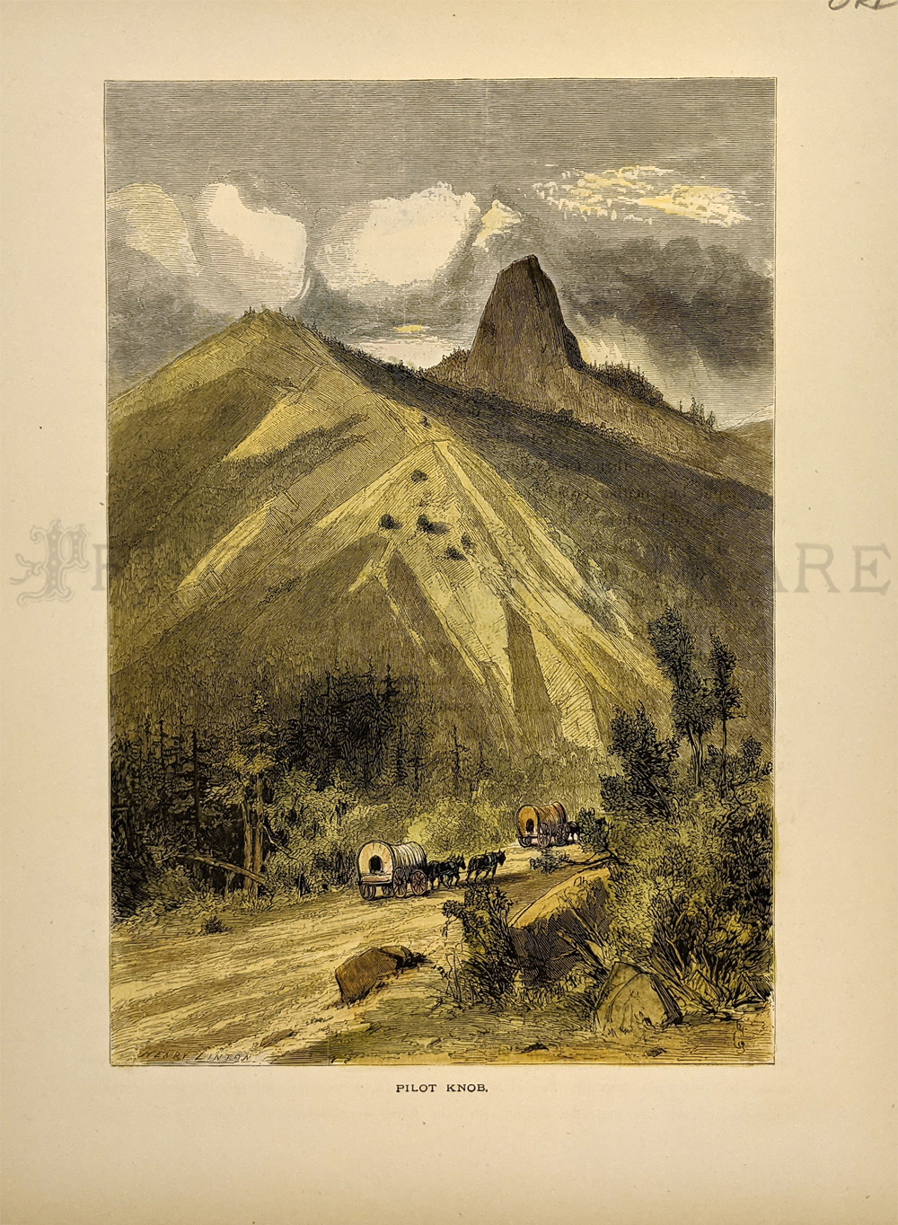 145Oregon: 'Pilot Rock' 1874 near Ashland. Indentified at the time as Pilot Knob. Hand colored, wood engraving. Showing covered wagons approaching. 9 1/2 x 12 in. $40 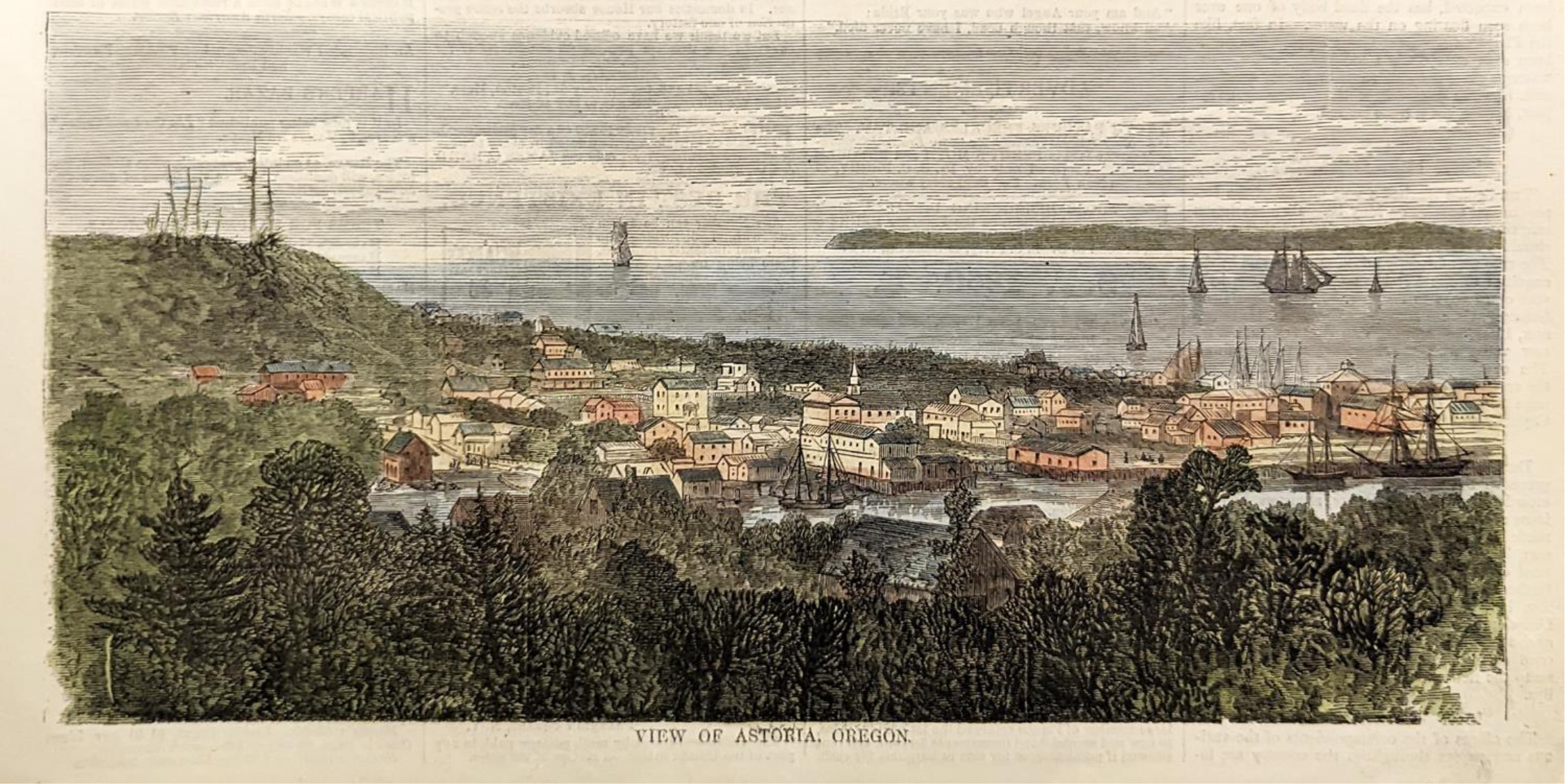 146Oregon: View of Astoria, Oregon. 1868 Harper's Weekly. Hand colored, wood engraving. 5 1/4 x 10 1/2 in. $40 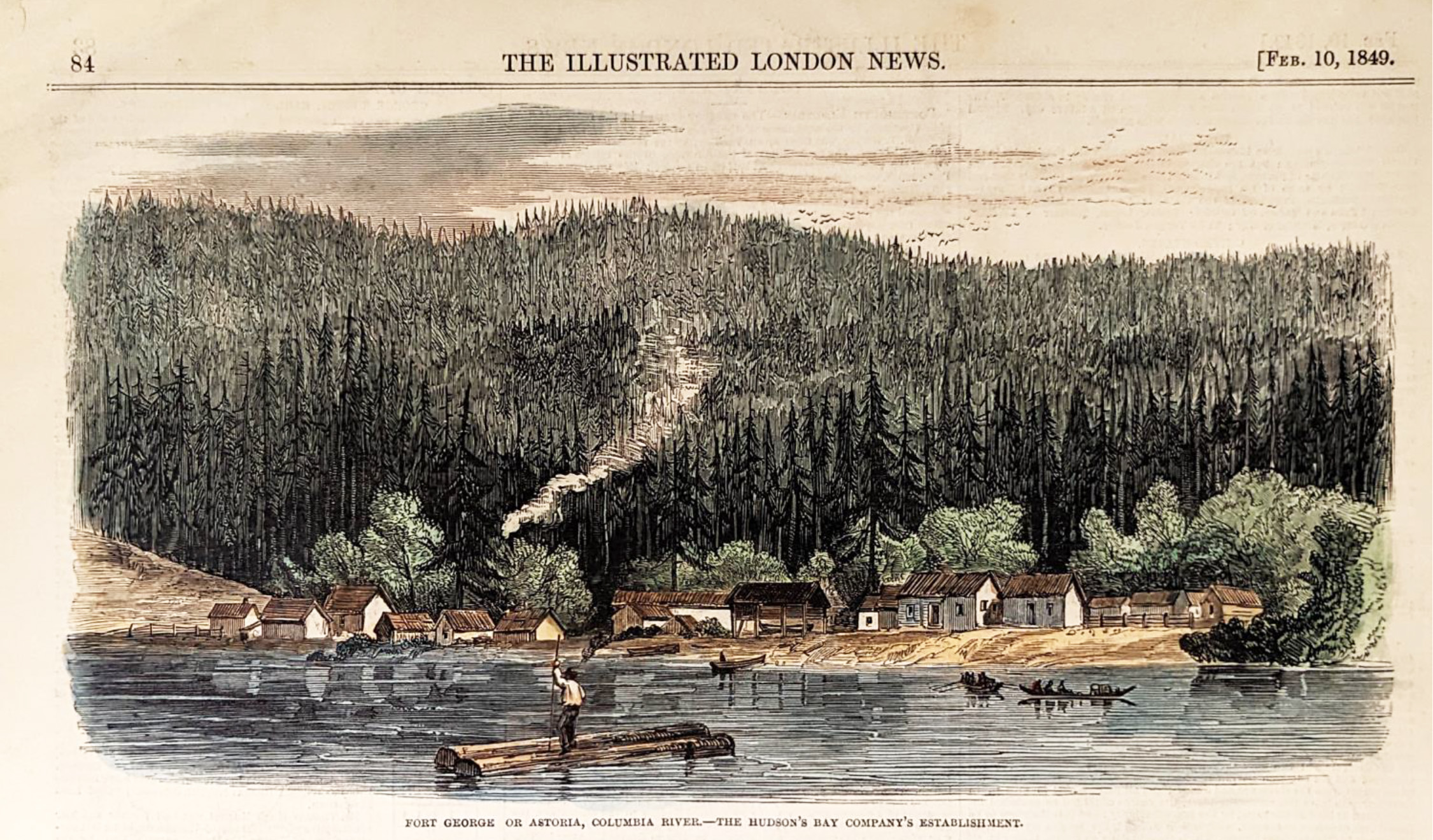 147Oregon: Fort George or Astoria, Columbia River - The Hudson's Bay Company's Establishments. 1849 Illustrated London News. Hand colored, wood engraving. 6 x 10 in. $40 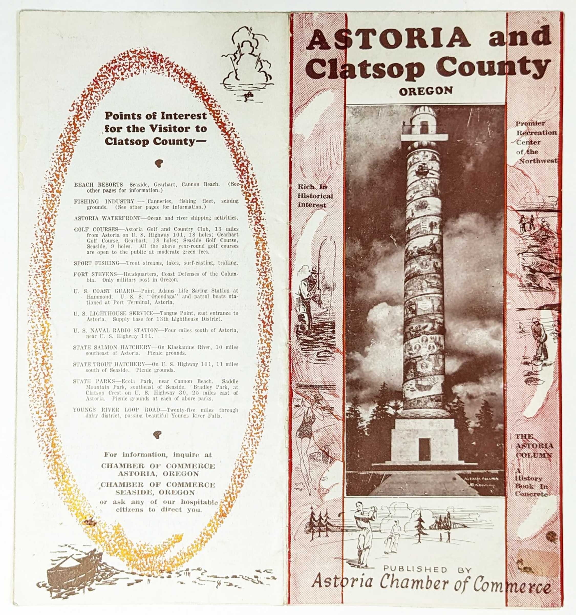 148Oregon: Astoria and Clatsop County, Oregon. Published by the Astoria Chamber of Commerce. Showing Points of interest and history of Astoria. 4 x 9 in. $30 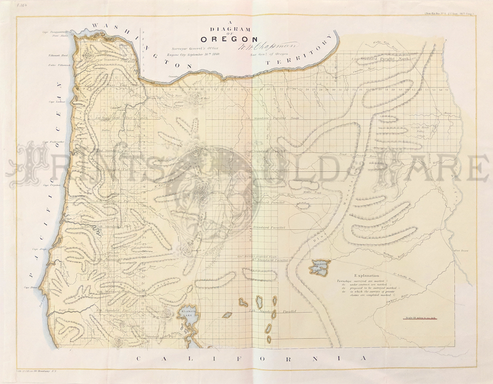 136Oregon: Diagram of Public Surveys in Oregon 1862 - A large early lithographed and hand colored land office map of Oregon that is signed in the plate by the Surveyor General in Eugene City. The map features good detail on a scale of 1 inch to 18 miles and delineates the status of public land surveys in 1862. Locates roads, towns, topography by hachure, major rivers, and the routes of exploration. Delineates and names General Harney's Cutoff, Fremont's Trail, the Immigrant Road, Fort Boisee, Applegates Trail, Meeks Trail, and more. Survey progress is limited to the western valley and Columbia River areas and at the time Washington Territory extends around the Eastern Oregon border, Fort Boise is noted but no Idaho. Condition: Excellent, some light folds and foxing one margin otherwise in spectacular condition. size, 24 x 18 image $300
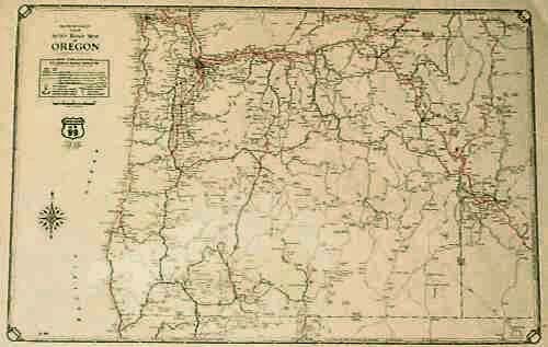 113or: Early Road Map of Oregon. 1928 Oregon road map, from Rand McNally's Commercial Atlas. Federal roads are shown in red, and state roads are black. 14x20 in. $30 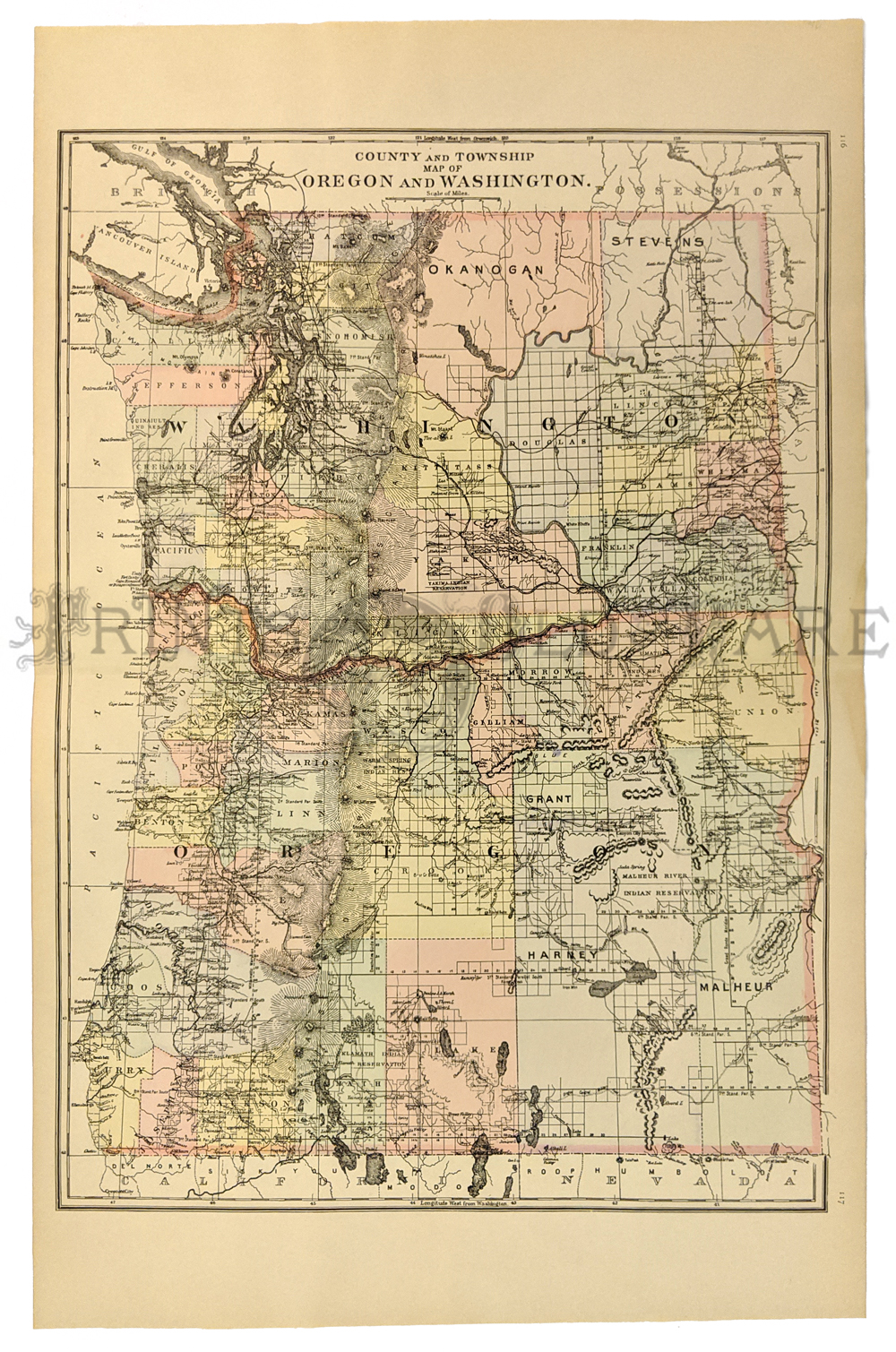 114or: 1887 Mitchell's Map of Oregon, Washington. Hand colored map of Oregon and Washington. Shows the locations of Indian reservations, cities, towns and major roads in both states. Also shows railroad lines and geographical features. 15x22 in. $90 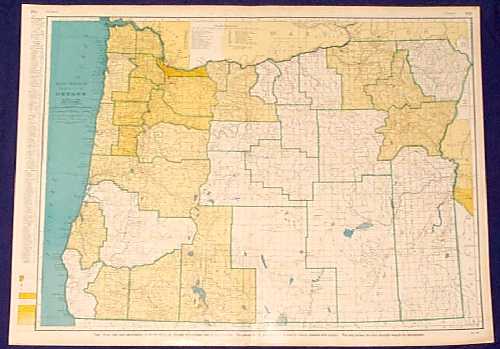 115or: 1943 Rand McNally Map of Oregon. Large, colorful map of Oregon from the 1943 edition of Rand McNally's Commercial Atlas. Shows cities, towns, railroad lines and geographical features. The population per square mile is indicated in each county by various shades of orange. 20x28 in. $80 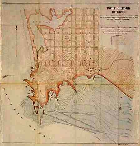 119or: 1895 Map of Port Orford Oregon. Interesting, hand colored map of Port Orford, published in 1895 by the Army Corps of Engineers. Water depths are shown in the ocean by the town, and the streets of the town itself are all shown and named. Map also shows the location of a stage road to Gold Beach. 20x20 in. $80 Check for availability 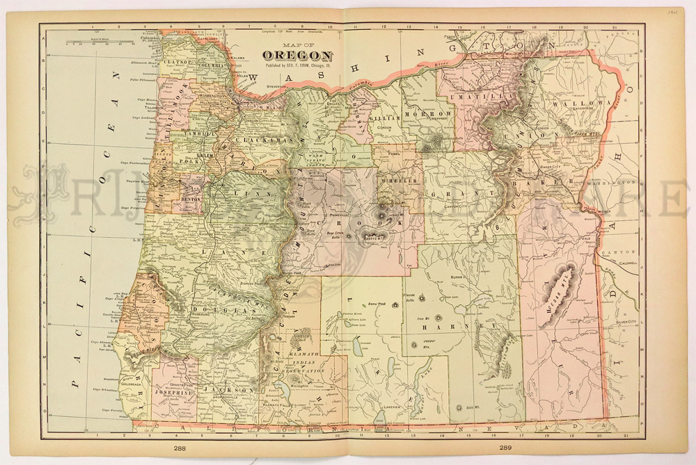 120or: 1901 Map of Oregon by George F. Cram. Nice map of Oregon, with each county colored separately. Locations of Indian reservations and railroad lines are shown, as well as cities, towns and geographical features. 14x22 in. $65 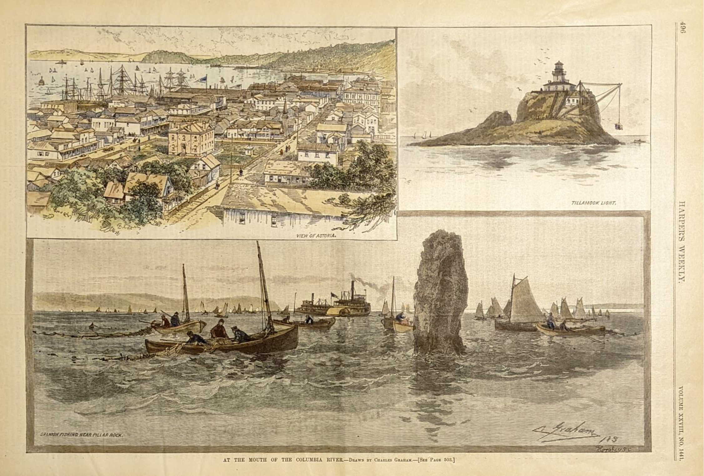
122or: 1884: Mouth of Columbia River Oregon. Three hand colored, engraved images from Harper's Weekly, titled "At the Mouth of the Columbia River." Each scene is titled separately: 1) View of Astoria; 2) Tillamook Light; and 3) Salmon Fishing Near Pillar Rock. 11x16 in. $60 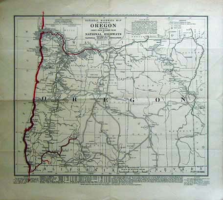 123or: 1919 Highway Map of Oregon showing 3400 miles of national highways proposted by the National Highways Association. Prepared by the National Highways Association. When the roads were first being located the Association published this early map showing tentative locations of roads for the state (indicated on map with the heavy lines). size: 15.5x14 in $80 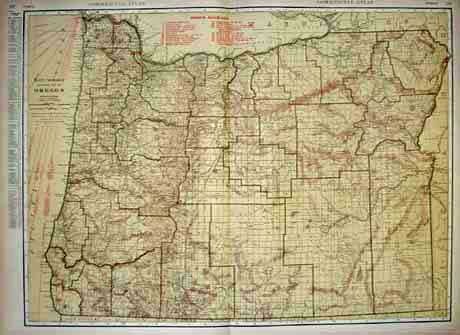 124or: Commercial Atlas Railroad Map of Oregon. Published by Rand McNally in 1928. Lists and shows routes of the railroads and steamships. Left margain lists population of principal cities in Oregon in 1928. size: 20.5x28 in $80 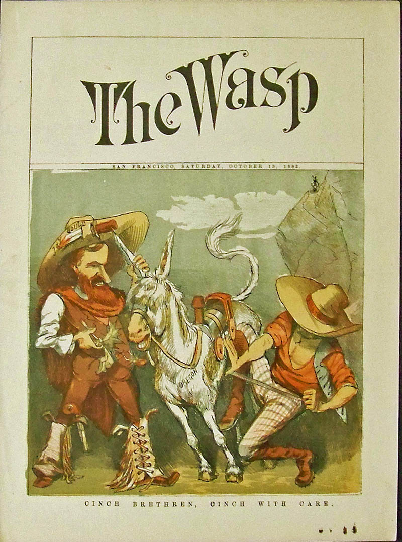 132or: 1883 Railroad Gould and Villard -- Rare Wasp cover from San Francisco -- Boom in Railroad building in the Northwest. Image shows two tycoons named Villard and Gould, former rivals to work together for awhile to control steamship company and their railroad. Title of image is, "Cinch Brethren, Cinch With Care." 13-1/2 x 10 in. $80 |
|||||||||
| Order Form | |||||||||||
| Back to Homepage | |||||||||||