 
|
|||||||||||
This is a small selection of our inventory of antique Pacific Islands and Oceana prints and maps. Additional inventory is available. Contact us with your request. 1-800-879-6277
|
|||||||||||
|---|---|---|---|---|---|---|---|---|---|---|---|

001paci: Carte Generale De L Ocean Pacifique, Urville 1834 A very fine and steel engraved black and white separately published map of Dumont D'Urville's explorations of the Pacific, based upon his routes. The map details the regions explored by the Astrolabe, under Dumont D'Urville's command. The map extends from Asia and Australia to the Western coasts of North and South America. The Pacific Ocean is delineated into Micronesie, Melanesie and Polynesie. Special Note: Rear Admiral Jules Sébastien César Dumont d'Urville (1790-1842), was a French explorer and naval officer, who explored the south and western Pacific, Australia, New Zealand, and Antarctica. Dumont d'Urville led an expedition into the South Pacific aboard the Astrolabe, which sailed to the coast of southern Australia, extensively mapped the South Island of New Zealand, explored the archipelagos of Tonga and Fiji, and the coasts of New Guinea. He located La Pérouse’s shipwreck in Vanikoro and collected numerous remains of his boats, before returning to France in 1829. After completing the voyage, where he was promoted to captain, he was put in charge of writing the report of his travels. The five volumes were published at the expense of the French government between 1832 and 1834. In his report, he criticized the military structures, his colleagues, the French Academy of Sciences and even the King - none of which, in his opinion, had given the voyage of the Astrolabe due acknowledgment. Condtion: Good several folds, and foxing throughout, small left margin with some browning on the folds. size 20 x 13 image $350 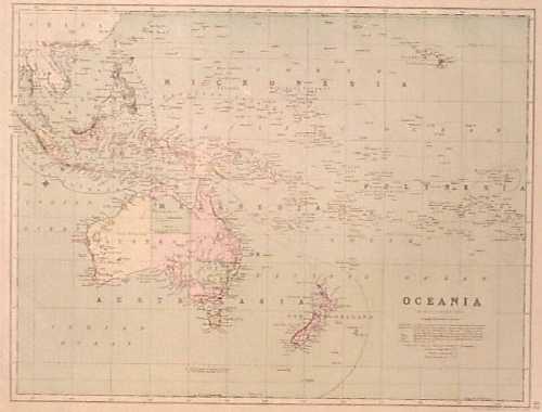
011paci: 1873 Map: Australia, Polynesia, Pacific. Interesting map with original hand coloring, drawn by Keith Johnston and published in an 1873 world atlas. Map title is "Oceania." It shows all of the small island groups in the Pacific as well as Australia, New Zealand and the East Indies. A key beneath the map title lists the European possessions in the region. 14x19 in. $50 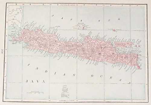 014paci: 1895 Map of the Island of Java. Interesting map, published in a world atlas circa 1895. Cities, towns and geographical features are shown in detail throughout the island. 11x14 in. $30 |
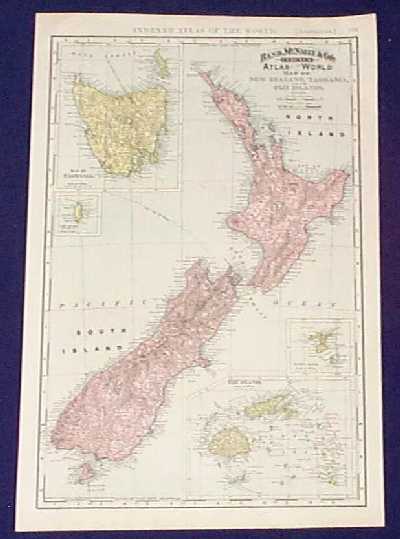 015paci: 1892 Map of New Zealand, Tasmania, Fiji. Detailed map from 1892 edition of Rand McNally's Indexed Atlas of the World. The map focuses on New Zealand, but also includes insets of Tasmania and the Fiji Islands. Cities, towns, major roads and geographical features are all shown. The locations of submarine telegraph cables are shown as well. 14x21 in. $60 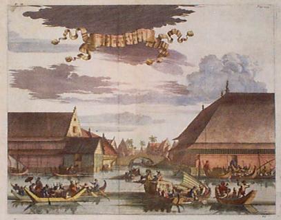
020paci: ca.1675 View: Batavia Indonesia. Beautifully hand colored, decorative scene, printed circa 1675 by an English publisher. Artist's name not shown. Title is "The Slaughter House of Batavia." The city of Batavia is now Jakarta, Indonesia. Boats are shown in the canals of the city, bringing cattle and sheep to the slaughterhouse. Excellent condition. 14x17 in. $250 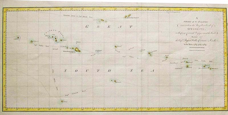
022paci: C.1765 Hand colored copper engraved Chart of the Islands (discovered in the Neighborhood of) Otaheite in the Course of Several Voyages round the World, made by the Captains Byron Wallis, Carteret & Cook. 21 x 11-1/2 in. $300 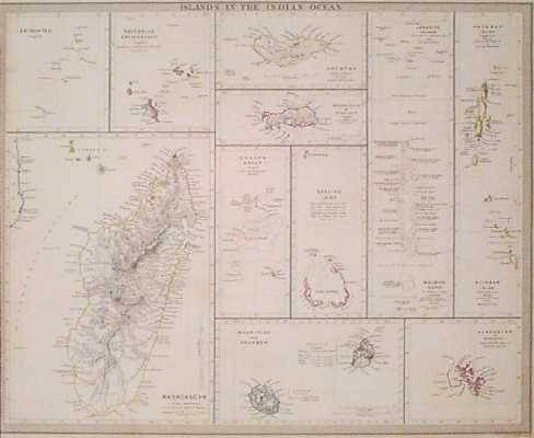 200paci: 1833 Map of Indian Ocean Islands. Interesting, engraved map of the islands in the Indian Ocean, published in 1833 by the Society for the Diffusion of Useful Knowledge (SDUK). Islands are colored with original outline hand coloring. Statistics on population and economy are printed next to each island. Left margin is trimmed to map border, but the image is not affected. 13x16 in. $150 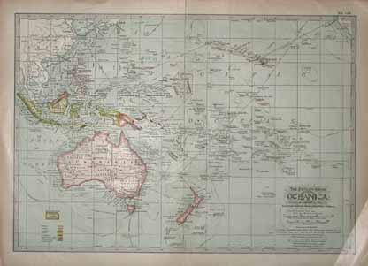 201paci: The Century Atlas, Oceanica. Published in 1911, map shows Islands including Hawaii, Australia, New Zealand, Samoa, Fiji, New Guinea, Philippines, and many more. Also shows principal railroad and steamship lines. 12x16 in. $40 |
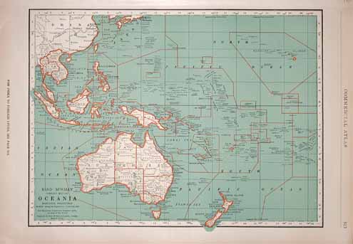 202paci: 1935 Commercial Atlas from Rand McNally. Library Map of Oceania. Shows Australia, New Zealand, Hawaii, Borneo, Philippines as well as many others. 14x20.5 in. $40 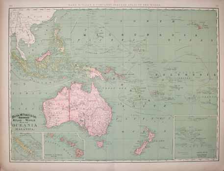 203paci: 1892 Rand McNally & Company's Indexed Atlas of the World, Map of Oceania and Malasia. Shows Australia, Borneo, New Guinea, New Zealand, Hawaii, Sumatra, and many more. Insets of New Caledonia and Loyalty Islands, Hawaiian or Sandwich Islands, and the Eastern Portion of Polynesia. 21.5x28.5 in. $60  204paci: Rand, McNally & Co.'s Oceania from 1891. Includes Malaysia, Micronesia, Polynesia, Melanesia, and Australasia. 13x20.5 in. $50 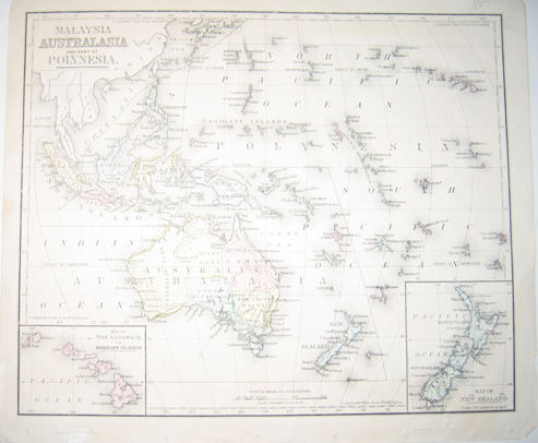 207paci: 1867 Malaysia, Australasia and Part of Polynesia map - With inset map in bottom left corner of The Sandwich or Hawaiian Islands; and inset map in bottom right corner of New Zealand. Hand colored map in fair condition with black-lined border surrounding it. 10x11.5in. $80 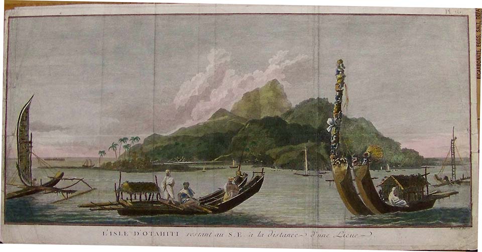 208paci: 1784 Color engraving showing the "L'Isle D' Otahiti restant au S.E. a la distance - D'une Lieue. Plate 16. Published in London by Alexander Hogg. This hand colored engraving was part of Captain Cook's voyage to the South Pacific, Tahiti. 18-1/2 x 9-1/2 in. $300 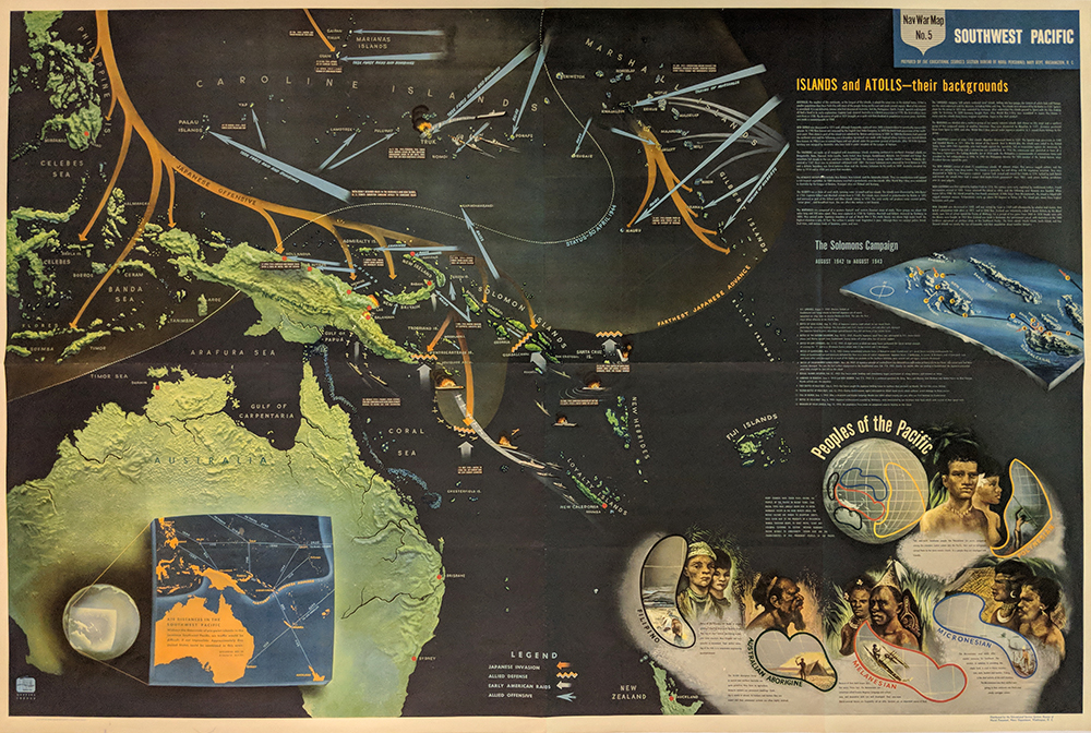 204army: Islands & Atolls. World War II - Pacific. 1944 Naval War Map #5. Islands and Atolls. Japanese Offensive. Beautiful Color inset of Races of the Pacific. 40 x 59 in. $150 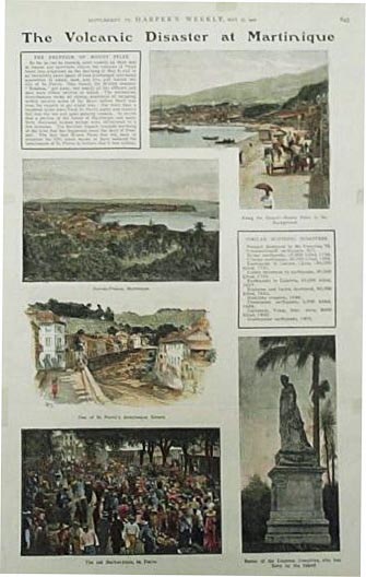 007ndis: 1902 Scene of Martinique Pre-Catastrophe. Published in a 1902 issue of Harper's Weekly, this print shows several colored, engraved images of street scenes in St. Pierre. Engravings are accompanied by text. 11x16 in. $40 |
|||||||||
| Order Form | |||||||||||
| Back to Homepage | |||||||||||