|
|||||||||||
This is a small selection of our inventory of antique Panama maps and prints. Additional inventory is available. Contact us with your request. 1-800-879-6277
|
|||||||||||
|---|---|---|---|---|---|---|---|---|---|---|---|
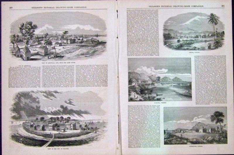 002pan: 1853 Double-page hand colored wood engraving featured in Gleason's Pictorial Drawing-Room Companion showing article on the City of Aspinwall and View of Aspinwall City, From the Light House on top left, View of the City of Charges on bottom left, Cruces, Panama on top right, Gorgona, Panama on right middle and on bottom right, Barbacoas, Panama. 22 x 15 in. $40  006pan: 1912 Panama Map . Large impressive antique map by Rand McNally with litho color. Inset of canal zone, also profile of canal. Authentic old map. 28x21 in. $60 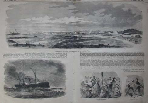 107pan: Black & White view of North Star Panama. Published in Frank Leslies Illustrated Newspaper December 3, 1859. This wood engraving is in excellent condition. 16 X 22 in. $40 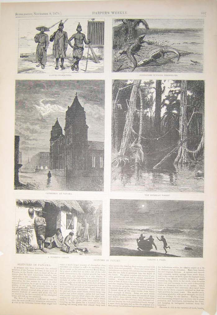 108pan: 1879 Elegant sketches of scenes in Panama. Beautiful engraved images titled,"Sketches in Panama, Native Characters, Alligators Sunning Themselves, Cathedral in Panama, The Isthmian Forest, A Domestic Group and Taking a Prize," from Harper's Weekly. Shows lovely sketches of Panama. 11 x 16 in. $50 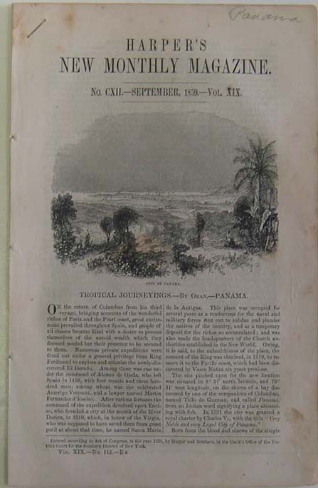 109pan: 1859 Gorgeous image of Panama. Intricate engraved image titled, "Tropical Journeyings-City of Panama," from Harper's New Monthly Magazine. Shows scene of the city of Panama. 6 x 9 in. $40  110pan: 1851 Elegant images of the Western Gate and the Cathedral at Panama. Gorgeous engravings titled,"View of the Western Gate of the City of Panama and A Fine Representation of the Cathedral at Panama," from Gleason's Pictorial Drawing Room Companion. Shows scenes of the Western Gate and Cathedral at Panama. 11 x 16 in. $50 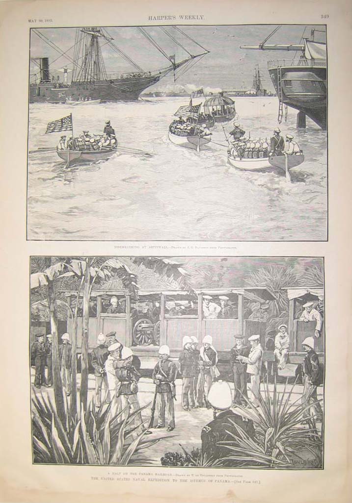 111pan: 1885 Beautiful images of sailors disembarking at Aspinwall and the U.S. Naval Expedition to the Isthmus of Panama. Wonderful engraved images titled,"Disembarking at Aspinwall and the United States Naval Expedition to the Isthmus of Panama," from Harper's Weekly. Shows scenes of the sailors disembarking at Aspinwall and the U.S. Naval Expedition to the Isthmus of Panama. 11 x 16 in. $50 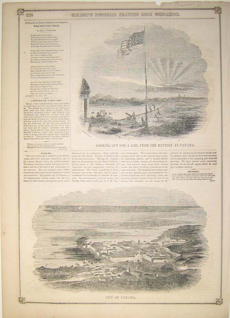 112pan: 1857 Elegant images of a lookout in Panama and the City of Panama. Intricate engraved images titled,"Looking Out For a Sail From the Battery at Panama and the City of Panama," from Gleason's Pictorial Drawing Room Companion. Shows scenes of men looking out for a ship at Panama and a beautiful view of the City of Panama. 11 x 16 in. $40 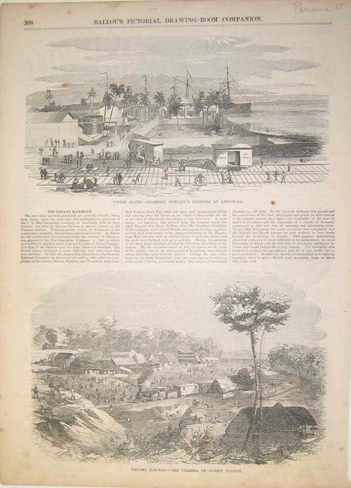 113pan: 1855 Gorgeous images of a U.S. Steamship Company's Premises at Aspinwall and the Panama Railway. Beautiful engraved images titled,"United States Steamship Company's Premises at Aspinwall and Panama Railway-The Culebra or Summit Station," from Ballou's Pictorial Drawing Room Companion. Shows wonderful scenes of a U.S. Steamship Company's Premises at Aspinwall and a beautiful view of the Panama Railway. 11 x 16 in. $40 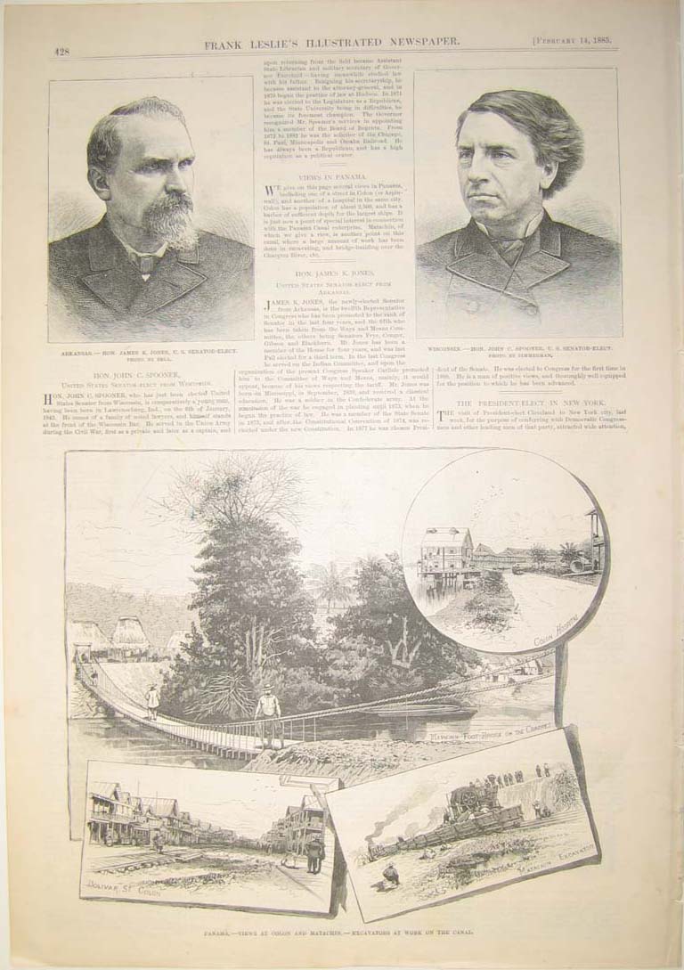 114pan: 1885 Intricate views of Colon and Matachin, Panama. Beautiful engraved image titled,"Panama-Views at Colon and Matachin-Excavators at Work on the Canal," from Frank Leslie's Illustrated Newspaper. Shows scenes of both Colon and Matachin, Panama. 11 x 16in. $50 |
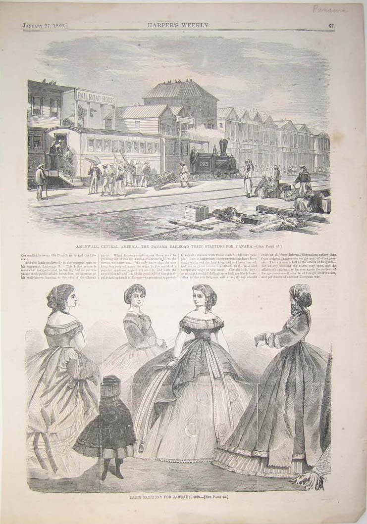 115pan: 1866 Beautiful image of Aspinwall, Central America and its railroad train. Elegant engraved image titled, "Aspinwill, Central America-The Panama Railroad Train Starting from Panama," from Harper's Weekly. Shows gorgeous image of the railroad station in Panama. 11 x 16in. $40 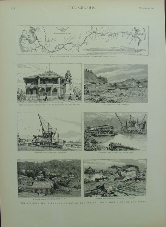 132pan: The Graphic 1892 The Difficulties int he Completion of The Panama Canal General views of the canal, with a small map of the project b/w 9" x 14" image, 12 x 16 in. page. $50 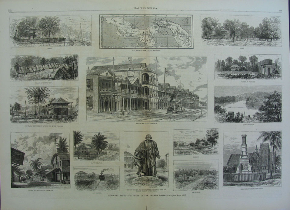 135pan: Harper's Weekly 1877 Sketches Along The Route of the Panama Canal Wood engraving views of the landmarks along the canal. Includes Gatun, Colon, Obisbo, and Bohio 21" x 14.5" image, 22 x 16.25 in. page $60 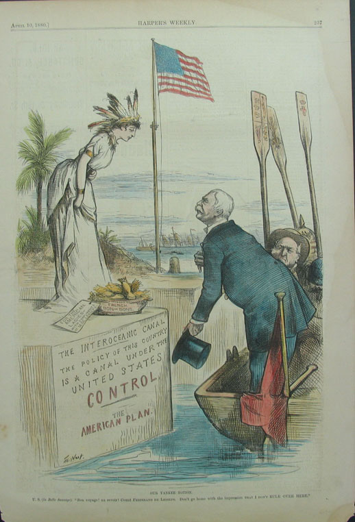 136pan: Harper's Weekly 1880 Our Yankee Nation U.S (to Belle Savage) "Bon Voyage! Au Revoir!" Count Ferdinand De Lesseps -"Don't go home with the impression that I don't RULE OVER HERE" Hand Colored, Thomas Nast (also avail in b/w) 11 x 16 in. $50 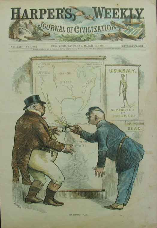 137pan: Harper's Weekly 1880 The European Plan Hand Colored, Thomas Nast (also avail in b/w) 11 x 16 in. $50 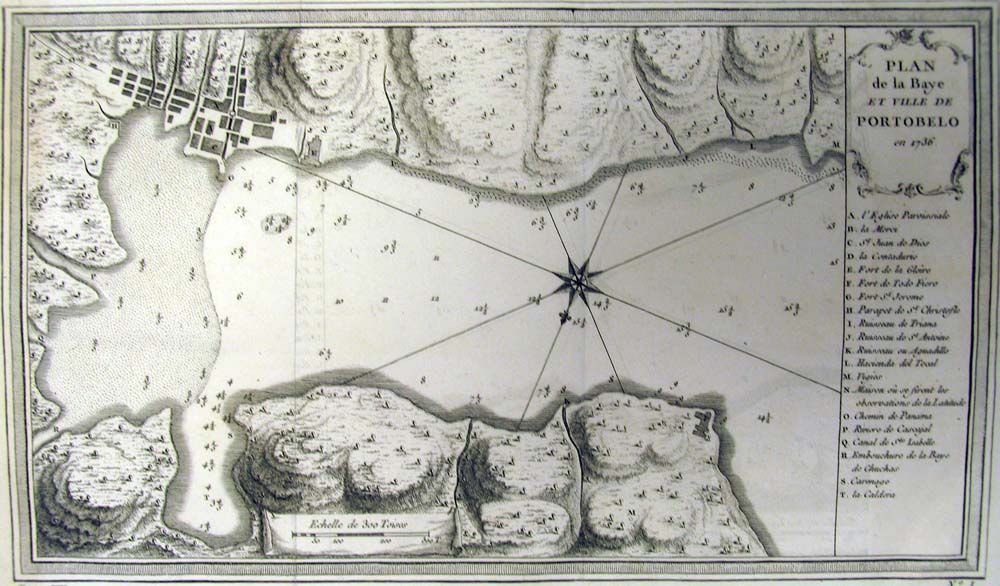 140pan: Bellin 1754 Plan de Baye et Ville de Portobelo en 1736 Copper engraving with key showing ports, churches and town features Fine Condition 5 x9 in. $150 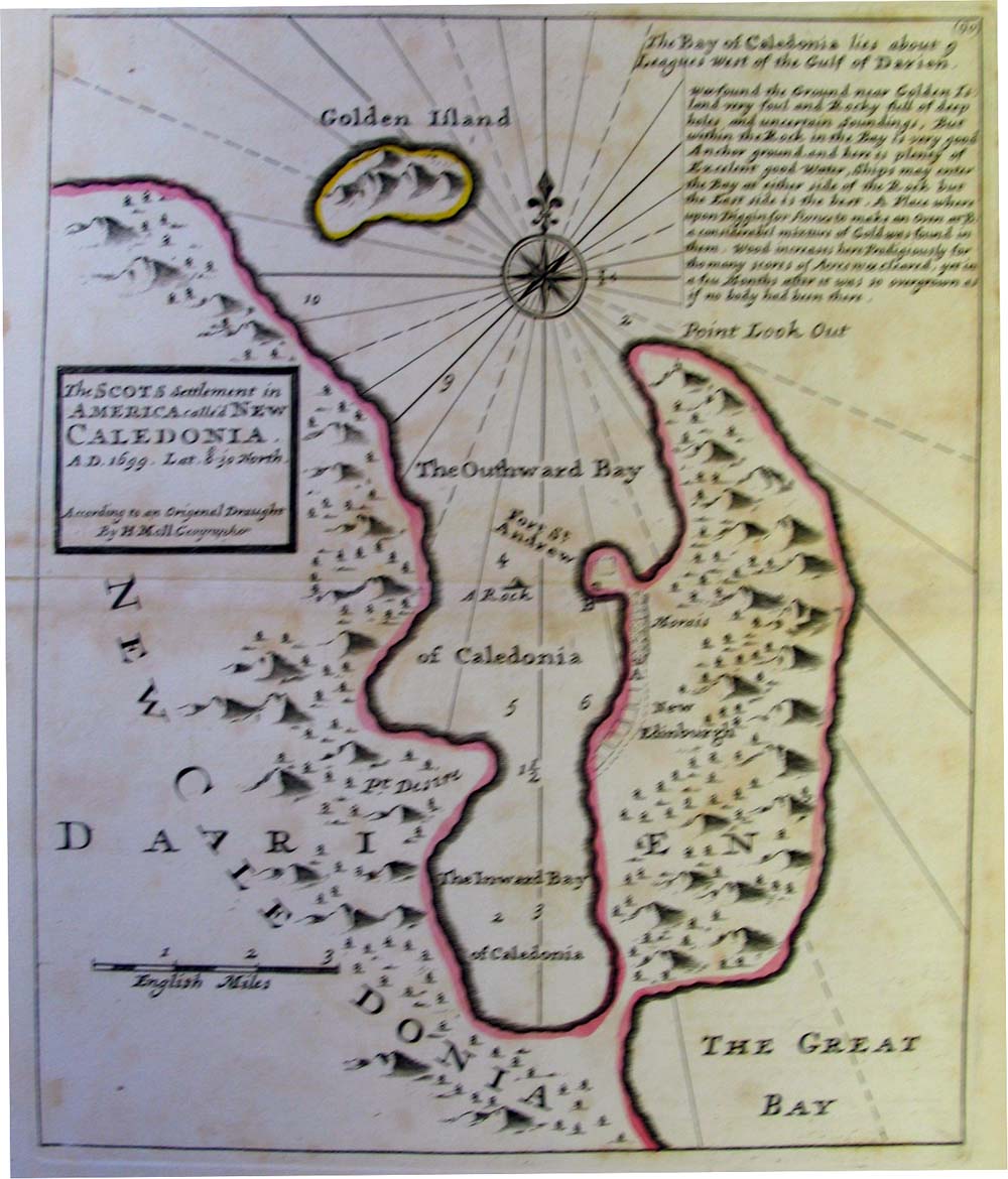 141pan: Moll circa 1730 The Scots Settlement in America Called New Caledonia A.D. 1699 Depicts attempt at settlement in what is now Panama Copper engraving, with color outlines, Very Good Condition, some light foxing 10 x 8 in. $400 
146pan: E Bowen 1740 An Exact Draught of the Castle of San Lorenzo ye Village and River of Chagre with the situation of Adml Vernon's Ships in ye Attack of the Fort March 24 1740...by R.T & sent over in the Diamond Man of War Hand Colored Copper engraving with inset of the key locations and the situations of the attack by Admiral Vernons Ships 5.25 x 6.5 in. $200
|
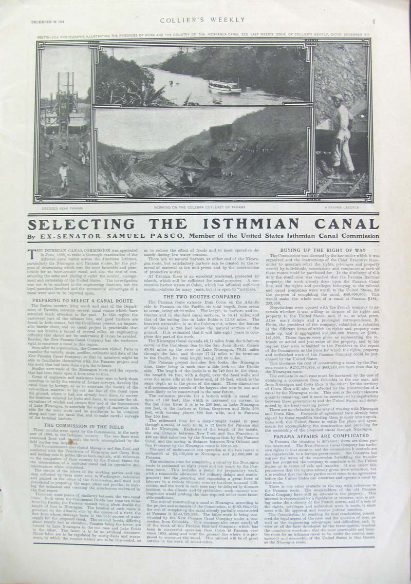 156pan: December 28, 1901 Collier's Weekly multi-paged publication titled, "Selecting The Isthmian Canal" by Ex-Senator Samuel Pasco, Member of the US Isthmian Canal Commission. Top of page half-tone images reflect the Dredges near Panama, Working on the Culebra Cut, East of Panama, and a Panama Laborer. Publication in good condition with a very small brown spot lower left column. 11 x 16 in. $40 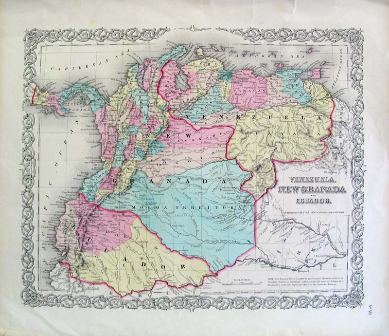 159pan: Rare 1855 Hand colored map of Venezuela, New Granada and Ecuador. Published by J. H. Colton & Company. Very detailed map showing the three countries including cities, districts and other areas of interest. 18-1/2 x 15-1/2 in. $120 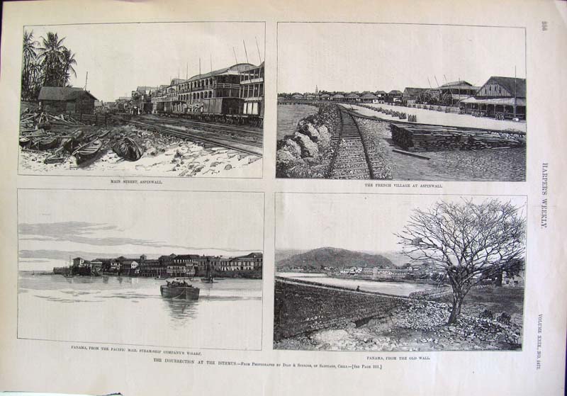 160pan: April 11, 1885 Harper's Weekly, Volume XXIX, No. 1477. Four wood-engraved sketches from photographs by Diaz & Spencer, of Santiago, Chili. Image on bottom left shows Panama, From the Pacific Mail Steam-Ship Company's Wharf and image on bottom right shows Panama, From the Old Wall. Top left image shows Main Street, Aspinwall and top right image shows The French Village at Aspinwall. 15-1/2 x 11 in. $40 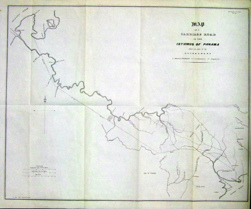
161pan: 1838 Uncolored U.S. Government Map of a Carriage Road in the Isthmus of Panama by Order of the Government by Maurice Falmark, 2d Commandant of Engineers. The road through Panama was well traveled by adventurers seeking gold in California. The map is in very good condition. 19 x 15 in. $290 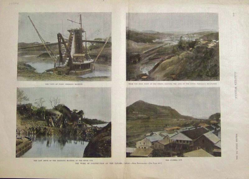
164pan: 1888 Hand color half-tone featured in Harper's Weekly showing four scenes related to the construction of the Panama Canal. 16 x 11-1/2 in. $40 
166pan: 1911 Rand, McNally & Co. New Ideal Atlas map showing The Isthmus of Panama with the Panama Canal with a color Profile of Panama Canal in a Vertical Scale shown on bottom of map. 14 x 11 in. $40 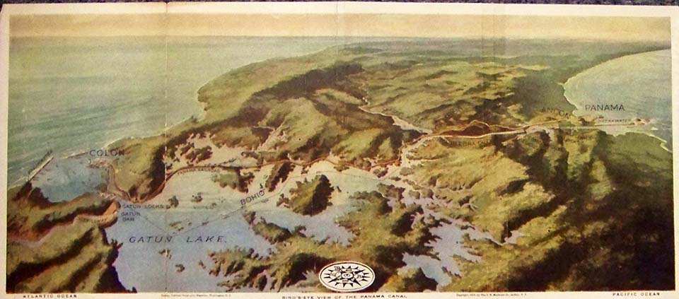
167pan: 1913 Color Bird's-Eye View of the Panama Canal, taken Courtesy of the National Geographic Magazine, Washington, D.C., showing the Atlantic Ocean on the left side and the Pacific Ocean on the right. Copyright by the J.N. Matthews Co. 16-1/2 x 7-1/2 in. $50 
168pan: C.B. Graham's hand color lithograph showing the Isthmus of Nicaragua. 11-1/2 x 9 in. $80 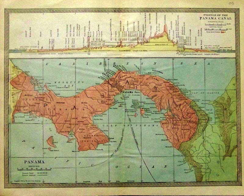
169pan: 1904 Color map of Panama which shows the Profile of the Panama Canal in a graph on top of map. Copyright by the Americana Company. 12-1/2 x 10 in. $50 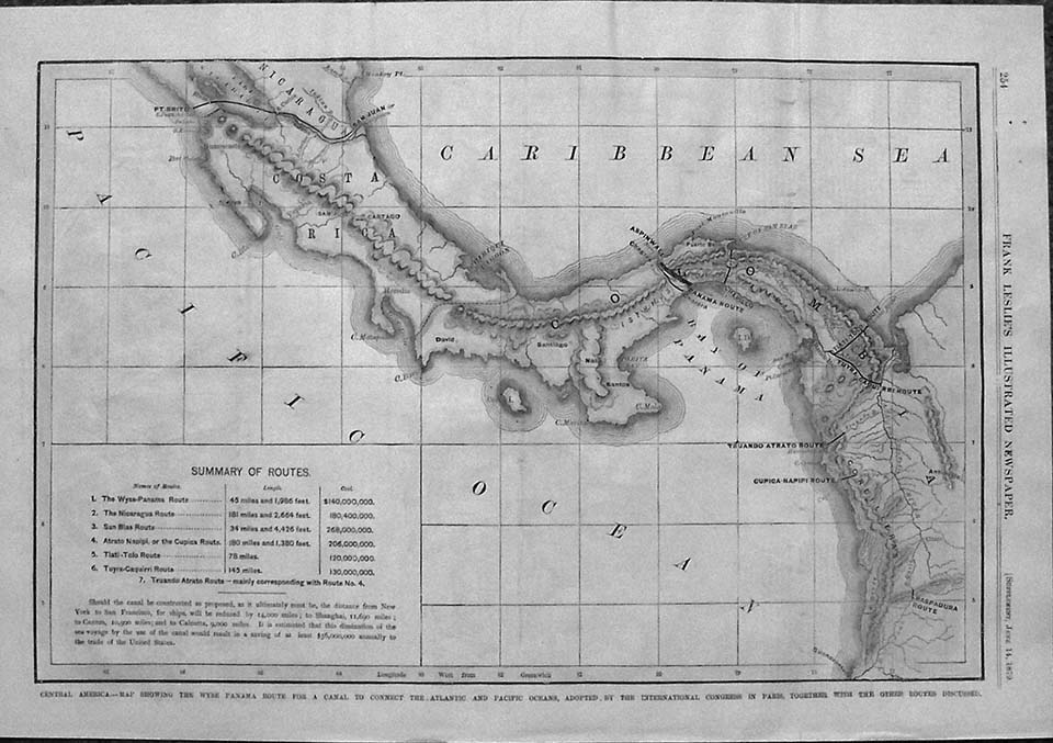
170pan: 1879 Engraved map showing Central America -- The Wyse Panama Route for a Canal to Connect the Atlantic and Pacific Oceans, Adopted by the International Congress in Paris, Together with the Other Routes Discussed. A Summary of Routes inset is bottom left of map. Featured in Frank Leslie's Illustrated Newspaper as a Supplement. 16 x 11 in. $40 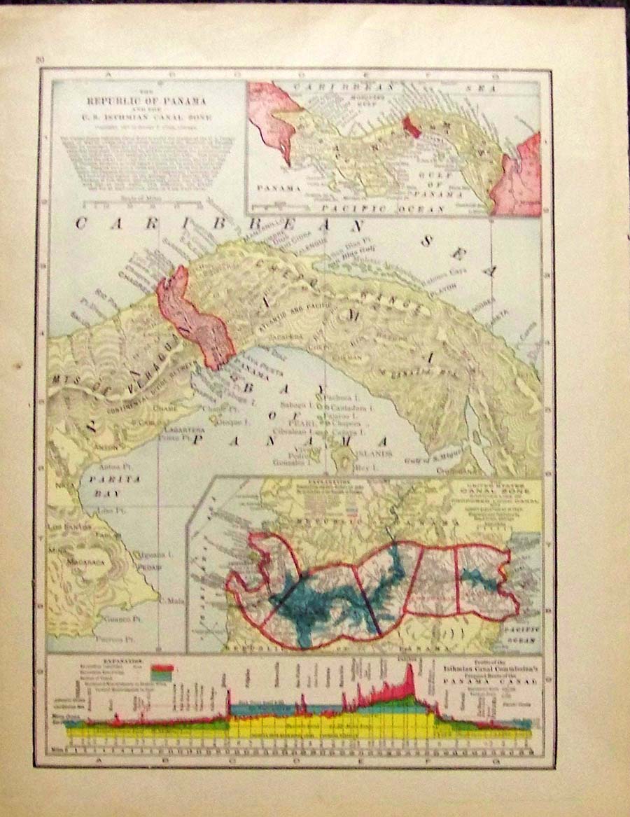
171pan: 1907 George F. Cram color engraved map showing The Republic of Panama and the U.S. Isthmian Canal Zone with insets of Panama and The United States Canal Zone Showing Line of Propsed Lock Canal outlined in red. Graph Explanation bar showing the Profile of the Isthmian Canal Commission's Proposed Route of the Panama Canal on bottom of map. 14-1/2 x 11-1/2 in. $40 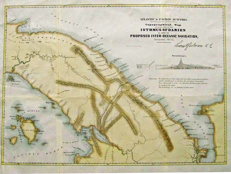
125rare: PANAMA. 1852 Lionel Gisborne Topographical Map of a Portion of the Isthmus of Darien. This important map shows the proposed canal prior to the Panama Canal, connecting the Atlantic to the Pacific. It also has a profile detailed. Excellent condition with expert hand colored steel plate engraving. 19.25 x 14.25" plus margins. $300 |
|||||||||
| Order Form | |||||||||||
| Back to Homepage | |||||||||||