001pa:
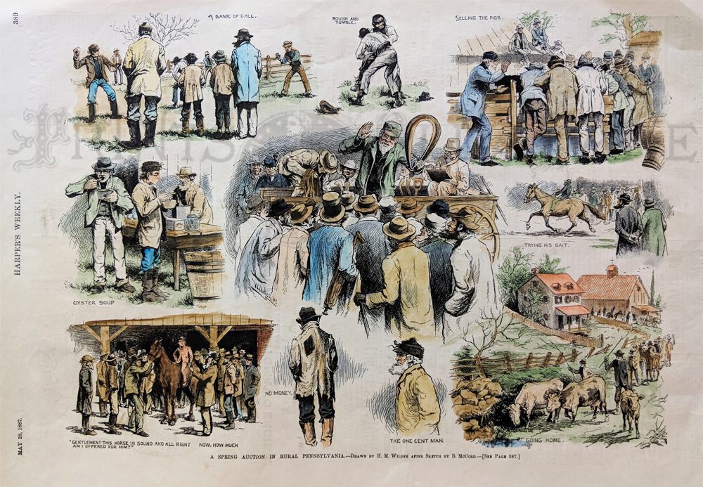
1887 Print: Auction in Rural Pennsylvania. This hand colored print is
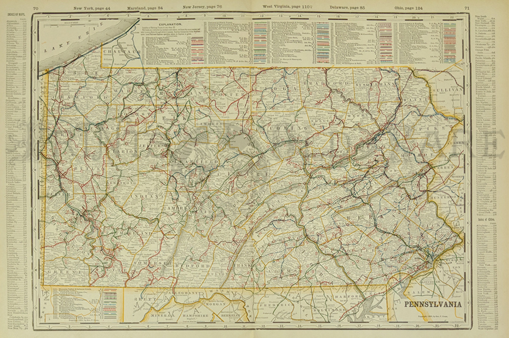
from the May 28, 1887 issue of Harper's Weekly. The print is titled, "A
Spring Auction in Rural Pennsylvania." It contains nine small scenes,
each one pertaining to events at the auction. This print is in
excellent condition.
11" x 16" $50
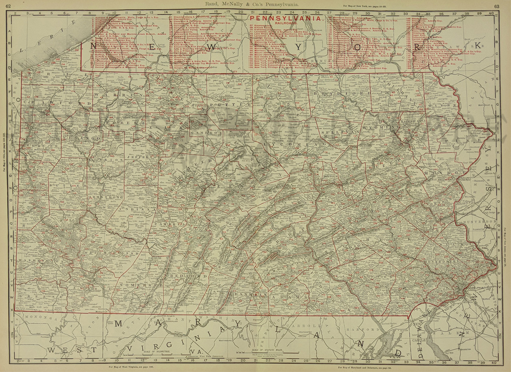
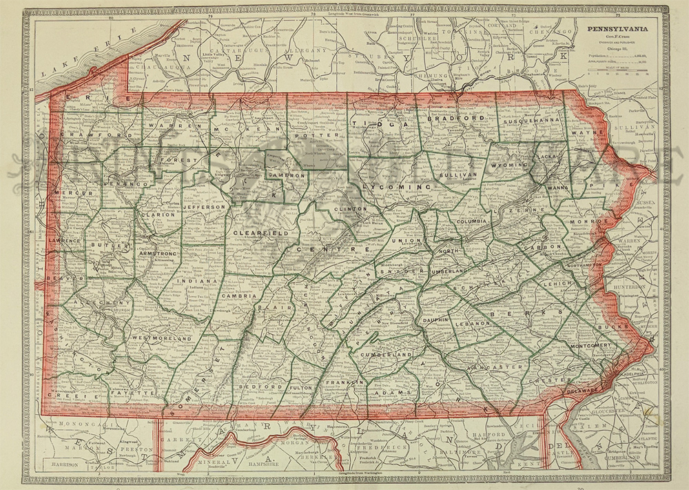
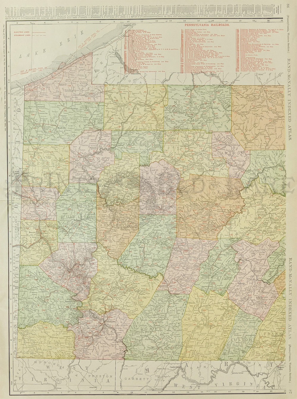
002Pennsylvania:
1898 Rand, McNally & Co.'s Pennsylvania Railroads map with red
outlined counties and railroads. Large railroad key on
top portion of map.
27-1/2 x 20-1/2 in. $260
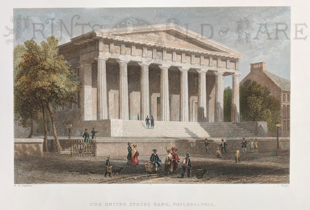
014pa:
1838 Bartlett view of Philadelphia. The United States
Bank. Hand colored steel engraving.
10-1/2x8 in. $60
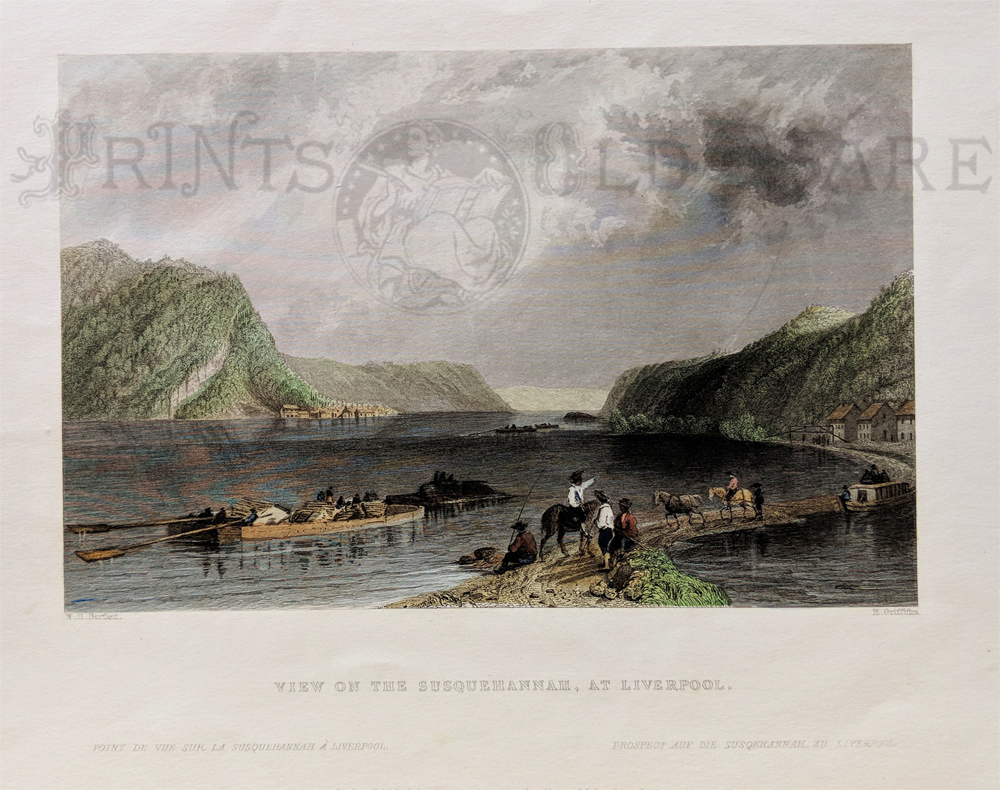
015pa:
1838 Pennsylvania Bartlett view. Susquehanna at Liverpool. Hand colored
steel engraving.
11x8 in. $60
018pa:
1895 Pennsylvania Cram map. Outline in color. 21x13-1/2 in. $60
021pa:
1882 Pennsylvania Map. Bradley county map. Original color.
24x17-3/4 in. $100
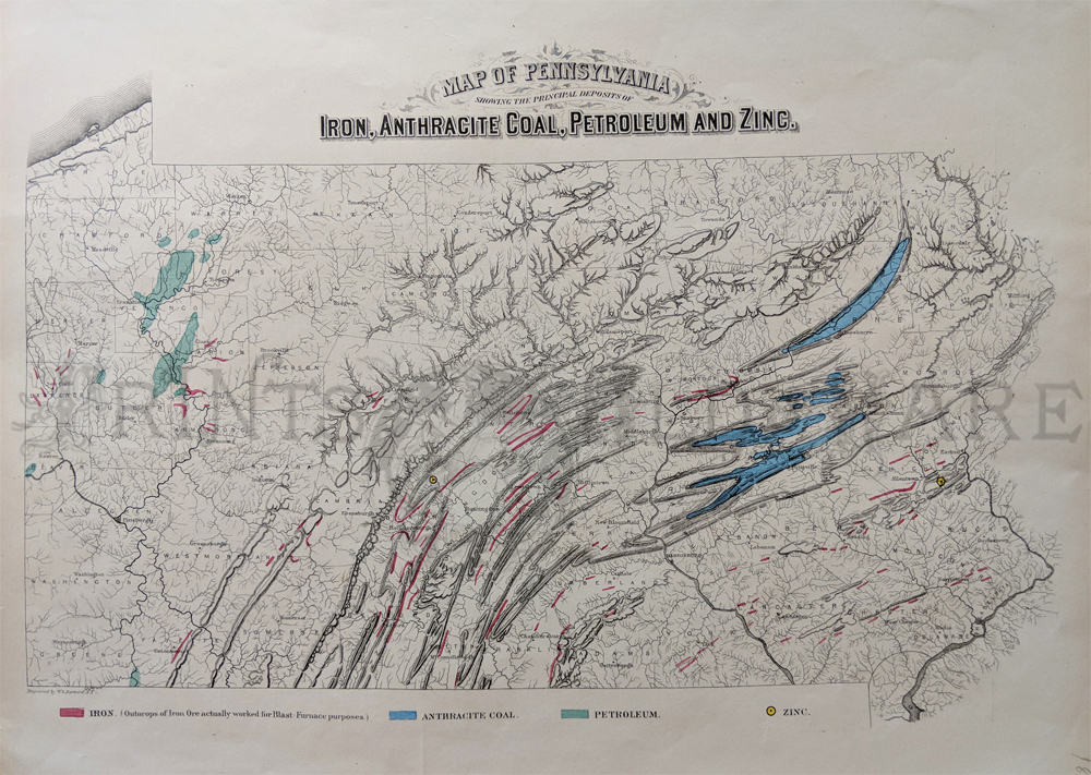
023Pennsylvania:
1872 Hand colored engraved Map of Pennsylvania, Showing the Principal
Deposits of Iron, Anthracite Coal, Petroleum and Zinc with a
color key below map.
17-1/2 x 13-1/2 in. $50
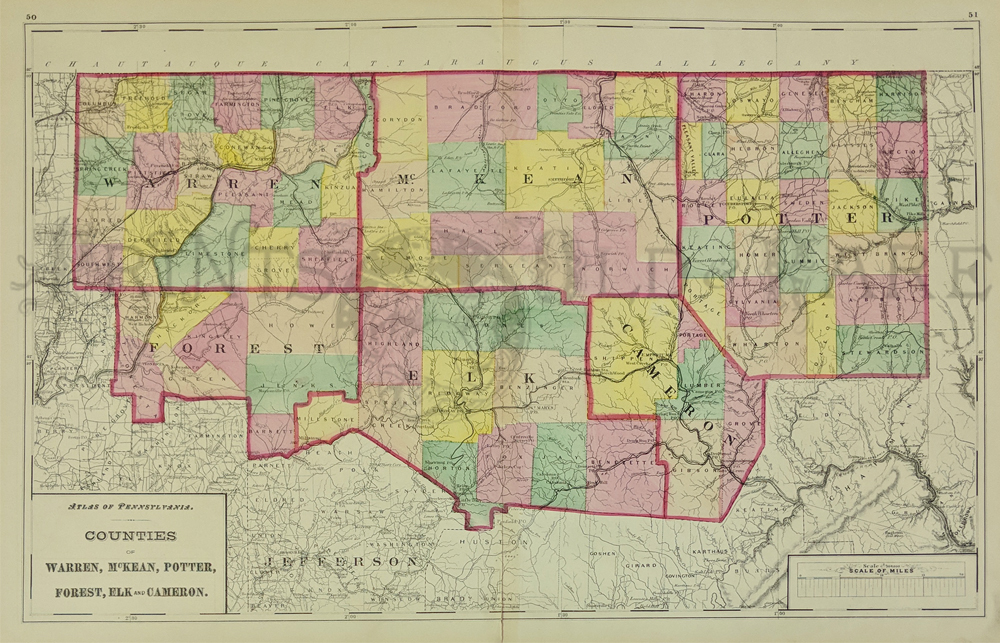
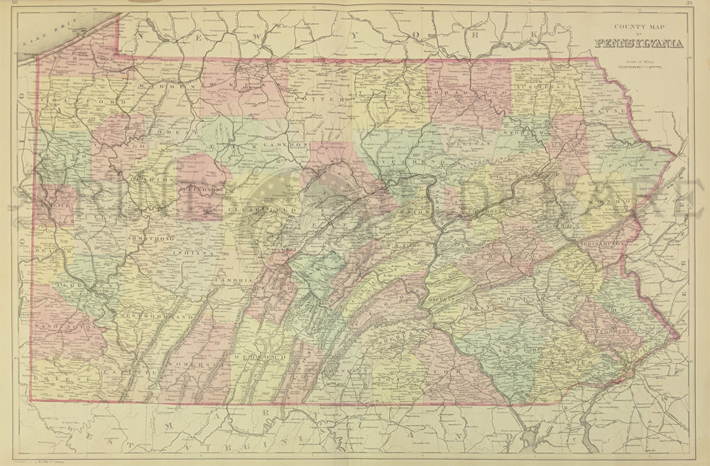
024Pennsylvania:
1871 Hand colored Atlas of Pennsylvania, which include the Counties of
Warren, McKean, Potter, Forest, Elk and Cameron. A Scale of Miles key
is listed in
bottom right of map.
26-1/2 x 17 in. $80
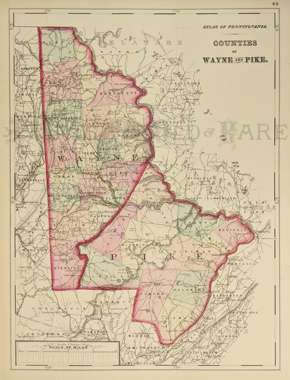
027Pennsylvania:
1872 Hand colored engraved Atlas of Pennsylvania's Counties of
Wayne and Pike.
17-1/4 x 13-1/4 in. $60
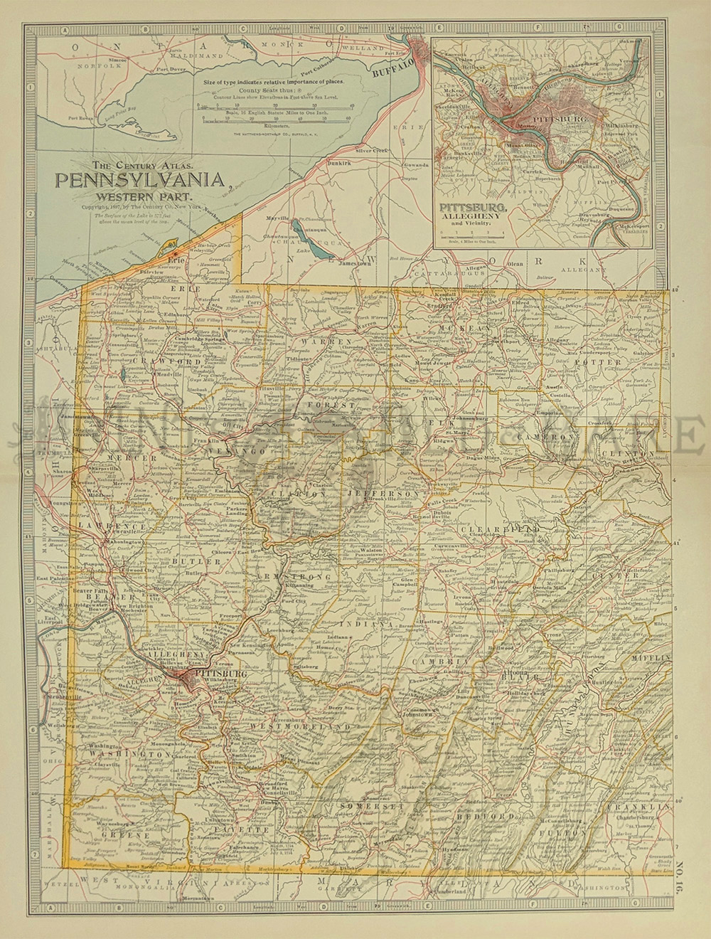
028Pennsylvania:
1897 Color Century Company's Atlas of Pennsylvania, Western Part. Inset
of Pittsburgh, Allegheny and Vicinity in upper right hand corner.
17 x 13 in. $40
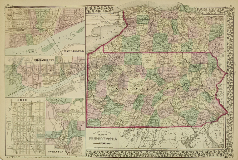
100pa:
1877 Mitchell Pennsylvania Map. Beautiful antique map, with original
hand coloring, from Mitchell's 1877 world atlas. Each county is
individually colored. Old cities, towns, railroad lines and
geographical features are all shown. On the left side, there are inset
maps of Harrisburg, Williamsport, Erie and Scranton. 15x22 in. $100
103pa:
1882 Pennsylvania Map by Gray. Beautiful, large hand colored map from
Gray's 1882 world atlas. Each county and township is colored
separately. Cities, towns, railroad lines and geographical features are
all shown. 17x28 in. $110
106pa:
Large 1911 Railroad Map of Western PA. Color map from Rand McNally's
1911 Commercial Atlas of America. Covers an area from the western
border of Pennsylvania to the center of the state. Locations and names
of each railroad line in the state are shown. Locations of electric
power lines and steamboat routes on Lake Erie are shown as well. Also
shows cities, towns and
geographical features.
20x27 in. $80
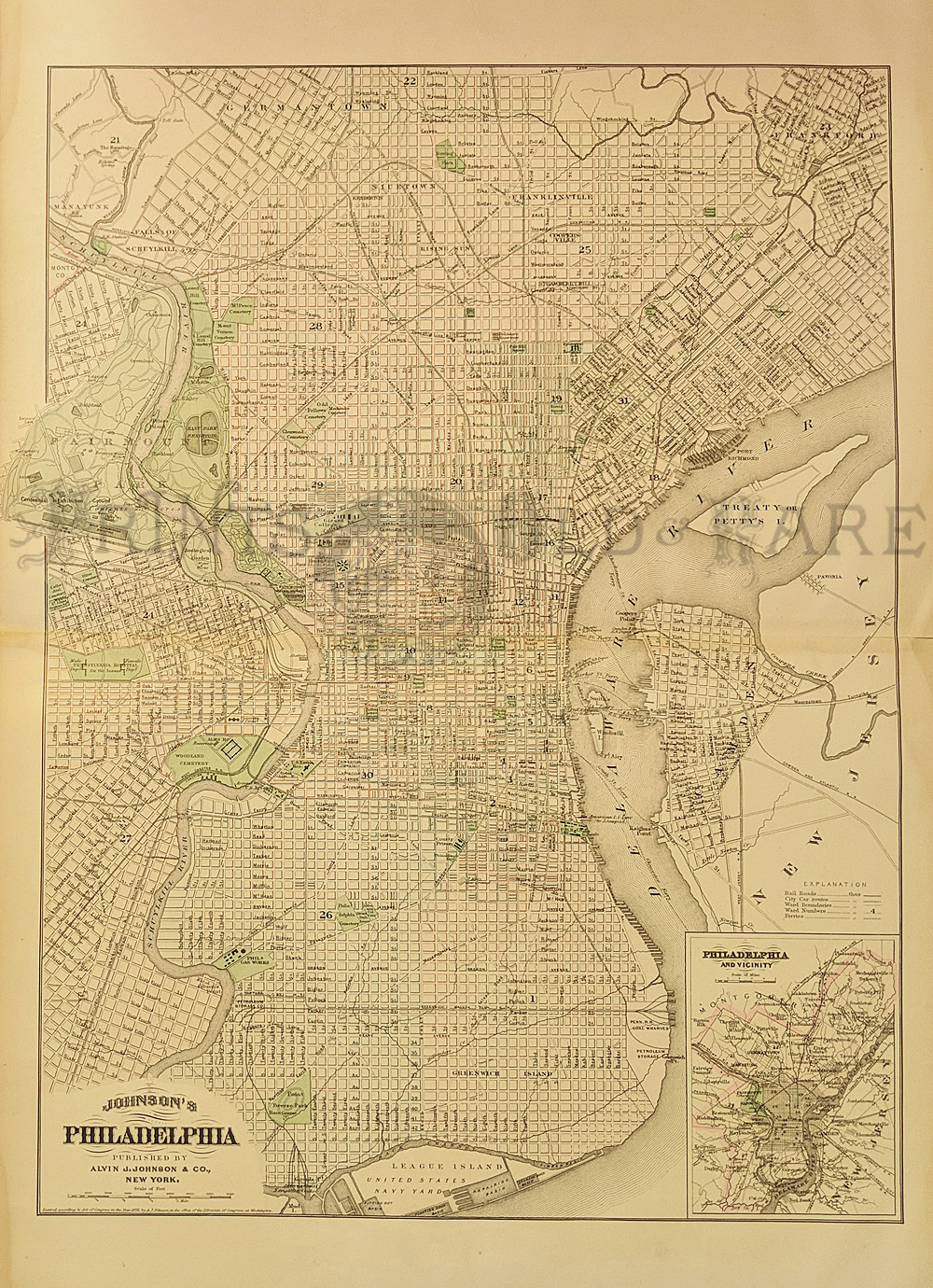
107pa:
1886 Map of Philadelphia by A.J. Johnson. Detailed,
engraved map of Philadelphia, with each ward of the city colored
separately hand colored. Locations of major buildings, parks and
cemeteries are marked. Also shows railroad lines, streetcar lines and
ferry routes. In the bottom right corner there is a small map of the
entire metro area.
18x26 in. $150
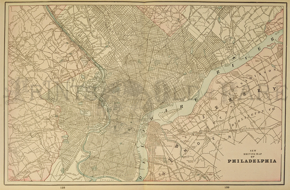
108pa:
1894 Map of Philadelphia Area. Interesting map of the Philadelphia
metro area, showing streets, railroad lines and major landmarks in the
city. Printed in color. 14x21 in. $80
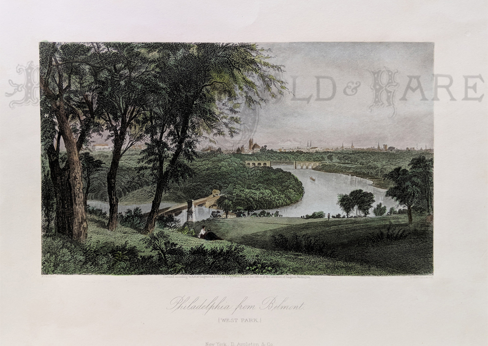
109pa:
1873 Philadelphia View. Beautifully hand colored scene
from Picturesque America, published in 1873. Title is "Philadelphia
from Belmont (West Park)." Shows the city from a distance, with rural
countryside and the river in the foreground.
9x12 in. $80
115pa:
1901 Map: Western & Eastern Pennsylvania. Beautiful map from
the 1901 first edition of George Cram's folio-size world atlas. Color
coded lines on the map show the names and locations of railroads
throughout the western & eastern half of the state. State and
county borders are outlined in yellow. Cities, towns and geographical
features are all shown. This map would look great in a frame! 18x27 in.
(2 Prints) $160
116pa:
1901 Cram Railroad Map of Pennsylvania. Beautiful map from the 1901
first edition of George Cram's folio-size world atlas. Covers the
entire state of Pennsylvania, with color coded lines showing the names
and locations of railroads throughout the state. State and county
borders are outlined in yellow. Cities, towns and geographical features
are all shown. This map would look great in a frame! 18x27 in. $80
124pa:
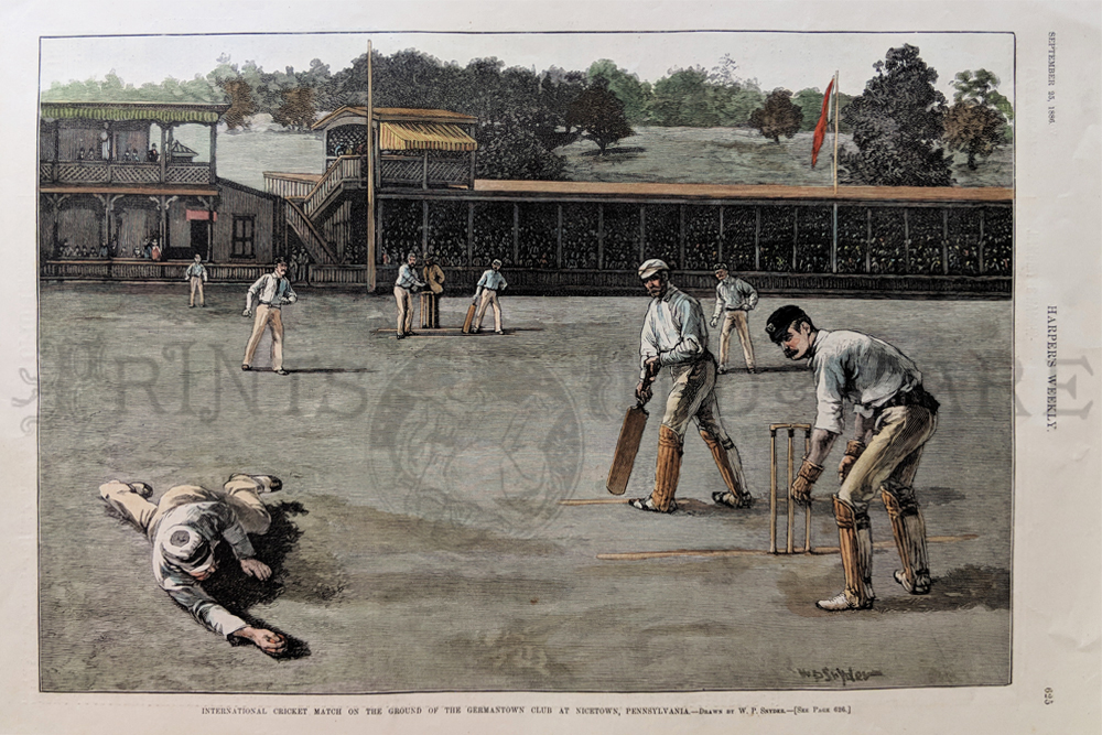
1886 Scene at a Pennsylvania Cricket Match. Hand colored engraving from
Harper's Weekly, titled "International Cricket Match on the Ground of
the Germantown Club at Nicetown, Pennsylvania." Shows a view from the
field, where one player has just caught the ball with a flying leap.
11x16 in. $60
125pa:
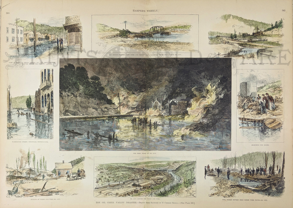
1892 Oil City Pennsylvania Fire, Flood. Hand colored engraving from
Harper's Weekly, titled "The Oil Creek Valley Disaster." Center image
shows oil burning on the water that flooded Oil City. Smaller images on
the top and sides show other scenes from the disaster. 16x22 in. $150

126pa:
1893 Communistic Town: Economy Pennsylvania. Eleven
hand-colored, engraved images from Harper's Weekly, titled "The Old
Communistic Town of Economy, Pennsylvania." Street scenes in the town
are shown, as well as portraits of some residents. 11x16 in. $60
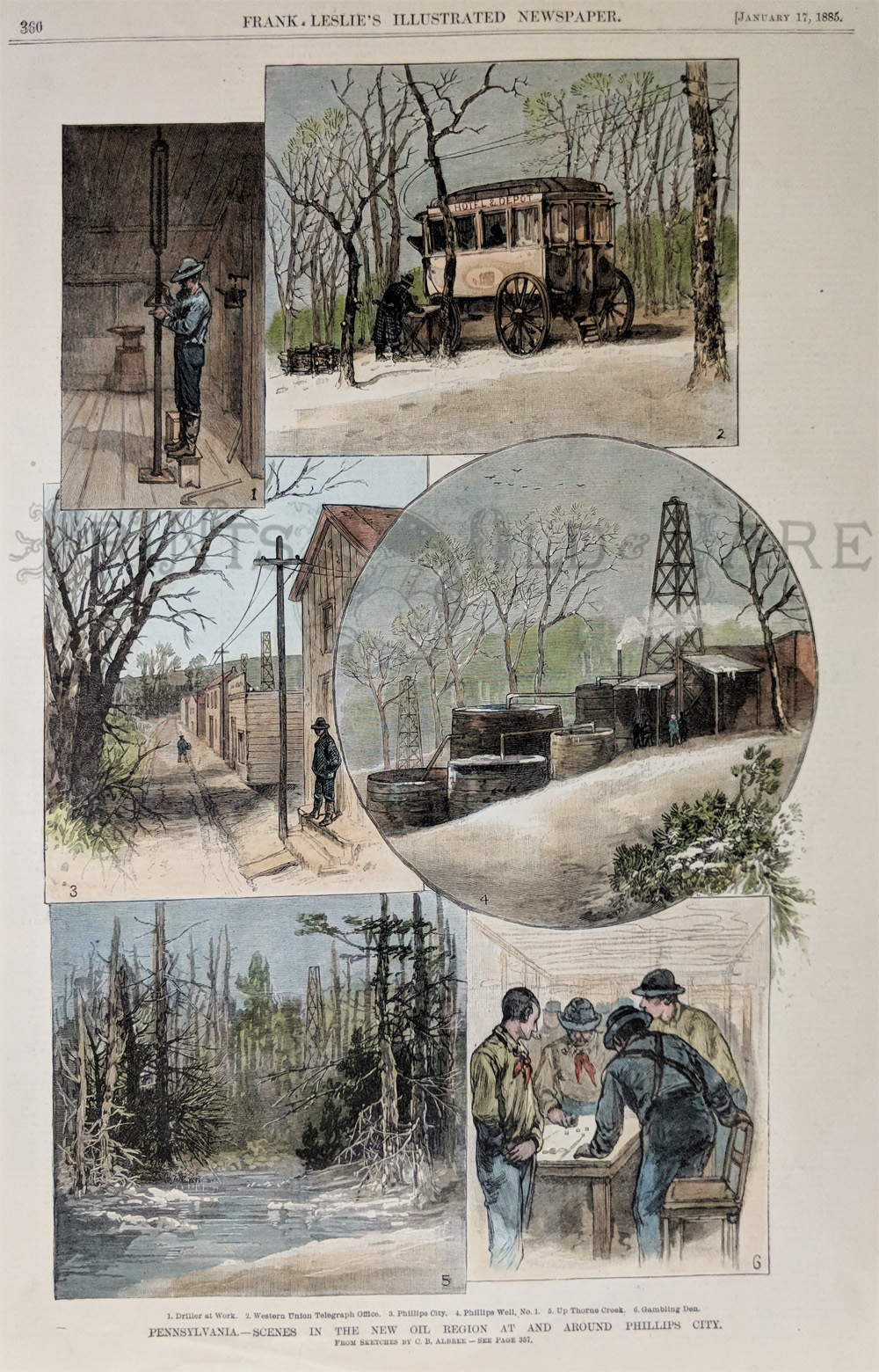
129pa:
From Frank Leslie's Illustrated Newspaper dated January 17, 1885. Six
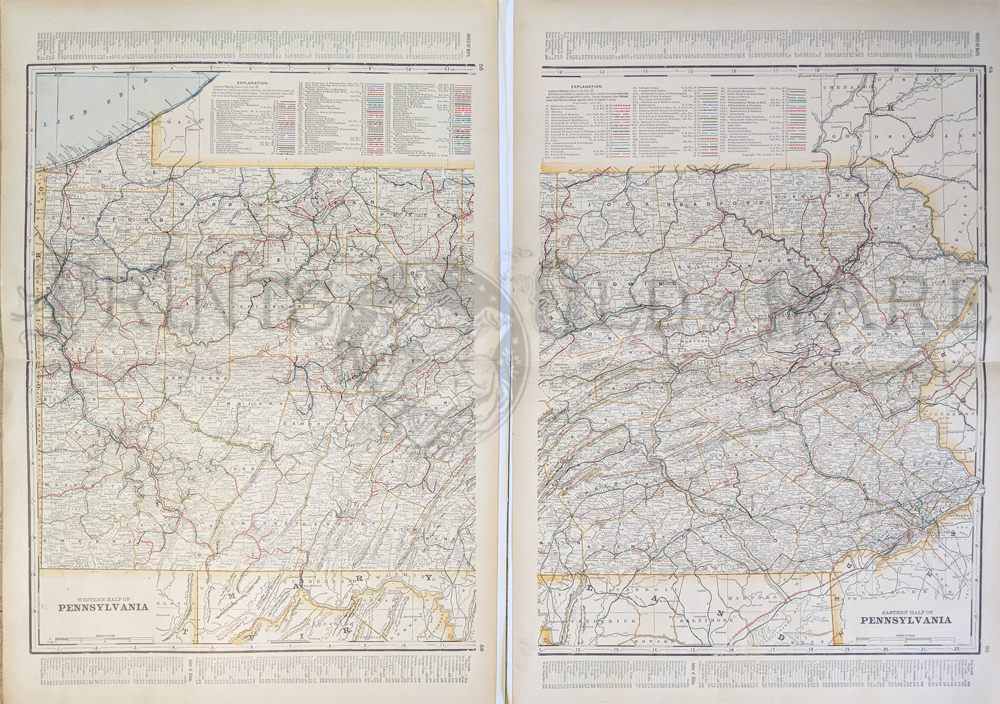
hand colored engravings titled Pennsylvania - Scenes in the New Oil
Region At and Around Phillips City. By Sketches by C.B. Albee. Scenes
captioned: Driller at Work, Western Union Telegraph Office, Phillips
City, Phillips Well No. 1, Up Thorne Creek, and Gambling Den. 11x16 in.
$60
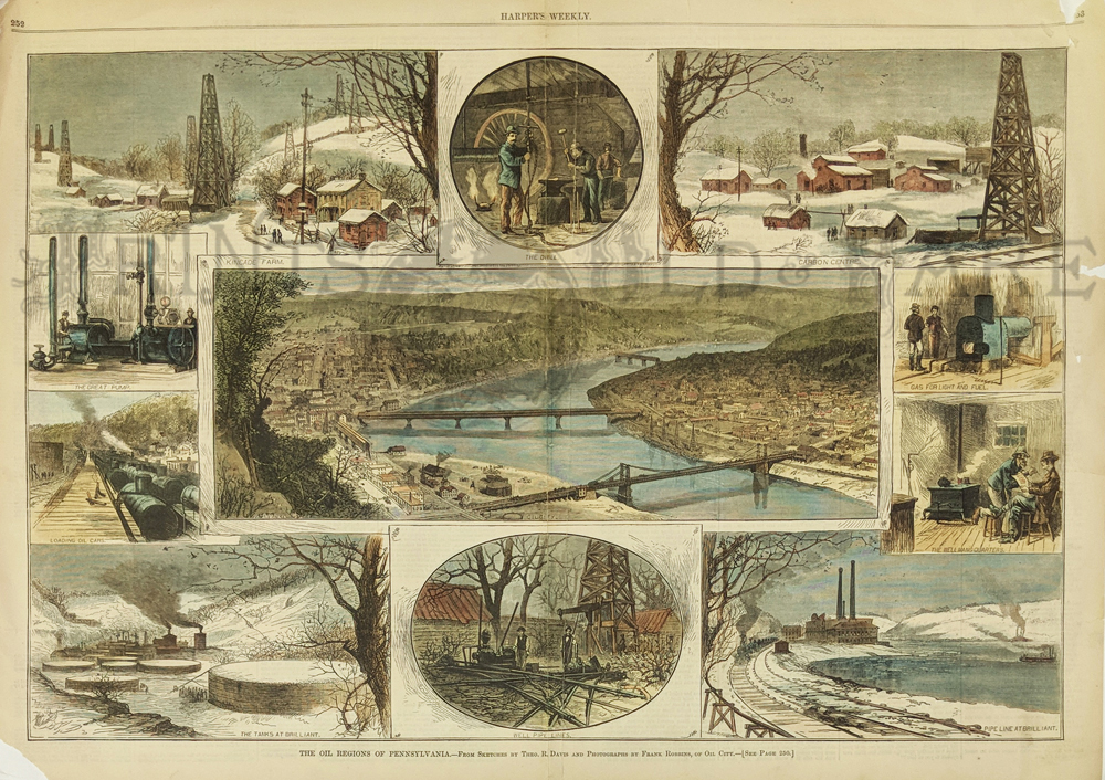
130pa:
Double page hand colored engraving from Harper's Weekly dated March 30,
1878. The Oil Regions of Pennsylvania. From Sketches by Theo. R. Davis
and Photographs by Frank Robbins, of Oil City. Large center picture is
an overview of Oil City with various scenes surrounding it. 22x16 in.
$100
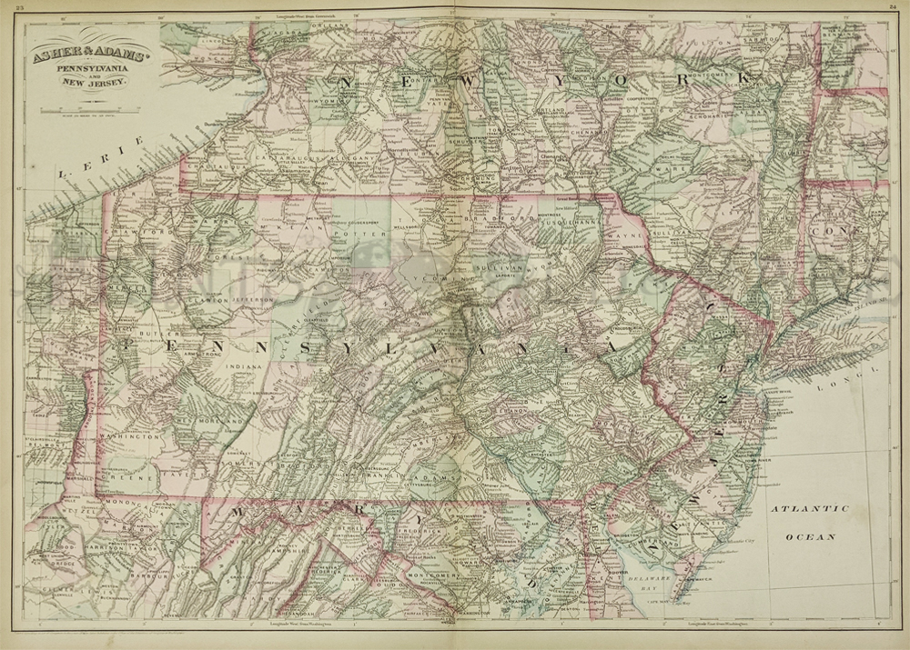
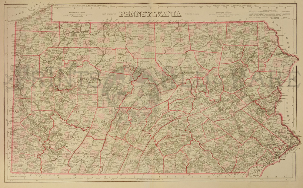
131pa:
Beautiful
1872 map of Pennsylvania and New Jersey. Published by Asher &
Adams
in the New Statistical and Topographical Atlas of the United States.
Original hand coloring. 17.5x24.5 in. $100
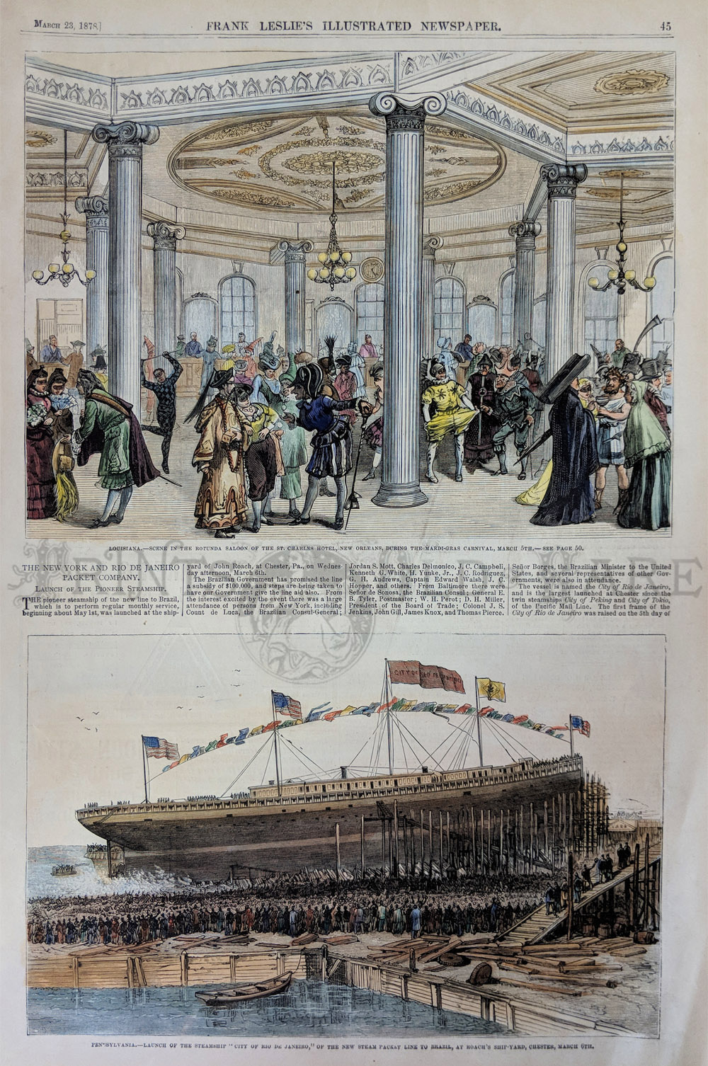
134pa:
1878 Pennsylvania - Launch of the Steamship "City of Rio de Janeiro,"
of the New Steam Packet Line to Brazil, at Roach's Ship-yard, Chester,
March 6th. Hand colored wood engraving on bottom of page with text,
published in Frank Leslie's Illustrated Newspaper on March 23, 1878.
11x16in. $40
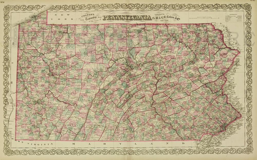
135pa:
1871 Colton's New Township Map of the State of Pennsylvania. Published
by G.W. & C.B. Colton & Co., New York. Very detailed
map shows counties in colors of pink, pale green and beige and has a
very ornate border. Map in excellent condition.
17.5x28in. $150
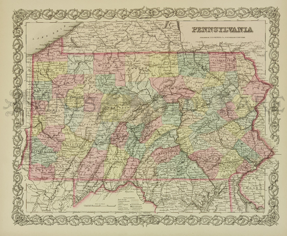
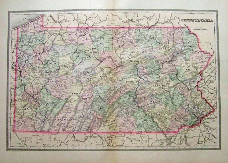
137pa: 1854 Pennsylvania Map -
Published by J.H. Colton & Co., No. 172 William St., New York.
Entered according to Act of Congress in the Year 1854 by J.H. Colton in
the Clerk's Office of the District Court of the United States, for the
Southern District of New York. Beautifully colored and detailed by
county with pink border for the state of Pennsylvania. Very
ornate border and in
excellent condition.
15.5x18.5in. $150

139pa:
1876 Bird's-Eye View of Philadelphia. From Sketches by Theo. R. Davis.
Drawn and Engraved Expressly for Harper's Weekly. Hand colored wood
engravings on a double-page spread which was published as a Supplement
in Harper's Weekly on May 27, 1876. 23x33in. $650
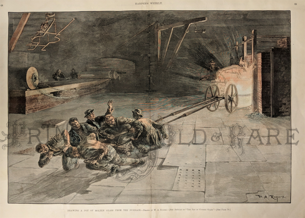
140pa:
1890
Drawing A Pot of Molten Glass From the Furnace - Drawn by W.A. Rogers.
Double-page hand colored wood engraving depicting a team of men
straining hard to pull a pot of molton glass out from the fires.
Published in Harper's
Weekly in 1890.
16x22in. $150
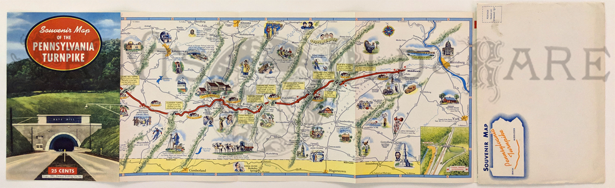
007pictorialmaps:
1941 Pennsylvania Turnpike Map. Souvenir with pictorial map one side,
facts and photos on verso. Fine condition – also comes with original
envelope. Printed in color.
8 x 33 in. $40
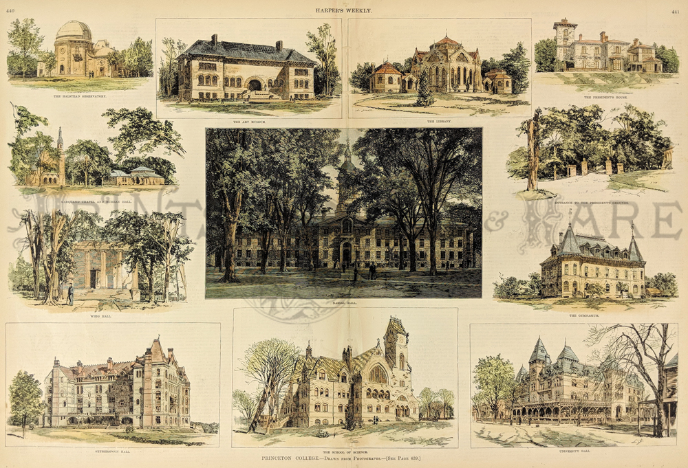
206univ:
Princeton College - Drawn from photographs. 12 vignettes showing
buildings and grounds around the college.
22 x 16 $200
|
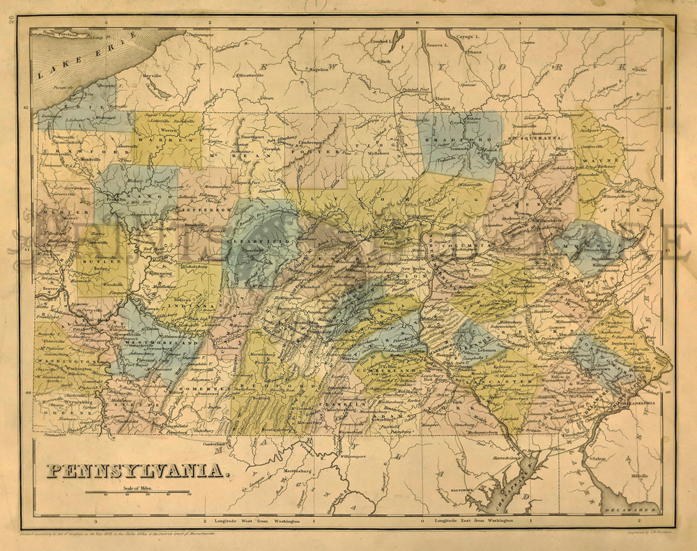
159pa:
Rare 1838 Pennsylvania Map by Bradford. Engraved by G.W. Boynton. Shows
Counties, Cities, and Geographic features.
13 x 16 in. $350
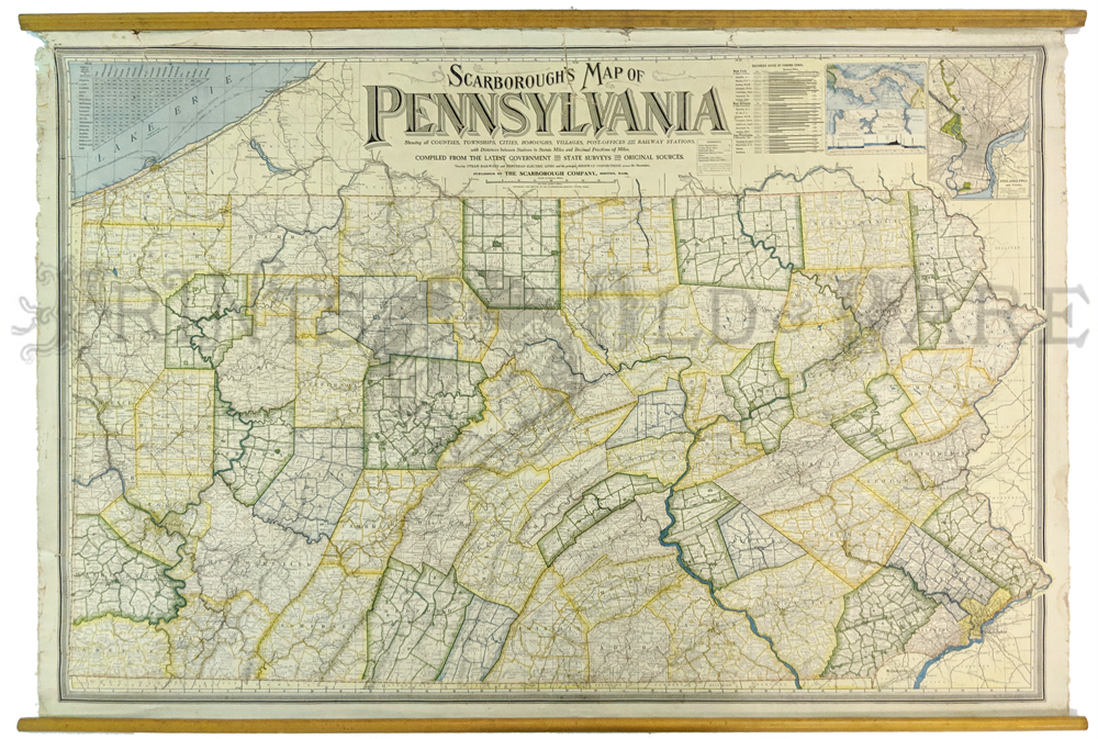
163Pennsylvania:
1904 Scarborough's Map of Pennsylvania. Showing all counties,
townships, cities, boroughs, villages, post-offices and rail-way
stations.Rail lines, suburban electric lines, and a few highways are
shown. Large wall map is made of oil cloth material and has wooden
rollers top and bottom. Verso contains 1900 census information about
the state's population and a
gazetteer keyed to a grid around the map edge. Top shows insets of
Philadelphia and Panama, plus a legend and milage table.
38 1/2 x 53 in. $450
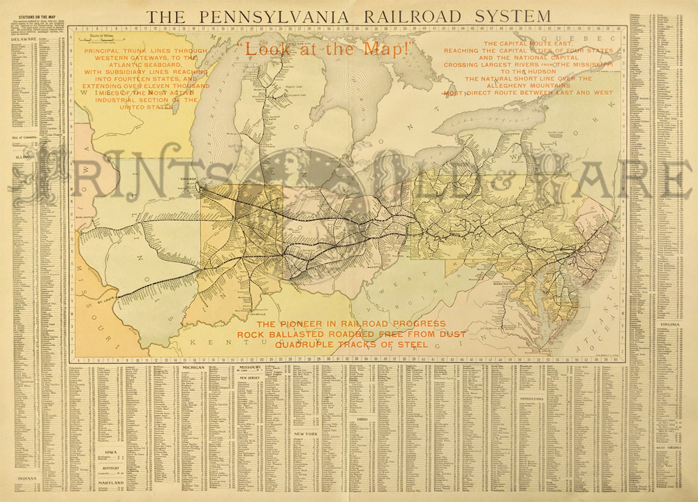
164Pennsylvania:
The Pennsylvania Railroad System. 1909. Published by Rand McNally.
Detailed country map shows cities, towns, counties, provinces, regions,
lakes and rivers, and many other details. Showing detailed information
on the railroad network at the time along with the scheduled stops.
Also provides capitals, scale of miles, and
a detailed list of towns down the side noting population.
Lithograph
21 1/2 x 28 in. $200
168Pennsylvania:
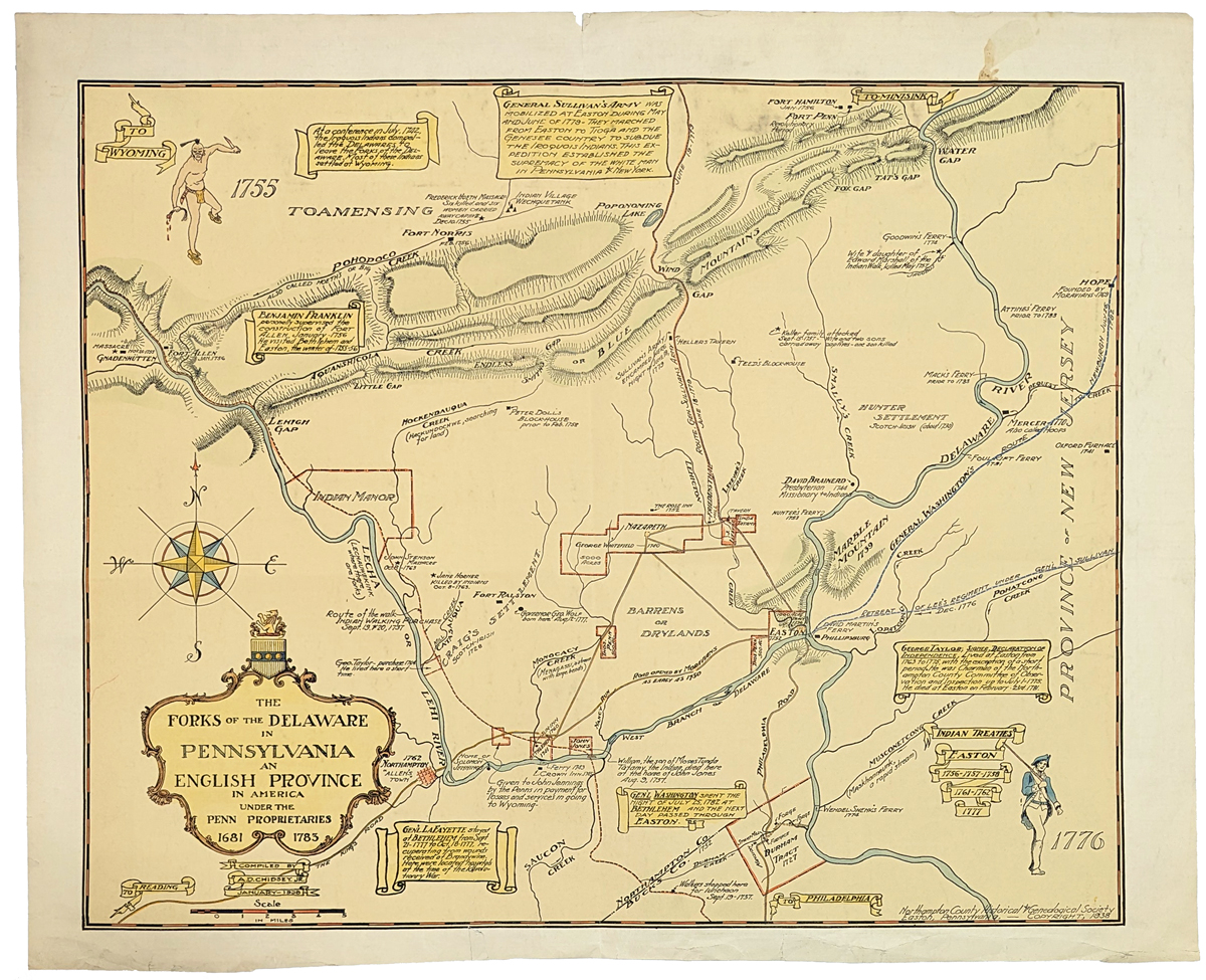
The
Forks of the Delaware in Pennsylvania an English Provice in
America. 1938. Historical map of PA showing forts, Indian settlements
1861-1783. **Minor stain top right quadrent.
21 1/4 x 26 in. $150
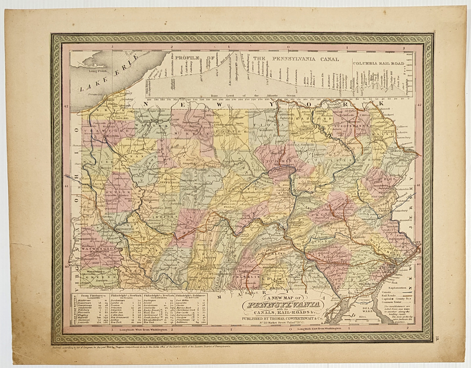
169Pennsylvania:
A New Map of Pennsylvania with its Canals, Rail-roads & c. 1853 Cowperthwait. Hand colored, engraving.
12 x 14 1/2 in. $250
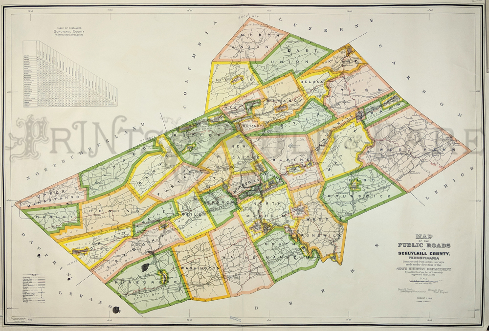
148pa:
1916 Color Map of Public Roads in Schuylkill County, Pennsylvania which
includes a "Table of Distances," made for the State Highway Department.
30 x 47 inches + margins.
$400
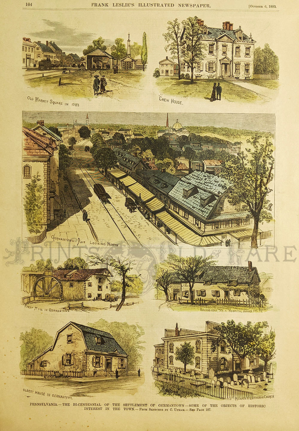
150pa:
1883 Frank Leslie's Illustrated Newspaper - Pennsylvania, The
Bi-Centennial of the Settlement of Germantown.
16 x 11 in. $90
151pa:
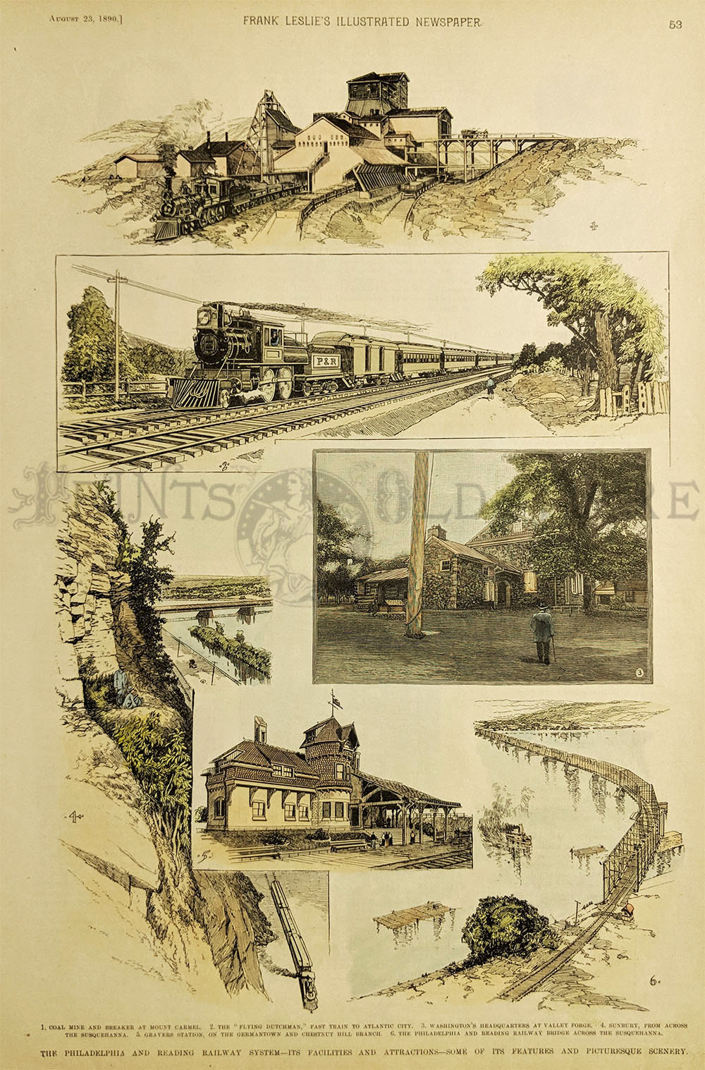
1890 Frank Leslie's Illustrated Newspaper - The Philadelphia and
Reading Railway System - Its Facilites and Attractions.
15 1/2 x 10 1/2 in. $75
153pa:
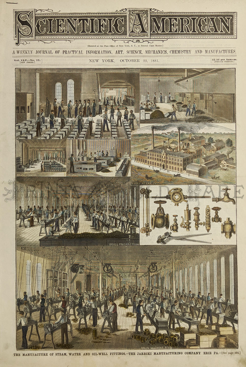
1881 Scientific American - The Manufacture of Steam, Water and Oil-well
Fittings - The Jarecki Manufacturing Company, Erie, PA.(2-Pages)
16 x 11 in. $90
154pa:
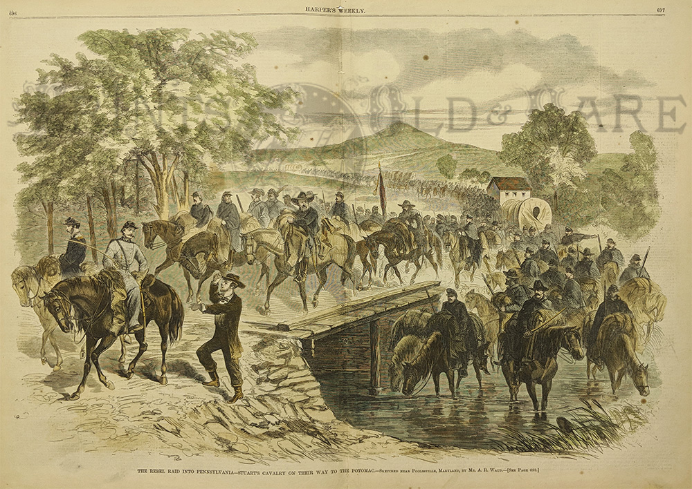
1862 Harper's Weekly. The Rebel Raid into Pennsylvania - Stuarts
Cavalry on their way to Potomac.
22 1/4 x 16 in. $80
155pa:
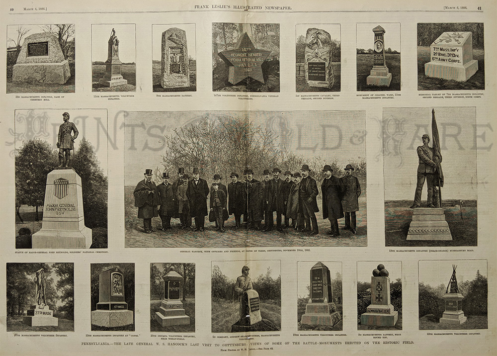
1886 Frank Leslie's Illustrated Newspaper - Pennsylvania - The Late
General W.S. Hancock's last visit to Gettysburg.
22 1/2 x 16 in. $70
156pa:
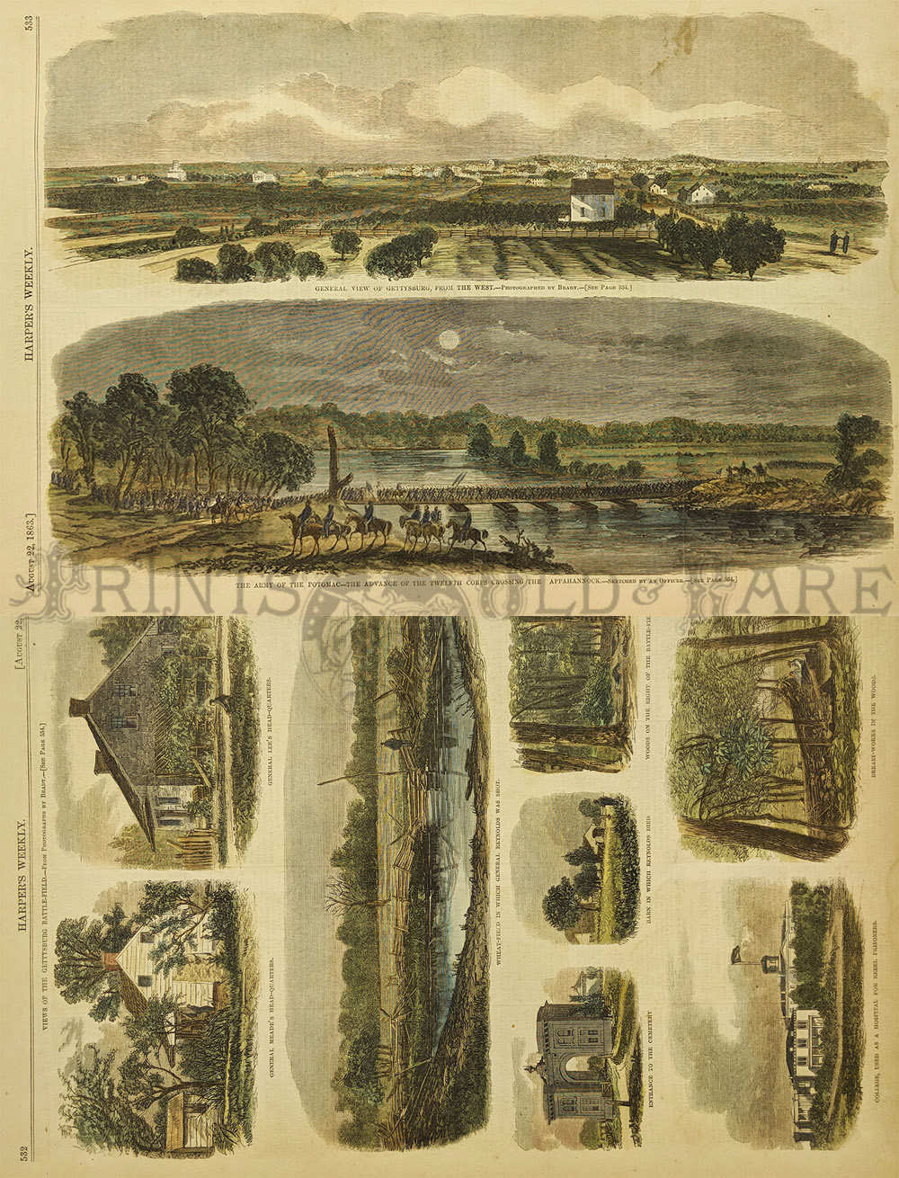
1863 Harper's Weekly - The Army of the Potomac - The Advance of the
twelfth corps crossing the Appahannock & Views of Gettysburg
Battlefield. (2 Prints)
15 3/4 x 11 in. $120
157pa:
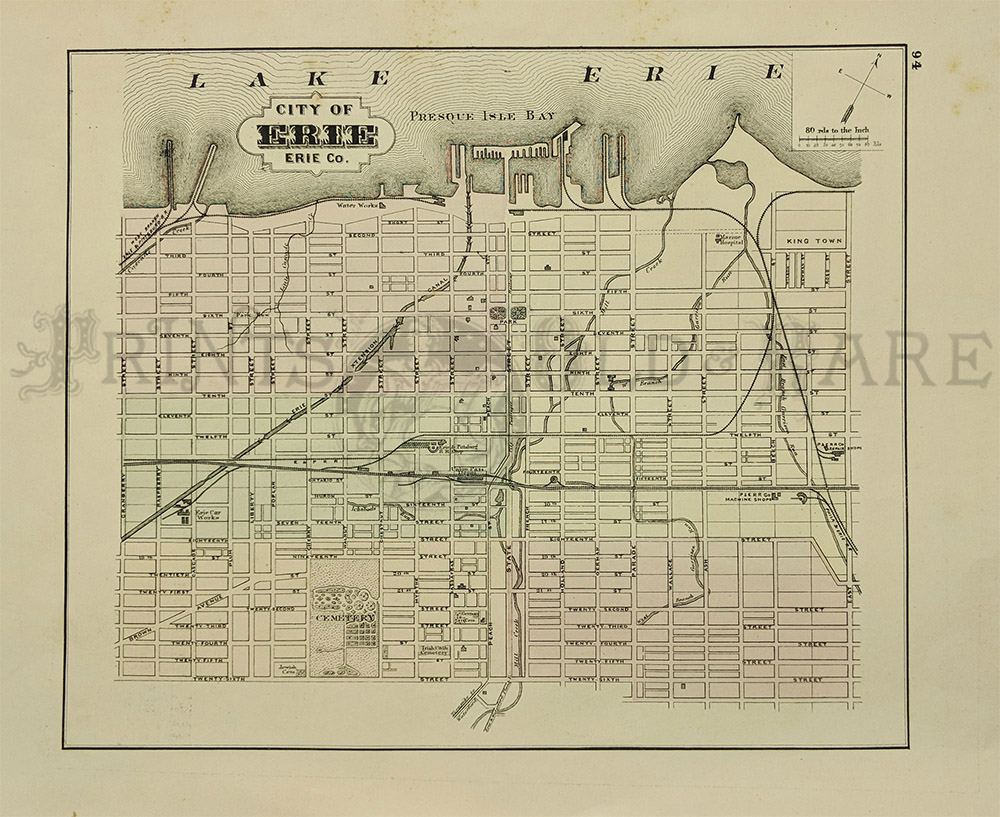
1872 Erie County. Engraved in 1872, version is a map of the city
Reading
in Berks County. Printed in color, Lithograph.
17 x 13 in. $90
150Pennsylvania:
1891 Bradley's Atlas of the World's hand colored map of Pennsylvania.
26 x 19 in. $80
151Pennsylvania:
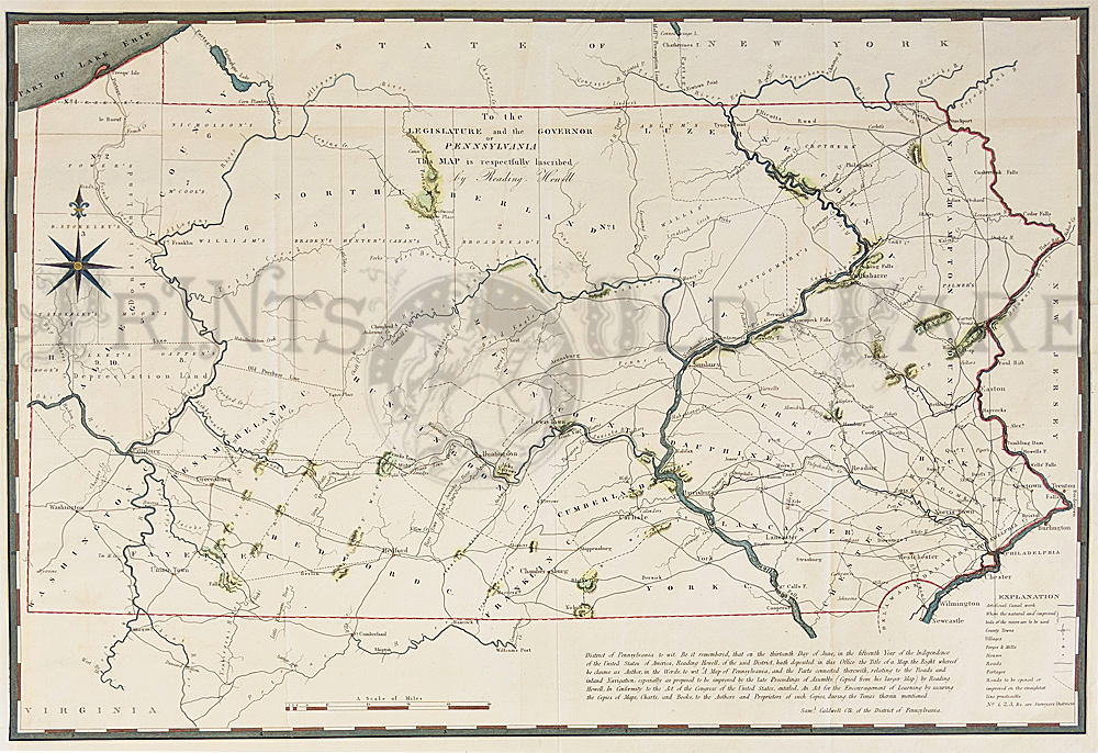
Pennsylvania Howell, 1834 - A large and engraved early map showing the
entire state with remarkable detail. It includes roads, canals,
donation lands, counties, townships and topography with an emphasis on
transportation. Most settlement is along the Delaware River and the
southeastern portion, as well as around Pittsburgh. Howell copied this
map from his larger map of 1792, which was one of the most important
maps of Pennsylvania to appear in the eighteenth century. A dedication
is at upper center "to the Legislature and the Governor of Pennsylvania
this map is respectfully inscribed by Reading Howell." This is a rare
and unusual map with nice decorative border and compass with Fluer de
Le. Condition: Excellent, fold in middle, small margins on left and
right side some slight aging color.
28 x 20-1/2 in. $500
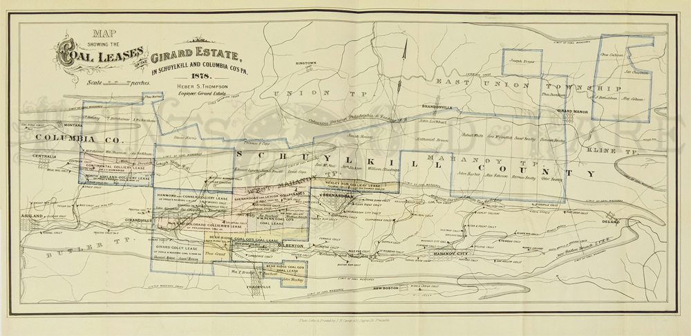
152Pennsylvania:
Map Showing the Coal Leases on the Girard Estate, in Schuylkill and
Columbia PA, 1878 A large horizontal and rare lithographed map with
original hand color of the coal leases in the Girard Estate, Columbia
County Pennsylvania, drawn by Heber S. Thompson and printed by J. H.
Camp, Philadelphia. Leases are pastel colored and named, with the town
of Frackville at the bottom center. Special Note: In Schuylkill and
Columbia Counties there were eleven coal collieries in operation under
ten leases. According to the 1879 Board report, the first coal removed
and sold commercially from the Estate’s mines occurred in 1863. That
year 40,788 tons were sent to market. In 1879, the amount marketed was
1,600,000 tons and royalties grosses $463,644. The Estates coal mines
were leased with a royalty of forty cents per ton and progressed to
fifty-four cents. Three- fourths of that was reinvested “in the real
property in the City, so as not to diminish the fund upon which the
support of the College must ultimately rely when these lands shall have
been stripped of their mineral resources.” In 1889, also, “the income
from the 35,407,710 tons of coal shipped this year has never been
equaled in the history of the trust”. Condition: Very Good, four
vertical folds hardly noticeable.
size 24 x 11 image
$200
|
|