|
|||||||||||
This is a small selection of our inventory of antique Pictorial maps. Additional inventory is available. Lowest Prices! Contact us with your request. 1-800-879-6277
|
|||||||||||
|---|---|---|---|---|---|---|---|---|---|---|---|
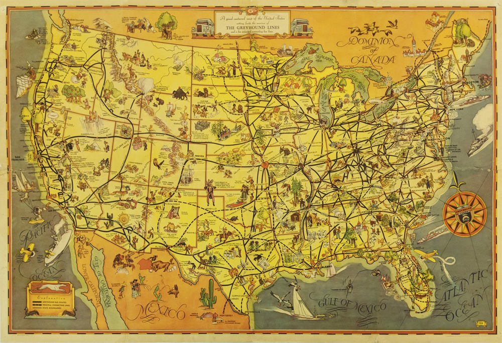
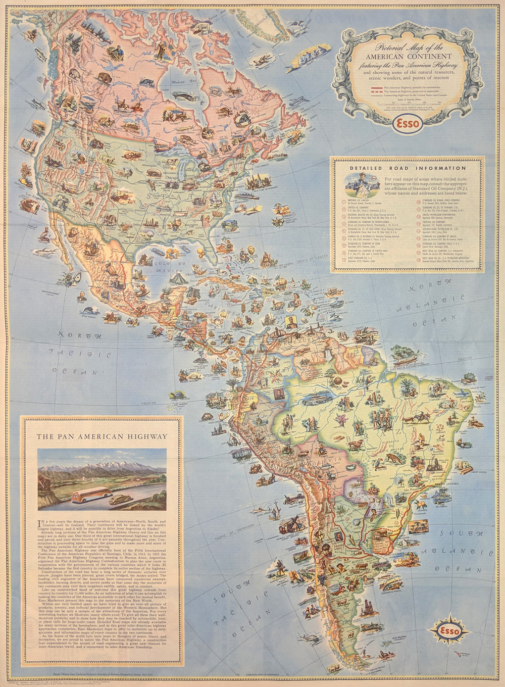 001pictorialmaps: Pan American Highway Pictorial Map - Esso Corporation by American Geographical Society c1930. Pictorial Map of the American Continent showing scenic wonders and points of interest. Printed in color. 24 1/2 x 18 in. $195 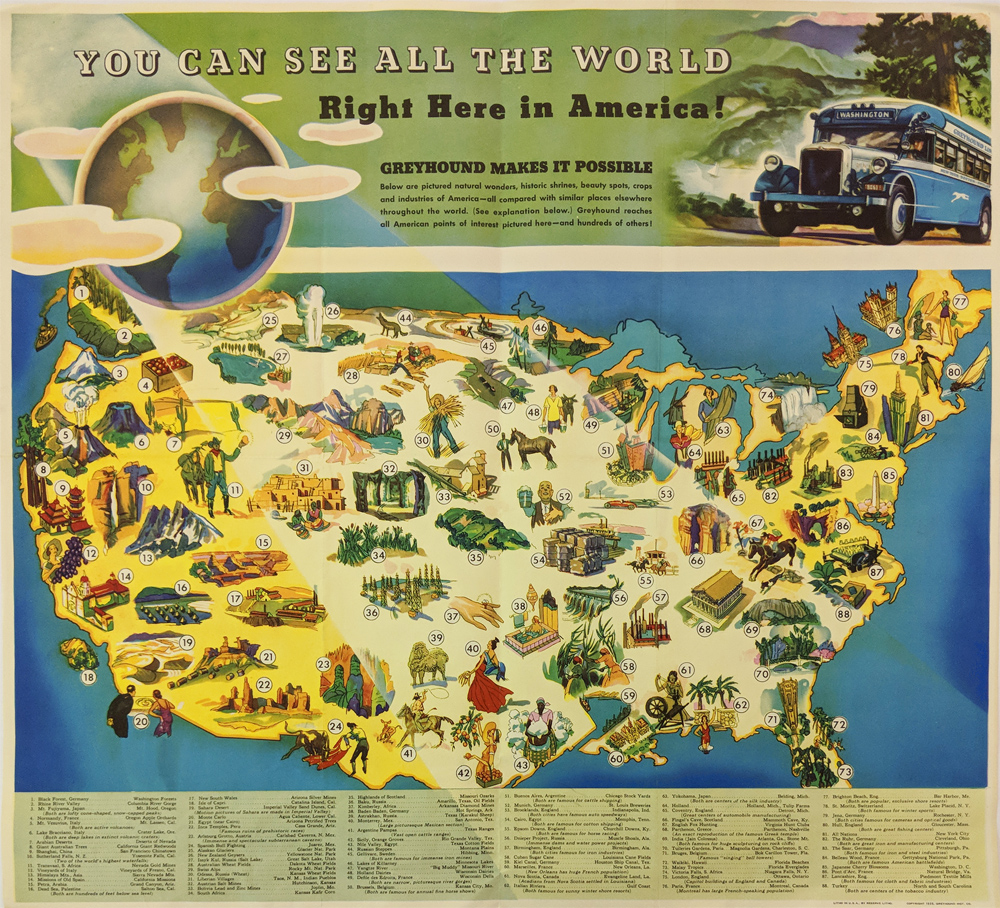 002pictorialmaps: 1935 Greyhound's Pictorial Map: "You Can See All The World" Right here in America. Map matches 88 US destinations with foreign places i.e. Baku Russia w/ Amarillo, Tx, Arabian Deserts w/ Nevada Deserts. Vignettes of sites. Printed in color. 24 x 22 in. $295 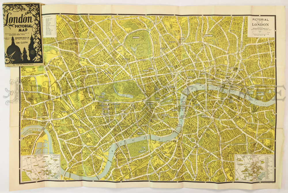 004pictorialmaps: London Pictorial Map. Geographers’ Map Co. Shows places of interest, stations. C.1940. Insets of cinema land and theatreland. Linen backed, printed in color. 30 x 21 in. $75 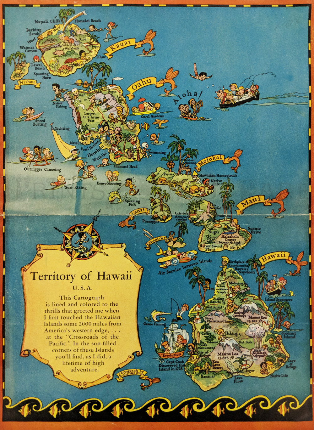 252Hawaii: Pictorial Map "Territory of Hawaii" by Ruth Taylor White. 1935. Humorous language tips on verso. 11 1/8 x 8 1/4 in. $90 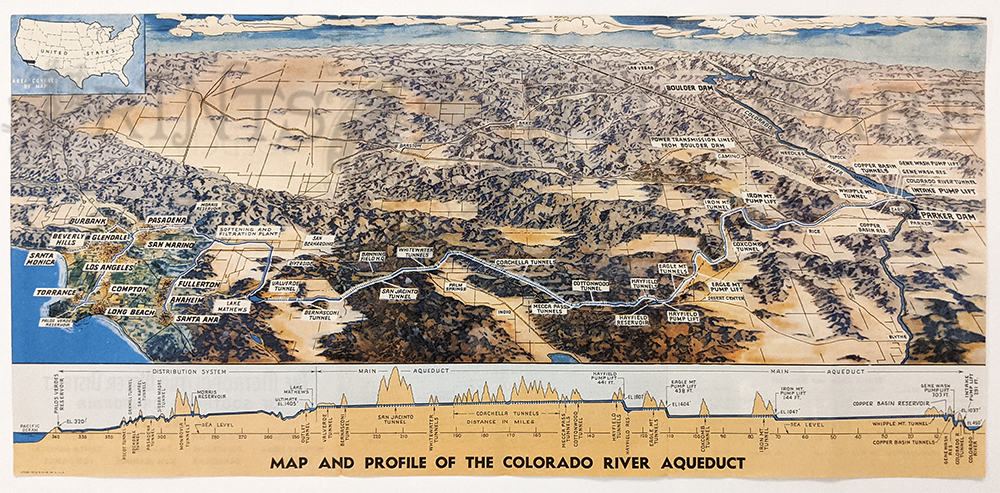 136los: Colorado River Aqueduct c.1940. Relief Map of Colorado River to L.A. Profile map of Colorado River to Pacific Ocean. 9 1/8 x 19 3/8 in. $85 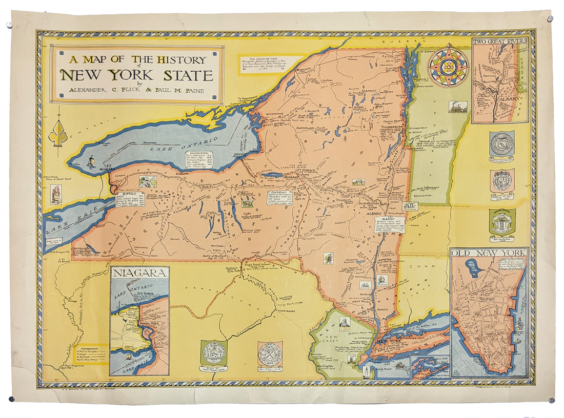 318NewYork: Map of the History of New York 1928 by Alexander Flick and Lance M. Paine. Colorful map depicting historical locations all over the state. Inset of Manhattan, Niagara, and Long Island. Lower left corner has been patched and small piece of bottom border has been archivally mended and/or patched. 21 x 29 in. $150 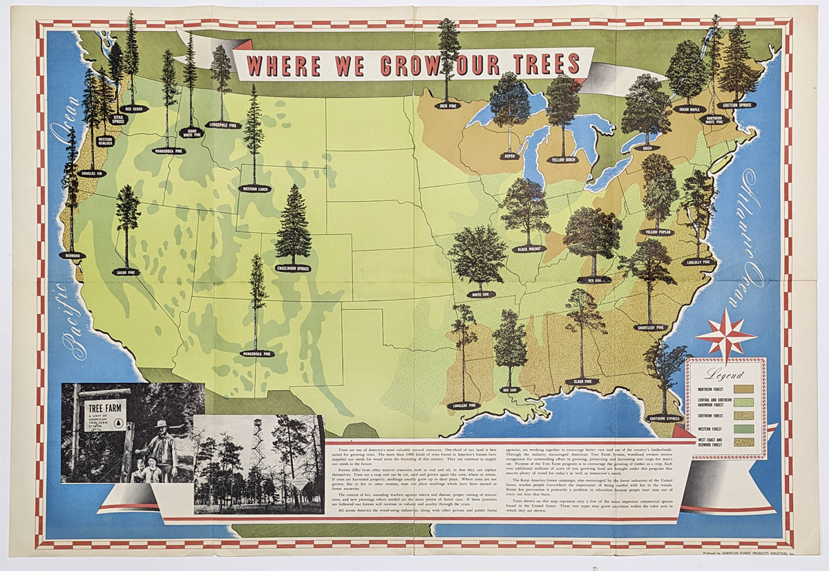 307UnitedStates: 'Where We Grow Our Trees' 1952 Pictorial Map of the United States showing the various regions of forests and species of trees across the country. Published by American Forest Products Industries, Inc. Washington, D.C. **Minor tears on folds center top and bottom. 24 x 36 in. $260 |
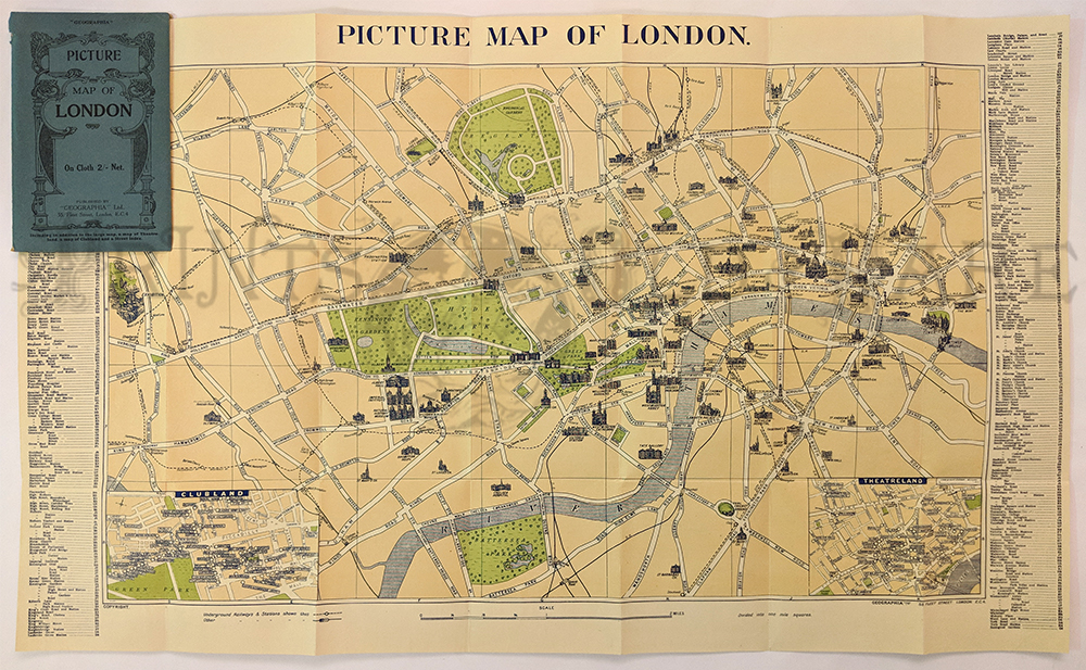 005pictorialmaps: Picture Map of London – by Geographia 1929-30. Fabric backed. Printed in color. Highlights historical sites & buildings. Tear on side. 29 1/2 x 19 in. $185 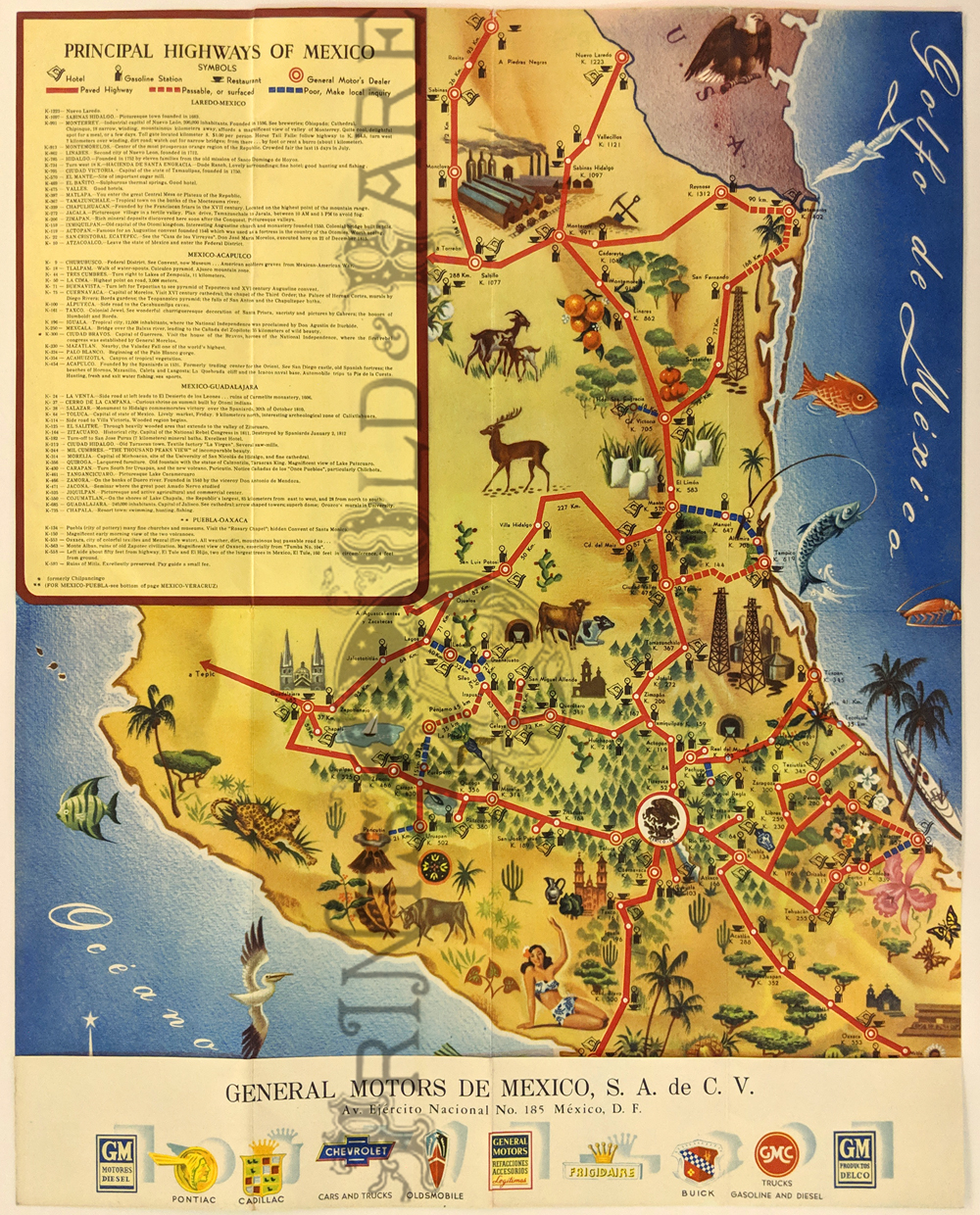 006pictorialmaps: Highway Map of Mexico – Pictorial map showing paved highways, passable and poor roads. Also, hotels, gas stations, restaurants and General Motors dealers. c.1950. Find condition. 17 x 23 in. $125 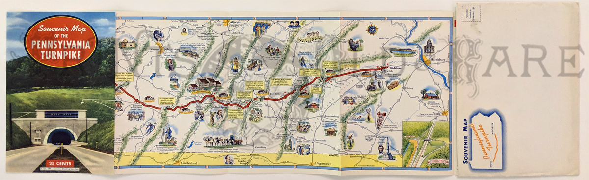 007pictorialmaps: 1941 Pennsylvania Turnpike Map. Souvenir with pictorial map one side, facts and photos on verso. Fine condition – also comes with original envelope. Printed in color. 8 x 33 in. $40 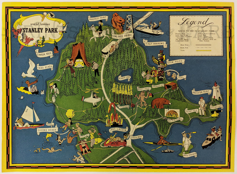 071can: c1940 Cartoon Pictorial Map of Stanley Park. Showing points of interest; Prospect Point, Lions Gate Bridge, Brockton Point Lighthouse, etc. Reverse describes Siwash Rock, Noted Monuments, The Zoo and Shakespeare Garden. 10 1/2 x 14 in. $90 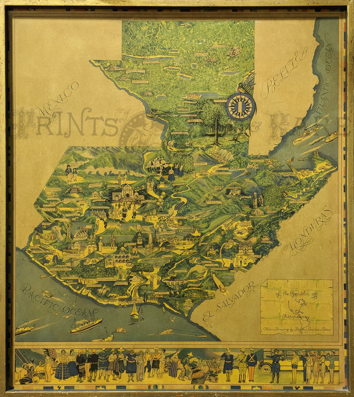 208cam: Guatemala Pictorial Map 1930s. Rare. Map by Delfino Sanchez Latour, Published by The National Tourist Committee. Mounted and framed. Bottom border shows people of Guatemala. Printed in color. 40 x 35 in. $350 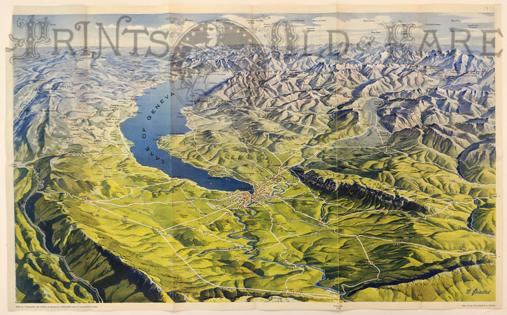 204swi: Geneva (Geneve) Pictorial Map by M. Bieder. 1970. Shows elevation of area around Lake Geneva, towns and roads. Colorful and interesting map. 16 3/8 x 26 5/8 in. $45 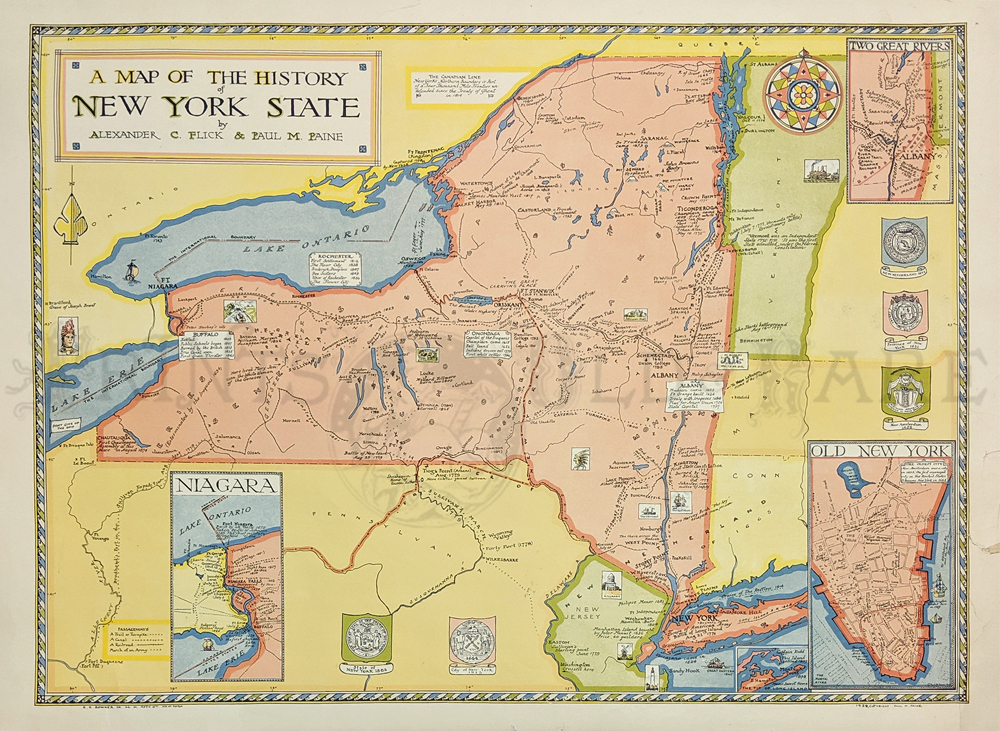 314NewYork: History of New York State by Alexander Hulk and Paul M. Paine 1929 – Insets of Niagara and Old New York, Hudson and Mohawk Rivers. Printed in Color. 22 7/8 x 31 1/8 in. $150
|
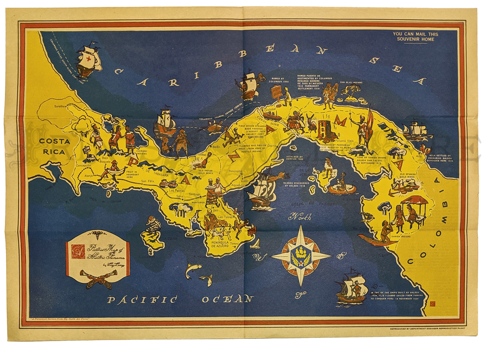 009pictorialmaps: Historic Panama by Ting Leon. c.1914. Cartoon images of historical events and Indians. Distributed by Panama Mobile Force and Security Command. Verso: a brief history & map with description. 12 3/8 x 17 7/8 in. $125 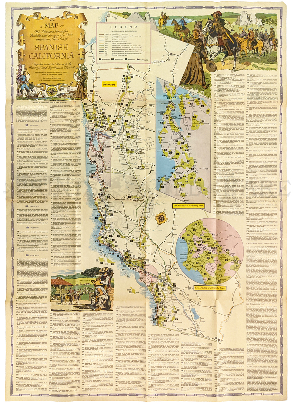 010pictorialmaps: Spanish California. 1956. A Map of the Missions, Pueblos, Ranchos and Routes of Exploration by Lowell Butler. For AAA, Published by Westways Magazine. 46 x 32 in. $65 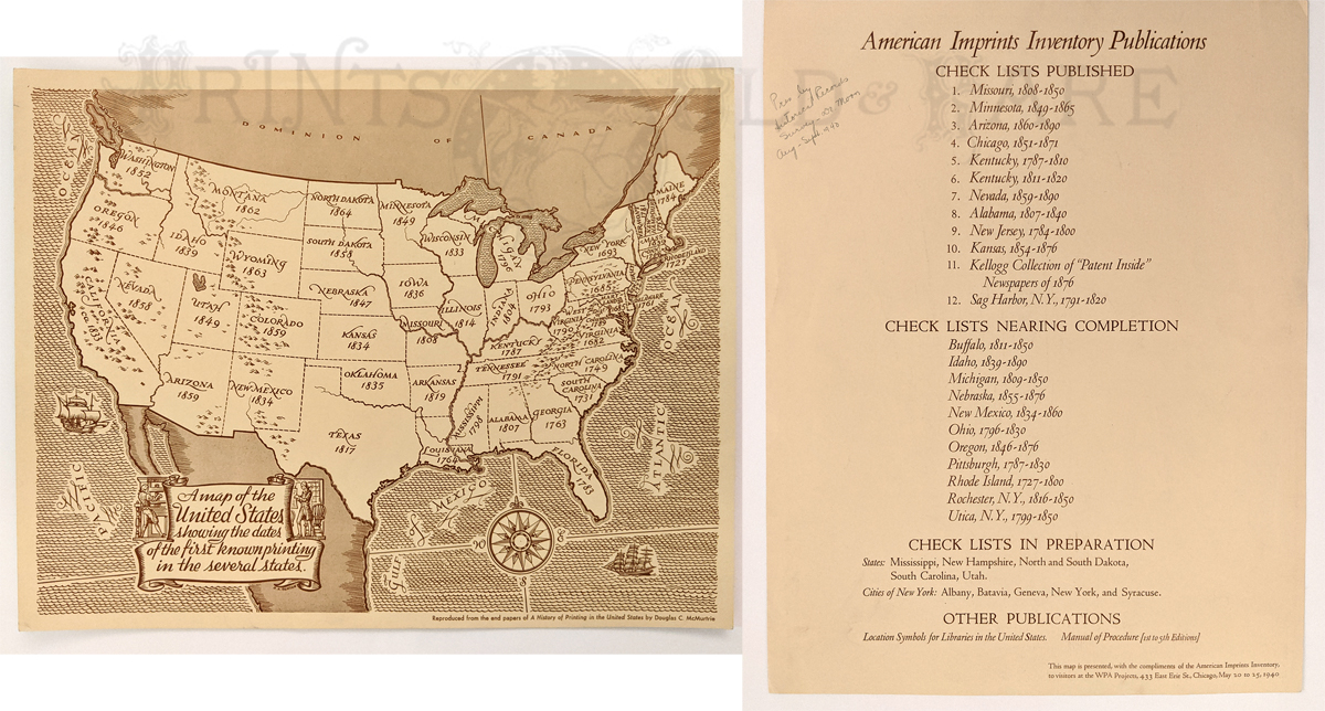 012pictorialmaps: Map of the US showing the dates of the first known printing in the several states 1940 by WPA by Douglas C. McMurtrie. Verso: American Imprints Inventory Publications. Pencil presentation: “Presented to Dr. Moon 1940.” 11 x 13 7/8 in. $150 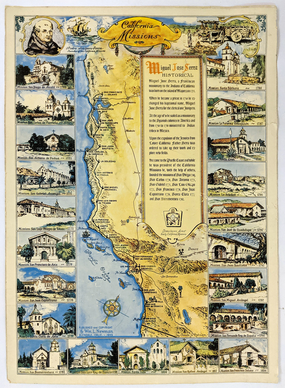 013pictorialmaps: California Missions Map 1949 Colorful original pictorial map by Wm. L. Newman. Shows locations, routes of the Franciscans, and pictures the missions. This vintage map is in fine condition. Size: 15 x 20 in. $325 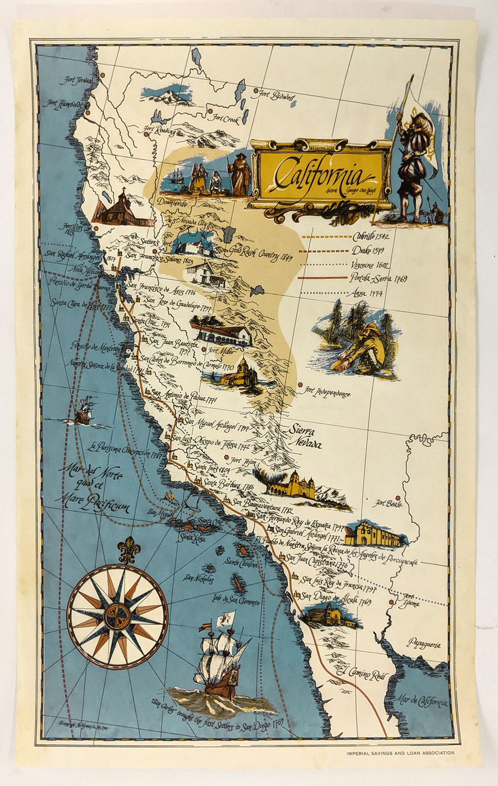 014pictorialmaps: California Pictorial Map c.1960 by George Otto Hanft. Attractive map – depicting locations and routes and important missions – with handsome compass rare gillions. Published defunct Imperial Savings and Loans. Size: 12 x 18 7/8 in. $250 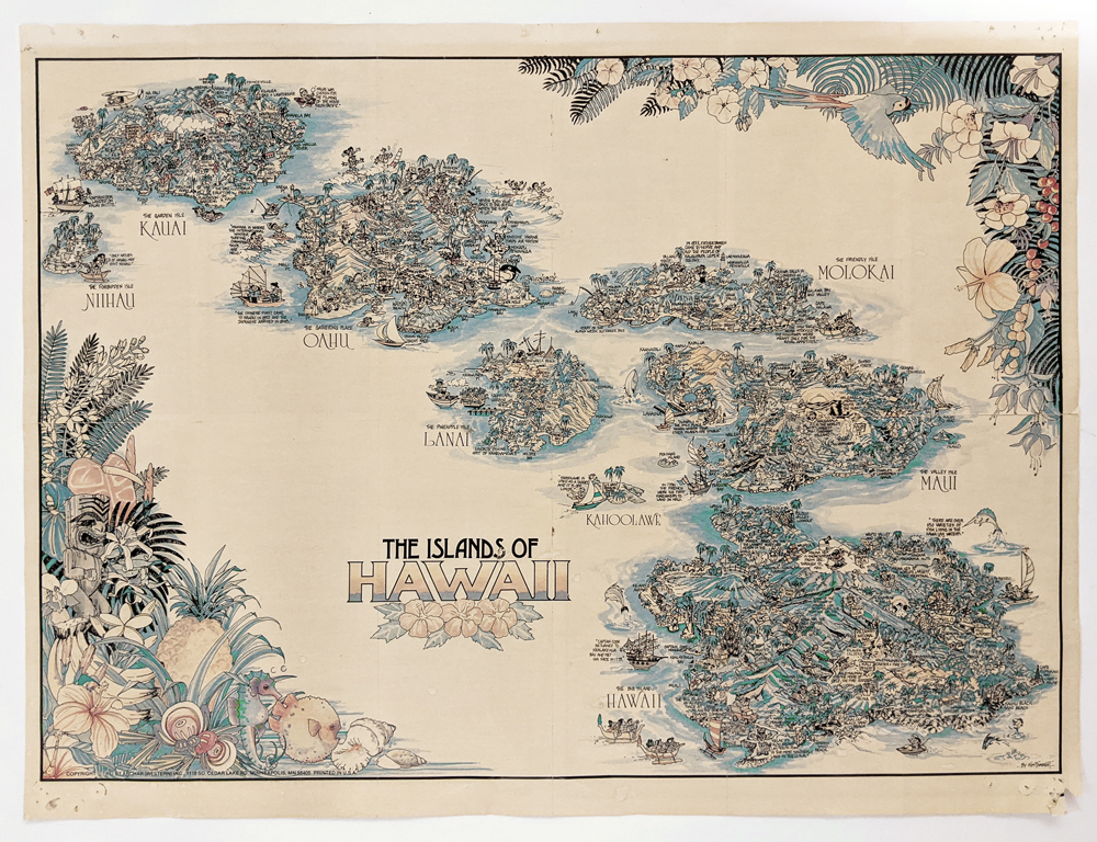 016pictorialmaps: Hawaii Map 1970s by Kim Forrest. Charming pictorial of the Hawaiian Island depicting locations and history. *Pinholes on corners where map was pinned up. Originally folded and now mended along center right fold. 23 x 17 1/4 in. $345 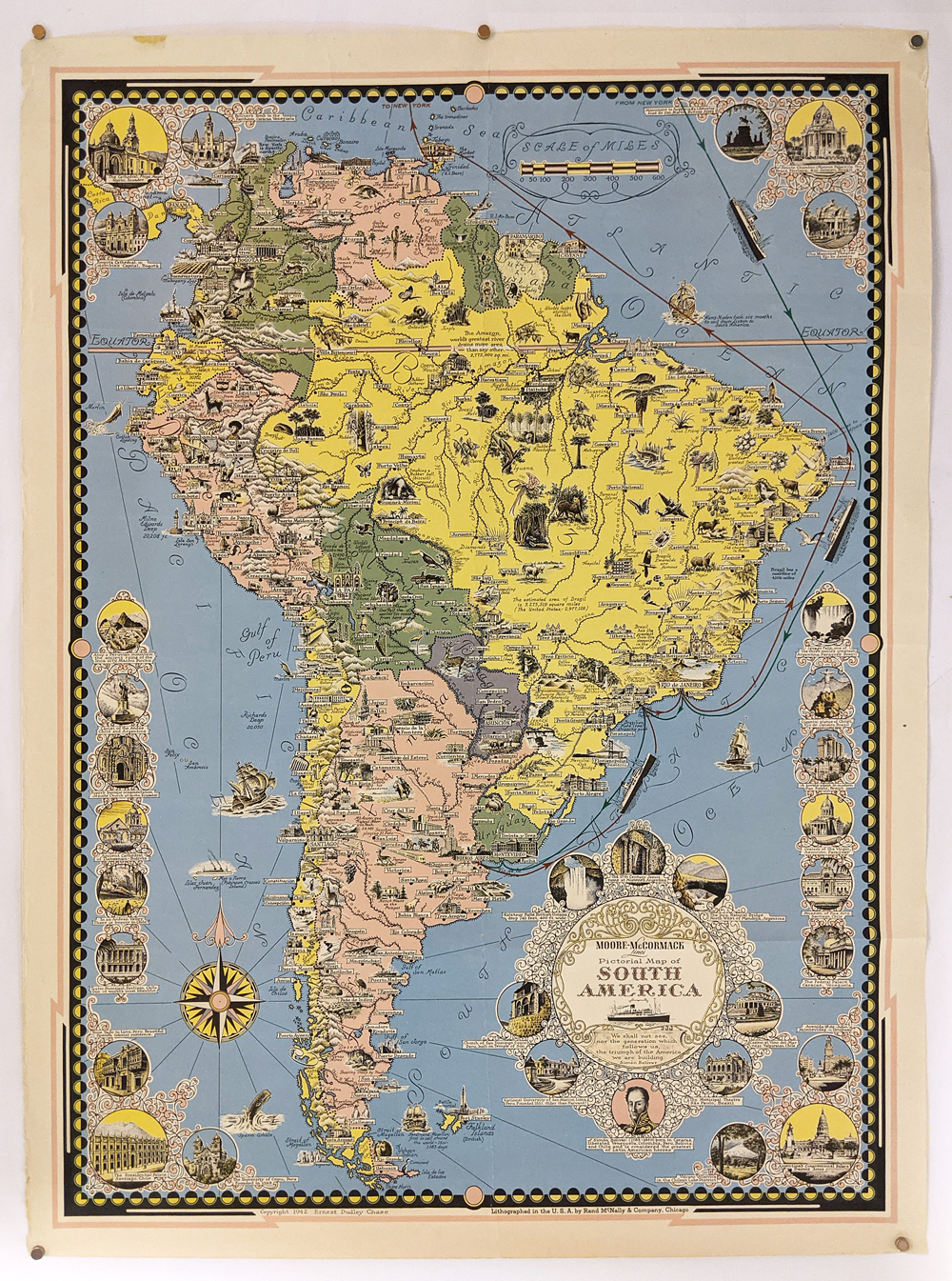 018pictorialmaps: South America 1942. Pictorial Map by Ernest Dudley Chase. Published by Rand McNally, it features a decorative border, detailed cartouche and compass nose and points of interest. Fine condition. 20 x 27 in. $250 |
|||||||||
| Order Form | |||||||||||
| Back to Homepage | |||||||||||