|
|||||||||||
This is a small selection of our inventory of antique Railroad prints for sale. Additional inventory is available. Contact us with your request. 1-800-879-6277
|
|||||||||||
|---|---|---|---|---|---|---|---|---|---|---|---|
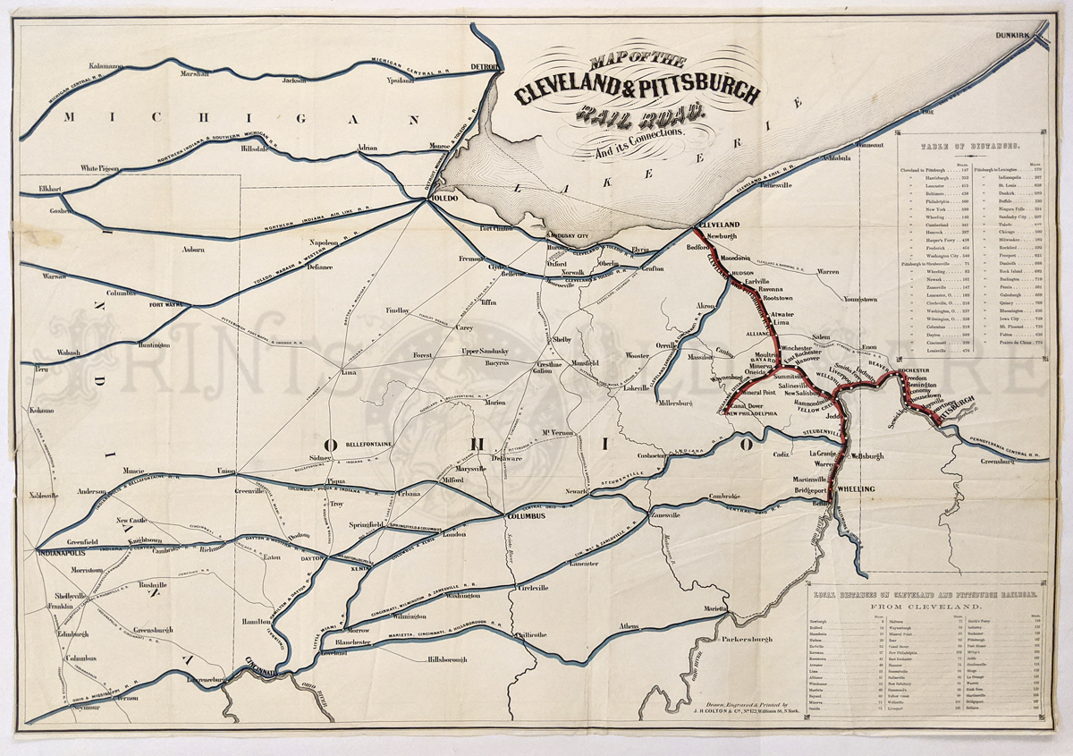
000rr: Map of the Cleveland and Pittsburgh Railroad and Its Connections, Colton 1880s. A very large and engraved, rare, detailed map of the north-central Ohio region with Lake Erie at top center showing drainage, cities and towns, township and county boundaries, names of railroads and the railroad network. Original hand colored routes are depicted with a large inset showing local distances from Cleveland. This is a rare and important Ohio railroad map. Condition: Very good with small margins, light multiple folds with slight yellowing around some of the folds; small patched tear on top left margin. 31 x 22 in. $950 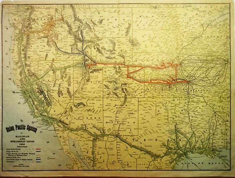
001rr: The Union Pacific System of Railroad and Steamship Lines 1904, Rand McNally Very handsome lithographed and original hand colored map of railroads and steamship lines in the Western United States. The map stretches from the Dakotas and Missouri to California, Oregon and Washington. Major hubs are Galveston, Kansas City Denver San Francisco, Chicago and Portland Oregon. Steamship lines stretch from San Francisco to the Columbia River Galveston and New Orleans. A very interesting and detailed map listing all stops along the way of each trunk. Condition: Good, small vertical margins some small tears at top margin major fold in middle otherwise in excellent shape size 25.5 x 18.5 image $150 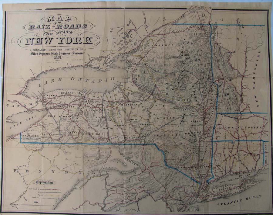
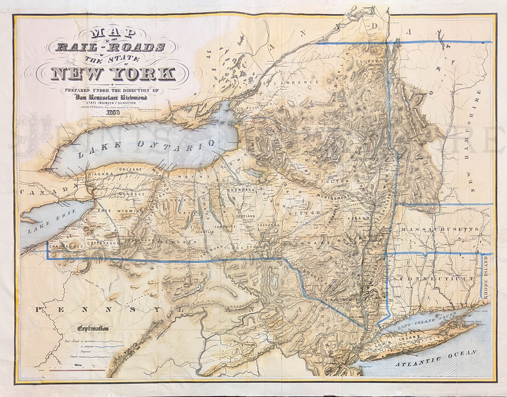
000NewYork: Rare Railroad map of New York State, 1857. Map shows cities, counties, and has a hand drawn relief for lakes and terrains. Map also shows railroads in operation, in progress and railroads proposed. Map is hand colored and engraved. The top margin is reinforced. 29 x 29 in. $800 
002rr: 1887 Railroad Car of the President. The interior luxury of the splendid car carrying President and Mrs. Cleveland is evident. Beautifully hand colored engraving. Authentic antique Harper's front page. 11x16 in. $50 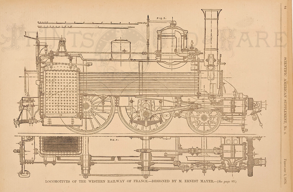 004rr: 1876 Locomotives of France. Detailed old black & white print of locomotives of France's Western Railway, from Scientific American. 15 x 10-1/2 in. $40 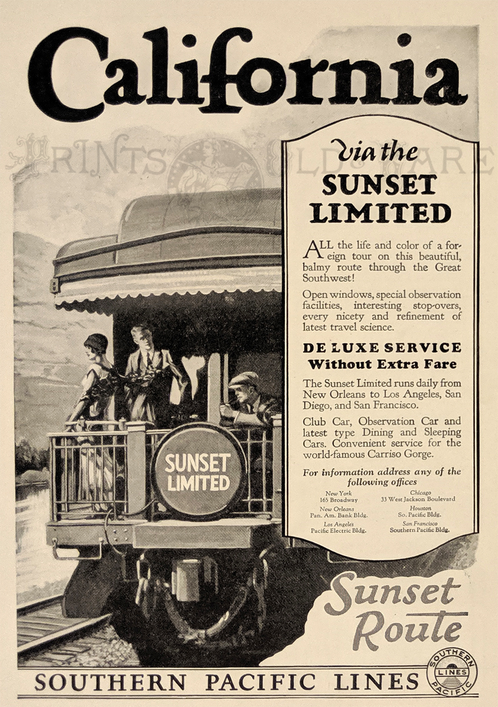 005rr: 1926 Southern Pacific Railroad ad. "Sunset Route" to California via the Sunset Limited is featured. 8 x 17 in. $20 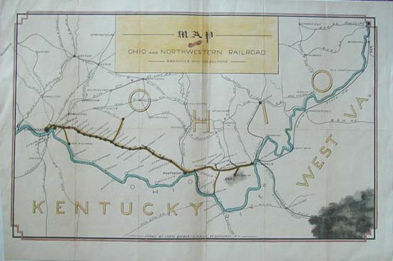 008rr: RARE MAP - OHIO & NORTHWESTERN RAILROAD. Route of the O&NW; Railroad from Cincinnati to Gallipolis, with all of its stops and with its branches to Waterloo and Hillboro and New Richmond. Many connecting lines are shown, including 12 in Ohio, 6 in Kentucky, 4 in West Virginia. This is a hand colored lithograph drawn by Frank Brewer, New York, c1860. 15 x 24 in. $180  010rr: 1892 Chicago & South Side Rapid Transit. Excellent original black & white half-tone of the locomotive, built by Baldwin Locomotive Works, Philadelphia. From Railroad Gazette. 15x10 in. $40 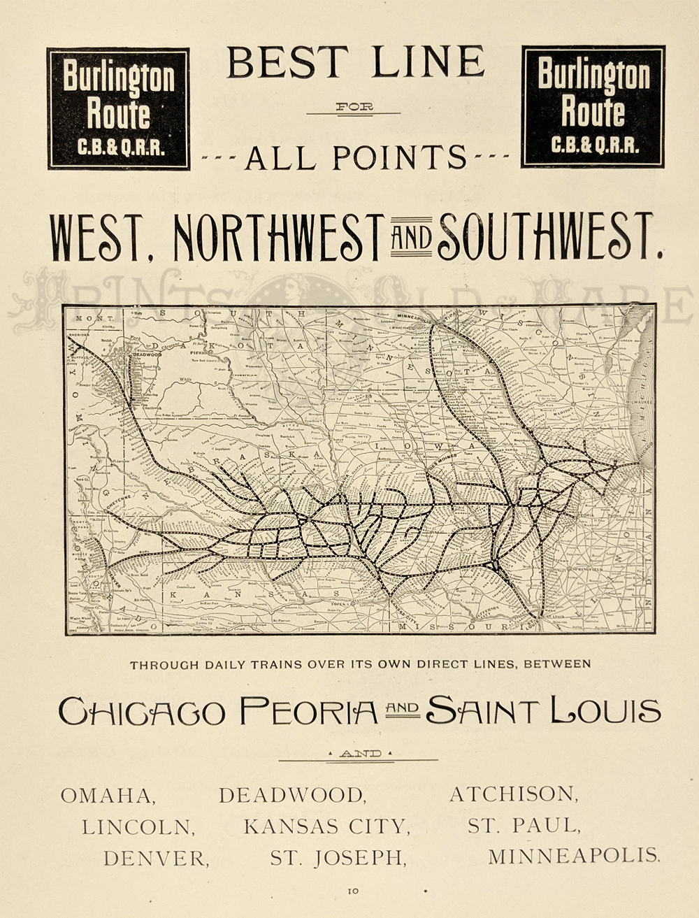 011rr: 1893 Burlington Route ad. "Best line to all points West, Northwest and Southwest." Shows routes. Impressive black & white antique ad. 11 x 14 in. $30 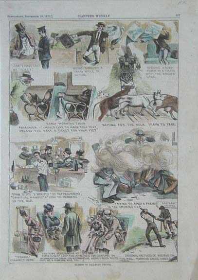
012rr: 1873 Railroad Humor. Several humorous hand colored engraved views of the difficulties of early railroad travel, from Harper's. 11x16 in. $50 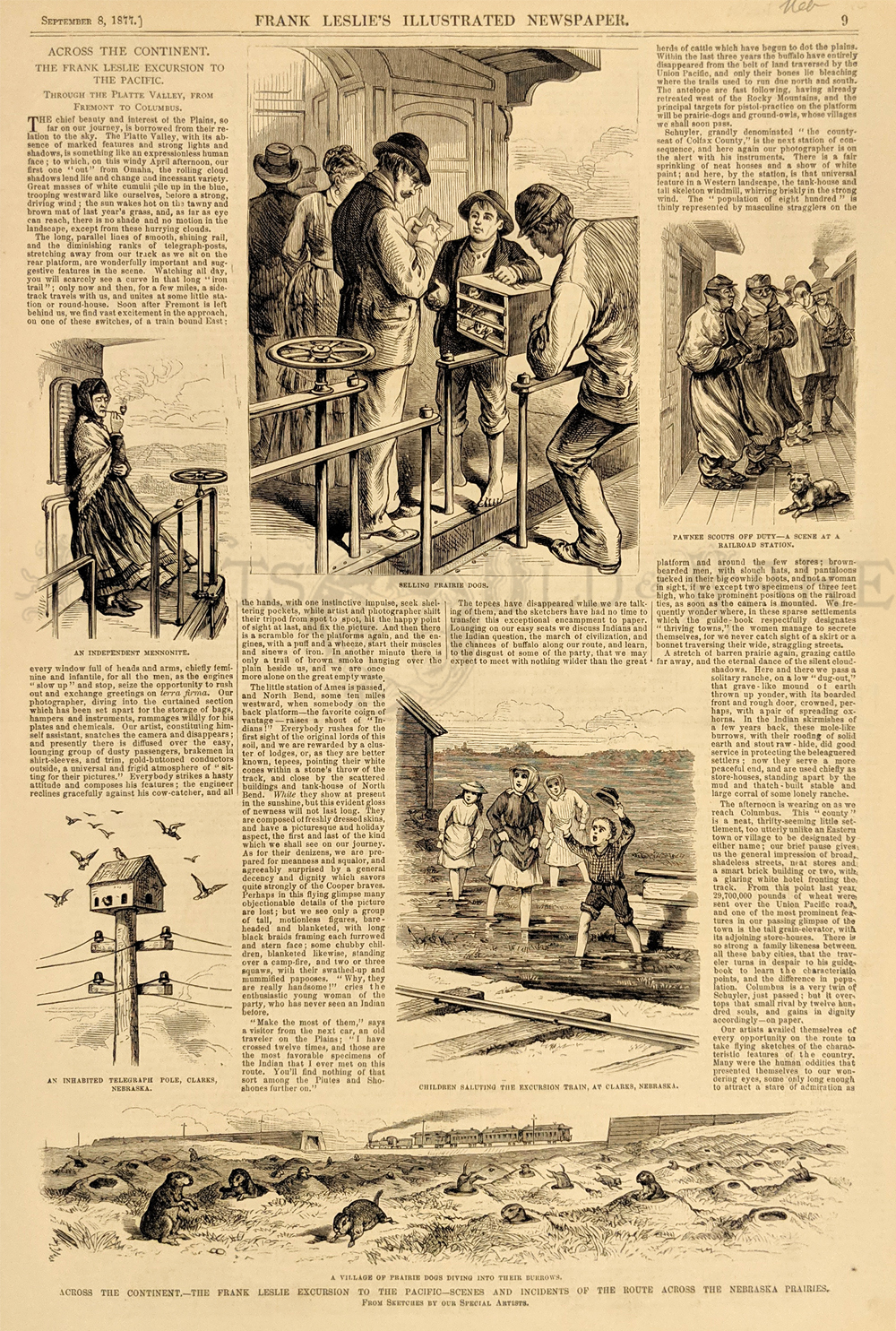 013rr: 1877 Across the Continent-The Frank Leslie Excursion to the Pacific-Scenes and Incidents of the Route Across the Nebraska Prairies. Rare 1877 Leslies Raiload print from his journey to California on the first railroad across the continent. This wood engraving shows The Platt River Valley, Nebraska. Print is in excellent condition. 11 x 16 in. $30 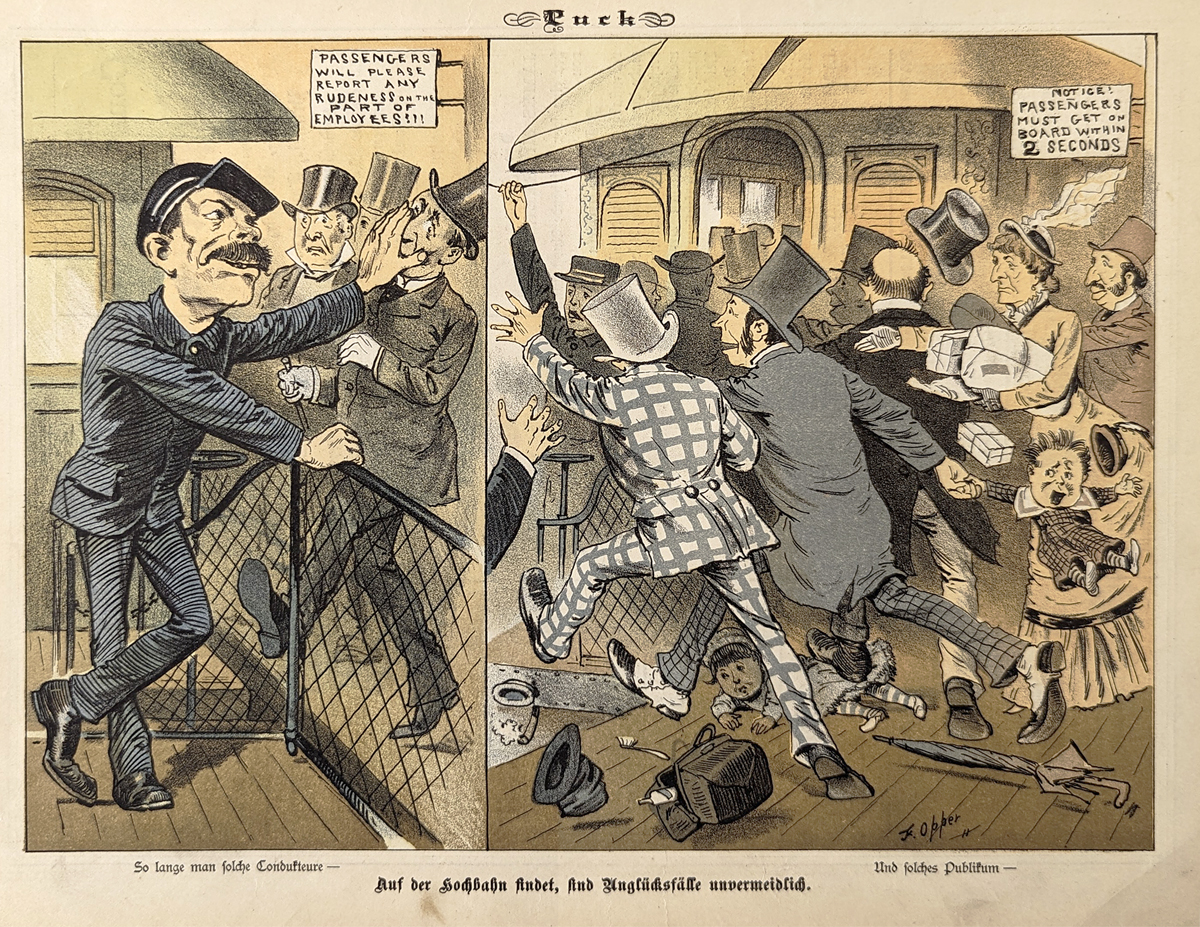 015rr: 1882 Railroad problems. Color lithograph from German Puck magazine - shows rude railroad employees and frantic passengers attempting to board during less thaqn adequate time to do so. Very good condition. 10 x 13 in. $40 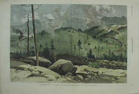 019rr: 1888 The Great Loop On The Denver and Rio Grande Railroad. Drawn and engraved by Charles Graham. This hand colored engraving is from the February 1888 edition of Harper's Weekly and shows a lovely view of the tracks winding through the canyon. size: 16x11 in. $80 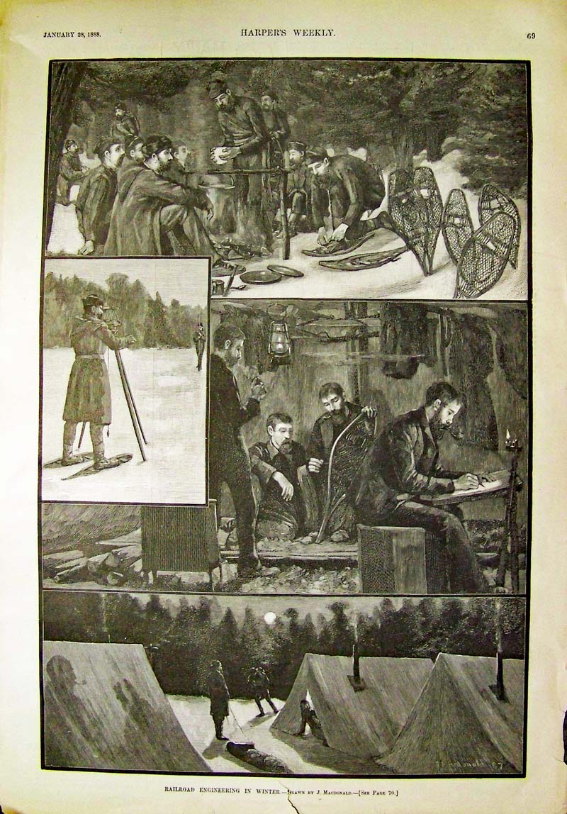
024rr: Railroad Engineering in Winter - - Four scenes of engineers at work at their desk and in the field. 1888 Wood engravings featured in Harper's Weekly. 14 x 10-1/2 in. $40 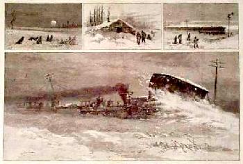
101rr: 1883 Railroad Winter Travel. Four engraved views, the largest showing the locomotive pushing a huge snow plow. From an 1883 issue of Harper's Weekly. 11x16 in. $30 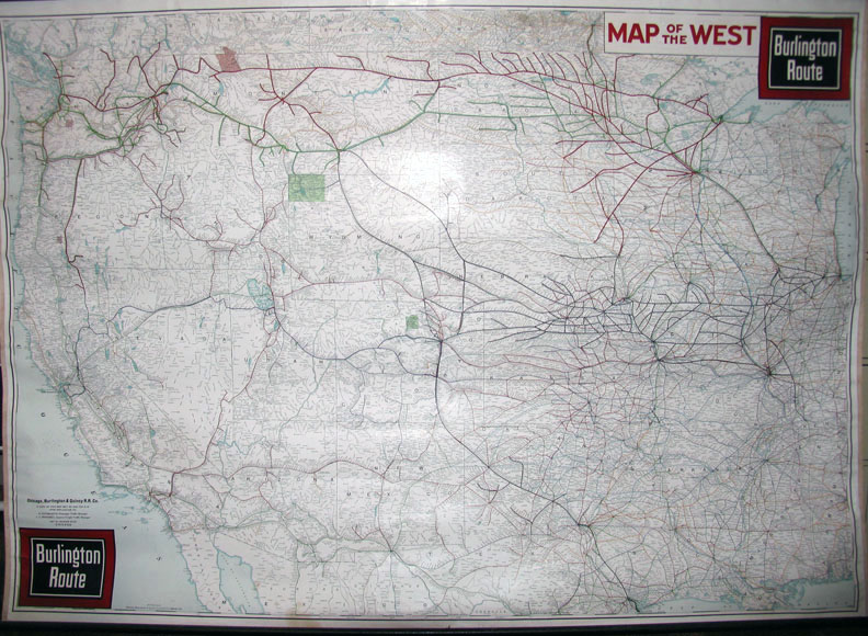 104rr: C.1940s Rolled Map of the West Burlington Route - Chicago, Burlington and Quincy Railroad Company map all ready for hanging. 62 x 44 in. $350 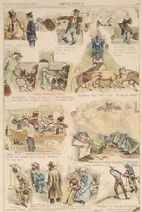
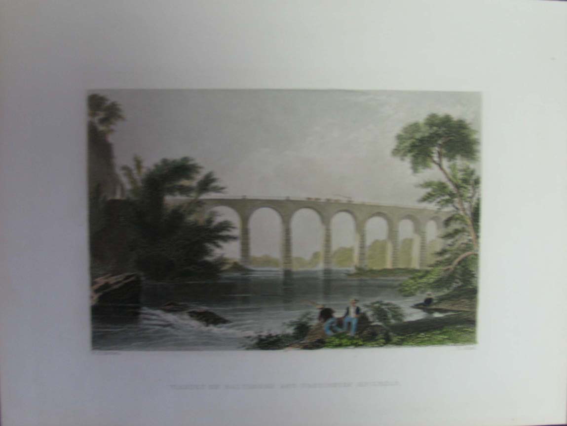
106rr: 1873 Humors of Railroad Travel. Hand colored engraving from the Sept. 20, 1873 issue of Harper's Weekly, showing humorous scenes encountered daily by train passengers: smoke-filled cars, cows crossing the tracks, etc. 11x16 in. $50 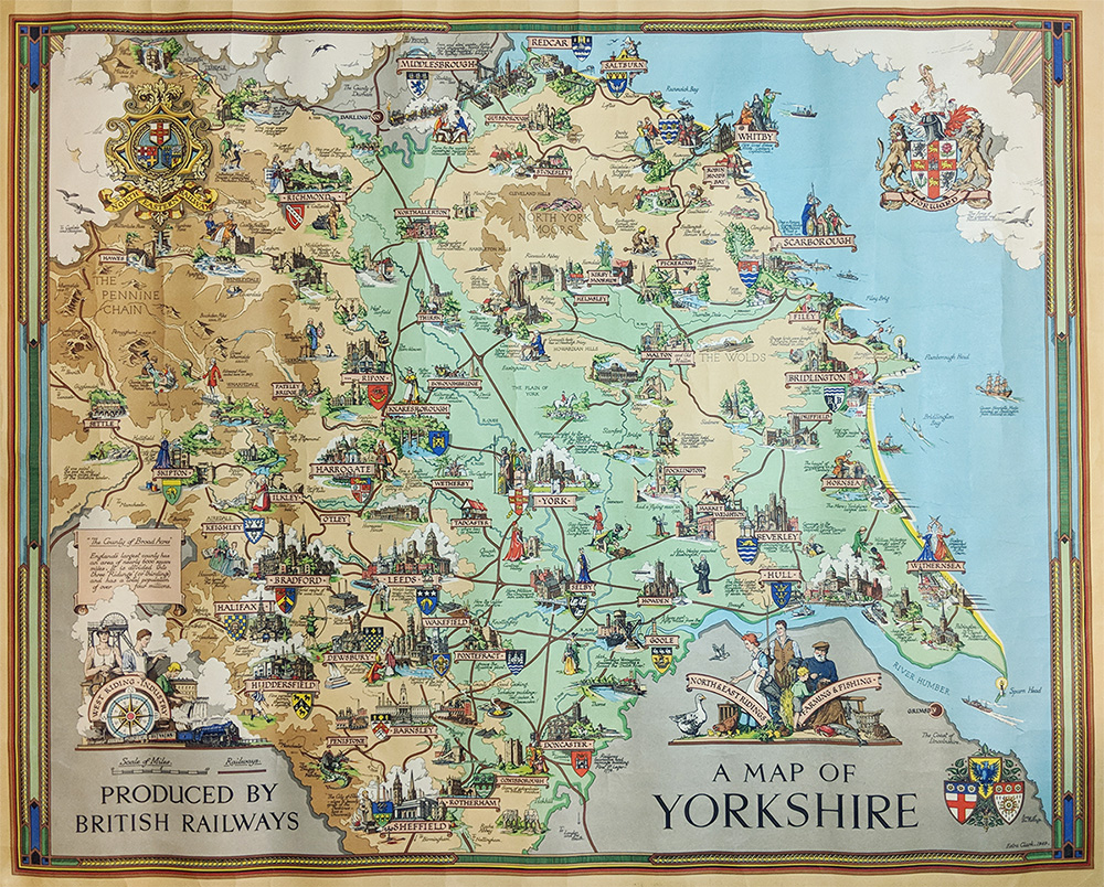 225eng: A Map of Yorkshire. Pictorial map - Color Lithograph by Esty Clark. Published by British Railways 1949. Features Yorkshire history & tourist sites. 40 x 49 in. $325 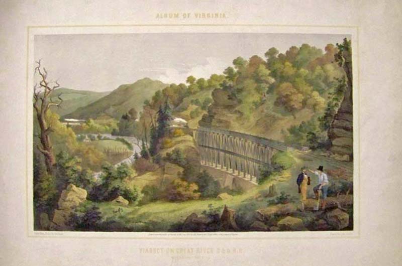 245va: 1857 Rare authentic lithograph titled, "Viaduct on Cheat River B & O R.R." which was Entered According to Congress in the year 1857 by Ed Beyer in the Clerk's Office of the District of Virginia. This is the original tinted lithograph which was enhanced by professional water colorists. Condition is very good. 24 x 16 in. $600 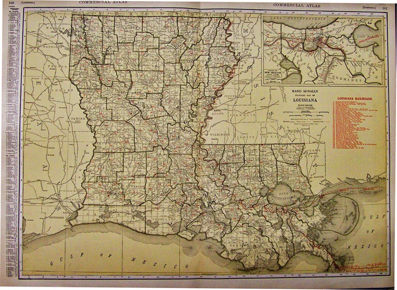 014la: 1928 Louisiana Railroad Map - This color map was published by Rand McNally and was featured in their Commercial Atlas and shows a red key to all the Louisiana Railroads. Upper right inset shows the City of New Orleans and the rail lines running through it. 28 x 20-1/2 in. $80
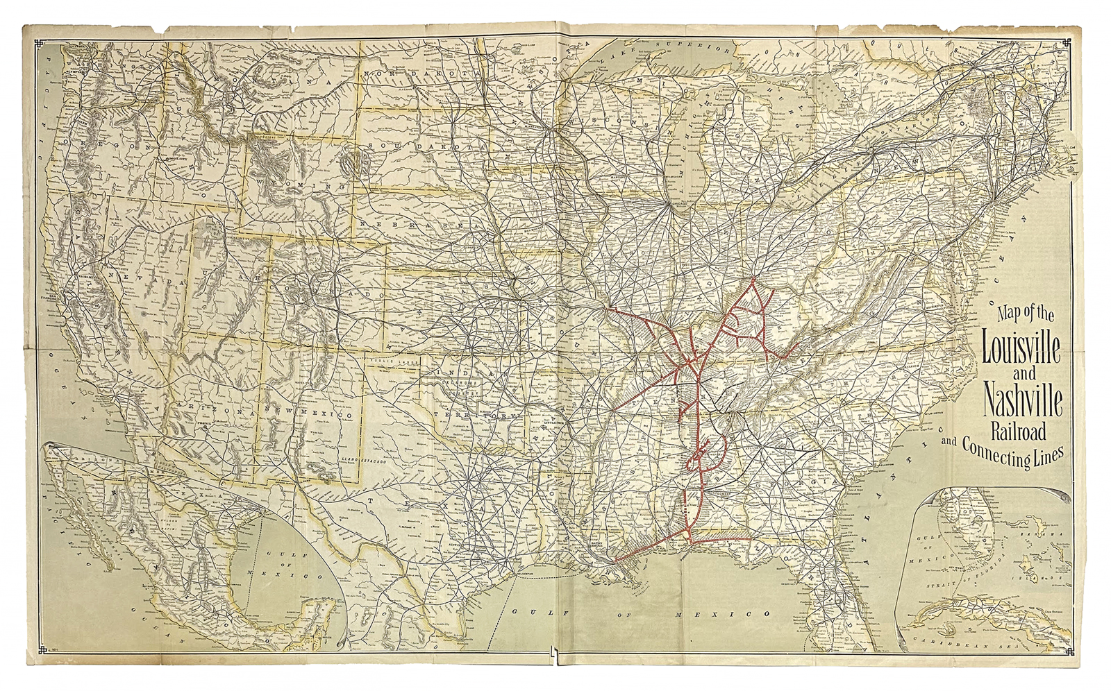 045Louisville: Map of the Louisville and Nashville Railroad and Connecting Lines. 1891. The routes of the Louisville and Nashville Railroad during the Gilded Age. Company lines in red, running far beyond the original connecting cities to places like Cincinnati, St. Louis, Memphis, New Orleans, and Pensacola. Dozens of stops are crammed along the length of each line. **Top border has missing pieces. Center fold reinforced. 19 1/2 x 33 in. $500 |
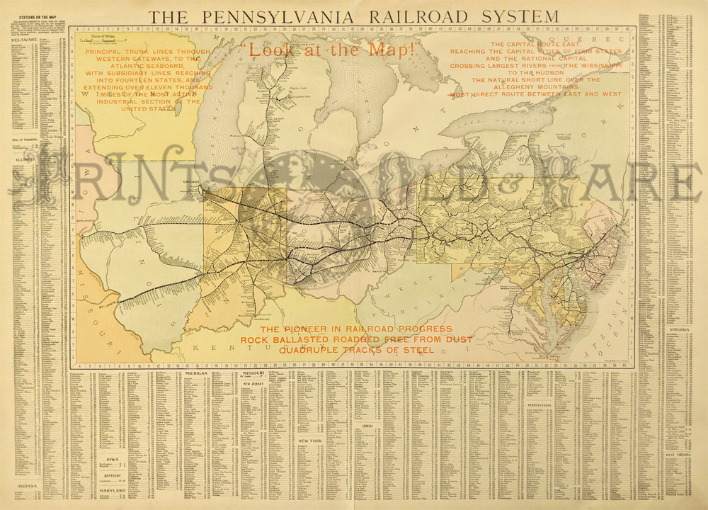 164Pennsylvania: The Pennsylvania Railroad System. 1909. Published by Rand McNally. Detailed country map shows cities, towns, counties, provinces, regions, lakes and rivers, and many other details. Showing detailed information on the railroad network at the time along with the scheduled stops. Also provides capitals, scale of miles, and a detailed list of towns down the side noting population. Lithograph 21 1/2 x 28 in. $200 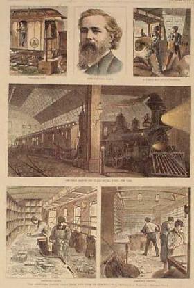 107rr: 1875 Scenes on a Mail Train to Chicago. Interesting hand colored engraving from the Oct. 9, 1875 issue of Harper's Weekly. Title is "The Lightning Postal Train from New York to Chicago. Shows the train leaving Grand Central Station, and postal workers inside sorting the mail. 11x16 in. $50 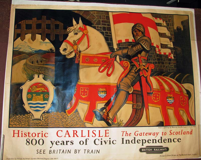
003post: 1924 British Railroad color poster showing the historic Carlyle Gateway to Scotland. Printed in Great Britain at the Baynard Press, London. Published by the British Railways. Artist was Greiffenhagen. 49-1/2 in. x 40 in. $400 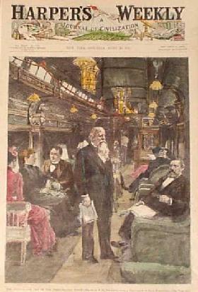
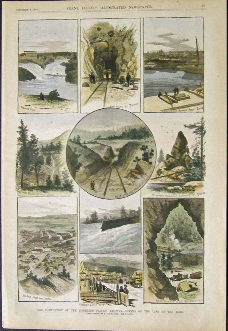
111rr: 1891 Presidential Railroad Car Scene. Hand colored engraving from the April 25, 1891 issue of Harper's Weekly, titled "The Observation Car of the Presidential Train." Shows the luxurious accommodations that the President had while travelling. 11x16 in. $50 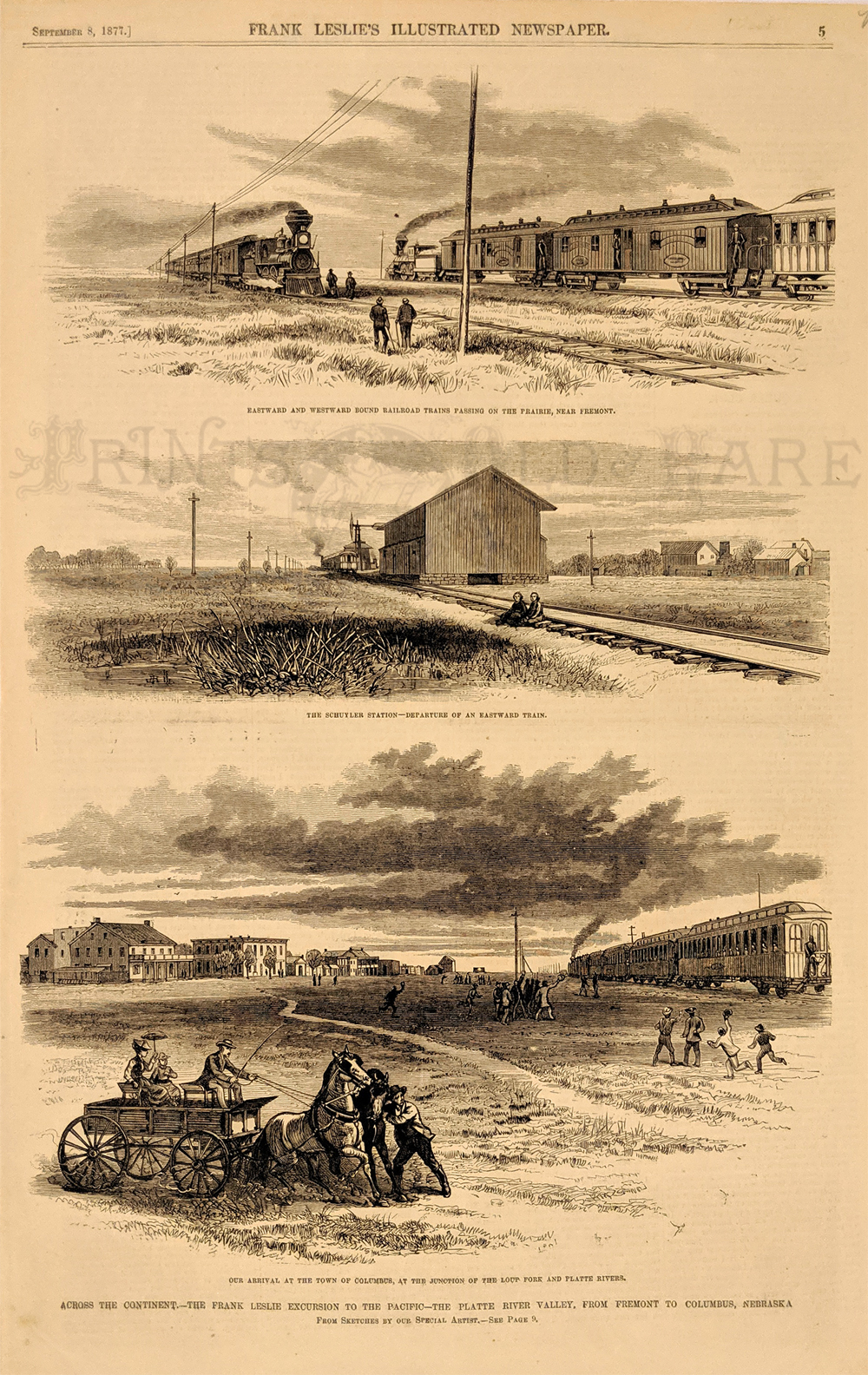 112rr: 1877 Across the continent-The Frank Leslie Excursion to the Pacific-The Platte River Valley from Fremont to Columbus, Nebraska. Leslie on the new transcontinental railroad. Authentic 1877 wood engraving from the September 8, 1877 edition of Frank Leslie's Illustrated Newspaper. 11x16 in. $50
|
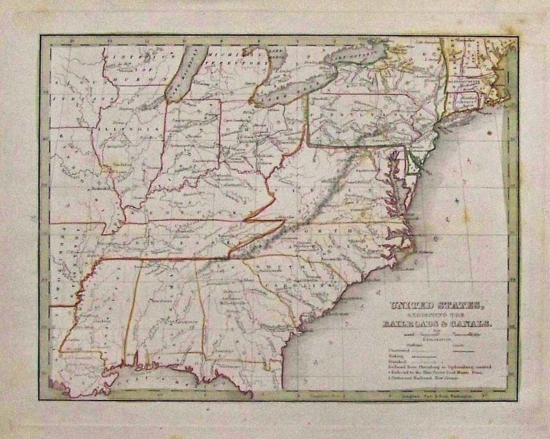
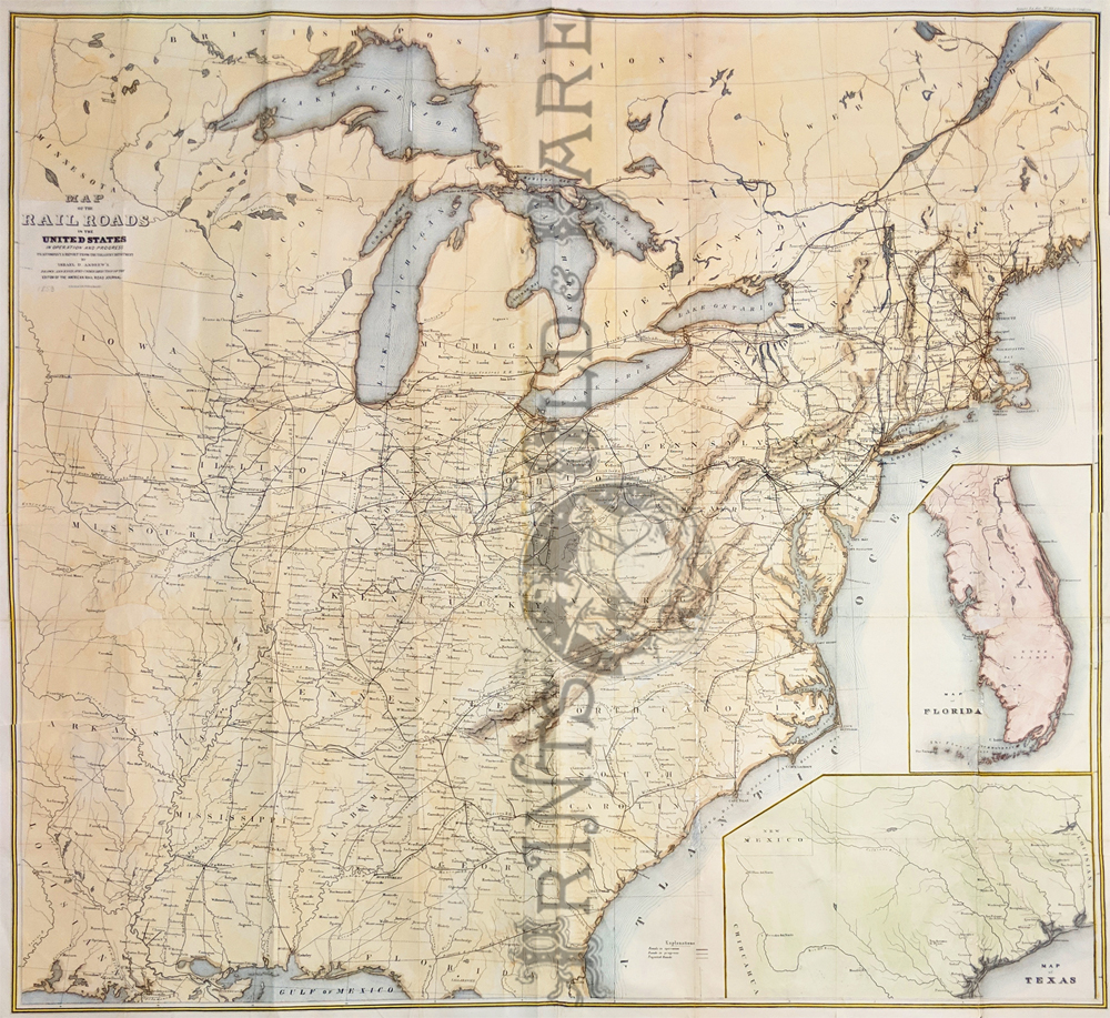 226rr: Map of the Railroads in the United States in operation and progress. 1853 Ackerman Lith. Company NY. Showing the railroad names, routes, roads in operation, projected, and in progress of the eastern part of the United States. Inset showing maps of Florida and Texas. *All folds have been reinforced. 40 x 42 in. $400 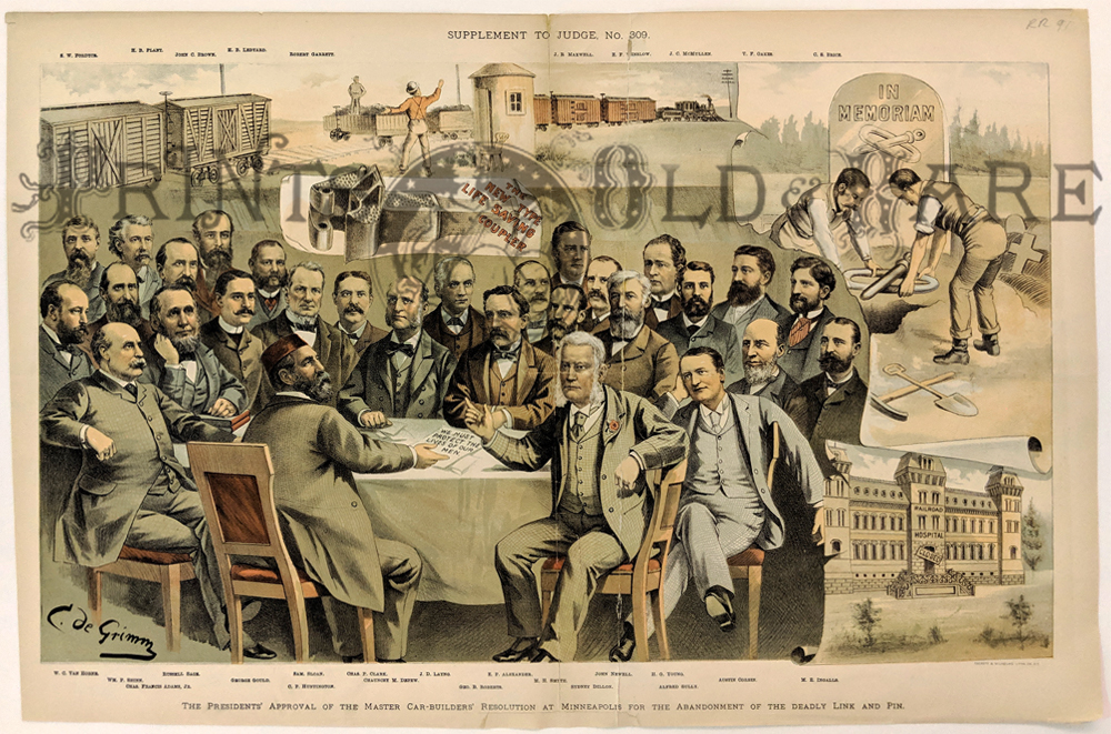 228rr: Life Saving Coupler Approved. 1887. Depew, George Gould, C.P. Huntington, Chauncey & 26 other Railroad car builders signing to abandon the deadly link and pin. Chromolithograph cartoon from Judge Magazine. Archivally mended in middle of original fold. 13 1/8 x 20 in. $90 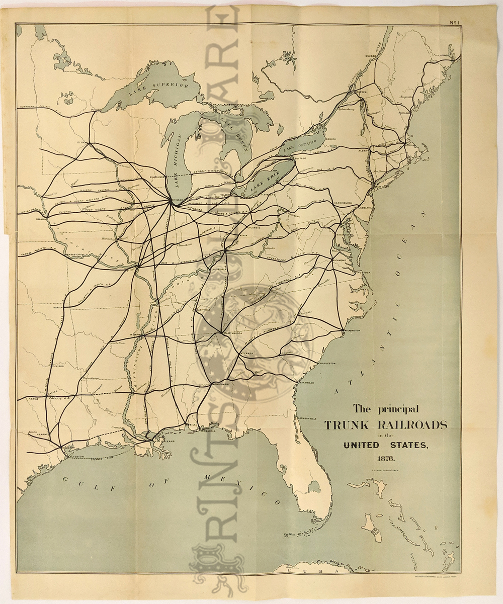 229rr: The Principal Trunk Railroads in the United States. 1876 lithograph. Showing the routes in the eastern half of the U.S. Orginally folded. 17 1/2 x 22 1/2 in. $150 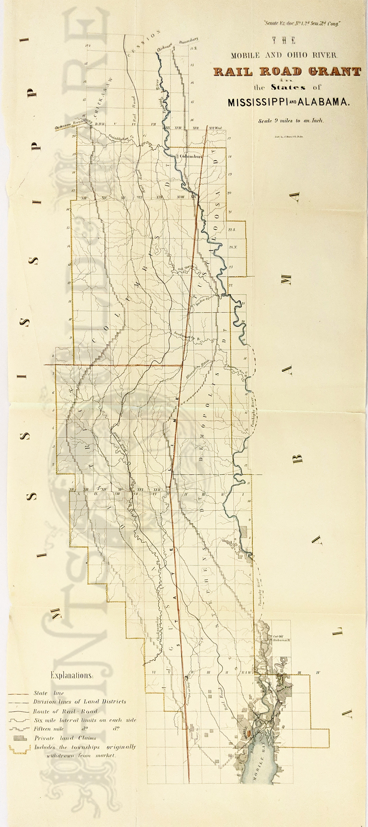 230rr: 1853 The Mobile and Ohio River Railroad Grant in the States of Mississippi and Alabama. Long map showing 20 miles on either side of railroad running down the state line between MS & AL. Shows Chickasaw boundary (just north of Columbus, MS) south to Mobile, AL. Also private land grants, rivers, counties, etc. Lithograph. 13 x 31 in. $600 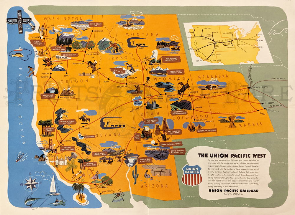 231rr: 1949 Colorful Union Pacific map publshed by the Union Pacific Railroad in their Western Wonderlands brouchure. Back side features half-tone views of scenic destinations and front side shows all Union Pacific routes throughout the Western United States. 18 x 23 1/2 in. $80 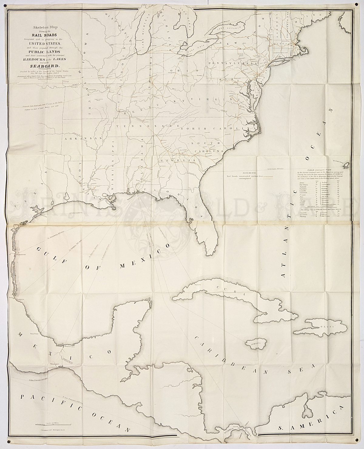 233rr: Skelton Map showing the Railroads completed and progress. 1849. Early map showing railroad network also shows cities, states, drainage, constructed & planned railroads, ship routes from the costal ports. 37 x 46 in. $125  234rr: 1873 Map Showing the Rail Road and Canal Lines Used in the Determination of Elevations by James Gardner. Very good condition. 19 x 23 1/4 in. $100 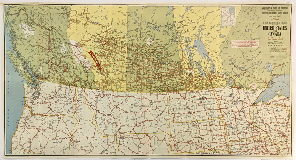 236rr: 1948 Department of Trade and Commerce and Canadian Goverment Travel Bureau Map indicating Main Automobile Roads between United States and Canada. Showing the main roads, ferries, steamship lines, and International boundaries. 20 3/4 x 37 5/8 in. $80 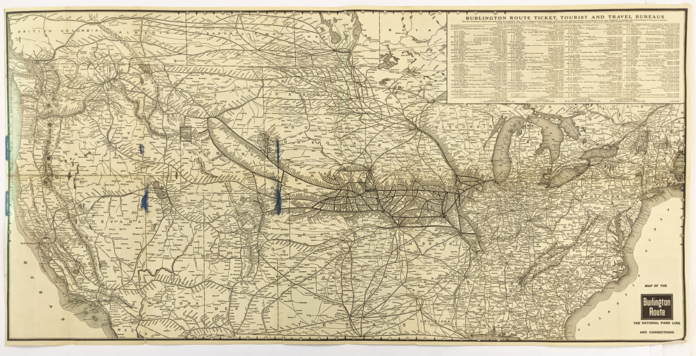 237rr: 1938 Map Of The Burlington Route. The National Park Line And Connections. Shows Colorado Rockies, Yellowstone, Glacier, California and the Pacific Northwest. **Has minor ink bleeds left side of the map. 18 5/8 x 37 in. $150 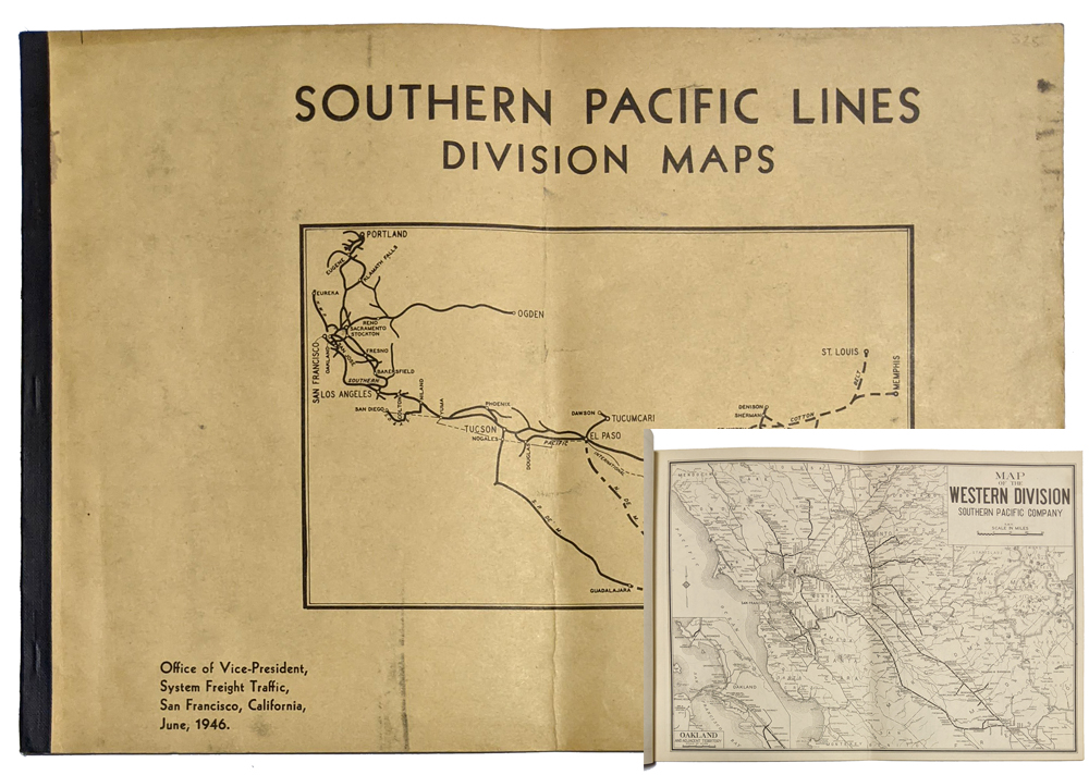 238rr: Southern Pacific 1946 Division Maps. (19) Maps - very detailed of the South Pacific R.R. Lines. Very good condition. 10 3/4 x 15 in. $325 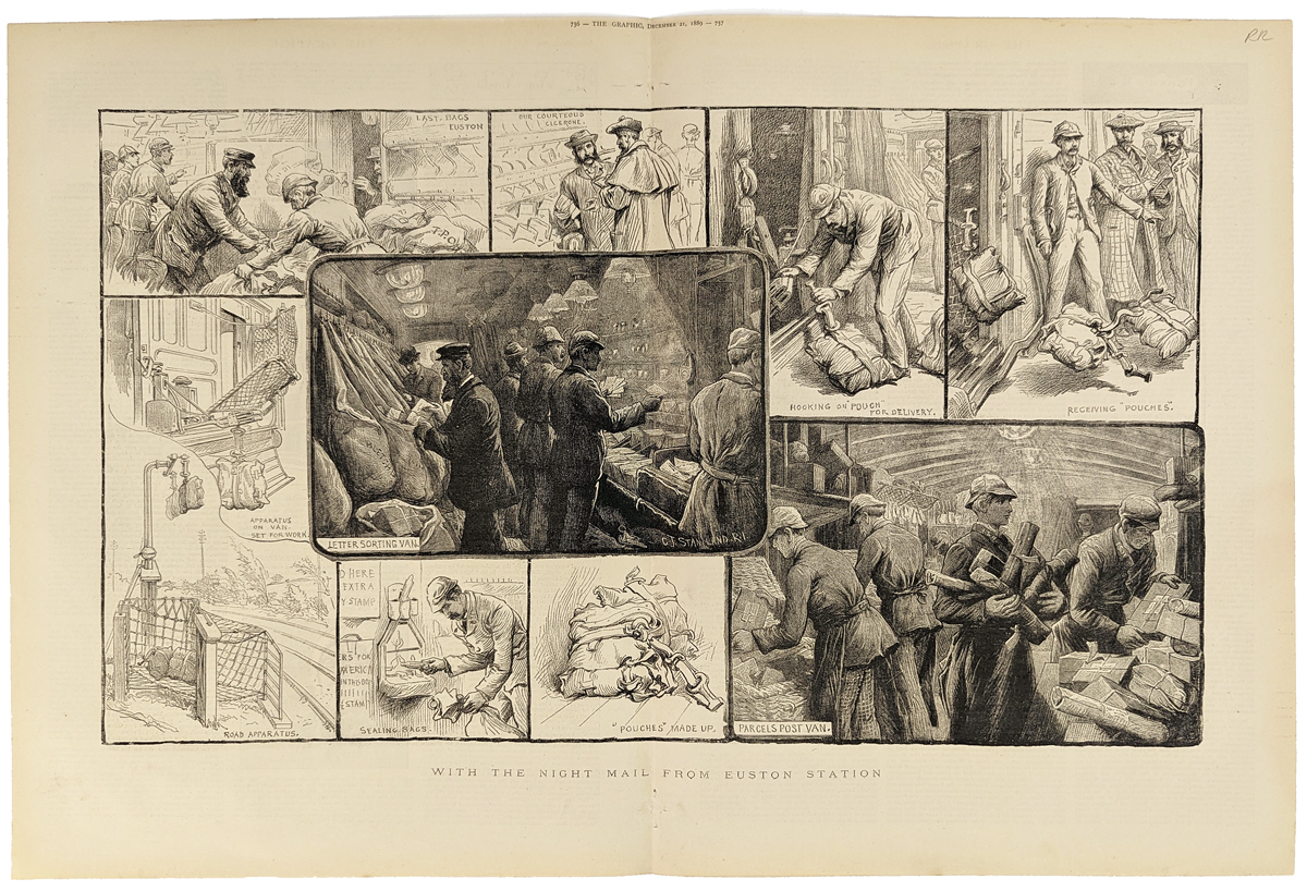 239rr: 1889 Large Railroad Mail Print. Wood engraved print shows several scenes of mail being handled on board the train. Published in The Graphic Magazine. 16 x 23 in. $80 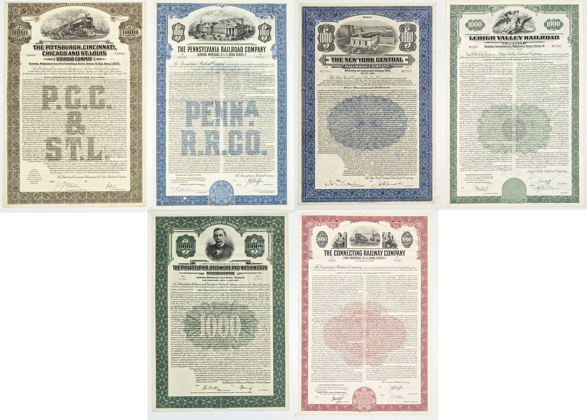 241rr: Six exquisite, engraved railroad bonds from various American railroads. Each bond is engraved on bank note paper, signed, and beautifully colored with its own unique railroad vignette. Bonds: NY Central, Vehigh Valley Pennsylvania, Pittsburg Centennial. Chicago & St Louis. Connecticut Railroad. Various sizes: 10 1/4 x 14 3/4 in. $80 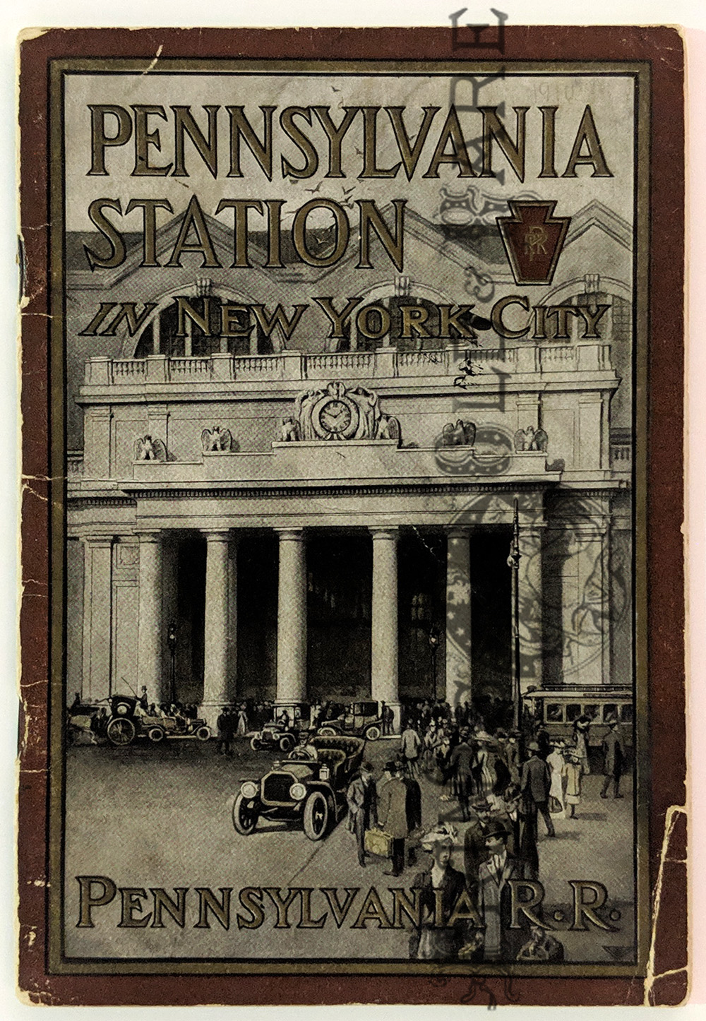 299nyc: “Pennsylvania Station in New York City.” 1910 Pamphlet published by the Pennsylvania RR. Pictorial covers, 24pp of illustrations and text including a plan. 7 ½ x 5 in. $60
|
|||||||||
| Order Form | |||||||||||
| Back to Homepage | |||||||||||