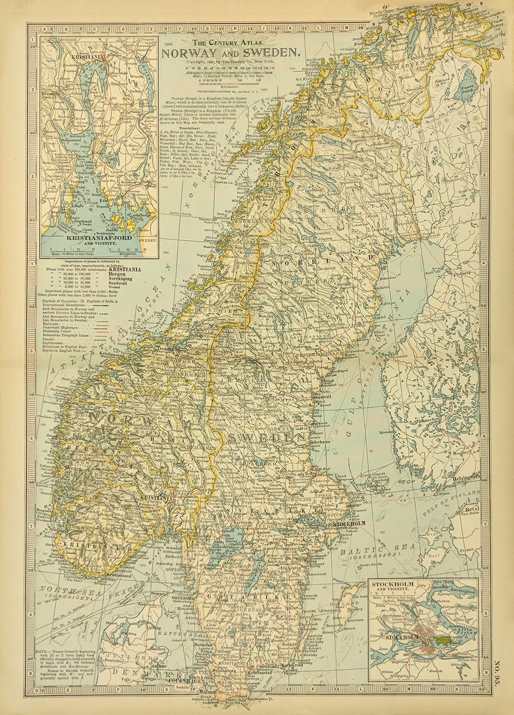
001scandanavia:
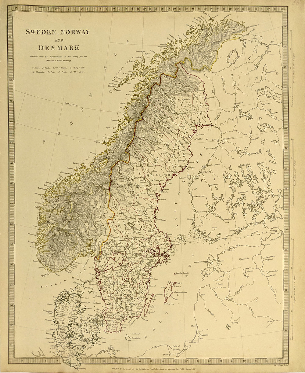
1911 Century Atlas of Norway and Sweden. Color map of Norway and Sweden
was published in the 1911 Century Atlas. It shows old geographical
details, capitals, railroad lines, submarine telegraph lines, highways,
steamship lines and elevations. Map also has two smaller inset maps of
Stockholm and Kristianiafjord and their vicinities.
12x16 in. $40
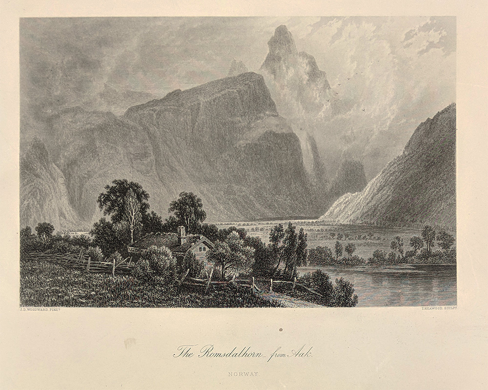
002scandanavia:
1876 View of the Romsdalhorn. Beautiful antique steel engraving
published as an illustration to a book in 1876 shows the Romsdalhorn
from Aak in Norway. 10x12 in. $40

003scandanavia:
1870 English Sketches of Norway. Lovely wood engravings published in an
1870 issue of Every Saturday, show an old mill, Landegot mountain, a
street in Bergen and a village in Saltern. Engravings accompanied by
text. 11x14 in. $30
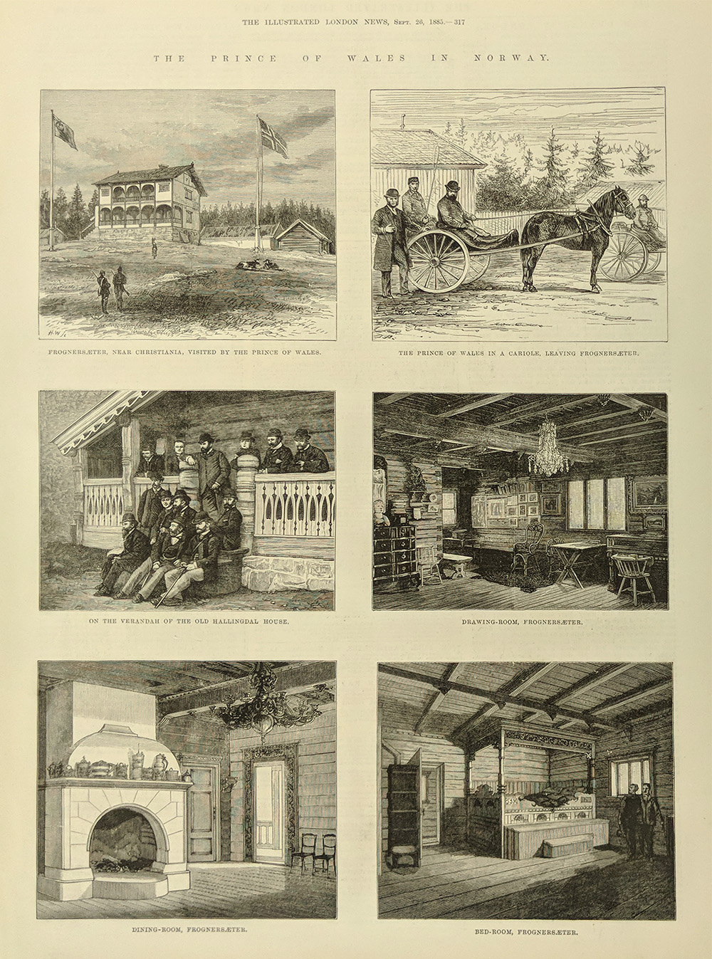
004scandanavia:
1885 Prince of Wales in Norway. Several wood engravings published in an
1885 issue of The Illustrated London News show scenes from the Prince
of Wales trip to Norway. Each engraving is accompanied by brief text.
11x16 in. $30

005scandanavia:
1856 Winter in Norway. Colored wood engraving published in an 1856
issue of The Illustrated London News shows a winter scene in Norway
from a picture by Adolphe Tidemand.
11x16 in. $40
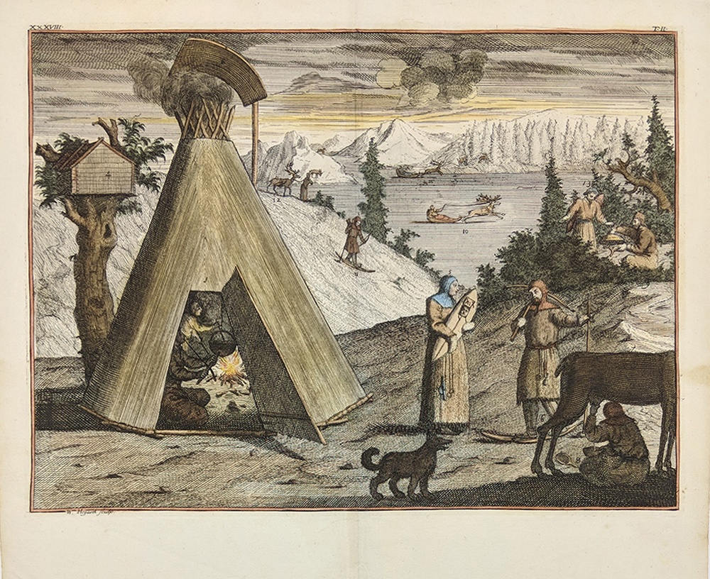
006scandanavia:
Large hand colored copper engraving printed c1750. Image shows the life
of the Laplanders in the north. Published by William Hogarth, Sculps.
Excellent Condition.
16x13 in. $250
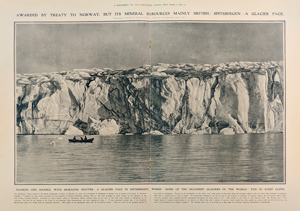
007scandanavia:
1920 Marble Glacier in Spitsbergen, Norway. Print published in a 1920
issue of The Illustrated London News shows a photograph of glaciers in
Spitsbergen, which had recently been awarded to Norway that same year.
Accompanied by text.
16x22 in. $30
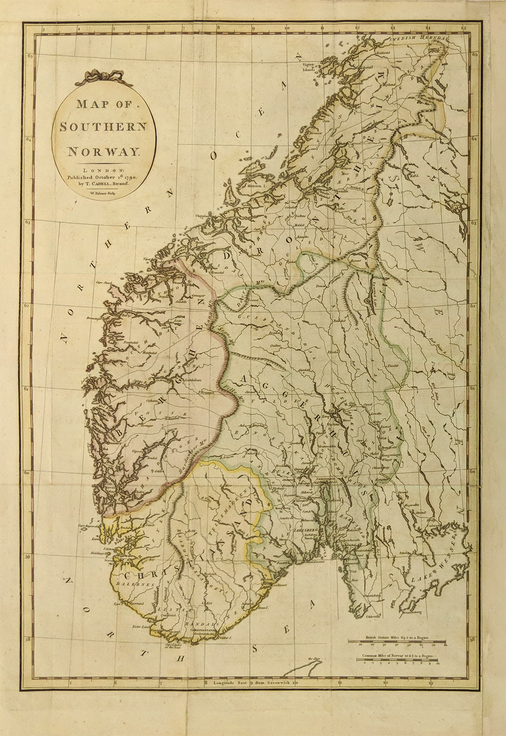
008scandanavia:
1790 Hand colored copper engraved Map mof Southern Norway. Published by
T. Cadell, in very good condition.
18 x 12-1/2 in. $90
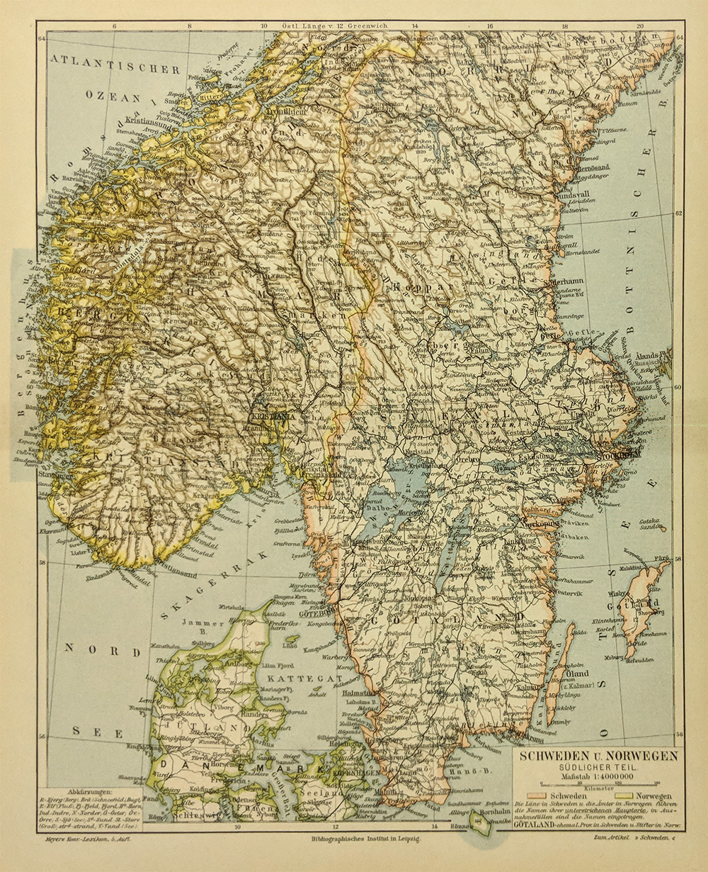
009scandanavia:
1896 Map of Sweden and Norway. Original hand-colored map published in
1896 by the Leipzig Institute shows Sweden and Norway. Map shows old
geographical details, waterways, towns and provinces.
9x12 in. $30
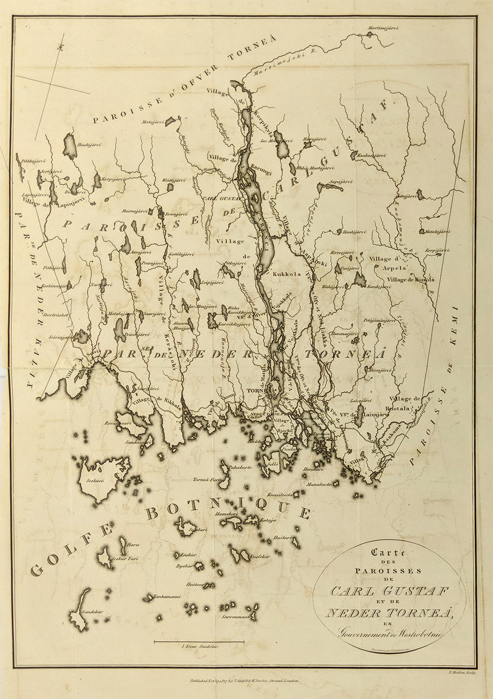
010scandanavia:
Carte des Paroisses de Carl Gustaf et de Neder Torneá. Published
November 17, 1817 by T. Cadell and W. Davies, Strand, London. Shows the
north part of the Bothnia Gulf, Land segment between Sweden and
Finland. Torniojoki now makes a frontier between Sweden and Finland. In
the 18th century when Rossia took Finlondia from Sweden, this frontier
became the frontierline between both the powers, Rusia and Sweden.
10x14 in. $75
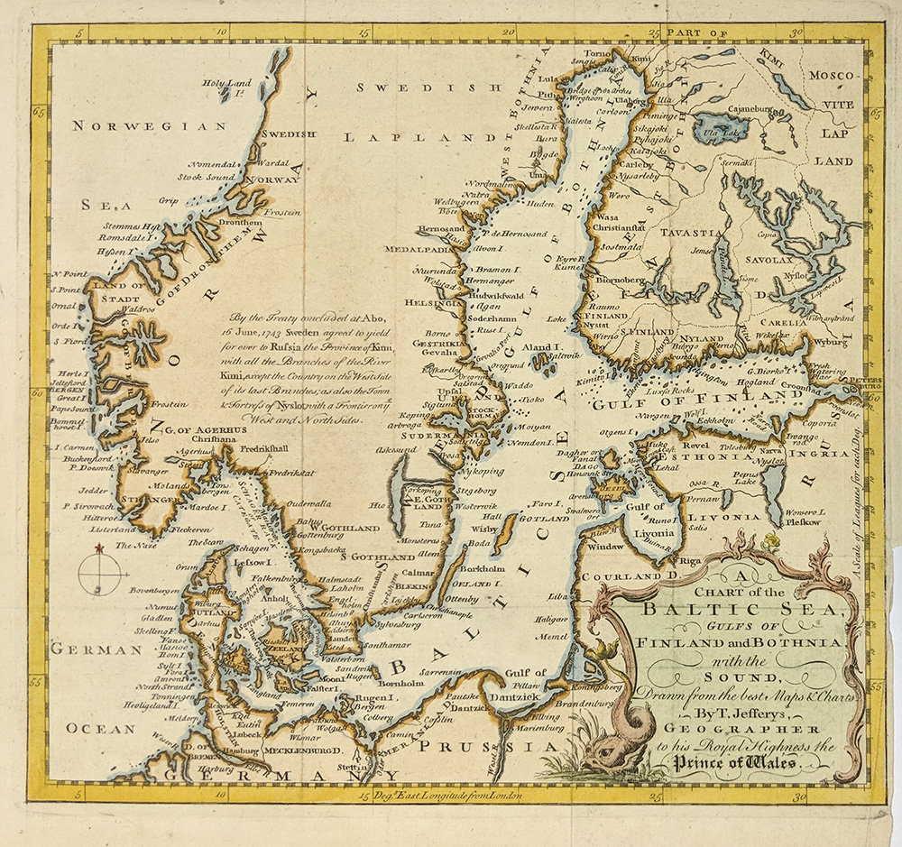
011scandanavia:
1748 A Chart of the Baltic Sea, Gulf of Finland and Bothnia with The
Sound, Drawn from the best maps and charts By T. Jefferys, Geographer
to his Royal Highness the Prince of Wales. Denmark and southern parts
of Norway, Sweden and Finland, southern coasts of Baltic Sea and Gulf
of Finland are shown.
10.5x10 in. $100
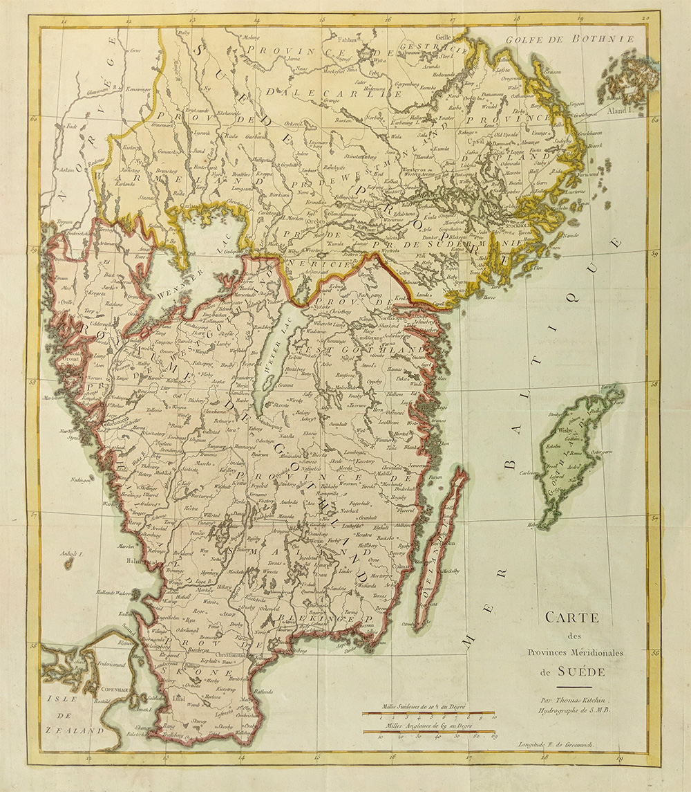
012scandanavia:
1740 Map of Southern Sweden, by Kitchin. Hand colored, engraved map of
the southern tip of Sweden, published by Thomas Kitchin in 1740. Title
is "Carte des Provinces Meridionales de Suede." Cities, towns and
geographical features are shown. Excellent condition.
17x20 in. $250

013scandanavia:
Map of Iceland. Map text in Swedish. Printed in color. 1895
11 x 9 1/2 in. $40
|
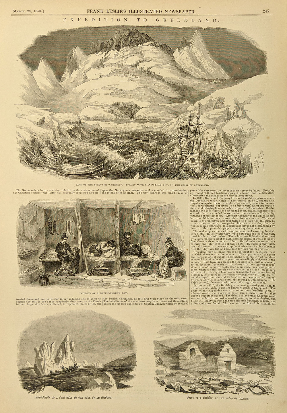
014scandanavia:
Expedition to Greenland. 5 Vignettes: Loss of Schooner Archeus,
Interior of a Hut. 1856 Wood engraving.
15 x 9 1/2 in. $40
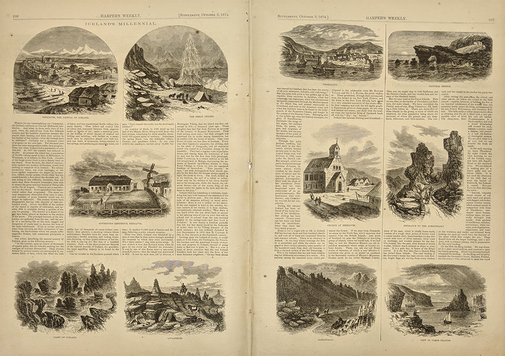 015scandanavia: 015scandanavia:
Icelands Millennial 1874 Wood engraving. 11 Vignettes of Important
cities and locations.
21 x 15 in. $60
 016scandanavia: 016scandanavia:
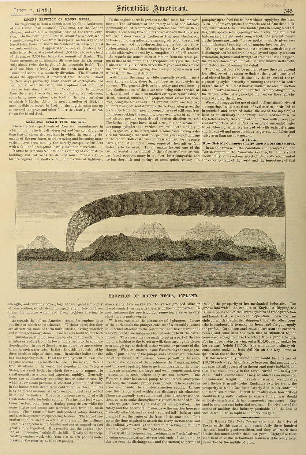
Eruption of Mount Hecla, Iceland. 1878 Wood engraving. Picture
& text is 4 1/2 x 9 in.
16 x 11 in. $30
 017scandanavia: 017scandanavia:
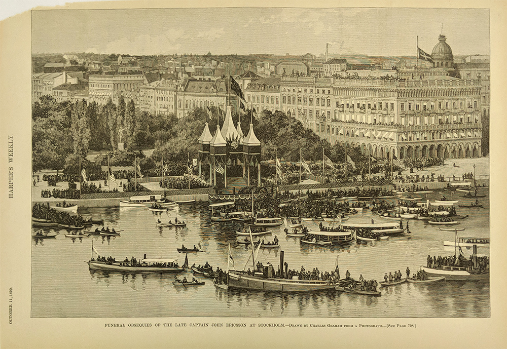
Waterfront view of Stockholm on the occasion of funeral of John
Ericsson. 1890 Wood engraving.
15 3/8 x 10 3/4 in. $40
018scandanavia:
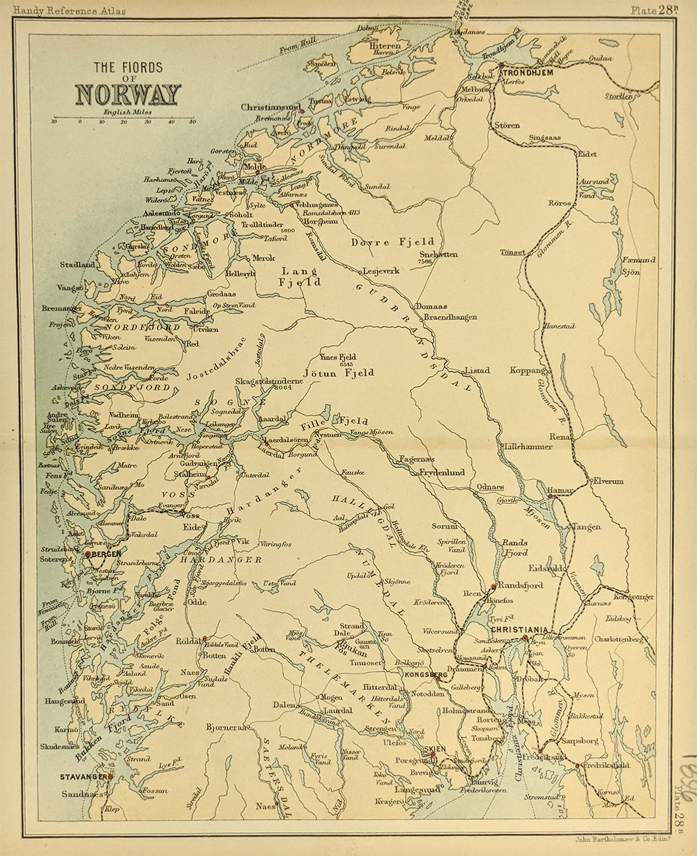
1896 Fiords of Norway Map. Close up view of the coastline. Printed in
color.
8 3/8 x 7 in. $40
019scandanavia:
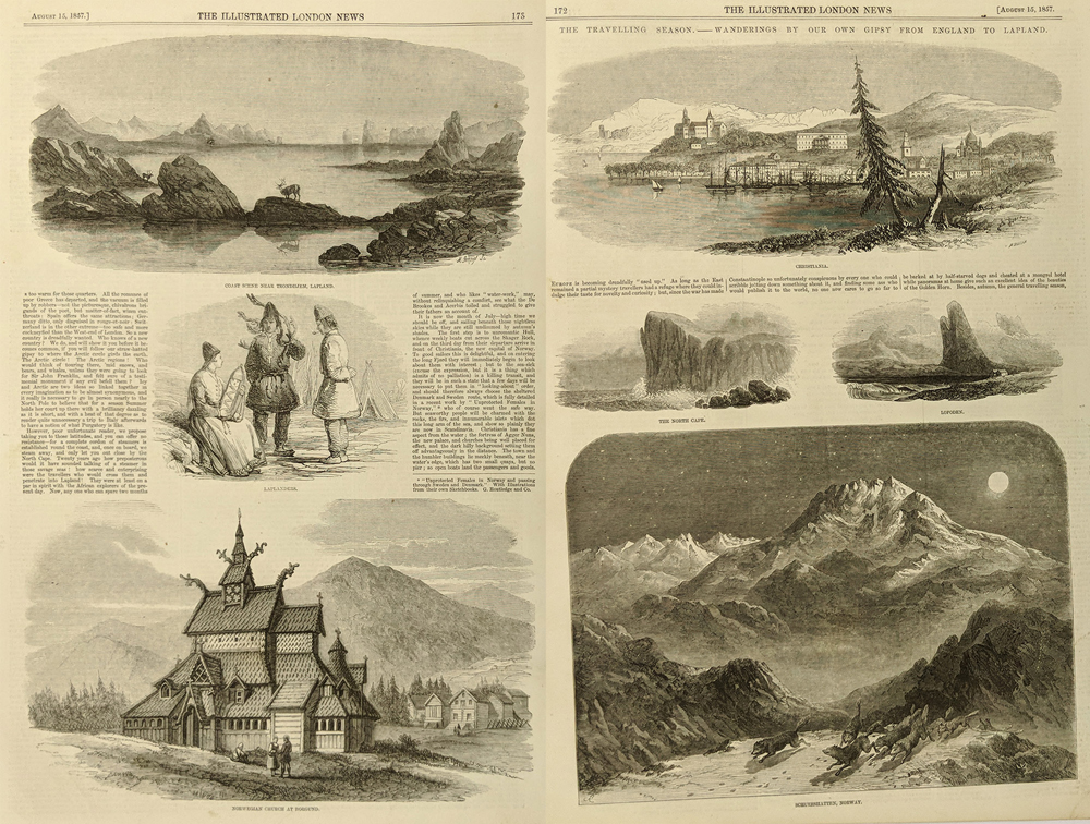
Norwegian Views - Christiania & Borgund to Lapland - 7
Vignettes. 2 Sheets together - each 15 x 10. 1857 Wood engraving.
15 x 10 in. $60

020scandanavia:
Costumes of Scandanavia (Feminine) 1920s Pochior Prints by Berth
Tricot.
14 x 9 1/2 in. $40
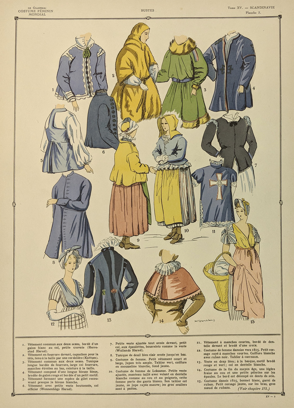
021scandanavia:
Costumes of Scandanavia (Feminine) 1920s Pochior Prints by Berth
Tricot.
14 x 9 1/2 in. $40

022scandanavia:
Costumes of Scandanavia (Feminine) 1920s Pochior Prints by Berth
Tricot.
14 x 9 1/2 in. $40

023scandanavia:
Costumes of Scandanavia (Feminine) 1920s Pochior Prints by Berth
Tricot.
14 x 9 1/2 in. $40
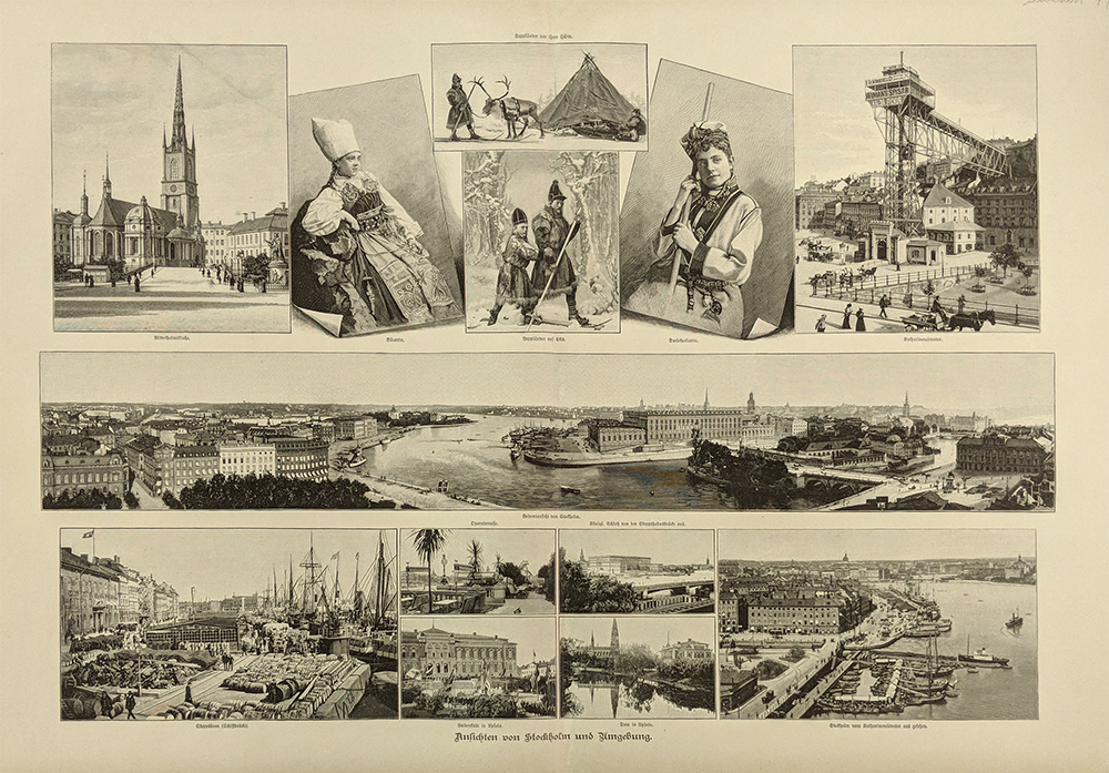
024scandanavia:
Stockholm & Umgebung. 12 Vignettes including a birdseye of
Stockholm. 1897 (German Language)
20 x 13 in. $80
025scandanavia:
Sweden, Norway, Denmark. also (Finland identified) S Duk. 1841 Water
color, Steel engraving.
15 3/4 x 12 1/2 in. $60
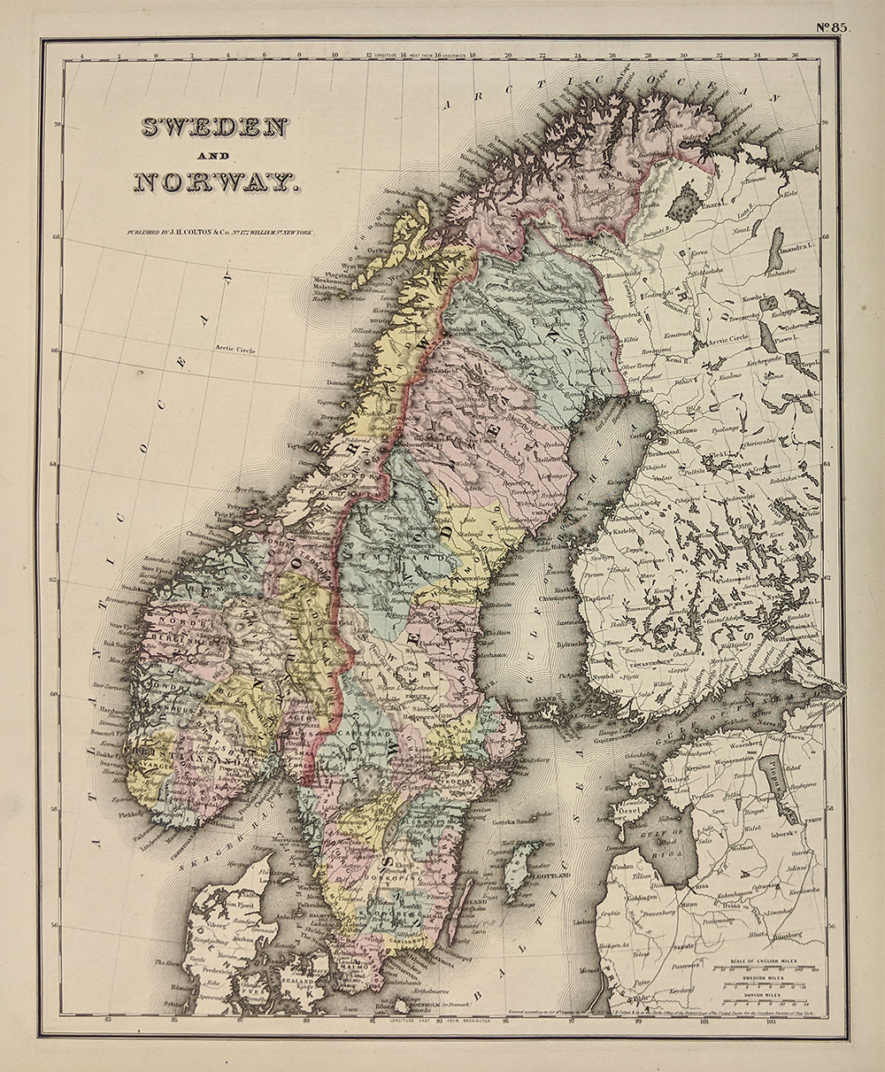
026scandanavia:
Sweden & Norway. Finland part of Russia. Fine antique map by
Colton. 1835 Water color, Steel engraving.
14 3/4 x 12 in. $40
027scandanavia:
Denmark, Sweden, Norway, and Lapland. Antique 1834 Water color, Steel
engraving map by Bradford. Fine condition.
10 x 7 3/4 in. $65
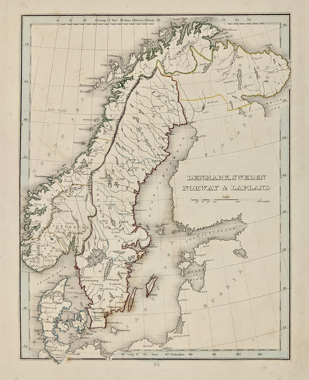
039scandanavia:
Stockholm 1952 City Map. Originally folded. Shows historical and
interesting sites.
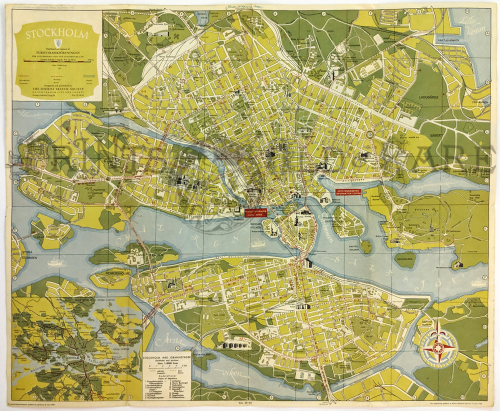
15 5/8 x 19 1/4 in. $40
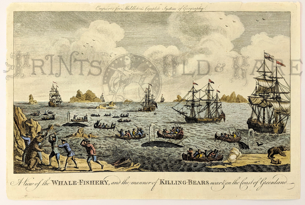 203whl: 203whl:
"A View of the Whale-Fishery, and the manner of Killing-Bears near and
on the Coast of Greenland." 1780 Hand colored, copper engraving.
Showing several ships and about a dozen longboats with men harpooning
whales. On shore, a small group of hunters are attacking a Polar Bear
and others are shooting at bears from a boat.
7 1/2 x 11 in. $150
|

040scandanavia:
Oslo City Map 1959 – Pictorial Map highlighting important locations.
Sponsored by Andresens Bank.
15 5/8 x 11 1/2 in. $30
 041scandanavia: 041scandanavia:
Norway “Sorlands-Banen” Relief map of the railroad route from Oslo to
Kristiansand to Stavanger. 1950.
19 1/2 x 12 1/8 in. $35
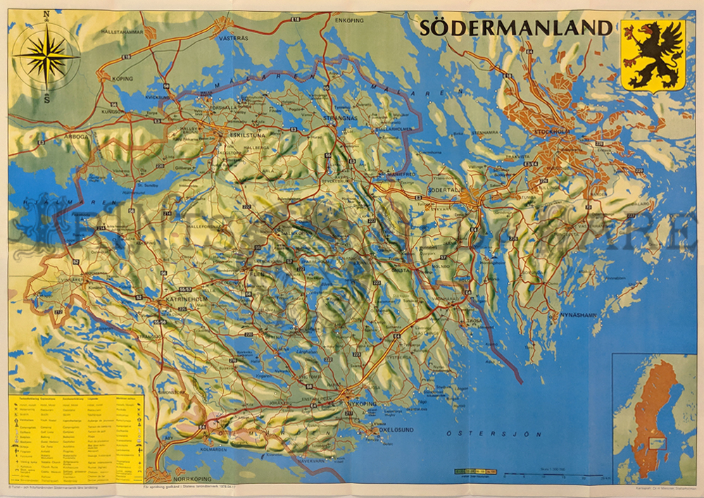 042scandanavia: 042scandanavia:
Stockholm & Vicinity (Sodermanland) 1978. Picturesque relief
map of area. Details of towns, coastlines, waterways, ferries and
points of interest.
23 5/8 x 16 3/8 in. $40
 043scandanavia: 043scandanavia:
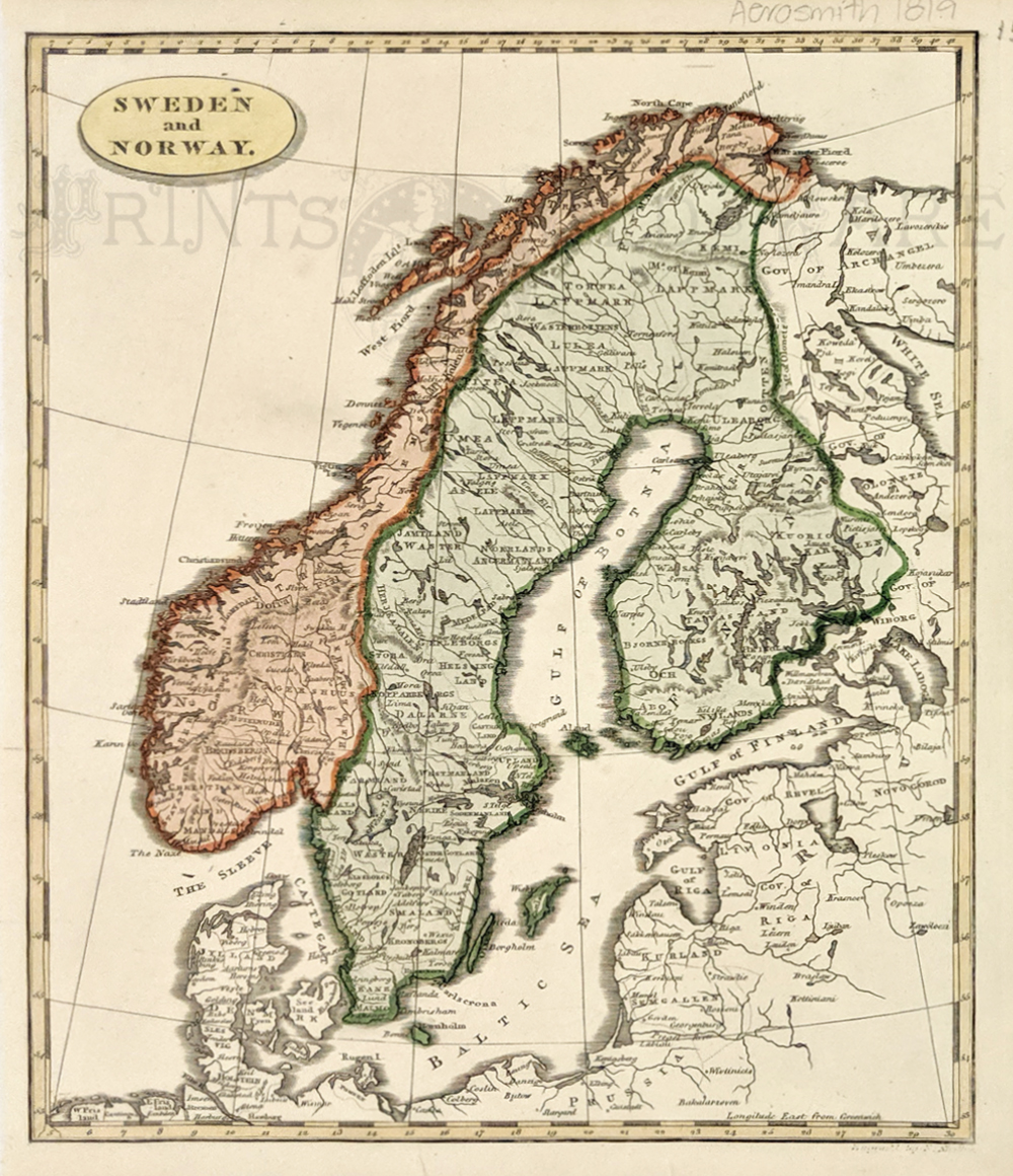
1819 Map of Sweden, Norway by Arrowsmith. This beautiful map of Sweden
and Norway was published in 1819 by Aaron Arrowsmith. Geographical
features, cities, towns and departments within each country are all
sown in detail.
9 x 11 in. $60
 044scandanavia: 044scandanavia:
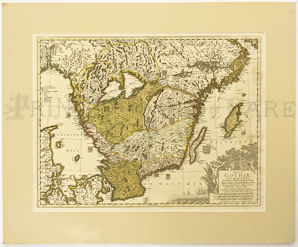
Sweden: Regni Gothiae 1680 by F. De Witt. Hand colored copper engraving
detailed map showing Islands, lakes, and rivers. Cartouche.
Mat size: 23 x 27 in. / Image: 16 3/8 x 20 ¾ in. $350
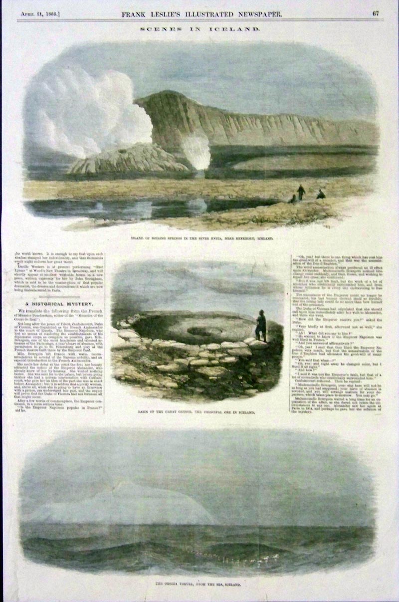
045scandanavia: 1866
Hand colored wood engraving from Frank Leslie's Illustrated Newspaper
showing, "Scenes in Iceland" with views of boiling springs and great
geysers.
15-1/2 x 10 in. $50

028scandanavia:
Iceland Antique Map c1890. Detailed descriptions in Swedish. Water
color, Lithograph.
13 1/8 x 9 5/8 in. $40
029scandanavia:
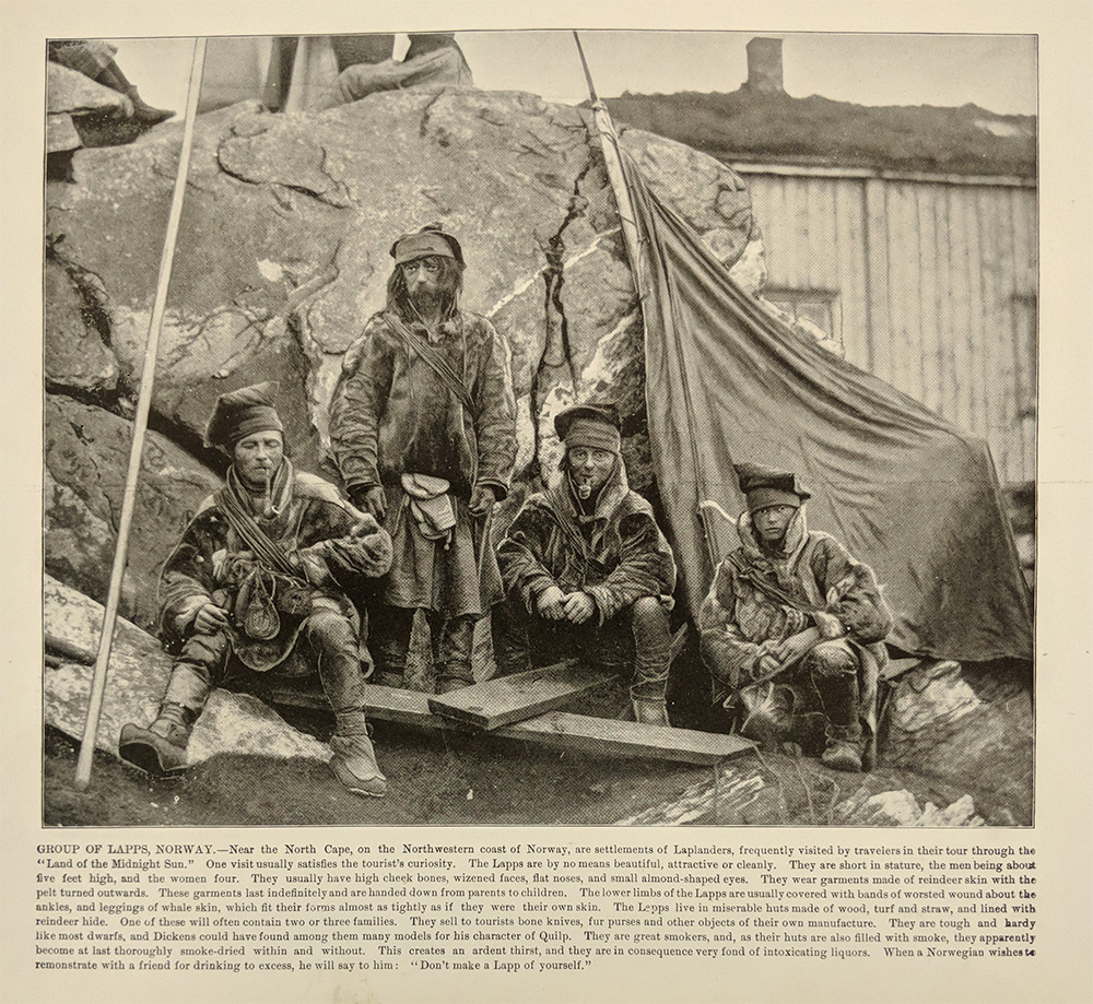
Group of Lapps, Norway. Near North Cape c1900 Half tone photo.
9 1/2 x 10 1/4 in. $35
030scandanavia:
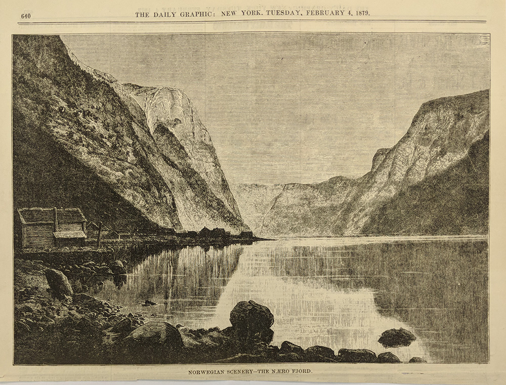
The Naero Fjord - Norway. 1879 Wood engraving.
10 x 12 3/4 in. $35
031scandanavia:
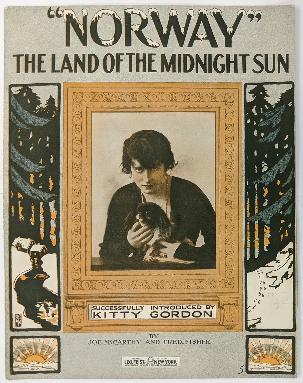
Norway: The Land of the Midnight Sun - Original song sheet 1915.
13 3/4 x 10 1/2 in. $30
032scandanavia:
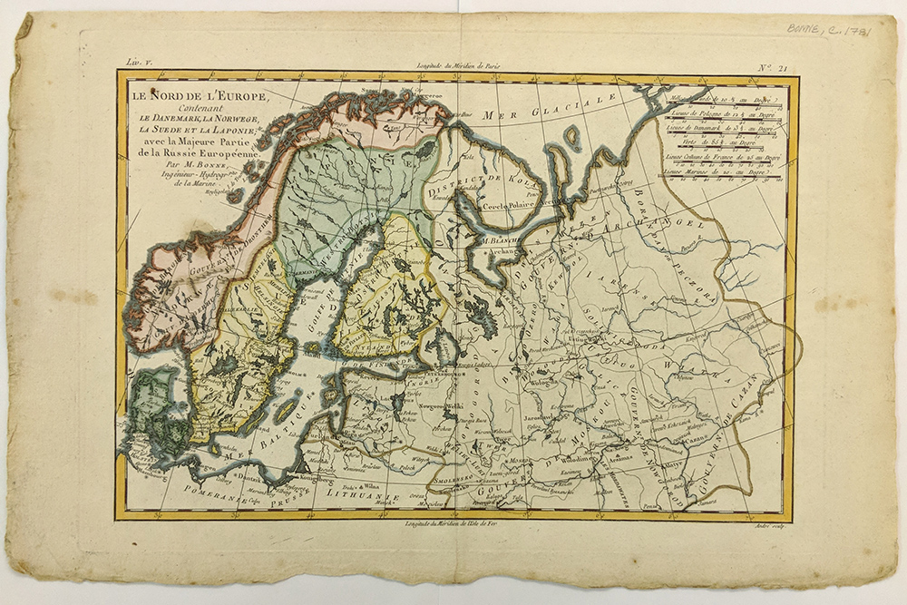
Le Nord de L'Europe 1781 by Bonne. Denmark, Norway, Sweden, Laponie,
and Russia. Water color, Copper engraving.
12 1/2 x 8 1/2 in. $150
033scandanavia:
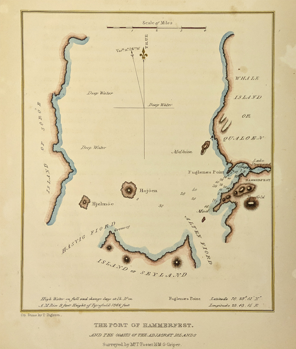
Port of Hammerfest
& the Coasts of the Adjacent Islands (Whale Island, Sores and
Seyland) Norway. Coast Pilot. c1830. Contains tidal info. Water color,
Copper engraving.
8 x 6 in. $50
034scandanavia:
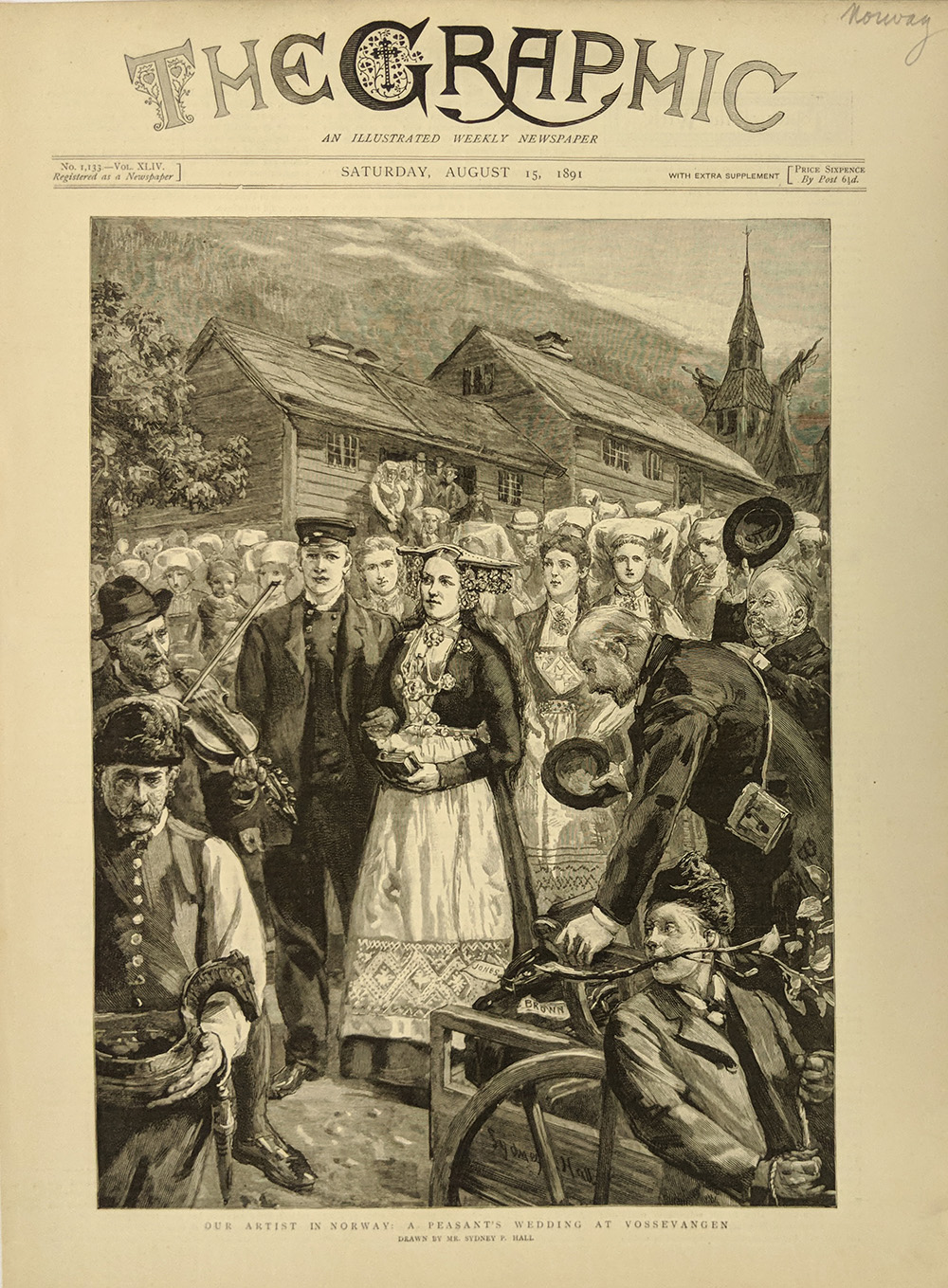
Peasants Wedding - Norway. Original Wood engraved cover of "The
Graphic" 1891.
15 x 9 in. $40
035scandanavia:
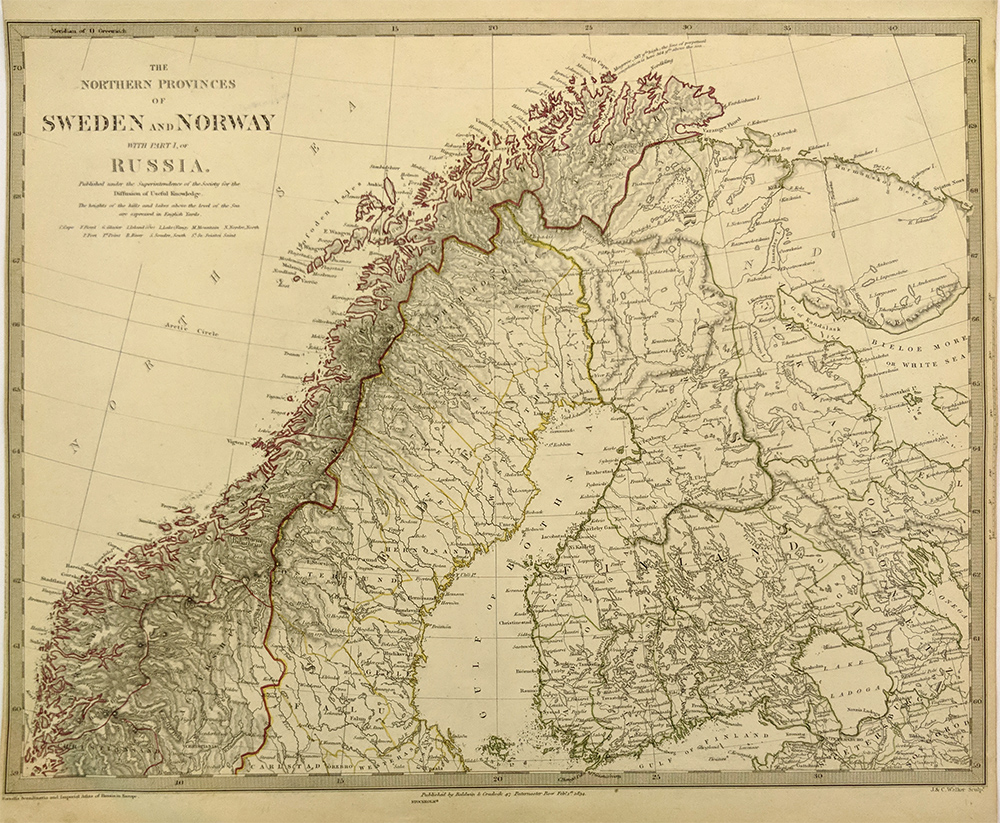
The Northern Proveness
of Sweden and Norway with parts of Russia (Finland being a Grand
Duchy). Imperial Atlas. J & C Walker. 1834 Steel engraving
outlined
in color.
15 1/2 x 12 1/2 in. $80

036scandanavia:
Finland 1920 Vintage Map by Cram. Printed in color.
10 x 13 1/2 in. $75

037scandanavia:
OST-Europe. Norway,
Sweden, The Grand Duchy of Finland apart of Russia, Gotha, Justus,
Perthes. 1872 Steel engraving, outlined in color. Insets of Christiana
& Stockholm.
16 x 13 1/2 in. $45
 038scandanavia: 038scandanavia:
Scandanavia
- Norway, Sweden, and today's Finland while still apart of Sweden -
just prior to becoming part of Russia. c1809 Cadell & Davies -
from
Pinkerton's Atlas. Water color, Wood engraving.
20 x 27 in. $90
|
|