 
|
|||||||||||
This is a small selection of our inventory of antique South America prints and maps. Additional inventory is available. Contact us with your request. 1-800-879-6277
|
|||||||||||
|---|---|---|---|---|---|---|---|---|---|---|---|
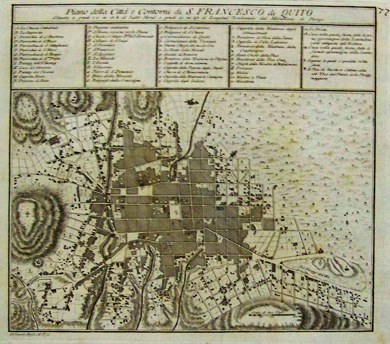 000sam: Piano della Citta e Contorni d S. Fancesco di Quito Ecuador, Rofoi, South America, 1763 - A wonderful black and white engraved map with extremely detailed legend at top of the town plan and inhabitants, churches and various chapels such as Cappelle Madonna. This town plan of Quito Ecuador identifies significant churches, parishes, monastic establishments, and government and municipal buildings with a lettered and numbered in the key at top. A cross on the map at left pinpoints El Panecillo, a hill of volcanic origin, and current site of the city's iconic Madonna of Quito monument. From the Gazzettiere Atlante dell' Americano, engraved by Rofoi, M. V. Condition: Very good, wide margins with marginal soiling and light toning along centerfold, some small brown foxing marks. size 11.5 x 10.5 image. $300 
001sam: Falkland Islands & Patagonia Tallis and Rapkin 1849 - Two highly decorative and detailed mid-19th century map of the Falkland Islands and Patagonia, which was drawn and engraved by J. Rapkin (vignettes by H. Winkles & W. Lacey) and published in John Tallis's Illustrated Atlas (London & New York: John Tallis & co, c.1851). The Illustrated Atlas, published from 1849 to 1853, was the last decorative world atlas. This map was typical of the many fine ones which appeared in this work with its decorative border and attractive vignettes. Illustrated are views of Penguins, Jason Islands; Eddystone Rock; Eagles; Fugeans; Christmas Sound. Condition: Good, folded with normal age coloring. size (two) 9.5 x 6 images on one page. $100 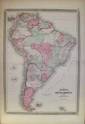 002sam: 1863 Johnson Map of South America. Original hand colored antique map, with attractive border. Large scale, very interesting map. 17-1/2x27 in. $100 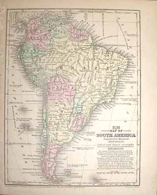 003sam: 1839 Rare South America Map. Early hand colored antique map by Mitchell. 9x11-1/2 in. $100  004sam: 1860 South America Map. Beautiful hand colored Mitchell map. Genuine antique, has inset of Isthmus of Panama. 12-1/2x15 in. $80 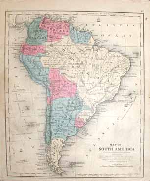 005sam: 1847 Cady & Burgess Map of South America. Very interesting hand colored antique map of South America. 9x11-1/2 in. $80  006sam: 1877 South America Map. Lightly hand colored antique map. Inset of Isthmus of Panama. 10x11-1/2 in. $60 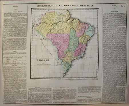 008sam: 1821 Carey & Lea Map of Brazil. Very old hand colored antique map. Includes text with geographical, statistical, and historical information. Large scale, very nice. 24x17 in. $300 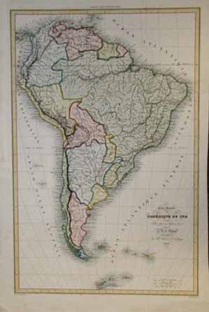 011sam: 1836 South America Map. Very attractive hand colored old French antique map of the South American continent. All text in French. Rare. 14x21 in. $250 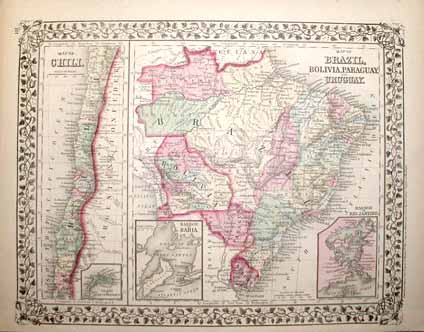 014sam: 1875 Map of Brazil, Bolivia, Paraguay, Uruguay & Chile. Excellent hand colored Mitchell map. Genuine antique. Insets of Bahia, Juan Fernandez and Rio Janeiro. 15-1/2x12-1/2 in. $60 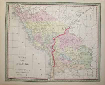 015sam: 1850 Peru and Bolivia Map. Antique hand colored Cowperthwait map. Very nice looking with attractive border. 17x13-1/2 in. $120 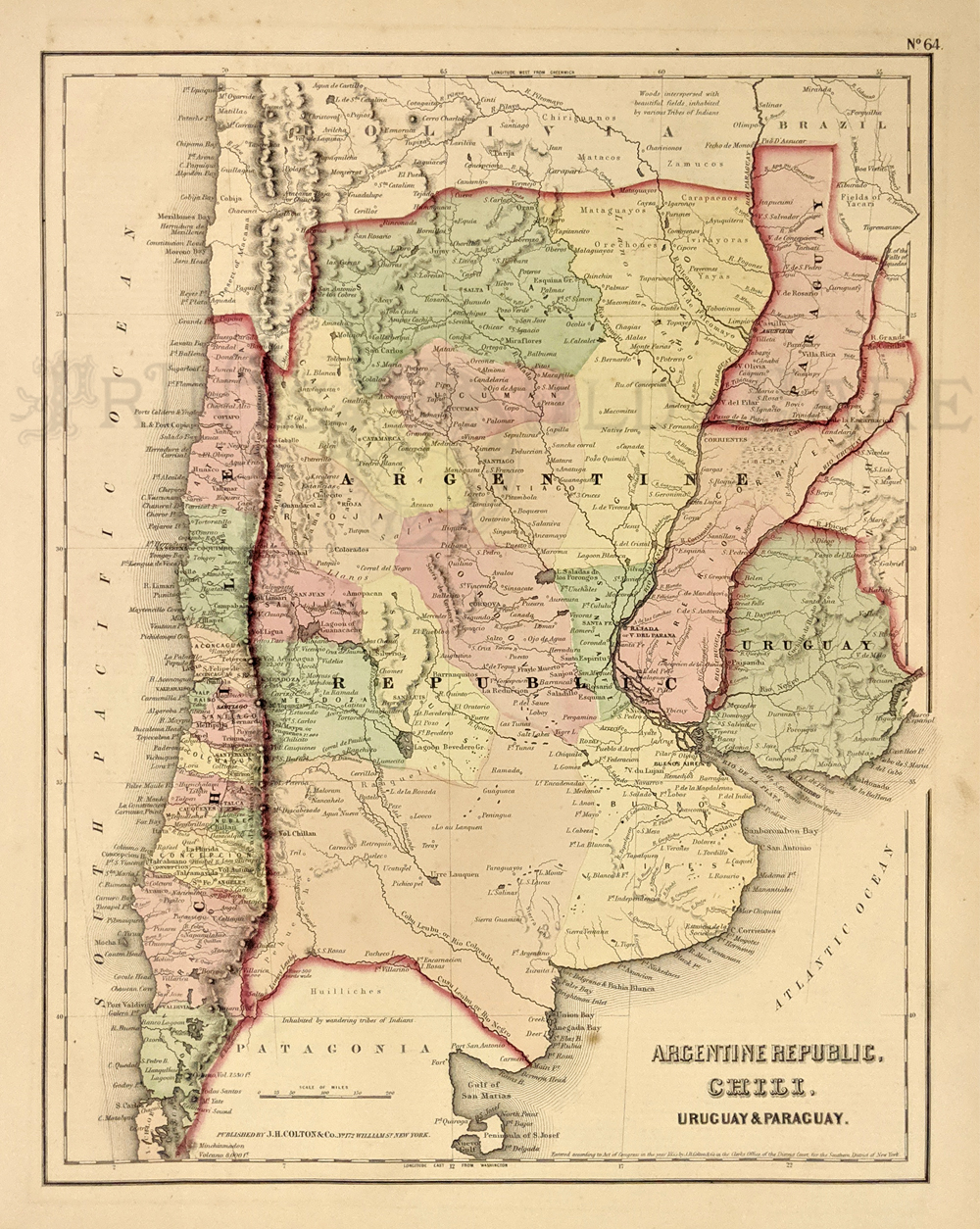 034arg: Argentine Republic, Chili, Uruguay and Paraguay. 1955 Colton. Detailed map of the region showing various cities, towns, forts, rivers, rapids, mountain passes, fords, and an assortment of additional topographical details. Hand colored, lithograph. 14 x 17 in. $60 |
224nam: North and South America, Becker and Patentees 1850 - An unusual small, omnigraph engraved map of North and South America, by Francis Paul Becker and Company, Patentees circa 1850 for a small atlas. Contemporary outline color, of each continent, with details of Indians and some countries, no California. Condition: Good, this map was published with narrow borders particularly on the left side, some light foxing on image and browning on margin edges. size 8.5 x 9.5 image $90 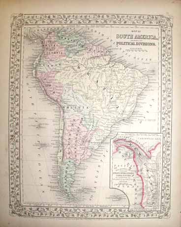 016sam 1867 Map of South America. Attractive hand colored Mitchell map, genuine antique. Inset of Isthmus of Panama region. 12x15 in. $80  018sam: 1821 Map of South America. Authentic original watercolored engraving. This beautiful map of South America was drawn by E. Paguenaud, and published in Lavoisne's Historical Atlas of 1821. The map shows the political divisions of the continent as they looked shortly after independence (quite different than they are today). On either side of the map image there is text describing the history, geography and populations of all the major countries. 18" x 21" $200 SOLD 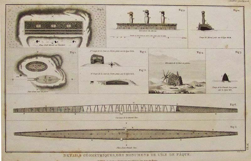 020sam: 1798 Copper engravings of Easter Island, off the coast of Chile titled, "Details Geometriques, Des Monumens De L'ile De Paque, from Voyages of La Perouse." Published as the Act directs by G.G. & J. Robinson, Paternoster Row, London. 16-1/2 x 10-1/2 in. $295 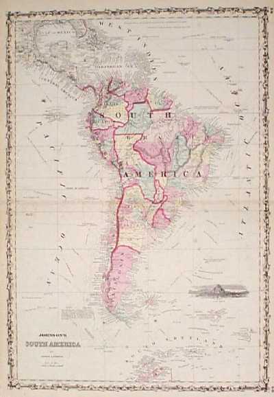 100sam: 1862 Johnson Map of South America. Hand colored, engraved map of the South American continent, from the 1862 edition of Johnson's Family Atlas. Major cities are shown throughout the continent, as well as in the Caribbean basin to the north. In the oceans, routes of famous explorers are traced with dotted lines. A small inset image of Cape Horn is in the lower right corner. The entire map image is surrounded by a decorative border. 18x26 in. $100 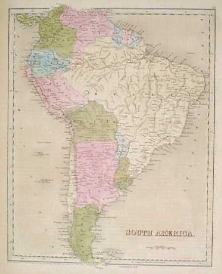 101sam: 1838 Bradford Map of South America. Fascinating map, with original hand coloring, from T.G. Bradford's famous world atlas of 1838. This map is from the 1846 printing of the atlas, and the phrase "corrected to 1846" appears below the bottom border. Each country on the continent is colored separately. Cities and geographical features are shown as well. 13x17 in. $200 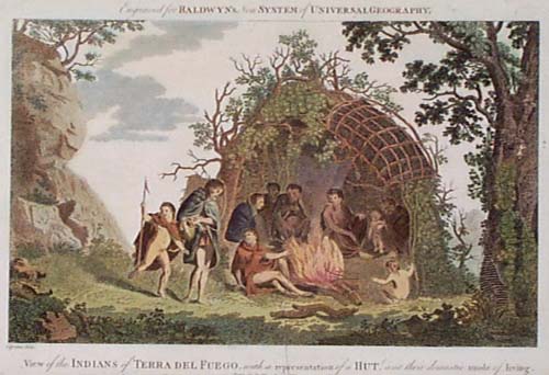 103sam: 1794 Tierra del Fuego South America Indians. Hand colored copper engraving from the 1794 edition of Baldwyn's New System of Geography, titled "View of the Indians of Terra Del Fuego, with a Representation of a Hut, and their Domestic Mode of Living." Shows a native family inside their hut, gathered around a fire. 9x15 in. $125 SOLD 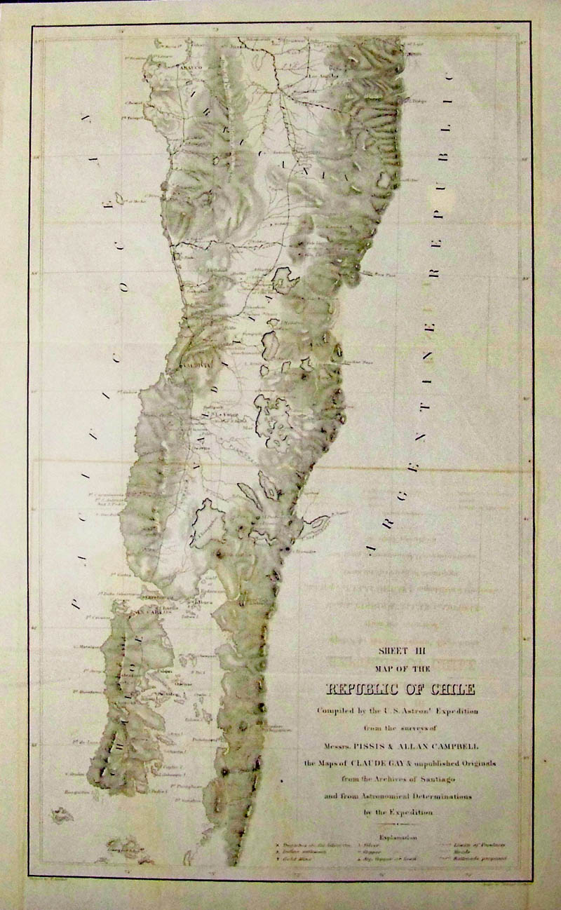 108sam: Republic of Chile, Prepared by U. S. Astron Expedition Surveys of Messrs. Pissis and Allan Campbell Sheet III. - Compiled by the U.S. Astron(mica)l Expedition from the surveys of Messrs. Pissis & Allan Campbell, the Maps of Claude Gay & unpublished Originals from the Archives of Santiago and from Astronomical Determinations by the Expedition. The expedition to the Southern Hemisphere took place from 1849 to 1852. It was published in Washington D.C. in 1855. The maps were drawn by F. Herbst and engraved by Selmar Siebert. The Key shows Copper, gold and silver resources and mines as well as provincial border lines, roads railroads The maps of Chile from latitude 24 to latitude 44 were published on three sheets. Sheet 1 from "La Chimba" to ""Serena" Sheet 2 from "Tongoy" to "Concepción" Sheet 3 from north of "Arauco" to the archipelago "Islas Guaitecas". Condition: Very Good with light transference from another sheet visible inside image otherwise good, wide margin. size: 9.5 x 17 image. $375 Check for availability  123rare: CHILE. c.1773 Nicolaus Bellin Plan de la Ville de Sant-Jago, Chile. Rare plat map of Santiago, Chile. Copperplate engraving on handmade paper with modern coloring. 11 1/2 x8" plus margins in excellent condition. $275. 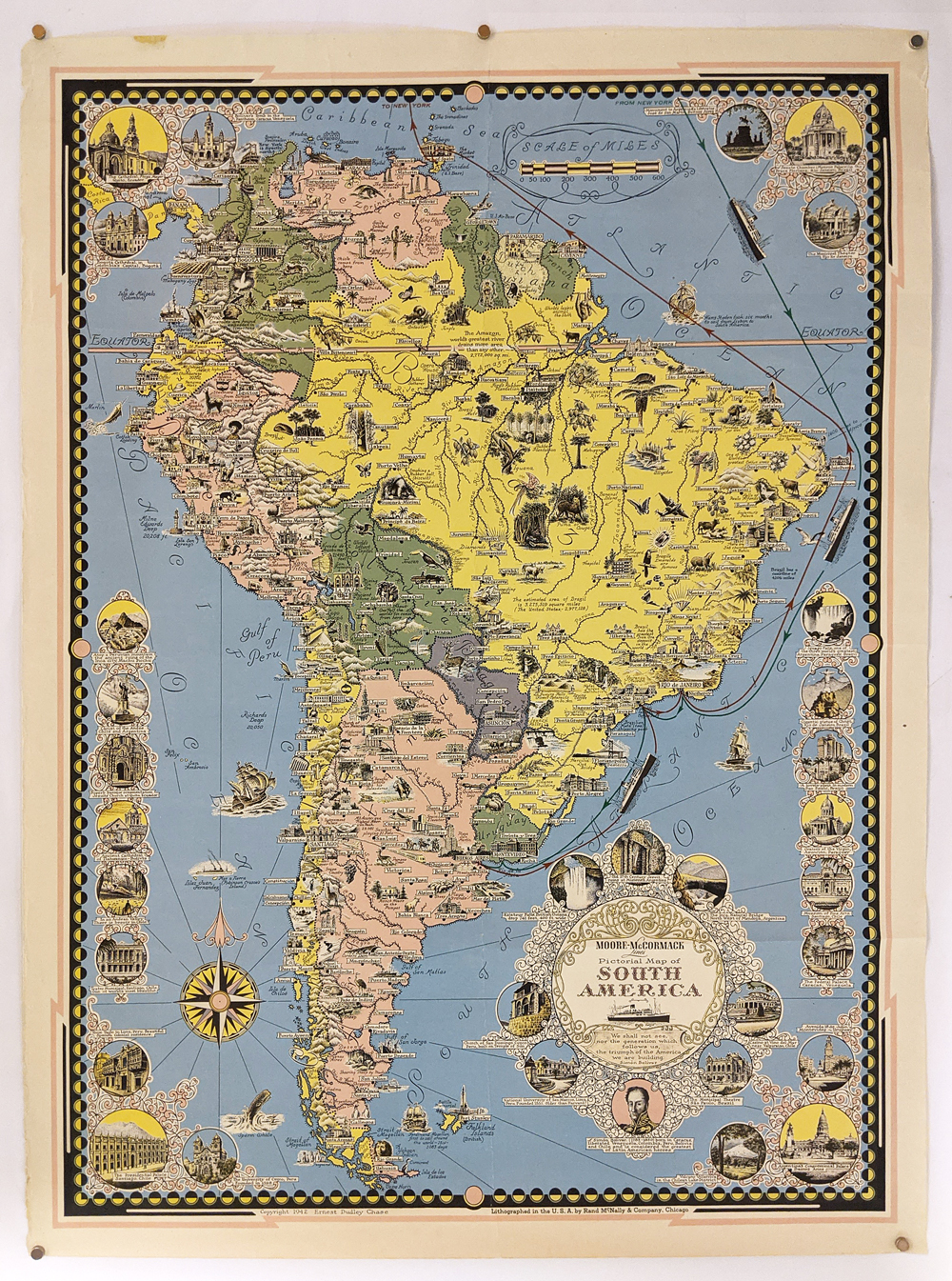 018pictorialmaps: South America 1942. Pictorial Map by Ernest Dudley Chase. Published by Rand McNally, it features a decorative border, detailed cartouche and compass nose and points of interest. Fine condition. 20 ½ x 27 ½ in. $250 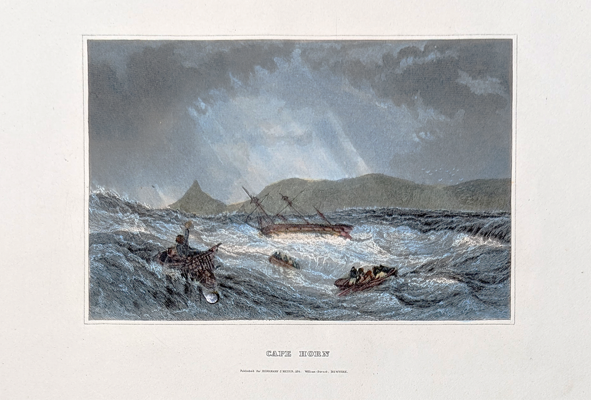 202SouthAmerica: Cape Horn c.1852. Dramatic views of ship floundering off coast. Hand colored, steel engraving. 10 1/4 x 7 1/8" in. $75  203SouthAmerica: Lima. City View. 1841. Hand colored, steel engraving. 10 1/4 x 7 1/8" in. $70  204SouthAmerica: Trerra del Fuego - Chile. 1778 Captain Cook. Hand colored, copper engraving from Middleton's Geography. 7 x 11" in. $90 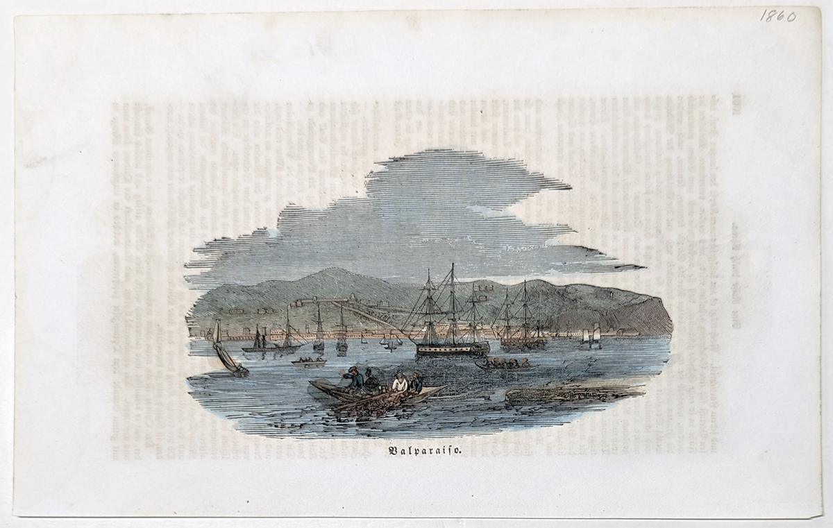 205SouthAmerica: Valpariso, Chile 1850. City View. Hand colored, wood engraving. 4 1/2 x 6 1/2" in. $40 |
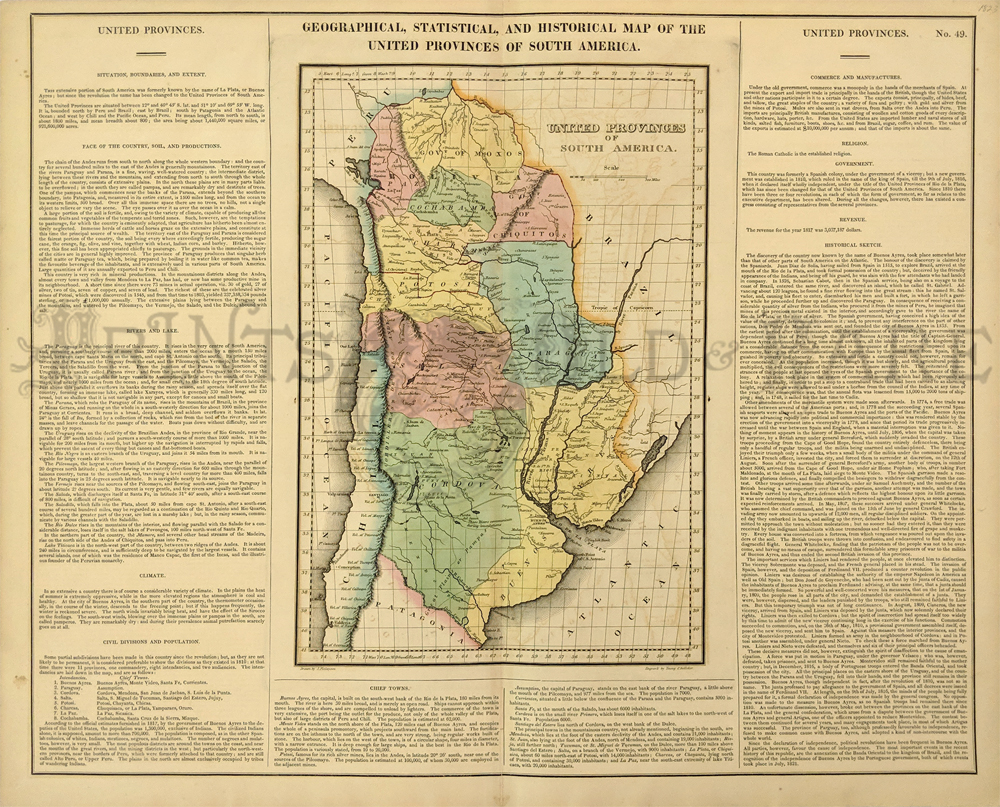 110sam: Geographical, Historical, and Statistical Map of the United Provinces of South America. 1823 Carey & Lea. Showing details on the country, its soil, climate, history, populations, city information, government and a host of other historical and political details. Hand colored. 22 x 17 1/2 in. $150 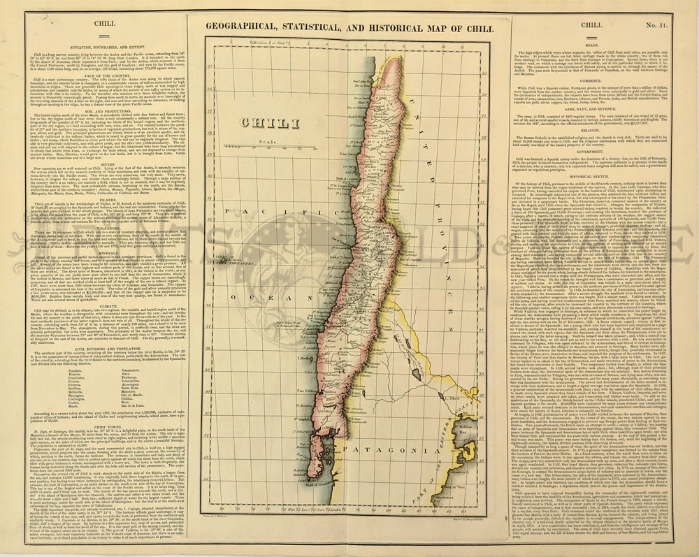 111sam: Geographical, Historical, and Statistical Map of the United Provinces of Chili. 1823 Carey & Lea. Showing details on the country, its soil, climate, history, populations, city information, government and a host of other historical and political details. Hand colored. 22 x 17 1/2 in. $150 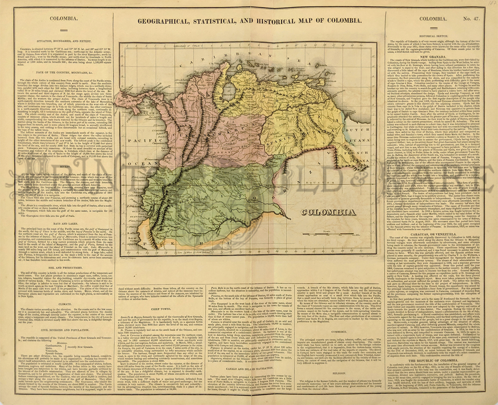 112sam: Geographical, Historical, and Statistical Map of the United Provinces of Colombia. 1823 Carey & Lea. Showing details on the country, its soil, climate, history, populations, city information, government and a host of other historical and political details. Hand colored. 22 x 17 1/2 in. $150 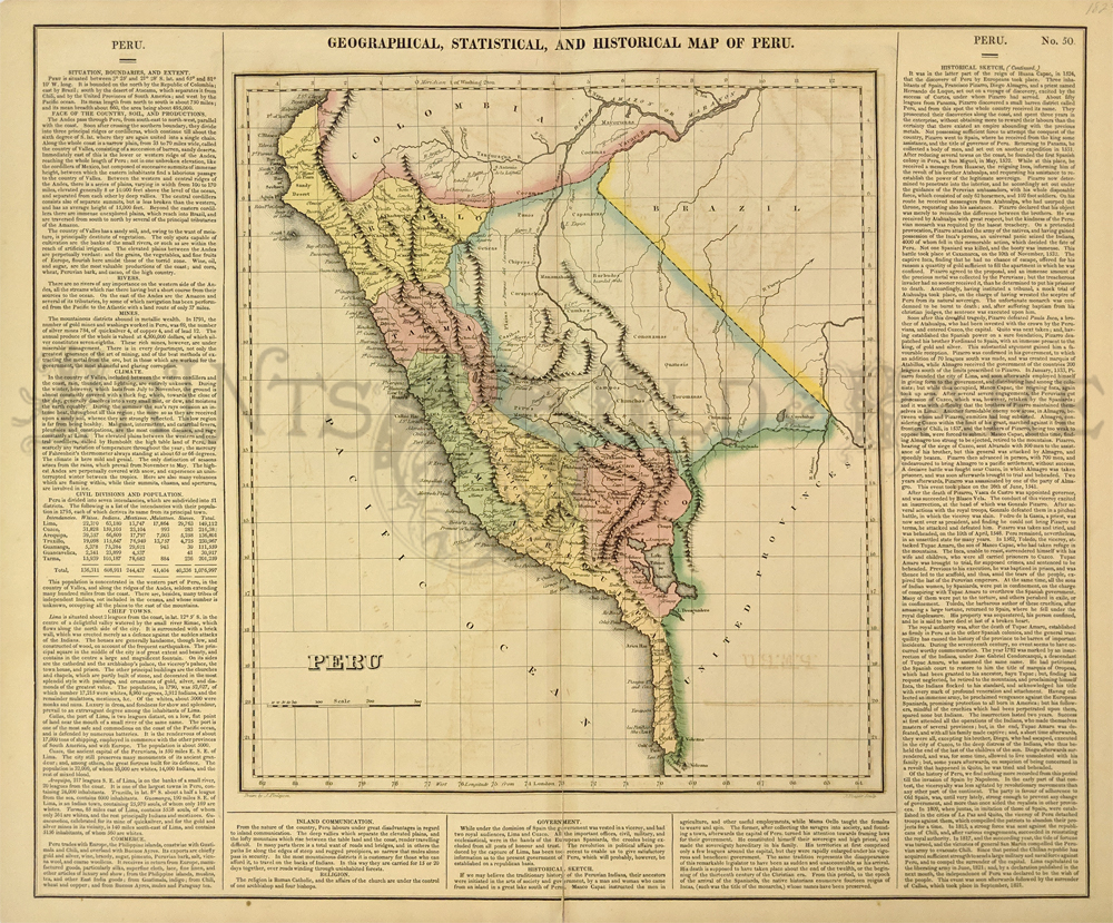 113sam: Geographical, Historical, and Statistical Map of the United Provinces of Peru. 1823 Carey & Lea. Showing details on the country, its soil, climate, history, populations, city information, government and a host of other historical and political details. Hand colored. 22 x 17 1/2 in. $150 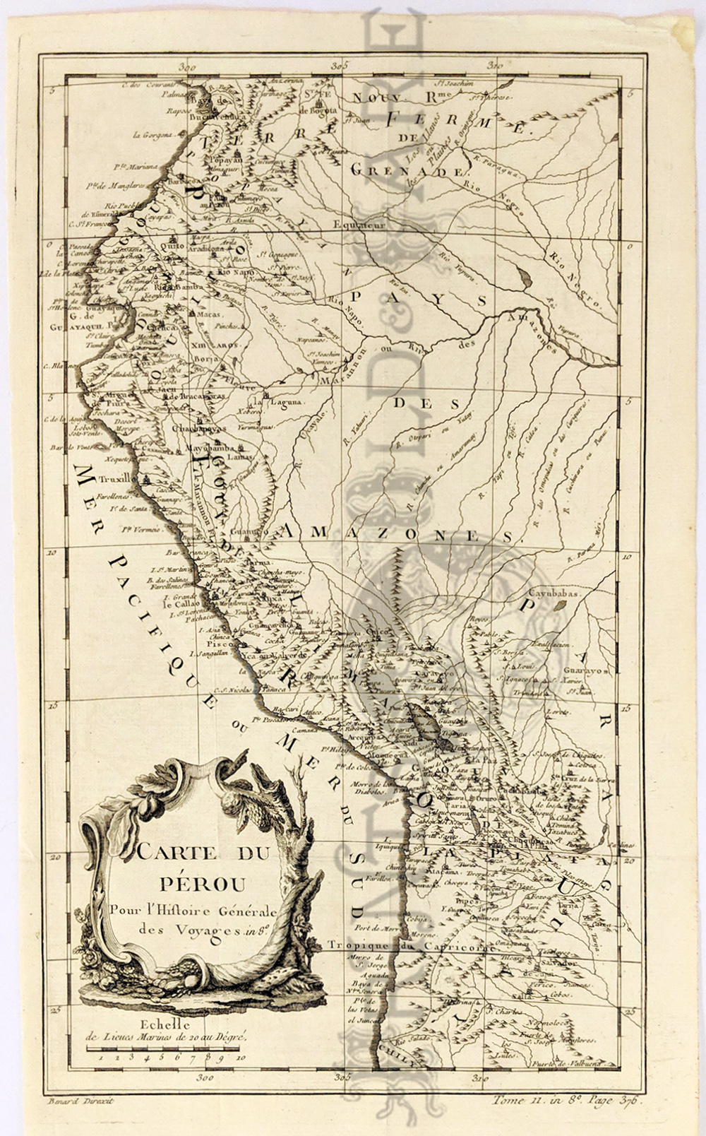 114sam: 1758 Carte du Pérou. Pour L’Histoire Generale des Voyages in 8º by Bellin. Showing the coastline of Peru and Ecuador with many historic places. Copperplate engraved with a decorative title. Hand colored. 15 x 9 in. $150 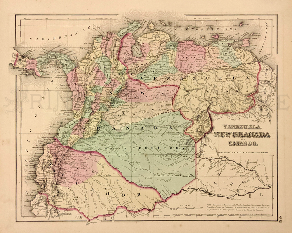 115sam: Venezuela, New Granada and Ecuador. 1855 Colton. Detailing the islands, cities, towns, rivers, and Isthmus of Panama. Hand colored, lithograph. Hand colored. 14 x 17 in. $25 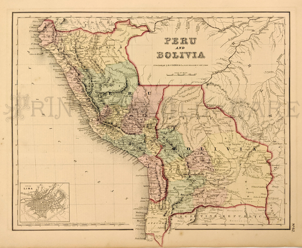 116sam: Peru and Bolivia. 1855 Colton. Showing the cities, towns, forts, rivers, rapids and additional topographical details. Lower left shows a small inset of the city of Lima, Peru. Hand colored, lithograph. 14 x 17 in. $25 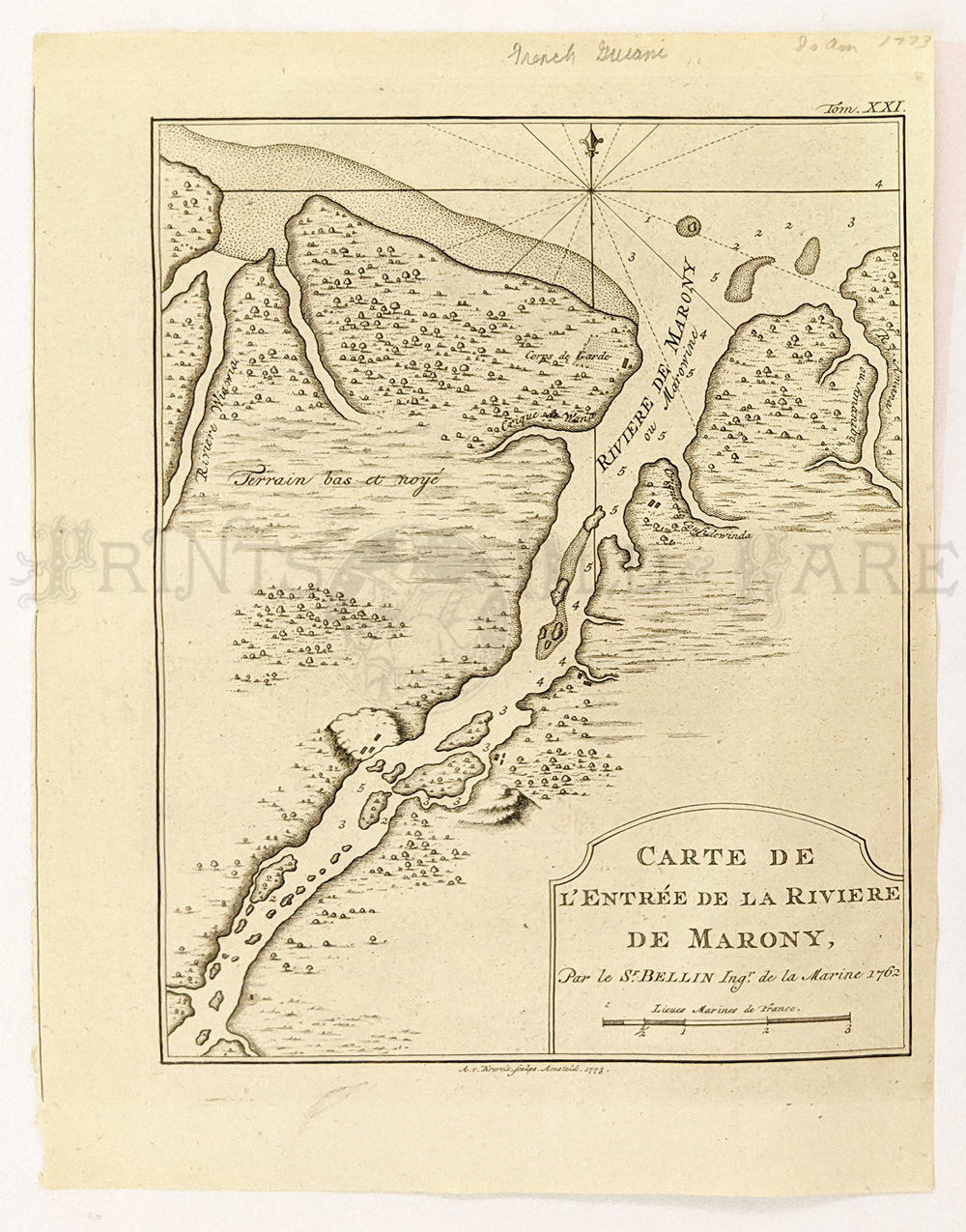 117sam: French Guiana 1762 copper engraved map by Bellin. Maroni River forms border with Surinam. This map shows the mouth of the Maroni river where it flows into the Atlantic Ocean. Map shows depths and relief. 7 5/8 x 10 1/8 in. $45 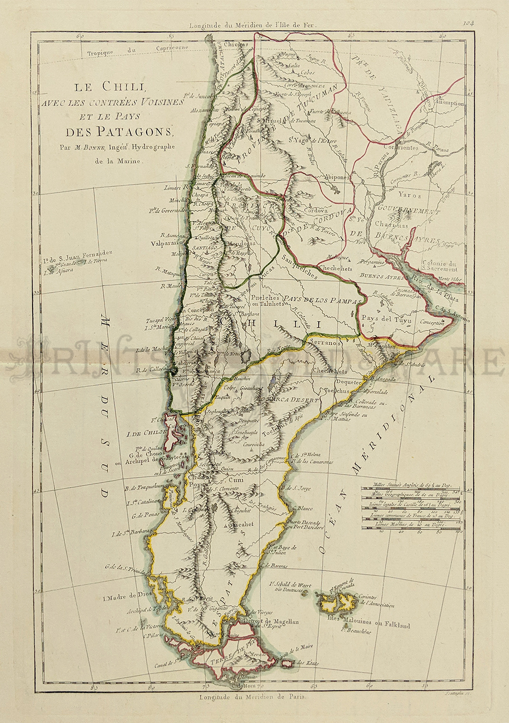 118sam: 1790. CHILE. Bonne Le Chili avec les Contrees Voisines et le pays Des Patagons. Published in Paris this watercolored copperplate engraving on handmade paper. Measures: 9.5 x 14.5" plus wide margins. $160  104sam: Colton’s Peru and Bolivia, 1855 - An excellent engraved and original colored first edition example of Colton's rare 1855 map Peru and Bolivia. Covers from Ecuador to the Argentine Republic and from the Pacific to Brazil. Shows Bolivia's claims to the Atacama desert and Peru's claims to Moquegua - both of which are today part of Chile. An inset detail map of Lima, Peru, appears in the lower left quadrant. Throughout the map Colton identifies various cities, towns, forts, rivers, rapids, fords, and an assortment of additional topographical details. Map is hand colored in pink, green, yellow and blue pastels to define national and regional boundaries. Surrounded by Colton's typical spiral motif border. Dated and copyrighted to J. H. Colton, 1855. Published as page no. 60 in volume 1 of the first edition of George Washington Colton's 1855 Atlas of the World. Condition: Very good, some small mottling on top margin, and top corner of margins chipped with normal aging color, size 15.5 x 13.5 image. $120 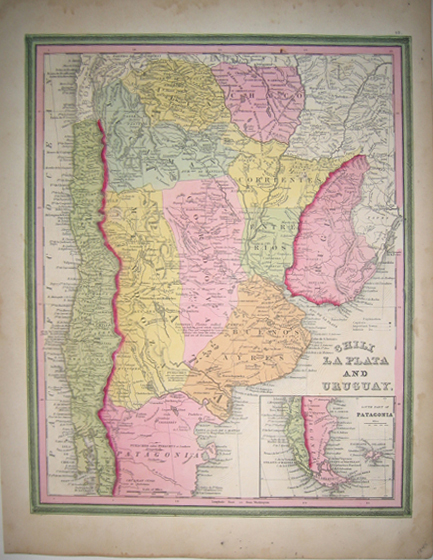
105sam: 1845 CHILI, LA PLATA, And URUGUAY, with inset on bottom right of the South Part of Patagonia. Map made by Henry Schenk Tanner for the "New Universal Atlas," a volume of work which in 1828 was hailed as a great advancement in the art and science of map-making. Tanner gained notoriety for this work and the one he published before it, his "New American Atlas." Both were widely considered to be important contributions to early American cartography. Hand colored rare map has a wide green and pink border and is in good condition with some minor water damage on outside edges of paper, outside of border. 14x17.5in. $100 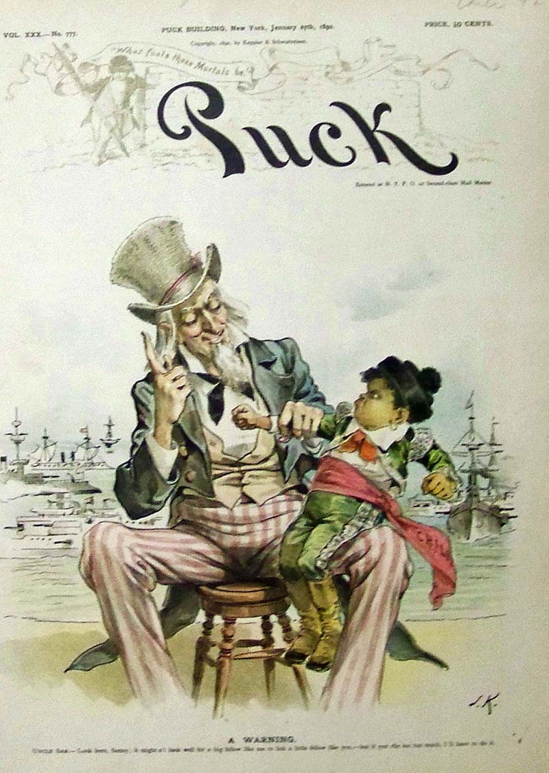
106sam: 1892 Puck Hand colored lithographed cover titled, "A Warning." Image shows Uncle Sam telling a pouting Chilean, "Look here, Sonny; it might n't look well for a big fellow like me to lick a little fellow like you, -- but if you rile me too much, I'll have to do it." 13 x 10 in. $100 |
|||||||||
| Order Form | |||||||||||
| Back to Homepage | |||||||||||