 
|
|||||||||||
This is a small selection of our inventory of antique Minneapolis & St. Paul, MN maps and prints. Additional inventory is available. Contact us with your request. 1-800-879-6277
|
|||||||||||
|---|---|---|---|---|---|---|---|---|---|---|---|
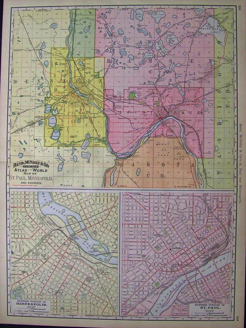 001msp: 1898 Color Rand, McNally & Co.'s Indexed Atlas of the World Map of St. Paul, Minneapolis, and Environs. Bottom left shows the Business Portion of Minneapolis and bottom right shows the Business Portion of St. Paul. 27-1/2 x 20-1/2 in. $160 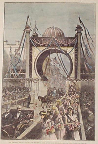 002msp: 1883 Northern Pacific Railroad Jubilee in St. Paul. Hand colored engraving from Harper's. 11x16 in. $50 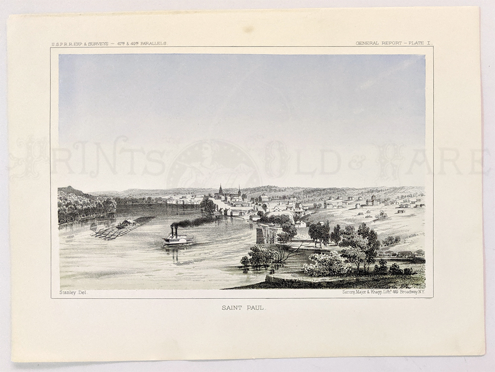 003msp: Saint Paul 1855. Birdseye view of waterfront. U.S. Railroad Survey. Lithograph. 8 1/2 x 11 3/8 in. $100 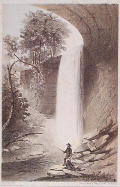 004msp: 1855 Minnehaha Falls view. Drawn by U.S. Government railroad surveyors. Antique lithograph, with some light foxing. 8-1/2x11 in. $50 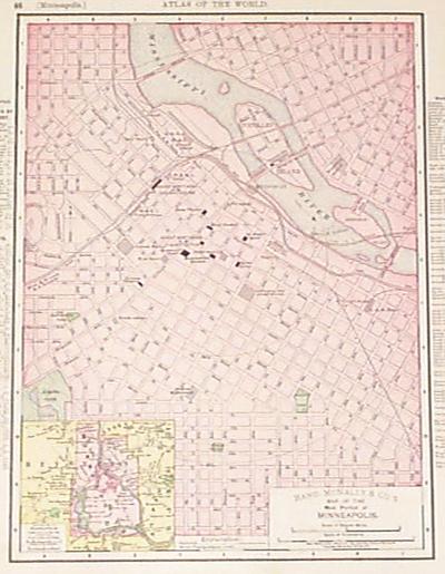 005msp: 1898 Map of Minneapolis. Antique lithograph, printed in color. Shows streets and major buildings in detail. 11-1/2x14 in. $40 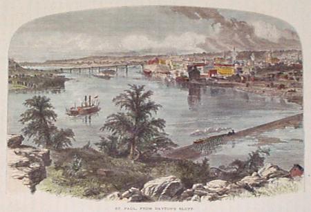 006msp: 1873 St. Paul view. Hand colored antique wood engraved view from Dayton's Bluff. Picturesque America. 9x12 in. $30  007msp: 1883 Valley of the Upper Mississippi. Several hand colored antique engravings on one page from Harpers. 11x16 in. $50 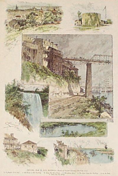 009msp: 1885 St. Paul and Fort Snelling. Several great hand colored antique engravings from original Harper's Weekly, 1885. 11x16 in. $50 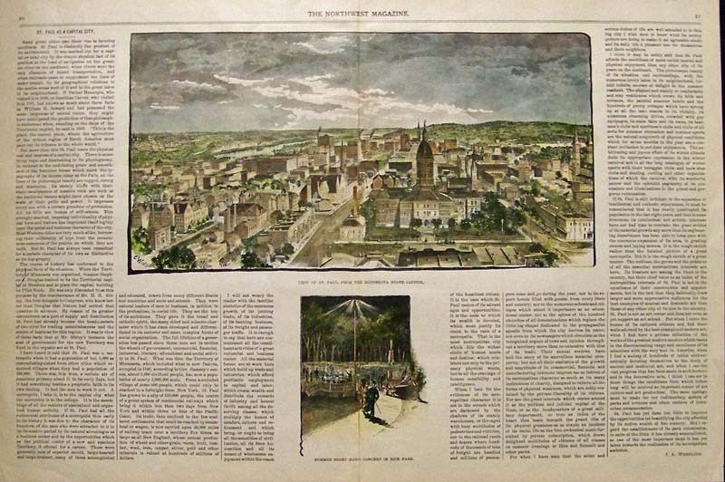 011StPaul: 1891 Rare Hand colored wood engraving showing a View of St. Paul from the Minnesota State Capitol in upper image and lower image shows a Summer Night Band Concert in Rice Park. Featured in The Northwest Magazine. 19-1/2 x 13-1/2 in. $100 |

012msp: 1880 Hand colored wood engraving from The Illustrated London News titled, "Hunting Sketches Among the Indians of Minnesota." 15-1/2 x 10-1/2 in. $50 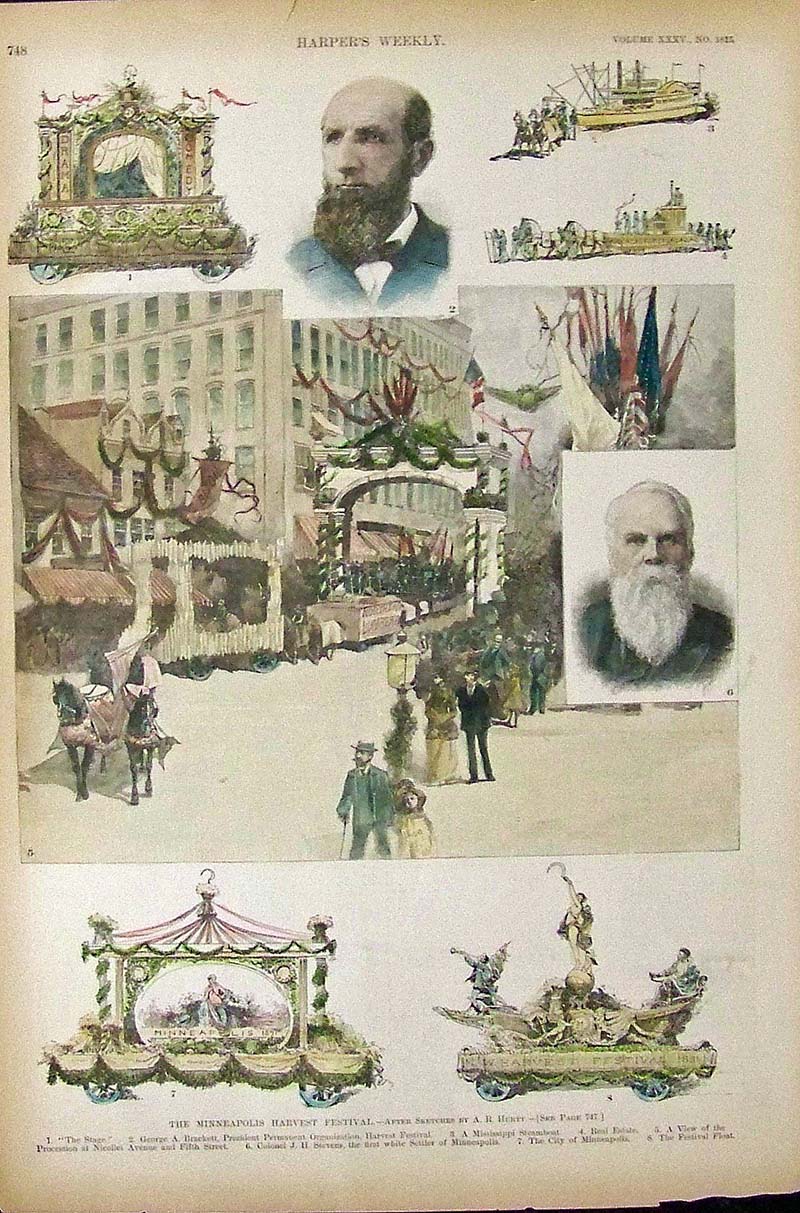
013Minneapolis: 1891 Hand colored wood engraved images showing the attractions at The Minneapolis Harvest Festival. 16 x 11 in. $50 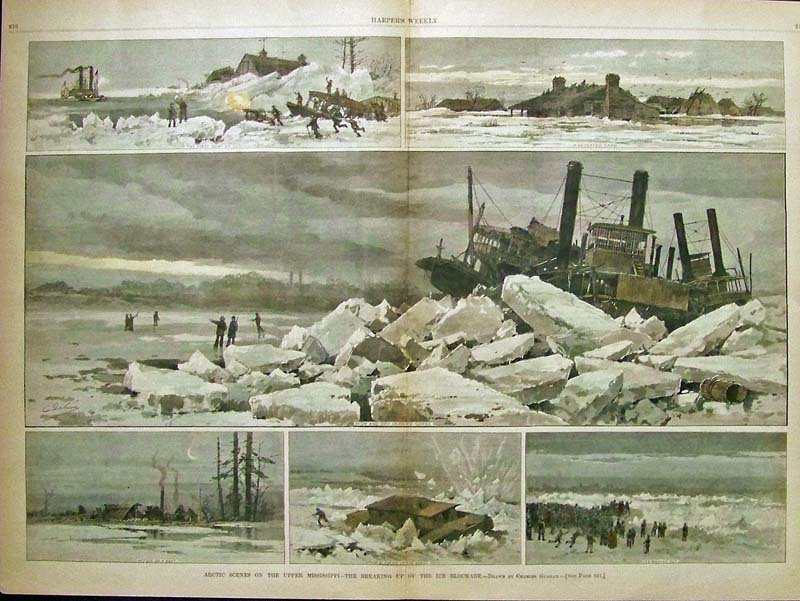 014msp: 1883 Hand colored wood engraving showing great winter scenes in an image titled, "Artic Scenes on the Upper Mississippi -- The Breaking Up of the Ice Blockade." Drawn by Charles Graham and featured in Harper's Weekly. 22 x 16 in. $120 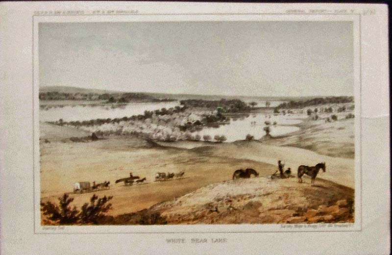
015Minneapolis: 1855 Color lithograph titled, "White Bear Lake," as part of the U.S. Railroad Expedition Surveys by Stanley. Lithograph published by Sarony, Major & Knapp. General Report -- Plate V. 11 x 7 in. $50 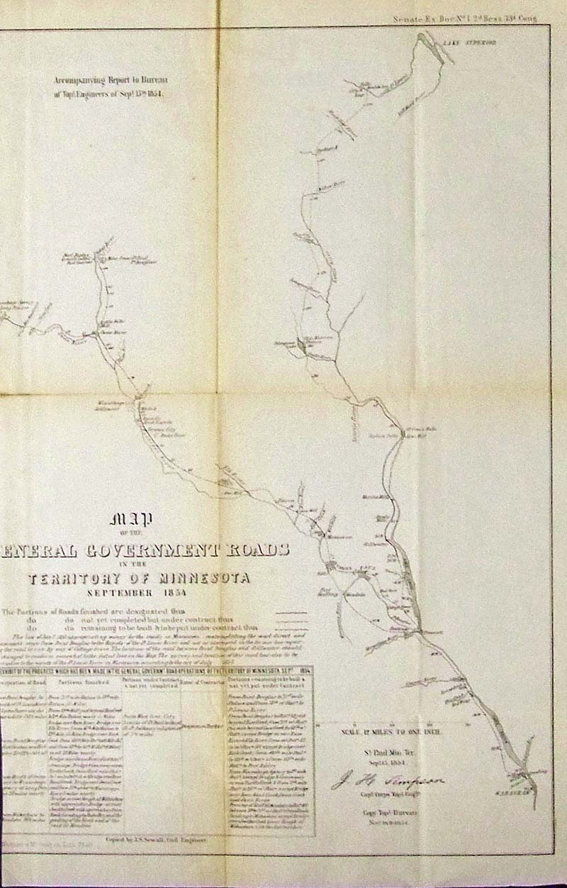
017StPaul: Rare 1854 Very early lithographed Map of the General Government Roads in the Territory of Minnesota. Map is slightly cropped on lower lefthand margin. Lithographed map by Wagner & McGuigan. 19-1/2 x 13-1/2 in. $150 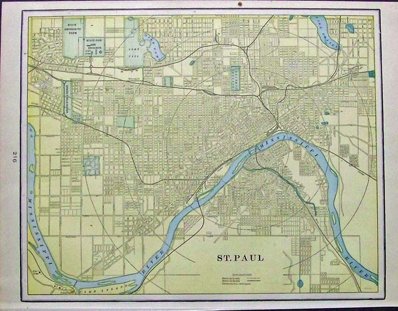
018StPaul: 1903 Color lithographed map of St. Paul, showing the Mississippi River running through it. 14-1/2 x 11 in. $30 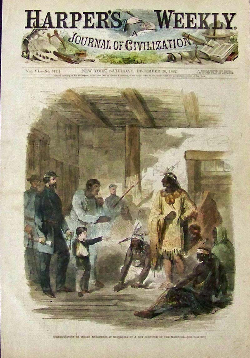
019msp: 1862 Hand colored wood engraving titled, "Identification of Indian Murderers in Minnesota By a Boy Survivor of the Massacre." Featured in Harper's Weekly, A Journal of Civilization. 16 x 11 in. $50 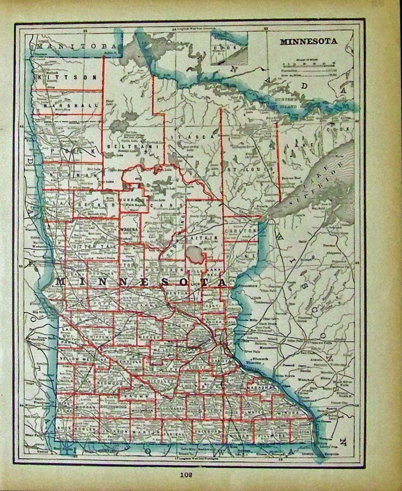
020msp: 1891 Color lithographed map of Minnesota showing the counties outlined in red. 13-1/2 x 11 in. $40
|
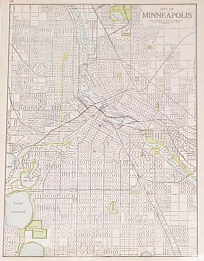 104msp: 1924 Map of Minneapolis Minnesota. Detailed map of Minneapolis by George F. Cram. All street names are shown, as well as railroad lines, streetcar lines, parks and cemeteries. In the downtown area, locations of railroad depots and major buildings are marked. 11x15 in. $30 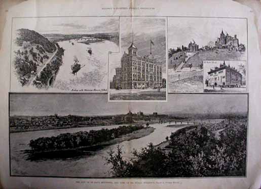 105msp: 1890 Views of St. Paul Minnesota. Engraved scenes from Harper's Weekly, titled, "The City of St. Paul, Minnesota, and some of its Public Buildings." Contains a large panoramic view of downtown St. Paul from across the river. Also shows the Chamber of Commerce, People's Church, Residences on Merriam's Hill, and a view looking up the river from the city. There are two water stains in both top corners of the margin, but the image is not affected. The stains could easily be covered by matting and framing. 16x22 in. $60 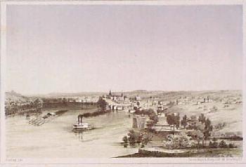 106msp: 1855 View of St. Paul Minnesota. Color lithograph, showing a view of St. Paul from the river. Published in 1855 as an illustration to a US government railroad survey report. 8x10 in. $80 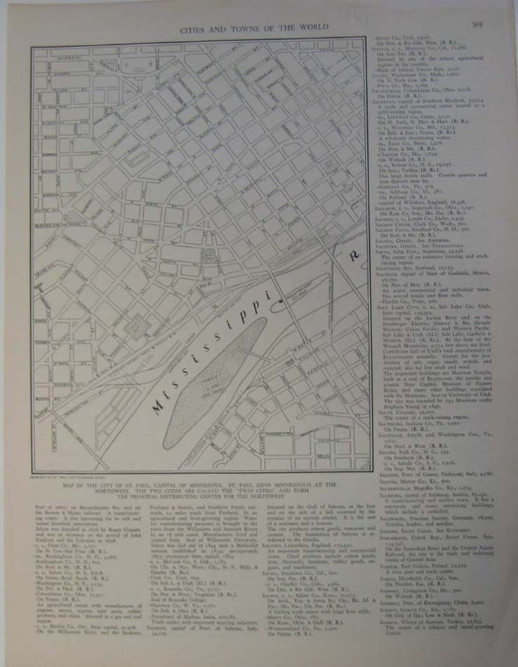 107msp: Map of downtown St. Paul. Map of the downtown area, which includes streets, parks and islands. Railroad and streetcar lines are shown as well. 10 x 14in. $30 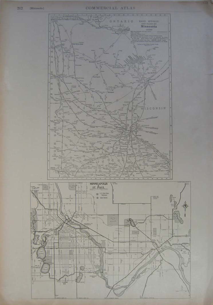 111msp: 1928 maps of Minnesota, Minneapolis and St. Paul. Maps show the state of Minnesota and the cities of Minneapolis and St. Paul. State map shows different cities, railroad and electric lines. City map shows parks, cemeteries, bodies of water, schools and highways published by Commercial Atlas. 20 x 14in. $40 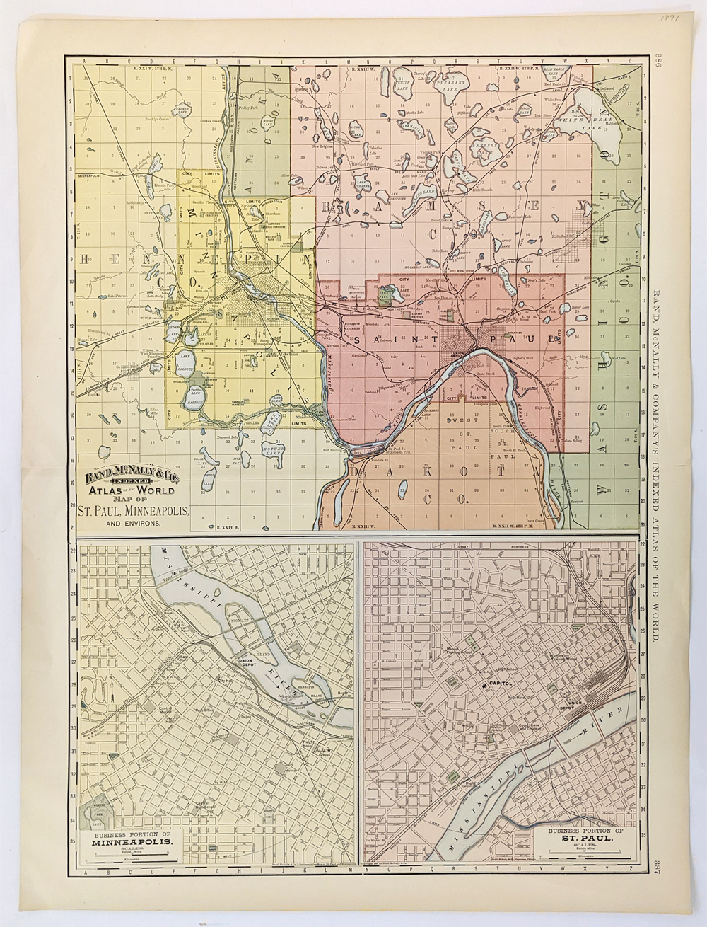 112msp: Maps of the cities of Minneapolis and St. Paul. City map shows hotels, parks, cemeteries, bodies of water, schools and highways published by Company's Indexed Atlas of the World. Map also includes two insets displaying the business portion of both Minneapolis and St. Paul. 27 x 21 in. $60 |
|||||||||
| Order Form | |||||||||||
| Back to Homepage | |||||||||||