|
|||||||||||
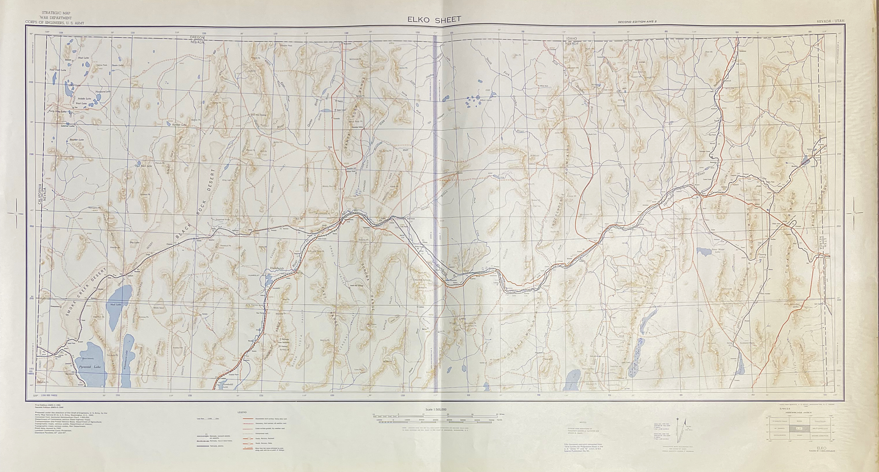
This is a small selection of our inventory of antique Utah maps and prints. Additional inventory is available. Contact us with your request. 1-800-879-6277
|
|||||||||||
|---|---|---|---|---|---|---|---|---|---|---|---|
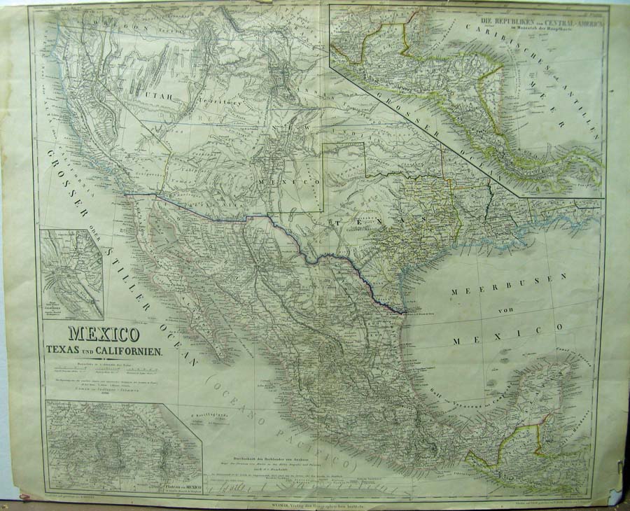 100tx: 1852 Kiepert Map of Mexico, Texas und Californien. Fine large format map which also includes Deseret (Utah Territory) and New Mexico Territory. Insets of the Gold Region, Central America and Mexico City. Hand colored steel engraved map. Condition: Very good. 27-1/2 x 22 in. $2,500 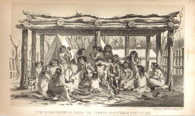 002ut: 1852 Utah Indian Prisoners. Lithograph from the Stansbury Expedition. 9x5-1/2 in. $40 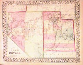 005ut: 1867 Mitchell Map of Utah and Nevada. Original color, attractive border. Counties shown by different colors. 15x12 in. $100 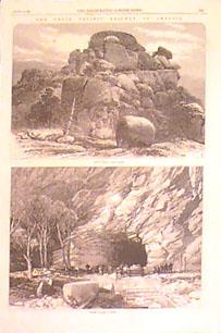 006ut: 1869 Utah Railroad. The Union Pacific railroad. Two engraved views by the London Illustrated the very year the railroad was completed as the first link from East to West. 10-1/2x16 in. $30 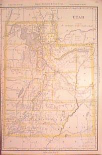 007ut: 1890 Utah Map. Large scale map by Rand McNally. Outline litho color in this very detailed map. 13x20 in. $80 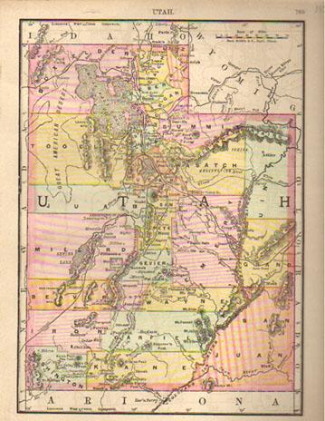 010ut: 1889 Utah Map. Litho color state map by Rand McNally. 9x11-1/2 in. $30 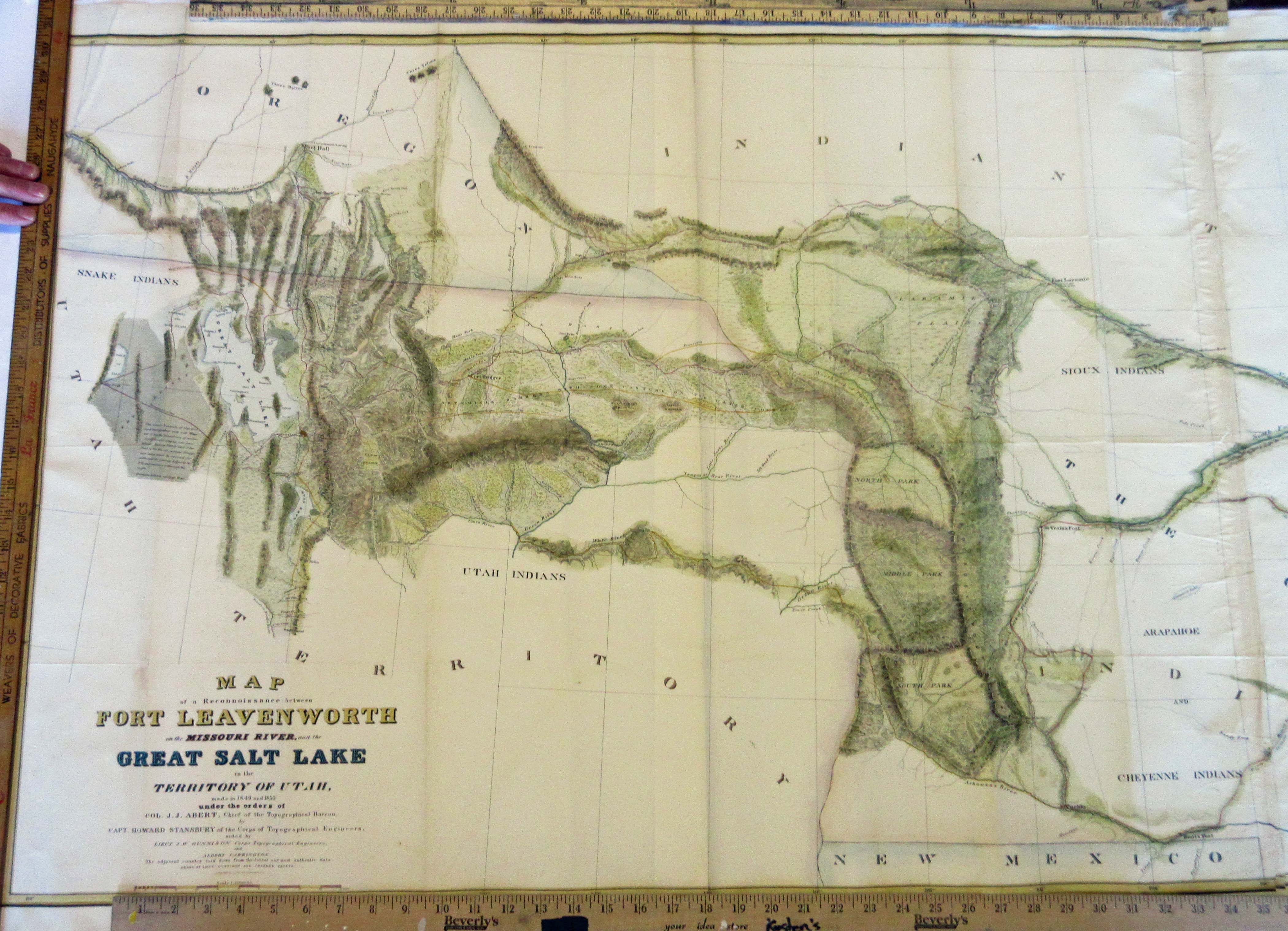
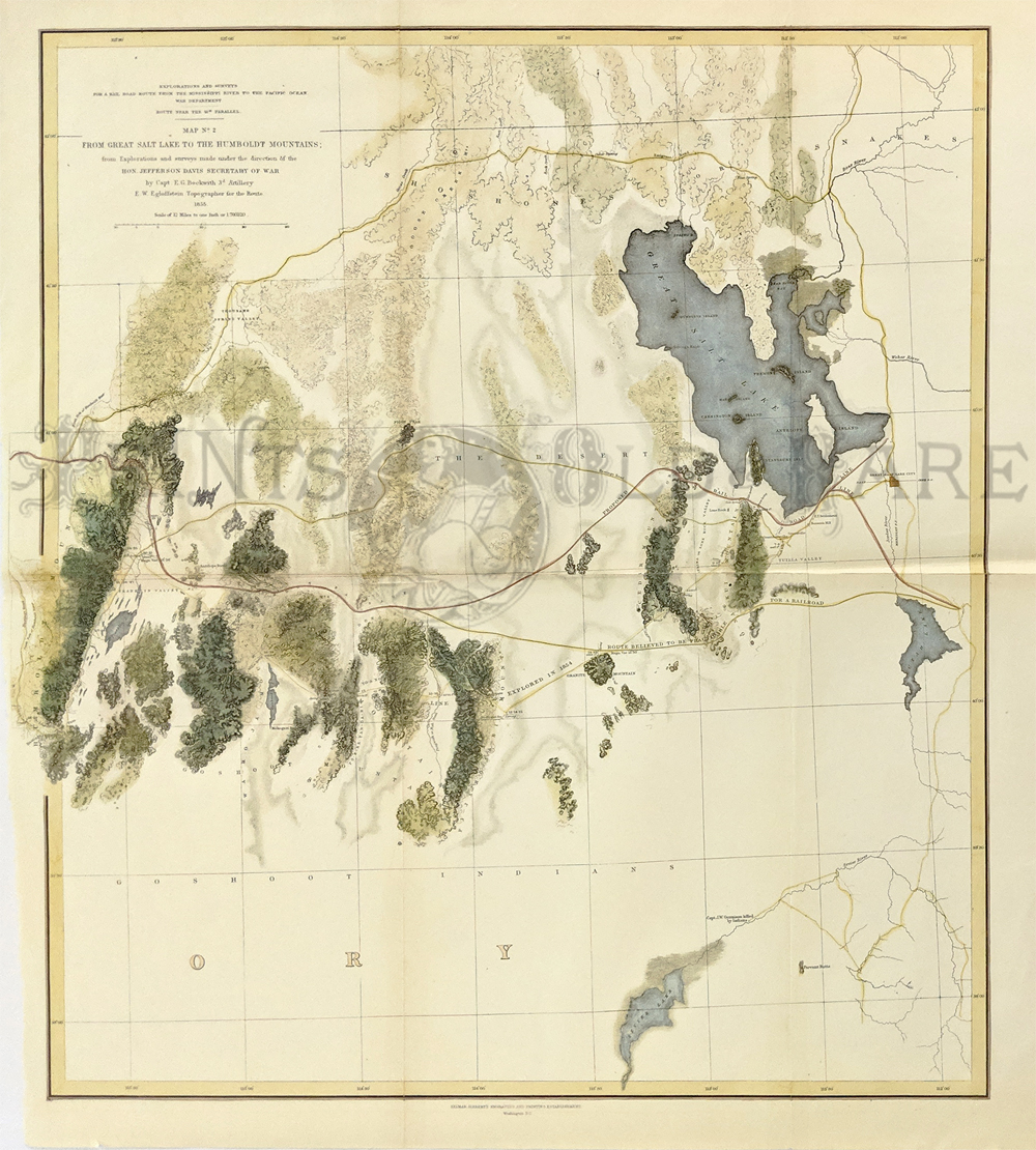
012Utah: 1849-1850 "Ft. Leavenworth to Great Salt Lake in the Territory of Utah." Hand colored lithographed Abert's map which shows locations of Snake, Arapahoe, Cheyenne, Sioux, and the Pawnee indians. Map also shows the Missouri and Platte River, North Park, Middle Park, and South Park, as well as Ft. Hall and Ft. Bredger. Image size is: 67 x 28 in. plus margins. $975 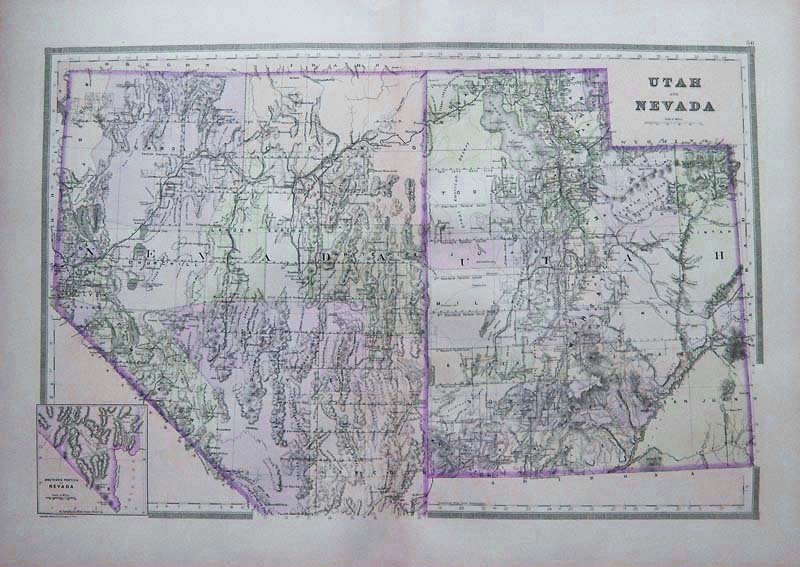
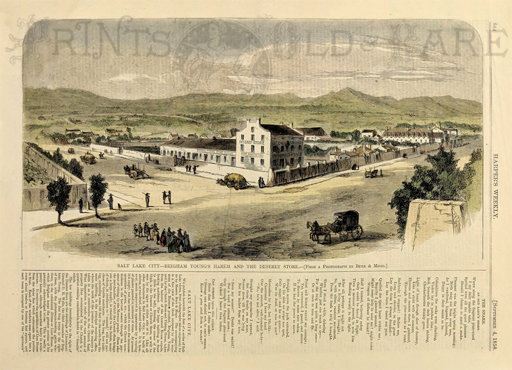
013Utah: 1886 Utah and Nevada Map. Large scale, by Bradley. Original color, attractive margins. 26x19-1/2 in. $100 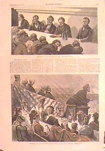 014ut: 1874 Mormons at Salt Lake. Two views including the Communion Table and Brigham Young's Wives. Hand colored from Harper's. 11x16 in. $50  016ut: 1892 Utah Map. Original color litho. 10-1/2x14 in. $30 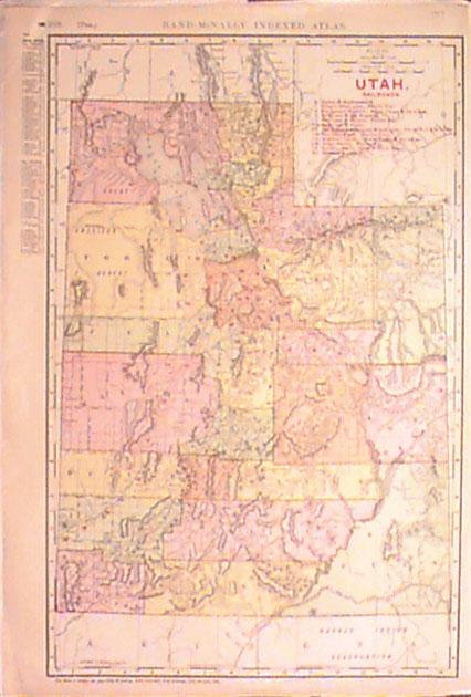 017ut: 1908 Utah Railroad Map. Color litho map by Rand McNally. Railroads are listed and the route of each shown. 15x20 in. $80 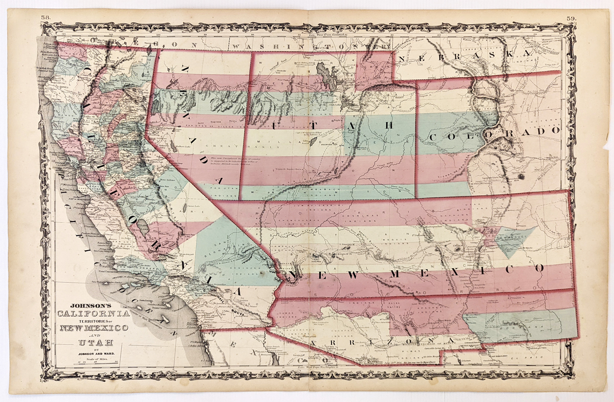
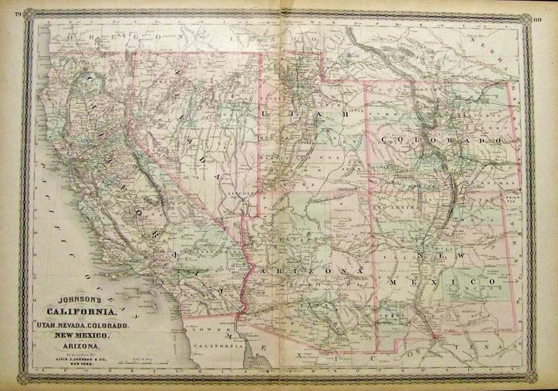
279California: Johnson’s California, Territories of New Mexico, Arizona, Colorado, Nevada and Utah 1863 - A large engraved and original hand colored map of California & the Southwest, the map has a very decorative border, pastel colored counties and shows a number of interesting territorial anomalies. Nevada has its lower corner truncated, leaving Las Vegas in Arizona. Utah extends approximately 1 degree too far to the west, prior to the last set of reductions undertaken by the US Government. Several counties still extend into both Arizona and New Mexico. In each of the states and territories, the county configurations are still largely incomplete. This is one of the most detailed accurate commercial maps of the era that includes the US Pony express route, explorer routes, the major routes of commerce, towns, forts, Indian Tribes, mountains, rivers, roads, mining districts, proposed railroad routes, important dates in the evolution of the US-Mexico Boundary, etc. Johnson's map of the West is one of the most interesting and collectable maps of the period. The maps were updated annually or more often, showing profound territorial boundary changes and county formations from year to year and even within a single year. Condition: Very good, fold in middle with some staining along the fold, water marks on margins and some light foxing inside image. size 23.5 15.5 image. $600 |
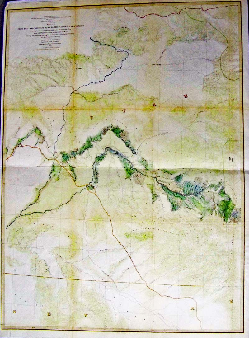 121Utah: From the COO-CHE TO PA Pass to the Wahsatch Mountains, 1855 Gunnison/Beckwith - A large lithograph map with original coloring and Gunnison's final and most detailed map of the series that Wheat illustrated in full. Minimal detail in the north and south, the map provides much detail along the route through western Colorado and Utah. Locates Fort Uintah, Brown's Hole, the Old Spanish Trail, and Bridger's Pass. An interesting and important map of the region that would eventually be followed by the Denver and Rio Grande Railroad. Special Note: Capt. Gunnison was killed by hostile Indians at the western portion of this exploration, but Capt. E.G. Beckwith recovered his survey notes and completed the map. Condition: Very Good, some folds with light discoloring small margins. size 23.2" x 31.5" image $300 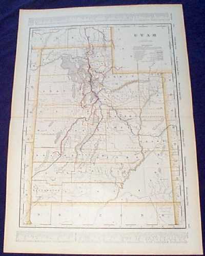
100ut: Detailed 1901 Railroad Map of Utah. Beautiful map from the 1901 first edition of George Cram's folio-size world atlas. Color coded lines on the map show the names and locations of railroads throughout the state. State and county borders are outlined in yellow. Cities, towns, Indian reservations and geographical features are all shown. 18x27 in. $100 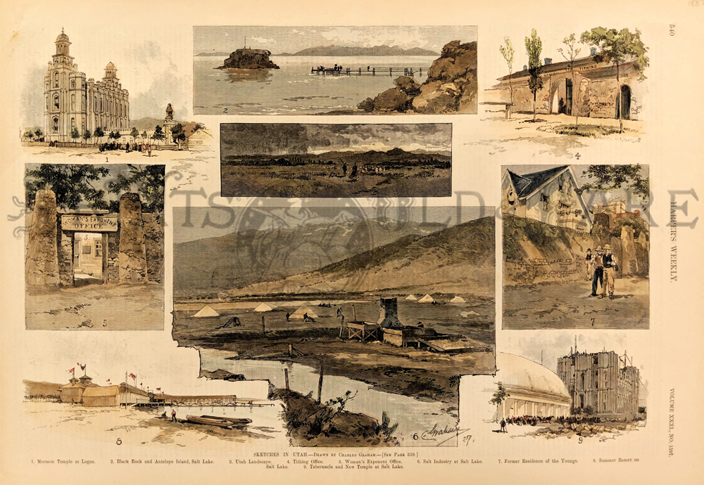
101ut: 1887 Scenes in Utah. Nine hand colored antique engravings from Harper's Weekly, showing scenes in the state of Utah. Most views are of the salt mining industry and Mormon buildings in the Great Salt Lake region. 11x16 in. $60 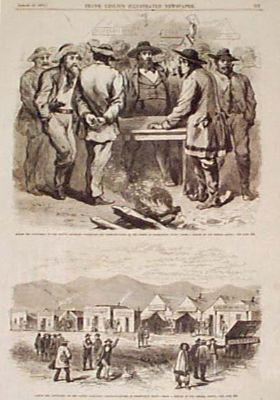 102ut: 1870: Gambling in Promontory Point Utah. Two engraved images from Frank Leslie's Illustrated Newspaper, showing the flourishing gambling houses in Promontory Point Utah. 11x16 in. $40 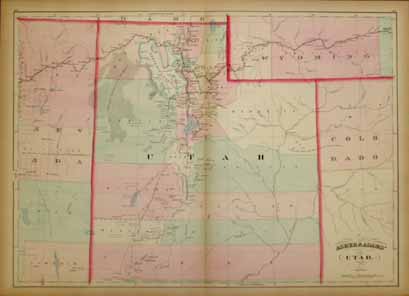 103ut: Beautiful 1872 map of Utah. Published by Asher & Adams in the New Statistical and Topographical Atlas of the United States. Original hand coloring. 17.5x24.5 in. $150 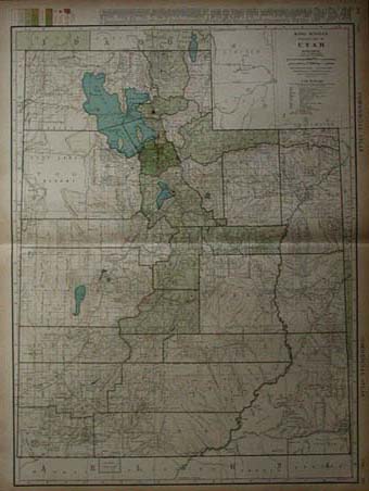 104ut: 1935 Rand McNally Standard map of Utah. Showing railraod lines, county borders and population density. Map is in excellent condition. 28x20 $50 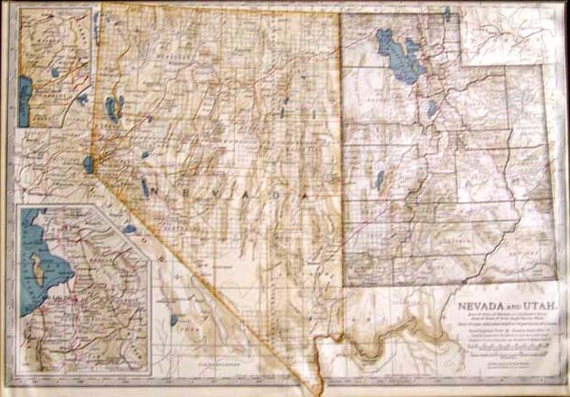 110ut: 1897 Hand colored map of Nevada and Utah with an inset of Salt Lake City on bottom left. Top left inset shows a closer view of the cities surrounding Lake Tahoe. Top right corner inset is of Wyoming. A small section of California is shown between Nevada and the insets on lefthand side. Map published by the Matthews-Northrup Works. Map is numbered 113. Map enclosed within a large cardboard frame and m total of all measures: 19-1/2 x 14-1/2 in. $60 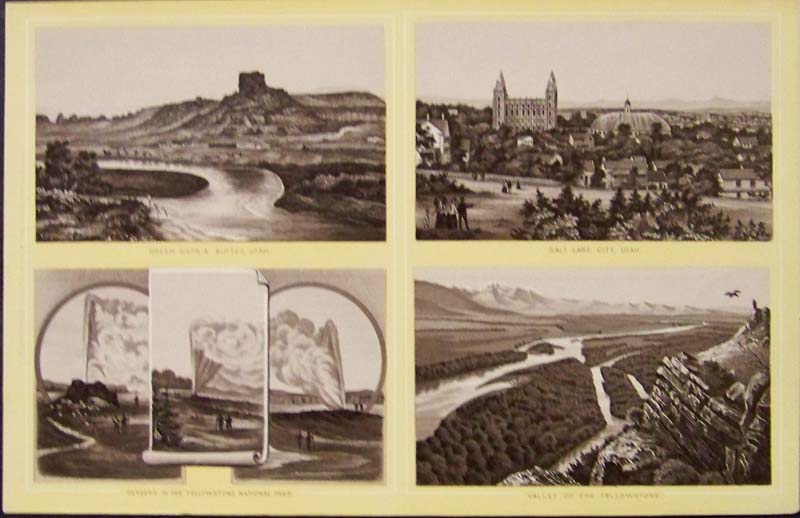 111ut: C.1880 Photogravure showing Geysers in the Yellowstone National Park; Green River & Buttes, Utah; Salt Lake City, Utah; and Valley of the Yellowstone in four views. 9 x 6 in. $30 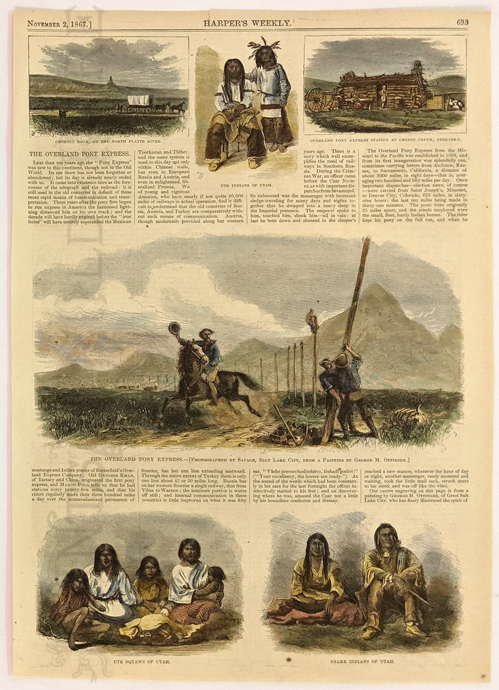 1170ut: 1867: Overland Pony Exprss, Utah. Original Harper's Weekly (1867). Overland Pony Express, Ute Indians and Squaws and Snake Indians. Color: Water Color. Type: Wood Engraving. 11x16 in. $60
|
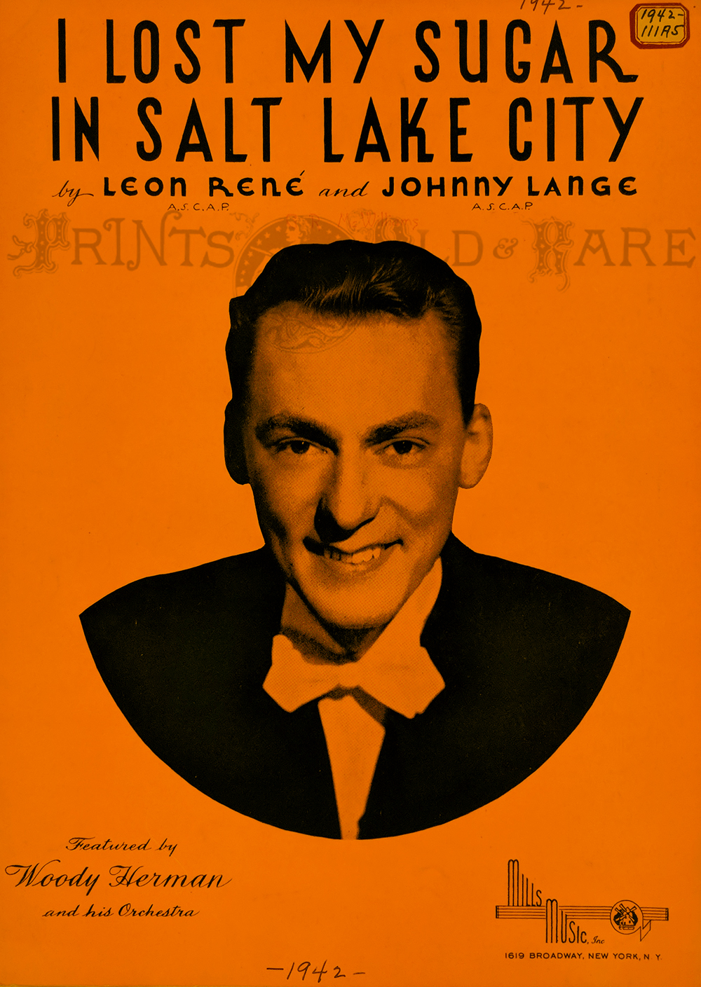 122ut: Salt Lake City – Vintage Sheet Music “I Lost My Sugar in Salt Lake City.” 1942. Featuring photo of Woody Herman. 12 x 9 in. $25 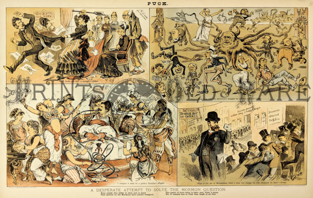 123ut: “A Desperate Attempt to Solve the Mormon Question.” 4 Vignettes of different views. “One wife is enough”, "Destructive monster," "Perfect Paradise," and "Easy Divorce – what use is it?" Puck chromolithograph. 1884. 12 x 19 in. $175  124ut: Map Showing the extent of Surveys in the Territory of Utah 1856. Showing a detailed survey of the country and settlements around the eastern half of the Great Salt Lake. Showing Salt Lake City, Ogden, Provo, etc. Prepared under the direction of David H. Burr. Hand colored, lithograph. 17 x 34 1/2 in. $450 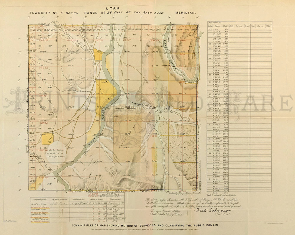 125ut: Utah Township Plat Showing Method of Surveying and Classifying the Public Domain. 1879. Showing the Township and subdivision lines; as well as the mountainous lines of Northeast Utah. Green River is also shown. Handcolored, lithograph. 17 1/4 x 22 in. $150 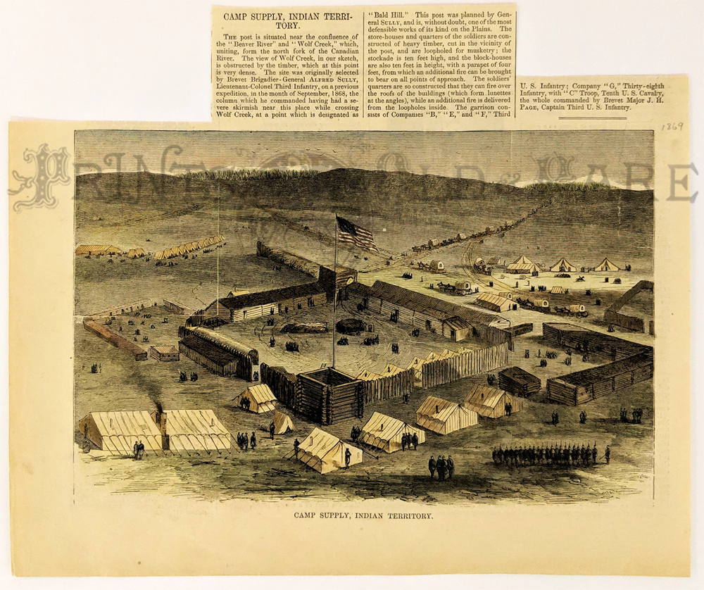 126ut: Camp Supply, Indian Territory. Military stockade near Beaver River and Wolf Creek (north fork of Canadian River), Utah. 1869 Harper's Weekly. Hand colored, wood engraving. 9 x 10 1/2 in. $40
|
|||||||||
| Order Form | |||||||||||
| Back to Homepage | |||||||||||