 
|
|||||||||||
This is a small selection of our inventory of antique Vermont maps and prints. Additional inventory is available. Contact us with your request. 1-800-879-6277
|
|||||||||||
|---|---|---|---|---|---|---|---|---|---|---|---|
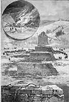
005vt: Railroad Accident at Woodstock Bridge Near White River Junction. 1887 Black and white antique wood engraving by Charles Graham for Harper's. 11x5in. $20 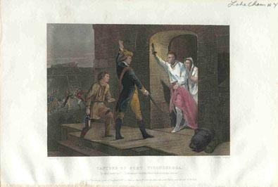 006vt: Capture of Fort Ticonderoga. Handcolored steel engraving, 1866. 10x7in. $50 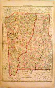 008vt: Grays map of New Hampshire and Vermont. Spectacular antique handcolored, each township in separate color. 17x24in. $80 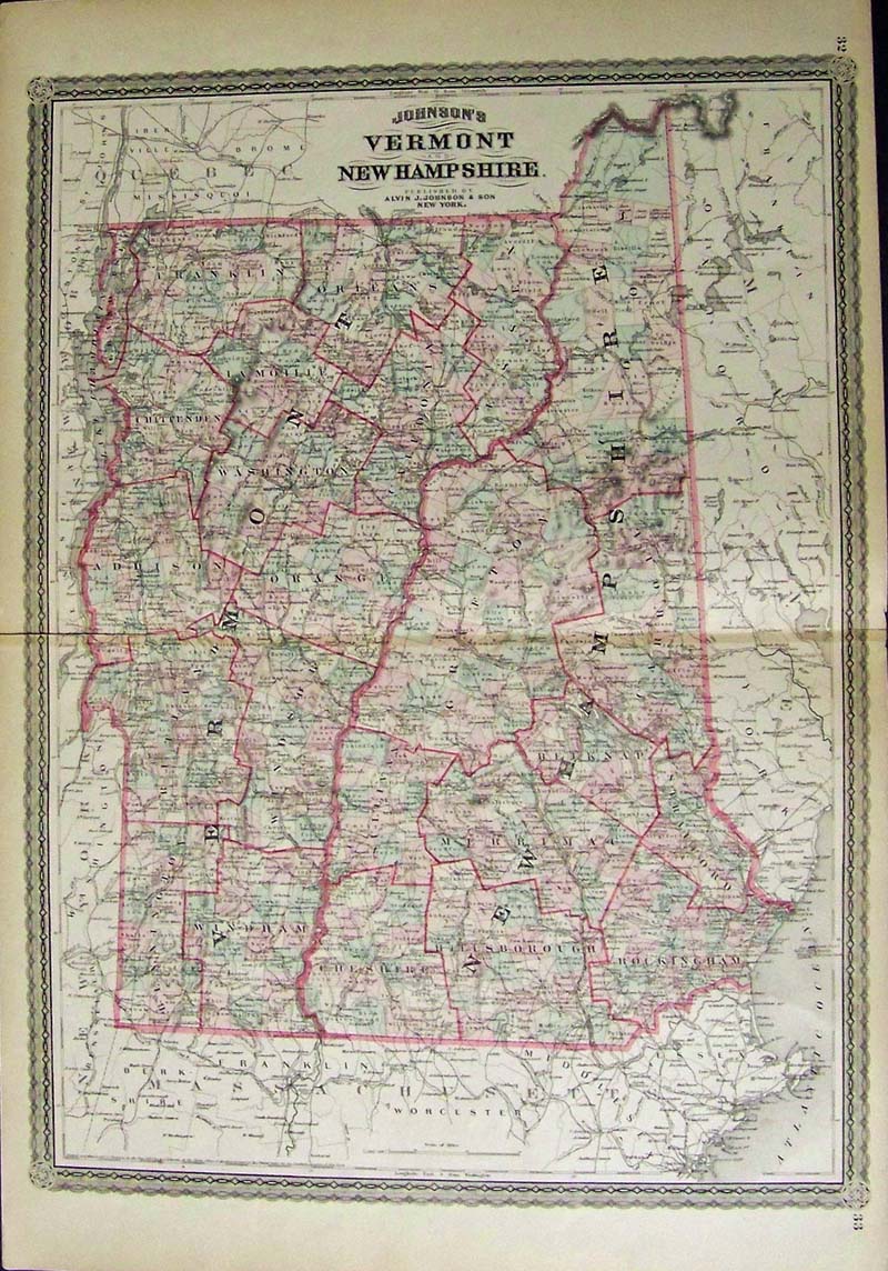
009vt: 1867 Johnson's Vermont and New Hampshire hand colored antique map. 26 x 18 in. $90 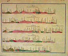 012vt: Geological Profiles of Vermont and Massachusetts, 1861. Handcolored. Five different profiles showing soil types and formulations. 13x10in. $40  013vt: Lake Memphremagog, South from Owl's Head. Hand colored wood engraving. 10x14in. $30 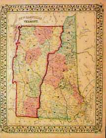 015vt: Map of New Hampshire and Vermont, 1867. Handcolored lithographic map by C. Augustus Mitchell. 11x15in. $80 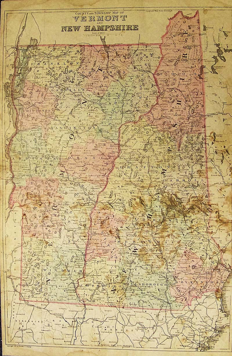 021Vermont: County and Township Map of Vermont and New Hampshire 1882 Bradley - Unusual engraved and original hand colored map of County and Township of Vermont and New Hampshire. Published by the M. Bradley and Co. Each county and township is colored separately, cities, towns, railroad lines, major roads and geographical features are all shown. Condition: Foxing and mottling through most of middle image, fold in middle with a small tear in center of Vermont, small margins. size 14.5 x 22.5 image $75 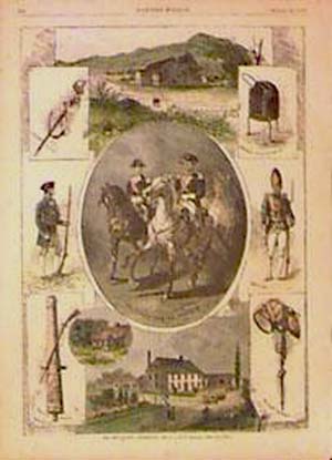 016vt: The Bennington Centennial, 1877. Handcolored wood engraving from Harper's Weekly. 11x15in. $50 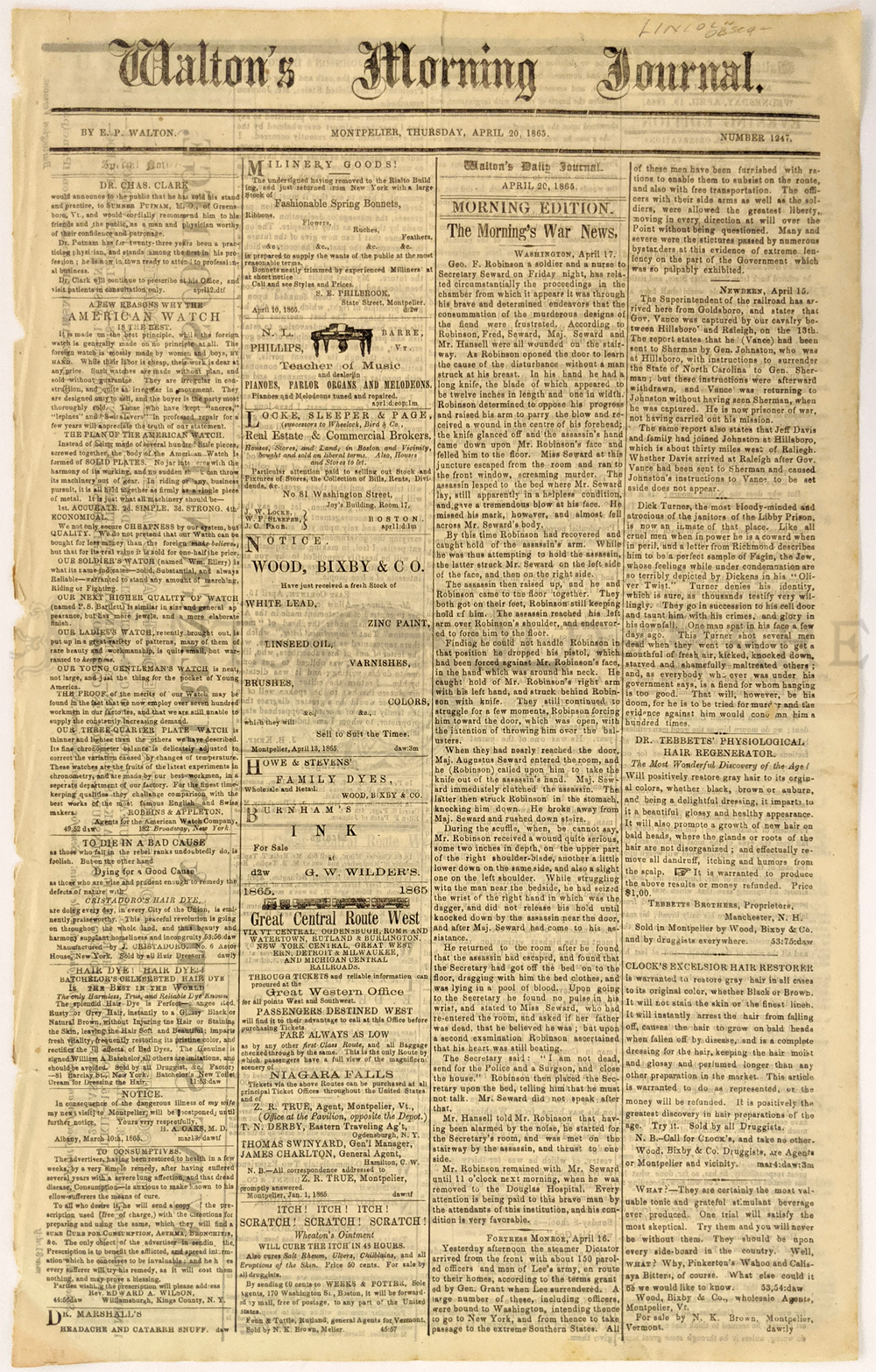 241linc: Lincoln Assassination. Account of Geo F. Robinson encounter with the assassin Lewis Payne who was attempting to kill Seward. Walton’s Morning Journal, Montpelier. April 20, 1865. Robinson later received $2000 gold metal and $5000 cash. 11 ½ x 18 3/8 $45 |
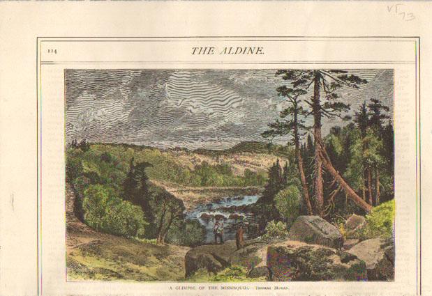 017vt: 1873 Moran - Missisquoi River Vermont. Authentic professionally watercolored engraving by Thomas Moran. This beautiful print of the Missisquoi River in Vermont was printed in the Aldine (an art journal) in 1873. A genuine antique print produced in 1873, NOT a reproduction! 8" x 11" $40 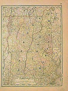 018vt: Vermont Map 1902. Large color lithographed map published by George F. Cram. 14x21in. $30 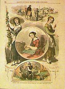 019vt: Scenes and Occupations Characteristic of New England Life. Handcolored wood engraving, 1855, from Ballou's Pictorial Drawing Room Companion. 11x15in. $50 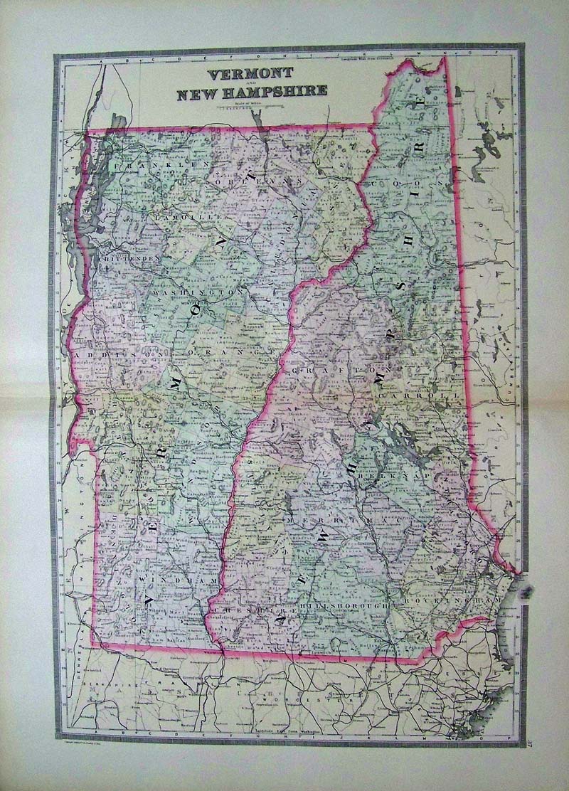
100vt: 1887 Bradley Map of Vermont, New Hampshire. Nicely hand colored map, from Bradley's 1887 world atlas. Each old county is separately colored, and townships are outlined within the counties. Cities, towns, railroad lines and geographical features are all shown. There are a few small age spots on the paper, but overall condition is very good. 26 x 19 in. $60 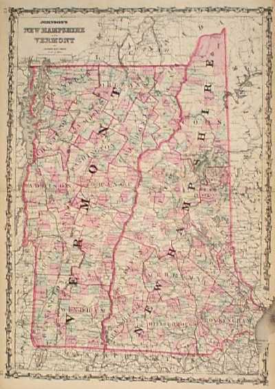 101vt: 1862 Johnson's Vermont, New Hampshire Map. Beautiful, decorative map, with original hand coloring. Counties are outlined in red, and each township is colored separately. Cities, towns, geographical features, railroad lines and major roads are all shown. This map would look great in a frame!! 18x26 in. $90 101vt: 1862 Johnson's Vermont, New Hampshire Map. Beautiful, decorative map, with original hand coloring. Counties are outlined in red, and each township is colored separately. Cities, towns, geographical features, railroad lines and major roads are all shown. This map would look great in a frame!! 18x26 in. $90 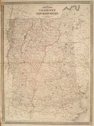 104vt: 1867 Map of Vermont, New Hampshire. Engraved, hand colored map of Vermont and New Hampshire, published by the A.J. Johnson Co. Each township is colored separately. Cities, towns, railroad lines, major roads and geographical features are all shown. Some chips in the left margin have been repaired by a restoration professional, but the map border and image are not affected. 18x24 in. $90 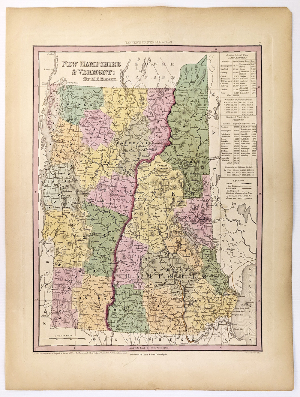 114NewHampshire: 1840 Tanner's Map of New Hampshire and Vermont. Counties, towns, roads with distances, railroads, and a host of other details. The key shows counties and towns in each state with populations. Hand colored, lithograph. 13 3/4 x 17 3/8 in. $300 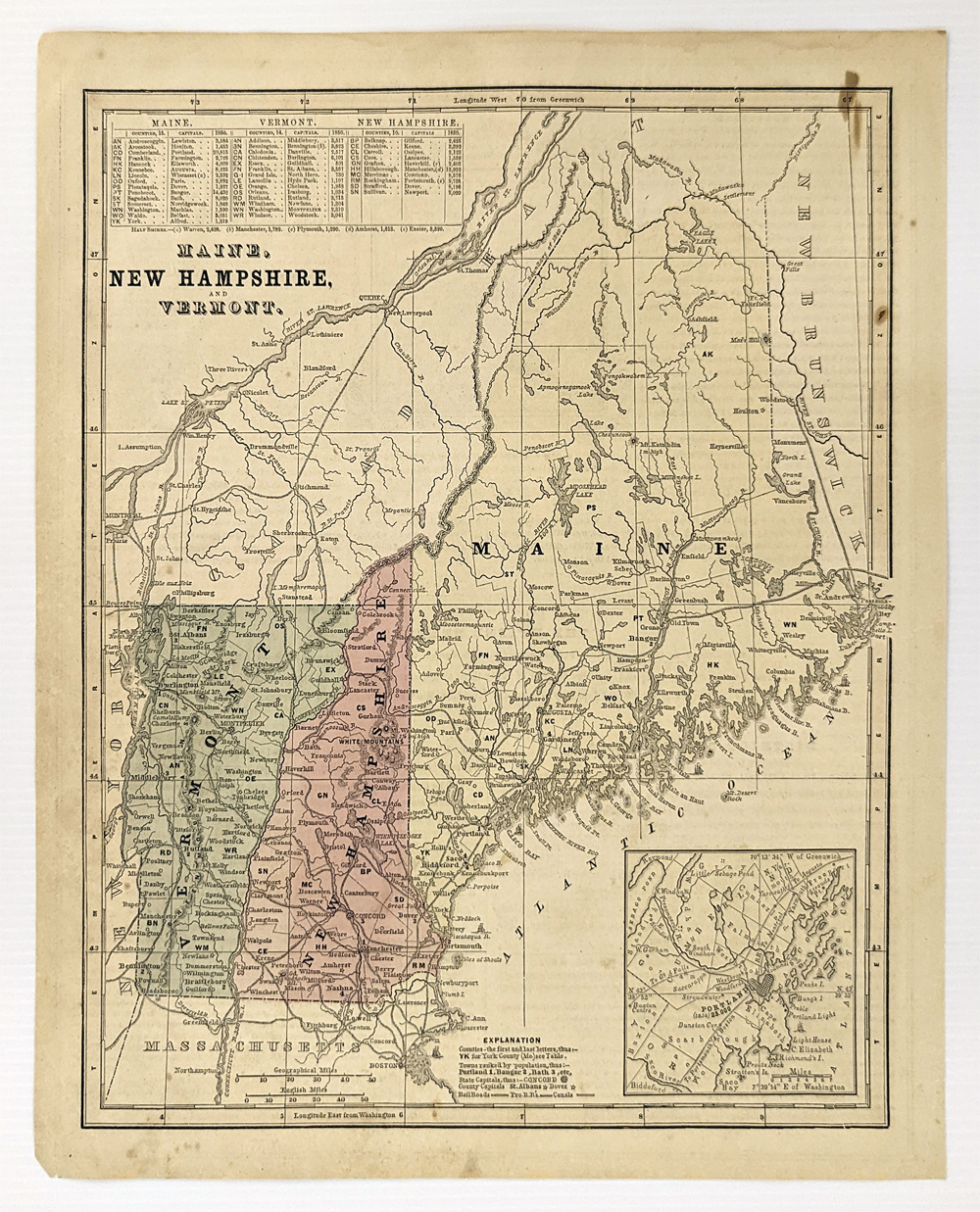 333Maine: 1861 Map of Maine, New Hampshire, and Vermont. Showing railroads, canals, capital and counties. Inset of Portland. Hand colored. 13 x 11 in. $60 |
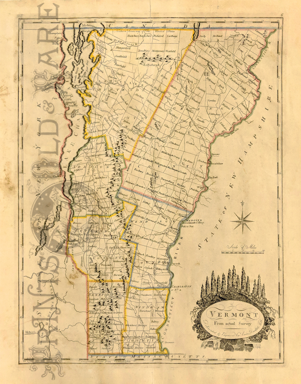 113vt: 1814 Doolittle Map of Vermont from Carey’s General Atlas. Counties hand outlines in color. Shows towns and property owners. 12 x 15 1/4 in. $595 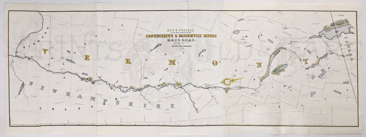 114vt: Connecticut and Passumpsic Rivers Railroad Map & Profile of route surveyed. Steam railroad ran from White River junction to Canadian Border. Hand colored lithograph. **Reinforced on folds. 20 1/4 x 55 in. $250 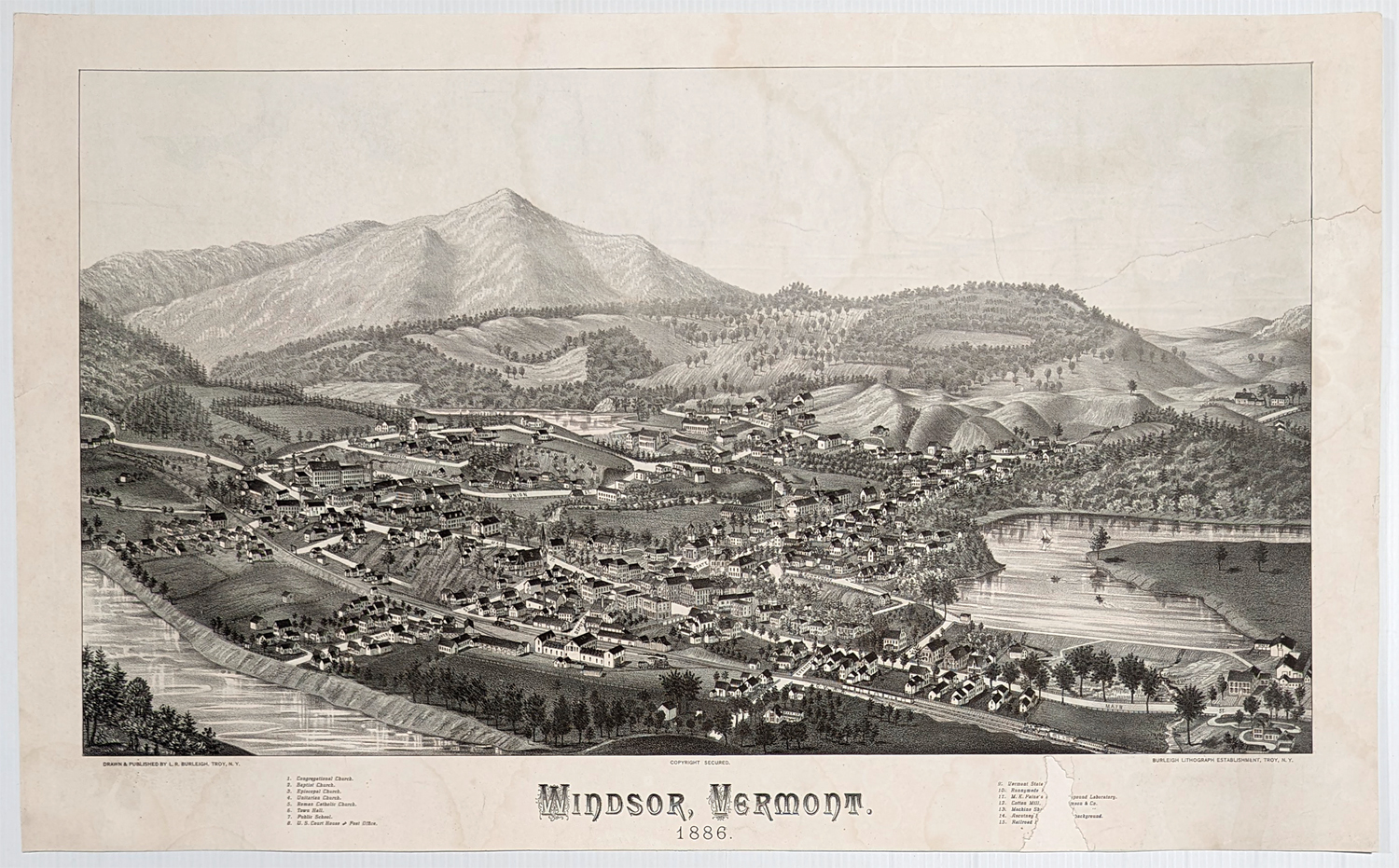 117Vermont: Birdseye, Windsor 1886. Rare original lithograph. 15 keys with description, Connecticut River is also shown. **Some damage to second section of keys - professionally mended. 14 1/2 x 23 1/2 in. $400  105vt: 1935 Vermont Population Map. Interesting map from Rand McNally's 1935 Commercial Atlas. Population density of each county is shown in varying shades of green. City populations are indicated by different shapes on the map. Also shows railroad lines throughout the state. 20x27 in. $80 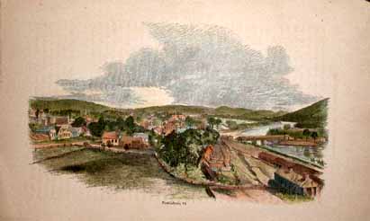 107vt: Hand colored wood engraving of Brattleboro, Vt. This is a beautiful c1880 city view. As a settlement, Brattleboro started out in 1724 as a scouting post and trading center. 6x9.5 in. $40 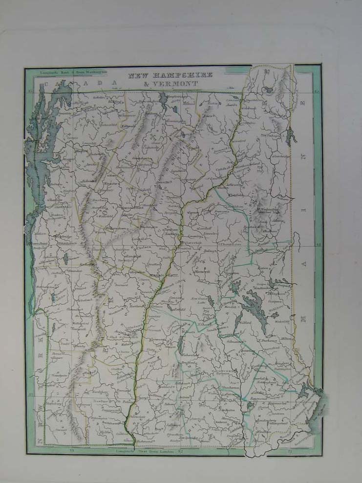 108vt: 1835 Elegant Map of New Hampshire and Vermont. Intricate hand colored map titled, "New Hampshire and Vermont," from Bradford's 1835 world atlas. Hand colored, engraved map shows railroads, canals, cities, counties and mountains. 12 x 10in. $200 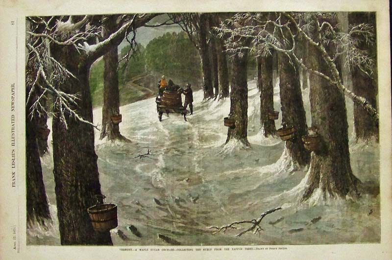 109vt: 1873 Hand colored wood engraving titled, "Vermont, -- A Maple Sugar Orchard -- Collecting the Syrup from the Tapped Trees." Drawn by Joseph Becker. Featured in Frank Leslie's Illustrated Newspaper. 15-1/2 x 10-1/2 in. $150 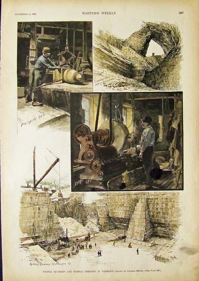
110vt: 1890 Harper's Weekly hand colored wood engraving showing Marble Quarries and Marble Dressing in Vermont. Drawn by Charles Mente. 16 x 11 in. $60 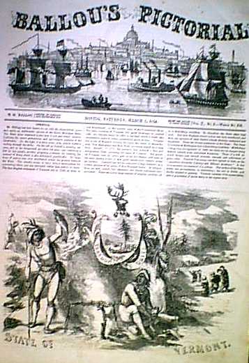 1160vt: 1856 Vermont State Seal & Article. Ballou's Pictorial (1856). State of Vermont Seal, plus article. Color: Black and White. Type: Wood Engraving. Size: 11x16 in. $30 |
|||||||||
| Order Form | |||||||||||
| Back to Homepage | |||||||||||