|
|||||||||||
This is a small selection of our inventory of antique Virginia maps and prints. Additional inventory is available. Contact us with your request. 1-800-879-6277
|
|||||||||||
|---|---|---|---|---|---|---|---|---|---|---|---|
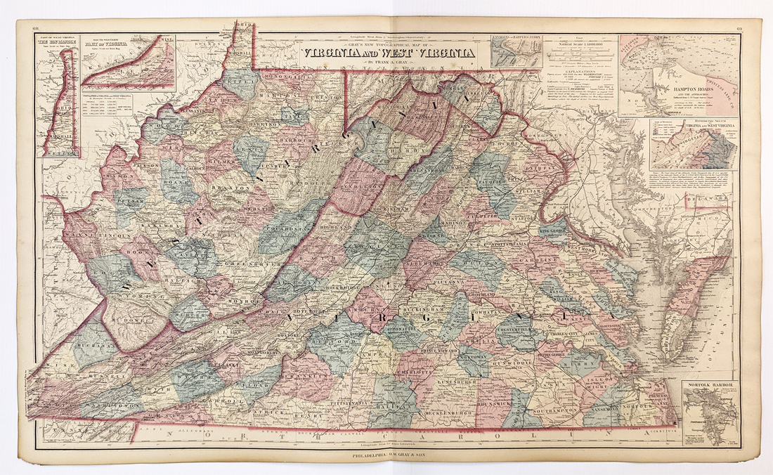
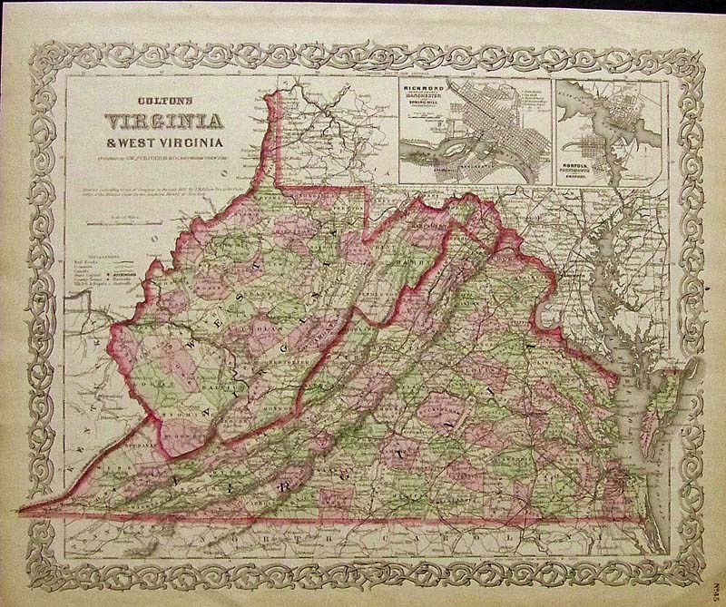 110va: Rare Colton 1855 hand colored engraved map of Virginia & West Virginia, with insets of Richmond & Norfolk in top right. 17-1/2 x 14 in. $250 SOLD  108Delaware: 1889 Bradley color lithograhed map showing Delaware, Maryland, Virginia and West Virginia. Featured in Bradley's Atlas of the World for Commercial and Library Reference. Entered according to Act of Congress in the Clerk's Office of the Librarian Congress at Washington. 26 x 19 in. $240 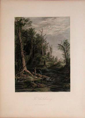
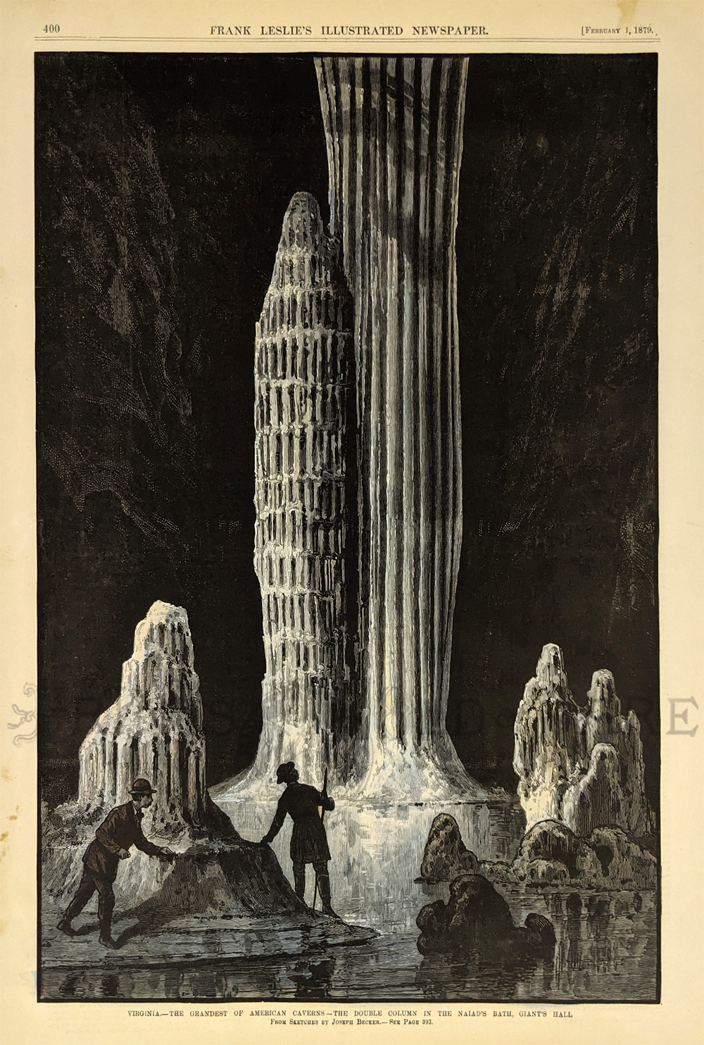
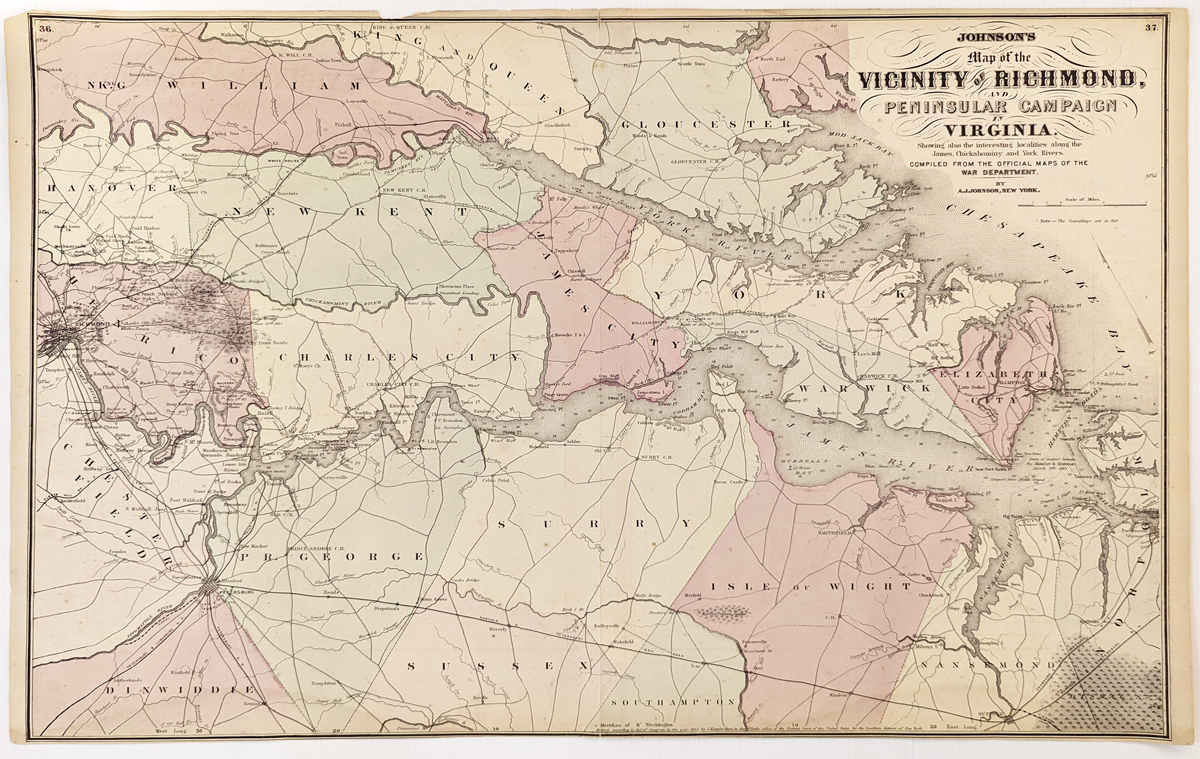
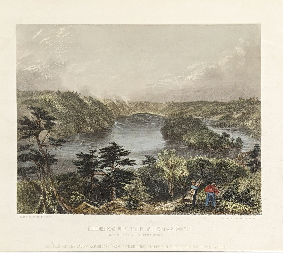
003va: 1873 The Chickahominy, Virginia. Hand colored steel engraving of hunters in a tranquil river scene. 9-1/2x12-1/2 in. $40 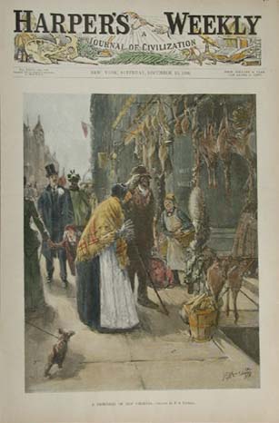 004va: Charming front page from the December 10, 1892 issue of Harper's Weekly. Hand colored antique engraving of a Richmond Market, titled, A Reminder of Old Virginia. 11x16 in. $50  005va: 1873 Virginia view. "Richmond from the James." Excellent hand colored rare steel engraving from Picuresque America. 12x9 in. $50  009va: ANTIQUE PRINT - VIRGINIA RESORTS 1885. Vignettes of famous Virginia landmarks - Natural Bridge & White Sulphur Springs. Hand colored engraving from Harper's Weekly, 1885. Very good condition. 15" x 22" $90  010va: Civil War Fortress Monroe, Virginia. Hand colored engraving of doctors treating the wounded. Ships docked in background, with text. 11x16 in. $50 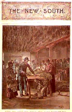 011va: 1887 PRINT - VIRGINIA - STRIPPING TOBACCO. Excellent hand colored antique engraving, cover of The New South, a supplement to Harper's Weekly, published January 29, 1887. "Danville, Virginia - Stripping Tobacco." Shows African American workers processing tobacco as plants hang drying from the ceiling. Slight water stain upper left corner. 11" x 16" $60 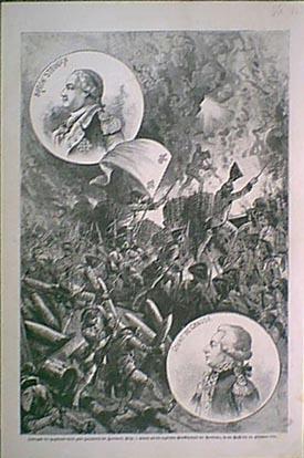 015va: Yorktown Revolutionary War view. This black & white German engraving was printed in 1881. 11-1/2x16 in. $30 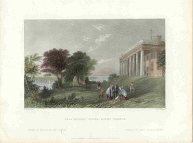 016va: 1838 Mount Vernon, Virginia. Bartlett hand colored steel engraving of George Washington's home. 10x8 in. $50  018va: Virginia Civil War Map. South side of James River and Chancellorsville. Litho color map produces by U.S. Government after the Civil War. Large scale, great detail. 29x19 in. $80 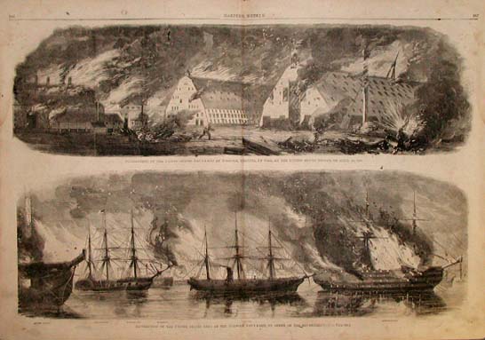 019va: 1861 Civil War- Norfolk, Virginia. Two large Civil War era engravings, published in Harper's Weekly, 1861. Destruction of U.S. ships at Norfolk Navy Yard, by order of the Government; and Destruction by Fire of the U.S. Navy Yard in Norfolk, by U.S. Troops on April 20, 1861. Authentic wartime coverage in Harper's. 22x16 in. $50 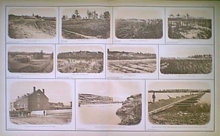 021va: Civil War Richmond Virginia. Excellent sepia tone views published on one large page by US Government after the War. 29x19 in. $100  022va: Civil War Yorktown - Williamsburg. Large litho Virginia map published by U.S. Government after the war. 29x19 in. $80  023va: 1884 Old Point Comfort Virginia. Several colored views of the old resort. Harper's. 16x11 in. $50 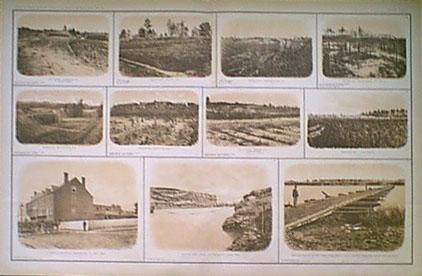 024va: Civil War Virginia Photogravures. Views from Civil War atlas produced by U.S. Government. Eleven very good sepia toned views on one large page. 18 x 29 in. $100 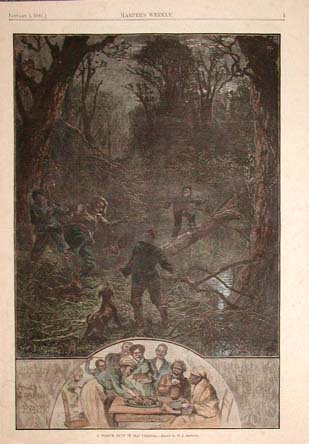 025va: 1881 - Possum Hunt in Virginia. Great hand colored engraving, "A Possum Hunt in Old Virginia." Full original page from Harper's Weekly, 1881. Shows group of Black men on a night hunt, and below is an image of the family sitting down to enjoy the meal. 11x16 in. $40  026va: 1862 - 1862 Johnson's Map of the Vicinity of Richmond and Peninsular Campaign in Virginia. Showing also the intersting localities along the James, Chickahominy and New York Rivers. Compiled from the official maps of the War Department. This hand colored map shows railroads, rivers, creeks, ferries, and battlefields. This map is in excellent condition. size: 18x27 in. $110  100va: 1880 Virginia Country Store Scene. Color, wood engraved print shows men in a Virginia country store discussing the Republican nominations. From an 1880 issue of Harper's Weekly. 11x16 in. $40  101va: 1885 Scene in an Old Virgina Tavern. Color wood engraved print shows a story telling scene in an old Virgina tavern. From an 1885 issue of Frank Leslie's Illustrated Newspaper. 11x16 in. $50 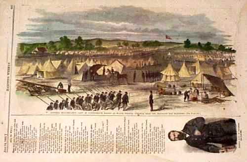 102va: 1861 Confederate Troops at White Springs, Virginia. Color wood engraved print shows General Beauragard's camp of confederate troops. From an 1861 issue of Harper's Weekly. 8x16 in. $40 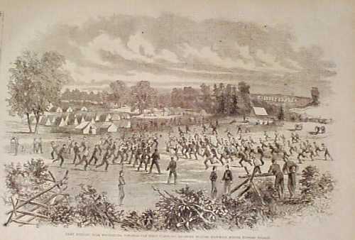 103va: 1861 Scene Camp Johnson, Winchester, Virginia. Wood engraved print shows the first Maryland regiment playing football at Camp Johnson. From an 1861 issue of Harper's Weekly. $30 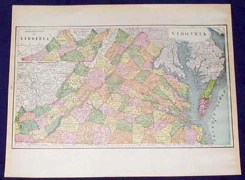 104va: 1910 Color Map of Western Part of Virginia. Authentic, antique color map of Virginia from 1910. 11x14 in. $30 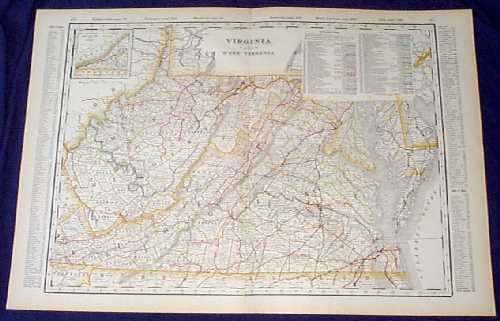 109va: 1901 Map: Virginia and West Virginia. Beautiful map from the 1901 first edition of George Cram's folio-size world atlas. Color coded lines on the map show the names and locations of railroads throughout the two states. State and county borders are outlined in yellow. Cities, towns and geographical features are all shown. 18x27 in. $100 SOLD  112va: 1886 George Washington's Room, Mount Vernon. Hand colored engraving from Harper's Weekly, titled "Mount Vernon: The Room in Which George Washington Died." Shows the interior of Washington's bedroom, where tourists are somberly walking through. 16x22 in. $100 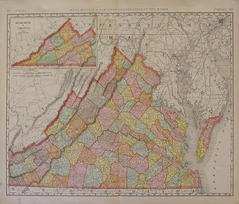 203va: 1898 Virginia. Large color map of Virginia with inset of Western Portion of Virginia in left upper corner.This map is from the Rand McNally Indexed Atlas and shows portions of Maryland, Pennsylvania, Deleware, and Kentucky.This map is in excellent condition. size: 20.5" x 28" $80 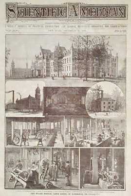 206va: 1886: Manual Labor School in Albermarle, VA. Engraved views from the Dec. 11, 1886 issue of Scientific American, showing scenes at the Miller Manual Labor School in Albermarle, VA. Included are views of the main building, chapel, laundry, boiler house, and several workshops. Excellent condition. 11x16 in. $30 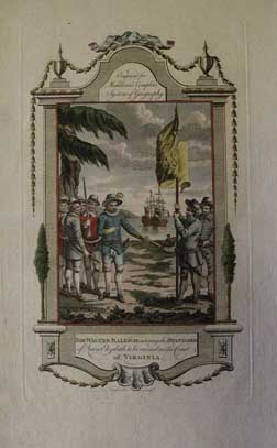
211va: Sir Walter Raleigh ordering the standard of Queen Elizabeth to be erected on the Coast of Virginia. Beautiful hand colored copper engraving from 1750. 9x14 in. $150 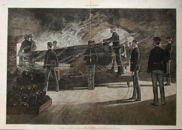 213va: Hand colored view of Fort Monroe in Virginia. Engraved by R.F. Zogbaum for Harper's Weekly published April 2, 1887. Caption below image reads 'Firing a gun in an old casemate fort'. Excellent condition, archivally repaired along center crease. 16 x 22 in. $120 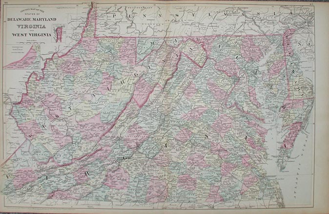 214va: County Map of the States of Delaware, Maryland, Virginia and West Virginia. Beautiful hand colored map published in 1881 by Mitchell. Map has each county individually colored and small insets of the western part of Virginia and Hancock. 15 X 23.5 in. $90 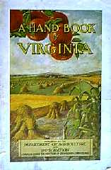 1190va: A Handbook of Virginia - 1915. Published by Dept. of Agriculture & Immigration, Richmond. 176 pages, soft cover illustrated publication designed to lure new settlers and business to Virginia. Profusely illustrated with photos, contains a colorful foldout map of the State. $80 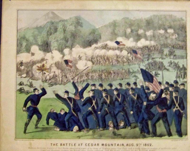 083ci: C.1864 Currier & Ives hand colored lithograph titled, "The Battle At Cedar Mountain, Aug. 9th 1862." Image is in good condition with toned margins and good color. 13-3/4 x 11 in. $250
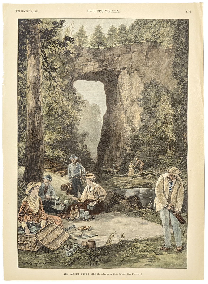
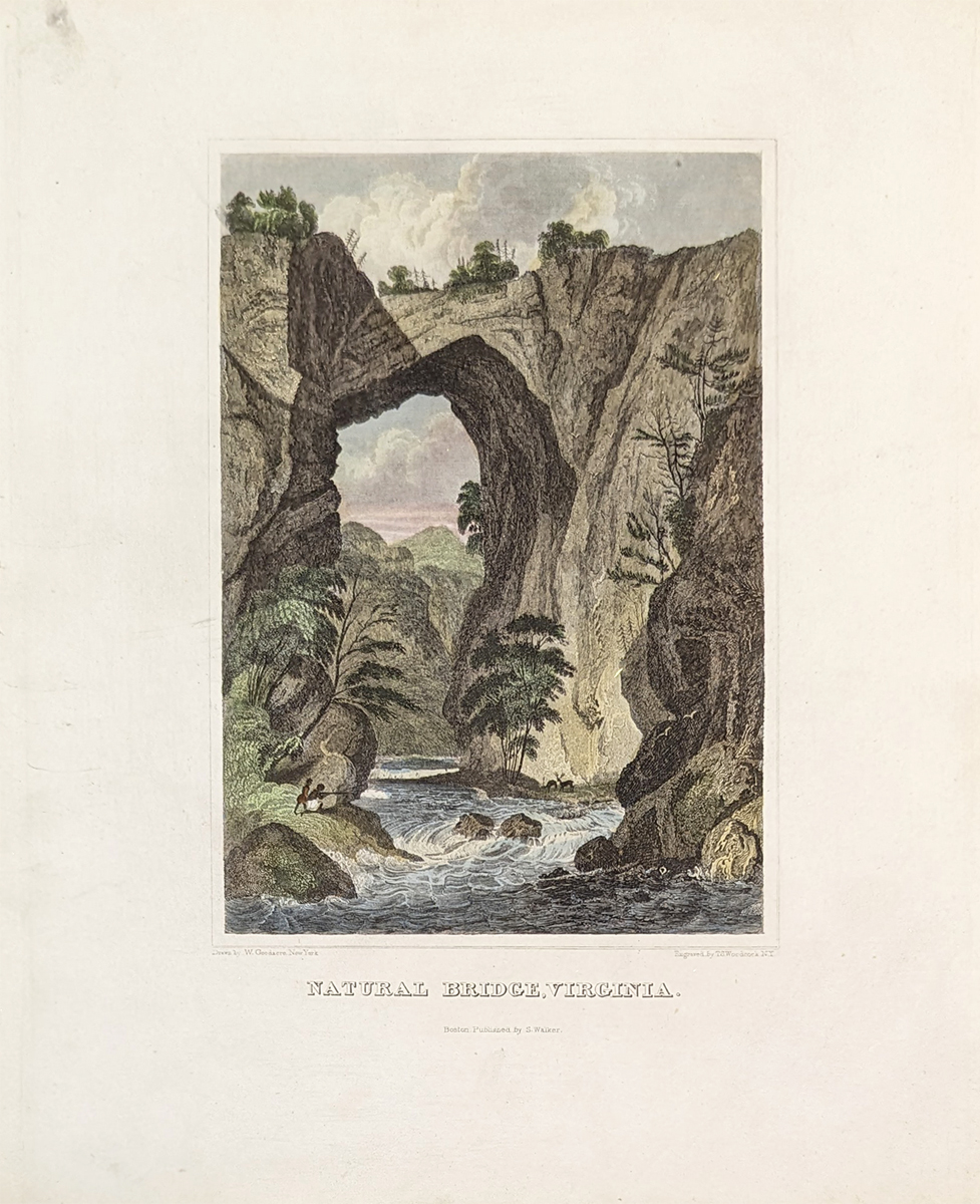
|

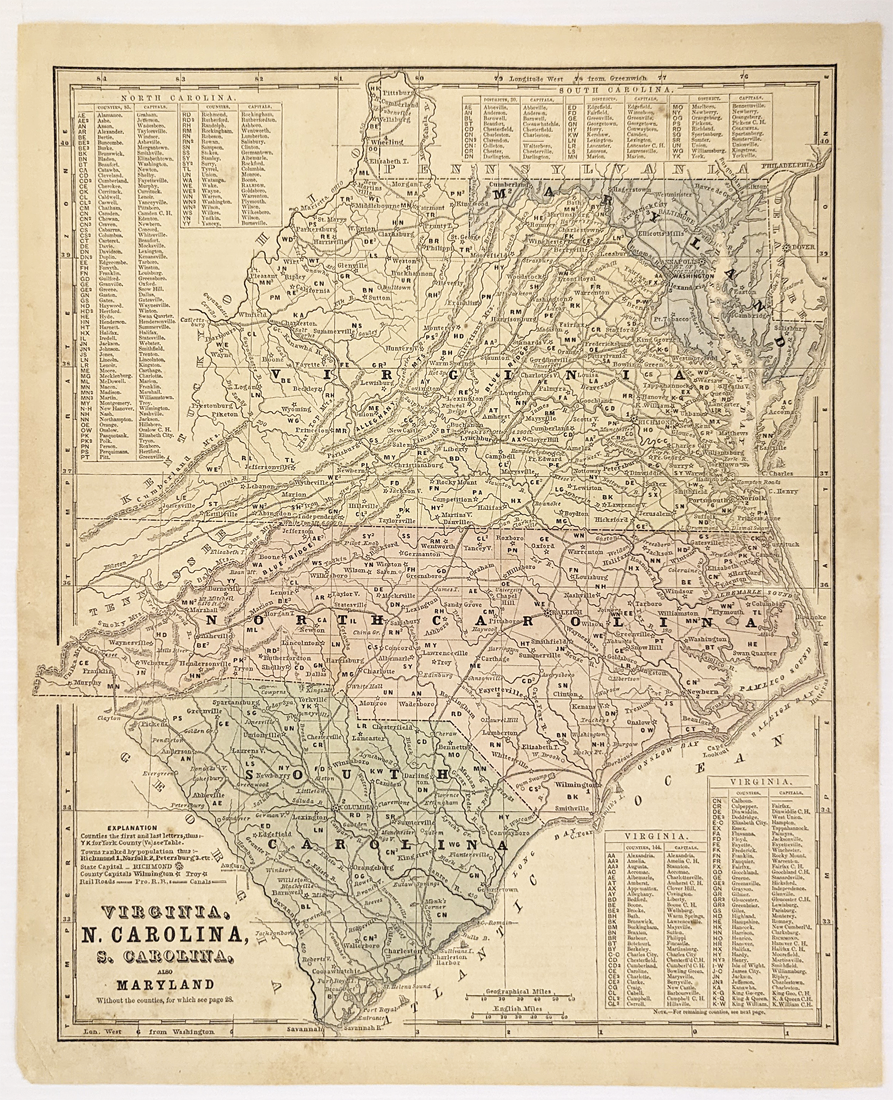
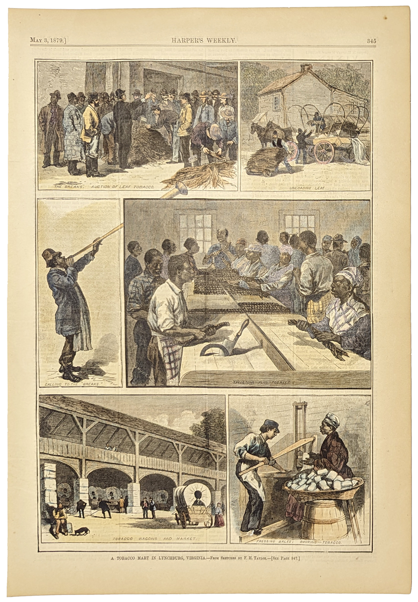
242Virginia: Carte Geographique, Statistical and Historical De La Virginie, Buchon 1825 - A rare double folio engraved and original color map of Virginia in French, from the first edition of Carey & Lea's Atlas. Carey’s typical text insets about geography, rivers, climate, populations etc., surround map in center. Size includes text below map, which includes wonderful contemporary details concerning the topography, indigenous lands, rivers, climate, towns, manufacturing, commerce, education, history, population by county (divided into white, free colored, and slaves) and other information. Special Note: Carey & Lea's Atlas is highly prized not only for its cartographic information but the marvelous information about each of the states and territories which is included. The atlas was issued in 6 editions in English, French & German, between 1822 and 1827. Condition: Very good, heavy stock small left margin, some browning on edges and inside map. size 18 x 25 image $400 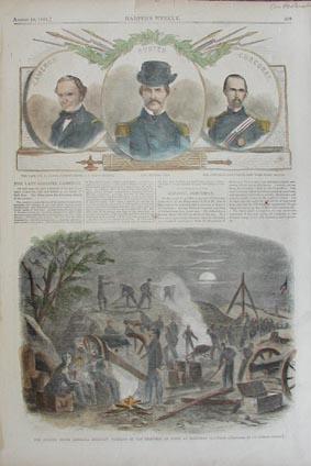 218va: Hand colored wood engraving from the August 10, 1861 issue of Harper's Weekly. Lower image shows, The Fourth South Carolina Regiment Working in the Trenches at Night at Manassas Junction. Three portraits on the top of page show, Col. Cameron, Seventy-Ninth N.Y. State Militia; Col. Hunter, U.S.A.; and Col. Corcoran, Sixty-Ninth New York State Militia. 11 X 16 in. $40 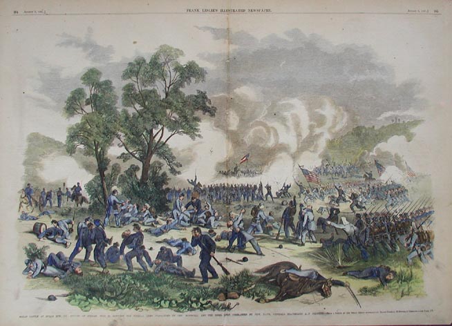 219va: Beautiful hand colored double page engraving from the August 3, 1861 issue of Frank Leslie's Illustrated Newspaper. Great Battle at Bull's Run, Va. Fought on Sunday, July 21, Between the Federal Army Commanded by Gen. McDowell, and the Rebel Army Commanded by Jeff. Davis, Generals Beauregard A.D. Johnston. 16 X 22 in. $90 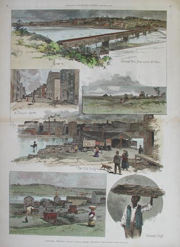 220va: Double page hand colored wood engraving from the Supplement to Harper's Weekly dated January 29, 1887. Titled: Danville, Virginia. Print shows several scenes of the town including; The Old Bridge, A Group of Warehouses, and General View from across the Dan. 16 X 22 in. $120 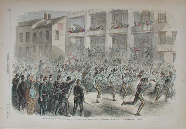 221va: Second Mississippi Regiment (wildcats) Passing along Main Street, Winchester, on their way to Bunker Hill, Virginia. Hand colored wood engraving from the August 3, 1861 issue of Harper's Weekly. 16 X 11 in. $40 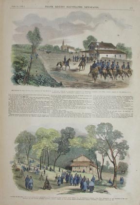 222va: Two hand colored engravings from the June 29, 1861 issue of Frank Leslie's Illustrated Newspaper. Lower image shows the Arrival of the First and Second Connecticut Regiments at the Village of Falls Church, Near Vienna, Va., on Wednesday Morning, June 19th Subsequent to the Surprise of the Ohio Regiment by the Masked Secession Battery. Upper image shows The Village of Falls Church, Va. - Arrival of the Second U.S. Cavalry, Company B. Lieutenant Tompkins, on Wednesday Morning, June 19th. 11 x 16 in. $60 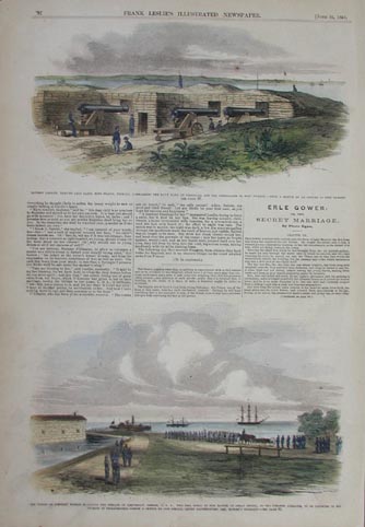 224va: Two hand colored wood engravings from the June 22, 1861 issue of Frank Leslie's Illustrated Newspaper. Lower image captioned, The Troops at Fortress Monroe Escorting the Remains of Lieutenant Greble, U.S.A., who Fell Nobly at the Battle of Great Bethel, to the Steamer Adelaide, to be Conveyed to his Friends in Philadelphia. Top image titled, Battery Lincoln, Erected upon Santa Rosa Island, Florida, Commanding the Navy Yard at Pensacola and the Approaches to Fort Pickens. 11 x 16 in. $60 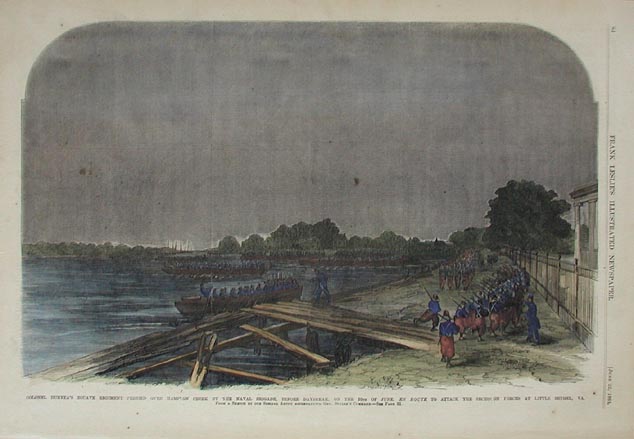 225va: Colonel Duryea's Zouave Regiment Ferried over Hampton Creek by the Naval Brigade, Before Daybreak, on the 10th of June, En Route to Attack the Secession Forces at Little Bethel, Va. Very nice hand colored wood engraving from the June 22, 1861 issue of Frank Leslie's Illustrated Newspaper. 16 X 11 in. $60 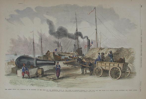 226va: Hand colored wood engraving titled, The Great Union Gun, Intended to be Mounted on the Deck of the Minnesota, Now on the Dock at Fortress Monroe, Va. - The Shot for the Union Gun Weighs Three Hundred and Fifty Pounds. From the August 10, 1861 issue of Frank Leslie's Illustrated Newspaper. 16 x 11 in. $60 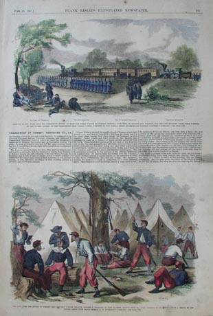 229va: Two hand colored wood engravings from the June 29, 1861 issue of Frank Leslie's Illustrated Newspaper. Bottom image shows The Day After the Battle of Romney - The Eleventh Indiana Zouaves, Colonel L. Wallace, in Camp M'Ginnis. Upper image of the Arrival of Gen. Tyler with the Connecticut Troops, to Support General Schenck and the Ohio Regiment near Vienna. 11 x 16 in. $60  228Virginia: 1850 1850 Cowperthwait hand colored New Map of Virginia With its Canale, Roads & Distances, which also shows the stagecoach and steam boat routes and the Chesapeake Canal. 17 x 13-1/2 in. $400 SOLD 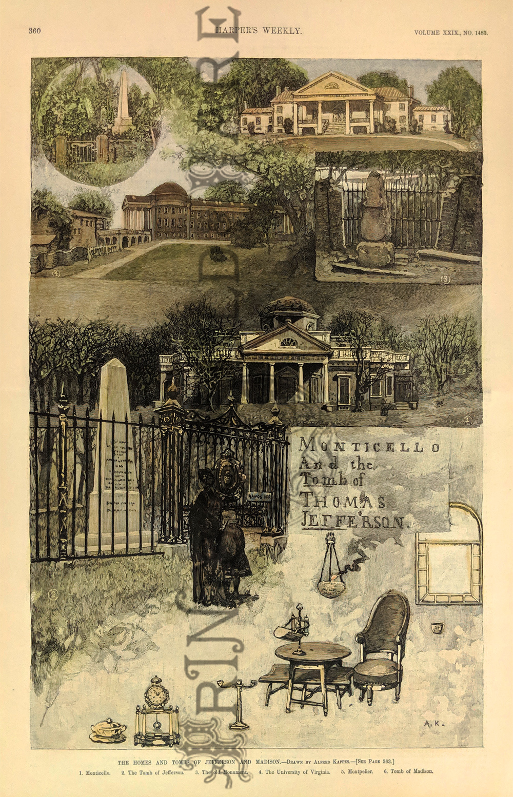 229pre: "The Homes and Tombs of Jefferson and Madison." Drawn by Alfred Kappes. Showing the Monticello, the tomb of Jefferson, The old Monuments, The University of Virginia, Montpelier, and tomb of Madison." Foreground shows some 18th century furniture. 1885 Harper's Weekly. Hand colored, wood engraving. 11 x 16 in. $80 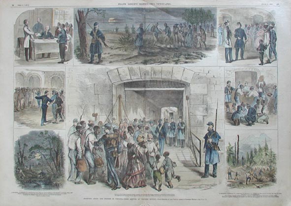 230va: Beautiful hand colored wood engraved double page spread. From the June 8, 1861 issue of Frank Leslie's Illustrated Newspaper. Stampede among the Negroes in Virginia - Their Arrival at Fortress Monroe. Shows several scenes of slaves escaping their owners and running away to Fortress Monroe, and slave owners trying to reclaim their runaway slaves. Center fold has been archivally reinforced. 16 X 22 in. $180 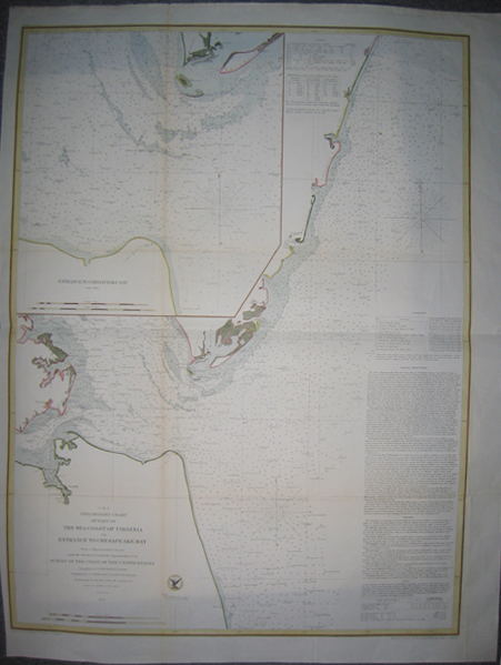 232va: 1855 Preliminary Chart of Part of The Sea Coast Of Virginia And Entrance To Chesapeake Bay - From a Trigonometrical Survey, under the direction of A.D. Bache, Superintendent of the Survey of the Coast of the United States. Triangulation by John Farley, Assistant; Topography by G.D. Wise, Assistant & J. Seib, Sub-Assistant; Hydrography under the command of Lieut. J.J. Almy U.S. N. Assist., 1855. Map is engraved by E. Yeager, H.S. Barnard, A. Petersen & App. R.F. Bartle. Map is in excellent condition and surrounded by wide yellow and black border. 23x30.5in. $300 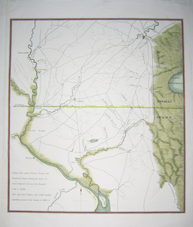 234va: RARE 1834 American State - A map of the country betwixt Chowan and Nansemond Rivers, showing the trade of a Canal proposed to be cut from Bennett's Creek to Suffolk. Vide. Acts of the Virginia and North Carolina Assemblies passed at the Session of 1804-5. Map also shows the boundary between Virginia and North Carolina. Map in excellent condition with orange and black border. 13.5x16in. $250  235va: 1886 Virginia - The Confederate Veteran's Home At Richmond - Distributing Rations of Tobacco - From a Sketch By a Staff Artist. Hand colored wood engraving published in Frank Leslie's Illustrated Newspaper on November 13, 1886. Scene depicts a group of male veterans lining up to receive their rations of tobacco. 11x16in. $60 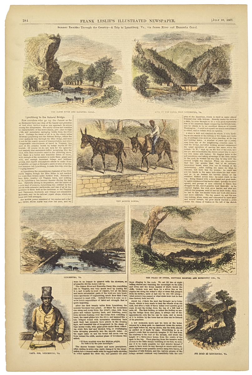 236va: 1867 Summer Rambles Through the Country - A Trip to Lynchburg, Va., via James River and Kanawha Canal. Seven hand colored wood engravings with text published in Frank Leslie's Illustrated Newspaper on July 20, 1867. Each scene depicts various cities and people in Virginia. 10.5x15.5in. $60 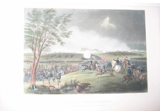 237va: c1863 Battle of Chancellorsville - General Sickles' Division Covering the Retreat; John R. Chapin, del. Steel engraving depicting the Battle of Chancellorsville. 7x10in. $40 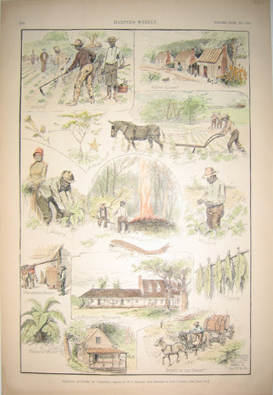 238va: 1885 Tobacco Culture In Virginia - Drawn by W.L. Sheppard From Sketches by John S. Gibbs. Hand colored wood engravings depicting the tobacco culture and process in Virginia. Published in Harper's Weekly in 1885; Volume XXIX., No. 1505. 11x16in. $60 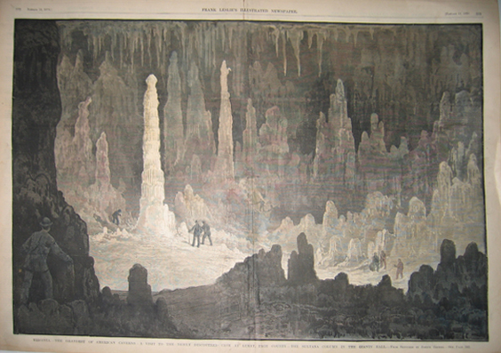 239va: 1879 Virginia - The Grandest of American Caverns - A Visit to the Newly Discovered Cave at Luray, Page County - The Sultana Column In the Giants' Hall - From Sketches by Joseph Becker. Double -page hand colored wood engraving published in Frank Leslie's Illustrated Newspaper on January 11, 1879. Scene depicts the majestic Luray Cave in Page County, with the Sultana Column in Giants' Hall. 16x22in. $100 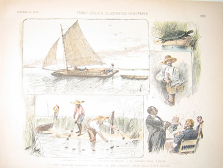 241va: 1889 The Terrapin-Catching Industry on the Virginia Coast - Drawn by W.L. Sheppard. An assortment of hand colored wood engravings published in Frank Leslie's Illustrated Newspaper on October 19, 1889. Each scene depicts the process of terrapin fishing. 8.5x11in. $40  245va: 1857 Rare authentic lithograph titled, "Viaduct on Cheat River B & O R.R." which was Entered According to Congress in the year 1857 by Ed Beyer in the Clerk's Office of the District of Virginia. This is the original tinted lithograph which was enhanced by professional water colorists. Condition is very good. 24 x 16 in. $600 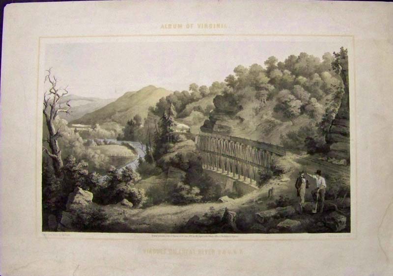 246va: 1857 Original Stone lithograph titled, "Viaduct on Cheat River B & O R.R." which was featured in Beyer's Album of Virginia and Entered According to Congress in the year 1857 by Ed Beyer in the Clerk's Office of the District of Virginia. This lithograph is in excellent condition with full margins. 23 x 16 in. $525 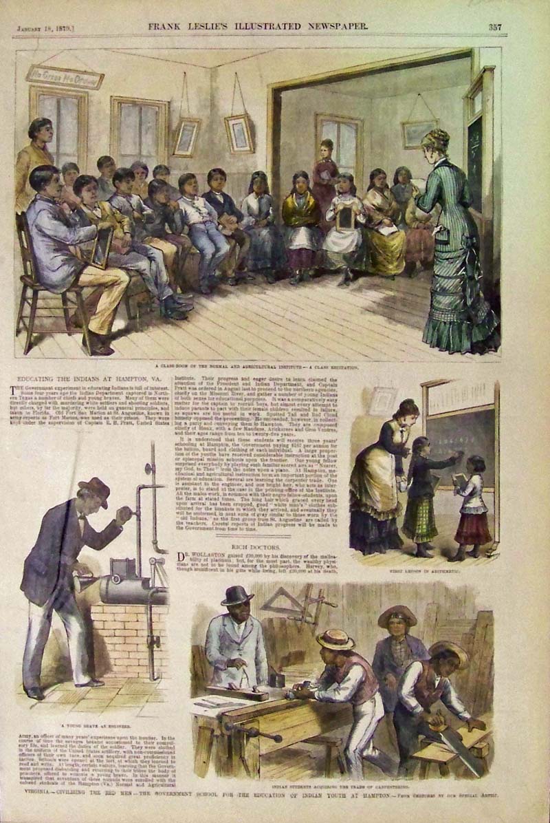 247va: 1879 Hand colored wood engraving featured in Frank Leslie's Illustrated Newspaper showing an "Indian School" in Hampton, Virginia. Four vignettes depict the young Indians in class,including the article. Title of images is, "Virginia -- Civilizing the Red Men -- The Government School for the Education of Indian Youth at Hampton." 16 x 11 in. $125 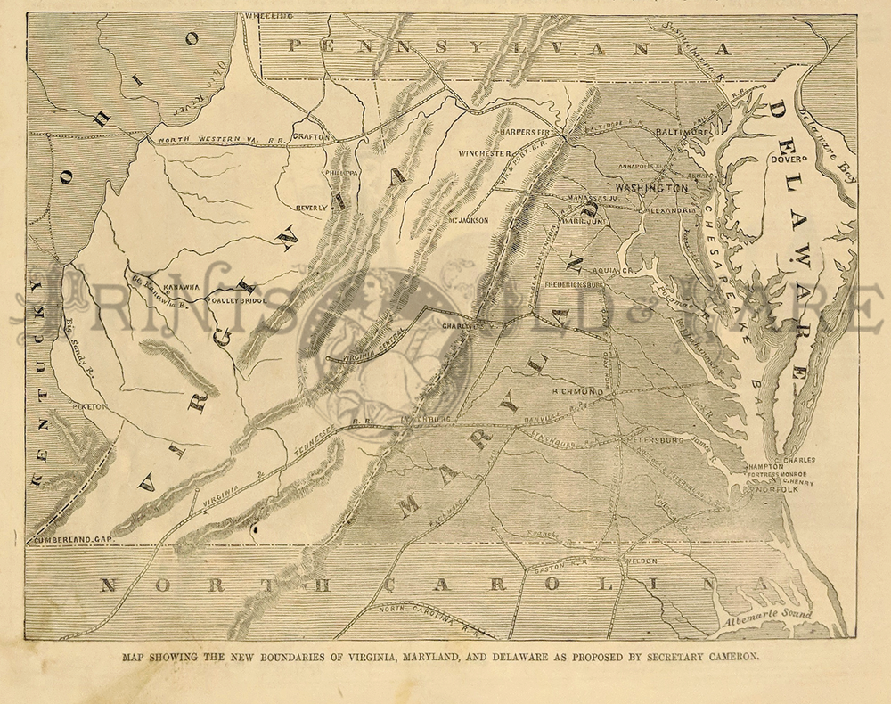
248va: "Map Showing The New Boundaries of Virginia, Maryland, and Delaware as Proposed by Secretary Cameron." Interesting map showing a federal government proposal to redraw the borders of Maryland, Virginia, Delaware, and DC. The reason: To spite Virginia for the Civil War and better protect the capital from attack. 1861 Harper's Weekly. Wood engraving. 7 x 10 in. $60 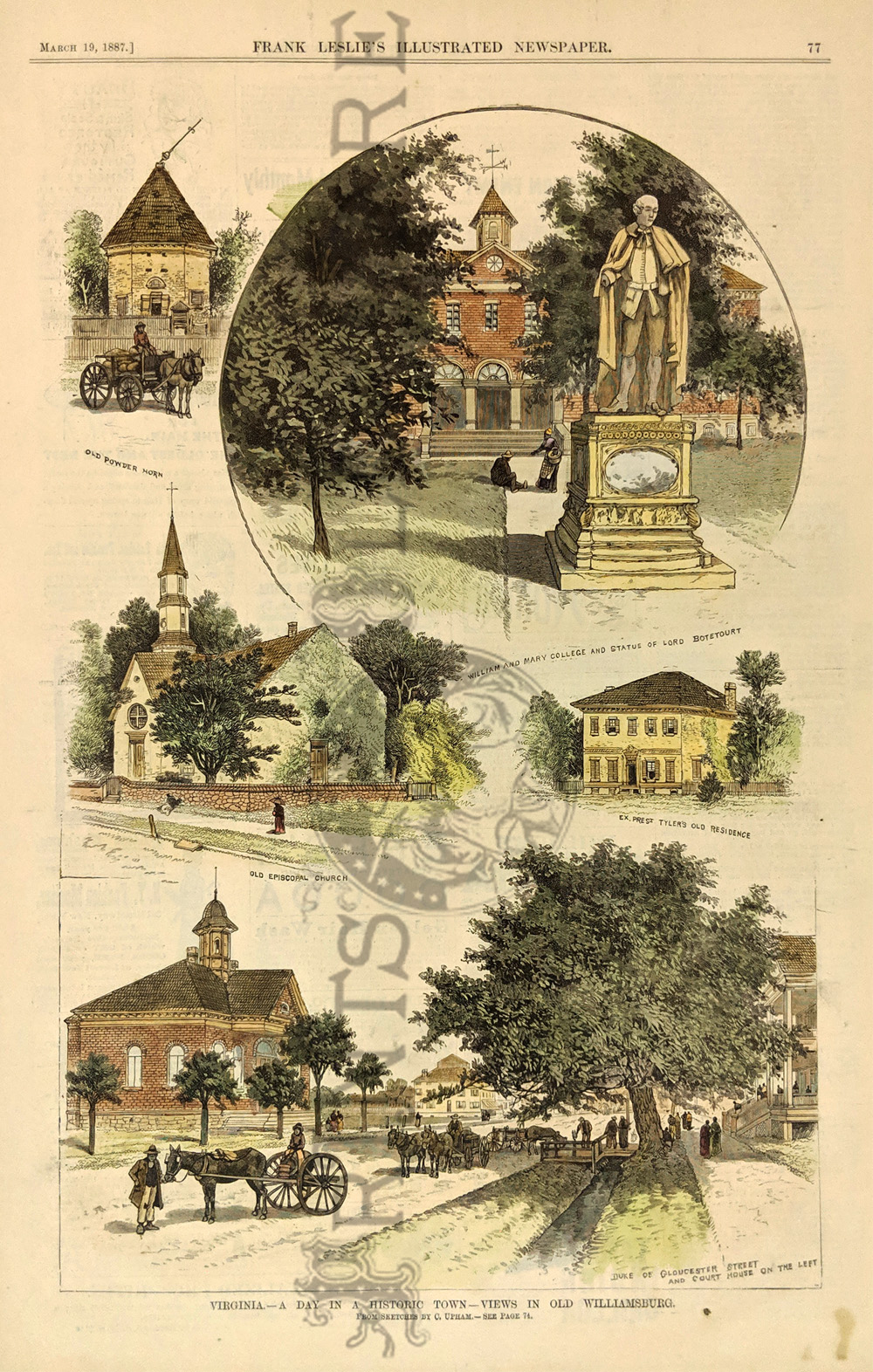 250va: "A Day in a Historic Town - Views in old Williamsburg, Virginia." 5 Vignettes showing the old episcopal church, ex pres. Tyler's old residence, old powder horn, William and Mary College, and statue of Lord Botetourt, and Duke of Gloucester St. with the court house on the left. 1887 Frank Leslies' Newspaper. Hand colored, wood engraved. 11 x 16 in. $80  252va: Johnson's 1866 Virginia, Delaware, Maryland and West Virgina Map. Shows various cities, towns, rivers and assortment of additional topographical details. 5 Vignettes showing Fortress Monore, University of Virgina, General Post Office, Treasury Buildings and a Patent Office. 16 x 26 1/2 in. $100
|
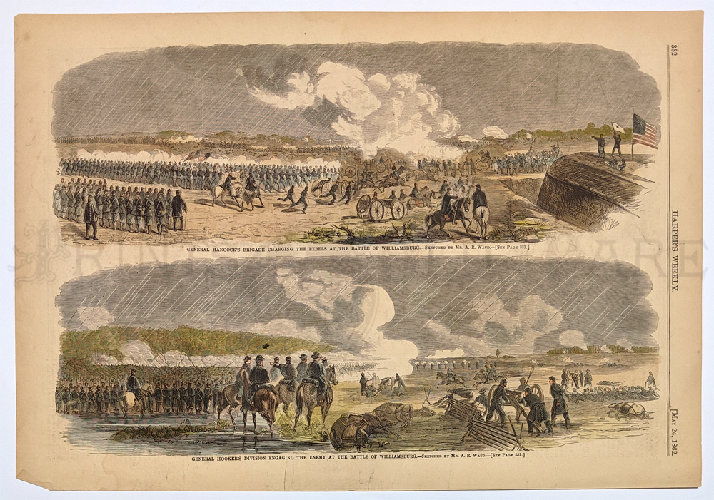
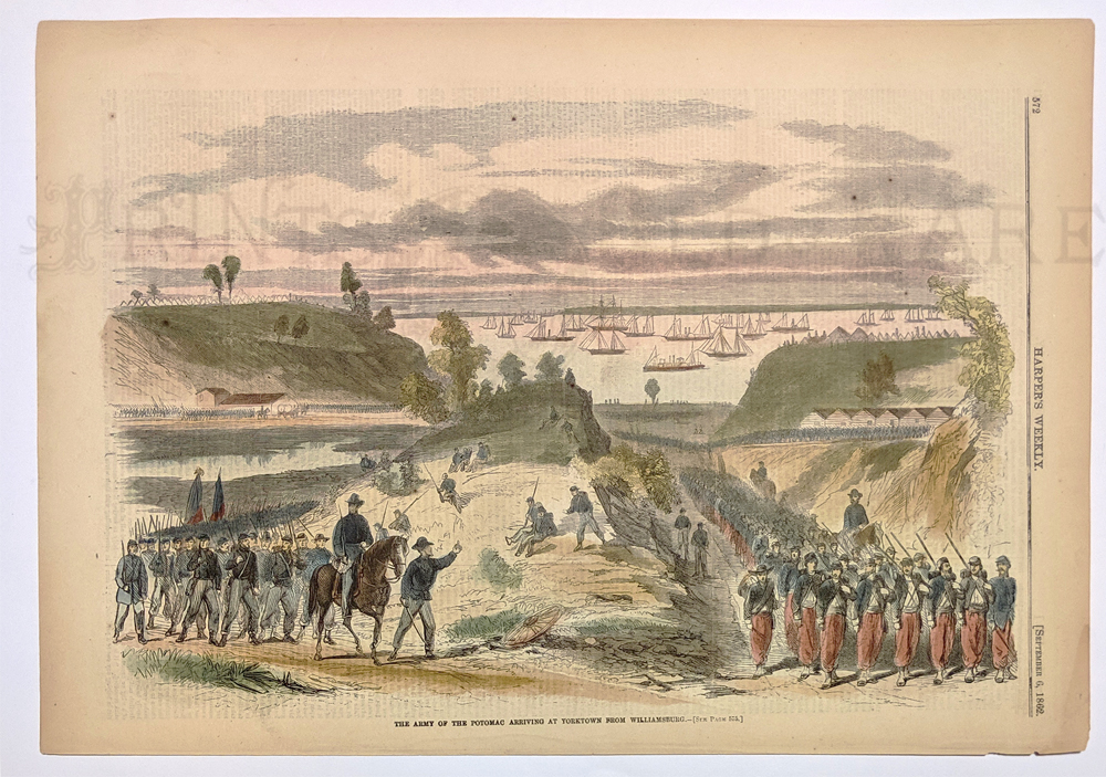
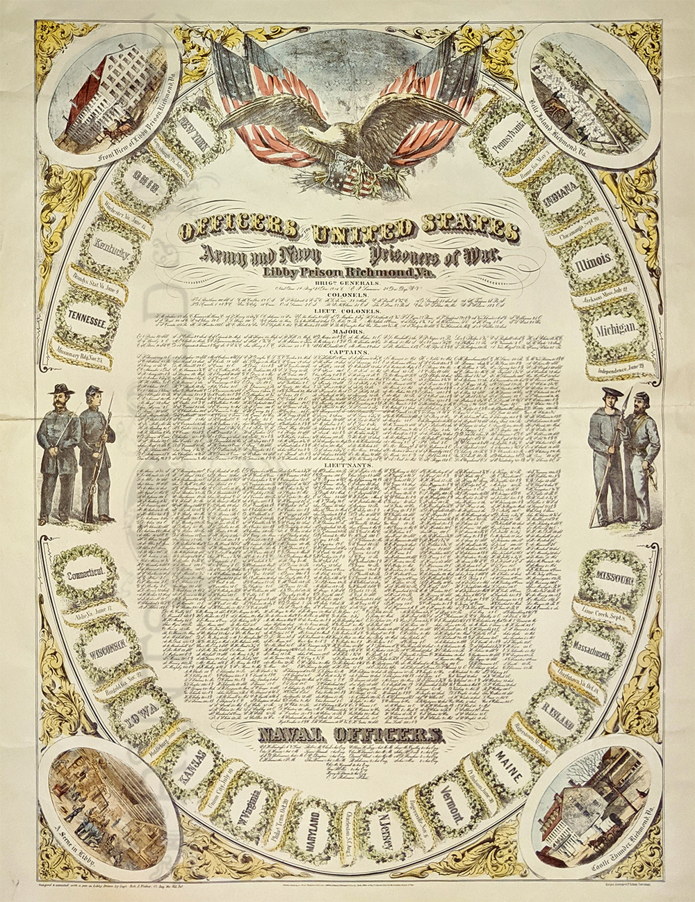 223cw: Officers of the United States Army and Navy Prisoners of War. Libby Prison, Richmond, Va. Huge lithograph which lists Army officers listed first by rank, followed by short list of Naval officers. Penned by Captain Robert J. Fisher of the 17th Missouri Volunteers during his imprisonment. The list is surmounted by a patriotic eagle and is surrounded by the name of each state in the Union. Print features vignettes in each corner depicting scenes of Libby Prison, Belle Island, and Castle Thunder, in Richmond, VA. *Archivally mended and patched. 27 x 41 in. $300 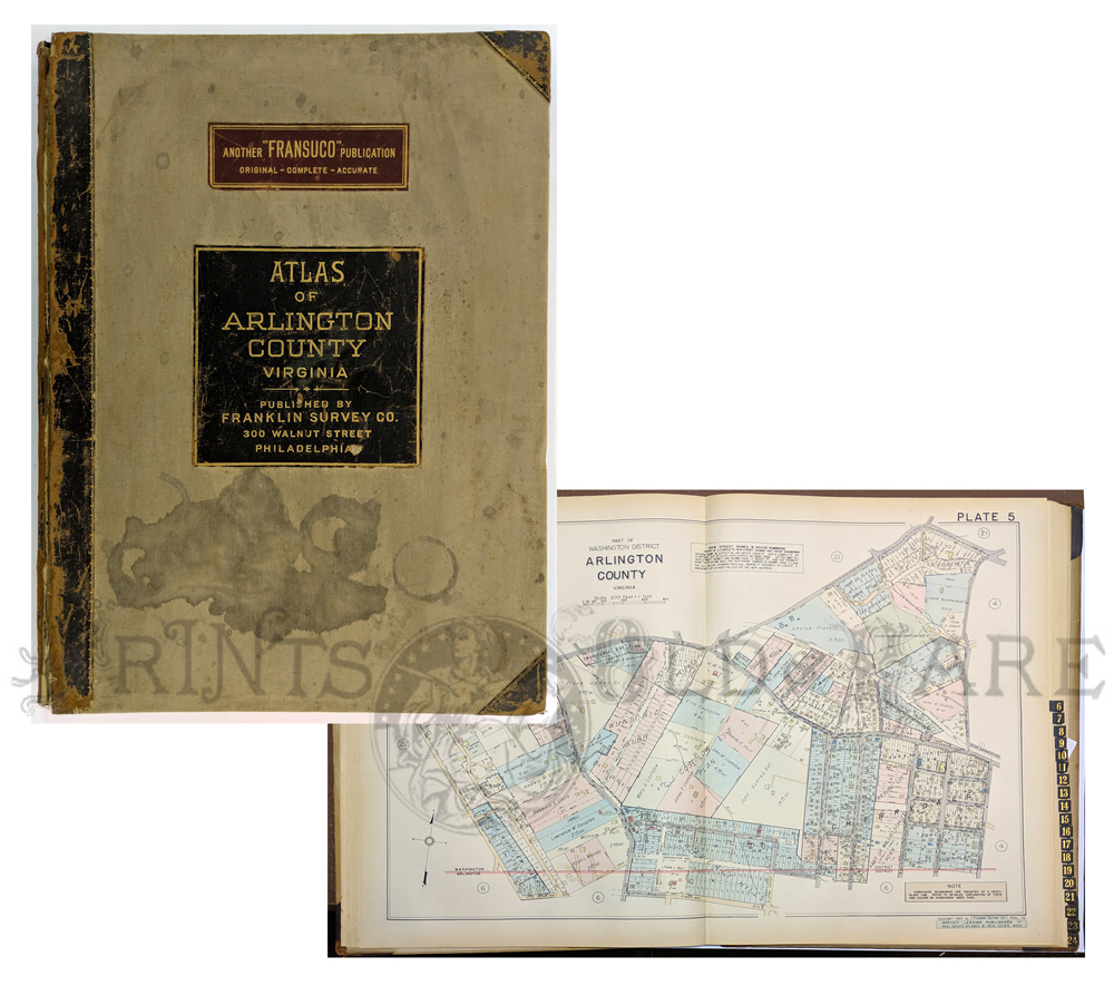 288Virginia: Atlas of Arlington County, Va. 1935. 26 colored maps including index and zone maps. Shows buildings, roads owners. Also has index of subdivisions. Elephant folio. Franklin Survey Co. Philadelphia. 18 3/8 x 24 1/4 in. $1,950 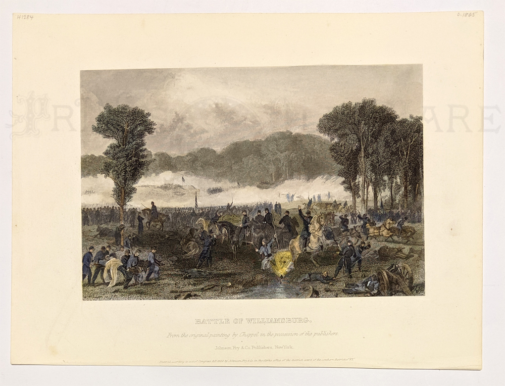 255va: Battle of Williamsburg. Fron the original painting by Chappel in the possession of the publishers. c.1865. Hand colored, steel engraving. 8 x 10 1/2 in. $80 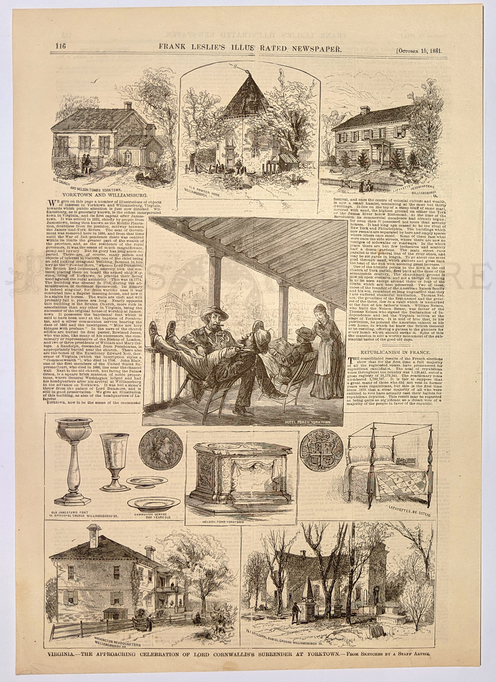 256va: "The Approaching Celebration of Lord Cornwallis's Surrender at Yorktown - Virginia." 1881 Frank Leslies' Newspaper. Shows 9 scenes of the hotels, church, burial ground and headquarters in Williamsburg & Yorktown. Wood engraving. 11 x 16 in. $40 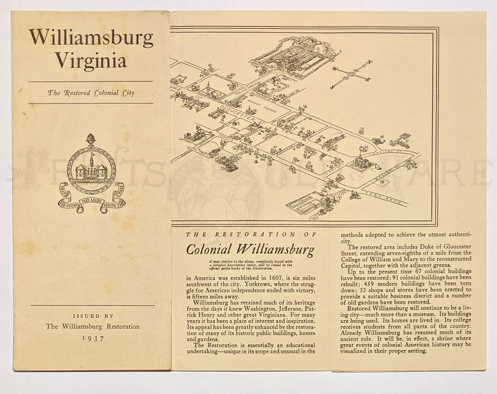 257va: 1937 Williamsburg, Virginia. The Restored Colonial City brouchure. Showing a small maps of the city with a key showing the various points of interest. Second map on verso showing the distances from Williamsburg to surrounding cities. 9 x 20 in. $30
|
|||||||||
| Order Form | |||||||||||
| Back to Homepage | |||||||||||