|
|||||||||||
This is a small selection of our inventory of antique Washington maps and prints. Additional inventory is available. Contact us with your request. 1-800-879-6277
|
|||||||||||
|---|---|---|---|---|---|---|---|---|---|---|---|
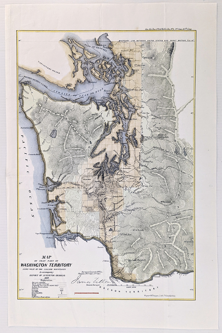
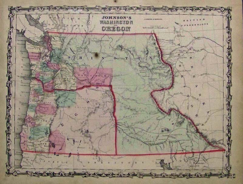
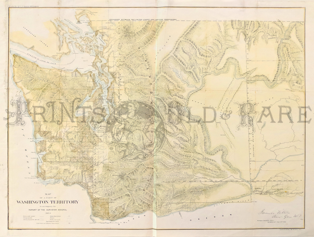
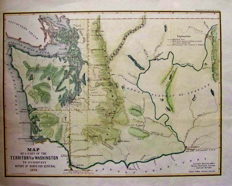 000Washington: 1855 Rare Map of a Part of the Territory of Washington to Accompany Report of Surveyor General. Hand colored lithographed map by James Tilton, Surveyor General. 21-1/2 x 17-1/2 in. $400 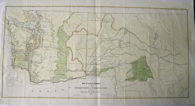
001Washington: Map of Public Surveys in the Territory of Washington, Henry 1862 A very large horizontal hand colored map created from surveys by Anson Henry (37th Cong 3d sess. House . Ex Doc No1) Shows mountains and rivers and areas where surveyed had been completed, extends from Rocky Mountains to the Olympic Peninsulat with extreme detail of Seattle and the Columbia River, nice shading and coloring throughout. Condtion: Folds but no browning and wide untrimmed margin. size 34.5 x 17 image $600 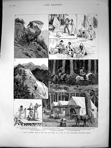
002wa: 1886 Scarce Mountain Mines of Washington. Titled "A Lady's Camping Tour in the Far, Far West." Five delightful hand colored views by a London publisher. 11-1/2x16 in. $60 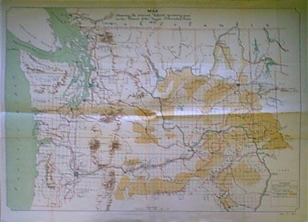 006wa: 1892 Wheat Growing Map, Washington. Columbia River region. Population of cities and counties given, railroads in red. Great detail, printed in color by US Government. 30x24 in. $100 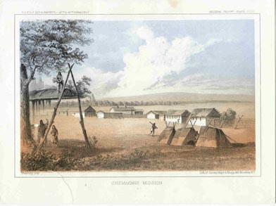 009wa: 1855 Washington Chemakane Mission. Lithograph by US Government for possible railroad route at 47th-49th parallels. Color view shows Indian settlement. 10-1/2x8 in. $60 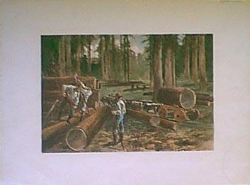
011wa: 1888 Lumbering in Washington. Hand colored photo-engraving. Impressive picture of the lumberjacks at work. 16x12 in. $60 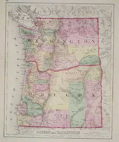 100wa: 1873 Map of Washington, Oregon by Gray. Beautiful, hand colored map from Gray's 1873 world atlas. Shows cities, towns, railroad lines and geographical features. Each county is colored separately. 14x17 in. $100 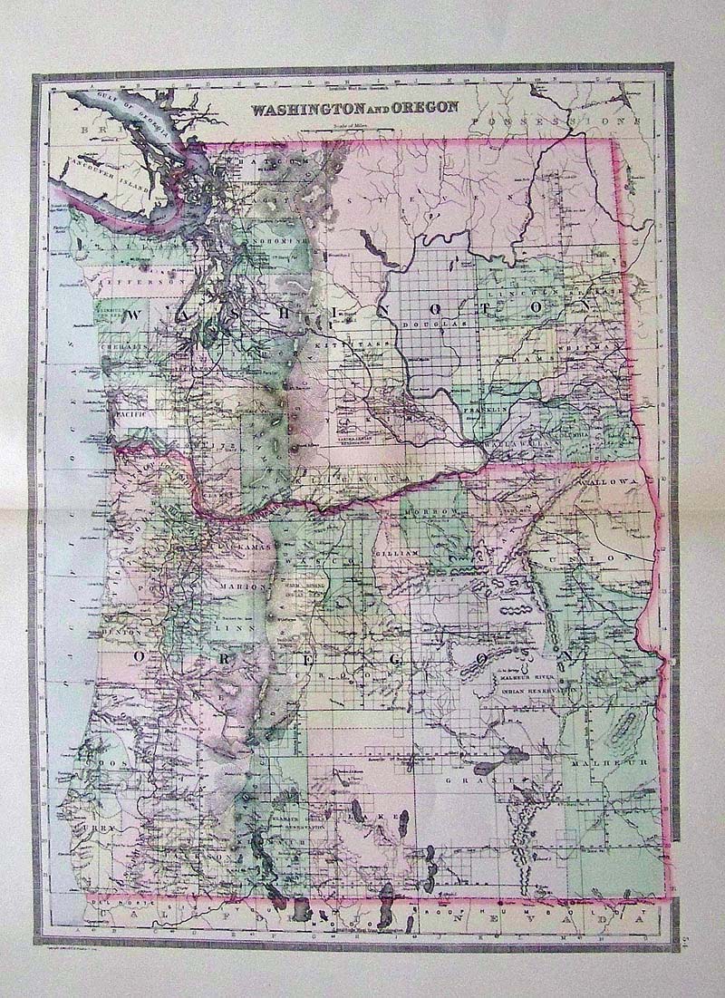 102Wasington: 1891 Bradley's Atlas of the World's hand colored map of Washington and Oregon. 26 x 19 in. $80 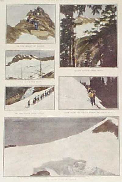
104wa: 1899 Views on the Cascade Mountains. Hand tinted photos from Harper's Weekly, titled "Climbing the Cascade Mountains: The Annual Outing of the Mazama Club." Shows groups of hikers ascending the mountains, as well as views of the surrounding scenery. In the center of the page, there is a very faint stamp from a library that previously owned this print. The stamp is visible, but not distracting. 11x16 in. $40 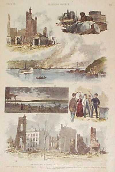
105wa: 1889 Seattle Washington Fire Scenes. Hand colored engraving from Harper's Weekly, titled "The Great Fire at Seattle. Contains scenes of the fire itself, and the ruins of the city afterwards. 11x16 in. $50 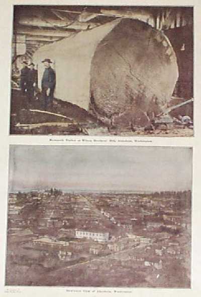
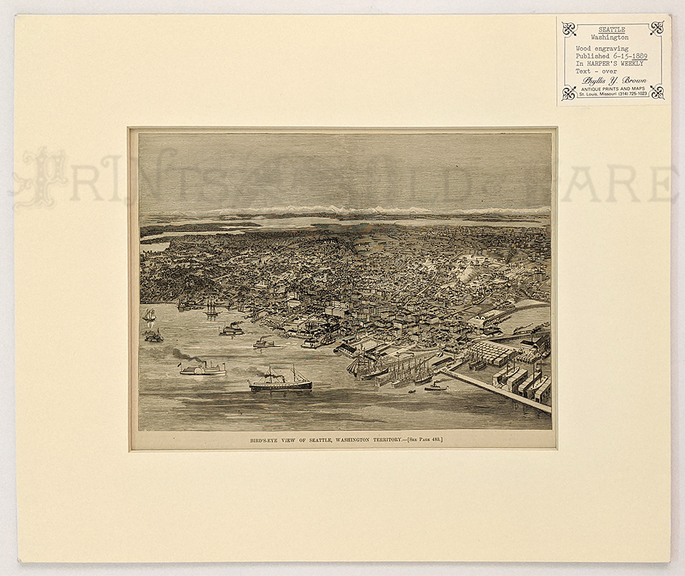
107wa: 1909 Aberdeen Washington Scenes. Two hand tinted rare photos from a 1909 publication, showing scenes in Aberdeen Washington. At top is a view of a mammoth log in an Aberdeen saw mill. At bottom is a bird's-eye view of the city. 11x16 in. $40 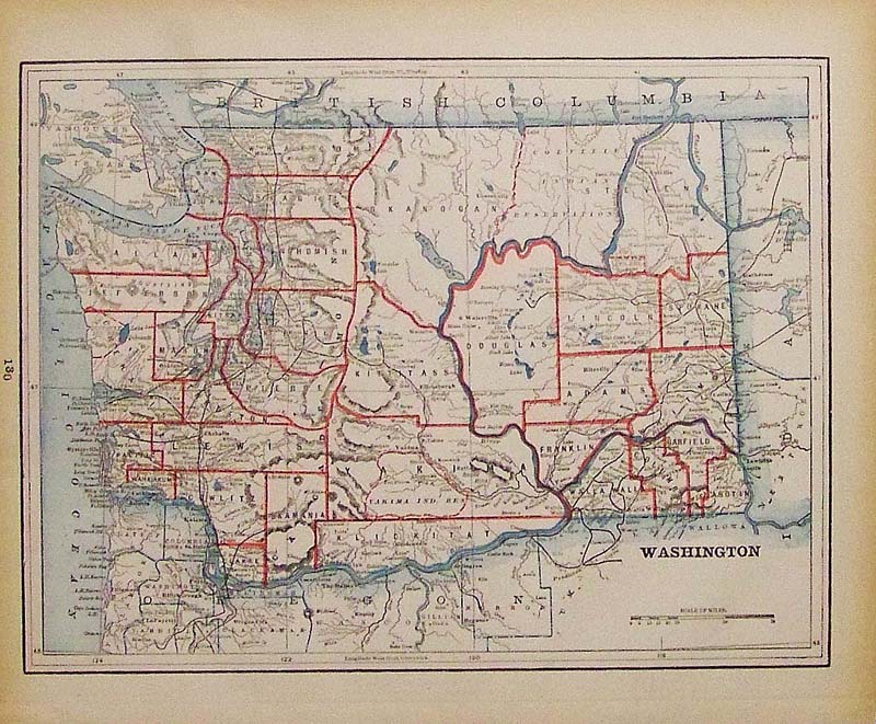 108Washington: 1881 Hand colored engraved Washington map showing Counties outlined in red. 13-1/2 x 11 in. $50 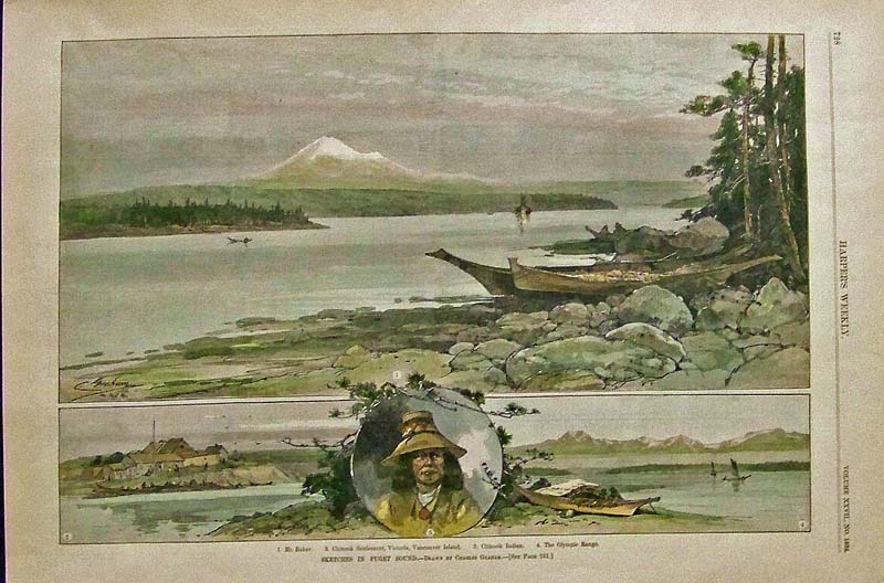
109Washington: 1883 Harper's Weekly hand colored wood engraving showing Sketches in Puget Sound. Drawn by Charles Graham. 16 x 11 in. $80 
110Washington: 1902 Dodd, Mead & Company color map of Oregon and Washington. 12-1/2 x 10 in. $30 
111Washington: Color Washington map showing outlined counties. 14-1/2 x 10 in. $30 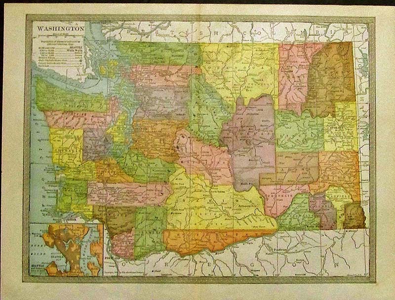
112Washington: 1904 Colorful map of Washington with a small inset of Seattle in bottom left corner. 13-1/2 x 10 in. $40 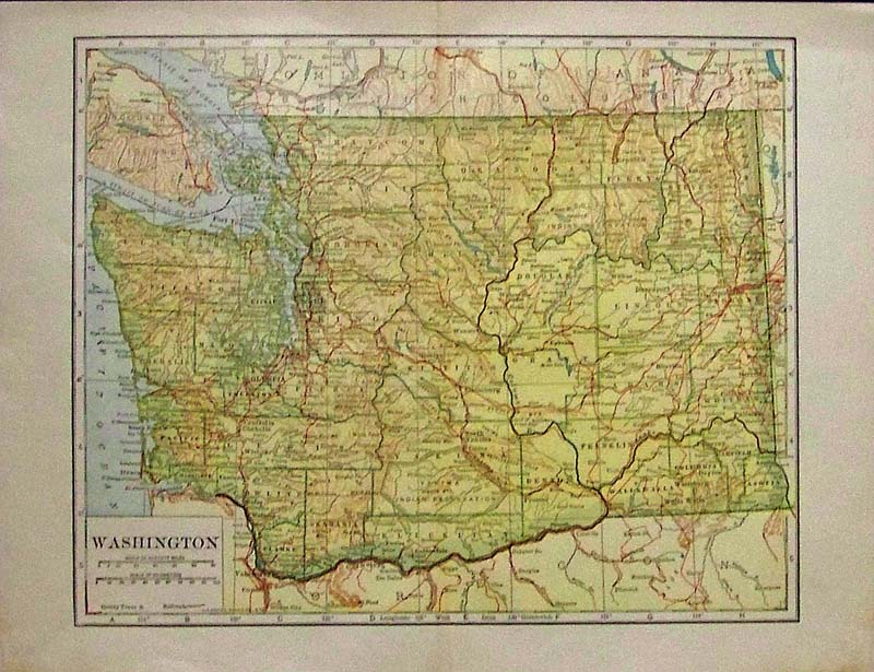
113Washington: Color map showing Washington and its vicinity. 13 x 10 in. $30 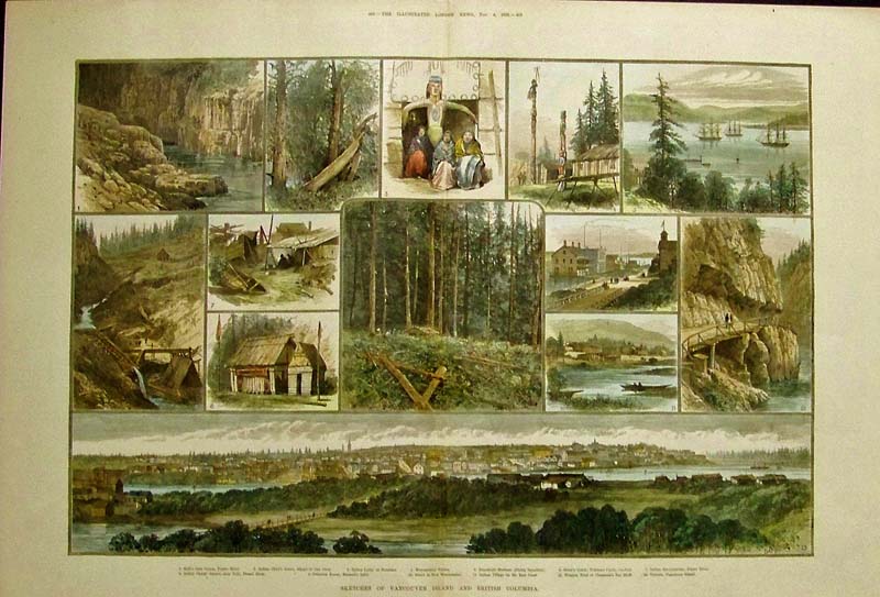
114Washington: 1882 Hand colored wood engraving showing Sketches of Vancouver Island and British Columbia. Featured in The Illustrated London News. 22-1/2 x 15-1/2 in. $150 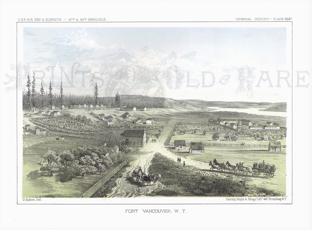
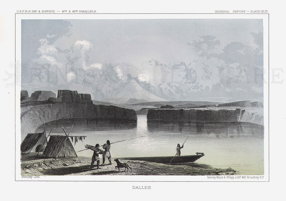
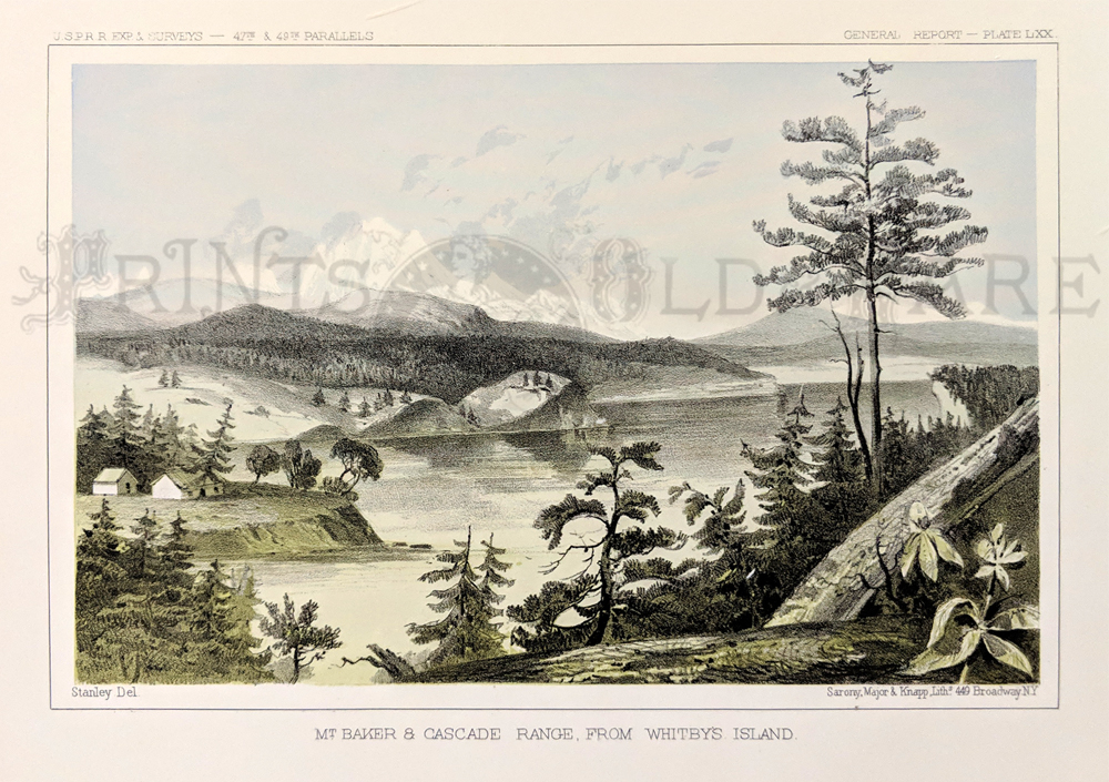
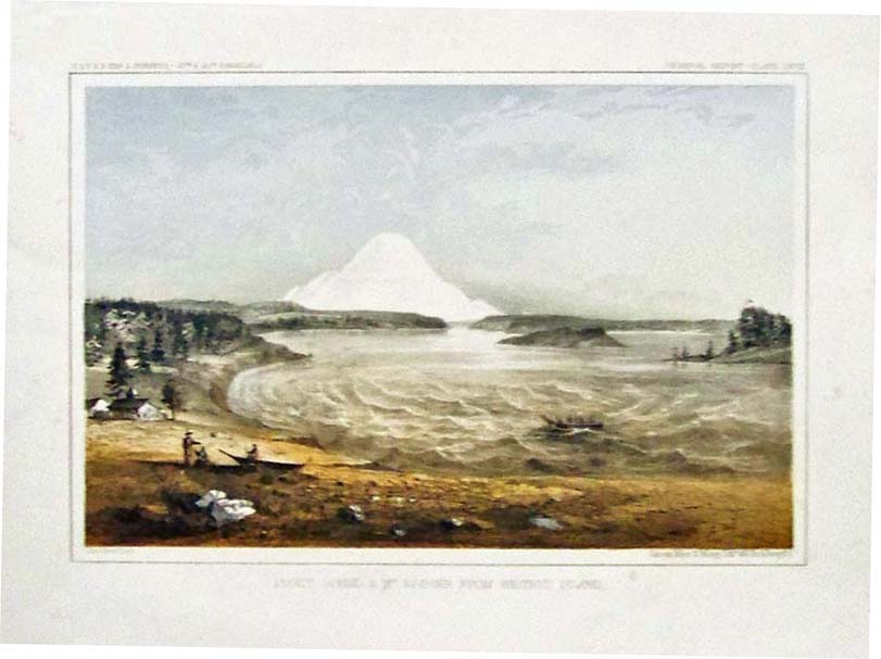
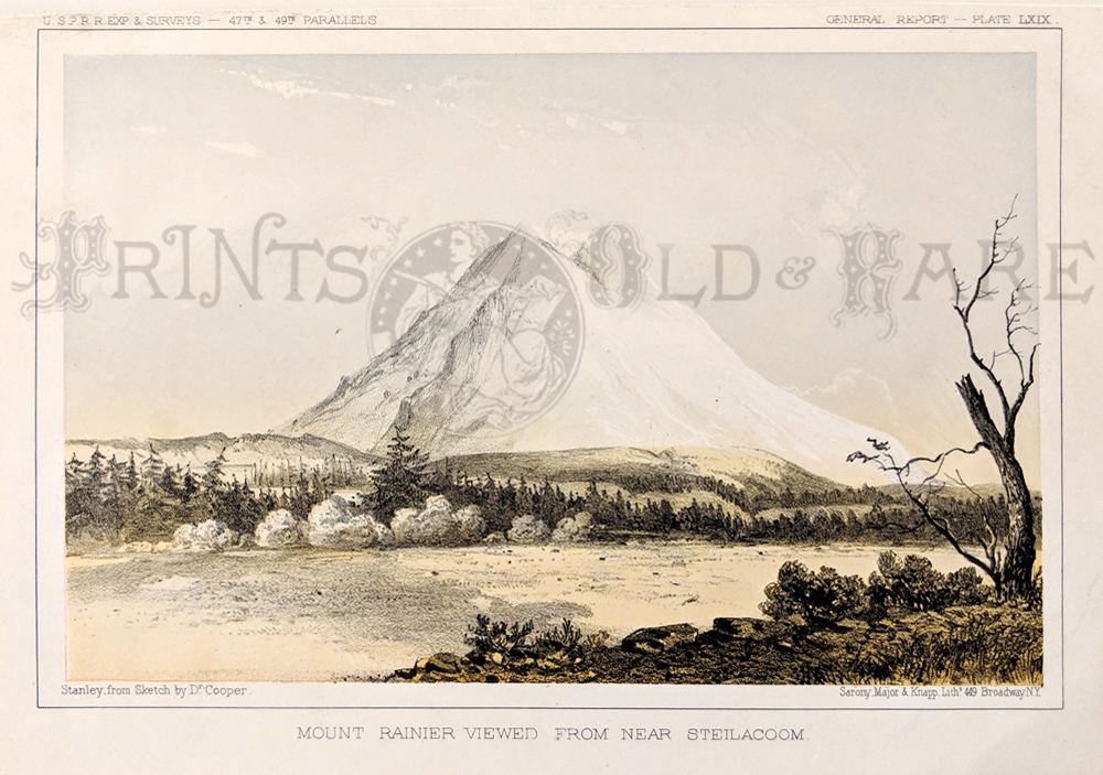
115Washington: 1855 Color lithographed US Pacific Railway and Expedition Survey's General Report - Plate XLIV titled Fort Vancouver, W.T. Lithographed by Sarony Major & Knapp. 11 x 8-1/2 in. $60 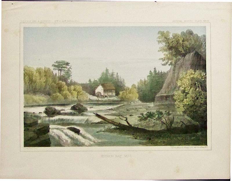
116Washington: 1855 Color lithographed USPRR Expedition & Survey's General Report with information sheet on the Survey for a Railroad Route showing the Hudson Bay Mill. Lithographed by Sarony, Major & Knapp. 11 x 8-1/2 in. $50 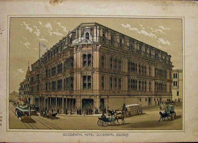
120Washington: 1888 Color half-tone showing the Occidental Hotel in Seattle in the Occidental Square. 8 x 6 in. $40 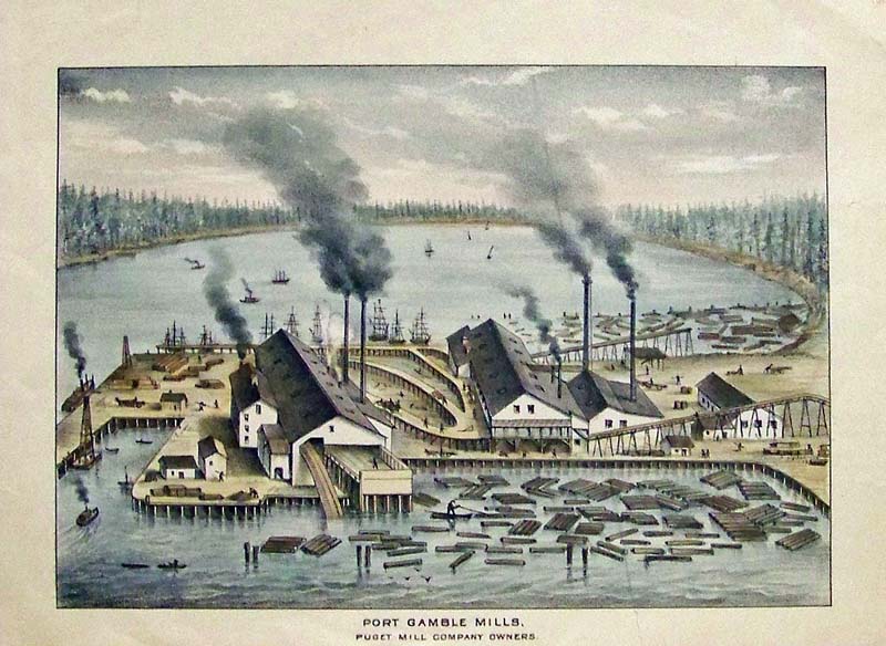 121Washington: C.1880 Hand colored steel engraving showing Port Gamble Mills, the Puget Mill Company Owners. 10 x 7-1/2 in. $50 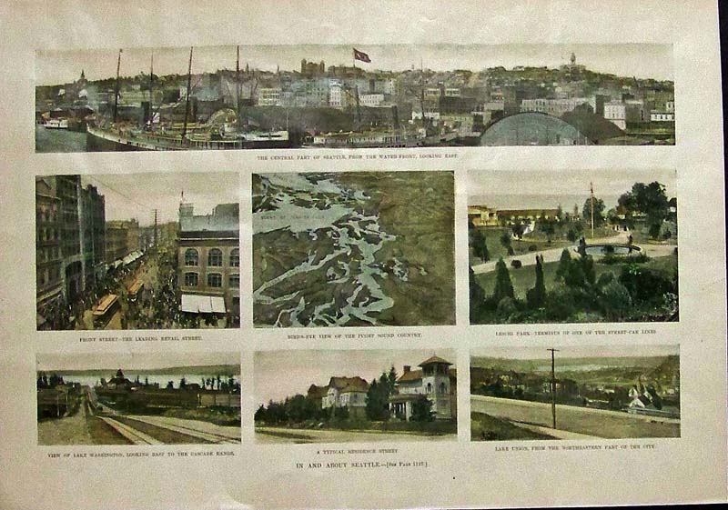
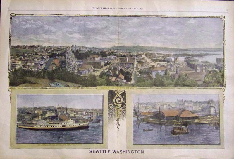
122Washington: 1897 Hand colored half-tones showing seven scenes in and about Seattle. Top image shows the Central Part of Seattle, from the Water-Front, Looking East. Featured in Harper's Weekly. 15 x 10-1/2 in. $80 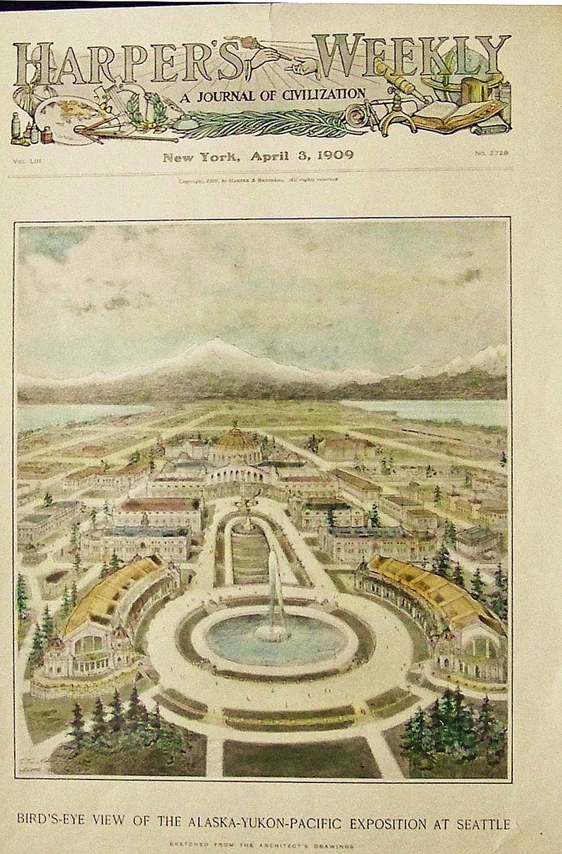 123Washington: 1909 Hand colored wood engraving showing a Bird's-Eye View of the Alaska-Yukon-Pacific Exposition at Seattle. Featured in Harper's Weekly, A Journal of Civilization. 15-1/2 x 11 in. $60 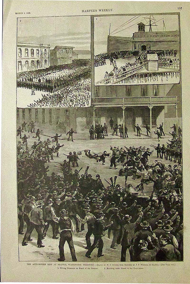 124Washington: 1886 Wood engraving from Harper's Weekly showing the Anti-Chinese Riot at Seattle, Washington Territory. Drawn by W.P. Snyder. 16 x 11 in. $30 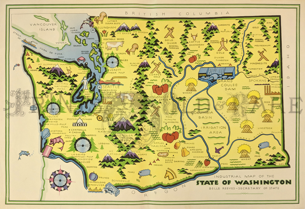
130Washington: 1945 Pictorial Map showing colorful products such as apples, potatoes, strawberries, cherries, animals, industries also Coulee Dam of Columbia, and Basin Irrigation. 26 x 18 in. $220 |
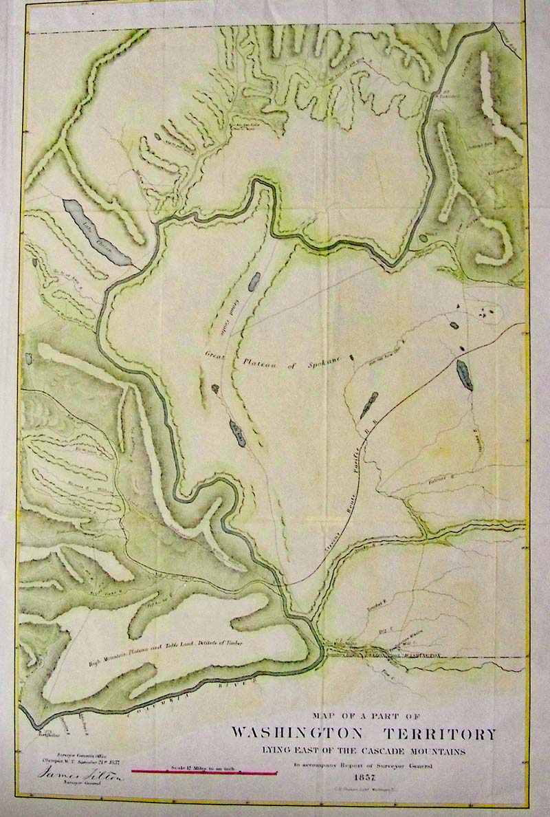 228Washington: Map of a Part of Washington Territory Lying East of the Cascade Mountains, Tilton, 1857 - A lithographed map of a Part of Washington Territory Lying East of the Cascade Mountains to Accompany Report of Surveyor General. This uncommon and very detailed map covers the Columbia River from Ft. Dallas eastward to Ft. Walla-Walla, and north to Ft. Colvill. The "Great Plateau of Spokane" spans the center of the map. In the upper right corner, the "Gold Mines" are shown along the "Western limits of the Rock Mountains". Steven`s survey route for the Pacific Railroad, creeks, rivers, lakes, roads, the Old Presbyterian Mission are also shown along with Lake Chelan. The map was surveyed by Tilton and lithographed by C.B. Graham, Washington D.C., 1857. Condition: Good dark impression, issued folding, with minor toning and numerous fold separations, small top margin. size 14" x 22.1" image $400 SOLD 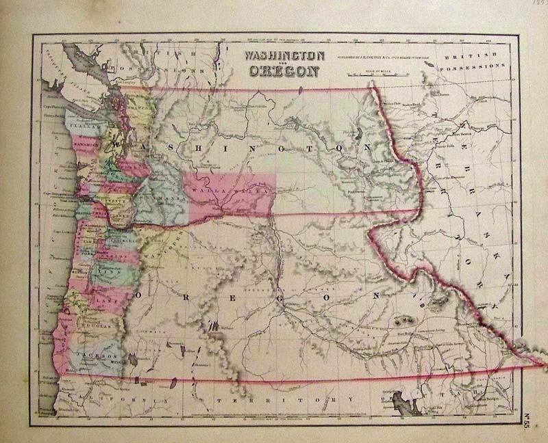
134Oregon: Washington and Oregon, Colton 1853 A very early and rare map of Washington and Oregon with original pastel coloring of newly formed counties in each state. Canada is British Possessions and Oregon and Washington extend into the states of Idaho, Montana, parts of Montana and Wyoming are shown as Nebraska Territory and California is also shown as a territory. Colton maps of this region exhibit dramatic changes from year to year, indicating actual changes in the expansion and settlement of the area. In this map Washington and Oregon extend fully to the Continental Divide where they encounter a Nebraska Territory that extends north all the way to Canada. This map also shows the routes of early explorers including the proposed Stevens route of the Pacific Railroad. The map also shows Indian tribes, passes, and important forts. Dated and copyrighted: 'Entered according to the Act of Congress in the Year of 1853 by J. H. Colton & Co. in the Clerk's Office of the District Court of the United States for the Southern District of New York.' Published from Colton's 172 William Str. Office in New York City. Condition: Very good, typical aging and browning on the edges, wide margins, some water spots and foxing on margin edges. 14.75 x 11.75 image $400
124Washington: 1886 Wood engraving from Harper's Weekly showing the Anti-Chinese Riot at Seattle, Washington Territory. Drawn by W.P. Snyder. 16 x 11 in. $30 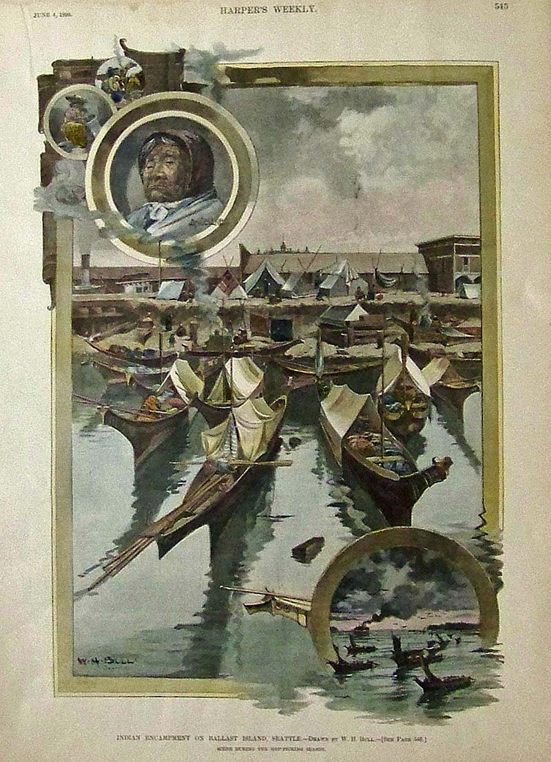
125Washington: 1892 Harper's Weekly hand colored wood engraving showing the Indian Encampment on Ballast Island in Seattle. Scene is shown during the hop-picking season. Drawn by W.H. Bull. 15-1/2 x 11 in. $80 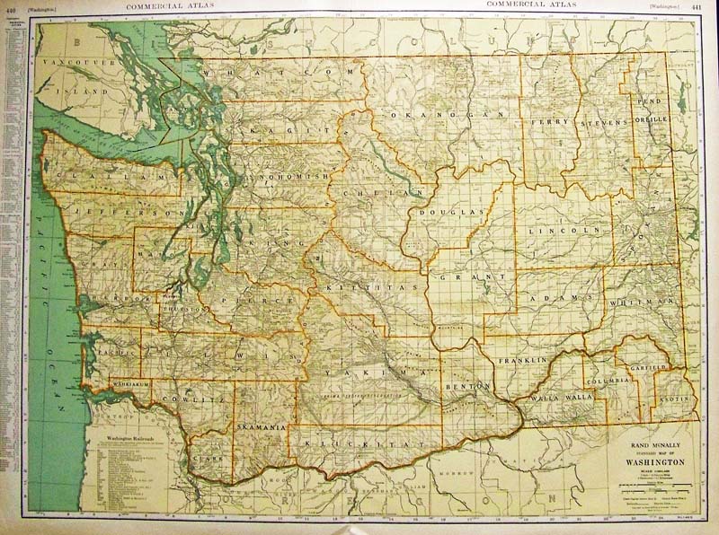
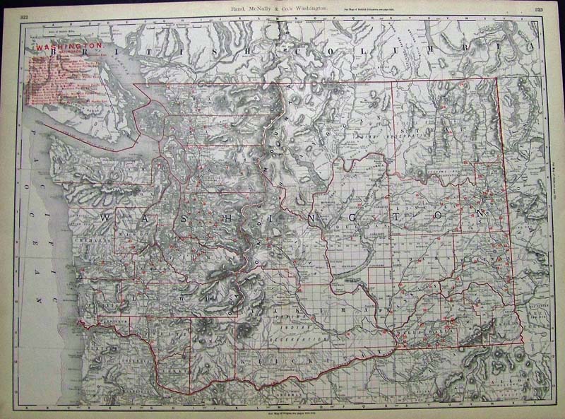
126Washington: 1932 Rand McNally color Standard Map of Washington featured in the Commercial Atlas. Index of its Principal Cities and another index sheet included. Small piece missing on side border bottom right. 27-1/2 x 20-1/2 in. $80 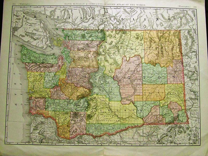
127Washington: 1893 Rand McNally & Company's Indexed Atlas of the World shows this colorful and majestic map of Washington State. 28 x 22 in. $100 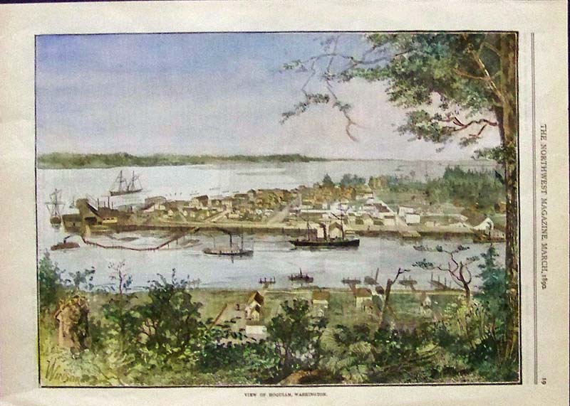
128Washington: 1890 Hand colored wood engraving featured in The Northwest Magazine showing a View of Hoquiam, Washington. 13-1/2 x 10 in. $100 
129Washington: 1890 Hand colored wood engraving featured in The Northwest Magazine showing Bucoda, Washington. 13-1/2 x 10 in. $100 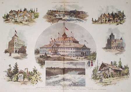
202wa: 1890 Scenes in Spokane Washington. Nine hand-colored, antique engraved scenes from the Sept. 6, 1890 issue of Harper's Weekly. Title is "Spokane Falls, State of Washington, and the Northwestern Exposition. Center image shows the exterior of the Exposition building. Smaller scenes on the sides show individual landmarks around the city. 16x22 in. $150 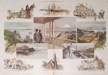
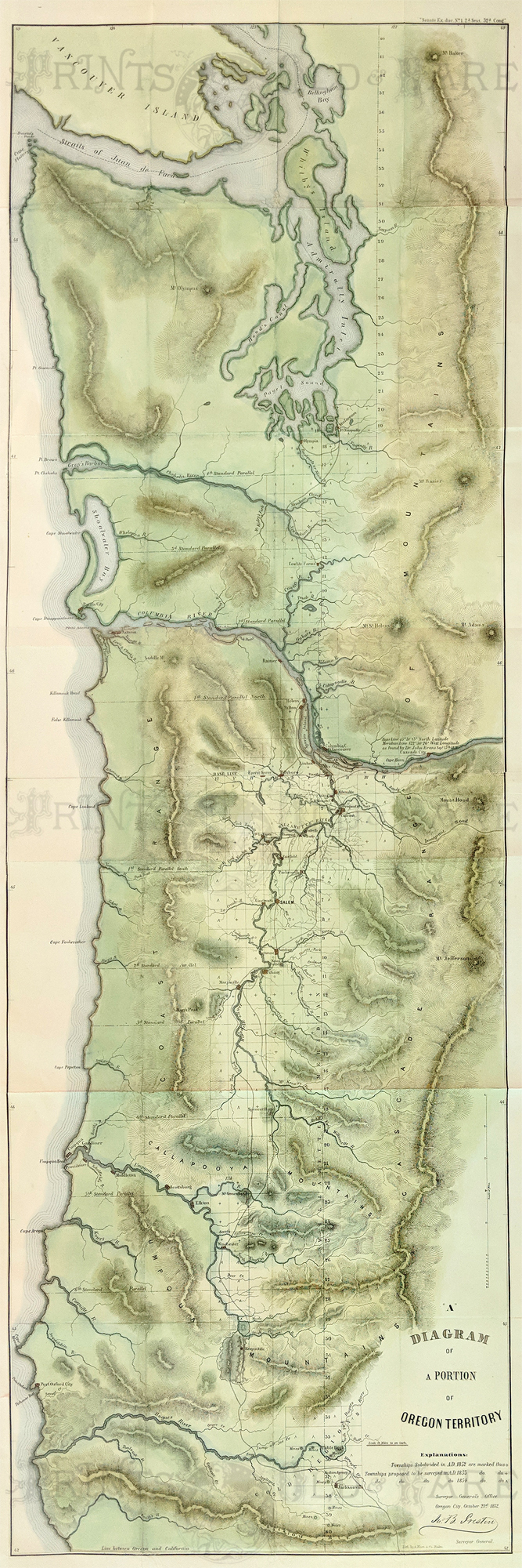
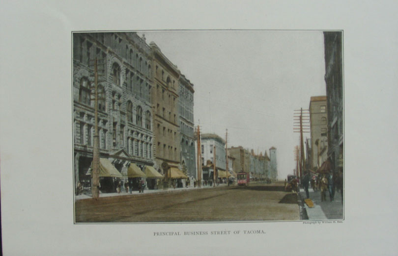
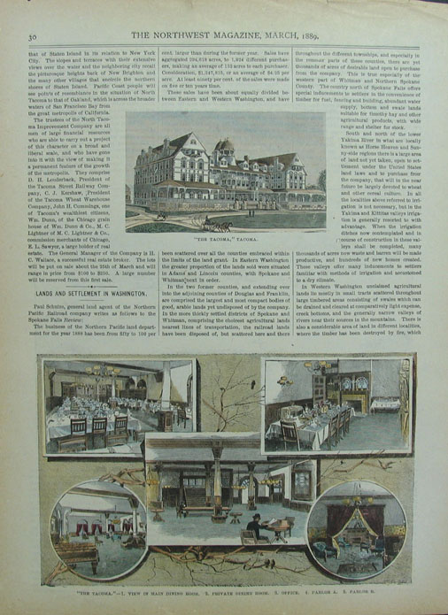
203wa: 1891 Views of Tacoma, Washington. Eleven hand-colored, engraved scenes from the June 20, 1891 issue of Harper's Weekly. Title is "The City of Tacoma and its Environs ." Each scene is numbered, with a descriptive title at the bottom of the page. 16x22 in. $150 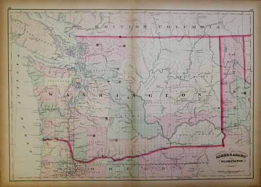 204wa: Beautiful 1872 map of Washington. Published by Asher & Adams in the New Statistical and Topographical Atlas of the United States. Original hand coloring. 17.5x24.5 in. $200 SOLD 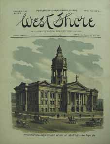 205wa: Very nice cover from the November 30, 1889 issue of West Shore. Color lithograph showing the New Court House at Seattle. 8.5x11 in. $60 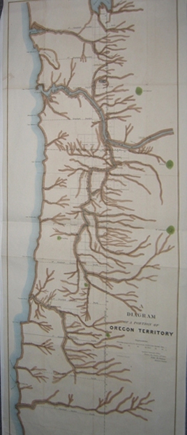 209wa: 1851 A Diagram Of A Portion Of Oregon Territory map - Surveyor Generals Office, Oregon City on October 20, 1851 by John B. Preston, Surveyor General. Diagram shows which towns are propsed to be surveyed in A.D. 1852. Excellent condition. 15x40in. $300 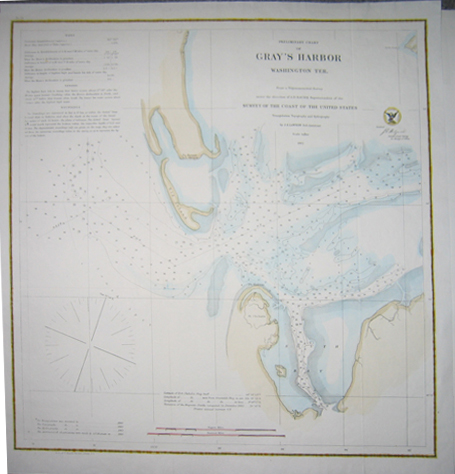 210wa: 1862 Preliminary Chart of Gray's Harbor, Washington Ter. depicts the tides and soundings of Gray's Harbor. Excellent condition. 18x19in. $150 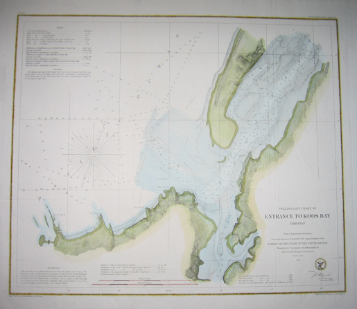 211wa: 1862 Priliminary Chart of (the) Entrance To Koos Bay, Oregon - Hand colored lithographed map depicts the tides and soundings in the entrance to Koos Bay. Excellent condition with a nice black and yellow border. 18x19.5in. $180 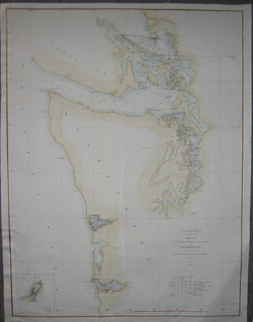 214wa: 1862 Color lithographed U.S. Coast Survey showing the Progress of the Survey in Section No. XI from Tillamook Bay to the Boundary in Sketch K. Inset of the Triangulation of Koos Bay, Oregon on bottom left of chart. 25-1/2 x 19-1/2 in. $180 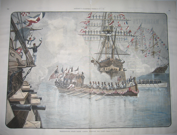
215wa: 1889 Washington's State Barge Passing Through The Fleet - Drawn By J.O. Davidson. Hand colored wood engraving published in a Supplement to Harper's Weekly on May 4, 1889. Scene depicts tall, flag-masted ships surrounding Washington's state barge as it passes through the fleet. 16x22in. $200 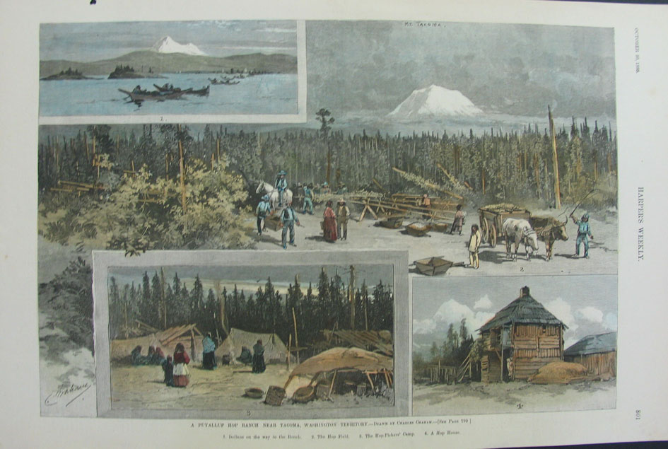 216wa: 1888 Harper's Weekly "A Puyallup Hop Ranch Near Tacoma, Washington Territory" 16x10.5in. $60 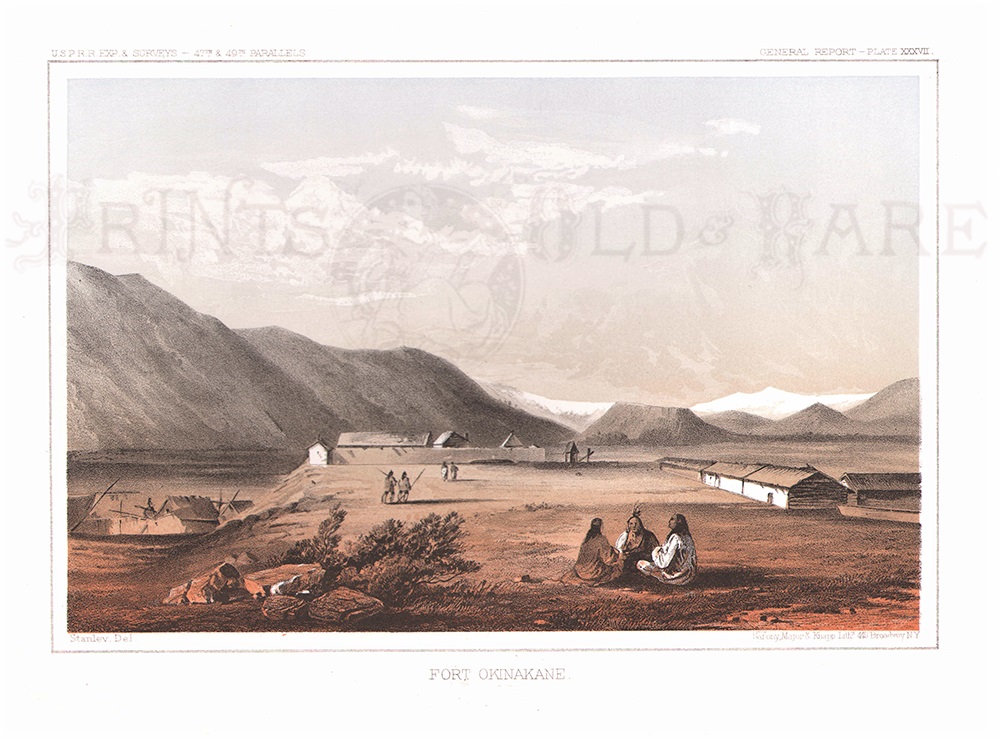 1132wa: 1855 Rare color lithograph showing early Western Fort Okinakane in an antique Railroad Expedition print. 11 x 8 in. $80 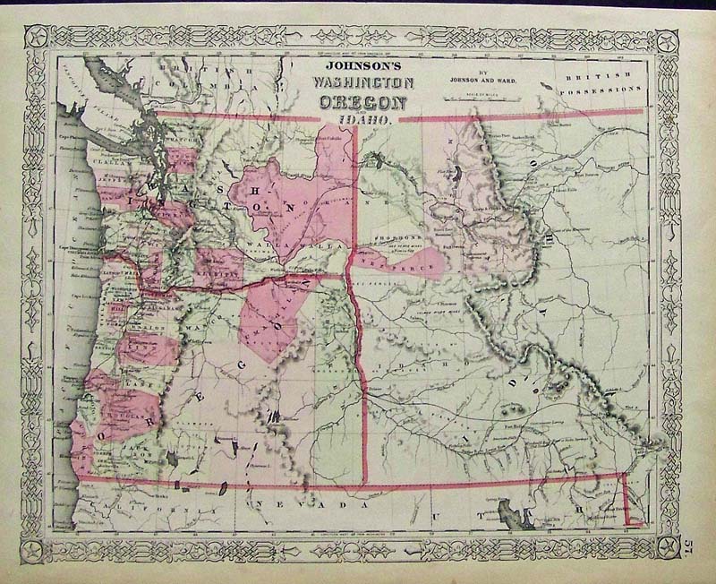 202ow: C.1860 Johnson's Washington, Oregon and Idaho hand colored engraved map. 18 x 14 in. $180 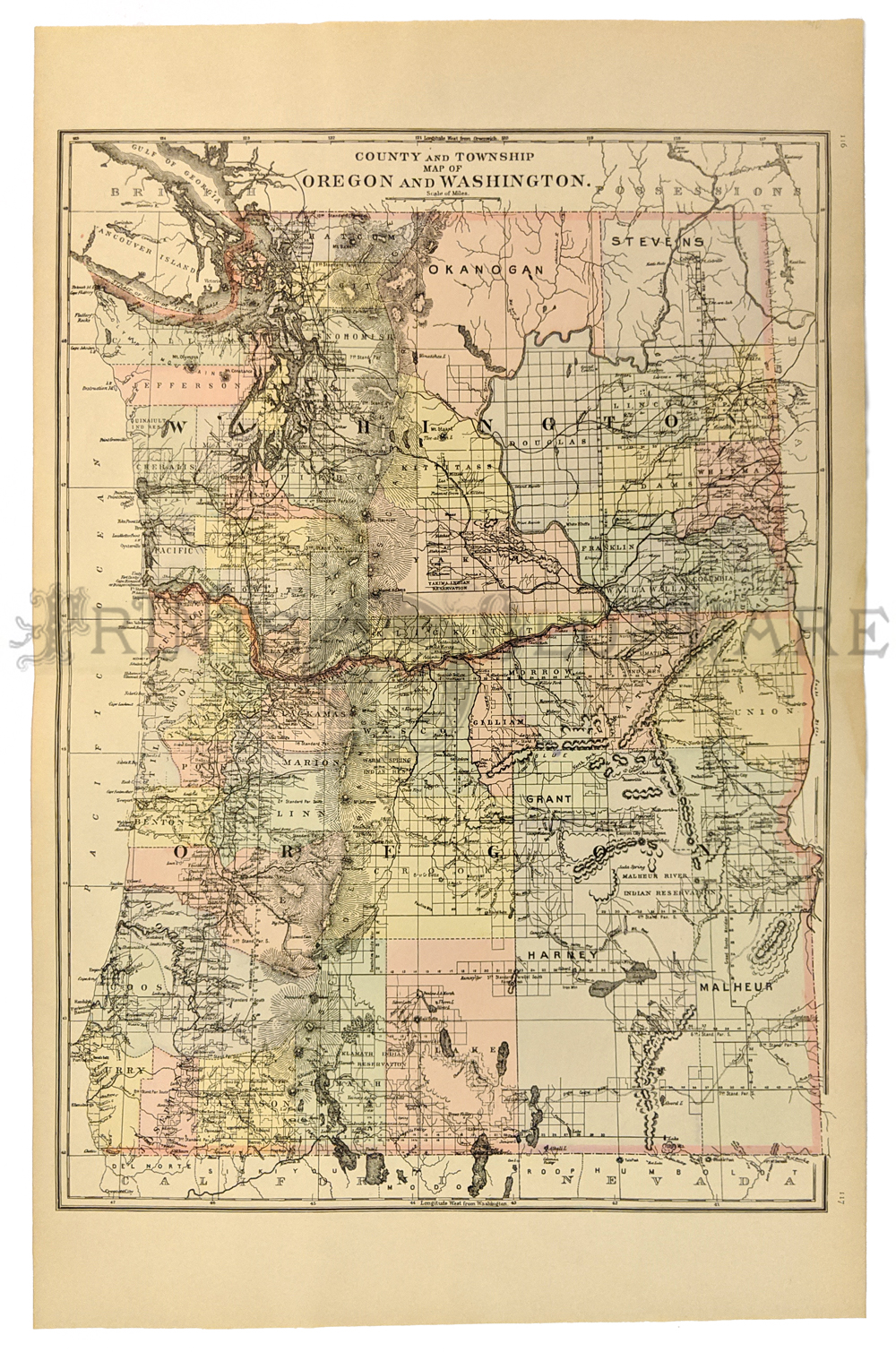 114or: 1887 Mitchell's Map of Oregon, Washington. Hand colored map of Oregon and Washington. Shows the locations of Indian reservations, cities, towns and major roads in both states. Also shows railroad lines and geographical features. 15x22 in. $90 |
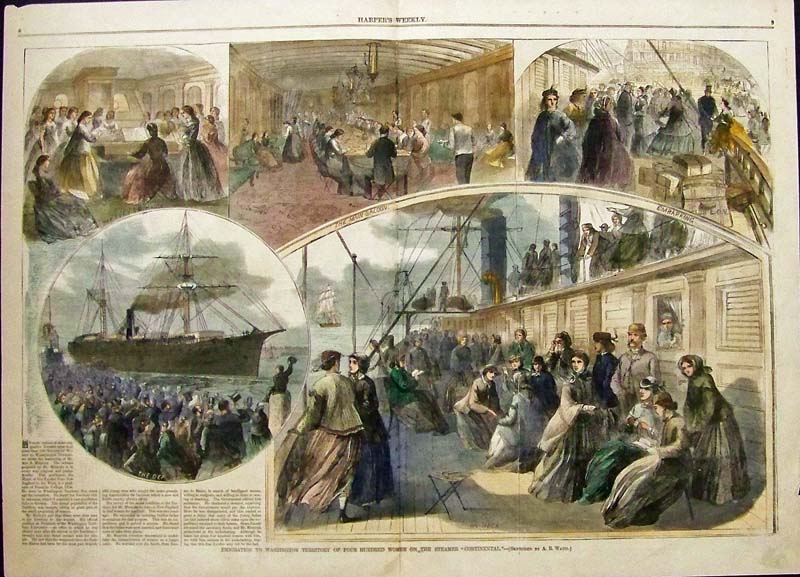
 014immi: 1866 Emigration to Washington Territory of Four Hundred Women on the Steamer "Continental." This hand colored engraving is the most important historical engraving of Washinton Territory. This genuine antique print from the January, 1866 edition of Harper's Weekly shows 5 views: the evening hymn, the main saloon, embarking, the departure, and on deck. 16x22 in. $200 |
|||||||||
| Order Form | |||||||||||
| Back to Homepage | |||||||||||