 
|
|||||||||||
This is a small selection of our inventory of antique Wisconsin maps and prints. Additional inventory is available. Contact us with your request. 1-800-879-6277
|
|||||||||||
|---|---|---|---|---|---|---|---|---|---|---|---|
ALSO SEE:
 click here to view Great Lakes Charts 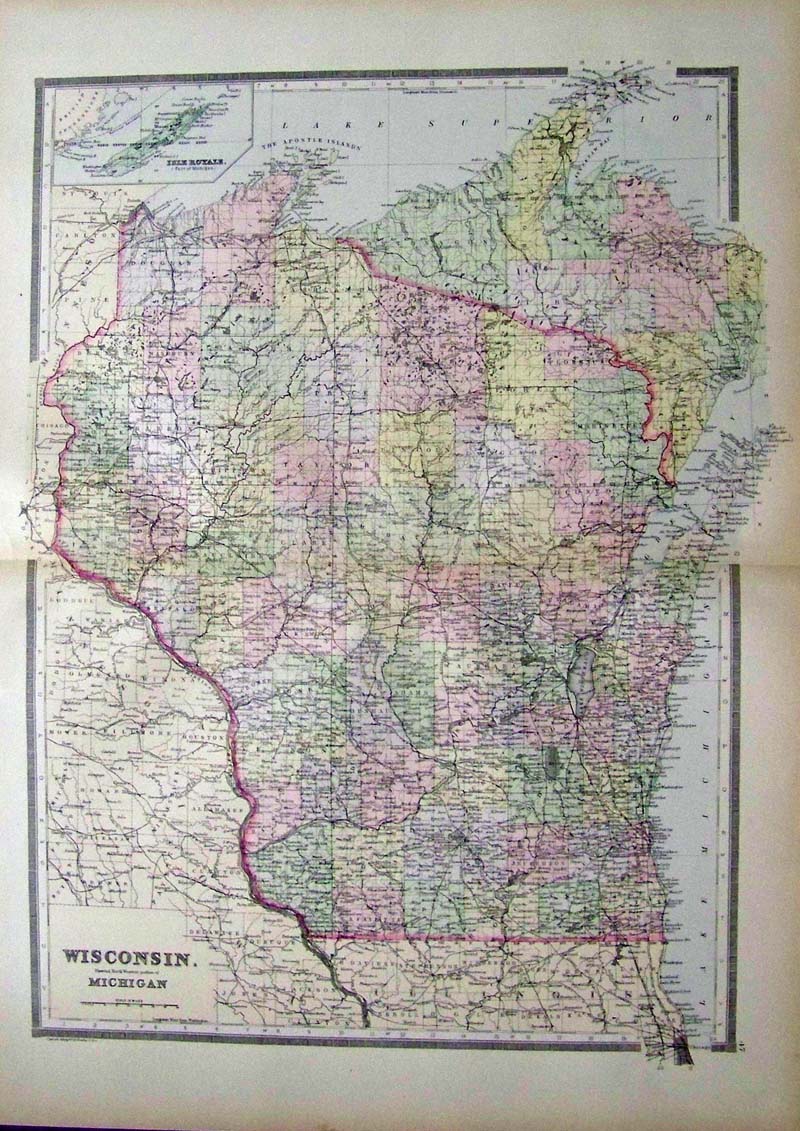
001Wisconsin: 1889 Bradley Map of Wisconsin. This beautiful map, with original hand watercoloring, was published in 1889 by M. Bradley. The antique map shows all of Wisconsin, and the western portion of Michigan's Upper Peninsula. In the upper left corner, there is a small inset map of Michigan's Isle Royale. Cities, towns, geographical features and railroad lines are all shown in detail. Map size is 19x26 in. The map is in excellent condition, with no tears, stains or other blemishes. $100 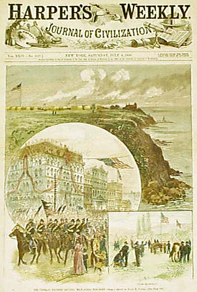 003wi: 1880 Milwaukee Wisconsin views. Downtown and waterfront. Hand colored engraving at the time of the Veteran Soldier Reunion. Front page Harper's. 11x15 in. $60 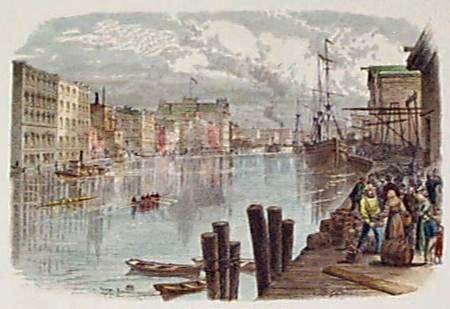 005wi: 1873 Milwaukee River. Hand colored engraving shows boats and city at the river. 12-1/2x9 in. $40  006wi: 1873 Kenosha Wisconsin views. "The Fishing Station" and "Kenosha Harbor." Hand colored engravings. 9-1/2x12-1/2 in. $40 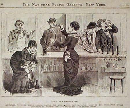 010wi: 1881 WISCONSIN LIQUOR LAW PRINT. Antique print - "Effects of a Singular Law." Illustration in the National Police Gazette (New York) shows Milwaukee liquor dealers making the Anti-Treating Law appear ridiculous by providing separate stalls for each thirsty citizen. 11" x 8" $40 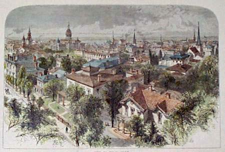 015wi: 1873 City of Milwaukee engraving. Excellent hand colored old bird's-eye view of city. 12-1/2x9 in. $80 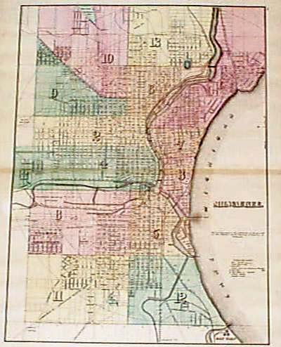 021wi: 1876 Milwaukee Map. Great original hand water-colored antique map. Streets, railroads & major buildings clearly indicated. Large scale. 17x26-1/2 in. $100 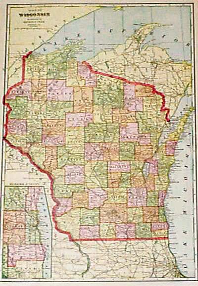 023wi: 1904 Wisconsin Map. Printed in color by Cram. Inset of Milwaukee vicinity. 14-1/2x22-1/2 in. $40 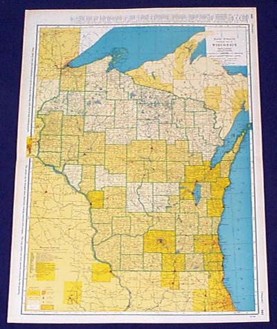 026wi: 1943 Map of Wisconsin. Very detailed large scale map by Rand McNally. Printed in color, shows about two dozen railroads in state. County and city populations are shown by color. 27x20-1/2 in. $60 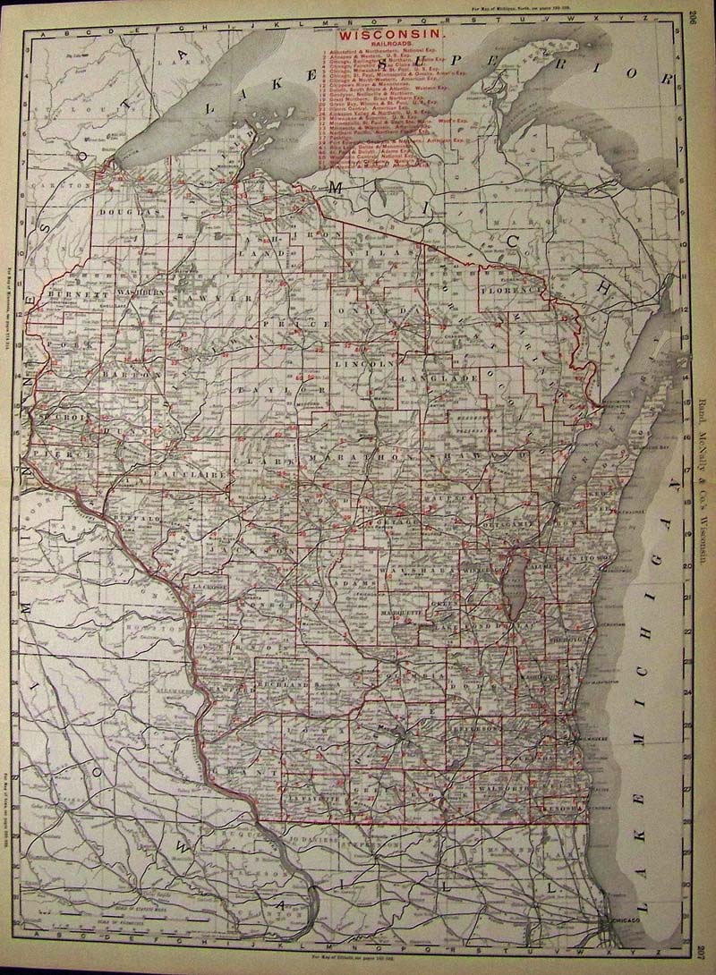
027Wisconsin: 1898 Color Rand, McNally & Co.'s Wisconsin Railroads Map showing all the railroads of that era in red with red county lines. 27-1/2 x 20-1/2 in. $180 |
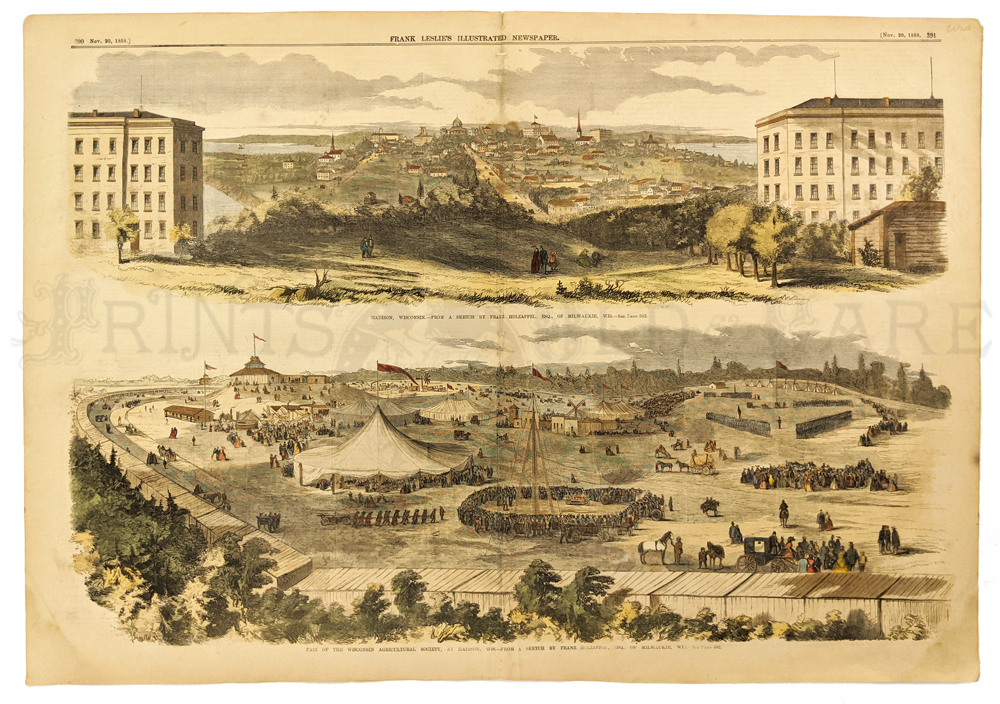 202wi: 1858 Madison Wisconsin Scenes. Two hand colored engraved images from Leslie's Weekly. Top view shows Madison from nearby hill. Bottom view showing Wisconsin's Agricultural Society fair, which was held in Madison. 16 x 22 in. $120 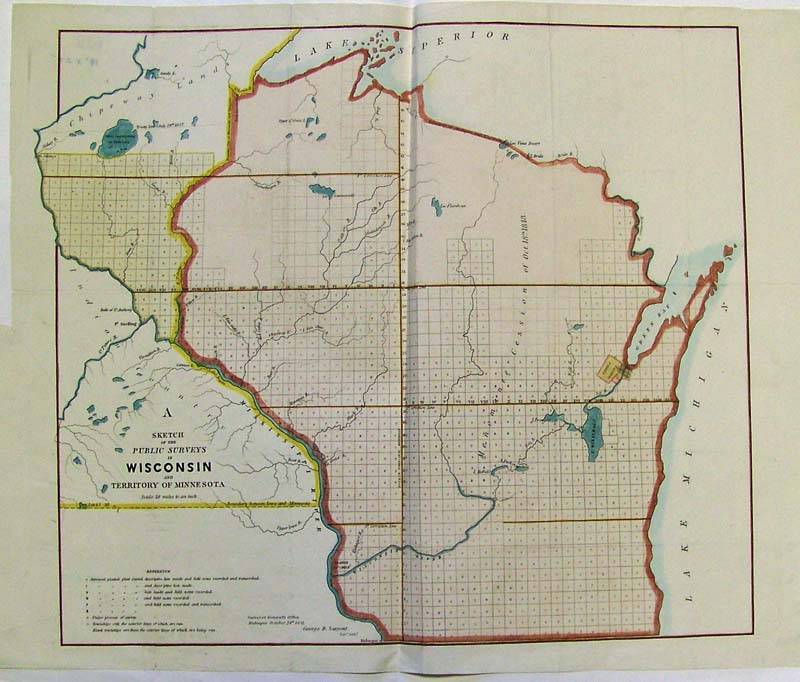
028Wisconsin: 1851 Hand colored lithographed Sketch of the Public Surveys in Wisconsin and Territory of Minnesota. 23-1/2 x 19 in. $160- 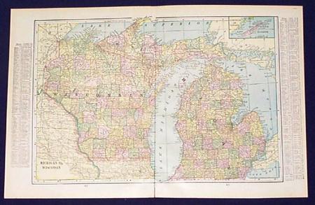
100wi: 1901 Map- Wisconsin, Michigan. Great 1901 color map of Wisconsin and Michigan - shows rivers, railroads. Lists counties and chief cities. 22x15 in. $40  101wi: 1886 Wisconsin Lumber Industry Views. Hand colored engraving from Harper's Weekly, titled "Rafting Logs." Shows recently-cut timber from forests in the Upper Midwest being floated down the Wisconsin and Mississippi Rivers. Interesting views of the once-thriving timber industry in the great North Woods. 16x22 in. $80 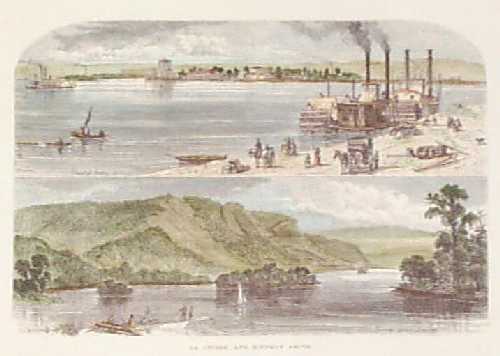 102wi: 1873 Views of Lacrosse Wisconsin. Hand colored engraving from Picturesque America, titled "Lacrosse and Scenery Above." Shows views of the steamboat landing at Lacrosse, and the bluff country along the river outside the city. 9x12 in. $40 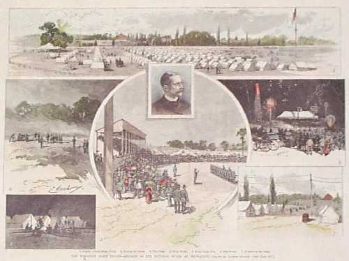 103wi: 1884 National Guard Meeting at Milwaukee. Hand colored engraving from Harper's Weekly, titled "The Wisconsin State Troops: Reunion of the National Guard at Milwaukee." Shows the campground, as well as the activities that took place there during the reunion. There are several small holes in the bottom margin, but the image is not affected. 11x16 in. $50 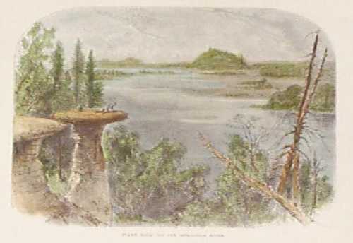 104wi: 1874 Wisconsin River Scene. Hand colored engraving from Picturesque America, titled "Stand Rock, on the Wisconsin River." Nice view of rural Wisconsin scenery. 9x12 in. $40 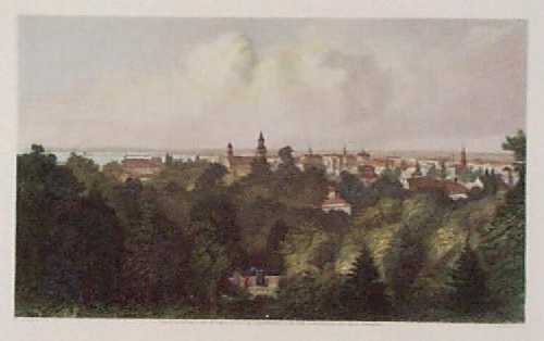 105wi: 1873 View of Milwaukee Wisconsin. Hand colored steel engraving from Picturesque America, titled "City of Milwaukee." Shows a view of the city from a nearby hill, with the lake in the background. 9x12 in. $50 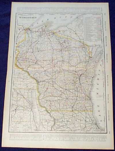 106wi: Detailed 1901 Railroad Map of Wisconsin. Beautiful map from the 1901 first edition of George Cram's folio-size world atlas. Color coded lines on the map show the names and locations of railroads throughout the state. State and county borders are outlined in yellow. Cities, towns and geographical features are all shown. Included is an inset map of the Milwaukee area. This map would look great in a frame! 18x27 in. $80  110wi: Beautiful 1872 map of Wisconsin. Published by Asher & Adams in the New Statistical and Topographical Atlas of the United States. Original hand coloring. 17.5x24.5 in. $150 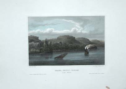 111wi: Beautifully hand colored steel engraving. Published by Herrmann J Meyer in Meyer's Universum c1850. Picture titled Grand _ Spirit _ Tables (Lake Pepin). Size 7.5 X 10 in. $60 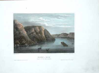
112wi: Beautifully hand colored steel engraving. Published by Herrmann J Meyer in Meyer's Universum c1850. Picture titled, Maiden _ Rock (Valley of the Mississippi). Size 7.5 X 10 in. $60 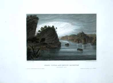
113wi: Beautifully hand colored steel engraving. Published by Herrmann J Meyer in Meyer's Universum c1850. Picture titled, Grand Tower and Devil's Bakeoven (Mississippi River). Size 7.5 X 10 in. $60 |
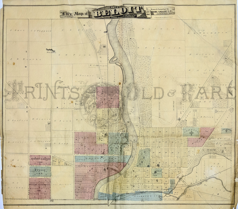 125wi: Beliot – Rare Map by Frank Krause of Janesville. 1873. Shows Rock River, land owners, and important buildings. Good condition – bottom edge of left corner is missing. Water colored, Steel engraved, Lithograph. 24 x 27 in. $175  126wi: Janesville, 1873 City Map. Ward Map. Shows Rock River, large land owners, and important buildings. Right border has 3" patch. Water colored, lithograph. 27 x 36 in. $150 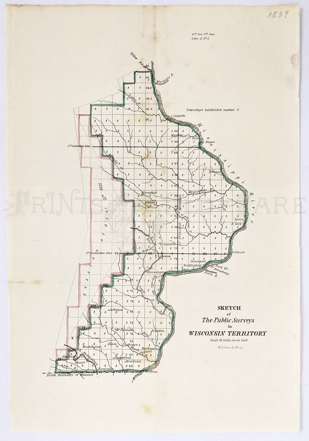 128wi: 1839 Sketch of The Public Surveys in Wisconsin Territory. Extends from Prairie du Chien to Green Bay and also to show part of the valley of the Wisconsin River where Grigon's Trading & Farming Establishment, several mills, Yellow Banks and Plover Portage are shown. Locates the lands of the Stockbridge and Oneida Indians. Hand colored to indicate the progress of surveys. 8 1/2 x 12 1/2 in. $120  115wi: La Crosse, Wisconsin Post Card Fold-out (18 Scenes). $20 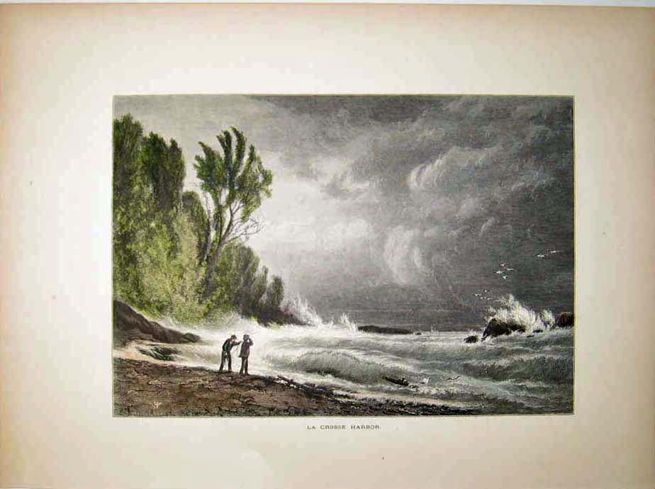 116wi: 1873 La Crosse Harbor. Hand colored wood engraving titled, "La Crosse Harbor," from 1873. 9.5x13in. $30 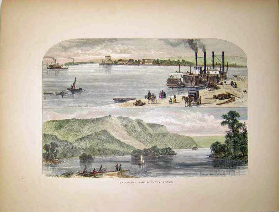 117wi: 1873 La Crosse, and Scenery Above. Hand colored wood engraving titled, " La Crosse, and Scenery Above." 9.5x12.5in. $40 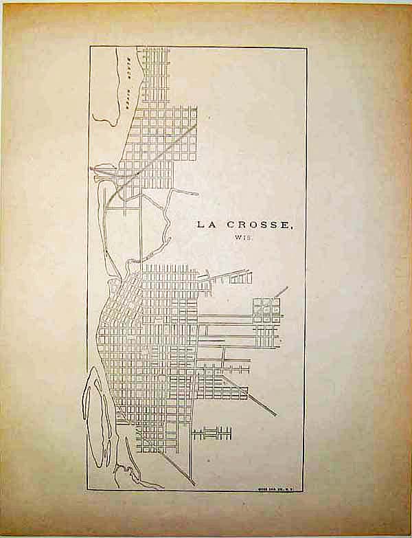 118wi: La Crosse, Wisconsin Map (Very simple grid-type design with extra page describing its amenities). 11.5x9in. $30 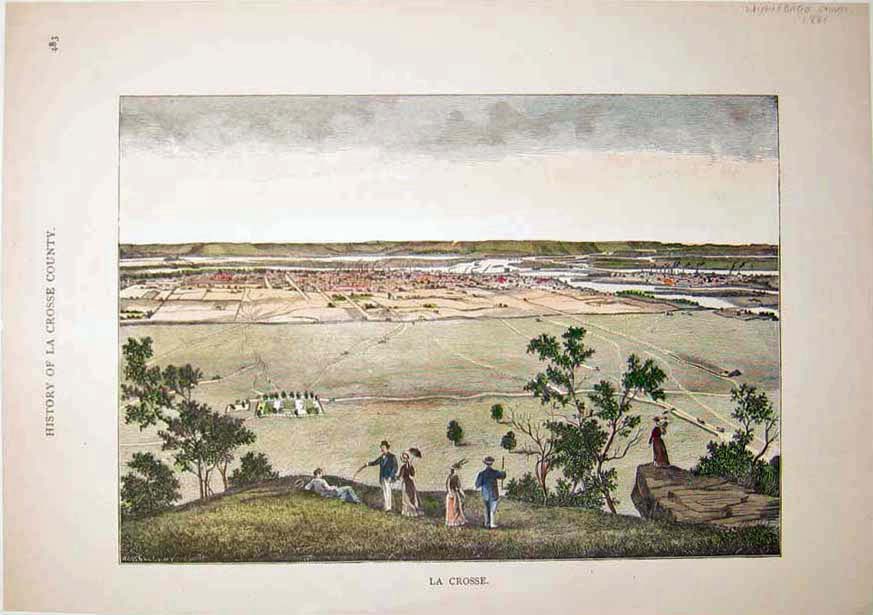 119wi: 1880 La Crosse wood engraving from the History of La Crosse County (Winnebago County), titled, "La Crosse." 10.5x7.5in. $40 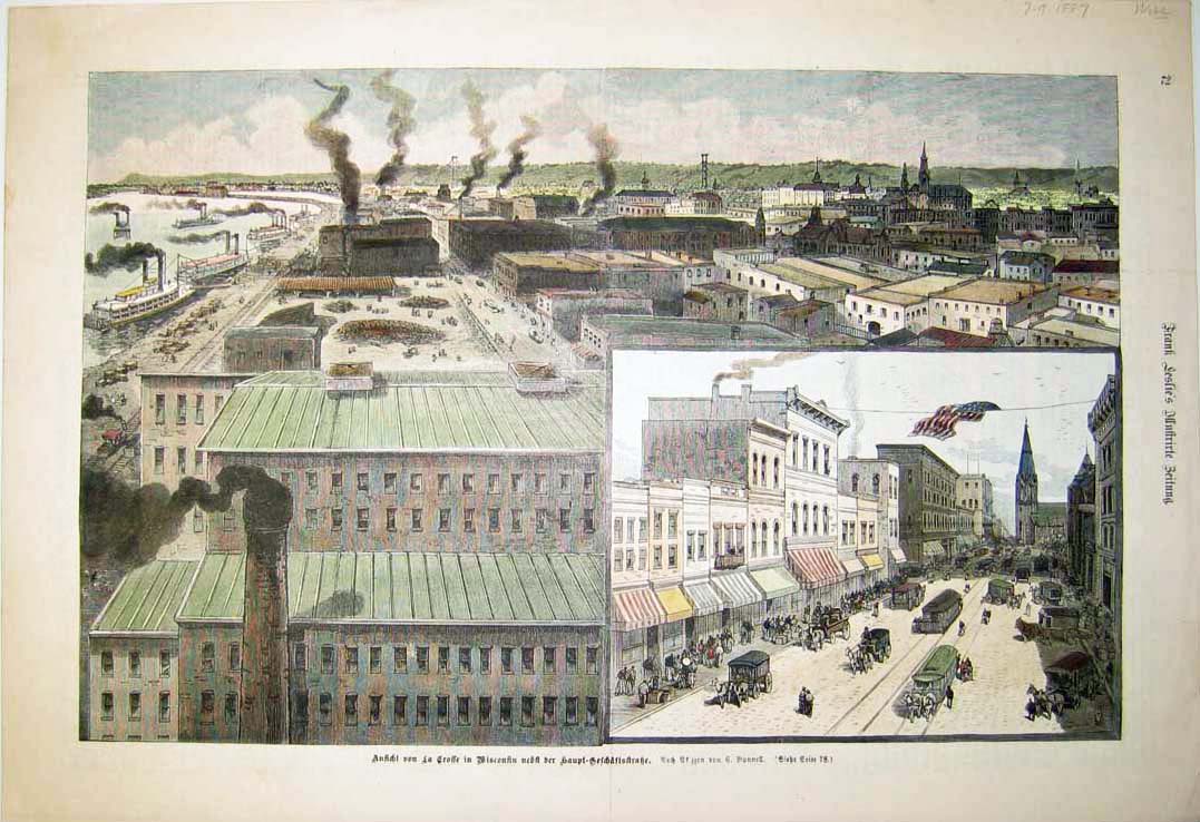 120wi: 1887 German title and language hand colored wood engraving of La Crosse, Wisconsin from Frank Leslie's Illustrated Newspaper, dated July 9, 1887. 11x16in. $80 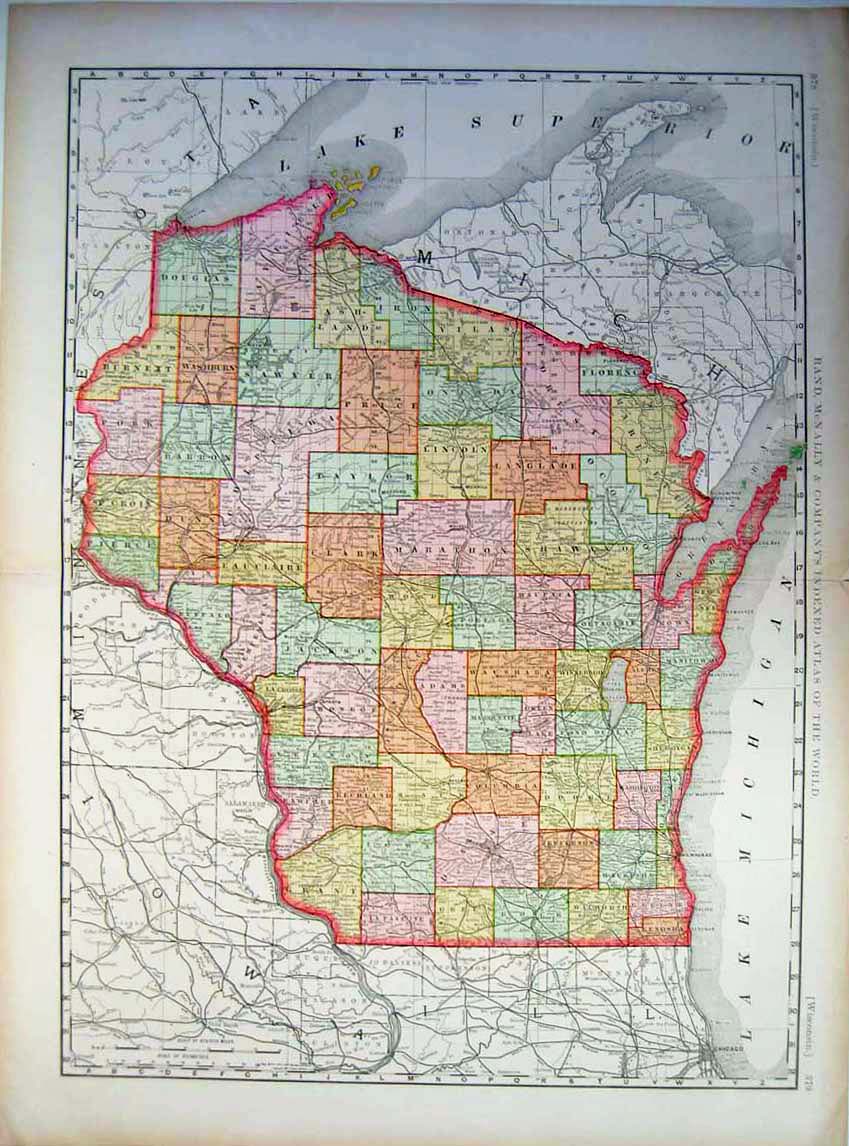 121wi: 1895 Map of Wisconsin and all its counties from Rand McNally & Company's Indexed Atlas of the World, Copyright 1895. 29.5x22in. $80 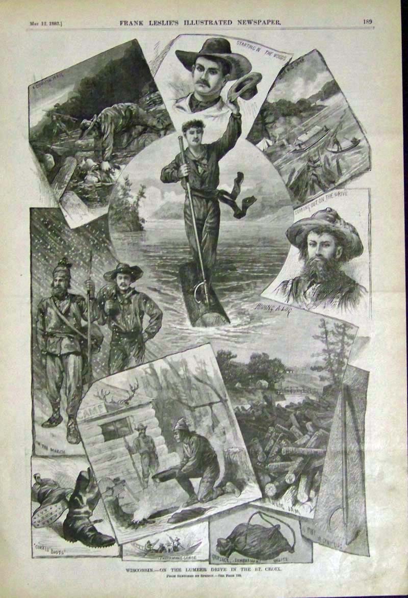 122wi: 1883 Rare wood engraving featured in Frank Leslie's Illustrated Newspaper titled, "Wisconsin, -- On the Lumber Drive in the St. Croix." A dozen vignettes of the lumbering trade in Northern Wisconsin. Fine condition. 16 x 11 in. $75 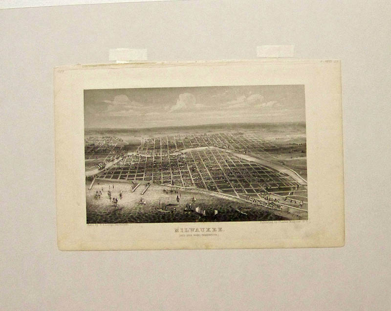
123wi: C.1860 Milwaukee bird's-eye by Charles Magnus -- Beautiful waterfront view which show the sailing ships and piers in this steel engraving. Shown in mat. Image size is: 9-1/2 x 6-1/2 in. $150 |
|||||||||
| Order Form | |||||||||||
| Back to Homepage | |||||||||||