 
|
|||||||||||
This is a small selection of our inventory of antique Louisiana maps and prints. Additional inventory is available. Contact us with your request. 1-800-879-6277
|
|||||||||||
|---|---|---|---|---|---|---|---|---|---|---|---|
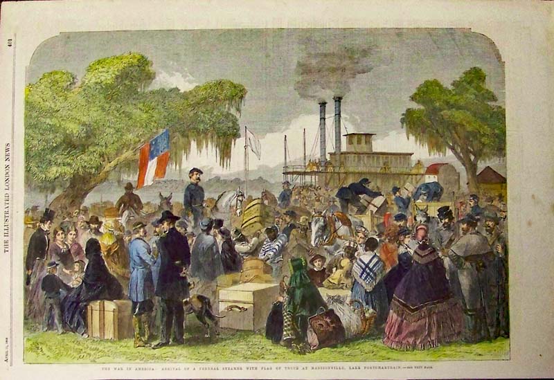 006la: Lake Portchartrain - Hand colored wood engraved scene at Madisonville during the Civil War. Featured in The Illustrated London News in 1863. 16 x 11 in. $80 SOLD 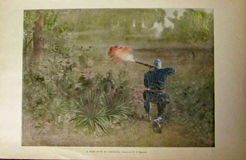
009la: A Deer Hunt in Louisiana - 1892 Hand colored half-tone engraving featured in Harper's Weekly. 16 x 11 in. $50 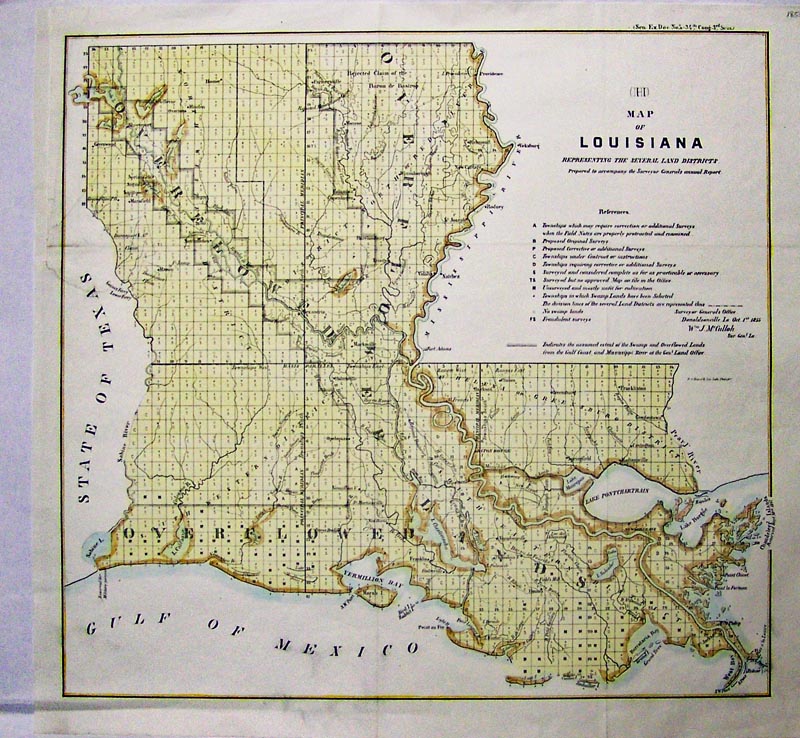
011la: 1856 Louisiana Land District Map - This is a hand colored lithographed, government map showing a representation of several land districts. 18 x 17 in. $150 SOLD  025ms: 1856 Steamer Wooding Up on the Mississippi River. This hand colored, double page engraving shows The Sutlan Steamer being loaded up. This is one of the very best dynamic Steam Boat engravings from the 1856 edition of Ballou's Pictorial. size: 22x16 in. $350 Check for Availability  367bh: Picking Cotton 1887. Hand colored, wood engraving showing laborers in a field. 11 x 16 in. $100 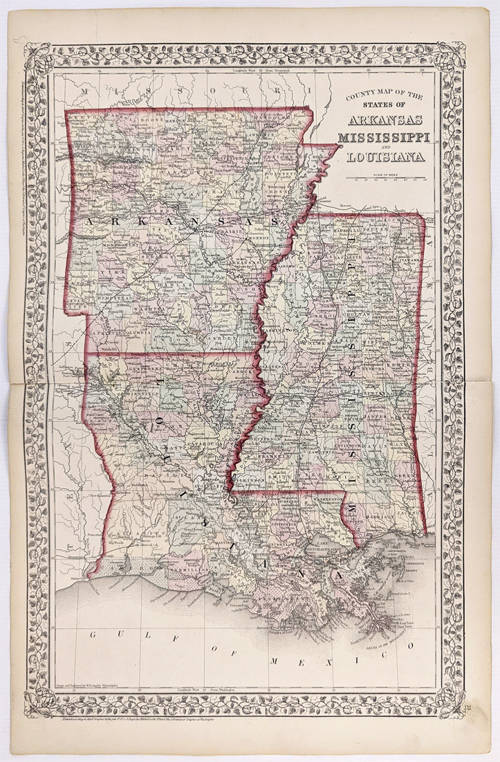 144Arkansas: 1872 Mitchell's County Map of Arkansas, Louisiana Mississippi. Showing various cities, towns, rivers, railroads, along with some topographical details. Hand colored, lithograph. 15 1/4 x 23 5/8 in. $150 |
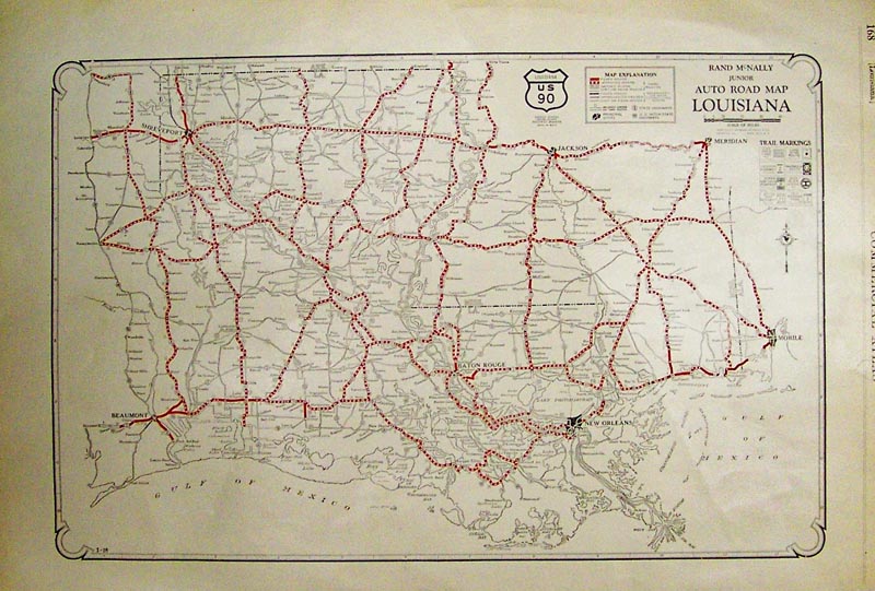
013la: Junior Auto Road Map for Louisiana published by Rand McNally whichs shows paved, graded and dirt roads. Printed in color. Fine condition. 20 x 14 in. $60  015la: 1883 Salt Mine at Petite Anse. Six fine hand colored original antique engravings on one page. Fascinating print shows salt mining operations in this Louisiana mine. Harper's. 11x16 in. $60 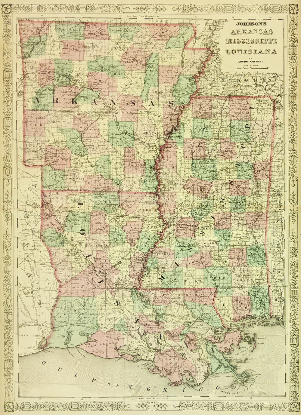 113la: 1863 Louisiana, Arkansas & Mississippi Johnson's map. Hand colored map with great detail, decorative border. 18 x 26 1/2 in. $110 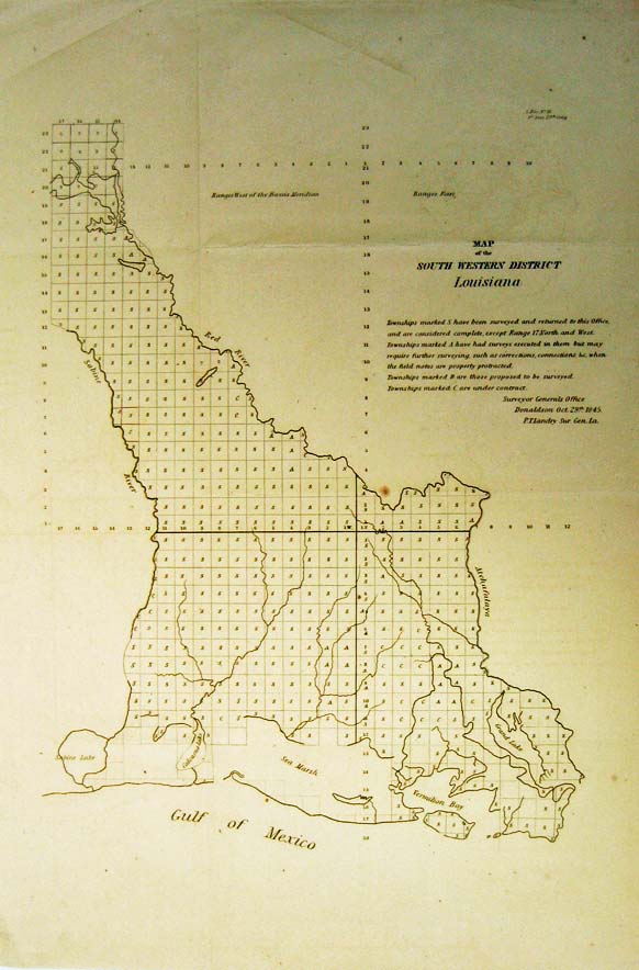 116la: 1845 South Western Louisiana Survey. Early map published by Surveyor Generals Office of U.S. Government . 12 x 18 in. $50 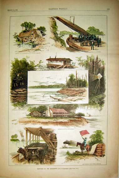 161la: 1883 Sketches On the Mississippi - By J.O. Davidson. Several hand colored wood engravings published in Harper's Weekly on March 10, 1883. Each scene depicts homes ravaged by the force of the Mississippi, the Corn Planter's Residence, and a Day Signal for Corn Landing. 11x16in. $60 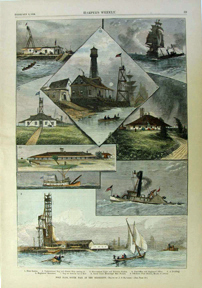 173la: Harper's Weekly Feb. 9, 1876 "Port Eads, South Pass of the Mississippi" hand colored. 11 x 15 1/2 in. $80 |
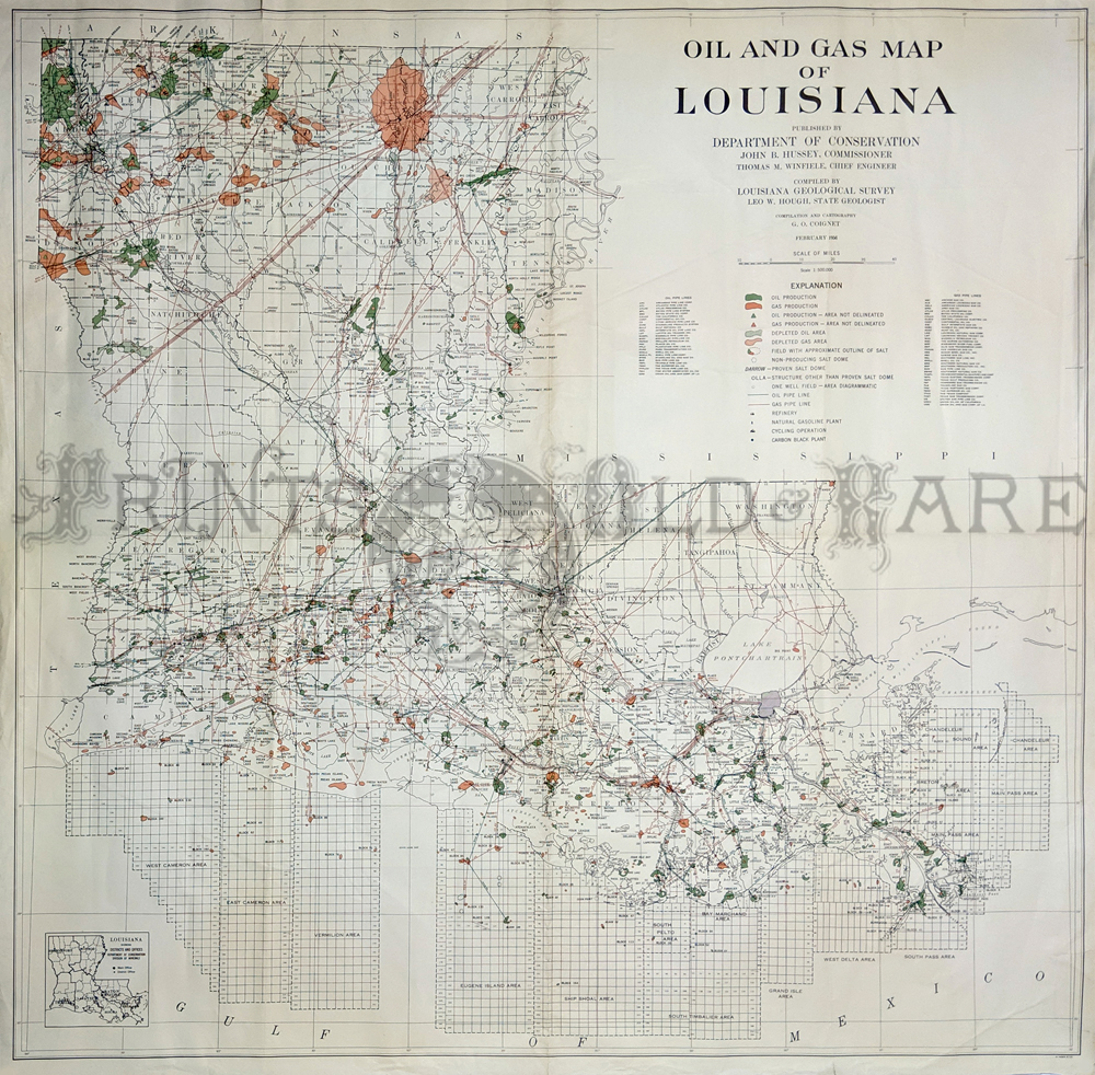 182la: 1956 Huge Oil & Gas map of Louisiana by G.O. Coignet by Louisiana Geological Survey. Key: Oil production, depletions, fields, salt dome, pipe lines, etc. 44 x 45 in. $250 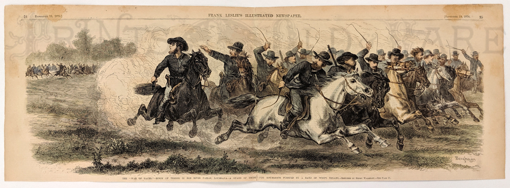 183la: The "War of Races." - Reign of terror in Red River Parish, Louisiana - A Guard of Escort for insurgents pursued by a band of white Texans. Sketched by Henry Walmsley. 1874 Frank Leslie's Newspaper. Hand colored, wood engraving. 7 3/4 x 22 in. $120 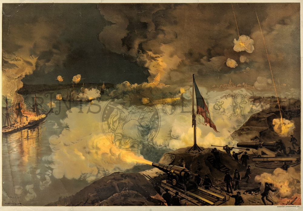 185la: Port Hudson 1888. Dramatic chromolithograph of this important Civil War battle for control of the Mississippi River in 1863. 17 x 24 in in. $350 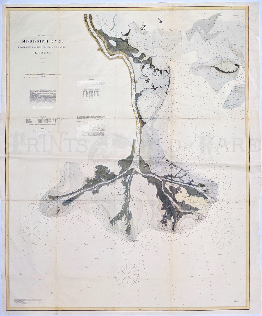 186la: Mississippi Delta 1874. Mississippi River from the Passes to Grand Prairie. Large (33 x 41” image) nautical chart. Hand colored, lithograph. Shows soundings and some inland detail. **has been archivally mended verso. 35 x 42 in. $800 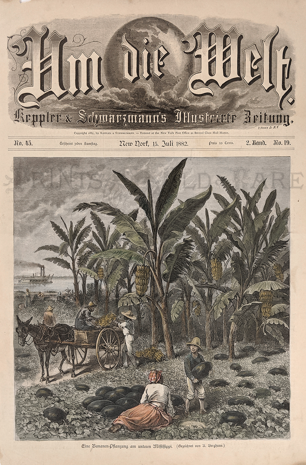 187la: Banana & Watermelon Plantation, 1882 on the Mississippi. Hand colored, wood engraving (German language) – Shows watermelon being loaded onto a wagon, banana trees, a river view and steamboat in the distance. Rare view. 10 x 14 in. $50 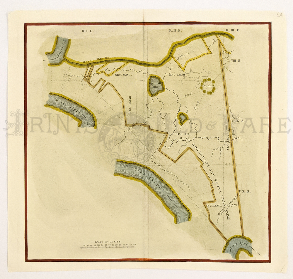 188la: Houmas Mansion setting 1840. Hand colored lithograph shows location of Donaldson and Scott Land. 9 3/8 x 8 5/8 in. $40 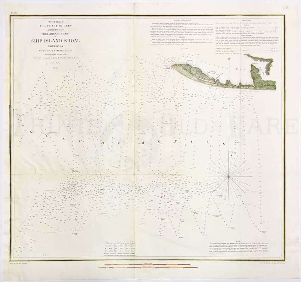 189la: Ship Island Shoal, 1853. Shows Caillou Bay and Gulf of Mexico. Hand colored lithograph by U.S. Coast Survey. 17 x 18 in. $80 See also: New Orleans, LA |
|||||||||
| Order Form | |||||||||||
| Back to Homepage | |||||||||||