 
|
|||||||||||
This is a small selection of our inventory of antique Tennessee maps and prints. Additional inventory is available. Contact us with your request. 1-800-879-6277
|
|||||||||||
|---|---|---|---|---|---|---|---|---|---|---|---|
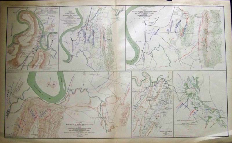 001tn: Civil War Tennessee Maps. Six maps on one page. Lithograph produced by U.S. Government after the War. 28x18 in. $80 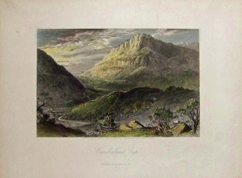 005tn: 1873 Cumberland Gap. Beautiful hand colored steel engraving. From Picturesque America. 13x10 in. $50 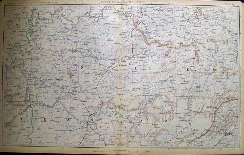 006tn: Civil War Map of Tennessee and Kentucky. Litho color, great detail. Shows towns, forts. From Official Records of Union and Confederate Armies. Published by U.S. Government after the Civil War. 28x18 in. $80 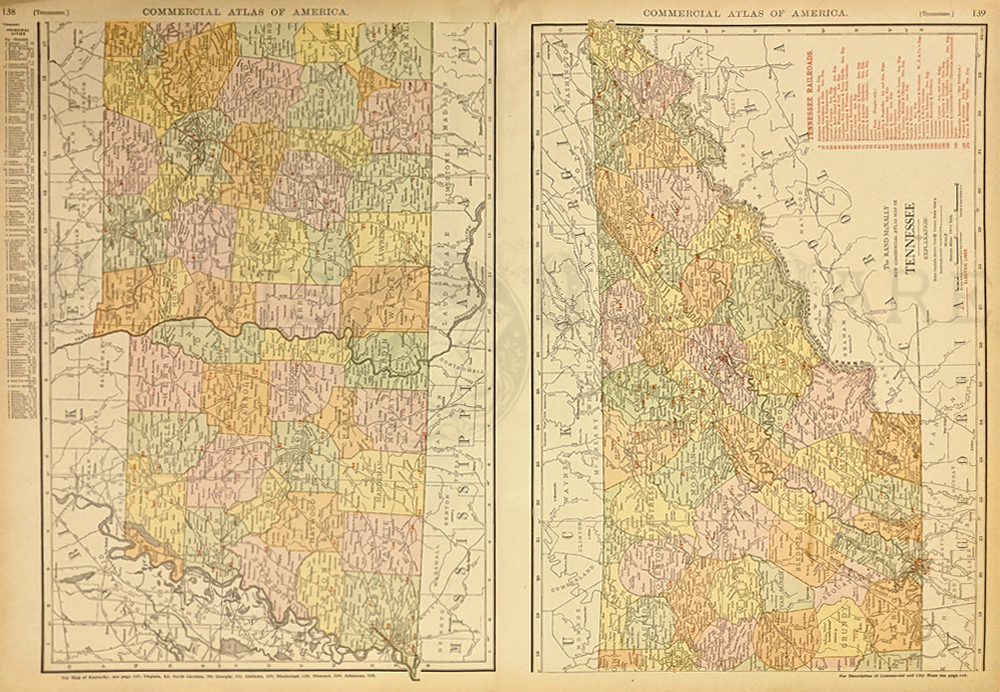 010tn: 1910 Large Railroad Map of Tennessee. Lists and shows an incredible 32 different railroads in this large scale color map. Excellent details. 21x27 in. $80 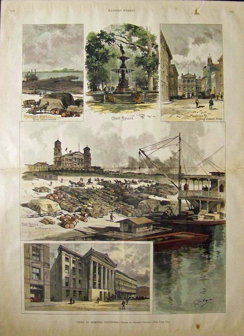 014tn: 1887 MEMPIS TENNESSEE VIEWS. Impressive double-page 1887 print of scenes in Memphis. Contains small views of prominent streets, parks and buildings, and large view of levee. Hand colored woodcut engraving from Harper's. 16x22 in. $100 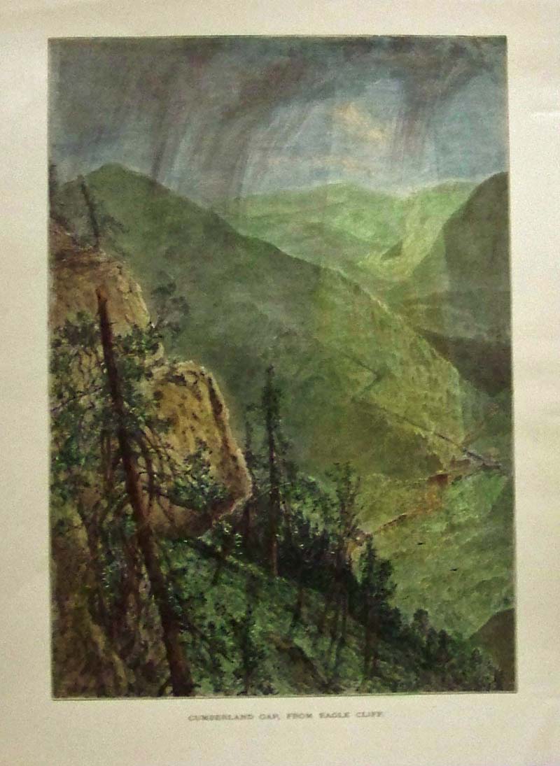
020tn: 1873 Cumberland Gap Tennessee. View from Eagle Cliff. Hand colored engraving. 8x11 in. $50 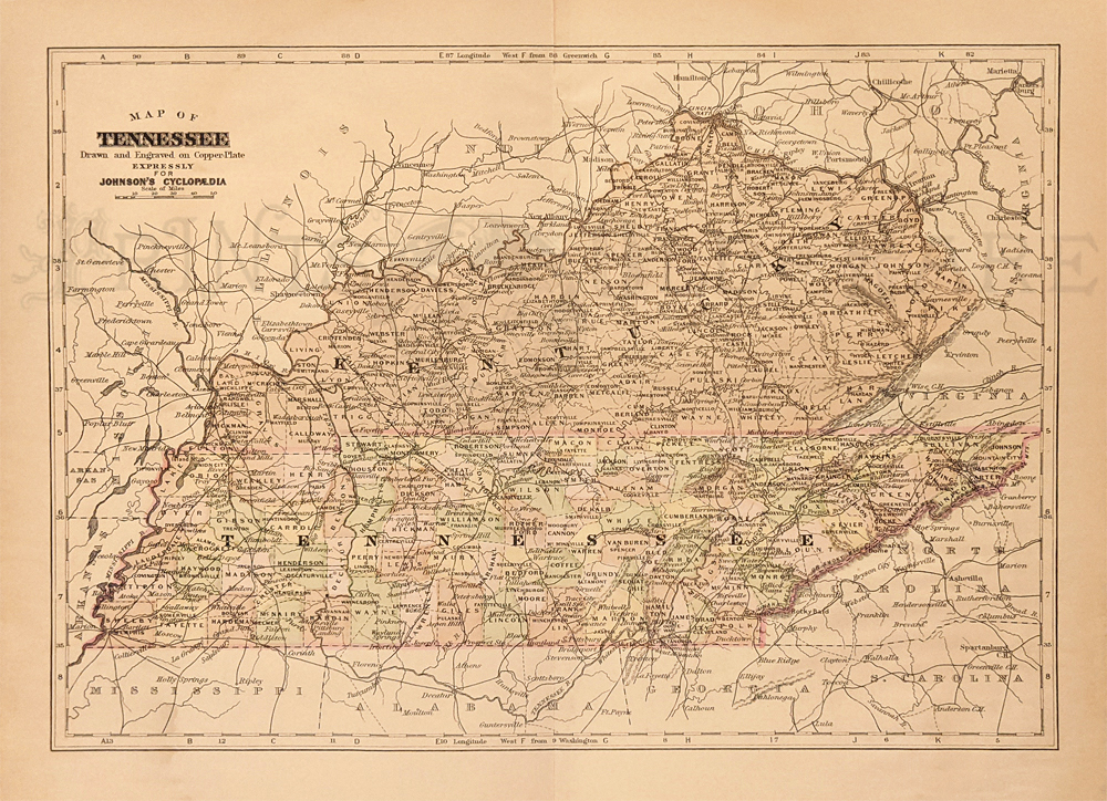 022tn: 1890 Johnson Tennessee County Map. Kentucky also shown in color. Hand colored, copper engraving. 11 x 13 1/2 in. $40 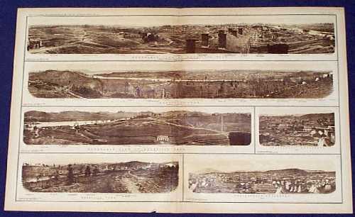
100tn: Civil War Tennessee Panoramas. Sepia tone panoramic views of Knoxville and Chattanooga, from the U.S. government's official atlas of Civil War records. Printed in 1895 from photographs taken during the Civil War. 18x28 in. $80 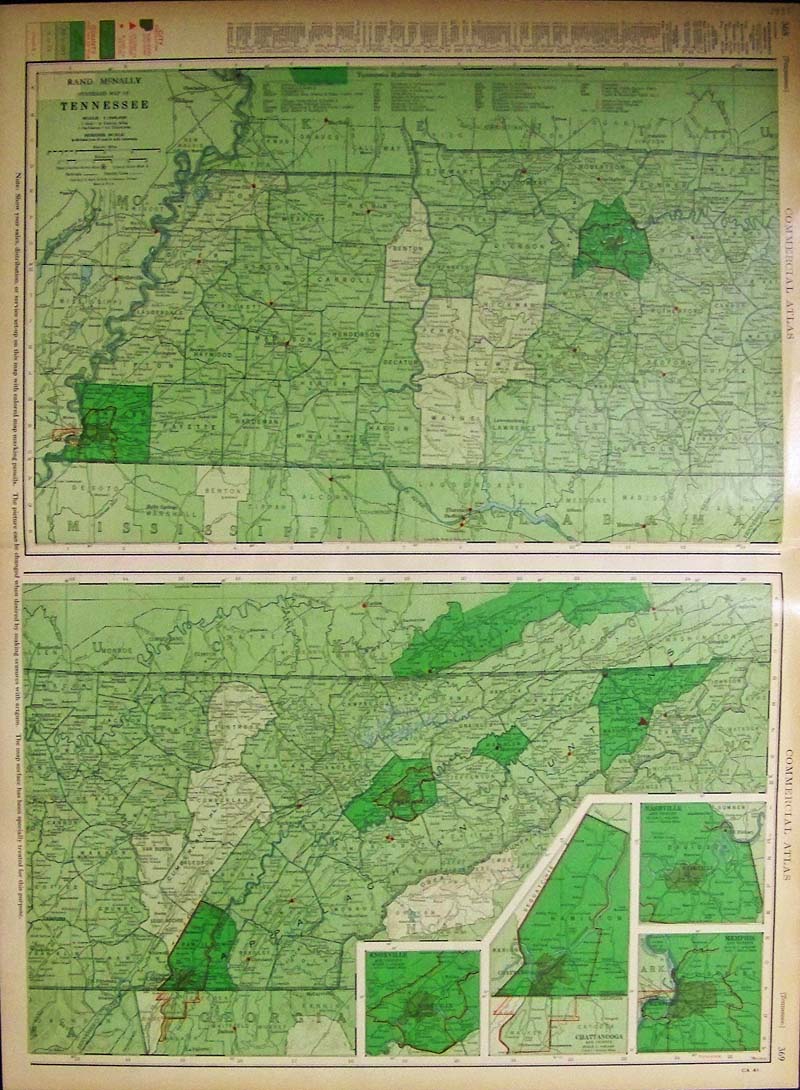 101tn: 1935 Tennessee Population Map. Interesting map from Rand McNally's 1935 Commercial Atlas. Population density of each county is shown in varying shades of green. City populations are indicated by different shapes on the map. Also shows railroad lines throughout the state. 20x27 in. $80 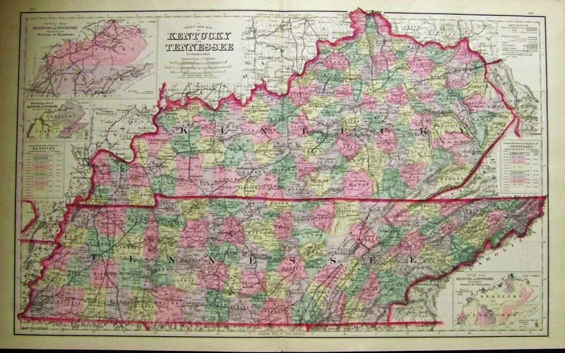 102tn: 1881 Gray's Map of Tennessee, Kentucky. Decorative map of Tennessee and Kentucky, published in Gray's world atlas of 1881. Each county is individually colored with original hand coloring. Cities, towns, railroad lines, canals and geographical features are all shown in detail. Inset maps along the sides show population densities, railroad systems and land elevations. Map is in excellent condition. 17x28 in. $120 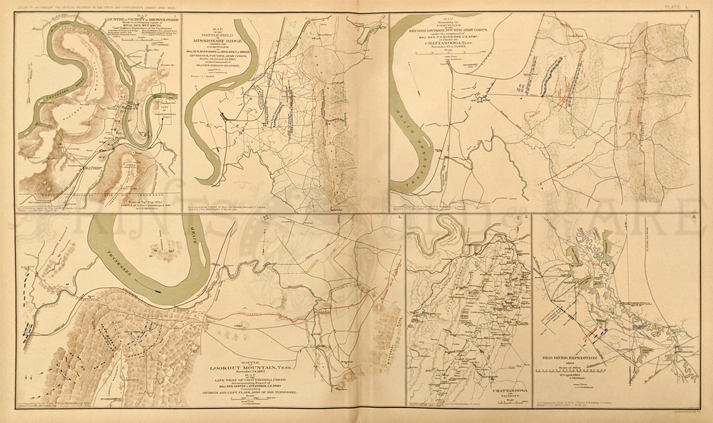 104tn: Civil War Map of Tennessee Localities. Sheet from the Atlas to Accompany the Official Records of the Union and Confederate Armies, published by the United States government in 1895. Contains six maps of battlefields in the South, including two detailed battle maps of the Chattanooga / Lookout Mountain area. 18 x 30 in. $80 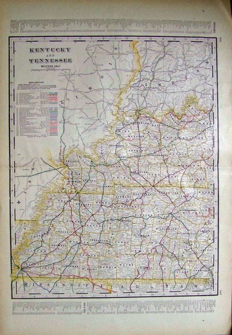 105tn: 1901 Map: western Tennessee and Kentucky. Map from the 1901 first edition of George Cram's folio-size world atlas. Color coded lines on the map show the names and locations of railroads throughout the region. State and county borders are outlined in yellow. Cities, towns and geographical features are all shown. 18x27 in. $100 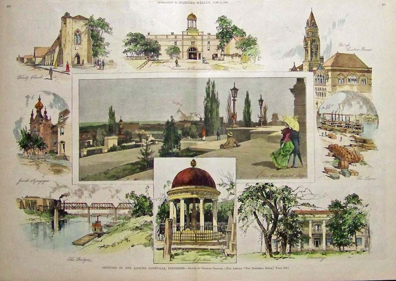 200tn: Old, Antique Views of Nashville Tennessee. Hand colored, engraved images from the June 11, 1887 issue of Harper's Weekly. Title is "Sketches In and Around Nashville, Tennessee." At center is a view of the city from the capitol steps. Smaller images around the edges show various landmarks throughout Nashville. 16x22 in. $120 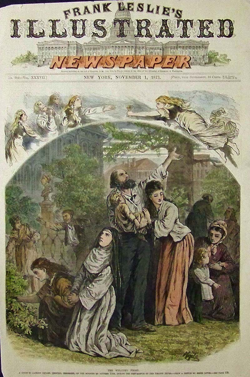 201tn: 1873 The Welcome Frost. A scene in Jackson Square, Memphis, Tennessee on the morning of October 11, during the prevalence of the yellow fever. This hand colored engraving is on the cover of the November, 1873 edition of Harper's Weekly. size: 11x16 in. $50 SOLD 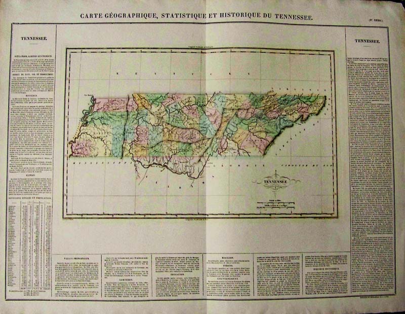 245Tennessee: Carte Geographique, Statistical and Historical Du Tennessee, 1822 - A rare double folio engraved and original color map of Tennessee in French, from the first edition of Carey & Lea's Atlas. Many counties still not formed, typical text insets about geography, rivers, climate, populations etc., surround map in center. Size includes text below map, which includes wonderful contemporary details concerning the topography, indigenous lands, rivers, climate, towns, manufacturing, commerce, education, history, population by county (divided into white, free colored, and slaves) and other information. Special Note: Carey & Lea's Atlas is highly prized not only for its cartographic information but the marvelous information about each of the states and territories which is included. The atlas was issued in 6 editions in English, French & German, between 1822 and 1827. Condition: Very good, heavy stock small left margin, some browning on edges. size 18 x 25 image $400 SOLD 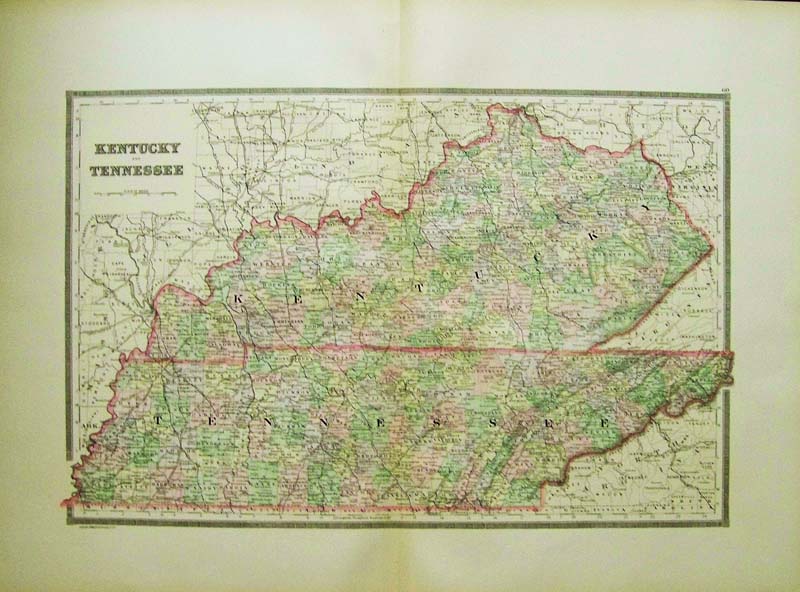 001Kentucky: 1889 Bradley color map of Kentucky and Tennessee. 26 x 19 in. $100 |
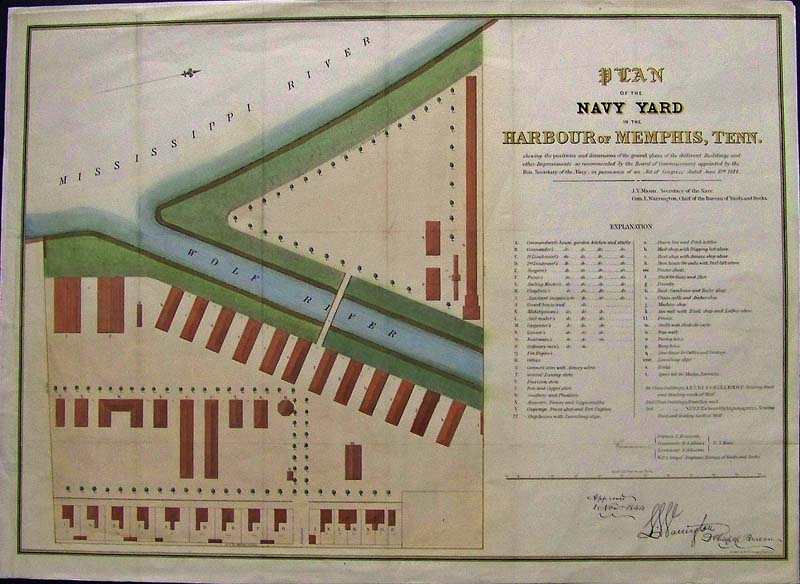 214Tennessee: 1844 Very rare hand colored lithographed Plan of the Navy in the Harbour of Memphis, Tennessee with an Explanation of all the positions and dimensions of the ground plans for different Buildings and other Improvements that were approved. 26 x 19 in. $700 SOLD 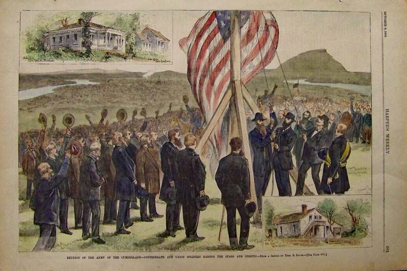
215Tennessee: 1881 Harper's Weekly Hand colored wood engraving showing the Reunion of the Army of the Cumberland--Confederate and Union Soldiers Raising the Stars and Stripes. Sketched by Theo. R. Davis. 16 x 11 in. $60 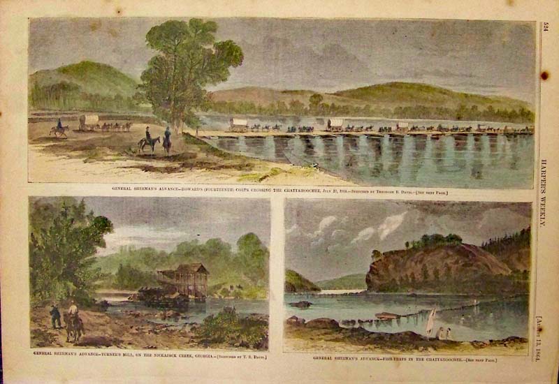
216Tennessee: 1864 Harper's Weekly hand colored wood engraving showing General Sherman's Advance in three images. 15-1/2 x 11 in. $60 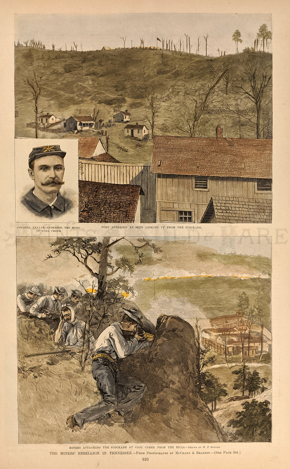 217Tennessee: Harper's Weekly hand colored wood engravings showing The Miners' Rebellion in Tennessee. 16 x 11 in. $80 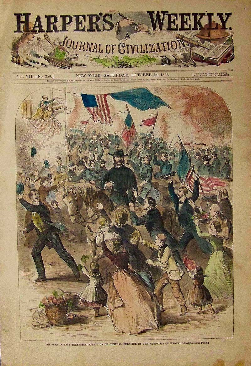
219Tennessee: 1863 Hand colored wood engraving titled, "The War in East Tennessee -- Reception of General Burnside By the Unionists of Knoxville." Featured in Harper's Weekly, A Journal of Civilization. 16 x 11 in. $80 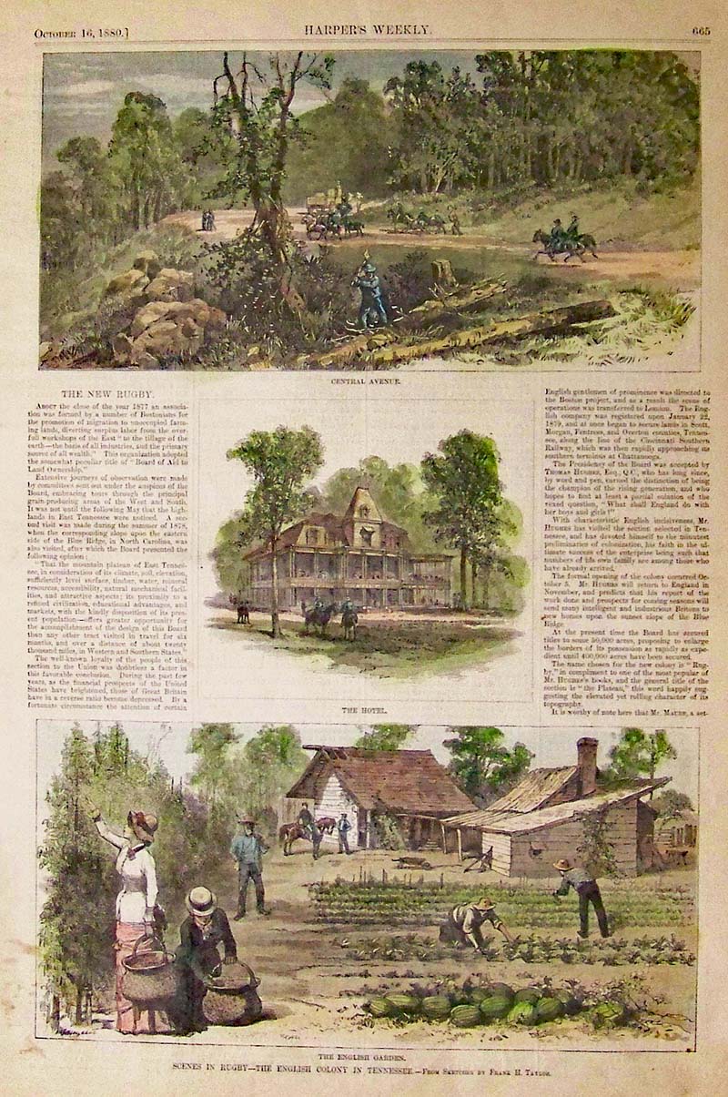
220Tennessee: 1880 Harper's Weekly hand colored wood engraved Scenes in Rugby -- The English Colony in Tennessee. 16 x 11 in. $80 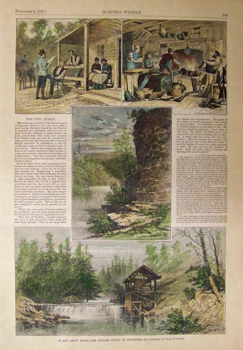 221Tennessee: 1880 Harper's Weekly hand colored wood engravings showing scenes In and About Rugby. 16 x 11 in. $80 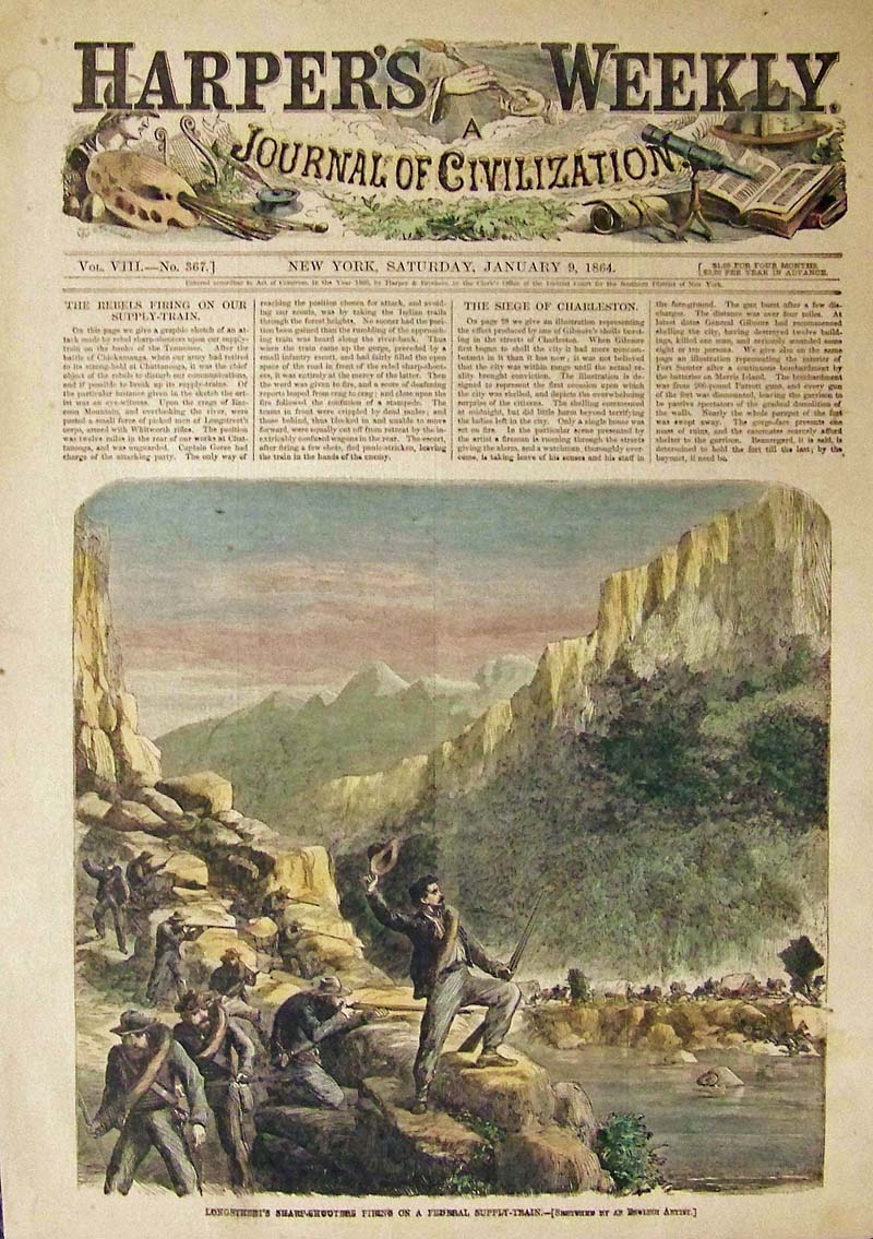
222Tennessee: 1864 Hand colored wood engraving showing the Longstreet's Sharp-Shooters Firing on a Federal Supply-Train. Featured in Harper's Weekly, A Journal of Civilization. 16 x 11 in. $60 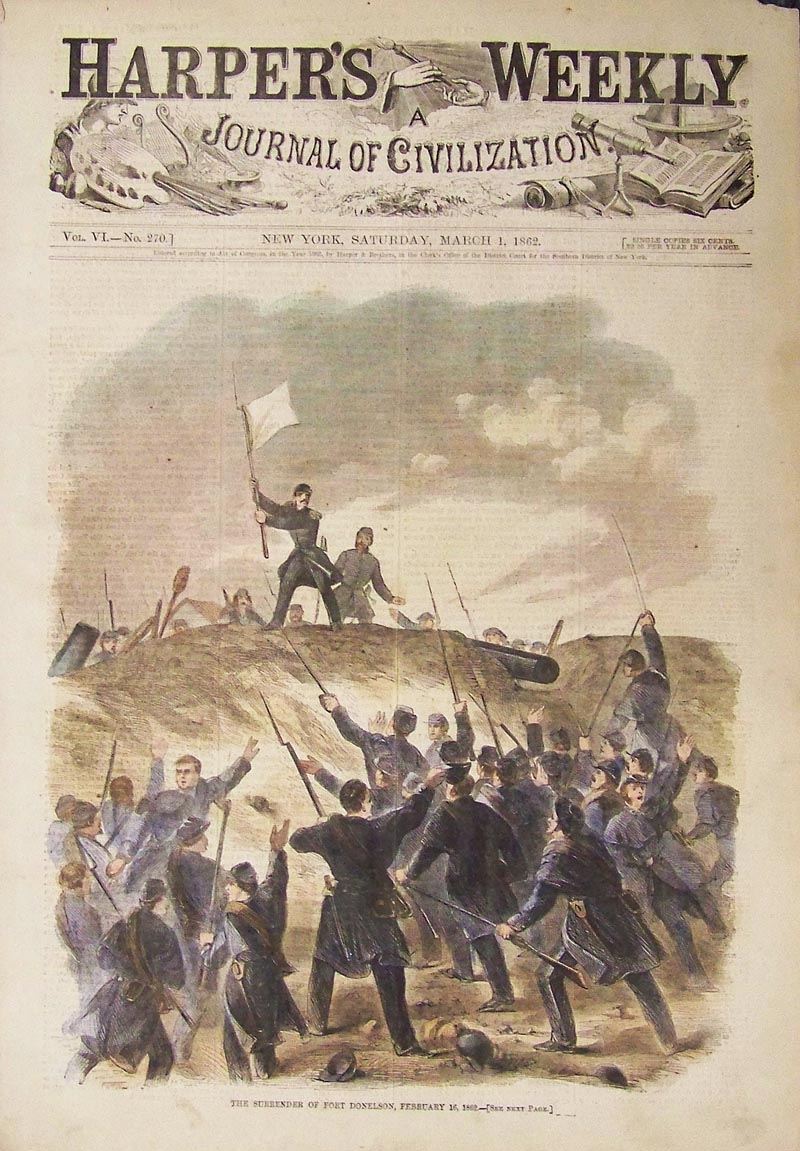
224Tennessee: 1862 Hand colored wood engraving showing "The Surrender of Fort Donelson, February 16, 1862." Featured in Harper's Weekly, A Journal of Civilization. 16 x 11 in. $60 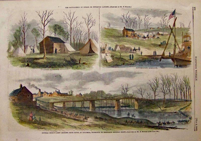
225Tennessee: 1862 Harper's Weekly hand colored wood engraved scenes of General Buell's Army Crossing Duck River, at Columbia, Tennessee, to Reinforce General Grant. 16 x 11 in. $80 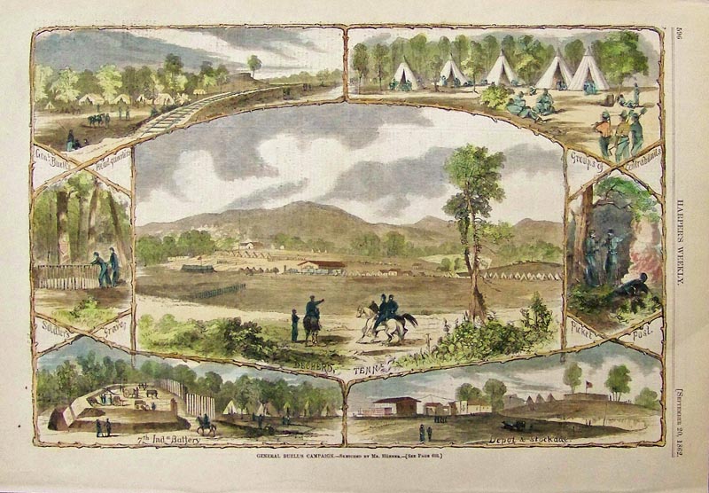
226Tennessee: 1862 Harper's Weekly hand colored wood engraving showing General Buell's Campaign. 16 x 11 in. $80 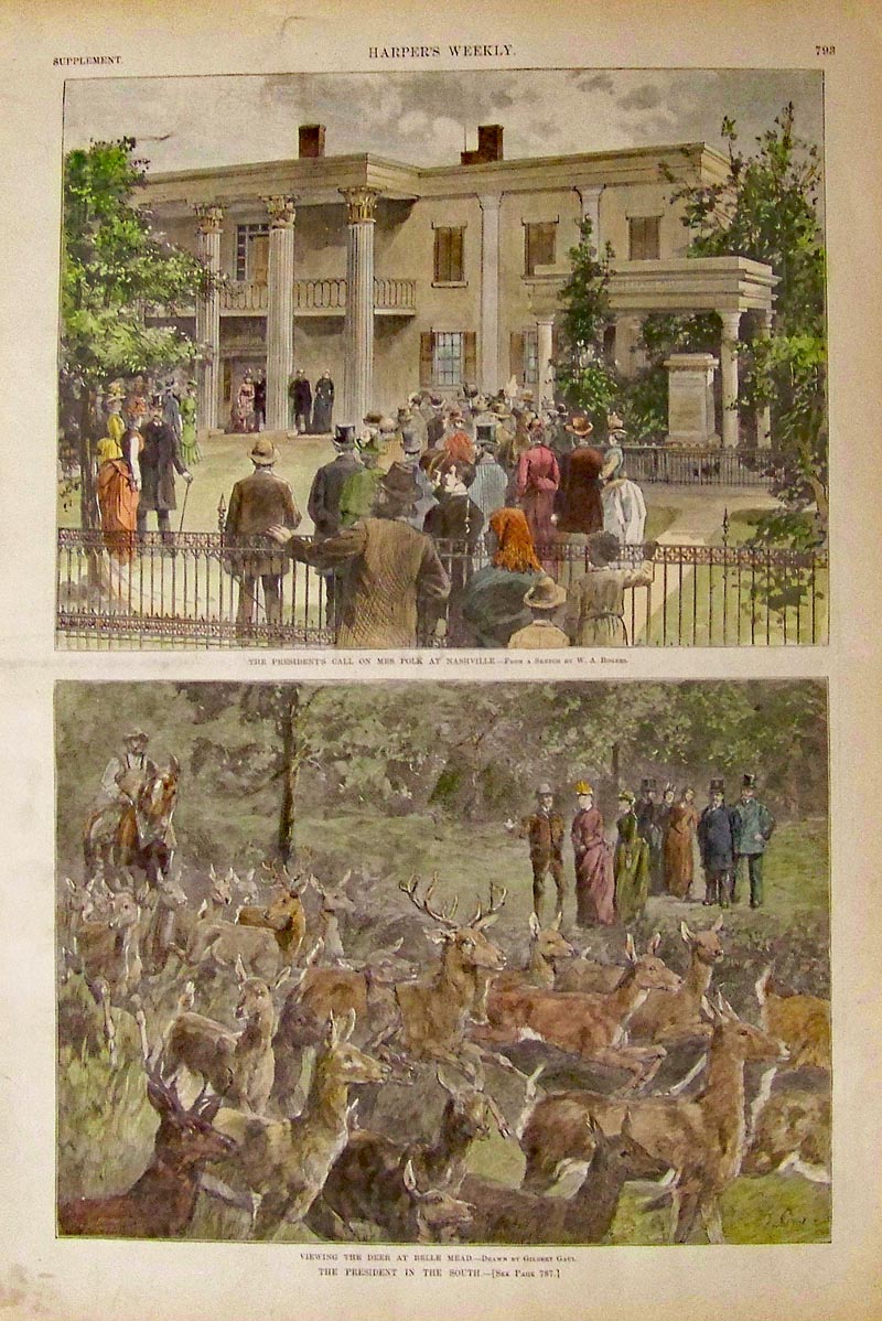
227Tennessee: Harper's Weekly hand colored wood engravings showing the President's Call on Mrs. Polk at Nashville in top image; and bottom image shows Viewing the deer at Belle Mead, both captioned The President in the South. 16 x 11 in. $100 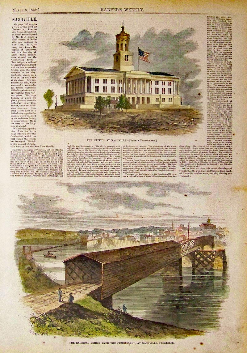
228Tennessee: 1862 Harper's Weekly hand colored wood engravings showing Nashville's Capitol in top image and bottom image shows the Railroad Bridge over the Cumberland, at Nashville, Tennessee. 16 x 11 in. $80 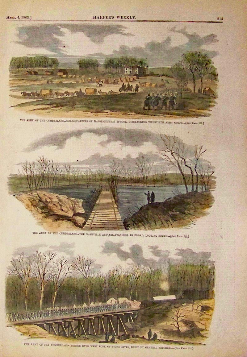
229Tennessee: 1863 Harper's Weekly hand colored wood engravings showing the Army at Cumberland - Headquarters of Major-General mcCook; the Nashville and Chattanooga Railroad; and Bridge over West Fork of Stone River in three images. 16 x 11 in. $60 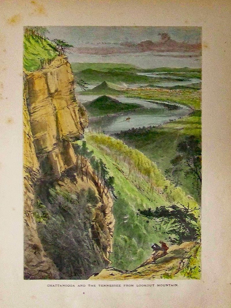 231Tennessee: 1873 Picturesque America hand colored wood engraving showing Chattanooga and the Tennessee from Lookout Mountain. 12 x 9-1/2 in. $50 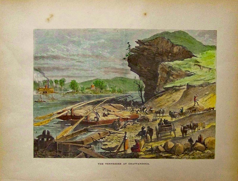
232Tennessee: 1873 Hand colored wood engraving showing, "The Tennessee at Chattanooga." 12 x 9-1/2 in. $50 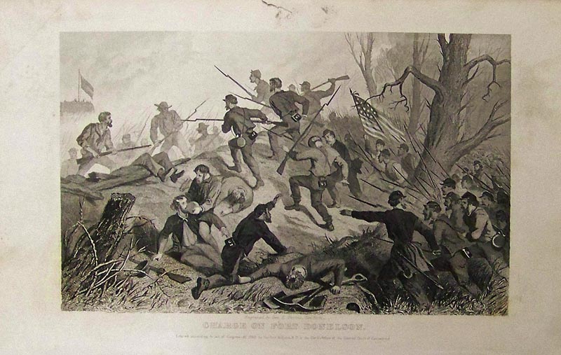 233Tennessee: 1862 Steel engraving showing the Charge of Fort Donelson. Entered according to an Act of Congress by Hurlbut, Williams and Co., of the Clerk's Office of the District Court of Connecticut. 9 x 6 in. $40 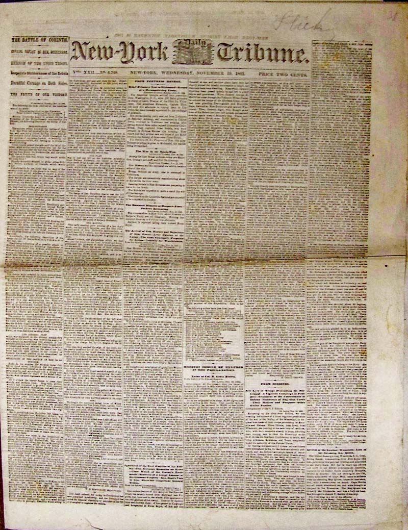 003cw: 1862 Civil War in Tribune - Battle of Corinth, Tennessee. This New-York Daily Tribune, dated November 19, 1862 features two long columns describing the battle, including description of "Desperate, stubborness of the Rebels." Eight pages total. Also inside newspaper are notes from Missouri, Refugees from Texas, and War in the Southwest. Fine condition, printed in black and white. 19 x 14-1/2 in. $35 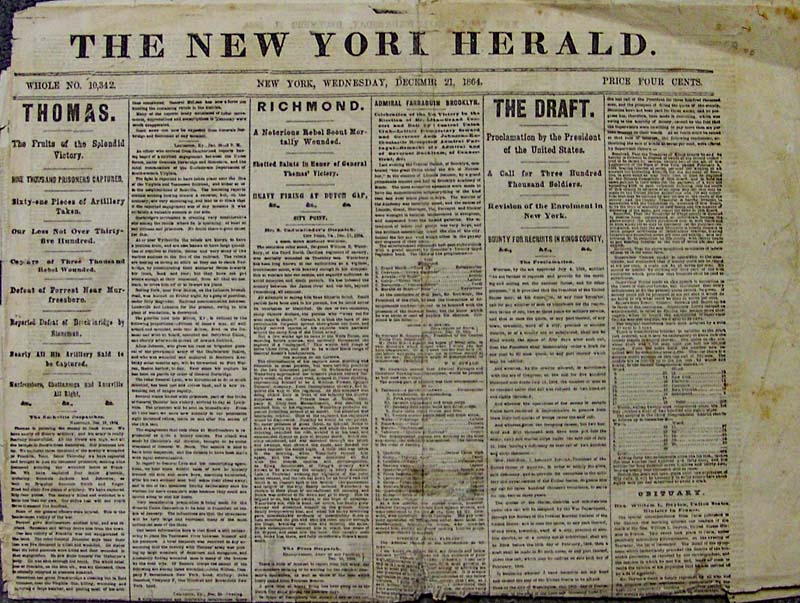 004cw: Battles of Tennessee, Dutch Gap, Murfreesboro featured in this 4 pp original New York Herald, December 21, 1864. Also includes The Draft, the death of "notorious rebel scout" William Waterby, and other interesting features. The original price for this 1864 newspaper was four cents. 24 x 16 in. $30 |
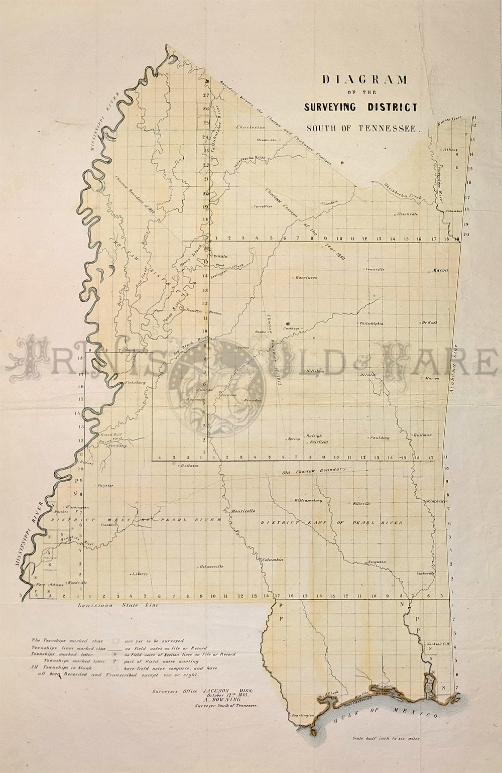 248Tennessee: Rare 1843 Diagram of the Surveying District South of Tennessee. Shows Old Choctaw Boundary, Choctaw Cession of 1830, Choctaw boundary of 1822, Choctaw District, and the north border of the mapped area is the boundary line between the Choctaw and Chickasaw Cessions. Southern portion is divided into districts west and east of the Pearl River. Also shows Vicksburg, Columbus, and Natches. 23 5/8 x 26 1/2 in. $800 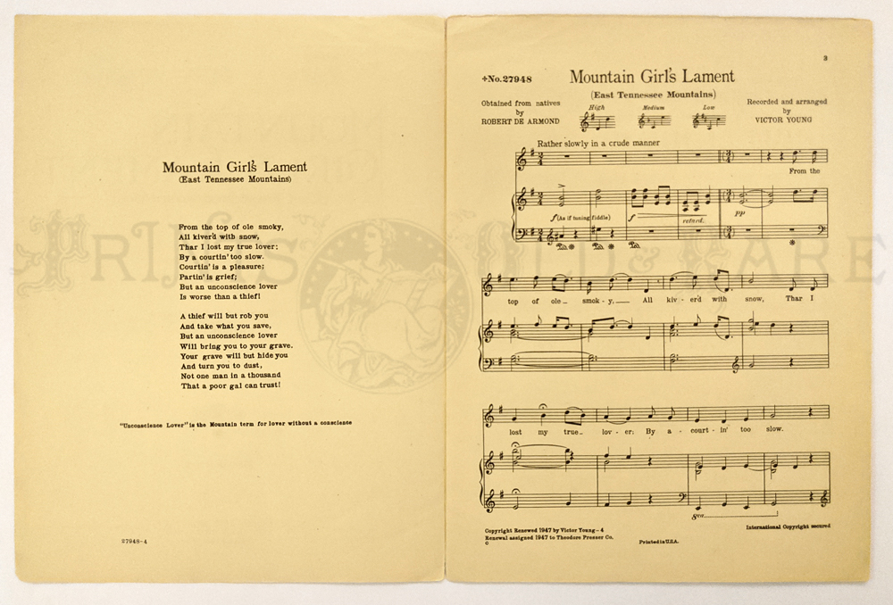 249Tennessee: Tennessee Folk Sheet Music 1947 “Mountain Girls Lament.” (East Tennessee Mountains) later known as “On Top of Old Smoky” – obtained from Natives – 2 verses dealing with an “unconscious lover” aka lover with no conscience. Published in Philadelphia 1947. 12 1/4 x 9 1/8 in. $30 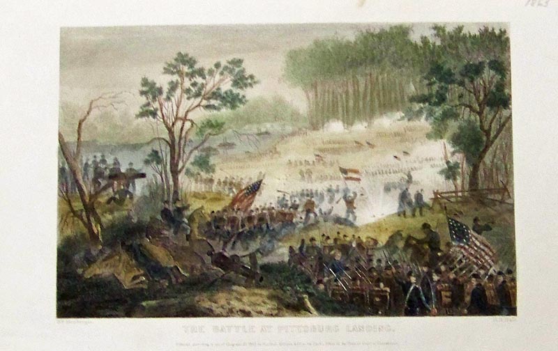 234Tennessee: 1862 Hand colored steel engraving showing The Battle at Pittsburgh Landing. Entered according to Act of Congress by Hurlbut, Williams & Co., of the Clerk's Office of the District Court of Connecticut. 9 x 6 in. $60 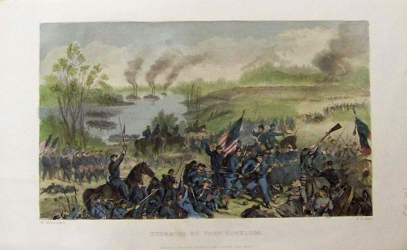
235Tennessee: 1863 Hand colored steel engraving showing the Storming of Fort Donelson, designed and engraved expressly for Abbott's Civil War. 9-1/2 x 6 in. $60 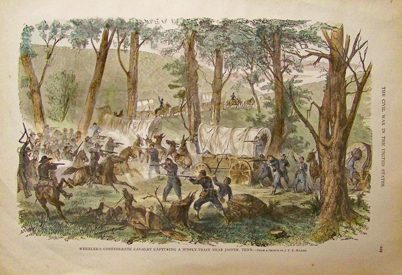
236Tennessee: Hand colored wood engraving titled, "Wheeler's Confederate Cavalry Capturing a Supply-Train near Jasper, Tenn." From a Sketch by J.F.E. Hillen. Featured in The Civil War in the United States. 16-1/2 x 12 in. $80 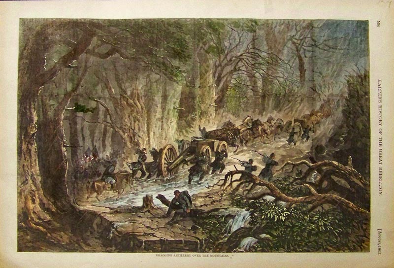
237Tennessee: 1863 Hand colored wood engraving titled, "Dragging Artillery Over the Mountains." Featured in Harper's History of the Great Rebellion. 16 x 10-1/2 in. $60 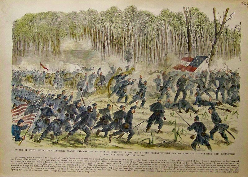
238Tennessee: 1864 Hand colored wood engraving showing the Battle of Stone River, Tenn. -- Decisive Charge and Capture of Byrne's Confederate Battery by the Seventy-Eighth Pennsylvania and Twenty-First Ohio Volunteers, Friday Evening, January 26, 1863. 16 x 11 in. $60 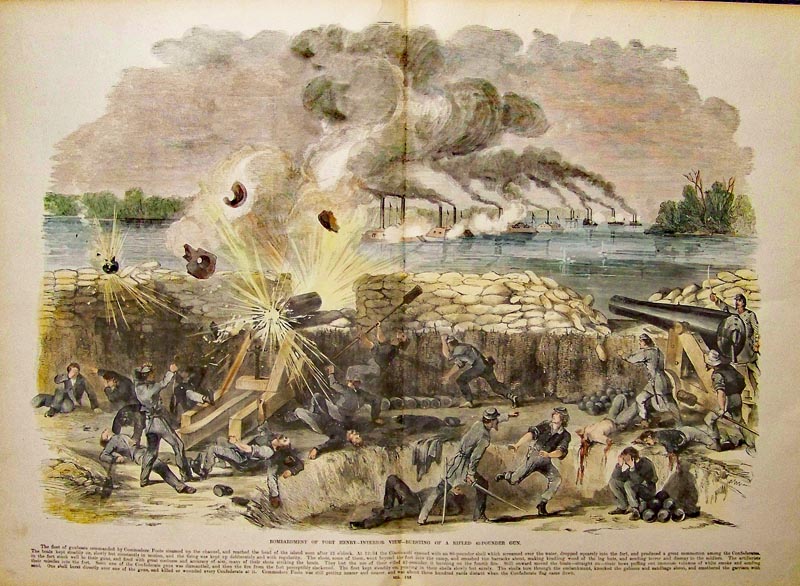
239Tennessee: 1864 Hand colored wood engraving showing the Bombardment of Fort Henry -- Interior View -- Bursting of a Rifled 42-Pounder Gun. 23 x 16 in. $120 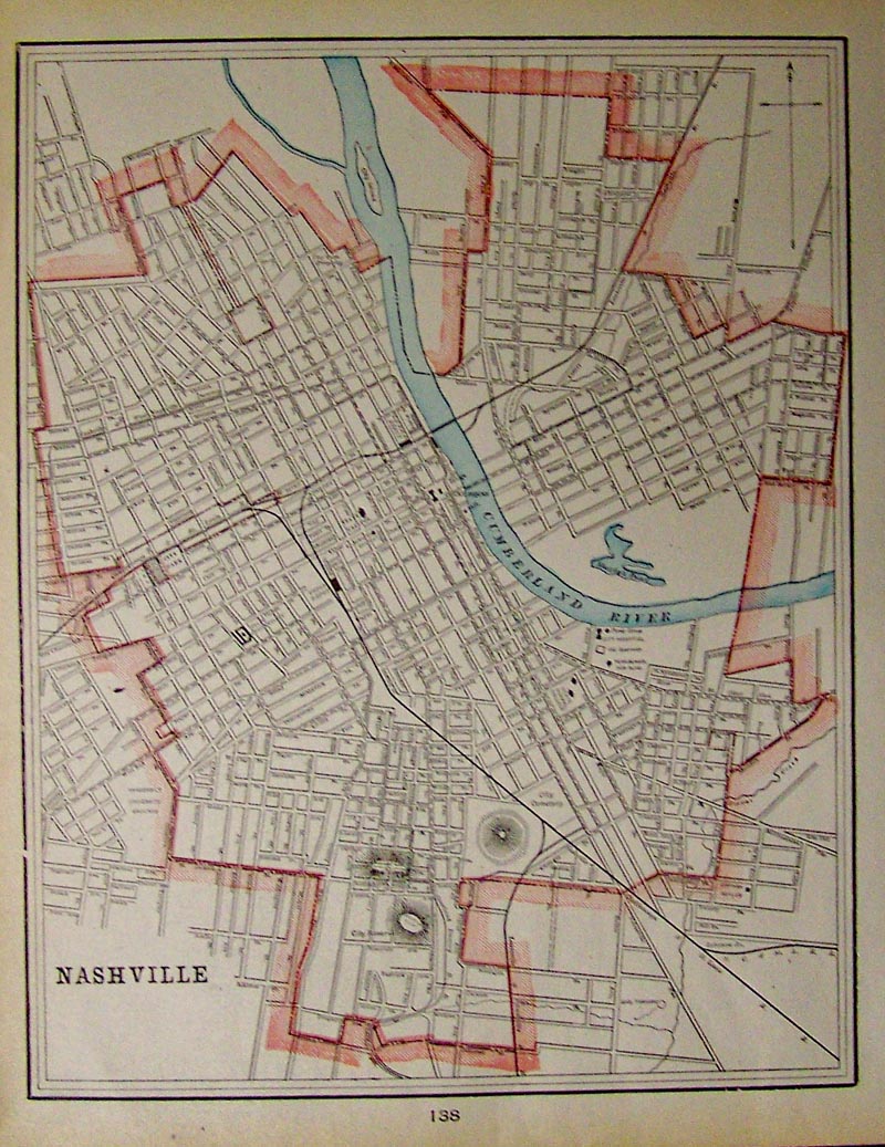
240Tennessee: 1904 Hand colored map of Nashville, showing the Cumberland River running through it. 14 x 11 in. $30 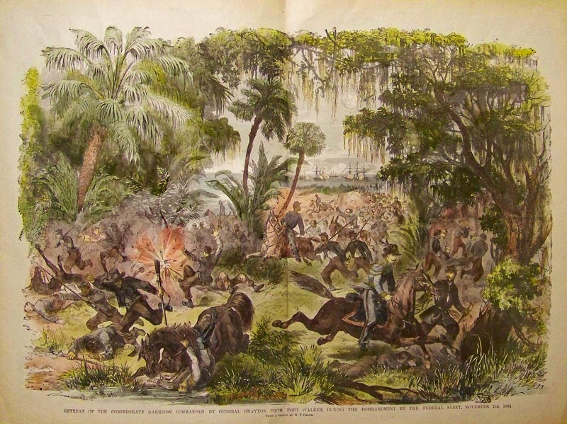
241Tennessee: 1862 Hand colored wood engraving showing the Retreat of the Confederate Garrison Commanded by General Drayton, From Fort Walker, During the Bombardment By the Federal Fleet, November 7th, 1861. 22 x 16-1/2 in. $80 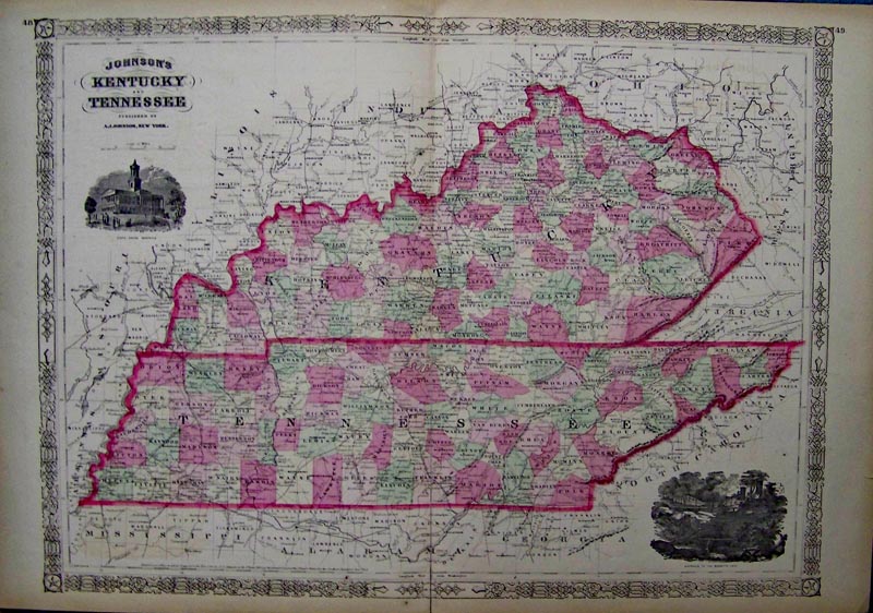
242Tennessee: Hand colored wood engraved Johnson's Kentucky and Tennessee map, which also shows the State House and the Entrance to the Mammoth Cave. 26 x 18 in. $120 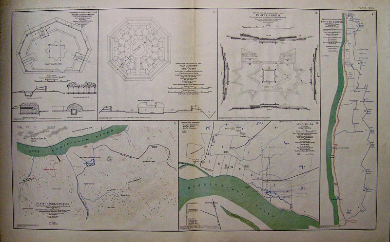
243Tennessee: 1865 Hand colored lithographed Atlas of Fort Donelson, Tennessee showing the Union and Confederate borders. Atlas was to Accompany the Official Records of the Union and Confederate Armies from 1861 through 1865. Also shown are the Defenses of Nashville, Tenn. Fort at Hyde Ferry; Fort Harker in Nashville, Tenn.; Fort Pickering in Memphis, Tenn.; Fort Donelson, Tenn.; Plan and Section of Redoubt; and Memphis and its Environs. Plate CXIV.Lithograph by Julius Bien & Co. 29 x 18-1/2 in. $80 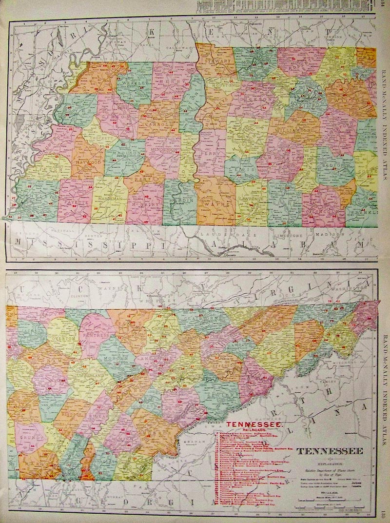
244Tennessee: 1904 Color Railroad Map of Tennessee, featured as part of a Rand-McNally Indexed Atlas. Guide to Chief Cities and red numbered railroad lines are shown for each county. 28 x 20-1/2 in. $120 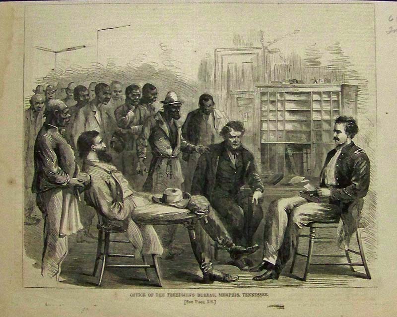 1024tn: 1866 Print: Freedmen's Bureau, Memphis. Office of the Freemen's Bureau in Memphis (1866). Color: Black and White. Type: Wood Engraving. Size: 11x7 in. $30 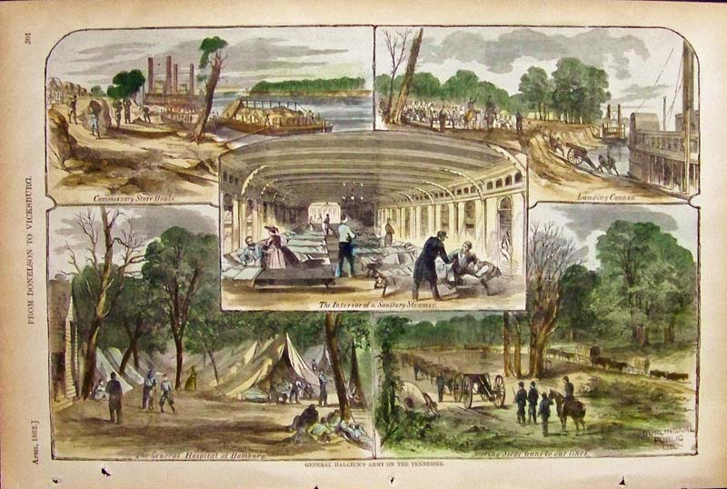 1025tn: 1862 Print: Gen. Halleck's Army, TN. Five prints on one page of General Halleck's Army (1862). Color: Water Color. Type: Wood Engraving. Size: 16x11 in. $50 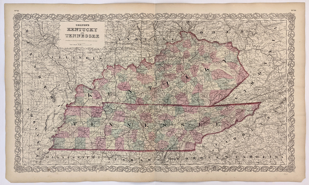 136Kentucky: 1866 Colton's Kentucky and Tennessee. Showing counties, towns, capital, railroads, rivers, lakes, etc. Hand colored, lithograph. 17 1/2 x 28 in. $140 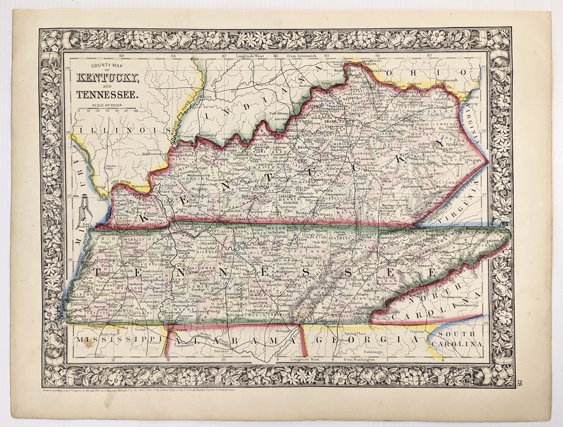 137Kentucky: 1860 County Map of Kentucky, and Tennessee by Mitchell. Showing counties, towns, rivers and some topographical details. Hand colored, lithograph. 12 1/8 x 15 1/4 in. $100 Also see: Knoxville, TN Chattanooga, TN Nashville, TN Memphis, TN |
|||||||||
| Order Form | |||||||||||
| Back to Homepage | |||||||||||